Bay of Suckquoy

Bay in Orkney

Scotland

Bay of Suckquoy

Anti-tank structures These are not marked on any map I can find, nor is their purpose obvious. But research reveals that they are WW2 anti tank (anti-invasion) structures. Mostly of truncated pyramids though some are filled oil-drums. Others, I'm told, can be found nearby on dry land.
Anti-tank structures Credit: Derek Mayes

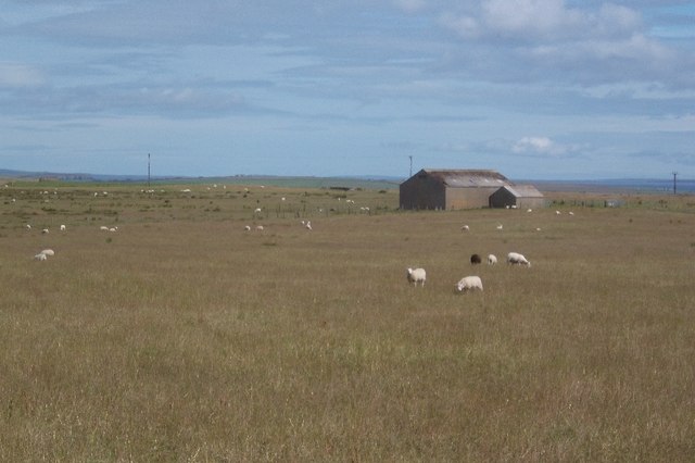
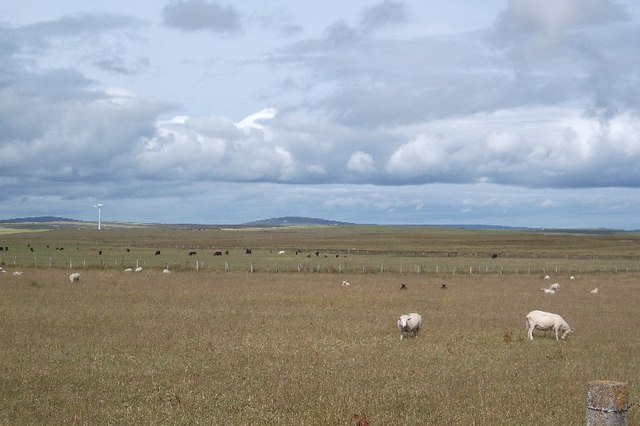
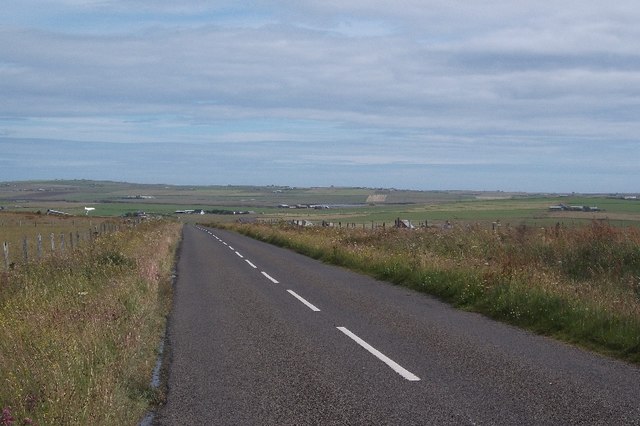
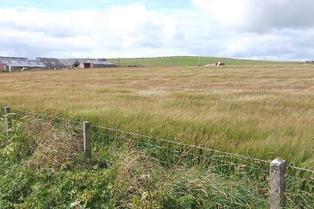
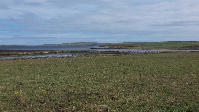
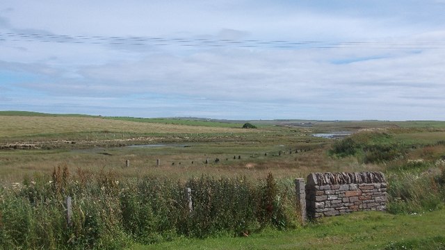
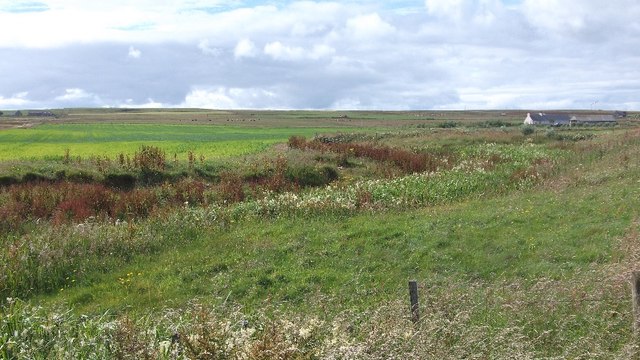
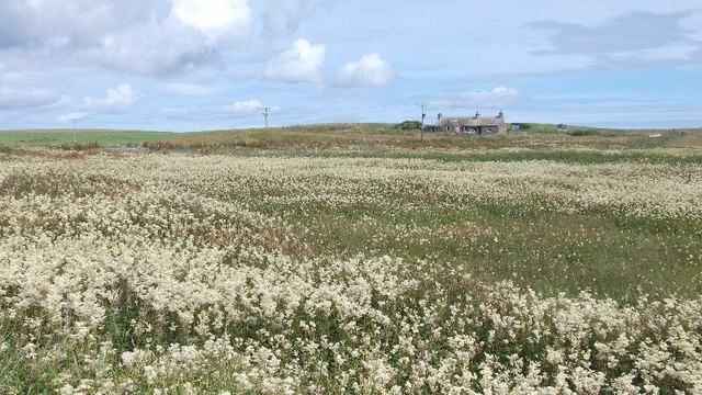
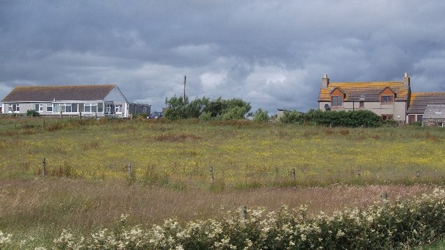
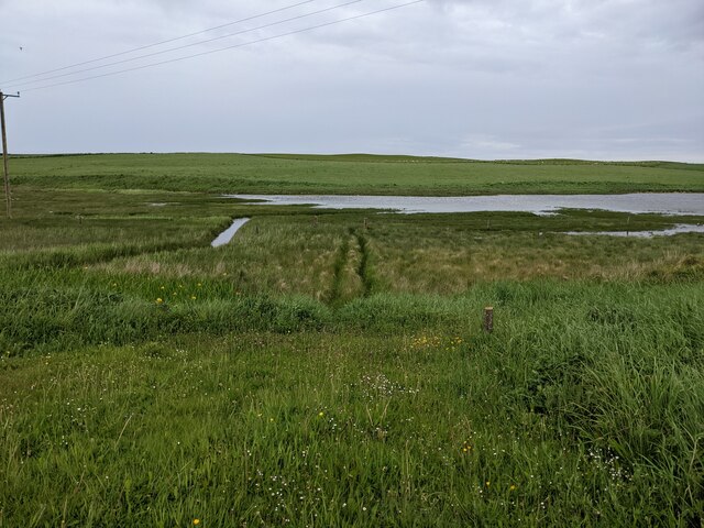
The Bay of Suckquoy is a picturesque bay located on the eastern coast of the Orkney Islands, Scotland. It lies approximately 10 miles north of the town of Kirkwall and is nestled between the parishes of Deerness and St. Andrews. The bay is surrounded by stunning natural beauty with rolling hills and rocky cliffs.

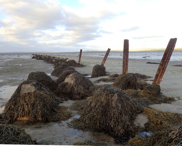
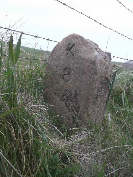
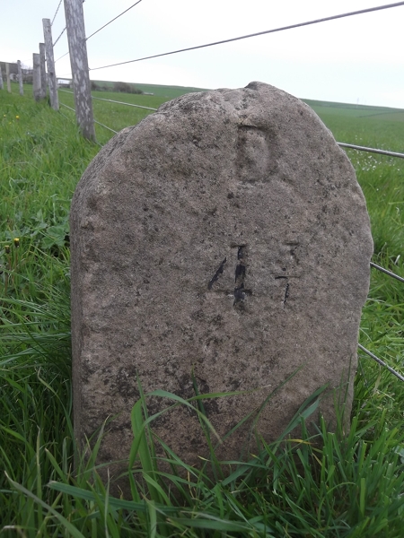
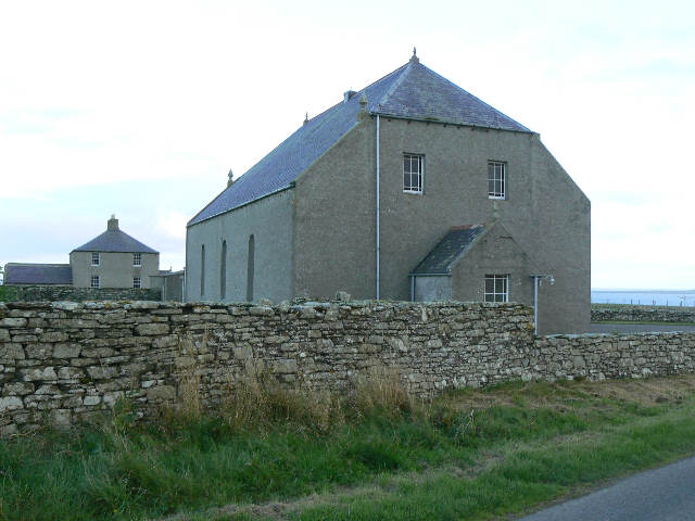
The Bay of Suckquoy is renowned for its rich historical and archaeological significance. It is home to the remains of an ancient settlement, which date back to the Neolithic period. The settlement consists of several well-preserved stone structures, including houses and chambered cairns, providing valuable insights into the lives of the early inhabitants of Orkney.

Furthermore, the bay is a haven for wildlife enthusiasts. Its tranquil waters are often frequented by various bird species, including puffins, razorbills, and guillemots, which nest on the cliffs during the breeding season. Seals can also be spotted basking on the rocks, adding to the bay's natural charm.

Visitors to the Bay of Suckquoy can indulge in outdoor activities such as hiking, birdwatching, and exploring the archaeological sites. The bay offers breathtaking views of the surrounding landscape, with rugged cliffs and the vast expanse of the North Sea stretching out before you.

Overall, the Bay of Suckquoy is a hidden gem in the Orkney Islands, offering a unique blend of natural beauty, historical significance, and wildlife diversity.

If you have any feedback on the listing, please let us know in the comments section below.

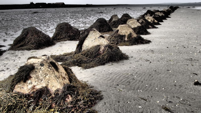
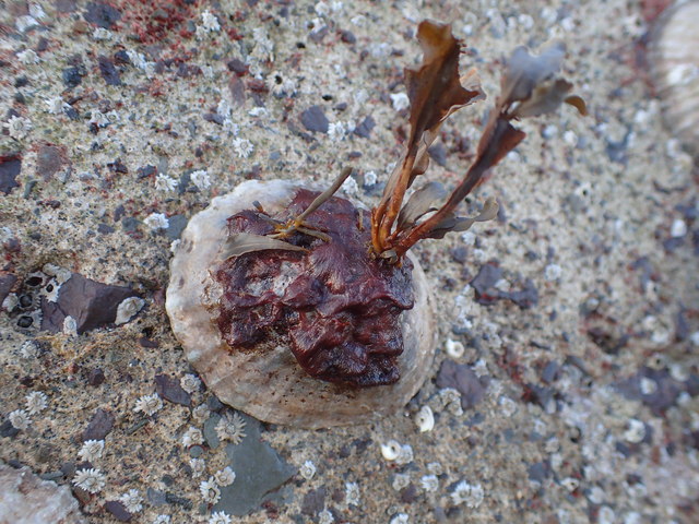
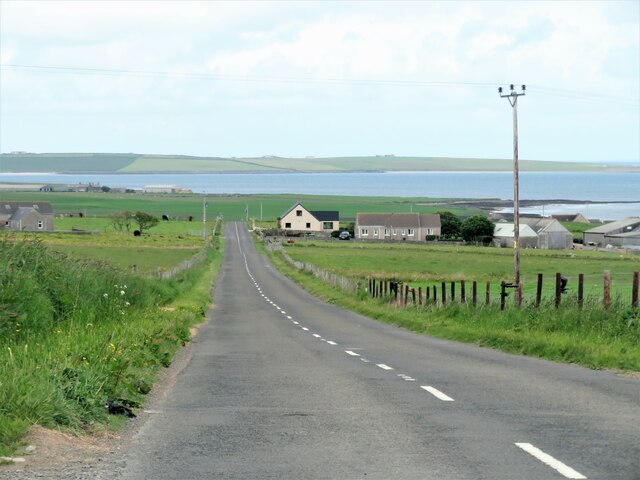
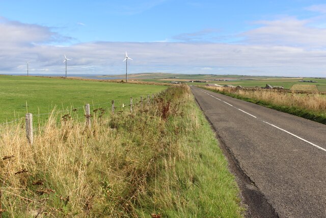
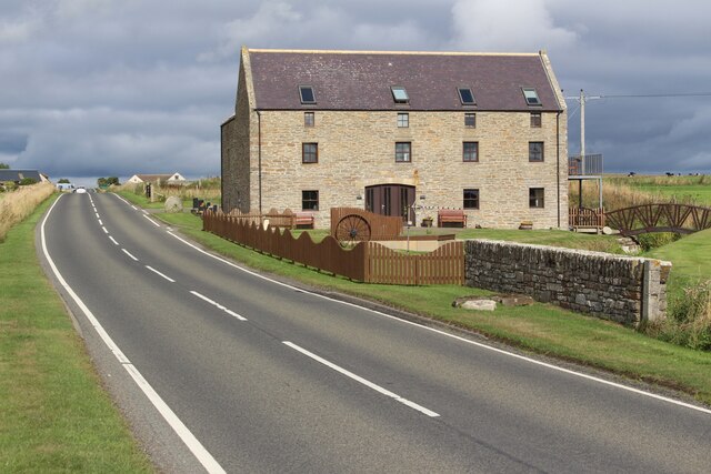
Bay of Suckquoy Images

Images are sourced within 2km of 58.920871/-2.8246565 or Grid Reference HY5204. Thanks to Geograph Open Source API. All images are credited.

Anti-tank structures These are not marked on any map I can find, nor is their purpose obvious. But research reveals that they are WW2 anti tank (anti-invasion) structures. Mostly of truncated pyramids though some are filled oil-drums. Others, I'm told, can be found nearby on dry land.
Anti-tank structures
These are not marked on any map I can find, nor is their purpose obvious. But research reveals that they are WW2 anti tank (anti-invasion) structures. Mostly of truncated pyramids though some are filled oil-drums. Others, I'm told, can be found nearby on dry land.
Field, Muckle Ocklester A rhombus shaped field with a substantial shed beyond.
Field, Muckle Ocklester
A rhombus shaped field with a substantial shed beyond.
Pasture, Ocklester
Pasture, Ocklester
B9052, Ocklester A good quality road crossing Mainland to the east of Kirkwall.
B9052, Ocklester
A good quality road crossing Mainland to the east of Kirkwall.
Barley, Foubister Arable land on the north side of Mainland, near Toab.
Barley, Foubister
Arable land on the north side of Mainland, near Toab.
Toab A field beside Bay of Suckquoy.
Toab
A field beside Bay of Suckquoy.
Estuary, Toab A tidal inlet at the head of Bay of Suckquoy.
Estuary, Toab
A tidal inlet at the head of Bay of Suckquoy.
Horsick Coastal farmland, Toab.
Horsick
Coastal farmland, Toab.
Meadowsweet, Millbrae Vast area of the ever popular fragrant wetland plant.
Meadowsweet, Millbrae
Vast area of the ever popular fragrant wetland plant.
Milldam Orkney hay meadows.
Milldam
Orkney hay meadows.
Old Milestone by the A960, St Peter's Pool, Kirkwall By the A960, in parish of Kirkwall St Ola (Mainland District), St Peter's Pool, West of bungalow.

Inscription reads:- : K / 8 : : D / 3¾ : (To Kirkwall and Deerness)

Surveyed

Milestone Society National ID: OR_KWDN08
Old Milestone by the A960, St Peter's Pool, Kirkwall
By the A960, in parish of Kirkwall St Ola (Mainland District), St Peter's Pool, West of bungalow. Inscription reads:- : K / 8 : : D / 3¾ : (To Kirkwall and Deerness) Surveyed Milestone Society National ID: OR_KWDN08
Old Milestone by the A960, St Ola, Kirkwall parish Stone post by the A960, in parish of Kirkwall, St Ola (Mainland District), East of bungalow, on verge, on rise, South side of road.

Inscription reads:-
: K / 7 : : D / 4¾ :
(To Kirkwall and Deerness)

Surveyed

Milestone Society National ID: OR_KWDN07
Old Milestone by the A960, St Ola, Kirkwall parish
Stone post by the A960, in parish of Kirkwall, St Ola (Mainland District), East of bungalow, on verge, on rise, South side of road. Inscription reads:- : K / 7 : : D / 4¾ : (To Kirkwall and Deerness) Surveyed Milestone Society National ID: OR_KWDN07
Wartime Structures These structures are worth recording - I can find no Web-references. They are significant historical and ecological features. The whole line, of mostly concrete truncated pyramids, reaches nearly 200 metres from dry land to quite low water. Some are exposed for most of the day, others for only an hour or two.
They all have a good coating of Wracks (seaweeds) which hide a varied collection of other Marine organisms, some quite rare.
Linked to <a title="https://www.geograph.org.uk/photo/4717066" href="https://www.geograph.org.uk/photo/4717066">Link</a>
and my series of iSpot Observations here <span class="nowrap"><a title="https://www.ispotnature.org/communities/uk-and-ireland/view/observation/778731/" rel="nofollow ugc noopener" href="https://www.ispotnature.org/communities/uk-and-ireland/view/observation/778731/">Link</a><img style="margin-left:2px;" alt="External link" title="External link - shift click to open in new window" src="https://s1.geograph.org.uk/img/external.png" width="10" height="10"/></span>
Wartime Structures
These structures are worth recording - I can find no Web-references. They are significant historical and ecological features. The whole line, of mostly concrete truncated pyramids, reaches nearly 200 metres from dry land to quite low water. Some are exposed for most of the day, others for only an hour or two. They all have a good coating of Wracks (seaweeds) which hide a varied collection of other Marine organisms, some quite rare. Linked to Link and my series of iSpot Observations here LinkExternal link
Rare seaweed The Wartime anti-tank structures at this location <a title="https://www.geograph.org.uk/photo/6190823" href="https://www.geograph.org.uk/photo/6190823">Link</a> are ecologically significant. Some of the lowest ones host quite rare marine organisms. There are plenty of common limpets of course.
On a few, and on some concrete surfaces, there is the quite rare seaweed Colaconema caespitosum - <span class="nowrap"><a title="http://www.seaweed.ie/descriptions/Colaconema_caespitosum.php" rel="nofollow ugc noopener" href="http://www.seaweed.ie/descriptions/Colaconema_caespitosum.php">Link</a><img style="margin-left:2px;" alt="External link" title="External link - shift click to open in new window" src="https://s1.geograph.org.uk/img/external.png" width="10" height="10"/></span>
World distribution - <span class="nowrap"><a title="https://www.gbif.org/species/5278379" rel="nofollow ugc noopener" href="https://www.gbif.org/species/5278379">Link</a><img style="margin-left:2px;" alt="External link" title="External link - shift click to open in new window" src="https://s1.geograph.org.uk/img/external.png" width="10" height="10"/></span>
Personally, I think the structures should be protected for their historical and environmental value.
Rare seaweed
The Wartime anti-tank structures at this location Link are ecologically significant. Some of the lowest ones host quite rare marine organisms. There are plenty of common limpets of course. On a few, and on some concrete surfaces, there is the quite rare seaweed Colaconema caespitosum - LinkExternal link World distribution - LinkExternal link Personally, I think the structures should be protected for their historical and environmental value.
Heading downhill at Foubister Looking north east down the hill towards Midbigging with Deer Sound beyond.
Heading downhill at Foubister
Looking north east down the hill towards Midbigging with Deer Sound beyond.
B9052 near Muckle Ocklester
Sebay Mill Former mill converted into holiday apartments.
Sebay Mill
Former mill converted into holiday apartments.
Where the Burn of Langskaill joins the Bay of Suckquoy
Show me another place!

Bay of Suckquoy is located at Grid Ref: HY5204 (Lat: 58.920871, Lng: -2.8246565)

Unitary Authority: Orkney Islands

Police Authority: Highlands and Islands

What 3 Words

///entitles.pace.directs. Near Tankerness, Orkney Islands

Related Wikis

St Peter's Pool, Orkney

St Peter's Pool is a bay in the East Mainland of Orkney, Scotland. This bay was the site of significant coastal defences during World War II, when a German...

Mine Howe

Mine Howe is an Iron Age subterranean man-made chamber dug 6 meters (20 feet) deep inside a large mound. It is located in the Tankerness area of Orkney...

Toab, Orkney

Toab is a parish on the Orkney Mainland, situated in the East Mainland. Toab is located off the A960 road at the head of Deer Sound on the Mainland, Orkney...

Holm, Orkney

Holm (pronounced /hæm/ ), also spelled Ham, is a parish on Mainland, Orkney.An adjacent Sound, running between Mainland, and Burray, is named after Holm...

Tankerness

Tankerness is a district in the St Andrews parish in Mainland, Orkney, Scotland. Essentially a peninsula, it is about 13 kilometres (8 mi) south-east of...

St Andrews, Orkney

St Andrews is a parish on Mainland, Orkney in Scotland. It is located east of the town of Kirkwall and the parish of St Ola and lies north of Holm and...

Deerness

Deerness (, locally , Old Norse: Dyrnes) is a quoad sacra parish (i.e. one created and functioning for ecclesiastical purposes only) and peninsula in Mainland...

Lamb Holm

Lamb Holm is a small uninhabited island in Orkney, Scotland. The Italian Chapel, constructed during the Second World War, is the island's main attraction...

Nearby Amenities

Located within 500m of 58.920871,-2.8246565
Power: pole
Lat/Long: 58.9211652/-2.8279603
Power: pole
Lat/Long: 58.9216138/-2.8290385
Power: pole
Lat/Long: 58.9219502/-2.8298485
Power: pole
Lat/Long: 58.9207706/-2.8270134
Power: pole
Lat/Long: 58.920477/-2.8273112
Power: pole
Lat/Long: 58.9200699/-2.8276759
Power: pole
Lat/Long: 58.9196573/-2.8281695
Power: pole
Lat/Long: 58.9193735/-2.8285208
Power: pole
Lat/Long: 58.91867/-2.8281239
Power: pole
Lat/Long: 58.9179638/-2.8277135
Generator Method: wind_turbine
Generator Source: wind
Generator Type: horizontal_axis
Power: generator
Lat/Long: 58.9206556/-2.8212655
Toab
Place: village
Lat/Long: 58.9222494/-2.8311016
Seamark Type: beacon_isolated_danger
Lat/Long: 58.9205625/-2.8261951
Broch (remains of)
Historic: archaeological_site
Lat/Long: 58.9216708/-2.8199946
Post Box
Ref: KW17 33
Lat/Long: 58.9230217/-2.8299615
Power: pole
Lat/Long: 58.9196619/-2.8304816
Power: pole
Lat/Long: 58.9199279/-2.8322662
Power: pole
Lat/Long: 58.9239423/-2.8185224
Power: pole
Lat/Long: 58.9237476/-2.8194122
Power: pole
Lat/Long: 58.9190624/-2.8188202
Power: pole
Lat/Long: 58.9189962/-2.8189698
Power: pole
Lat/Long: 58.9190741/-2.8199651
Power: pole
Lat/Long: 58.9191779/-2.8210082
Power: pole
Lat/Long: 58.9184051/-2.8185727
Power: pole
Lat/Long: 58.919403/-2.818956
Power: pole
Lat/Long: 58.9205299/-2.8194059
Power: pole
Lat/Long: 58.921143/-2.8196384
Power: pole
Lat/Long: 58.9217126/-2.8198671
Power: pole
Lat/Long: 58.9223698/-2.8201197
Power: pole
Lat/Long: 58.922916/-2.8203158
Power: pole
Lat/Long: 58.9233188/-2.8204854
The data included in this document is from www.openstreetmap.org. The data is made available under ODbL.

Have you been to Bay of Suckquoy?

Leave your review of Bay of Suckquoy below (or comments, questions and feedback).