Inniens Bay

Bay in Orkney

Scotland

Inniens Bay

Holm of Faray View to the island from the ferry to Kirkwall with Lavey Sound to the far right of picture.
Holm of Faray Credit: Andy Farrington

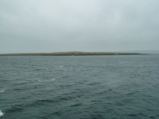
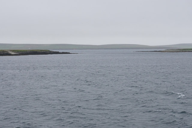
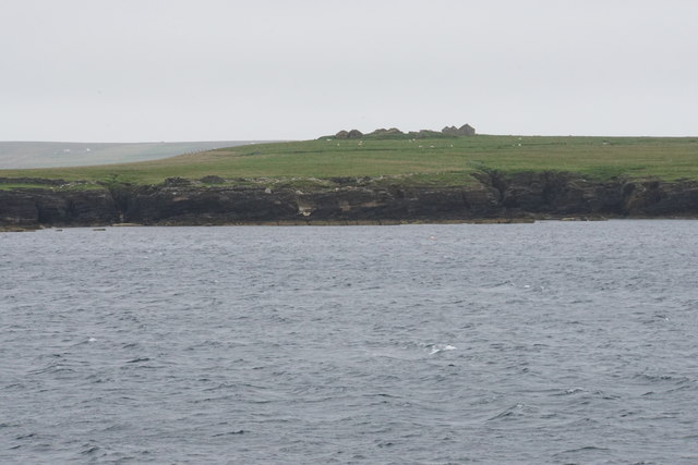
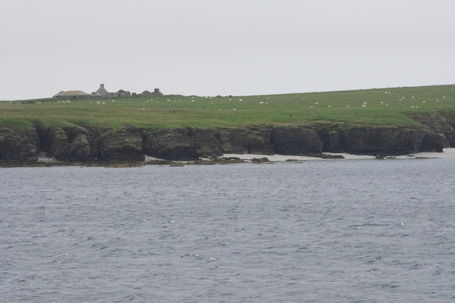
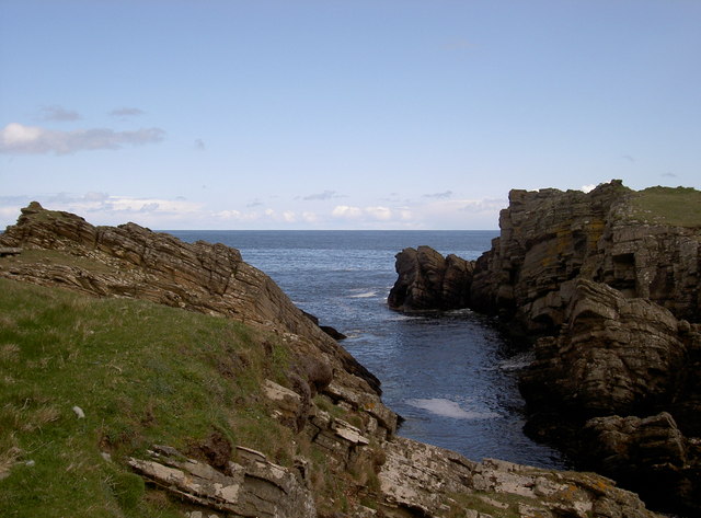
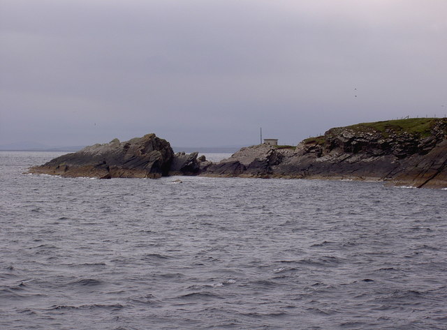
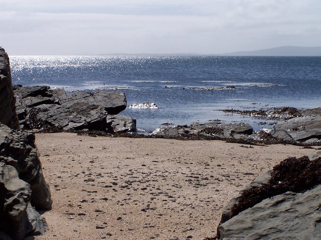
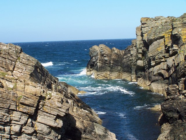
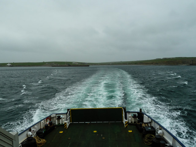
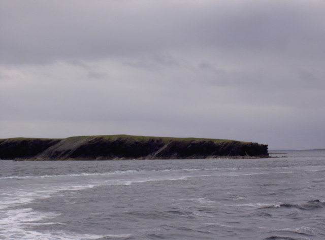
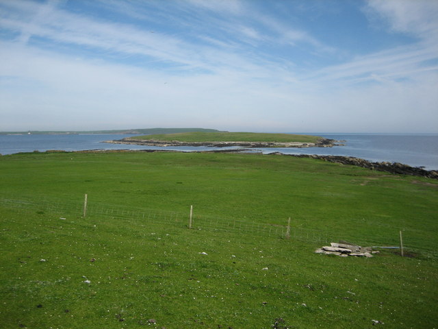
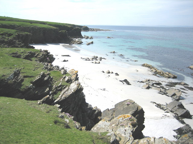
Inniens Bay, located on the island of Orkney in Scotland, is a picturesque bay renowned for its natural beauty and historical significance. Situated on the western coast of the Mainland, the largest island in the Orkney archipelago, the bay offers breathtaking views of the Atlantic Ocean and the surrounding rugged coastline.

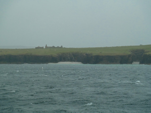
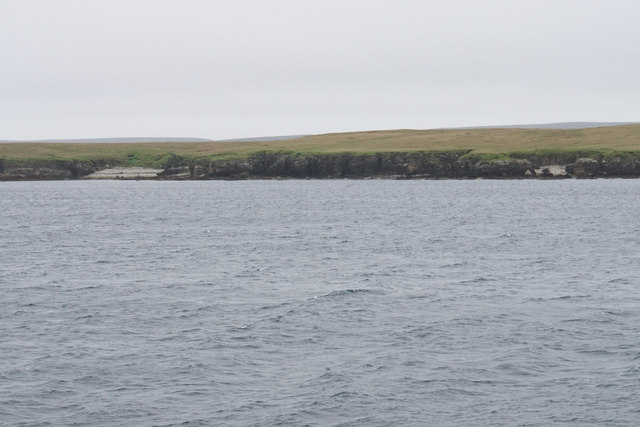
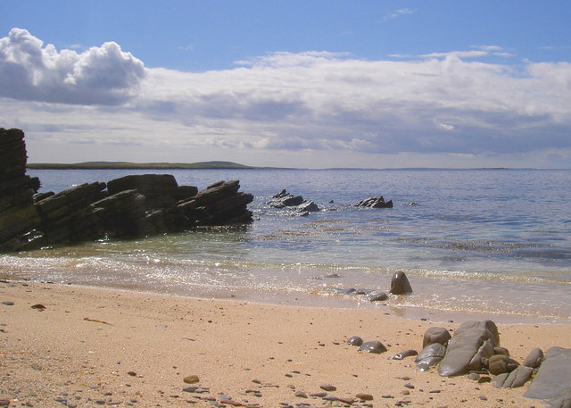
The bay is characterized by its long stretch of sandy beach, which is a popular destination for locals and tourists alike. The pristine golden sands provide an ideal spot for sunbathing, picnicking, and leisurely walks along the shore. The waters of the bay are relatively calm, making it a safe haven for swimming and water sports during the warmer months.

Inniens Bay is also home to a diverse range of flora and fauna, making it an important site for nature enthusiasts. The surrounding dunes and grassy areas are populated with various plant species, including wildflowers and sea grasses. The bay is also a haven for birdwatchers, with numerous seabirds and waders frequenting the area.

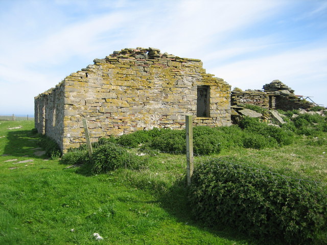
From a historical perspective, Inniens Bay is of significant interest due to its association with the Neolithic period. The nearby Skara Brae, a UNESCO World Heritage site, is a well-preserved prehistoric settlement that dates back over 5,000 years. The bay was likely an important resource for the ancient inhabitants of Skara Brae, providing them with access to fish and other marine resources.

Overall, Inniens Bay offers a unique blend of natural beauty and historical importance, making it a must-visit destination for those exploring the wonders of Orkney.

If you have any feedback on the listing, please let us know in the comments section below.

Inniens Bay Images

Images are sourced within 2km of 59.233721/-2.834791 or Grid Reference HY5238. Thanks to Geograph Open Source API. All images are credited.

Holm of Faray View to the island from the ferry to Kirkwall with Lavey Sound to the far right of picture.
Holm of Faray
View to the island from the ferry to Kirkwall with Lavey Sound to the far right of picture.
Faray View to the island with Broad Sand Geo to the left and Long Sand Geo right on the shore. The abandoned dwelling to the left of picture on the horizon is Cott.
Faray
View to the island with Broad Sand Geo to the left and Long Sand Geo right on the shore. The abandoned dwelling to the left of picture on the horizon is Cott.
Holm of Faray The western side of the island has a few geos. Tystie Geo and Outfloe Geo are visible here.
Holm of Faray
The western side of the island has a few geos. Tystie Geo and Outfloe Geo are visible here.
Point of Dogs Bones and Lavey Sound The southern tip of the Holm of Faray facing the northern tip of Faray.
Point of Dogs Bones and Lavey Sound
The southern tip of the Holm of Faray facing the northern tip of Faray.
Faray The remains of Quoy Farm are on top of the rise, while the cliff below is split by some geos.
Faray
The remains of Quoy Farm are on top of the rise, while the cliff below is split by some geos.
Cliffs of Faray The beginning of a sandy beach which is not very accessible. On top is an abandoned croft called Cott.
Cliffs of Faray
The beginning of a sandy beach which is not very accessible. On top is an abandoned croft called Cott.
Sany Geo, near Weatherness Looking southwest towards the island of Faray and Eday.
Sany Geo, near Weatherness
Looking southwest towards the island of Faray and Eday.
Weather Ness, Rapness, Orkney The rocky outcrop on the right is separated from Westray by the sea.
Weather Ness, Rapness, Orkney
The rocky outcrop on the right is separated from Westray by the sea.
Weatherness, Westray The hut marks the point where the underwater telephone cables first came ashore on Westray.
Weatherness, Westray
The hut marks the point where the underwater telephone cables first came ashore on Westray.
Coral Sands On a sheltered beach, a close inspections shows the sands to be mainly coral; a lovely place to pass a sunny afternoon.
Coral Sands
On a sheltered beach, a close inspections shows the sands to be mainly coral; a lovely place to pass a sunny afternoon.
Weather Ness Exposure to the easterly winds here comes as a surprise after the sheltered approach towards the old telegraph station on the point of Weather Ness.
Weather Ness
Exposure to the easterly winds here comes as a surprise after the sheltered approach towards the old telegraph station on the point of Weather Ness.
Rapness: ferry arriving Looking out from Westray's ferry terminal as the boat comes in. It will soon take me and fellow travellers back to Kirkwall, a 90-minute journey.
Rapness: ferry arriving
Looking out from Westray's ferry terminal as the boat comes in. It will soon take me and fellow travellers back to Kirkwall, a 90-minute journey.
MV Varagen Leaving Westray through Rapness Sound with the ferry terminal centre horizon.
MV Varagen
Leaving Westray through Rapness Sound with the ferry terminal centre horizon.
Cliffs, North end Holm of Faray These cliffs are found at the entrance/exit to Weatherness, which can be a very choppy stretch of water due to strong tides. The Holm of Faray is no longer inhabited except for about a month in springtime for lambing.
Cliffs, North end Holm of Faray
These cliffs are found at the entrance/exit to Weatherness, which can be a very choppy stretch of water due to strong tides. The Holm of Faray is no longer inhabited except for about a month in springtime for lambing.
Lavey Sound and Holm of Faray Lavey Sound separates the northern tip of Faray (in the foreground) from the Holm of Faray except at low tide.  The small pile of rocks in the right foreground is a well located at HY529378, and Westray can be seen on the distant horizon.
Lavey Sound and Holm of Faray
Lavey Sound separates the northern tip of Faray (in the foreground) from the Holm of Faray except at low tide. The small pile of rocks in the right foreground is a well located at HY529378, and Westray can be seen on the distant horizon.
Doggerboat Farmhouse (east side), Faray In 1881 Faray had nine named houses according to the census, however the island has neen uninhabited since shortly after World War II.
Doggerboat Farmhouse (east side), Faray
In 1881 Faray had nine named houses according to the census, however the island has neen uninhabited since shortly after World War II.
Long Sand, Faray The name suggested for this beautiful sandy beach is based on the 1880 (revised 1900, 2nd edition printed 1903) Ordnance Survey map's name for the large geo located halfway along the beach.  The scale for the referenced map is 6 inches = 1 mile.
Long Sand, Faray
The name suggested for this beautiful sandy beach is based on the 1880 (revised 1900, 2nd edition printed 1903) Ordnance Survey map's name for the large geo located halfway along the beach. The scale for the referenced map is 6 inches = 1 mile.
School, Faray The old school building has been restored to provide accommodations on the island during lambing season.  It appears on the 1880 Ordnance Survey map (revised 1900, 2nd edition printed 1903).
School, Faray
The old school building has been restored to provide accommodations on the island during lambing season. It appears on the 1880 Ordnance Survey map (revised 1900, 2nd edition printed 1903).
Show me another place!

Inniens Bay is located at Grid Ref: HY5238 (Lat: 59.233721, Lng: -2.834791)

Unitary Authority: Orkney Islands

Police Authority: Highlands and Islands

What 3 Words

///custodian.according.spelling. Near Backaland, Orkney Islands

Related Wikis

Holm of Faray

The Holm of Faray is a small island in Orkney, Scotland, near Faray and Westray, which it lies between. Together with its neighbour Faray, it is designated...

Faray

Faray (Old Norse: Færey) is a small island in Orkney, Scotland, lying between Eday and Westray. Previously inhabited, the low-lying island is now a successful...

Rapness

Rapness is a settlement on the island of Westray in Orkney, Scotland. The slipway is the ferry terminal for the Orkney Ferries crossing from Kirkwall on...

Rusk Holm

Rusk Holm is a small island in the Orkney Islands, near Faray to the west. == History == There is a prehistoric cairn on it . Rusk Holm is also home to...

Nearby Amenities

Located within 500m of 59.233721,-2.834791
Created By: almien_coastlines mod
Lat/Long: 59.233055/-2.832617
Created By: almien_coastlines mod
Lat/Long: 59.237017/-2.829349
The data included in this document is from www.openstreetmap.org. The data is made available under ODbL.

Have you been to Inniens Bay?

Leave your review of Inniens Bay below (or comments, questions and feedback).