Bay of Swartmill

Bay in Orkney

Scotland

Bay of Swartmill

Old Milestone by the B9066, near Loch of Swartmill, Westray Parish By the B9066, in parish of Westray (District), Moss brae, opposite red telephone box.

Surveyed

Milestone Society National ID: OR_WYPWRP03.
Old Milestone by the B9066, near Loch of Swartmill, Westray Parish Credit: Milestone Society

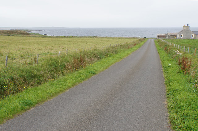
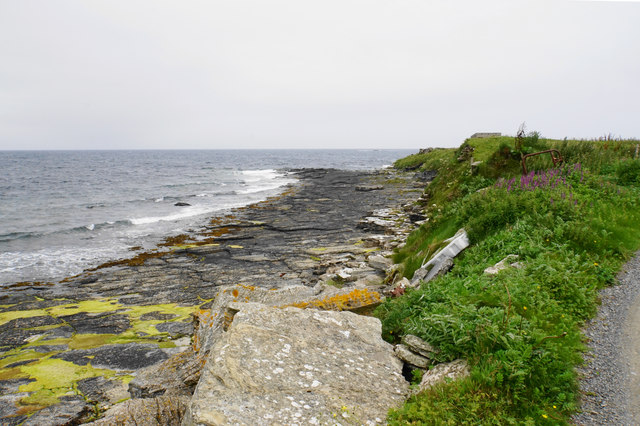
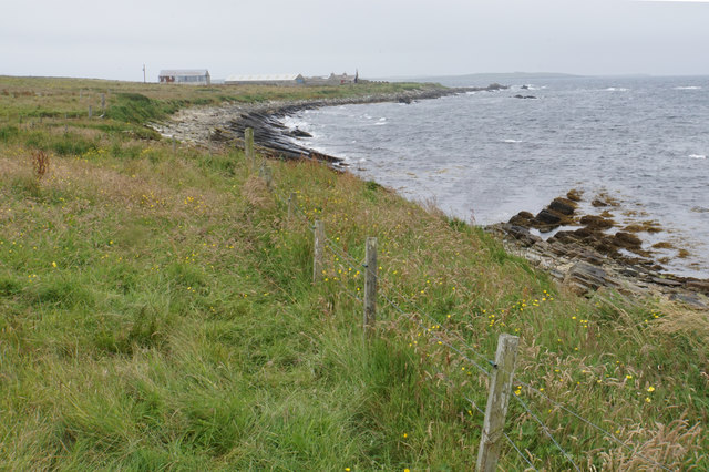
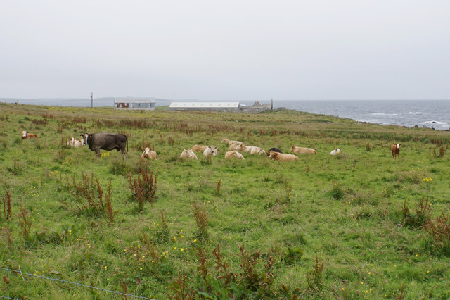
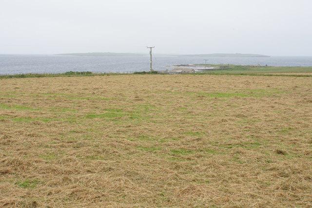
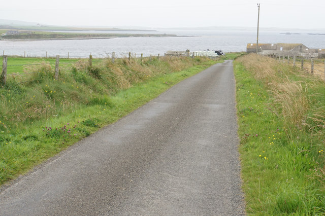
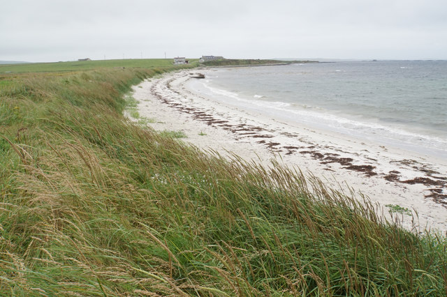
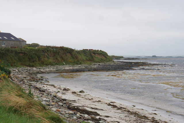
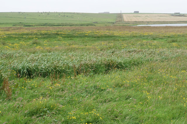
The Bay of Swartmill is a picturesque bay located on the west coast of the Orkney Mainland, an island in Scotland. It is situated near the village of Swartmill, which is known for its stunning views and tranquil atmosphere. The bay is bordered by rugged cliffs and sandy beaches, making it a popular destination for nature enthusiasts and beachcombers alike.

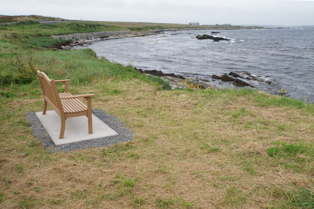
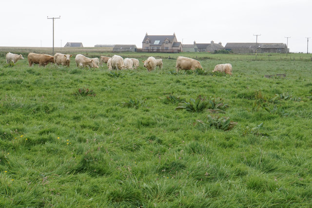
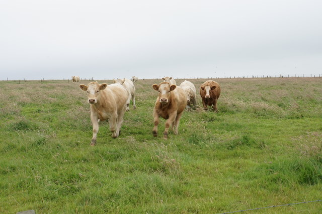
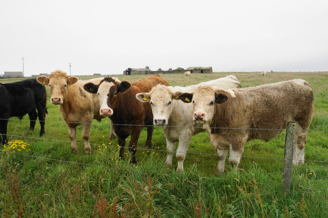
The Bay of Swartmill offers breathtaking vistas of the North Atlantic Ocean, with its clear blue waters and crashing waves. The bay is also home to a diverse range of wildlife, including seabirds, seals, and even occasional sightings of dolphins and whales. Birdwatchers can spot various species such as puffins, guillemots, and kittiwakes nesting on the cliffs surrounding the bay.

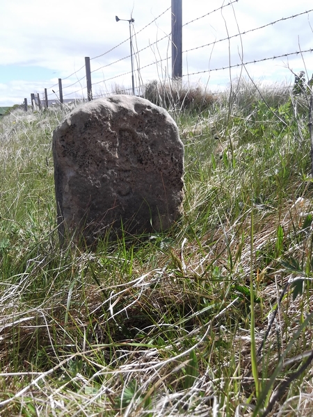
The bay is not only a natural beauty but also holds historical significance. Close to the bay is the remains of the Swartmill Broch, an ancient circular stone tower dating back to the Iron Age. This archaeological site attracts history enthusiasts who are keen to explore the area's rich heritage.

Visitors to the Bay of Swartmill can enjoy a peaceful stroll along the sandy beach, take in the stunning views, or indulge in activities such as kayaking or fishing. The bay is also a popular spot for picnics and barbecues, offering a perfect setting for family outings or a relaxing day by the sea.

Overall, the Bay of Swartmill is a captivating destination that combines natural beauty, wildlife, and historical significance, making it a must-visit location for those exploring the Orkney Mainland.

If you have any feedback on the listing, please let us know in the comments section below.

Bay of Swartmill Images

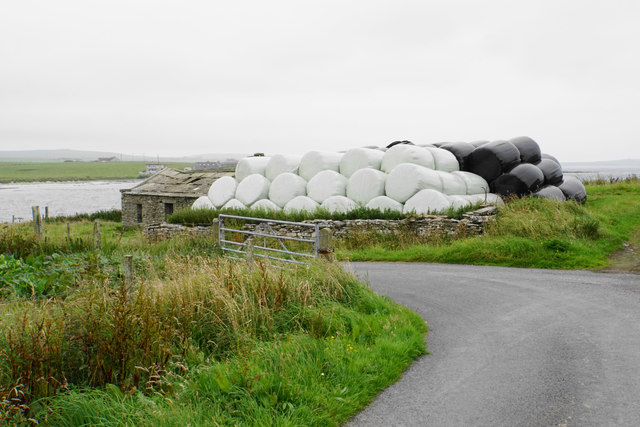
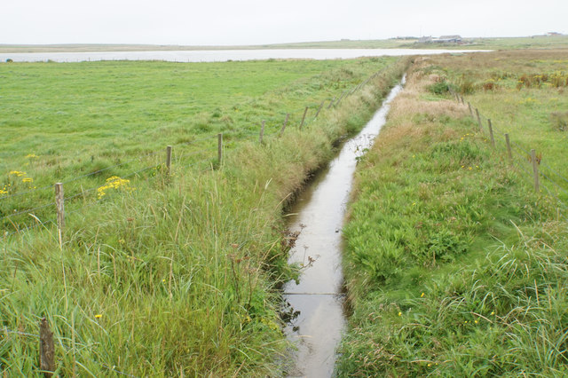
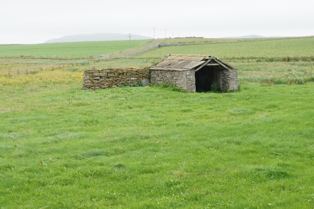
Images are sourced within 2km of 59.305016/-2.9036061 or Grid Reference HY4846. Thanks to Geograph Open Source API. All images are credited.

Old Milestone by the B9066, near Loch of Swartmill, Westray Parish By the B9066, in parish of Westray (District), Moss brae, opposite red telephone box.

Surveyed

Milestone Society National ID: OR_WYPWRP03.
Old Milestone by the B9066, near Loch of Swartmill, Westray Parish
By the B9066, in parish of Westray (District), Moss brae, opposite red telephone box. Surveyed Milestone Society National ID: OR_WYPWRP03.
Road to Surrigarth The bay of Skel Wick is opening up ahead.
Road to Surrigarth
The bay of Skel Wick is opening up ahead.
Bench near Surrigarth Looking out over Skel Wick.
Bench near Surrigarth
Looking out over Skel Wick.
Point of Furrigeo A low headland on the southern side of Skel Wick.
Point of Furrigeo
A low headland on the southern side of Skel Wick.
Cattle at Surrigarth Looking inland towards Kirkhouse Farm.
Cattle at Surrigarth
Looking inland towards Kirkhouse Farm.
Village shop at Surrigarth Very well stocked for its size, and it has a good range of local bottled beer. The porch is fairly recent.
Village shop at Surrigarth
Very well stocked for its size, and it has a good range of local bottled beer. The porch is fairly recent.
Coast near Ramsay Looking towards Ramsay Ness on the side of Skel Wick.
Coast near Ramsay
Looking towards Ramsay Ness on the side of Skel Wick.
Cattle near Ramsay A fairly exposed position on the eastern side of Westray.
Cattle near Ramsay
A fairly exposed position on the eastern side of Westray.
Cattle on the move These ones were very eager to see me.
Cattle on the move
These ones were very eager to see me.
Cattle near North Tuan The farm behind, North Tuan, is now a ruin.
Cattle near North Tuan
The farm behind, North Tuan, is now a ruin.
Cut grass near Thorn Farm Looking out towards Spo Ness, with Papa Westray in the distance.
Cut grass near Thorn Farm
Looking out towards Spo Ness, with Papa Westray in the distance.
Road to Swartmill The Bay of Swartmill is laid out ahead. In the distance is the northern end of Westray.
Road to Swartmill
The Bay of Swartmill is laid out ahead. In the distance is the northern end of Westray.
Pile of silage bales at Swartmill Farm The pile was emitting a strong aroma.
Pile of silage bales at Swartmill Farm
The pile was emitting a strong aroma.
Bay of Swartmill A white sandy beach with the tide currently fairly high.
Bay of Swartmill
A white sandy beach with the tide currently fairly high.
Outflow from the Loch of Swartmill The inland loch drains into the sea here.
Outflow from the Loch of Swartmill
The inland loch drains into the sea here.
Barn near Smithquoy
Barn near Smithquoy
Coast below Smithquoy Looking to the northern end of the Bay of Swartmill.
Coast below Smithquoy
Looking to the northern end of the Bay of Swartmill.
Different grasses by the Loch of Swartmill Low-lying soggy ground between the loch and the sea.
Different grasses by the Loch of Swartmill
Low-lying soggy ground between the loch and the sea.
Show me another place!

Bay of Swartmill is located at Grid Ref: HY4846 (Lat: 59.305016, Lng: -2.9036061)

Unitary Authority: Orkney Islands

Police Authority: Highlands and Islands

What 3 Words

///upward.cubed.funny. Near Pierowall, Orkney Islands

Related Wikis

Holland House, Papa Westray

Holland Farm is a historic farm complex located on the island of Papa Westray in Orkney, Scotland. The two-storey harled flagstone house with crow-stepped...

Westside Church

Westside Church, (also known as Cross Kirk), is a ruined 12th century church located on the island of Westray in Orkney, Scotland. Archaeological excavations...

Knap of Howar

The Knap of Howar () on the island of Papa Westray in Orkney, Scotland is a Neolithic farmstead which may be the oldest preserved stone house in northern...

Papa Westray

Papa Westray () (Scots: Papa Westree), also known as Papay, is one of the Orkney Islands in Scotland, United Kingdom. The fertile soil has long been a...

Nearby Amenities

Located within 500m of 59.305016,-2.9036061
Spo Ness
Place: locality
Lat/Long: 59.3035894/-2.9049186
The data included in this document is from www.openstreetmap.org. The data is made available under ODbL.

Have you been to Bay of Swartmill?

Leave your review of Bay of Swartmill below (or comments, questions and feedback).