Langland Bay

Bay in Glamorgan

Wales

Langland Bay

Busy at Verdi's A hot sunny day has brought people out onto the terrace at Verdi's restaurant
Busy at Verdi's Credit: Des Blenkinsopp

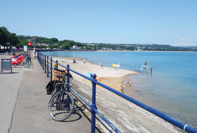
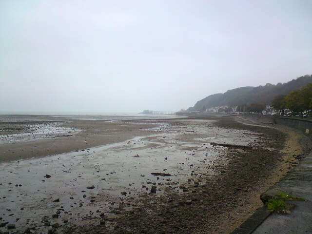
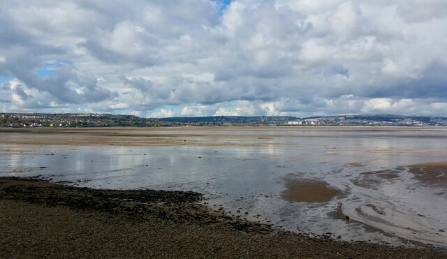
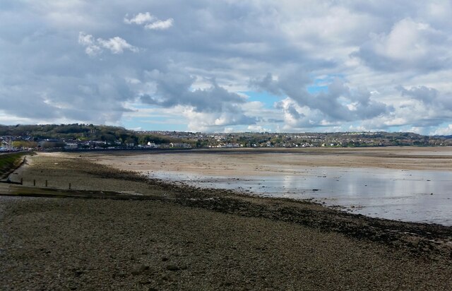
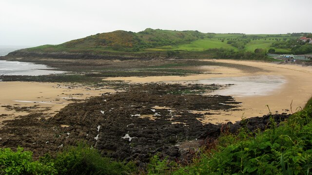
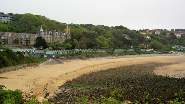
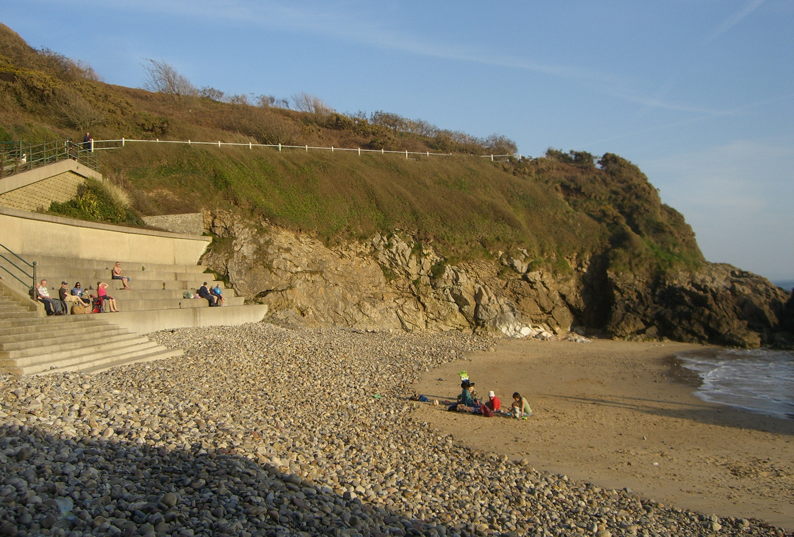
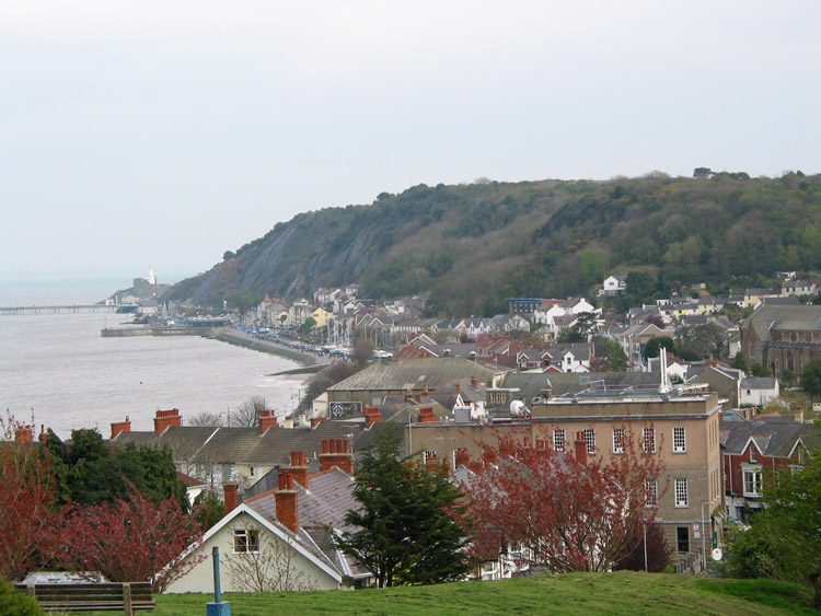
Langland Bay is a picturesque and popular coastal location situated in the county of Glamorgan, South Wales. It is located approximately 5 miles southwest of Swansea and is well-known for its stunning natural beauty and sandy beach. The bay is nestled between the headlands of Rotherslade and Bracelet Bay, offering breathtaking views of the Bristol Channel.

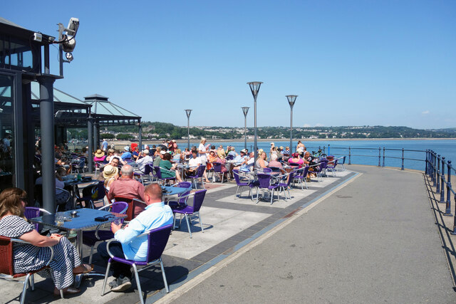
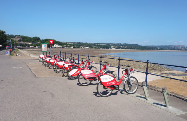
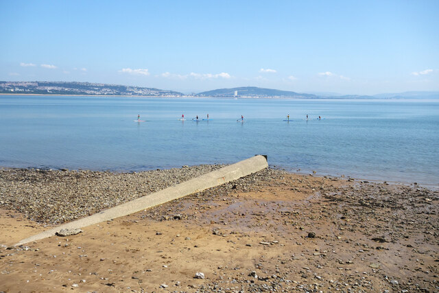
The beach at Langland Bay is a popular destination for both locals and tourists alike. It stretches for approximately 750 meters and is backed by a promenade, providing a pleasant walk along the coast. The beach is sandy, making it ideal for sunbathing, picnicking, and beach games. The waters are generally calm, making it a great spot for swimming and water sports such as paddleboarding and kayaking.

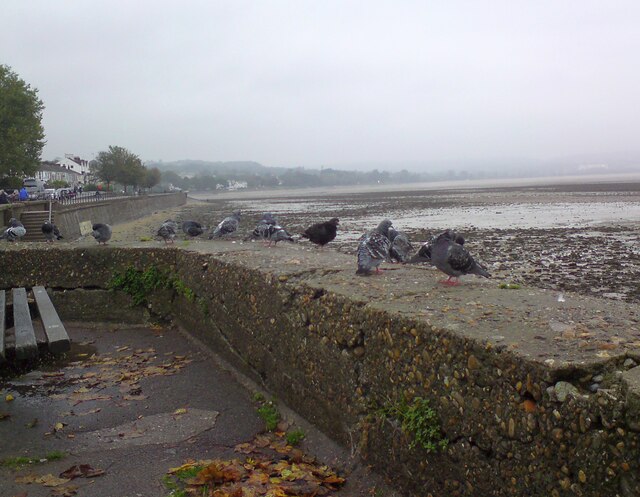
The bay is surrounded by lush green cliffs and offers a peaceful and tranquil atmosphere. It is also home to a variety of wildlife, including seabirds and marine life, which can be spotted from the shore or while exploring the rock pools at low tide. The bay is also a popular spot for fishing enthusiasts.

Langland Bay is well-served by amenities, with a beachside café, restaurant, and public toilets available. There is also a car park nearby, providing convenient access to the beach. Lifeguards are on duty during the summer months, ensuring the safety of visitors.

Overall, Langland Bay is a stunning coastal destination that offers a combination of natural beauty, recreational activities, and a peaceful ambiance, making it a popular choice for visitors seeking relaxation and outdoor enjoyment.

If you have any feedback on the listing, please let us know in the comments section below.
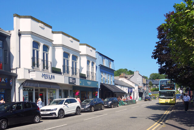
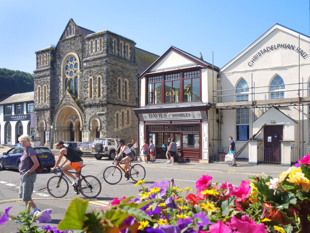
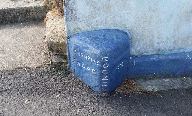
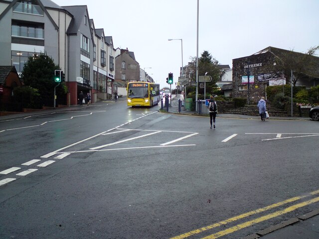
Langland Bay Images

Images are sourced within 2km of 51.566058/-4.0091374 or Grid Reference SS6087. Thanks to Geograph Open Source API. All images are credited.

Busy at Verdi's A hot sunny day has brought people out onto the terrace at Verdi's restaurant
Busy at Verdi's
A hot sunny day has brought people out onto the terrace at Verdi's restaurant
Hire Bikes by the Beach A cycleway runs beside the bay all the way from Mumbles Head into Swansea.
A rack of Santander hire bikes is just here.
Hire Bikes by the Beach
A cycleway runs beside the bay all the way from Mumbles Head into Swansea. A rack of Santander hire bikes is just here.
Paddleboarders and Pipe Paddleboarders enjoying a very calm sea off the small patch of beach which is in SS6187.
Paddleboarders and Pipe
Paddleboarders enjoying a very calm sea off the small patch of beach which is in SS6187.
Memorial by Myrtle Terrace On the corner of Myrtle Terrace and Mumbles Road is a rather forgotten looking stone memorial celebrating the marriage of the Prince of Wales (later King Edward 7th) and Princess Alexandra in 1863.
Memorial by Myrtle Terrace
On the corner of Myrtle Terrace and Mumbles Road is a rather forgotten looking stone memorial celebrating the marriage of the Prince of Wales (later King Edward 7th) and Princess Alexandra in 1863.
Devon Place, Mumbles Residential street one block in from the sea front.
Devon Place, Mumbles
Residential street one block in from the sea front.
Shop Fronts, Mumbles Road A short terrace of shops with a bit extra added to the top of the facade for effect.
Shop Fronts, Mumbles Road
A short terrace of shops with a bit extra added to the top of the facade for effect.
Religion & Cakes, Mumbles Road Mumbles Methodist Church, opened 1878, and the Christadelphian Hall, with Davies of Mumbles, bakers and confectioners, in between.
Religion & Cakes, Mumbles Road
Mumbles Methodist Church, opened 1878, and the Christadelphian Hall, with Davies of Mumbles, bakers and confectioners, in between.
Low Tide at Oystermouth Low tide exposes a large beach, unfortunately not blessed with the wide expanses of sand found elsewhere.
The notice on the railings refers to the Covid epidemic of 2020/21.
Low Tide at Oystermouth
Low tide exposes a large beach, unfortunately not blessed with the wide expanses of sand found elsewhere. The notice on the railings refers to the Covid epidemic of 2020/21.
High Tide at Oystermouth The high tide comes right up to the sea wall. A concrete slipway is a makeshift beach for these people.
High Tide at Oystermouth
The high tide comes right up to the sea wall. A concrete slipway is a makeshift beach for these people.
Ordnance Survey Cut Mark This OS cut mark can be found on the wall between Nos 364 & 366 Mumbles Road. It marks a point 7.001m above mean sea level.
Ordnance Survey Cut Mark
This OS cut mark can be found on the wall between Nos 364 & 366 Mumbles Road. It marks a point 7.001m above mean sea level.
Turnpike Boundary Stone
Mumbles foreshore Looking towards Mumbles and the pier from Oystermouth.
Mumbles foreshore
Looking towards Mumbles and the pier from Oystermouth.
Newton Road, Mumbles The B4593 out of Oystermouth. On the corner of Castle Avenue is  the Ostreme Community Centre. In 1978 Ostreme Community Association obtained a 35 year lease from All Saints' Church, Oystermouth to refurbish their derelict church hall and run it as a community centre. In 1980 after major work, Ostreme Centre opened to the public as an independent community hall managed by volunteers.
<span class="nowrap"><a title="http://www.ostremecentre.co.uk/about-us/" rel="nofollow ugc noopener" href="http://www.ostremecentre.co.uk/about-us/">Link</a><img style="margin-left:2px;" alt="External link" title="External link - shift click to open in new window" src="https://s1.geograph.org.uk/img/external.png" width="10" height="10"/></span>
Newton Road, Mumbles
The B4593 out of Oystermouth. On the corner of Castle Avenue is the Ostreme Community Centre. In 1978 Ostreme Community Association obtained a 35 year lease from All Saints' Church, Oystermouth to refurbish their derelict church hall and run it as a community centre. In 1980 after major work, Ostreme Centre opened to the public as an independent community hall managed by volunteers. LinkExternal link
Oystermouth pigeons 
At most seaside resorts it is the gulls that gather on the seawall scavenging for visitors' titbits as they sit watching the tide. But this is Oystermouth and we are within the city of Swansea so here it is urban pigeons that congregate on the seawall.
Oystermouth pigeons
At most seaside resorts it is the gulls that gather on the seawall scavenging for visitors' titbits as they sit watching the tide. But this is Oystermouth and we are within the city of Swansea so here it is urban pigeons that congregate on the seawall.
Swansea Bay
Swansea Bay
Swansea Bay
Swansea Bay
Langland Bay View west from the coastal path
Langland Bay
View west from the coastal path
Langland Bay Beach Chalets Behind the chalets is the WCIU Holiday & Convalescent Home built in baronial style. Viewed from the coastal path
Langland Bay Beach Chalets
Behind the chalets is the WCIU Holiday & Convalescent Home built in baronial style. Viewed from the coastal path
Show me another place!

Langland Bay is located at Grid Ref: SS6087 (Lat: 51.566058, Lng: -4.0091374)

Unitary Authority: Swansea

Police Authority: South Wales

What 3 Words

///specifies.oath.league. Near Bishopston, Swansea

Related Wikis

Rotherslade

Rotherslade is a small stretch of sandy beach at the eastern end of Langland Bay in the south Gower Peninsula, Wales. Previously known as 'Little Langland...

Langland Bay

Langland Bay is a popular coastal holiday resort in Gower, Swansea in south Wales. It is a popular surfing beach which regularly meets the European Blue...

Mumbles (district)

The Mumbles is a district of Swansea, Wales, located on the south-east corner of the unitary authority area. It is also a local government community of...

Oystermouth

Oystermouth (Welsh: Ystumllwynarth) is a village (and former electoral ward) in the district of Mumbles, Swansea, Wales. It is part of the Mumbles community...

All Saints' Church, Oystermouth

All Saints' Church, Oystermouth (officially "All Saints, Oystermouth") is an Anglican church in the diocese of Swansea and Brecon, south Wales. It is located...

Newton, Swansea

Newton is a village (and former electoral ward) in the city of and County of Swansea, Wales. The village is located near the Mumbles just inland and uphill...

Oystermouth Castle

Oystermouth Castle (Welsh: Castell Ystum Llwynarth) is a Norman stone castle in Wales, overlooking Swansea Bay on the east side of the Gower Peninsula...

Oystermouth Cemetery

Oystermouth Cemetery (Welsh: Mynwentydd Ystumllwynarth) is a municipal cemetery in the village of Oystermouth, Swansea, South Wales. It was opened in 1883...

Nearby Amenities

Located within 500m of 51.566058,-4.0091374
Traffic Signals
Direction: forward
Lat/Long: 51.5686153/-4.0072886
Traffic Signals
Traffic Signals Direction: backward
Lat/Long: 51.5684004/-4.0074139
Rotherslade
Created By: Potlatch 0.9c
Is In: Swansea
Place: hamlet
Lat/Long: 51.5689647/-4.0065355
Langland Bay
Natural: bay
Lat/Long: 51.5656992/-4.0100393
Snaple Point
Tourism: viewpoint
Lat/Long: 51.5644193/-4.0142874
Post Box
Collection Times: Mo-Fr 17:30; Sa 12:45
Operator: Royal Mail
Operator Wikidata: Q638098
Lat/Long: 51.5703358/-4.0079433
Post Box
Operator: Royal Mail
Operator Wikidata: Q638098
Lat/Long: 51.5690288/-4.0105119
Entrance: main
Lat/Long: 51.5677523/-4.0141595
Barrier: swing_gate
Material: metal
Swing Gate Type: double
Lat/Long: 51.5677953/-4.0138517
Bench
Lat/Long: 51.5673495/-4.0147618
Bench
Lat/Long: 51.5671372/-4.0150095
Bench
Lat/Long: 51.5653816/-4.01428
Bench
Lat/Long: 51.5669788/-4.0045999
Cafe
Surfside Cafe
Addr Postcode: SA3 4QW
Addr Street: Rotherslade Road
Fhrs Id: 410376
Website: https://www.surfsidecafes.com/
Lat/Long: 51.568045/-4.0060529
Noexit: yes
Lat/Long: 51.5684988/-4.0046522
Defibrillator
Emergency: defibrillator
Lat/Long: 51.5683868/-4.0106496
Turning Circle
Lat/Long: 51.5684871/-4.0039308
Noexit: yes
Lat/Long: 51.5677598/-4.0057155
Direction: 175
Generator Method: photovoltaic
Generator Output Electricity: yes
Generator Solar Modules: 18
Generator Source: solar
Generator Type: solar_photovoltaic_panel
Location: roof
Power: generator
Lat/Long: 51.5674231/-4.002511
Direction: SSE
Generator Method: photovoltaic
Generator Output Electricity: yes
Generator Solar Modules: 38
Generator Source: solar
Generator Type: solar_photovoltaic_panel
Location: roof
Note: panels in "VVVV" format to get more in smaller area
Power: generator
Lat/Long: 51.5683225/-4.0040794
Direction: SSE
Generator Method: photovoltaic
Generator Output Electricity: yes
Generator Solar Modules: 28
Generator Source: solar
Generator Type: solar_photovoltaic_panel
Location: roof
Note: panels in "VVVV" format to get more in smaller area
Power: generator
Lat/Long: 51.5683142/-4.0041941
Direction: 235
Generator Method: photovoltaic
Generator Output Electricity: yes
Generator Solar Modules: 12
Generator Source: solar
Generator Type: solar_photovoltaic_panel
Location: roof
Power: generator
Lat/Long: 51.5681604/-4.0054359
Direction: 175
Generator Method: photovoltaic
Generator Output Electricity: yes
Generator Solar Modules: 12
Generator Source: solar
Generator Type: solar_photovoltaic_panel
Location: roof
Power: generator
Lat/Long: 51.5700385/-4.0082482
Bench
Backrest: yes
Lat/Long: 51.564592/-4.014304
Bench
Backrest: yes
Lat/Long: 51.5644911/-4.0142182
Bench
Backrest: yes
Lat/Long: 51.5645366/-4.014357
Bench
Backrest: yes
Lat/Long: 51.5645049/-4.014363
Bench
Backrest: yes
Lat/Long: 51.5644665/-4.0143637
Bench
Backrest: yes
Lat/Long: 51.5644715/-4.0145095
Bench
Backrest: yes
Lat/Long: 51.5644888/-4.0146409
Bench
Backrest: yes
Lat/Long: 51.5645155/-4.0146691
Direction East: Limeslade
Direction West: Rotherslade
Guide Type: destination
Information: guidepost
Tourism: information
Lat/Long: 51.5667409/-4.0030974
Direction East: Limeslade
Direction West: Rotherslade
Guide Type: destination
Information: guidepost
Tourism: information
Lat/Long: 51.5671745/-4.0052296
Bench
Lat/Long: 51.5643694/-4.0144099
Barrier: lift_gate
Lift Gate Type: single
Lat/Long: 51.5689794/-4.0069346
Fixme: continues
Lat/Long: 51.5685188/-4.0067469
Bench
Backrest: yes
Lat/Long: 51.5643832/-4.0141806
Bench
Backrest: yes
Lat/Long: 51.5643928/-4.0143774
Bench
Backrest: yes
Lat/Long: 51.5647529/-4.0141256
Waste Basket
Lat/Long: 51.5659292/-4.0144606
Waste Basket
Lat/Long: 51.5663593/-4.0148431
Bench
Backrest: yes
Lat/Long: 51.5660151/-4.0144884
Bench
Backrest: yes
Lat/Long: 51.5660467/-4.0144891
Bench
Backrest: yes
Lat/Long: 51.5660742/-4.0144706
Bench
Backrest: yes
Lat/Long: 51.5661068/-4.0145212
Bench
Backrest: yes
Lat/Long: 51.566153/-4.0145437
Bench
Backrest: yes
Lat/Long: 51.5661889/-4.0145927
Bench
Backrest: yes
Lat/Long: 51.5662195/-4.0146376
Bench
Backrest: yes
Lat/Long: 51.5662564/-4.0146946
Bench
Backrest: yes
Lat/Long: 51.5662956/-4.0147486
Bench
Backrest: yes
Lat/Long: 51.566327/-4.0147801
Bench
Backrest: yes
Lat/Long: 51.5670648/-4.0150278
Waste Basket
Lat/Long: 51.5670952/-4.0150138
Waste Basket
Lat/Long: 51.5677553/-4.0137126
Barrier: bollard
Lat/Long: 51.5683859/-4.0105874
Bench
Backrest: yes
Lat/Long: 51.5684134/-4.009877
Bench
Backrest: yes
Lat/Long: 51.5684121/-4.0099977
Bench
Backrest: yes
Lat/Long: 51.5684134/-4.0099313
Bench
Backrest: yes
Lat/Long: 51.5684138/-4.0098207
Bench
Backrest: yes
Lat/Long: 51.5684151/-4.0097751
Bench
Backrest: yes
Lat/Long: 51.5684105/-4.009706
Bench
Backrest: yes
Lat/Long: 51.5684088/-4.009647
The data included in this document is from www.openstreetmap.org. The data is made available under ODbL.

Have you been to Langland Bay?

Leave your review of Langland Bay below (or comments, questions and feedback).