Langland Bay

Settlement in Glamorgan

Wales

Langland Bay

Ordnance Survey Cut Mark This OS cut mark can be found on the wall between Nos 364 & 366 Mumbles Road. It marks a point 7.001m above mean sea level.
Ordnance Survey Cut Mark Credit: Adrian Dust

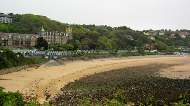
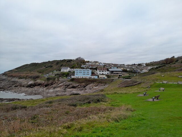
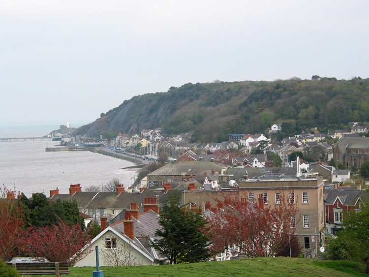
Langland Bay is a picturesque coastal village located in the county of Glamorgan, Wales. Situated on the Gower Peninsula, it is a popular tourist destination known for its stunning sandy beach and breathtaking scenery. The bay is nestled between the larger resorts of Caswell Bay and Mumbles, offering visitors a tranquil and idyllic setting.

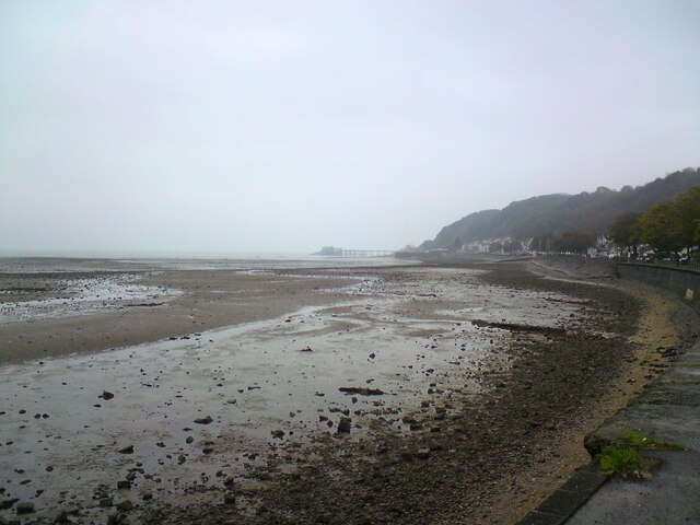
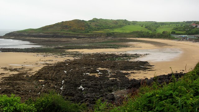
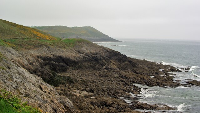
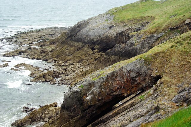
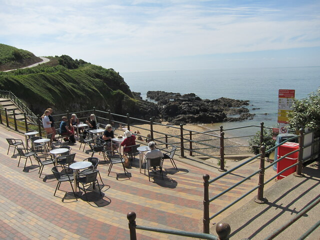
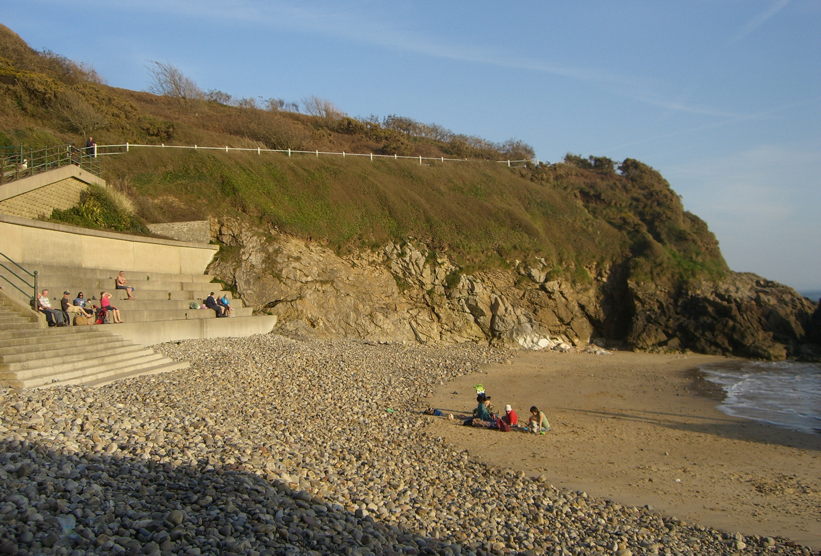
The beach at Langland Bay stretches for approximately half a mile and is renowned for its clean waters and excellent water quality, making it a haven for swimmers, surfers, and water sports enthusiasts. The bay is also a designated Blue Flag beach, ensuring visitors of its high environmental standards. The sands are backed by rugged cliffs and grassy slopes, providing a perfect spot for picnics and sunbathing, while the surrounding coastal paths offer fantastic opportunities for walking and exploring.

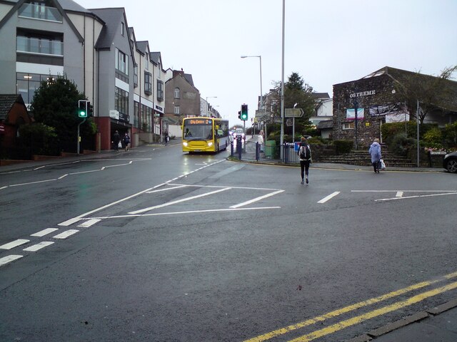
Langland Bay is not only known for its natural beauty but also boasts a rich history. The nearby Langland Bay Golf Club, established in 1904, is one of the oldest golf courses in Wales and offers stunning views of the bay. The village itself is a charming mix of traditional and modern architecture, with a range of amenities including cafes, restaurants, and boutique shops.

Throughout the year, Langland Bay hosts various events and festivals, attracting both locals and tourists. These include beach volleyball tournaments, live music performances, and food fairs, adding to the vibrant and welcoming atmosphere of the area.

In summary, Langland Bay in Glamorgan is a postcard-perfect coastal village renowned for its beautiful beach, clear waters, and stunning scenery. With its range of activities and amenities, it offers a perfect retreat for those seeking relaxation or outdoor adventures in a picturesque setting.

If you have any feedback on the listing, please let us know in the comments section below.
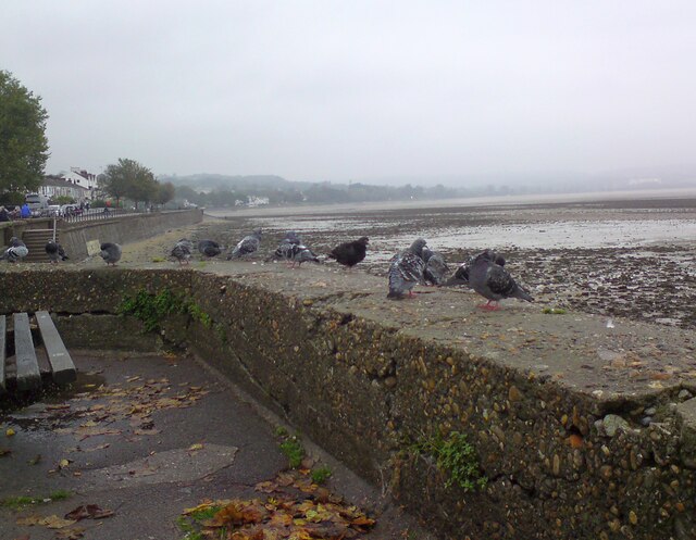
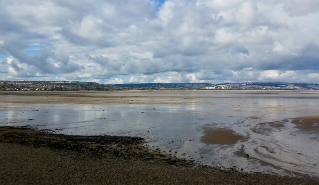
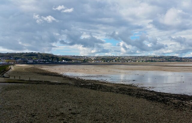
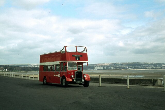
Langland Bay Images

Images are sourced within 2km of 51.568094/-4.010598 or Grid Reference SS6087. Thanks to Geograph Open Source API. All images are credited.

Ordnance Survey Cut Mark This OS cut mark can be found on the wall between Nos 364 & 366 Mumbles Road. It marks a point 7.001m above mean sea level.
Ordnance Survey Cut Mark
This OS cut mark can be found on the wall between Nos 364 & 366 Mumbles Road. It marks a point 7.001m above mean sea level.
Turnpike Boundary Stone
Mumbles foreshore Looking towards Mumbles and the pier from Oystermouth.
Mumbles foreshore
Looking towards Mumbles and the pier from Oystermouth.
Newton Road, Mumbles The B4593 out of Oystermouth. On the corner of Castle Avenue is  the Ostreme Community Centre. In 1978 Ostreme Community Association obtained a 35 year lease from All Saints' Church, Oystermouth to refurbish their derelict church hall and run it as a community centre. In 1980 after major work, Ostreme Centre opened to the public as an independent community hall managed by volunteers.
<span class="nowrap"><a title="http://www.ostremecentre.co.uk/about-us/" rel="nofollow ugc noopener" href="http://www.ostremecentre.co.uk/about-us/">Link</a><img style="margin-left:2px;" alt="External link" title="External link - shift click to open in new window" src="https://s1.geograph.org.uk/img/external.png" width="10" height="10"/></span>
Newton Road, Mumbles
The B4593 out of Oystermouth. On the corner of Castle Avenue is the Ostreme Community Centre. In 1978 Ostreme Community Association obtained a 35 year lease from All Saints' Church, Oystermouth to refurbish their derelict church hall and run it as a community centre. In 1980 after major work, Ostreme Centre opened to the public as an independent community hall managed by volunteers. LinkExternal link
Oystermouth pigeons 
At most seaside resorts it is the gulls that gather on the seawall scavenging for visitors' titbits as they sit watching the tide. But this is Oystermouth and we are within the city of Swansea so here it is urban pigeons that congregate on the seawall.
Oystermouth pigeons
At most seaside resorts it is the gulls that gather on the seawall scavenging for visitors' titbits as they sit watching the tide. But this is Oystermouth and we are within the city of Swansea so here it is urban pigeons that congregate on the seawall.
Swansea Bay
Swansea Bay
Swansea Bay
Swansea Bay
Langland Bay View west from the coastal path
Langland Bay
View west from the coastal path
Langland Bay Beach Chalets Behind the chalets is the WCIU Holiday & Convalescent Home built in baronial style. Viewed from the coastal path
Langland Bay Beach Chalets
Behind the chalets is the WCIU Holiday & Convalescent Home built in baronial style. Viewed from the coastal path
Coastal Path on Newton Cliff View east on the path to Snaple Point
Coastal Path on Newton Cliff
View east on the path to Snaple Point
Cliff Erosion Split in the bedding plane? Viewed from the coastal path around Newton Cliff.
Cliff Erosion
Split in the bedding plane? Viewed from the coastal path around Newton Cliff.
Oystermouth Castle The curtain wall to the west
Oystermouth Castle
The curtain wall to the west
The Chapel At Oystermouth Castle before the 2011 renovation
The Chapel
At Oystermouth Castle before the 2011 renovation
Across Limeslade Bay Viewed from the car park below the old coastguard station.
Across Limeslade Bay
Viewed from the car park below the old coastguard station.
Ordnance Survey Rivet This repositioned OS rivet can be found a stone east side of the cemetery path. It marked a point 55.745m above mean sea level.
Ordnance Survey Rivet
This repositioned OS rivet can be found a stone east side of the cemetery path. It marked a point 55.745m above mean sea level.
Rotherslade Bay
Rotherslade Bay
At Limeslade Bay – 1979 South Wales Transport bus 500 was on a private tour, covering bus routes in the Swansea and Gower area. It appears to be turning into the dead-end road at Limeslade, but is being posed for photographers! The house on the right was demolished around 2017.

The bus was built in 1953 for the Eastern National company and converted to open top configuration in 1965. It moved to South Wales in 1974 to provide open top services in the Swansea Bay and Gower area. It survives in preservation.

This is one of a series of views featuring buses in the 60s, 70s, and 80s. <a title="https://www.geograph.org.uk/search.php?i=137652761" href="https://www.geograph.org.uk/search.php?i=137652761">Link</a>
At Limeslade Bay – 1979
South Wales Transport bus 500 was on a private tour, covering bus routes in the Swansea and Gower area. It appears to be turning into the dead-end road at Limeslade, but is being posed for photographers! The house on the right was demolished around 2017. The bus was built in 1953 for the Eastern National company and converted to open top configuration in 1965. It moved to South Wales in 1974 to provide open top services in the Swansea Bay and Gower area. It survives in preservation. This is one of a series of views featuring buses in the 60s, 70s, and 80s. Link
At Oystermouth – 1979 South Wales Transport bus 500 was on a private tour, covering bus routes in the Swansea and Gower area, and was posed for photography at this location.

The bus was built in 1953 for the Eastern National company and converted to open top configuration in 1965. It moved to South Wales in 1974 to provide open top services in the Swansea Bay and Gower area. It survives in preservation.

This is one of a series of views featuring buses in the 60s, 70s, and 80s. <a title="https://www.geograph.org.uk/search.php?i=137652761" href="https://www.geograph.org.uk/search.php?i=137652761">Link</a>
At Oystermouth – 1979
South Wales Transport bus 500 was on a private tour, covering bus routes in the Swansea and Gower area, and was posed for photography at this location. The bus was built in 1953 for the Eastern National company and converted to open top configuration in 1965. It moved to South Wales in 1974 to provide open top services in the Swansea Bay and Gower area. It survives in preservation. This is one of a series of views featuring buses in the 60s, 70s, and 80s. Link
Show me another place!

Langland Bay is located at Grid Ref: SS6087 (Lat: 51.568094, Lng: -4.010598)

Unitary Authority: Swansea

Police Authority: South Wales

What 3 Words

///incorrect.owned.wiring. Near Bishopston, Swansea

Related Wikis

Rotherslade

Rotherslade is a small stretch of sandy beach at the eastern end of Langland Bay in the south Gower Peninsula, Wales. Previously known as 'Little Langland...

Langland Bay

Langland Bay is a popular coastal holiday resort in Gower, Swansea in south Wales. It is a popular surfing beach which regularly meets the European Blue...

Oystermouth

Oystermouth (Welsh: Ystumllwynarth) is a village (and former electoral ward) in the district of Mumbles, Swansea, Wales. It is part of the Mumbles community...

Mumbles (district)

The Mumbles is a district of Swansea, Wales, located on the south-east corner of the unitary authority area. It is also a local government community of...

Newton, Swansea

Newton is a village (and former electoral ward) in the city of and County of Swansea, Wales. The village is located near the Mumbles just inland and uphill...

Oystermouth Cemetery

Oystermouth Cemetery (Welsh: Mynwentydd Ystumllwynarth) is a municipal cemetery in the village of Oystermouth, Swansea, South Wales. It was opened in 1883...
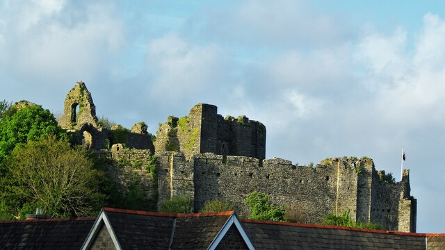
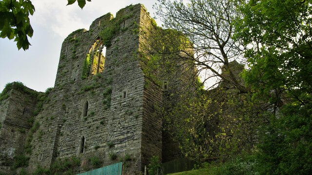
Oystermouth Castle

Oystermouth Castle (Welsh: Castell Ystum Llwynarth) is a Norman stone castle in Wales, overlooking Swansea Bay on the east side of the Gower Peninsula...

All Saints' Church, Oystermouth

All Saints' Church, Oystermouth (officially "All Saints, Oystermouth") is an Anglican church in the diocese of Swansea and Brecon, south Wales. It is located...

Related Videos

Castle On The Hill #travel #wales

Visited the castle in Mumbles near Swansea today and actually got some sunshine! #swansea #wales #travel.

Walking the Wales Coast Path: From Rotherslade to Caswell Bay, Mumbles, Swansea, Wales, UK (Oct'23)

Join me on a leisurely stroll along the picturesque coastline of Mumbles, from the charming Rotherslade Bay to the vibrant ...

MUMBLES near Swansea, Wales

MUMBLES near Swansea, Wales. A full seafront walking tour of this welsh seaside holiday village, from Mumbles Pier to ...

Nearby Amenities

Located within 500m of 51.568094,-4.010598
Traffic Signals
Direction: forward
Lat/Long: 51.5686153/-4.0072886
Traffic Signals
Traffic Signals Direction: backward
Lat/Long: 51.5684004/-4.0074139
Rotherslade
Created By: Potlatch 0.9c
Is In: Swansea
Place: hamlet
Lat/Long: 51.5689647/-4.0065355
Langland
Created By: Potlatch 0.9c
Is In: Swansea
Place: suburb
Lat/Long: 51.5711252/-4.0127945
Langland Bay
Natural: bay
Lat/Long: 51.5656992/-4.0100393
Bus Stop
Langland Corner (NE)
Bench: yes
Bus: yes
Naptan AtcoCode: 5810AWC50045
Naptan Bearing: NE
Naptan CommonName: Langland Corner (NE)
Naptan Crossing: Langland Road
Naptan NaptanCode: swagtdp
Naptan PlusbusZoneRef: SWANSEA
Naptan Street: Southward Lane
Public Transport: platform
Shelter: yes
Source: naptan_import
Tactile Paving: no
Lat/Long: 51.5713462/-4.0082606
Bus Stop
Langland Corner (S)
Bench: yes
Bus: yes
Naptan AtcoCode: 5810AWC50046
Naptan Bearing: S
Naptan CommonName: Langland Corner (S)
Naptan Crossing: Higher Lane
Naptan NaptanCode: swagtdt
Naptan PlusbusZoneRef: SWANSEA
Naptan Street: Langland Road
Public Transport: platform
Shelter: yes
Source: naptan_import
Tactile Paving: no
Lat/Long: 51.5713498/-4.0080023
Bus Stop
Groves Avenue (W)
Bus: yes
Naptan AtcoCode: 5810AWC50130
Naptan Bearing: W
Naptan CommonName: Groves Avenue (W)
Naptan Crossing: Groves Avenue
Naptan NaptanCode: swagtga
Naptan PlusbusZoneRef: SWANSEA
Naptan Street: Southward Lane
Public Transport: platform
Source: naptan_import
Lat/Long: 51.5721839/-4.0129035
Bus Stop
Langland Corner (NW)
Bus: yes
Naptan AtcoCode: 5810AWO26335
Naptan Bearing: NW
Naptan CommonName: Langland Corner (NW)
Naptan Crossing: Overland Road
Naptan NaptanCode: swagtdw
Naptan PlusbusZoneRef: SWANSEA
Naptan Street: Higher Lane
Public Transport: platform
Source: naptan_import
Lat/Long: 51.5709737/-4.0076983
Snaple Point
Tourism: viewpoint
Lat/Long: 51.5644193/-4.0142874
Post Box
Collection Times: Mo-Fr 17:30; Sa 12:45
Operator: Royal Mail
Operator Wikidata: Q638098
Lat/Long: 51.5703358/-4.0079433
Post Box
Operator: Royal Mail
Operator Wikidata: Q638098
Lat/Long: 51.5690288/-4.0105119
Entrance: main
Lat/Long: 51.5677523/-4.0141595
Passing Place
Lat/Long: 51.5694228/-4.0146563
Barrier: swing_gate
Material: metal
Swing Gate Type: double
Lat/Long: 51.5677953/-4.0138517
Bench
Lat/Long: 51.5673495/-4.0147618
Bench
Lat/Long: 51.5671372/-4.0150095
Bench
Lat/Long: 51.5653816/-4.01428
Bench
Lat/Long: 51.5669788/-4.0045999
Cafe
Surfside Cafe
Addr Postcode: SA3 4QW
Addr Street: Rotherslade Road
Fhrs Id: 410376
Website: https://www.surfsidecafes.com/
Lat/Long: 51.568045/-4.0060529
Noexit: yes
Lat/Long: 51.5684988/-4.0046522
Defibrillator
Emergency: defibrillator
Lat/Long: 51.5683868/-4.0106496
Turning Circle
Lat/Long: 51.5684871/-4.0039308
Noexit: yes
Lat/Long: 51.5677598/-4.0057155
Direction: SSE
Generator Method: photovoltaic
Generator Output Electricity: yes
Generator Solar Modules: 38
Generator Source: solar
Generator Type: solar_photovoltaic_panel
Location: roof
Note: panels in "VVVV" format to get more in smaller area
Power: generator
Lat/Long: 51.5683225/-4.0040794
Direction: SSE
Generator Method: photovoltaic
Generator Output Electricity: yes
Generator Solar Modules: 28
Generator Source: solar
Generator Type: solar_photovoltaic_panel
Location: roof
Note: panels in "VVVV" format to get more in smaller area
Power: generator
Lat/Long: 51.5683142/-4.0041941
Direction: 235
Generator Method: photovoltaic
Generator Output Electricity: yes
Generator Solar Modules: 12
Generator Source: solar
Generator Type: solar_photovoltaic_panel
Location: roof
Power: generator
Lat/Long: 51.5681604/-4.0054359
Direction: 145
Generator Method: photovoltaic
Generator Output Electricity: yes
Generator Solar Modules: 18
Generator Source: solar
Generator Type: solar_photovoltaic_panel
Location: roof
Power: generator
Lat/Long: 51.5716506/-4.0067925
Direction: 175
Generator Method: photovoltaic
Generator Output Electricity: yes
Generator Solar Modules: 12
Generator Source: solar
Generator Type: solar_photovoltaic_panel
Location: roof
Power: generator
Lat/Long: 51.5700385/-4.0082482
Direction: 125
Generator Method: photovoltaic
Generator Output Electricity: yes
Generator Solar Modules: 16
Generator Source: solar
Generator Type: solar_photovoltaic_panel
Location: roof
Power: generator
Lat/Long: 51.571894/-4.0095189
Direction: SW
Generator Method: photovoltaic
Generator Output Electricity: yes
Generator Solar Modules: 16
Generator Source: solar
Generator Type: solar_photovoltaic_panel
Location: roof
Power: generator
Lat/Long: 51.5719169/-4.0117867
Direction: 145
Generator Method: photovoltaic
Generator Output Electricity: yes
Generator Solar Modules: 16
Generator Source: solar
Generator Type: solar_photovoltaic_panel
Location: roof
Power: generator
Lat/Long: 51.5704382/-4.0141209
Direction: 165
Generator Method: photovoltaic
Generator Output Electricity: yes
Generator Solar Modules: 16
Generator Source: solar
Generator Type: solar_photovoltaic_panel
Location: roof
Power: generator
Lat/Long: 51.5678961/-4.0164491
Direction: 170
Generator Method: photovoltaic
Generator Output Electricity: yes
Generator Solar Modules: 13
Generator Source: solar
Generator Type: solar_photovoltaic_panel
Location: roof
Power: generator
Lat/Long: 51.5708435/-4.0161812
Bench
Backrest: yes
Lat/Long: 51.564592/-4.014304
Bench
Backrest: yes
Lat/Long: 51.5644911/-4.0142182
Bench
Backrest: yes
Lat/Long: 51.5645366/-4.014357
Bench
Backrest: yes
Lat/Long: 51.5645049/-4.014363
Bench
Backrest: yes
Lat/Long: 51.5644665/-4.0143637
Bench
Backrest: yes
Lat/Long: 51.5644715/-4.0145095
Bench
Backrest: yes
Lat/Long: 51.5644888/-4.0146409
Bench
Backrest: yes
Lat/Long: 51.5645155/-4.0146691
Direction East: Limeslade
Direction West: Rotherslade
Guide Type: destination
Information: guidepost
Tourism: information
Lat/Long: 51.5671745/-4.0052296
Bench
Lat/Long: 51.5643694/-4.0144099
Bench
Backrest: yes
Lat/Long: 51.5715051/-4.0079471
Bench
Backrest: yes
Lat/Long: 51.571541/-4.0079659
Barrier: lift_gate
Lift Gate Type: single
Lat/Long: 51.5689794/-4.0069346
Fixme: continues
Lat/Long: 51.5685188/-4.0067469
Bench
Backrest: yes
Lat/Long: 51.5643832/-4.0141806
Bench
Backrest: yes
Lat/Long: 51.5643928/-4.0143774
Bench
Backrest: yes
Lat/Long: 51.5647529/-4.0141256
Waste Basket
Lat/Long: 51.5659292/-4.0144606
Waste Basket
Lat/Long: 51.5663593/-4.0148431
Bench
Backrest: yes
Lat/Long: 51.5660151/-4.0144884
Bench
Backrest: yes
Lat/Long: 51.5660467/-4.0144891
Bench
Backrest: yes
Lat/Long: 51.5660742/-4.0144706
Bench
Backrest: yes
Lat/Long: 51.5661068/-4.0145212
Bench
Backrest: yes
Lat/Long: 51.566153/-4.0145437
Bench
Backrest: yes
Lat/Long: 51.5661889/-4.0145927
Bench
Backrest: yes
Lat/Long: 51.5662195/-4.0146376
Bench
Backrest: yes
Lat/Long: 51.5662564/-4.0146946
Bench
Backrest: yes
Lat/Long: 51.5662956/-4.0147486
Bench
Backrest: yes
Lat/Long: 51.566327/-4.0147801
Bench
Backrest: yes
Lat/Long: 51.5670648/-4.0150278
Waste Basket
Lat/Long: 51.5670952/-4.0150138
Waste Basket
Lat/Long: 51.5677553/-4.0137126
Barrier: bollard
Lat/Long: 51.5683859/-4.0105874
Bench
Backrest: yes
Lat/Long: 51.5684134/-4.009877
Bench
Backrest: yes
Lat/Long: 51.5684121/-4.0099977
Bench
Backrest: yes
Lat/Long: 51.5684134/-4.0099313
Bench
Backrest: yes
Lat/Long: 51.5684138/-4.0098207
Bench
Backrest: yes
Lat/Long: 51.5684151/-4.0097751
Bench
Backrest: yes
Lat/Long: 51.5684105/-4.009706
Bench
Backrest: yes
Lat/Long: 51.5684088/-4.009647
Bus Stop
Bus: yes
Public Transport: platform
Lat/Long: 51.571402/-4.0079605
The data included in this document is from www.openstreetmap.org. The data is made available under ODbL.

Have you been to Langland Bay?

Leave your review of Langland Bay below (or comments, questions and feedback).