Batcombe

Settlement in Somerset Mendip

England

Batcombe

Eastcombe Lane
Eastcombe Lane Credit: Vieve Forward

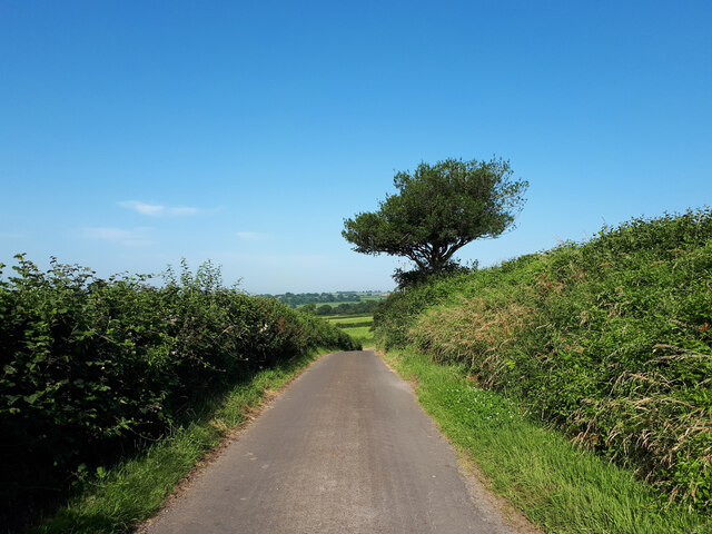
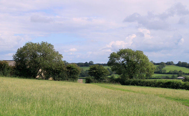
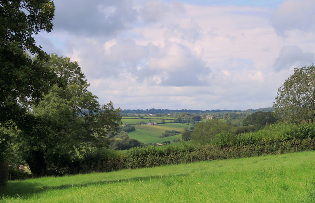
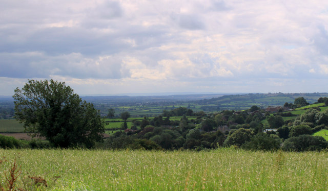
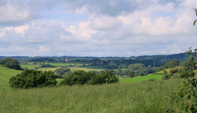
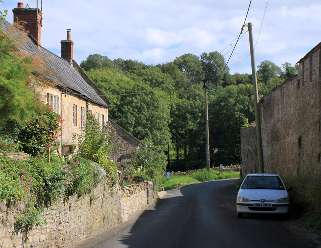
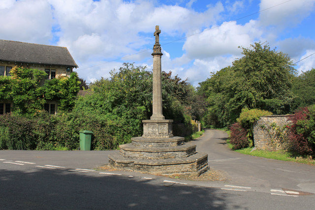
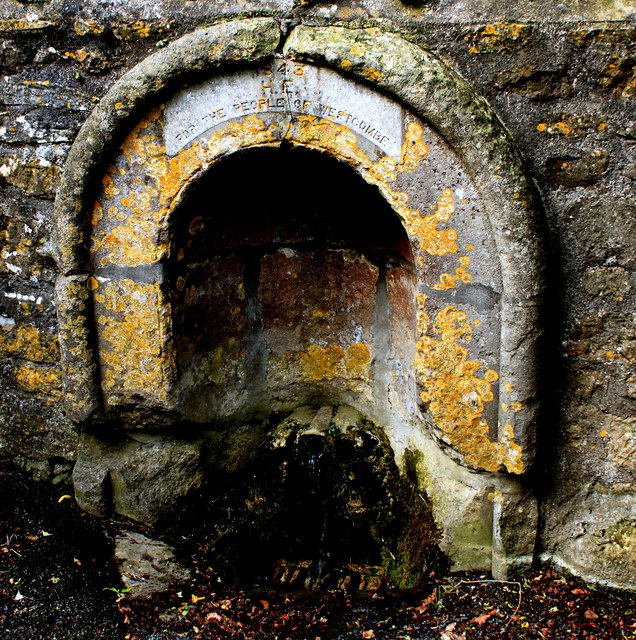
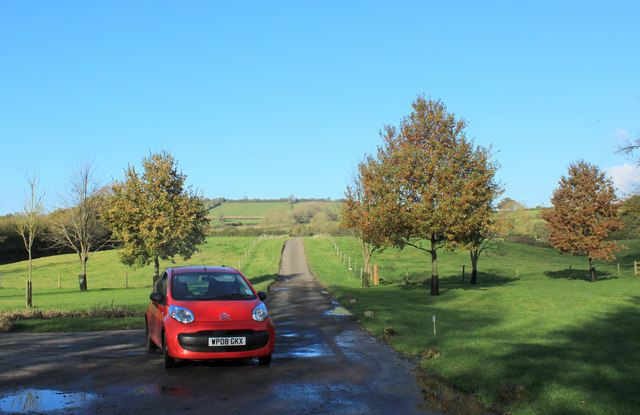
Batcombe is a small village located in the county of Somerset, England. Situated in the picturesque Mendip Hills, it lies approximately 5 miles southwest of Shepton Mallet and 13 miles south of the historic city of Bath. The village is nestled in a valley, surrounded by rolling countryside and is known for its stunning natural beauty.

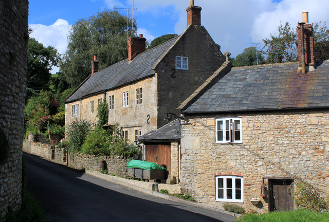
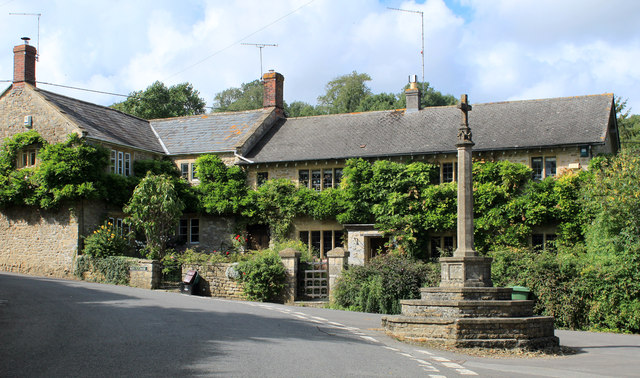
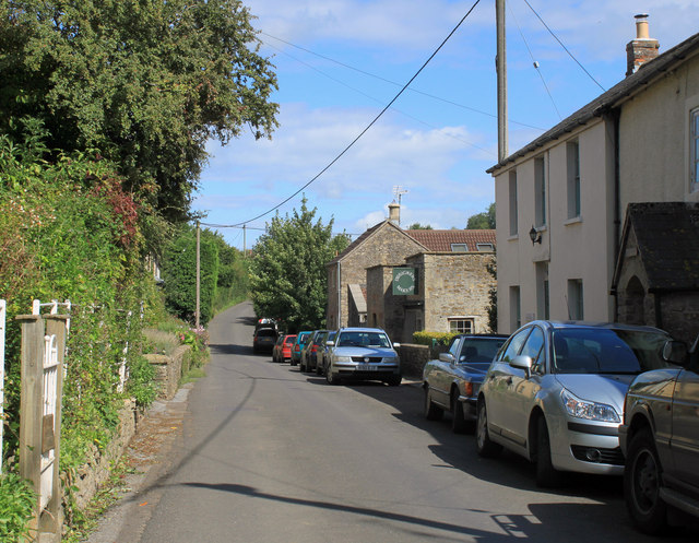
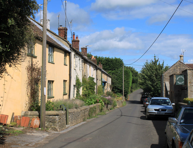
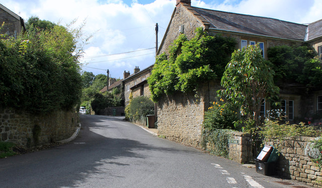
With a population of around 400 residents, Batcombe has a tight-knit community and a strong sense of community spirit. The village is characterized by its charming stone cottages, many of which date back to the 17th and 18th centuries, giving it a quintessential English countryside feel.

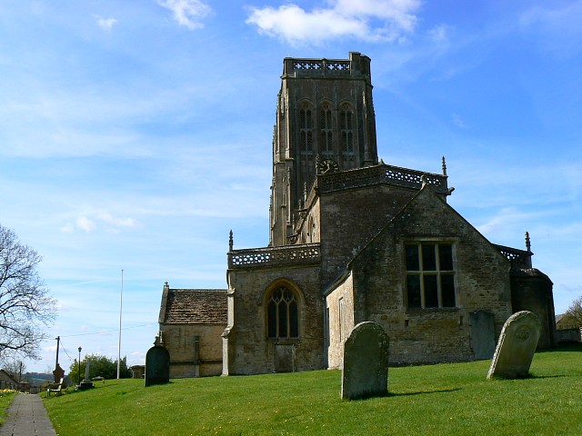
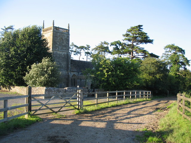
Batcombe is home to the Grade I listed St. Mary's Church, which was originally built in the 12th century and features a unique circular nave. The church is a focal point of the village and holds regular services and community events.

The village also boasts a lively pub, The Three Horseshoes, which offers a warm and welcoming atmosphere to both locals and visitors. The pub serves traditional English food and ales, making it a popular spot for tourists exploring the area.

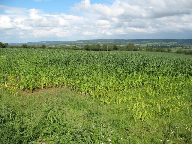
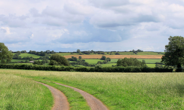
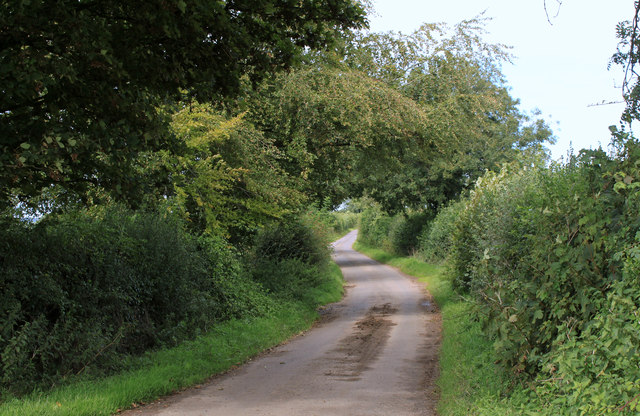
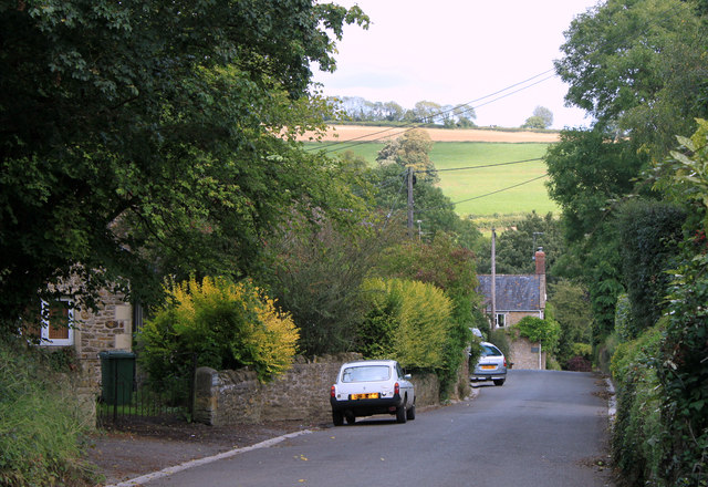
Batcombe is surrounded by ample opportunities for outdoor activities, including scenic walks, cycling routes, and horse riding trails. The area is also renowned for its agricultural heritage, with many farms and fields dotting the landscape.

Overall, Batcombe is a tranquil and idyllic village, perfect for those seeking a peaceful retreat within the stunning Somerset countryside.

If you have any feedback on the listing, please let us know in the comments section below.

Batcombe Images

Images are sourced within 2km of 51.150543/-2.445004 or Grid Reference ST6839. Thanks to Geograph Open Source API. All images are credited.

Eastcombe Lane
Eastcombe Lane
Crop field next to the A359 at Seat Hill
2011 : Track and footpath to Batcombe The track is not a public right of way, the footpath is.
Batcome is in the valley beyond the well trimmed hedgerow.
2011 : Track and footpath to Batcombe
The track is not a public right of way, the footpath is. Batcome is in the valley beyond the well trimmed hedgerow.
2011 : Cottages in Batcombe On my first visit to Batcome the impression I had was of a small but lively village, an impression borne out by its website.

"The village of Batcombe has a long history that goes back to Saxon times. It became rich in the 14th century due to the woollen trade and it was during this time that the very fine Parish Church of St Mary the Blessed Virgin was built to replace the earlier structure. It boasts a fine tower which affords splendid views of the beautiful valley in which Batcombe nestles.
Local Mendip limestone has historically been used to construct the local cottages and houses, many of which date from the 17th and 18th centuries."

The above was copied from: <span class="nowrap"><a title="http://www.batcombe.org.uk/history.htm" rel="nofollow ugc noopener" href="http://www.batcombe.org.uk/history.htm">Link</a><img style="margin-left:2px;" alt="External link" title="External link - shift click to open in new window" src="https://s1.geograph.org.uk/img/external.png" width="10" height="10"/></span> an informative website.
2011 : Cottages in Batcombe
On my first visit to Batcome the impression I had was of a small but lively village, an impression borne out by its website. "The village of Batcombe has a long history that goes back to Saxon times. It became rich in the 14th century due to the woollen trade and it was during this time that the very fine Parish Church of St Mary the Blessed Virgin was built to replace the earlier structure. It boasts a fine tower which affords splendid views of the beautiful valley in which Batcombe nestles. Local Mendip limestone has historically been used to construct the local cottages and houses, many of which date from the 17th and 18th centuries." The above was copied from: LinkExternal link an informative website.
2011 : War Memorial and cottages Westcombe The three front gates, three front doors and three TV aerials suggest this is a row of three cottages not a single grand house, though it may have been at one time. 

The wisteria must have been terrific.
2011 : War Memorial and cottages Westcombe
The three front gates, three front doors and three TV aerials suggest this is a row of three cottages not a single grand house, though it may have been at one time. The wisteria must have been terrific.
2011 : South on Cockpit Lane to Batcombe
2011 : Top of the hill above Batcombe Looking south east, Batcombe is in the valley below.
2011 : Top of the hill above Batcombe
Looking south east, Batcombe is in the valley below.
2011 : West of north from Cockpit Lane Looking up the valley toward Higher Alham.
2011 : West of north from Cockpit Lane
Looking up the valley toward Higher Alham.
2011 : West from Cockpit Lane A meadow which looks overdue for mowing then the valley of the River Alham.
2011 : West from Cockpit Lane
A meadow which looks overdue for mowing then the valley of the River Alham.
2011 : Mendip view from Cockpit Lane
2011 : Kale Street, Batcombe Heading east toward Upton Noble.
The green sign proclaims "Designers Makers" what they design and what they make have been unable to discover, even with the power of the web.
2011 : Kale Street, Batcombe
Heading east toward Upton Noble. The green sign proclaims "Designers Makers" what they design and what they make have been unable to discover, even with the power of the web.
2011 : Cottages in Kale Street, Batcombe Signs of roof repairs bottom left. Pretty successful top left.
Kale Street heads east out of the village to the A359 and Upton Noble.
2011 : Cottages in Kale Street, Batcombe
Signs of roof repairs bottom left. Pretty successful top left. Kale Street heads east out of the village to the A359 and Upton Noble.
2011 : Gold Hill, Batcombe Looking toward the River Alham.
2011 : Gold Hill, Batcombe
Looking toward the River Alham.
2011 : Westcombe War Memorial And wheely bin.
For a view from the west see <a href="https://www.geograph.org.uk/photo/341181">ST6739 : Westcombe</a>
The lane behind goes to Home Farm.
2011 : Westcombe War Memorial
And wheely bin. For a view from the west see ST6739 : Westcombe The lane behind goes to Home Farm.
2011 : The heart of Westcombe, looking west Toward Stoney Stratton and Evercreech.
Like Batcombe, Westcombe displays a healthy contempt for the web. Makes life a little difficult for the geographer but who is to blame it?
2011 : The heart of Westcombe, looking west
Toward Stoney Stratton and Evercreech. Like Batcombe, Westcombe displays a healthy contempt for the web. Makes life a little difficult for the geographer but who is to blame it?
2011 : Down Westcombe Way When people in Westcombe say "Drop in sometime" they really mean it.
Cockpit Lane is at the top of the distant hill, the River Alham runs along the foot.
2011 : Down Westcombe Way
When people in Westcombe say "Drop in sometime" they really mean it. Cockpit Lane is at the top of the distant hill, the River Alham runs along the foot.
2011 : Water supply Westcombe This image has been over-enhanced to improve the legibility of the inscription which reads: "1843  H.E. for the people of Westcombe".
2011 : Water supply Westcombe
This image has been over-enhanced to improve the legibility of the inscription which reads: "1843 H.E. for the people of Westcombe".
2012 : Spargrove Lane, bottom of the hill Westcombe is at the top, and a few farms.
Westcombe Hill is behind.
2012 : Spargrove Lane, bottom of the hill
Westcombe is at the top, and a few farms. Westcombe Hill is behind.
Show me another place!

Batcombe is located at Grid Ref: ST6839 (Lat: 51.150543, Lng: -2.445004)

Administrative County: Somerset

District: Mendip

Police Authority: Avon and Somerset

What 3 Words

///invisible.muddle.take. Near Bruton, Somerset

Nearby Locations

Batcombe Batcombe

Related Wikis

Batcombe, Somerset

Batcombe is a village and civil parish in Somerset, England, situated in the steep valley of the River Alham 5 miles (8 km) south-east of Shepton Mallet...

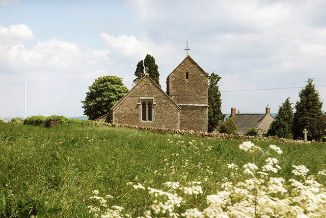
Church of St Mary Magdalene, Upton Noble

The Anglican Church Of St Mary and St John in Upton Noble, within the English county of Somerset, was built in the 12th century. It is a Grade II* listed...

Upton Noble

Upton Noble is a village and civil parish on the River Frome. It is roughly 4.5 miles (7 km) north-east of Bruton, and 7 miles (11 km) from Frome town...

Church of St James, Milton Clevedon

The Anglican Church of St James in Milton Clevedon, within the English county of Somerset, was rebuilt in 1790. It is a Grade II* listed building.The first...

Small Down Knoll

Small Down Knoll, or Small Down Camp, is a Bronze Age hill fort near Evercreech in Somerset, England. The hill is on the southern edge of the Mendip Hills...

Milton Clevedon

Milton Clevedon is a village and civil parish 1 mile (1.6 km) south of Evercreech in the Mendip district of Somerset, England. == History == The name of...

Wanstrow railway station

Wanstrow railway station was a small station on the East Somerset Railway serving the village of Wanstrow in Somerset. The East Somerset Railway opened...

Church of St Mary, Wanstrow

The Anglican Church Of St Mary in Wanstrow, within the English county of Somerset, was built in the 15th century. It is a Grade II* listed building.The...

Nearby Amenities

Located within 500m of 51.150543,-2.445004
Batcombe
Place: village
Source Ref: NPE
Wikidata: Q2296620
Wikipedia: en:Batcombe, Somerset
Lat/Long: 51.1501785/-2.4449645
Post Box
Operator: Royal Mail
Operator Wikidata: Q638098
Ref: BA4 147
Lat/Long: 51.1485924/-2.4462179
Historic: memorial
Memorial: war_memorial
Lat/Long: 51.1498029/-2.4434085
Post Box
Operator: Royal Mail
Operator Wikidata: Q638098
Post Box Type: wall
Ref: BA4 30
Royal Cypher: EIIR
Royal Cypher Wikidata: Q33102113
Lat/Long: 51.1509827/-2.4422841
Natural: peak
Lat/Long: 51.1477216/-2.4405547
The data included in this document is from www.openstreetmap.org. The data is made available under ODbL.

Have you been to Batcombe?

Leave your review of Batcombe below (or comments, questions and feedback).