Batcombe

Settlement in Dorset

England

Batcombe

Hilfield: pasture land, looking towards Batcombe Hill
Hilfield: pasture land, looking towards Batcombe Hill Credit: Keith Salvesen

Batcombe is a small village located in the county of Dorset, England. Situated in the scenic countryside, it is nestled in the valley of the river Wriggle. The village is part of the West Dorset district and falls under the jurisdiction of the civil parish of Buckland Newton.

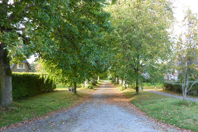
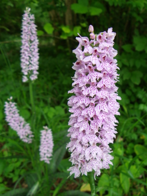
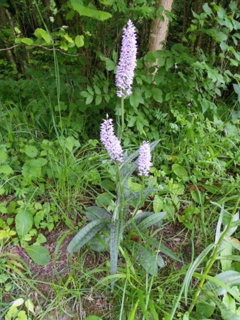
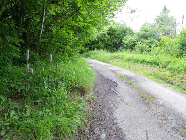
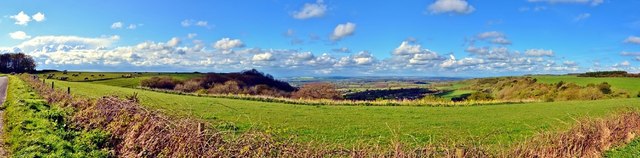
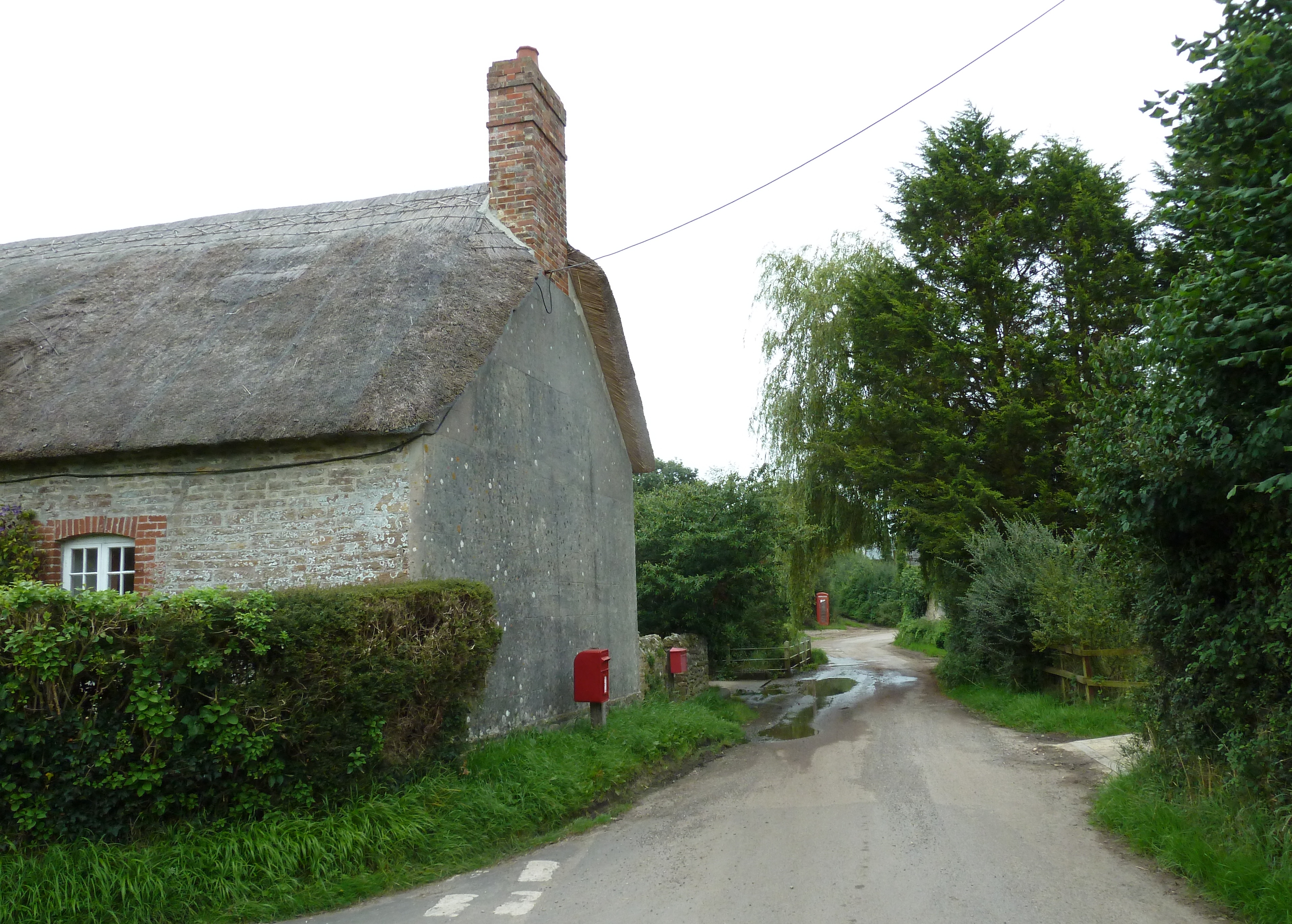
With a population of around 200 inhabitants, Batcombe is a quintessential English village renowned for its natural beauty and tranquility. The landscape surrounding Batcombe is characterized by rolling hills, lush green fields, and picturesque farmland. The village itself is composed of a cluster of charming cottages and historic buildings, which give it a timeless and idyllic atmosphere.

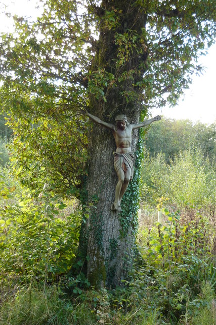
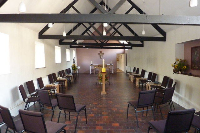
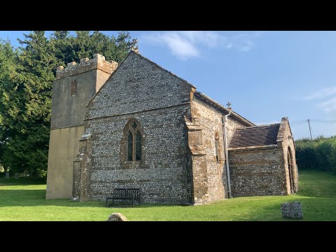
Notable landmarks in Batcombe include the Church of St. Mary, a medieval church dating back to the 12th century. The church's architecture is a mix of Norman and Gothic styles, and its interior features beautiful stained glass windows and intricate woodwork.

Batcombe is also known for its strong sense of community. The village hosts various events throughout the year, including fairs, festivals, and gatherings, which foster a sense of belonging among its residents. The village pub, The Three Horseshoes, serves as a social hub and offers a warm and welcoming atmosphere.

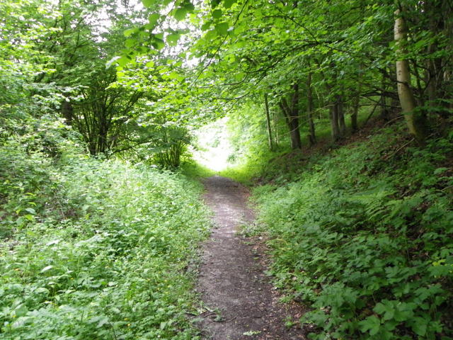
For those seeking outdoor activities, Batcombe offers ample opportunities for walking, hiking, and exploring the surrounding countryside. The village is also conveniently located near several other charming Dorset villages and towns, such as Sherborne and Dorchester, making it an ideal base for exploring the region.

Overall, Batcombe is a peaceful and picturesque village that offers a true taste of rural England. Its natural beauty, historic charm, and strong community spirit make it a hidden gem in the Dorset countryside.

If you have any feedback on the listing, please let us know in the comments section below.

Batcombe Images

Images are sourced within 2km of 50.835477/-2.5436487 or Grid Reference ST6104. Thanks to Geograph Open Source API. All images are credited.

Hilfield: pasture land, looking towards Batcombe Hill
Children's playground and the George Albert Hotel The hotel on Wardon Hill is family-run and opened in 2010.  It is very convenient for the Southern Counties shooting ranges at Clay Pigeon right beside it.  The Olympic shooting competitions could be held here next year (rumours) and this afternoon there was an international competition in progress.
Children's playground and the George Albert Hotel
The hotel on Wardon Hill is family-run and opened in 2010. It is very convenient for the Southern Counties shooting ranges at Clay Pigeon right beside it. The Olympic shooting competitions could be held here next year (rumours) and this afternoon there was an international competition in progress.
International flags - George Albert Hotel These flags line the entrance of the hotel and of the Southern Counties shooting ranges. International shooting competitions take place here and next year, rumour  has it, that this could be the venue for the Shooting Olympics.
International flags - George Albert Hotel
These flags line the entrance of the hotel and of the Southern Counties shooting ranges. International shooting competitions take place here and next year, rumour has it, that this could be the venue for the Shooting Olympics.
Long Ash Lane
Long Ash Lane
Lay-by complete with lorries
Sheep pasture on Gore Hill (co-ordinated grazing)
Footpath on Gore Hill
Crucifix beyond the Hidden Garden of Hilfield Friary Hilfield Friary is set on the edge of the Dorset Downs with magnificent views across the Blackmore Vale – rural England at its greenest, the countryside of Thomas Hardy’s novels.  There have been Franciscan brothers living here in a collection of what were once farm buildings since 1921, providing refuge for the homeless, the experience of community, and a place for prayer, reflection and renewal.
Crucifix beyond the Hidden Garden of Hilfield Friary
Hilfield Friary is set on the edge of the Dorset Downs with magnificent views across the Blackmore Vale – rural England at its greenest, the countryside of Thomas Hardy’s novels. There have been Franciscan brothers living here in a collection of what were once farm buildings since 1921, providing refuge for the homeless, the experience of community, and a place for prayer, reflection and renewal.
The Bell at Hilfield Friary The Society of St Francis is a Religious Order in the Anglican
Communion, committed to following Christ in the way of Saint
Francis of Assisi in humility, love and joy.
The Bell at Hilfield Friary
The Society of St Francis is a Religious Order in the Anglican Communion, committed to following Christ in the way of Saint Francis of Assisi in humility, love and joy.
Hilfield, the Friary of Saint Francis
Inside the Chapel at the Friary of Saint Francis
Woodland path near Hilfield This path is one of many that allow walkers to access Hilfield Woods.
Woodland path near Hilfield
This path is one of many that allow walkers to access Hilfield Woods.
Common spotted orchid (Dactylorhiza fuchsii), Hilfield Common spotted orchids have dense cone-shaped flower spikes, with narrow, spotted leaves.
Common spotted orchid (Dactylorhiza fuchsii), Hilfield
Common spotted orchids have dense cone-shaped flower spikes, with narrow, spotted leaves.
Common spotted orchid (Dactylorhiza fuchsii), Hilfield The Common spotted orchid can be found almost anywhere, in dune slacks, meadows, roadside verges and woodland edges.  For a close-up <a href="https://www.geograph.org.uk/photo/2476015">ST6304 : Common spotted orchid (Dactylorhiza fuchsii), Hilfield</a>
Common spotted orchid (Dactylorhiza fuchsii), Hilfield
The Common spotted orchid can be found almost anywhere, in dune slacks, meadows, roadside verges and woodland edges. For a close-up ST6304 : Common spotted orchid (Dactylorhiza fuchsii), Hilfield
Minor road near Hilfield The minor road heads towards Batcombe.  There are Common spotted orchids on the verge.  For a closer view of the orchids <a href="https://www.geograph.org.uk/photo/2476020">ST6304 : Common spotted orchid (Dactylorhiza fuchsii), Hilfield</a>
Minor road near Hilfield
The minor road heads towards Batcombe. There are Common spotted orchids on the verge. For a closer view of the orchids ST6304 : Common spotted orchid (Dactylorhiza fuchsii), Hilfield
Hilfield Hill View at sunset across misty fields
Hilfield Hill
View at sunset across misty fields
Batcombe: Panoramic View of the Down
A37 northbound
A37 northbound
Show me another place!

Batcombe is located at Grid Ref: ST6104 (Lat: 50.835477, Lng: -2.5436487)

Unitary Authority: Dorset

Police Authority: Dorset

What 3 Words

///circles.otherwise.nurture. Near Maiden Newton, Dorset

Nearby Locations

Pleck Batcombe Batcombe

Related Wikis

Batcombe, Dorset

Batcombe is a small straggling village and civil parish in Dorset, England, situated 12 miles (19 km) north-west of Dorchester below the northern scarp...

Batcombe Down

Batcombe Down (grid reference ST623040) is an 18.6 hectare biological Site of Special Scientific Interest in Dorset, England: notified in 1952. == Sources... ==

Redford, Dorset

Redford is a hamlet about equidistant from Batcombe, Melbury Bubb and Woolcombe in the county of Dorset in South West England. It lies within the Dorset...

Hilfield

Hilfield is a small, scattered village and civil parish in west Dorset, England, situated under the scarp face of the Dorset Downs 7 miles (11 km) south...

Cerne, Totcombe and Modbury Hundred

Cerne, Totcombe and Modbury Hundred was a hundred in the county of Dorset, England. Some of its tithings and parishes were exclaves which indicates that...

Holywell, Dorset

Holywell is a hamlet in Dorset, England, located on the A37 roughly midway between Yeovil and Dorchester. A tributary of the River Frome passes through...

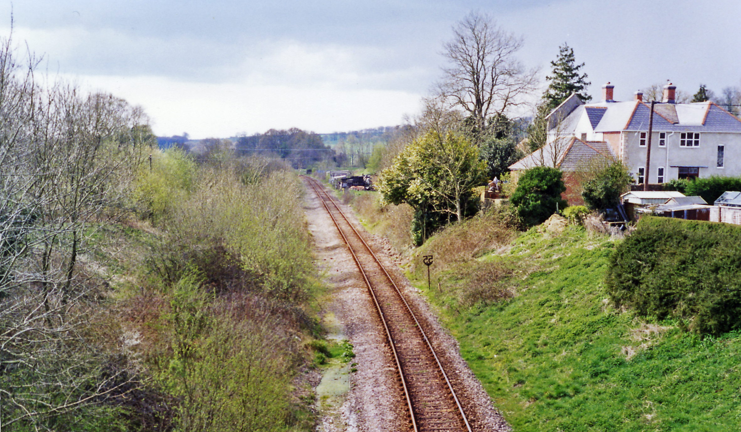
Evershot railway station

Evershot was a railway station in the county of Dorset in England. Served by trains on what is now known as the Heart of Wessex Line, it was two miles...

Frome St Quintin

Frome St Quintin is a village in the county of Dorset in southern England, situated approximately 11 miles (18 km) northwest of the county town Dorchester...

Related Videos

Pre-Retreat Ponderings - Walking the Land from Cerne Abbas to Hilfield Friary

Last week I went on a retreat for the first, to think about a lot of things, process feelings and reflect. This is the first video of quite a ...

Marvel at the grounds at Hilfield Friary

Just a wander and wonder around (some) of the grounds at Hilfield Friary. Hilfield Friary https://www.hilfieldfriary.org.uk/ Nomad ...

#016 Clay Pigeon - @BritishMinibikesBMB Round 8 (Audio & Video YouTube/Spotify) #hkc217podcast

This Episode is Sponsored by SheffieldVanHireLTD.co.uk We travel to Clay Pigeon near the south coast for the final round of the ...

Nearby Amenities

Located within 500m of 50.835477,-2.5436487
Batcombe
Is In: Dorset, England, UK
Place: village
Lat/Long: 50.8338059/-2.5430094
The data included in this document is from www.openstreetmap.org. The data is made available under ODbL.

Have you been to Batcombe?

Leave your review of Batcombe below (or comments, questions and feedback).