Tòb na Carradh
Bay in Ross-shire
Scotland
Tòb na Carradh

Tòb na Carradh, also known as Bay, is a picturesque coastal village located in Ross-shire, Scotland. Situated on the east coast of the Highlands, it lies approximately 12 miles north of Inverness. The bay is nestled between the rugged cliffs and offers stunning panoramic views of the North Sea.
The village is renowned for its natural beauty, with its pristine sandy beaches and crystal-clear turquoise waters. The bay is a popular destination for outdoor enthusiasts, offering a range of activities such as swimming, fishing, and kayaking. Its tranquil atmosphere and scenic surroundings make it an ideal spot for relaxation and rejuvenation.
Tòb na Carradh is also known for its rich history. The village boasts a number of historic sites, including the ruins of an ancient castle that overlooks the bay. These remnants of the past provide a glimpse into the area's fascinating heritage.
In terms of amenities, the village offers a selection of charming bed and breakfasts, as well as a few local shops and restaurants. Visitors can savor traditional Scottish cuisine, enjoy freshly caught seafood, or simply unwind with a pint of locally brewed ale.
Overall, Tòb na Carradh, Ross-shire, is a hidden gem on Scotland's east coast. Its stunning natural beauty, rich history, and range of activities make it a must-visit destination for those seeking a peaceful and scenic escape.
If you have any feedback on the listing, please let us know in the comments section below.
Tòb na Carradh Images
Images are sourced within 2km of 58.198086/-6.8450024 or Grid Reference NB1533. Thanks to Geograph Open Source API. All images are credited.


Tòb na Carradh is located at Grid Ref: NB1533 (Lat: 58.198086, Lng: -6.8450024)
Unitary Authority: Na h-Eileanan an Iar
Police Authority: Highlands and Islands
What 3 Words
///shapeless.hulk.zeal. Near Carloway, Na h-Eileanan Siar
Nearby Locations
Related Wikis

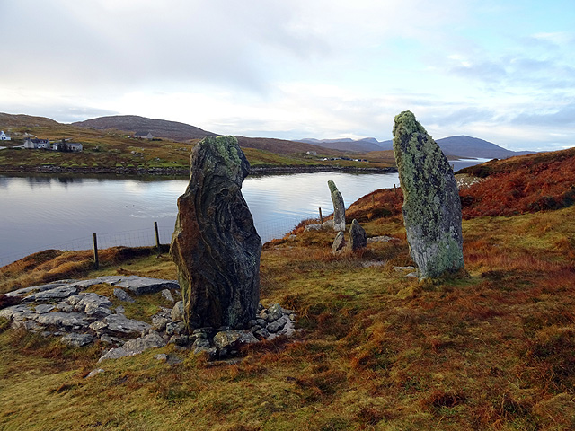
Callanish VIII
The Callanish VIII stone setting is one of many megalithic structures around the better-known (and larger) Calanais I on the west coast of the Isle of...

Dun Bharabhat, Great Bernera
Dun Bharabhat (or Dun Baravat) is an Iron Age galleried dun or "semi-broch" situated on the island of Great Bernera near Lewis in Scotland (grid reference...

Fuaigh Mòr
Fuaigh Mòr (sometimes anglicised as Vuia Mor) is an island in the Outer Hebrides of Scotland. It is off the west coast of Lewis near Great Bernera in...
Loch Ròg
Loch Ròg or Loch Roag is a large sea loch on the west coast of Lewis, Outer Hebrides. It is broadly divided into East Loch Roag and West Loch Roag with...
Nearby Amenities
Located within 500m of 58.198086,-6.8450024Have you been to Tòb na Carradh?
Leave your review of Tòb na Carradh below (or comments, questions and feedback).