Mol Mòr
Beach in Ross-shire
Scotland
Mol Mòr

Mol Mòr, located in Ross-shire, Scotland, is a picturesque beach renowned for its stunning natural beauty and peaceful atmosphere. Situated along the coastline of the North Sea, the beach offers visitors a tranquil escape from the bustling city life.
Covered in soft golden sand, Mol Mòr stretches for approximately two miles, providing ample space for leisurely walks, picnics, and sunbathing. The beach is backed by high sand dunes that not only add to its scenic charm but also protect it from strong winds. These dunes are adorned with various coastal plants and grasses, creating a vibrant and diverse ecosystem.
Mol Mòr is a popular destination for wildlife enthusiasts, with the beach serving as a habitat for a variety of bird species, including oystercatchers, curlews, and terns. Visitors may also spot seals basking on the rocks or swimming in the nearby waters.
The beach offers stunning panoramic views of the surrounding area, including the majestic mountains of Wester Ross. On clear days, the Isle of Skye can be seen in the distance, creating a breathtaking backdrop for beachgoers.
Facilities at Mol Mòr are limited, with no shops or cafes on-site. However, there is a small car park nearby, providing convenient access to the beach. Visitors are advised to bring their own provisions and take any waste with them to preserve the natural beauty of the area.
Overall, Mol Mòr is a hidden gem on the Scottish coastline, offering visitors a serene and idyllic beach experience with its stunning landscapes, abundant wildlife, and peaceful ambiance.
If you have any feedback on the listing, please let us know in the comments section below.
Mol Mòr Images
Images are sourced within 2km of 58.196225/-6.850405 or Grid Reference NB1533. Thanks to Geograph Open Source API. All images are credited.


Mol Mòr is located at Grid Ref: NB1533 (Lat: 58.196225, Lng: -6.850405)
Unitary Authority: Na h-Eileanan an Iar
Police Authority: Highlands and Islands
What 3 Words
///samplers.snippets.lance. Near Carloway, Na h-Eileanan Siar
Nearby Locations
Related Wikis

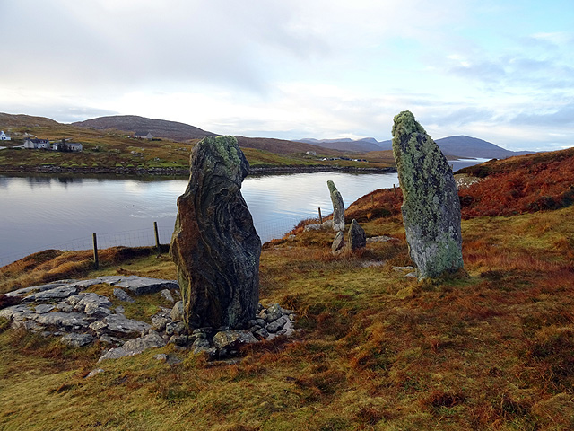
Callanish VIII
The Callanish VIII stone setting is one of many megalithic structures around the better-known (and larger) Calanais I on the west coast of the Isle of...

Dun Bharabhat, Great Bernera
Dun Bharabhat (or Dun Baravat) is an Iron Age galleried dun or "semi-broch" situated on the island of Great Bernera near Lewis in Scotland (grid reference...

Loch Ròg
Loch Ròg or Loch Roag is a large sea loch on the west coast of Lewis, Outer Hebrides. It is broadly divided into East Loch Roag and West Loch Roag with...
Fuaigh Mòr
Fuaigh Mòr (sometimes anglicised as Vuia Mor) is an island in the Outer Hebrides of Scotland. It is off the west coast of Lewis near Great Bernera in...
Nearby Amenities
Located within 500m of 58.196225,-6.850405Have you been to Mol Mòr?
Leave your review of Mol Mòr below (or comments, questions and feedback).