Rubha Chàrmaig
Coastal Feature, Headland, Point in Ross-shire
Scotland
Rubha Chàrmaig

Rubha Chàrmaig is a prominent coastal feature located in Ross-shire, Scotland. This headland, also referred to as a point, is situated on the western coast of the Scottish Highlands and offers stunning views of the surrounding landscape and the North Atlantic Ocean.
The headland is characterized by its rugged cliffs, which rise dramatically from the sea below. These cliffs are composed of various types of rock, including granite and sandstone, and have been shaped and carved by the relentless forces of wind and waves over thousands of years. The result is a striking and picturesque coastline that attracts visitors from near and far.
Rubha Chàrmaig is also known for its diverse wildlife. The surrounding waters are home to a variety of marine species, including seals, dolphins, and a wide array of seabirds. Visitors to the area may be lucky enough to spot these creatures in their natural habitat.
The headland is easily accessible via a well-maintained footpath that winds its way along the cliff tops. This path provides breathtaking views of the surrounding coastline and offers opportunities for hikers and wildlife enthusiasts to explore the area further.
In addition to its natural beauty, Rubha Chàrmaig also holds historical significance. The headland is dotted with ancient ruins and archaeological sites, including the remains of a medieval fort. These remnants serve as a reminder of the area's rich cultural heritage and offer a glimpse into its past.
Overall, Rubha Chàrmaig is a captivating coastal feature that showcases the raw beauty of the Scottish Highlands. With its stunning cliffs, diverse wildlife, and historical significance, it is a must-visit destination for nature lovers and history enthusiasts alike.
If you have any feedback on the listing, please let us know in the comments section below.
Rubha Chàrmaig Images
Images are sourced within 2km of 58.199048/-6.8449975 or Grid Reference NB1533. Thanks to Geograph Open Source API. All images are credited.


Rubha Chàrmaig is located at Grid Ref: NB1533 (Lat: 58.199048, Lng: -6.8449975)
Unitary Authority: Na h-Eileanan an Iar
Police Authority: Highlands and Islands
What 3 Words
///ushering.define.issued. Near Carloway, Na h-Eileanan Siar
Nearby Locations
Related Wikis

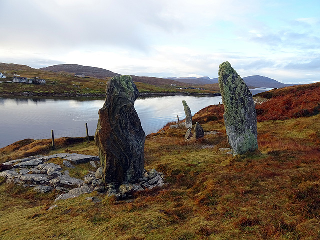
Callanish VIII
The Callanish VIII stone setting is one of many megalithic structures around the better-known (and larger) Calanais I on the west coast of the Isle of...

Dun Bharabhat, Great Bernera
Dun Bharabhat (or Dun Baravat) is an Iron Age galleried dun or "semi-broch" situated on the island of Great Bernera near Lewis in Scotland (grid reference...

Fuaigh Mòr
Fuaigh Mòr (sometimes anglicised as Vuia Mor) is an island in the Outer Hebrides of Scotland. It is off the west coast of Lewis near Great Bernera in...
Loch Ròg
Loch Ròg or Loch Roag is a large sea loch on the west coast of Lewis, Outer Hebrides. It is broadly divided into East Loch Roag and West Loch Roag with...
Fuaigh Beag
Fuaigh Beag or Vuia Be(a)g is an island in the Outer Hebrides. It is off the west coast of Lewis near Great Bernera in Loch Roag. Its name means "little...
Great Bernera
Great Bernera (; Scottish Gaelic: Beàrnaraigh Mòr), often known just as Bernera (Scottish Gaelic: Beàrnaraigh), is an island and community in the Outer...

Breaclete
Breacleit (or Roulanish; Scottish Gaelic: Breacleit; Old Norse: Breiðiklettr) is the central village on Great Bernera in the Outer Hebrides, Scotland....
Ceabhaigh
Ceabhaigh is a small island in an arm of Loch Ròg on the west coast of Lewis in the Outer Hebrides of Scotland. It is about 25 hectares (62 acres) in extent...
Related Videos

A Hebridean Odyssey: Part 15 - Lewis: Great Bernera
This video is the fifteenth in a series that documents a trip taken in May 2022, in which we visited 16 of the Hebridean islands.

The Isle of Great Bernera
Great Bernera is a small island off the coast of a bigger island, the isle of Lewis. Recently, I've been staying on the isle of Lewis ...

Island Of Great Bernera On History Visit To The Outer Hebrides Of Scotland
Tour Scotland short travel video clip, with Scottish music, of the Island Of Great Bernera on ancestry, genealogy, history visit to the ...
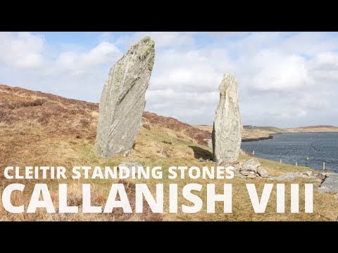
Callanish VIII | Cleitir Standing Stones | Isle of Lewis | Neolithic Age Scotland | Before Caledonia
'Before Caledonia' a journey through Scotland's Ancient Sites. ---------- FACEBOOK share photos, articles, review books and ...
Nearby Amenities
Located within 500m of 58.199048,-6.8449975Have you been to Rubha Chàrmaig?
Leave your review of Rubha Chàrmaig below (or comments, questions and feedback).