Rubha Iain Ruaidh

Coastal Feature, Headland, Point in Inverness-shire

Scotland

Rubha Iain Ruaidh
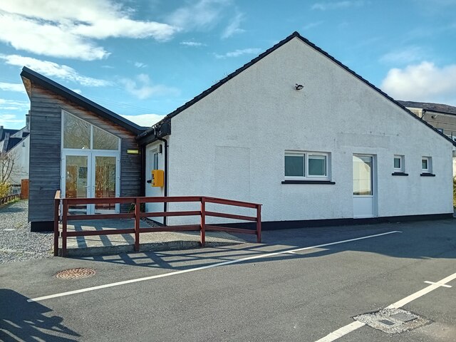
North Harris Free Church (Free Church of Scotland) An active church.
North Harris Free Church (Free Church of Scotland) Credit: David Bremner

Rubha Iain Ruaidh, located in Inverness-shire, Scotland, is a striking coastal feature known for its impressive headland and point. Situated on the west coast of Scotland, this rugged headland stretches out into the North Atlantic Ocean, offering breathtaking panoramic views of the surrounding landscape.

The name "Rubha Iain Ruaidh" is derived from Gaelic, with "Rubha" meaning "point" and "Iain Ruaidh" referring to a person named "John the Red." The name is believed to have originated from a historical figure who once inhabited the area, but the exact details remain uncertain.

The headland itself is characterized by its rocky cliffs, which rise dramatically from the sea, creating a dramatic and picturesque scene. The cliffs are often subject to the powerful forces of wind and waves, contributing to the area's rugged beauty. A pebbled beach can also be found at the base of the headland, providing a serene spot for visitors to relax and enjoy the coastal atmosphere.

Rubha Iain Ruaidh is a popular destination for outdoor enthusiasts, offering opportunities for hiking, photography, and wildlife observation. The headland serves as a nesting site for various seabirds, including guillemots and kittiwakes, making it a haven for birdwatchers.

Access to Rubha Iain Ruaidh is relatively easy, with a nearby car park and footpath leading to the headland. However, caution should be exercised when exploring the area, as the cliffs can be steep and potentially hazardous.

Overall, Rubha Iain Ruaidh is a captivating coastal feature that showcases the raw beauty of Scotland's west coast. Its dramatic cliffs, stunning views, and abundant wildlife make it a must-visit destination for nature lovers and adventure seekers alike.

If you have any feedback on the listing, please let us know in the comments section below.

Rubha Iain Ruaidh Images

Images are sourced within 2km of 57.882659/-6.8051674 or Grid Reference NG1598. Thanks to Geograph Open Source API. All images are credited.

North Harris Free Church (Free Church of Scotland) An active church.
North Harris Free Church (Free Church of Scotland)
An active church.
Tarbert Church (Free Presbyterian Church of Scotland) An active church.
Tarbert Church (Free Presbyterian Church of Scotland)
An active church.
Tarbert Fire Station
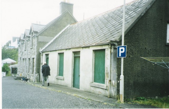
MacAskill's former store Tarbert For many years these premises were run by a Mr MacAskill as a general store. He continued to work in the store until his nineties.
MacAskill's former store Tarbert
For many years these premises were run by a Mr MacAskill as a general store. He continued to work in the store until his nineties.
HM Coastguard station, Tarbert HM Coastguard station above Tarbert, with the Tarbert TV relay (tv transmitter) in the background.
HM Coastguard station, Tarbert
HM Coastguard station above Tarbert, with the Tarbert TV relay (tv transmitter) in the background.
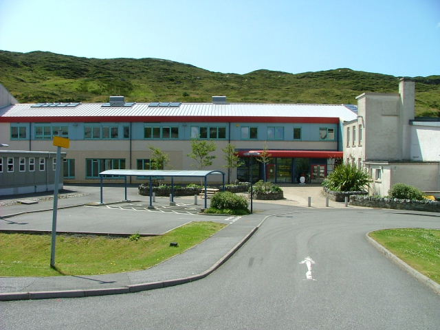
Sir Edward Scott School This houses the only secondary school on Harris, the nearest being in Stornoway on the island of Lewis. The age range of the pupils is from 4 to 18 years.
Sir Edward Scott School
This houses the only secondary school on Harris, the nearest being in Stornoway on the island of Lewis. The age range of the pupils is from 4 to 18 years.
Tarbert Police Station
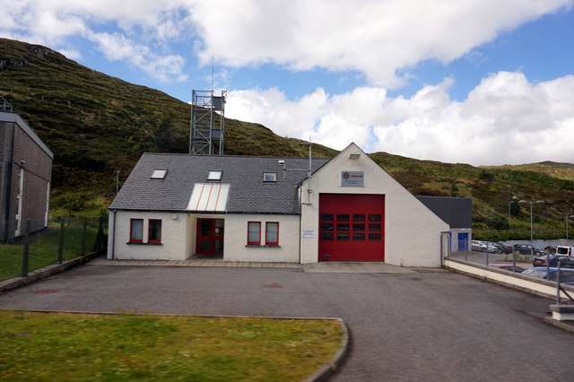
Tarbert Fire Station Situated next to the Sir Edward Scott junior secondary school.
Tarbert Fire Station
Situated next to the Sir Edward Scott junior secondary school.
Ruined croft building Below Cnoc na Cloiche.
Ruined croft building
Below Cnoc na Cloiche.
Moorland above Tarbert Looking east towards the village.
Moorland above Tarbert
Looking east towards the village.
Old Pier Road Tarbert.
Old Pier Road
Tarbert.
Kayaks and mobile climbing wall Situated behind the local junior secondary school in Tarbert.
Kayaks and mobile climbing wall
Situated behind the local junior secondary school in Tarbert.
Ruined house above Old Pier Road, Tarbert This was a cottar house, a house without associated land and was not part of a croft. It was occupied until the early 1930s. Loch a' Siar is in the background.
Ruined house above Old Pier Road, Tarbert
This was a cottar house, a house without associated land and was not part of a croft. It was occupied until the early 1930s. Loch a' Siar is in the background.
Ruined house above Old Pier Road, Tarbert
Sir Edward Scott Junior Secondary School, Tarbert The school is currently being extended. The grey primary school is across the road. A ruined house is in the foreground.
Sir Edward Scott Junior Secondary School, Tarbert
The school is currently being extended. The grey primary school is across the road. A ruined house is in the foreground.
Tarbert from Direcleit The area around Scott Road and, in the background, the hill of Giolabhal Glas.
Tarbert from Direcleit
The area around Scott Road and, in the background, the hill of Giolabhal Glas.
Tarbert: postbox № HS3 118, Scott Road This postbox serves the houses in Scott Road, high up above the main village. It is emptied daily except Sunday at 9:30am.
Tarbert: postbox № HS3 118, Scott Road
This postbox serves the houses in Scott Road, high up above the main village. It is emptied daily except Sunday at 9:30am.
Tarbert: steps into another myriad These steps lead from the houses in Scott Road, on the hillside above, down into the main village of Tarbert. In doing so, they cross the gridline from NB into NG, roughly halfway down the flight immediately ahead of us.
Tarbert: steps into another myriad
These steps lead from the houses in Scott Road, on the hillside above, down into the main village of Tarbert. In doing so, they cross the gridline from NB into NG, roughly halfway down the flight immediately ahead of us.
Show me another place!

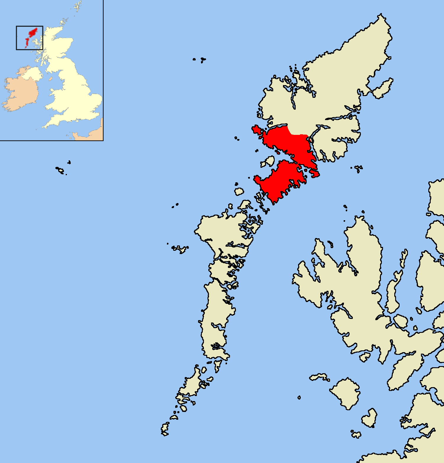
Rubha Iain Ruaidh is located at Grid Ref: NG1598 (Lat: 57.882659, Lng: -6.8051674)

Unitary Authority: Na h-Eileanan an Iar

Police Authority: Highlands and Islands

What 3 Words

///happy.chugging.former. Near Tarbert, Na h-Eileanan Siar

Related Wikis

Harris distillery

Harris distillery is a Scotch whisky and Gin distillery in Tarbert on the Isle of Harris, Scotland. The distillery was the first legal distillery ever...

Tarbert, Harris

Tarbert (Scottish Gaelic: An Tairbeart [ən̪ˠ ˈt̪ɛrʲɛbərˠʃt̪]) is the main community on Harris in the Western Isles of Scotland. The name means "isthmus...

Sgeotasaigh

Scotasay (Scottish Gaelic: Sgeotasaigh) is small island in the Outer Hebrides of Scotland. It lies 1 kilometre (0.6 miles) off the east coast of Harris...

Harris, Outer Hebrides

Harris (Scottish Gaelic: Na Hearadh, pronounced [nə ˈhɛɾəɣ] ) is the southern and more mountainous part of Lewis and Harris, the largest island in the...

Nearby Amenities

Located within 500m of 57.882659,-6.8051674
Passing Place
Lat/Long: 57.8853543/-6.8113785
Passing Place
Lat/Long: 57.8843989/-6.8120009
Passing Place
Lat/Long: 57.8832648/-6.8133545
Barrier: cattle_grid
Lat/Long: 57.8856313/-6.7993926
Turning Circle
Lat/Long: 57.884492/-6.7998164
Passing Place
Lat/Long: 57.8857037/-6.7990889
Passing Place
Lat/Long: 57.8836779/-6.8127779
Barrier: cattle_grid
Lat/Long: 57.8842475/-6.8125873
Material: wood
Power: pole
Lat/Long: 57.8842131/-6.8111394
Material: wood
Power: pole
Lat/Long: 57.8837867/-6.811489
Material: wood
Power: pole
Lat/Long: 57.8844175/-6.8116884
Material: wood
Power: pole
Lat/Long: 57.8846289/-6.8122718
Material: wood
Power: pole
Lat/Long: 57.8833065/-6.8119247
Power: pole
Lat/Long: 57.8861238/-6.8009607
Power: pole
Lat/Long: 57.8859899/-6.8019593
Power: pole
Lat/Long: 57.8866185/-6.8016421
Passing Place
Lat/Long: 57.8866338/-6.8012383
Power: pole
Lat/Long: 57.8849066/-6.799492
Power: pole
Lat/Long: 57.8844788/-6.7993203
Power: pole
Lat/Long: 57.8852987/-6.7996422
Power: pole
Lat/Long: 57.8857692/-6.7998407
Entrance: yes
Lat/Long: 57.8844316/-6.7996568
Bagh Direcleit
Natural: bay
Lat/Long: 57.8836988/-6.8031755
Rubha Iain Ruaidh
Natural: cape
Lat/Long: 57.8822158/-6.8043771
Loch Ceann Dibig
Natural: bay
Lat/Long: 57.880476/-6.8110075
Barrier: cattle_grid
Lat/Long: 57.8860721/-6.8002126
The data included in this document is from www.openstreetmap.org. The data is made available under ODbL.

Have you been to Rubha Iain Ruaidh?

Leave your review of Rubha Iain Ruaidh below (or comments, questions and feedback).