Loch Direcleit

Lake, Pool, Pond, Freshwater Marsh in Inverness-shire

Scotland

Loch Direcleit

West Loch Tarbert from the pier
West Loch Tarbert from the pier Credit: Alan Reid

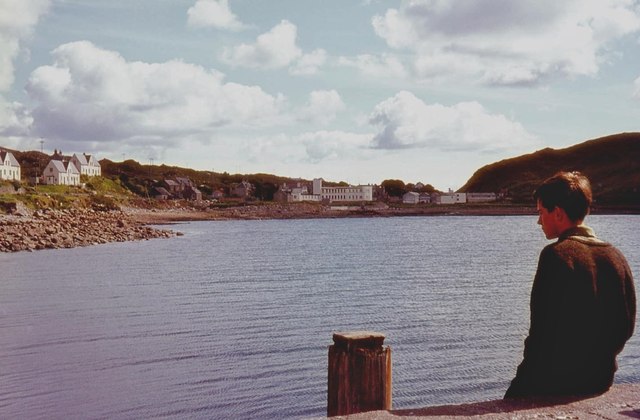
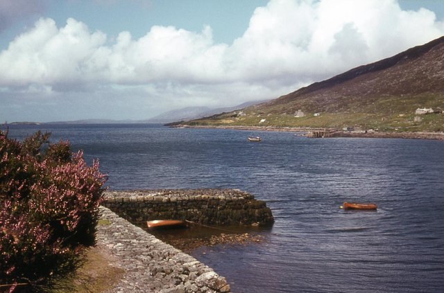
Loch Direcleit is a picturesque freshwater loch located in the county of Inverness-shire in the Scottish Highlands. Situated amidst the stunning landscape of the Great Glen, this natural waterbody is renowned for its tranquil beauty and diverse ecosystem.

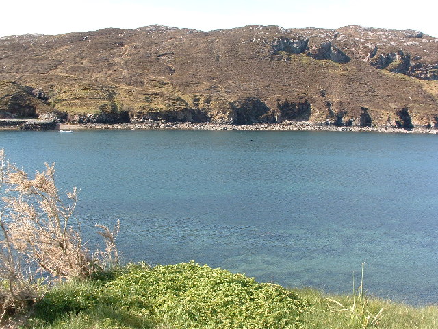
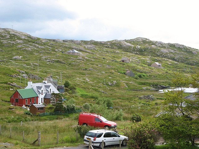
Covering an area of approximately 2 square kilometers, Loch Direcleit is a relatively small yet significant water feature in the region. It is nestled between rolling hills and surrounded by lush greenery, making it a popular destination for nature enthusiasts and tourists alike.

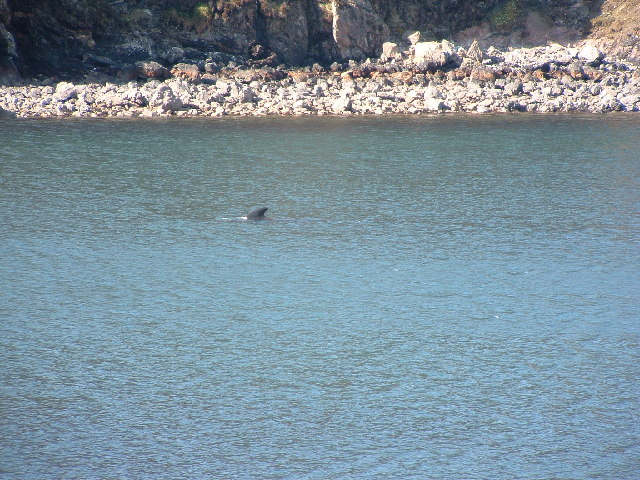
The loch is fed by several small streams and rivers, ensuring a constant supply of freshwater. Its crystal-clear waters are home to a wide variety of fish species, including brown trout and pike, making it a haven for anglers seeking a rewarding fishing experience.

The shores of Loch Direcleit are adorned with a vibrant mix of vegetation, ranging from reeds and rushes to heather and ferns. This diversity attracts a plethora of bird species, making it a favored spot for birdwatching. Visitors can often spot common species such as ducks, swans, and herons, as well as rarer sightings like ospreys and golden eagles.

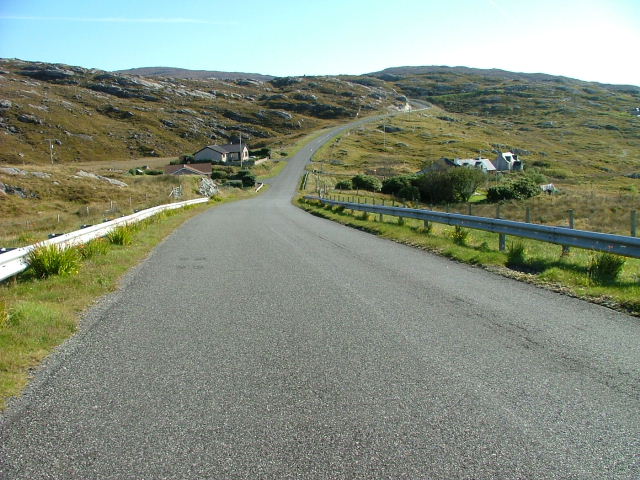
For those seeking a peaceful retreat, Loch Direcleit offers a serene ambiance, providing ample opportunities for leisurely walks, picnics, and photography. Its unspoiled surroundings and breathtaking vistas make it an ideal location for immersing oneself in the beauty of the Scottish Highlands.

Overall, Loch Direcleit is a hidden gem in Inverness-shire, offering a unique blend of natural beauty, biodiversity, and tranquility that captivates all who visit.

If you have any feedback on the listing, please let us know in the comments section below.

Loch Direcleit Images

Images are sourced within 2km of 57.888912/-6.8001592 or Grid Reference NG1598. Thanks to Geograph Open Source API. All images are credited.

West Loch Tarbert from the pier
West Loch Tarbert piers
Spinning wool for tweed in Harris
Tarbert Fire Station
The Lovely Janice They don't make them like that any more! Bus parked in the car park of the Harris Hotel
The Lovely Janice
They don't make them like that any more! Bus parked in the car park of the Harris Hotel
View of West Bay at Tarbert View from the pier on the north side of the bay towards the pier on the south side, the interesting bit of the photo is the dorsal fin a bit right and up from the centre.
View of West Bay at Tarbert
View from the pier on the north side of the bay towards the pier on the south side, the interesting bit of the photo is the dorsal fin a bit right and up from the centre.
Tarbert bay Whale presumably a Minke whale, not huge but the biggest I've seen
Tarbert bay Whale
presumably a Minke whale, not huge but the biggest I've seen
MacAskill's former store Tarbert For many years these premises were run by a Mr MacAskill as a general store. He continued to work in the store until his nineties.
MacAskill's former store Tarbert
For many years these premises were run by a Mr MacAskill as a general store. He continued to work in the store until his nineties.
Urgha Beag Urgha Beag consists of a handful of crofts on the minor road running between Tarbert and the island of Scalpay.
Urgha Beag
Urgha Beag consists of a handful of crofts on the minor road running between Tarbert and the island of Scalpay.
Houses at Oban A small settlement on the Tarbert to Scalpay road.
Houses at Oban
A small settlement on the Tarbert to Scalpay road.
Looking Towards Tarbert On the Scalpay to Tarbert road.
Looking Towards Tarbert
On the Scalpay to Tarbert road.
HM Coastguard station, Tarbert HM Coastguard station above Tarbert, with the Tarbert TV relay (tv transmitter) in the background.
HM Coastguard station, Tarbert
HM Coastguard station above Tarbert, with the Tarbert TV relay (tv transmitter) in the background.
Sir Edward Scott School This houses the only secondary school on Harris, the nearest being in Stornoway on the island of Lewis. The age range of the pupils is from 4 to 18 years.
Sir Edward Scott School
This houses the only secondary school on Harris, the nearest being in Stornoway on the island of Lewis. The age range of the pupils is from 4 to 18 years.
Tarbert Police Station
Tarbert Fire Station Situated next to the Sir Edward Scott junior secondary school.
Tarbert Fire Station
Situated next to the Sir Edward Scott junior secondary school.
Abhainn na Leig Rather dry after a recent prolonged dry spell.
Abhainn na Leig
Rather dry after a recent prolonged dry spell.
Ruined croft building Below Cnoc na Cloiche.
Ruined croft building
Below Cnoc na Cloiche.
Moorland above Tarbert Looking towards Loch a Siar and the football pitch beside the junior secondary school.

The cream-coloured concrete carbuncle is the Old Hostel. This was once used to house the school kids that couldn't get home every night from classes -in the days when there were poor roads and no public transport. The Hostel is now the hub for community-related organisations including the Council, Harris Voluntary Services, North Harris Trust and the dentist and school canteen.
It is scheduled to be demolished in the near future following a major redevelopment of Sir E Scott school.
Moorland above Tarbert
Looking towards Loch a Siar and the football pitch beside the junior secondary school. The cream-coloured concrete carbuncle is the Old Hostel. This was once used to house the school kids that couldn't get home every night from classes -in the days when there were poor roads and no public transport. The Hostel is now the hub for community-related organisations including the Council, Harris Voluntary Services, North Harris Trust and the dentist and school canteen. It is scheduled to be demolished in the near future following a major redevelopment of Sir E Scott school.
Show me another place!

Loch Direcleit is located at Grid Ref: NG1598 (Lat: 57.888912, Lng: -6.8001592)

Unitary Authority: Na h-Eileanan an Iar

Police Authority: Highlands and Islands

What 3 Words

///float.parsnip.cherish. Near Tarbert, Na h-Eileanan Siar

Related Wikis

Harris distillery

Harris distillery is a Scotch whisky and Gin distillery in Tarbert on the Isle of Harris, Scotland. The distillery was the first legal distillery ever...

Tarbert, Harris

Tarbert (Scottish Gaelic: An Tairbeart [ən̪ˠ ˈt̪ɛrʲɛbərˠʃt̪]) is the main community on Harris in the Western Isles of Scotland. The name means "isthmus...

Harris, Outer Hebrides

Harris (Scottish Gaelic: Na Hearadh, pronounced [nə ˈhɛɾəɣ] ) is the southern and more mountainous part of Lewis and Harris, the largest island in the...

Sgeotasaigh

Scotasay (Scottish Gaelic: Sgeotasaigh) is small island in the Outer Hebrides of Scotland. It lies 1 kilometre (0.6 miles) off the east coast of Harris...

Nearby Amenities

Located within 500m of 57.888912,-6.8001592
Passing Place
Lat/Long: 57.8884518/-6.807591
Passing Place
Lat/Long: 57.8854895/-6.797236
Post Box
Collection Times: Mo-Fr 09:30; Sa 09:30
Operator: Royal Mail
Post Box Type: lamp
Ref: HS3 119
Royal Cypher: scottish_crown
Source: survey
Lat/Long: 57.8888532/-6.8036306
Bus Stop
Diracleit
Bench: yes
Naptan AtcoCode: 6010731633
Naptan Bearing: N
Naptan CommonName: Diracleit
Naptan Indicator: Mill Road
Naptan Landmark: Mill Road
Naptan NaptanCode: 94723675
Naptan Street: Mill Road
Shelter: yes
Source: naptan_import
Lat/Long: 57.8888217/-6.8061695
Direcleit
Alt Name En: Direcleit;Diraclete;Dieraclete
Alt Name Gd: Diricleit;Diracleit
Name En: Deiraclete
Name Gd: Direcleit
Place: hamlet
Lat/Long: 57.8861374/-6.7990981
Barrier: cattle_grid
Lat/Long: 57.8896147/-6.806953
Barrier: cattle_grid
Lat/Long: 57.8929946/-6.7995656
Passing Place
Lat/Long: 57.8930781/-6.797753
Barrier: cattle_grid
Source: survey
Lat/Long: 57.8887996/-6.8034008
Barrier: cattle_grid
Lat/Long: 57.8856313/-6.7993926
Turning Circle
Lat/Long: 57.884492/-6.7998164
Passing Place
Lat/Long: 57.8853396/-6.7951405
Passing Place
Lat/Long: 57.8857037/-6.7990889
Material: wood
Power: pole
Lat/Long: 57.8886138/-6.8080569
Material: wood
Power: pole
Lat/Long: 57.8889868/-6.8070931
Material: wood
Power: pole
Lat/Long: 57.8929521/-6.8006922
Material: wood
Power: pole
Lat/Long: 57.8927978/-6.8002606
Material: wood
Power: pole
Lat/Long: 57.8929516/-6.802256
Material: wood
Power: pole
Lat/Long: 57.8932152/-6.8013562
Material: wood
Power: pole
Lat/Long: 57.8929398/-6.7985994
Power: pole
Lat/Long: 57.8924183/-6.8022859
Barrier: cattle_grid
Lat/Long: 57.8869707/-6.7939772
Material: wood
Power: pole
Lat/Long: 57.8902471/-6.8032651
Material: wood
Power: pole
Lat/Long: 57.8899164/-6.8042441
Material: wood
Power: pole
Lat/Long: 57.8895115/-6.8054618
Material: wood
Power: pole
Lat/Long: 57.88917/-6.8062651
Material: wood
Power: pole
Lat/Long: 57.8907155/-6.8030397
Material: wood
Power: pole
Lat/Long: 57.8914091/-6.8027474
Power: pole
Lat/Long: 57.8929044/-6.8027499
Power: pole
Lat/Long: 57.8924682/-6.8029189
Power: pole
Lat/Long: 57.8856304/-6.7964072
Power: pole
Lat/Long: 57.8859882/-6.7977886
Power: pole
Lat/Long: 57.8863361/-6.7991201
Power: pole
Lat/Long: 57.8862407/-6.800014
Power: pole
Lat/Long: 57.8861338/-6.8009392
Power: pole
Lat/Long: 57.886007/-6.8019459
Power: pole
Lat/Long: 57.8867242/-6.7941206
Power: pole
Lat/Long: 57.8862685/-6.7944155
Power: pole
Lat/Long: 57.8858676/-6.7943598
Power: pole
Lat/Long: 57.8909211/-6.7949035
Power: pole
Lat/Long: 57.891138/-6.7950027
Power: pole
Lat/Long: 57.8914295/-6.7951486
Power: pole
Lat/Long: 57.8919269/-6.7953826
Power: pole
Lat/Long: 57.8922263/-6.7955304
Power: pole
Lat/Long: 57.888052/-6.8023342
Power: pole
Lat/Long: 57.886595/-6.8016461
Power: pole
Lat/Long: 57.887457/-6.8017337
Power: pole
Lat/Long: 57.8888838/-6.8031643
Power: pole
Lat/Long: 57.8891986/-6.8034855
Passing Place
Lat/Long: 57.8866338/-6.8012383
Passing Place
Lat/Long: 57.8877726/-6.8019009
Power: pole
Lat/Long: 57.8884464/-6.8028144
Power: pole
Lat/Long: 57.8849066/-6.799492
Power: pole
Lat/Long: 57.8844788/-6.7993203
Power: pole
Lat/Long: 57.8852987/-6.7996422
Power: pole
Lat/Long: 57.8857692/-6.7998407
Entrance: yes
Lat/Long: 57.8844316/-6.7996568
Barrier: cattle_grid
Lat/Long: 57.8860721/-6.8002126
The data included in this document is from www.openstreetmap.org. The data is made available under ODbL.

Have you been to Loch Direcleit?

Leave your review of Loch Direcleit below (or comments, questions and feedback).