Bàgh Direcleit

Bay in Inverness-shire

Scotland

Bàgh Direcleit
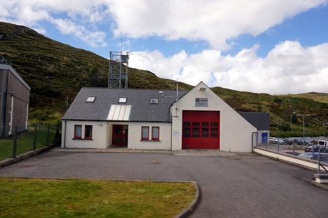
Tarbert Fire Station
Tarbert Fire Station Credit: Ian S

Bàgh Direcleit, located in Inverness-shire, Scotland, is a stunning bay renowned for its natural beauty and historical significance. Situated on the west coast of the Isle of Lewis, it forms part of the larger Loch Roag, a sea loch that stretches towards the Atlantic Ocean.

The bay is surrounded by breathtaking landscapes, characterized by rugged cliffs, pristine sandy beaches, and rolling hills. It is an idyllic spot for nature lovers, offering opportunities for hiking, birdwatching, and wildlife spotting. The bay is home to a variety of bird species, including golden eagles, puffins, and gannets, making it a haven for ornithologists.

Bàgh Direcleit also holds great historical importance. The area is dotted with ancient ruins, such as the Dun Charlabhaidh broch, an Iron Age fort that overlooks the bay. These remnants serve as a reminder of the area's rich cultural heritage and provide an insight into its past.

Visitors to Bàgh Direcleit can also explore the nearby village of Callanish, famous for its ancient standing stones. These Neolithic structures, dating back over 5,000 years, are considered one of the most remarkable megalithic sites in Scotland.

In summary, Bàgh Direcleit is a captivating bay in Inverness-shire, offering a harmonious blend of natural beauty and historical significance. Whether it's admiring the breathtaking landscapes, learning about the area's ancient past, or simply enjoying the tranquility, Bàgh Direcleit is a destination that appeals to a wide range of interests.

If you have any feedback on the listing, please let us know in the comments section below.

Bàgh Direcleit Images

Images are sourced within 2km of 57.883551/-6.8029899 or Grid Reference NG1598. Thanks to Geograph Open Source API. All images are credited.

Tarbert Fire Station
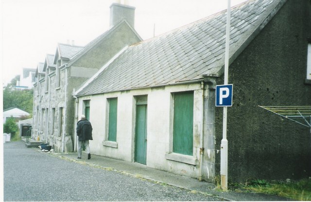
MacAskill's former store Tarbert For many years these premises were run by a Mr MacAskill as a general store. He continued to work in the store until his nineties.
MacAskill's former store Tarbert
For many years these premises were run by a Mr MacAskill as a general store. He continued to work in the store until his nineties.
HM Coastguard station, Tarbert HM Coastguard station above Tarbert, with the Tarbert TV relay (tv transmitter) in the background.
HM Coastguard station, Tarbert
HM Coastguard station above Tarbert, with the Tarbert TV relay (tv transmitter) in the background.
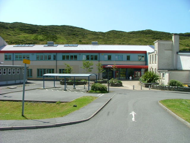
Sir Edward Scott School This houses the only secondary school on Harris, the nearest being in Stornoway on the island of Lewis. The age range of the pupils is from 4 to 18 years.
Sir Edward Scott School
This houses the only secondary school on Harris, the nearest being in Stornoway on the island of Lewis. The age range of the pupils is from 4 to 18 years.
Tarbert Police Station
Tarbert Fire Station Situated next to the Sir Edward Scott junior secondary school.
Tarbert Fire Station
Situated next to the Sir Edward Scott junior secondary school.
Abhainn na Leig Rather dry after a recent prolonged dry spell.
Abhainn na Leig
Rather dry after a recent prolonged dry spell.
Ruined croft building Below Cnoc na Cloiche.
Ruined croft building
Below Cnoc na Cloiche.
Moorland above Tarbert Looking east towards the village.
Moorland above Tarbert
Looking east towards the village.
Old Pier Road Tarbert.
Old Pier Road
Tarbert.
Kayaks and mobile climbing wall Situated behind the local junior secondary school in Tarbert.
Kayaks and mobile climbing wall
Situated behind the local junior secondary school in Tarbert.
Whalebone arch Situated outside the Sir Edward Scott school. In 1975 two teachers from the school dived just off the old whaling station at Bunavoneader, a few miles up the road and recovered two whale jawbones from the debris. These two bones were set in concrete at the entrance to the school.
Whalebone arch
Situated outside the Sir Edward Scott school. In 1975 two teachers from the school dived just off the old whaling station at Bunavoneader, a few miles up the road and recovered two whale jawbones from the debris. These two bones were set in concrete at the entrance to the school.
Ruined house above Old Pier Road, Tarbert This was a cottar house, a house without associated land and was not part of a croft. It was occupied until the early 1930s. Loch a' Siar is in the background.
Ruined house above Old Pier Road, Tarbert
This was a cottar house, a house without associated land and was not part of a croft. It was occupied until the early 1930s. Loch a' Siar is in the background.
Ruined house above Old Pier Road, Tarbert
Sir Edward Scott Junior Secondary School, Tarbert The school is currently being extended. The grey primary school is across the road. A ruined house is in the foreground.
Sir Edward Scott Junior Secondary School, Tarbert
The school is currently being extended. The grey primary school is across the road. A ruined house is in the foreground.
Tarbert from Direcleit The area around Scott Road and, in the background, the hill of Giolabhal Glas.
Tarbert from Direcleit
The area around Scott Road and, in the background, the hill of Giolabhal Glas.
Tarbert: postbox № HS3 118, Scott Road This postbox serves the houses in Scott Road, high up above the main village. It is emptied daily except Sunday at 9:30am.
Tarbert: postbox № HS3 118, Scott Road
This postbox serves the houses in Scott Road, high up above the main village. It is emptied daily except Sunday at 9:30am.
Tarbert: steps into another myriad These steps lead from the houses in Scott Road, on the hillside above, down into the main village of Tarbert. In doing so, they cross the gridline from NB into NG, roughly halfway down the flight immediately ahead of us.
Tarbert: steps into another myriad
These steps lead from the houses in Scott Road, on the hillside above, down into the main village of Tarbert. In doing so, they cross the gridline from NB into NG, roughly halfway down the flight immediately ahead of us.
Show me another place!

Bàgh Direcleit is located at Grid Ref: NG1598 (Lat: 57.883551, Lng: -6.8029899)

Unitary Authority: Na h-Eileanan an Iar

Police Authority: Highlands and Islands

What 3 Words

///nanny.roofs.bind. Near Tarbert, Na h-Eileanan Siar

Related Wikis

Harris distillery

Harris distillery is a Scotch whisky and Gin distillery in Tarbert on the Isle of Harris, Scotland. The distillery was the first legal distillery ever...

Tarbert, Harris

Tarbert (Scottish Gaelic: An Tairbeart [ən̪ˠ ˈt̪ɛrʲɛbərˠʃt̪]) is the main community on Harris in the Western Isles of Scotland. The name means "isthmus...

Sgeotasaigh

Scotasay (Scottish Gaelic: Sgeotasaigh) is small island in the Outer Hebrides of Scotland. It lies 1 kilometre (0.6 miles) off the east coast of Harris...

Harris, Outer Hebrides

Harris (Scottish Gaelic: Na Hearadh, pronounced [nə ˈhɛɾəɣ] ) is the southern and more mountainous part of Lewis and Harris, the largest island in the...

East Loch Tarbert

East Loch Tarbert (Scottish Gaelic: Loch an Tairbeairt) is a sea loch that lies to the east of Harris in the Outer Hebrides of Scotland. The loch contains...

Ardhasaig

Ardhasaig (Scottish Gaelic: Àird Àsaig) is a settlement on the western coast of north Harris, in the Outer Hebrides, Scotland. Ardhasaig is also within...

Bun Abhainn Eadarra

Bun Abhainn Eadarra or Bunavoneadar is a hamlet adjacent to the Loch Bun Abhainn Eadarra, on the south shore of North Harris, in the Outer Hebrides, Scotland...

Scalpay, Outer Hebrides

Scalpay (; Scottish Gaelic: Sgalpaigh or Sgalpaigh na Hearadh; i.e. "Scalpay of Harris" to distinguish it from Scalpay off Skye) is an island in the Outer...

Nearby Amenities

Located within 500m of 57.883551,-6.8029899
Passing Place
Lat/Long: 57.8854895/-6.797236
Direcleit
Alt Name En: Direcleit;Diraclete;Dieraclete
Alt Name Gd: Diricleit;Diracleit
Name En: Deiraclete
Name Gd: Direcleit
Place: hamlet
Lat/Long: 57.8861374/-6.7990981
Barrier: cattle_grid
Lat/Long: 57.8856313/-6.7993926
Turning Circle
Lat/Long: 57.884492/-6.7998164
Passing Place
Lat/Long: 57.8857037/-6.7990889
Material: wood
Power: pole
Lat/Long: 57.8842131/-6.8111394
Power: pole
Lat/Long: 57.8856304/-6.7964072
Power: pole
Lat/Long: 57.8859882/-6.7977886
Power: pole
Lat/Long: 57.8863361/-6.7991201
Power: pole
Lat/Long: 57.8862407/-6.800014
Power: pole
Lat/Long: 57.8861238/-6.8009607
Power: pole
Lat/Long: 57.8859899/-6.8019593
Power: pole
Lat/Long: 57.8880377/-6.802349
Power: pole
Lat/Long: 57.8866185/-6.8016421
Power: pole
Lat/Long: 57.887492/-6.8017619
Passing Place
Lat/Long: 57.8866338/-6.8012383
Passing Place
Lat/Long: 57.8877726/-6.8019009
Power: pole
Lat/Long: 57.8849066/-6.799492
Power: pole
Lat/Long: 57.8844788/-6.7993203
Power: pole
Lat/Long: 57.8852987/-6.7996422
Power: pole
Lat/Long: 57.8857692/-6.7998407
Entrance: yes
Lat/Long: 57.8844316/-6.7996568
Bagh Direcleit
Natural: bay
Lat/Long: 57.8836988/-6.8031755
Rubha Iain Ruaidh
Natural: cape
Lat/Long: 57.8822158/-6.8043771
Barrier: cattle_grid
Lat/Long: 57.8860721/-6.8002126
The data included in this document is from www.openstreetmap.org. The data is made available under ODbL.

Have you been to Bàgh Direcleit?

Leave your review of Bàgh Direcleit below (or comments, questions and feedback).