Cnoc Glas

Hill, Mountain in Ross-shire

Scotland

Cnoc Glas

Great Bernera bridges The new bridge under construction and the old white bridge.
Great Bernera bridges Credit: Catherine Morgan

Cnoc Glas is a prominent hill located in Ross-shire, Scotland. Situated in the northwest Highlands, it is part of the Torridon Mountain range. Rising to an elevation of approximately 829 meters (2,720 feet), Cnoc Glas offers stunning panoramic views of the surrounding landscape.

The hill is characterized by its rugged and rocky terrain, typical of the Torridon range. Its slopes are covered in a patchwork of heather, grass, and scattered boulders, providing a challenging but rewarding climb for experienced hikers and mountaineers. The summit of Cnoc Glas offers a breathtaking vista over Loch Maree, one of Scotland's most picturesque freshwater lochs.

Wildlife enthusiasts will be delighted to find a variety of species inhabiting the area. Ptarmigans, mountain hares, and red deer are frequently spotted on the lower slopes, while golden eagles can sometimes be seen soaring high above. The hill is also home to a diverse range of plant life, including hardy alpine species such as saxifrages and moss campion.

Due to its remote location, Cnoc Glas provides a serene and peaceful environment for outdoor enthusiasts. However, its challenging terrain and unpredictable weather conditions require careful planning and appropriate equipment for those wishing to undertake the ascent. It is advisable to consult maps, weather forecasts, and experienced local guides before attempting the climb.

In conclusion, Cnoc Glas is a magnificent hill in Ross-shire, Scotland, offering breathtaking views, diverse wildlife, and a rewarding challenge for outdoor enthusiasts. It is an excellent destination for hikers and mountaineers seeking a memorable experience in the stunning Scottish Highlands.

If you have any feedback on the listing, please let us know in the comments section below.
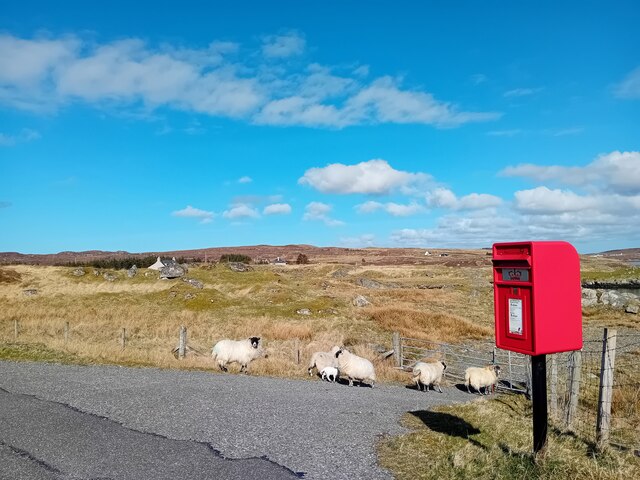
Cnoc Glas Images

Images are sourced within 2km of 58.197128/-6.8500853 or Grid Reference NB1533. Thanks to Geograph Open Source API. All images are credited.

Great Bernera bridges The new bridge under construction and the old white bridge.
Great Bernera bridges
The new bridge under construction and the old white bridge.
Postbox on Great Bernera HS2 88. Royal Mail list this box as 'Shore'.
Postbox on Great Bernera
HS2 88. Royal Mail list this box as 'Shore'.
"The Bridge Across the Atlantic" Bernera Bridge is one of several bridges which claim to span the Atlantic Ocean. This one connects the Lewis mainland with the island of Great Bernera / Bearnaraigh. Note the standing stones on the far side of the bridge.
<span class="nowrap"><a title="http://www.uigandbernera.com/" rel="nofollow ugc noopener" href="http://www.uigandbernera.com/">Link</a><img style="margin-left:2px;" alt="External link" title="External link - shift click to open in new window" src="https://s1.geograph.org.uk/img/external.png" width="10" height="10"/></span>
"The Bridge Across the Atlantic"
Bernera Bridge is one of several bridges which claim to span the Atlantic Ocean. This one connects the Lewis mainland with the island of Great Bernera / Bearnaraigh. Note the standing stones on the far side of the bridge. LinkExternal link
Bernera Bridge Opened in 1953 and connecting Lewis with Great Bernera / Bearnaraigh.
<span class="nowrap"><a title="http://www.uigandbernera.com/" rel="nofollow ugc noopener" href="http://www.uigandbernera.com/">Link</a><img style="margin-left:2px;" alt="External link" title="External link - shift click to open in new window" src="https://s1.geograph.org.uk/img/external.png" width="10" height="10"/></span>
Bernera Bridge
Opened in 1953 and connecting Lewis with Great Bernera / Bearnaraigh. LinkExternal link
Sea Kayakers by Port a Chruidh Kayakers who have come from Miavaig / Miabhaig and are heading eastwards, having just passed below Bernera Bridge. The mainland of Lewis is on the far side of the 1953 bridge.
<span class="nowrap"><a title="http://www.uigandbernera.com/" rel="nofollow ugc noopener" href="http://www.uigandbernera.com/">Link</a><img style="margin-left:2px;" alt="External link" title="External link - shift click to open in new window" src="https://s1.geograph.org.uk/img/external.png" width="10" height="10"/></span>
Sea Kayakers by Port a Chruidh
Kayakers who have come from Miavaig / Miabhaig and are heading eastwards, having just passed below Bernera Bridge. The mainland of Lewis is on the far side of the 1953 bridge. LinkExternal link
Lewisian Gneiss Pink, folded Lewisian gneiss at the north end of Bernera Bridge. These are amongst the oldest rocks in the world.
<span class="nowrap"><a title="http://www.uigandbernera.com/" rel="nofollow ugc noopener" href="http://www.uigandbernera.com/">Link</a><img style="margin-left:2px;" alt="External link" title="External link - shift click to open in new window" src="https://s1.geograph.org.uk/img/external.png" width="10" height="10"/></span>
Lewisian Gneiss
Pink, folded Lewisian gneiss at the north end of Bernera Bridge. These are amongst the oldest rocks in the world. LinkExternal link
Stone Circle by Bernera Bridge Ancient stone circle on a mound above the north end of the bridge. the stones are part of the famous Callanish complex of standing stones.
Stone Circle by Bernera Bridge
Ancient stone circle on a mound above the north end of the bridge. the stones are part of the famous Callanish complex of standing stones.
Cleitir Stone Circle Calanais VIII - four standing stones above Bernera Bridge and the sound separating the island from Lewis.
Cleitir Stone Circle
Calanais VIII - four standing stones above Bernera Bridge and the sound separating the island from Lewis.
Bernera Bridge
Bernera Bridge
Standing stones by Bernera Bridge
Great Bernera: postbox № HS2 82 and a ruined croft house This postbox stands at the southern end of the island, a few hundred yards from the Bernera Bridge. Behind it, we see a ruined croft house, so common in the Scottish islands.
Great Bernera: postbox № HS2 82 and a ruined croft house
This postbox stands at the southern end of the island, a few hundred yards from the Bernera Bridge. Behind it, we see a ruined croft house, so common in the Scottish islands.
Great Bernera Road Bridge Great Bernera lies in Loch Roag on the north-west coast of Lewis and is linked to it by a road bridge. Built in 1953, the bridge was the first pre-stressed concrete bridge in Europe. The main settlement on the island is Breaclete (Gaelic: Breacleit).
I was here bagging the island of Great Bernera with George Morl and its high point a TuMP called Middle Shalaval, at 87 metres and a P87 hill.
Great Bernera Road Bridge
Great Bernera lies in Loch Roag on the north-west coast of Lewis and is linked to it by a road bridge. Built in 1953, the bridge was the first pre-stressed concrete bridge in Europe. The main settlement on the island is Breaclete (Gaelic: Breacleit). I was here bagging the island of Great Bernera with George Morl and its high point a TuMP called Middle Shalaval, at 87 metres and a P87 hill.
Callanish X
Callanish X
Great Bernera Road Bridge The road south hugged the shore in 1975. Now it blasts straight ahead.
Great Bernera Road Bridge
The road south hugged the shore in 1975. Now it blasts straight ahead.
Standing Stones look over Sruth Iarsiadar  The name in this case means the current at Iarsiadar. It's a narrow tidal channel between Great Bernera and the rest of Lewis.
Standing Stones look over Sruth Iarsiadar
The name in this case means the current at Iarsiadar. It's a narrow tidal channel between Great Bernera and the rest of Lewis.
Tursachan standing stone and Bernera Road Bridge The stone is one of a group of three standing with a fourth being prostrate.
Tursachan standing stone and Bernera Road Bridge
The stone is one of a group of three standing with a fourth being prostrate.
A view over Loch Barraglom From Iarsiadar.
A view over Loch Barraglom
From Iarsiadar.
The Bernera Bridge The bridge was opened in 1953 and widened in 1998. Prior to that, Bernera was connected to the main island by ferry but during construction of the bridge, divers found the remains of a causeway, of unknown age.
The Bernera Bridge
The bridge was opened in 1953 and widened in 1998. Prior to that, Bernera was connected to the main island by ferry but during construction of the bridge, divers found the remains of a causeway, of unknown age.
Show me another place!

Cnoc Glas is located at Grid Ref: NB1533 (Lat: 58.197128, Lng: -6.8500853)

Unitary Authority: Na h-Eileanan an Iar

Police Authority: Highlands and Islands

What 3 Words

///dialects.tooth.claw. Near Carloway, Na h-Eileanan Siar

Related Wikis

Callanish VIII

The Callanish VIII stone setting is one of many megalithic structures around the better-known (and larger) Calanais I on the west coast of the Isle of...

Dun Bharabhat, Great Bernera

Dun Bharabhat (or Dun Baravat) is an Iron Age galleried dun or "semi-broch" situated on the island of Great Bernera near Lewis in Scotland (grid reference...

Loch Ròg

Loch Ròg or Loch Roag is a large sea loch on the west coast of Lewis, Outer Hebrides. It is broadly divided into East Loch Roag and West Loch Roag with...

Fuaigh Mòr

Fuaigh Mòr (sometimes anglicised as Vuia Mor) is an island in the Outer Hebrides of Scotland. It is off the west coast of Lewis near Great Bernera in...

Nearby Amenities

Located within 500m of 58.197128,-6.8500853
Aird Toranais
Natural: peninsula
Lat/Long: 58.1988976/-6.8485196
The data included in this document is from www.openstreetmap.org. The data is made available under ODbL.

Have you been to Cnoc Glas?

Leave your review of Cnoc Glas below (or comments, questions and feedback).