Camas Shannageadh

Bay in Ross-shire

Scotland

Camas Shannageadh

Gob Geòdha nam Bradan
Gob Geòdha nam Bradan Credit: Sandy Gerrard

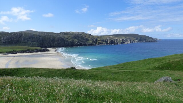
Camas Shannageadh is a picturesque bay located in Ross-shire, Scotland. Nestled on the west coast of the Scottish Highlands, this bay offers breathtaking views of the rugged coastline and the vast Atlantic Ocean. The name "Camas Shannageadh" is derived from Scottish Gaelic, with "Camas" meaning bay or inlet, and "Shannageadh" referring to a specific rocky point in the bay.

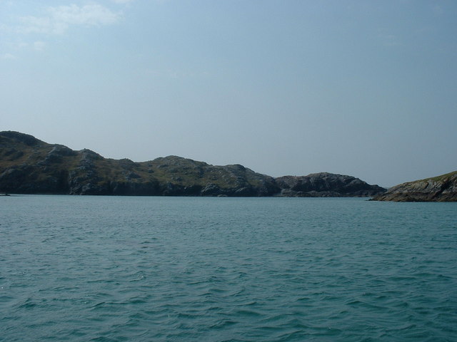
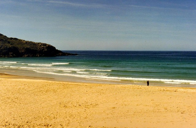
The bay is renowned for its natural beauty, characterized by its pristine sandy beaches, crystal-clear turquoise waters, and dramatic cliffs. It is a haven for outdoor enthusiasts, attracting visitors with its opportunities for hiking, birdwatching, and water sports such as kayaking and paddleboarding. The bay is also home to diverse marine life, making it a popular spot for fishing and snorkeling.

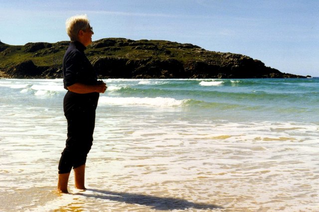
Surrounded by lush green hills and breathtaking landscapes, Camas Shannageadh offers a tranquil and serene atmosphere, perfect for those seeking a peaceful retreat. Visitors can enjoy leisurely walks along the beach, immersing themselves in the stunning scenery and observing the diverse flora and fauna that inhabit the area.

The bay is easily accessible by road, with nearby parking facilities available. It is also within proximity to other notable attractions in Ross-shire, such as the picturesque villages of Gairloch and Ullapool. Whether it's for a day trip or a longer stay, Camas Shannageadh is a must-visit destination for those seeking natural beauty and tranquility in the Scottish Highlands.

If you have any feedback on the listing, please let us know in the comments section below.

Camas Shannageadh Images

Images are sourced within 2km of 58.227966/-6.9661569 or Grid Reference NB0837. Thanks to Geograph Open Source API. All images are credited.

Gob Geòdha nam Bradan
Sheepfold at Tobha Mòr
Sheepfold and boundary wall near Tobha Mòr
Rocky surface at Eala Sheadha
Eastern side of the Eala Sheadha Headland
Sunrise, Gridig
Sunrise, Gridig
Beach at Pabaigh Mor
Tràigh na Beirigh and Pabaigh Mòr
Traigh na Beirigh beach Lewis Looking out from the beach just in front of the Caravan site towards the headland at Kneep on the left and Pabaigh Mor on the right.
Traigh na Beirigh beach Lewis
Looking out from the beach just in front of the Caravan site towards the headland at Kneep on the left and Pabaigh Mor on the right.
Lagoon between Pabaigh Mor and Pabaigh Beag View to west showing narrows between these two islands off the northwest coast off Na h-Eileanan an Iar (Outer Hebrides).
Lagoon between Pabaigh Mor and Pabaigh Beag
View to west showing narrows between these two islands off the northwest coast off Na h-Eileanan an Iar (Outer Hebrides).
Tràigh na Clibhe on the Isle of Lewis This beautiful north-facing beach, Tràigh na Clibhe, is popular with surfers (two are just visible beyond the lone figure). It is protected on both sides by 50 foot high cliffs (not in view here, but see <a title="https://www.geograph.org.uk/photo/1618866" href="https://www.geograph.org.uk/photo/1618866">Link</a> )
Tràigh na Clibhe on the Isle of Lewis
This beautiful north-facing beach, Tràigh na Clibhe, is popular with surfers (two are just visible beyond the lone figure). It is protected on both sides by 50 foot high cliffs (not in view here, but see Link )
Tràigh na Clibhe On the skyline is the low headland which marks the left edge of Tràigh na Clibhe beach. This north-facing beach is also protected on both sides by 50 foot high cliffs (not in view here, but see <a title="https://www.geograph.org.uk/photo/1618866" href="https://www.geograph.org.uk/photo/1618866">Link</a> ). In the hinterland is the village of Cliobh (Cliff) to the south and the town of Bhaltos (Valtos) to the east, providing several alternative names for this popular beach.
Tràigh na Clibhe
On the skyline is the low headland which marks the left edge of Tràigh na Clibhe beach. This north-facing beach is also protected on both sides by 50 foot high cliffs (not in view here, but see Link ). In the hinterland is the village of Cliobh (Cliff) to the south and the town of Bhaltos (Valtos) to the east, providing several alternative names for this popular beach.
Traigh na Clibhe North-west facing bay, backed by sand dunes, north of Cliobh.
Traigh na Clibhe
North-west facing bay, backed by sand dunes, north of Cliobh.
Bhaltos / Valtos Community of crofts, fishermen's houses and holiday homes on Pabbay Sound / Caolas Phabaigh.
Bhaltos / Valtos
Community of crofts, fishermen's houses and holiday homes on Pabbay Sound / Caolas Phabaigh.
Valtos Pier Sheltering the small harbour of Valtos / Bhaltos on Pabbay Sound / Caolas Phabaigh. The island of Pabaigh Mor / Big Pabbay is in the background.
Valtos Pier
Sheltering the small harbour of Valtos / Bhaltos on Pabbay Sound / Caolas Phabaigh. The island of Pabaigh Mor / Big Pabbay is in the background.
Machair Above Berie Sands Fertile grassland with summer flowers in bloom - with view across Traigh na Beirigh.
Machair Above Berie Sands
Fertile grassland with summer flowers in bloom - with view across Traigh na Beirigh.
Tràigh na Clibhe
Tràigh na Clibhe
View from near Bhaltos towards Pabaigh Mor
Show me another place!

Camas Shannageadh is located at Grid Ref: NB0837 (Lat: 58.227966, Lng: -6.9661569)

Unitary Authority: Na h-Eileanan an Iar

Police Authority: Highlands and Islands

What 3 Words

///soaks.grills.embellish. Near Carloway, Na h-Eileanan Siar

Related Wikis

Kneep

Kneep (Scottish Gaelic: Cnìp) is a village on the Isle of Lewis, in the Outer Hebrides, Scotland. Kneep is within the parish of Uig.Various archaeological...

Cliff, Lewis

Cliff (Scottish Gaelic: Cliobh) is a small settlement on the Isle of Lewis, in the Outer Hebrides, Scotland. Cliff is within the parish of Uig. The settlement...

Pabaigh Mòr

Pabay Mòr or Pabaigh Mòr is an uninhabited island in the Outer Hebrides of Scotland. == History == The island's name comes from papey, an Old Norse name...

Loch na Berie

Loch Na Berie is a broch in the Outer Hebrides of Scotland, located approximately 400 yards from the shore, and is thought to have been located on an island...

Nearby Amenities

Located within 500m of 58.227966,-6.9661569
The data included in this document is from www.openstreetmap.org. The data is made available under ODbL.

Have you been to Camas Shannageadh?

Leave your review of Camas Shannageadh below (or comments, questions and feedback).