Creig Thormaid Mhòr

Cliff, Slope in Ross-shire

Scotland

Creig Thormaid Mhòr

Gob Geòdha nam Bradan
Gob Geòdha nam Bradan Credit: Sandy Gerrard

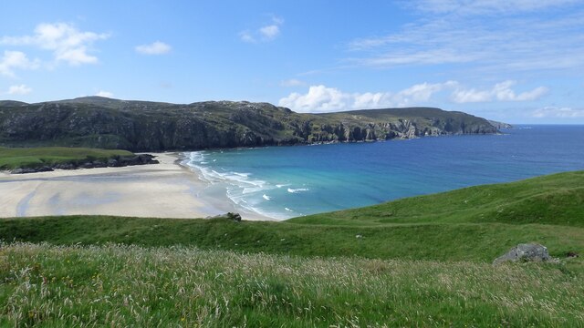
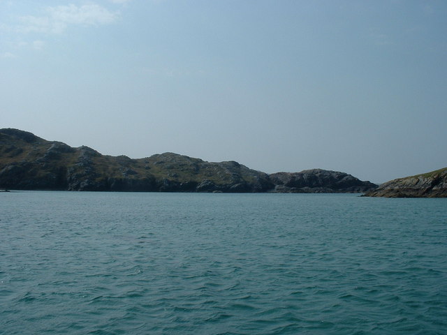
Creig Thormaid Mhòr, located in Ross-shire, Scotland, is a prominent natural feature that mesmerizes visitors with its breathtaking cliff and slope formations. Rising majestically from the rugged terrain, this geological wonder showcases the raw beauty of the Scottish Highlands.

The cliff, characterized by its sheer vertical drop, stands as a testament to the power of erosion over the ages. Its imposing presence creates a dramatic backdrop against the surrounding landscape, captivating onlookers with its imposing height and rugged texture. The cliff's composition primarily consists of ancient rock formations, shaped by the forces of nature throughout millennia.

Adjacent to the cliff, a steep slope descends towards the valley below. Covered in lush vegetation, the slope serves as a habitat for diverse flora and fauna, adding to the area's ecological significance. Mosses, ferns, and heather adorn the landscape, creating a harmonious blend of colors and textures.

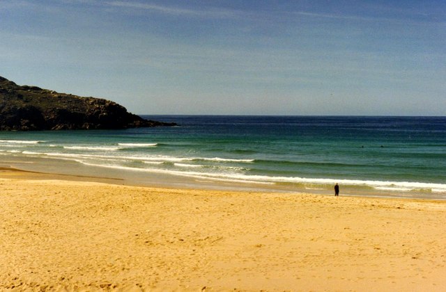
Creig Thormaid Mhòr's setting within Ross-shire provides visitors with stunning panoramic views of the surrounding countryside. As the cliff and slope overlook the valley, visitors can admire rolling hills, sparkling lochs, and the distant peaks of the Scottish Highlands. The ever-changing weather patterns further enhance the allure of this natural wonder, as mist, rainbows, and sunlight play with the landscape, creating a magical atmosphere.

Whether for nature enthusiasts, photographers, or those seeking tranquility, Creig Thormaid Mhòr offers an unforgettable experience, immersing visitors in the rugged beauty and rich geological history of the Scottish Highlands.

If you have any feedback on the listing, please let us know in the comments section below.

Creig Thormaid Mhòr Images

Images are sourced within 2km of 58.232663/-6.9652284 or Grid Reference NB0837. Thanks to Geograph Open Source API. All images are credited.

Gob Geòdha nam Bradan
Sheepfold at Tobha Mòr
Sheepfold and boundary wall near Tobha Mòr
Rocky surface at Eala Sheadha
Eastern side of the Eala Sheadha Headland
Crystal clear seas off North West coast of Na h-Eileanan an Iar View to about 3 metres depth from RIB floating in lagoon between Pabaigh Mor and Pabaigh Beag.  See also <a href="https://www.geograph.org.uk/photo/1120209">NB1038 : Lagoon on Pabbay Mor</a>
Crystal clear seas off North West coast of Na h-Eileanan an Iar
View to about 3 metres depth from RIB floating in lagoon between Pabaigh Mor and Pabaigh Beag. See also NB1038 : Lagoon on Pabbay Mor
Beach at Pabaigh Mor
Geodh'an Tuill penetrates Pabaigh Mor Pabaigh More has a tidally flooded low-lying area in the middle of the island (at one time used for buffering lobsters) which connects to the open sea over a reef to the northwest, and through a couple of rocky channels heading northeast. It's clear that those channels must have started the same way as this cave, which has penetrated right to the lagoon (from which it is separated only by a storm beach thrown up by waves entering the cave) and, on a geological timescale, is just about at the end of its life. Although one of our group walked over the arch, and once we'd paddled round the island several of us entered the cave from the sea, it is not the most confidence-inspiring roof, especially at this landward end.
Geodh'an Tuill penetrates Pabaigh Mor
Pabaigh More has a tidally flooded low-lying area in the middle of the island (at one time used for buffering lobsters) which connects to the open sea over a reef to the northwest, and through a couple of rocky channels heading northeast. It's clear that those channels must have started the same way as this cave, which has penetrated right to the lagoon (from which it is separated only by a storm beach thrown up by waves entering the cave) and, on a geological timescale, is just about at the end of its life. Although one of our group walked over the arch, and once we'd paddled round the island several of us entered the cave from the sea, it is not the most confidence-inspiring roof, especially at this landward end.
Lagoon between Pabaigh Mor and Pabaigh Beag View to west showing narrows between these two islands off the northwest coast off Na h-Eileanan an Iar (Outer Hebrides).
Lagoon between Pabaigh Mor and Pabaigh Beag
View to west showing narrows between these two islands off the northwest coast off Na h-Eileanan an Iar (Outer Hebrides).
Tràigh na Clibhe on the Isle of Lewis This beautiful north-facing beach, Tràigh na Clibhe, is popular with surfers (two are just visible beyond the lone figure). It is protected on both sides by 50 foot high cliffs (not in view here, but see <a title="https://www.geograph.org.uk/photo/1618866" href="https://www.geograph.org.uk/photo/1618866">Link</a> )
Tràigh na Clibhe on the Isle of Lewis
This beautiful north-facing beach, Tràigh na Clibhe, is popular with surfers (two are just visible beyond the lone figure). It is protected on both sides by 50 foot high cliffs (not in view here, but see Link )
Tràigh na Clibhe On the skyline is the low headland which marks the left edge of Tràigh na Clibhe beach. This north-facing beach is also protected on both sides by 50 foot high cliffs (not in view here, but see <a title="https://www.geograph.org.uk/photo/1618866" href="https://www.geograph.org.uk/photo/1618866">Link</a> ). In the hinterland is the village of Cliobh (Cliff) to the south and the town of Bhaltos (Valtos) to the east, providing several alternative names for this popular beach.
Tràigh na Clibhe
On the skyline is the low headland which marks the left edge of Tràigh na Clibhe beach. This north-facing beach is also protected on both sides by 50 foot high cliffs (not in view here, but see Link ). In the hinterland is the village of Cliobh (Cliff) to the south and the town of Bhaltos (Valtos) to the east, providing several alternative names for this popular beach.
Traigh na Clibhe North-west facing bay, backed by sand dunes, north of Cliobh.
Traigh na Clibhe
North-west facing bay, backed by sand dunes, north of Cliobh.
Bhaltos / Valtos Community of crofts, fishermen's houses and holiday homes on Pabbay Sound / Caolas Phabaigh.
Bhaltos / Valtos
Community of crofts, fishermen's houses and holiday homes on Pabbay Sound / Caolas Phabaigh.
Valtos Pier Sheltering the small harbour of Valtos / Bhaltos on Pabbay Sound / Caolas Phabaigh. The island of Pabaigh Mor / Big Pabbay is in the background.
Valtos Pier
Sheltering the small harbour of Valtos / Bhaltos on Pabbay Sound / Caolas Phabaigh. The island of Pabaigh Mor / Big Pabbay is in the background.
Machair Above Berie Sands Fertile grassland with summer flowers in bloom - with view across Traigh na Beirigh.
Machair Above Berie Sands
Fertile grassland with summer flowers in bloom - with view across Traigh na Beirigh.
Tràigh na Clibhe
Tràigh na Clibhe
View from near Bhaltos towards Pabaigh Mor
Traigh Bhaltos
Traigh Bhaltos
Show me another place!

Creig Thormaid Mhòr is located at Grid Ref: NB0837 (Lat: 58.232663, Lng: -6.9652284)

Unitary Authority: Na h-Eileanan an Iar

Police Authority: Highlands and Islands

What 3 Words

///bidder.conspire.carpeted. Near Carloway, Na h-Eileanan Siar

Related Wikis

Kneep

Kneep (Scottish Gaelic: Cnìp) is a village on the Isle of Lewis, in the Outer Hebrides, Scotland. Kneep is within the parish of Uig.Various archaeological...

Pabaigh Mòr

Pabay Mòr or Pabaigh Mòr is an uninhabited island in the Outer Hebrides of Scotland. == History == The island's name comes from papey, an Old Norse name...

Cliff, Lewis

Cliff (Scottish Gaelic: Cliobh) is a small settlement on the Isle of Lewis, in the Outer Hebrides, Scotland. Cliff is within the parish of Uig. The settlement...

Vacsay

Vacsay (Scottish Gaelic: Bhacsaigh from Old Norse "bakkiey" meaning "peat bank island") is one of the Outer Hebrides. It is off the west coast of Lewis...

Have you been to Creig Thormaid Mhòr?

Leave your review of Creig Thormaid Mhòr below (or comments, questions and feedback).