Stac a' Ruta

Coastal Feature, Headland, Point in Ross-shire

Scotland

Stac a' Ruta

Gob Geòdha nam Bradan
Gob Geòdha nam Bradan Credit: Sandy Gerrard

Stac a' Ruta is a prominent coastal feature located in Ross-shire, Scotland. It is a headland or point that juts out into the sea, offering spectacular views of the surrounding coastal landscape.

This headland is situated on the northwestern coast of Ross-shire and is characterized by its rugged cliffs and steep slopes. It is composed of ancient rock formations, primarily made up of sandstone and limestone, which have been shaped over time by the relentless force of the sea. The cliffs of Stac a' Ruta rise to a height of approximately 100 meters, providing a dramatic backdrop to the crashing waves below.

The headland is known for its rich biodiversity, with a variety of coastal plant species found in the area. The cliffs provide nesting sites for seabirds such as puffins, guillemots, and razorbills, making it a popular spot for birdwatchers. The surrounding waters are also home to a diverse range of marine life, including seals, dolphins, and occasionally whales.

Access to Stac a' Ruta is possible via a coastal path that winds along the headland, offering visitors the opportunity to explore the area's natural beauty. The path provides stunning panoramic views of the rugged coastline and the open sea. It is advisable to wear appropriate footwear and take caution when walking near the cliff edges, as they can be steep and unstable in some areas.

Overall, Stac a' Ruta is a remarkable coastal feature in Ross-shire, offering visitors a chance to experience the rugged beauty and rich biodiversity of the Scottish coastline.

If you have any feedback on the listing, please let us know in the comments section below.
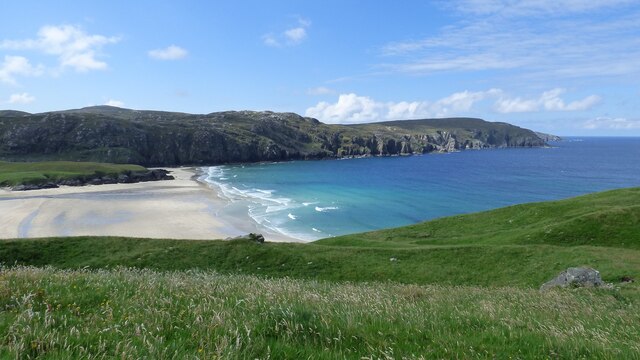
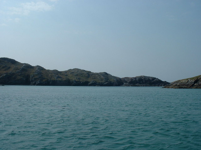
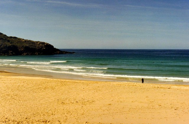
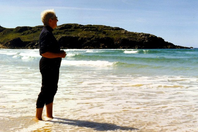
Stac a' Ruta Images

Images are sourced within 2km of 58.22583/-6.9674096 or Grid Reference NB0837. Thanks to Geograph Open Source API. All images are credited.

Gob Geòdha nam Bradan
Sheepfold at Tobha Mòr
Sheepfold and boundary wall near Tobha Mòr
Rocky surface at Eala Sheadha
Eastern side of the Eala Sheadha Headland
Tràigh na Beirigh In the 1960's this was a deserted beach.  Now it has to be shared with caravanners.
Tràigh na Beirigh
In the 1960's this was a deserted beach. Now it has to be shared with caravanners.
Sunrise, Gridig
Sunrise, Gridig
Beach at Pabaigh Mor
Tràigh na Beirigh and Pabaigh Mòr
Traigh na Beirigh beach Lewis Looking out from the beach just in front of the Caravan site towards the headland at Kneep on the left and Pabaigh Mor on the right.
Traigh na Beirigh beach Lewis
Looking out from the beach just in front of the Caravan site towards the headland at Kneep on the left and Pabaigh Mor on the right.
Lagoon between Pabaigh Mor and Pabaigh Beag View to west showing narrows between these two islands off the northwest coast off Na h-Eileanan an Iar (Outer Hebrides).
Lagoon between Pabaigh Mor and Pabaigh Beag
View to west showing narrows between these two islands off the northwest coast off Na h-Eileanan an Iar (Outer Hebrides).
Tràigh na Clibhe on the Isle of Lewis This beautiful north-facing beach, Tràigh na Clibhe, is popular with surfers (two are just visible beyond the lone figure). It is protected on both sides by 50 foot high cliffs (not in view here, but see <a title="https://www.geograph.org.uk/photo/1618866" href="https://www.geograph.org.uk/photo/1618866">Link</a> )
Tràigh na Clibhe on the Isle of Lewis
This beautiful north-facing beach, Tràigh na Clibhe, is popular with surfers (two are just visible beyond the lone figure). It is protected on both sides by 50 foot high cliffs (not in view here, but see Link )
Tràigh na Clibhe On the skyline is the low headland which marks the left edge of Tràigh na Clibhe beach. This north-facing beach is also protected on both sides by 50 foot high cliffs (not in view here, but see <a title="https://www.geograph.org.uk/photo/1618866" href="https://www.geograph.org.uk/photo/1618866">Link</a> ). In the hinterland is the village of Cliobh (Cliff) to the south and the town of Bhaltos (Valtos) to the east, providing several alternative names for this popular beach.
Tràigh na Clibhe
On the skyline is the low headland which marks the left edge of Tràigh na Clibhe beach. This north-facing beach is also protected on both sides by 50 foot high cliffs (not in view here, but see Link ). In the hinterland is the village of Cliobh (Cliff) to the south and the town of Bhaltos (Valtos) to the east, providing several alternative names for this popular beach.
Traigh na Clibhe North-west facing bay, backed by sand dunes, north of Cliobh.
Traigh na Clibhe
North-west facing bay, backed by sand dunes, north of Cliobh.
Bhaltos / Valtos Community of crofts, fishermen's houses and holiday homes on Pabbay Sound / Caolas Phabaigh.
Bhaltos / Valtos
Community of crofts, fishermen's houses and holiday homes on Pabbay Sound / Caolas Phabaigh.
Valtos Pier Sheltering the small harbour of Valtos / Bhaltos on Pabbay Sound / Caolas Phabaigh. The island of Pabaigh Mor / Big Pabbay is in the background.
Valtos Pier
Sheltering the small harbour of Valtos / Bhaltos on Pabbay Sound / Caolas Phabaigh. The island of Pabaigh Mor / Big Pabbay is in the background.
Machair Above Berie Sands Fertile grassland with summer flowers in bloom - with view across Traigh na Beirigh.
Machair Above Berie Sands
Fertile grassland with summer flowers in bloom - with view across Traigh na Beirigh.
Tràigh na Clibhe
Tràigh na Clibhe
Show me another place!

Stac a' Ruta is located at Grid Ref: NB0837 (Lat: 58.22583, Lng: -6.9674096)

Unitary Authority: Na h-Eileanan an Iar

Police Authority: Highlands and Islands

What 3 Words

///opened.together.curtains. Near Carloway, Na h-Eileanan Siar

Related Wikis

Cliff, Lewis

Cliff (Scottish Gaelic: Cliobh) is a small settlement on the Isle of Lewis, in the Outer Hebrides, Scotland. Cliff is within the parish of Uig. The settlement...

Kneep

Kneep (Scottish Gaelic: Cnìp) is a village on the Isle of Lewis, in the Outer Hebrides, Scotland. Kneep is within the parish of Uig.Various archaeological...

Pabaigh Mòr

Pabay Mòr or Pabaigh Mòr is an uninhabited island in the Outer Hebrides of Scotland. == History == The island's name comes from papey, an Old Norse name...

Loch na Berie

Loch Na Berie is a broch in the Outer Hebrides of Scotland, located approximately 400 yards from the shore, and is thought to have been located on an island...

Nearby Amenities

Located within 500m of 58.22583,-6.9674096
Passing Place
Lat/Long: 58.2234255/-6.9605884
The data included in this document is from www.openstreetmap.org. The data is made available under ODbL.

Have you been to Stac a' Ruta?

Leave your review of Stac a' Ruta below (or comments, questions and feedback).