Tobha Mòr

Hill, Mountain in Ross-shire

Scotland

Tobha Mòr

Gob Geòdha nam Bradan
Gob Geòdha nam Bradan Credit: Sandy Gerrard

Tobha Mòr, located in Ross-shire, Scotland, is a prominent hill/mountain that stands at an elevation of approximately 482 meters (1,581 feet). It is part of the broader Ben Wyvis range, which is renowned for its stunning natural beauty and captivating landscapes.

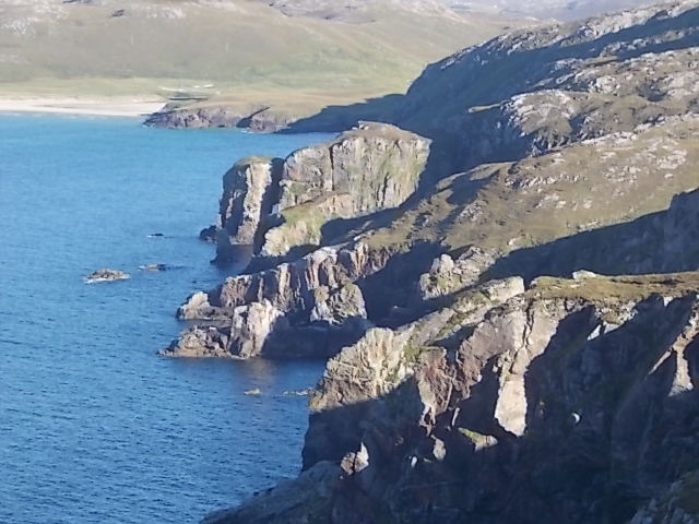
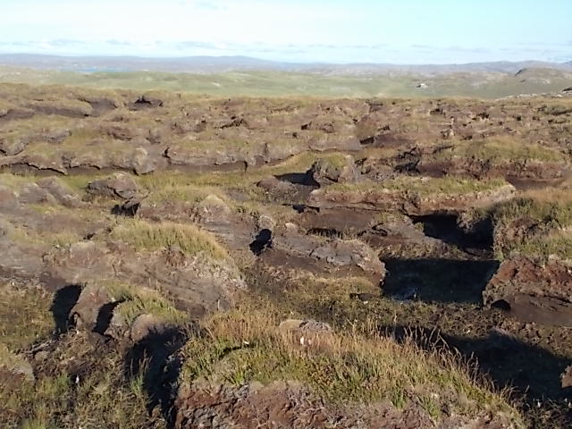
Tobha Mòr is situated within the Ben Wyvis National Nature Reserve, which covers an area of approximately 4,500 hectares. The reserve is known for its diverse flora and fauna, including rare and protected species. The hill/mountain itself is characterized by its distinctive pyramidal shape, with steep slopes that provide a challenging ascent for hikers and mountaineers.

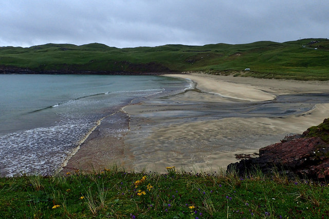
The summit of Tobha Mòr offers breathtaking panoramic views of the surrounding countryside, including the scenic Cromarty Firth and the Black Isle. On a clear day, one can even catch a glimpse of the Cairngorms National Park in the distance.

Aside from its natural beauty, Tobha Mòr is also steeped in history. The area was once inhabited by the Picts, an ancient Celtic people, and traces of their settlements can be found in the surrounding area. Additionally, the hill/mountain has played a role in local folklore and legends, adding a touch of mystique to its already enchanting atmosphere.

Tobha Mòr is a popular destination for outdoor enthusiasts, offering a variety of activities such as hiking, wildlife spotting, and photography. Its accessibility and proximity to nearby towns, such as Dingwall and Inverness, make it an ideal location for both locals and visitors to explore the Scottish Highlands.

If you have any feedback on the listing, please let us know in the comments section below.
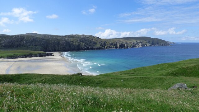
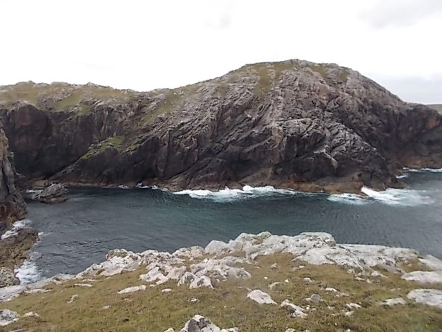
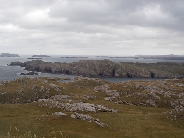
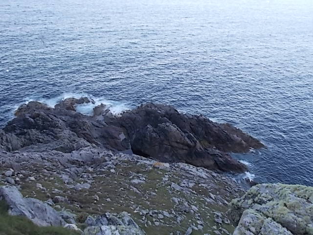
Tobha Mòr Images

Images are sourced within 2km of 58.231602/-6.9652163 or Grid Reference NB0837. Thanks to Geograph Open Source API. All images are credited.

Gob Geòdha nam Bradan
Sheepfold at Tobha Mòr
Sheepfold and boundary wall near Tobha Mòr
Rocky surface at Eala Sheadha
Eastern side of the Eala Sheadha Headland
Crystal clear seas off North West coast of Na h-Eileanan an Iar View to about 3 metres depth from RIB floating in lagoon between Pabaigh Mor and Pabaigh Beag.  See also <a href="https://www.geograph.org.uk/photo/1120209">NB1038 : Lagoon on Pabbay Mor</a>
Crystal clear seas off North West coast of Na h-Eileanan an Iar
View to about 3 metres depth from RIB floating in lagoon between Pabaigh Mor and Pabaigh Beag. See also NB1038 : Lagoon on Pabbay Mor
Sunrise, Gridig
Sunrise, Gridig
Beach at Pabaigh Mor
Geodh'an Tuill penetrates Pabaigh Mor Pabaigh More has a tidally flooded low-lying area in the middle of the island (at one time used for buffering lobsters) which connects to the open sea over a reef to the northwest, and through a couple of rocky channels heading northeast. It's clear that those channels must have started the same way as this cave, which has penetrated right to the lagoon (from which it is separated only by a storm beach thrown up by waves entering the cave) and, on a geological timescale, is just about at the end of its life. Although one of our group walked over the arch, and once we'd paddled round the island several of us entered the cave from the sea, it is not the most confidence-inspiring roof, especially at this landward end.
Geodh'an Tuill penetrates Pabaigh Mor
Pabaigh More has a tidally flooded low-lying area in the middle of the island (at one time used for buffering lobsters) which connects to the open sea over a reef to the northwest, and through a couple of rocky channels heading northeast. It's clear that those channels must have started the same way as this cave, which has penetrated right to the lagoon (from which it is separated only by a storm beach thrown up by waves entering the cave) and, on a geological timescale, is just about at the end of its life. Although one of our group walked over the arch, and once we'd paddled round the island several of us entered the cave from the sea, it is not the most confidence-inspiring roof, especially at this landward end.
Traigh na Beirigh beach Lewis Looking out from the beach just in front of the Caravan site towards the headland at Kneep on the left and Pabaigh Mor on the right.
Traigh na Beirigh beach Lewis
Looking out from the beach just in front of the Caravan site towards the headland at Kneep on the left and Pabaigh Mor on the right.
Geodha Maladail
Geodha Maladail
Pabaigh Mor Numerous caves on the south west side of the island
Pabaigh Mor
Numerous caves on the south west side of the island
Rubha Brataig Despite being adjacent to the tallest and steepest cliffs in Lewis, one can access these rocks in calm weather, a good pollack mark, but a very steep walk back up!
Rubha Brataig
Despite being adjacent to the tallest and steepest cliffs in Lewis, one can access these rocks in calm weather, a good pollack mark, but a very steep walk back up!
South west edge of Camas na Clibhe Looking back to Clibhe beach and coastline from Rubha Brataig
South west edge of Camas na Clibhe
Looking back to Clibhe beach and coastline from Rubha Brataig
Peat hags Stay up slope as much as you can to avoid walking through this "moonscape". A line from the end of Loch Deireadh Banaig to Rubha Mor should avoid the worst but not all, tough walking!
Peat hags
Stay up slope as much as you can to avoid walking through this "moonscape". A line from the end of Loch Deireadh Banaig to Rubha Mor should avoid the worst but not all, tough walking!
Remains of a mill, Allt Tota Pallair A small dry stone wall built across the burn, with an old millstone.
Remains of a mill, Allt Tota Pallair
A small dry stone wall built across the burn, with an old millstone.
Remains of a mill, Allt Tota Pallair A small dry stone wall built across the burn, with an old millstone.
Remains of a mill, Allt Tota Pallair
A small dry stone wall built across the burn, with an old millstone.
Tràigh na Clibhe
Tràigh na Clibhe
Show me another place!

Tobha Mòr is located at Grid Ref: NB0837 (Lat: 58.231602, Lng: -6.9652163)

Unitary Authority: Na h-Eileanan an Iar

Police Authority: Highlands and Islands

What 3 Words

///wages.overused.grower. Near Carloway, Na h-Eileanan Siar

Related Wikis

Kneep

Kneep (Scottish Gaelic: Cnìp) is a village on the Isle of Lewis, in the Outer Hebrides, Scotland. Kneep is within the parish of Uig. Various archaeological...

Cliff, Lewis

Cliff (Scottish Gaelic: Cliobh) is a small settlement on the Isle of Lewis, in the Outer Hebrides, Scotland. Cliff is within the parish of Uig. The settlement...

Pabaigh Mòr

Pabay Mòr or Pabaigh Mòr is an uninhabited island in the Outer Hebrides of Scotland. == History == The island's name comes from papey, an Old Norse name...

Vacsay

Vacsay (Scottish Gaelic: Bhacsaigh from Old Norse "bakkiey" meaning "peat bank island") is one of the Outer Hebrides. It is off the west coast of Lewis...

Have you been to Tobha Mòr?

Leave your review of Tobha Mòr below (or comments, questions and feedback).