Allen Island

Island in Sussex Adur

England

Allen Island

Grinstead Lane railway bridge The Bridge was built in the mid sixties for the new A2025 bypass road. The level crossing could be avoided.
Grinstead Lane railway bridge Credit: James Emmans

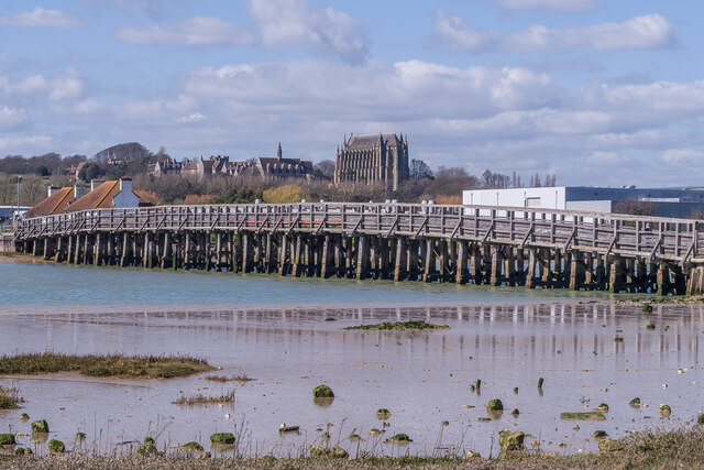
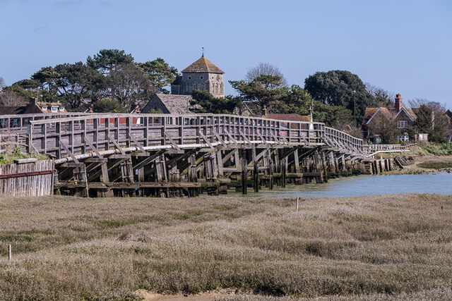
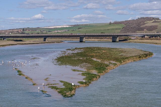
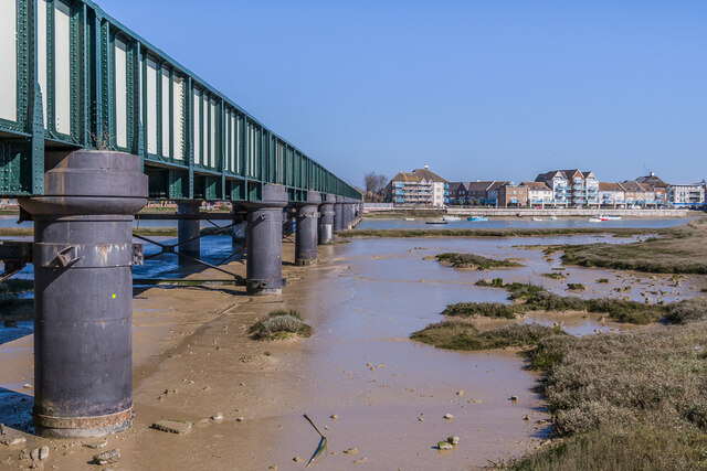
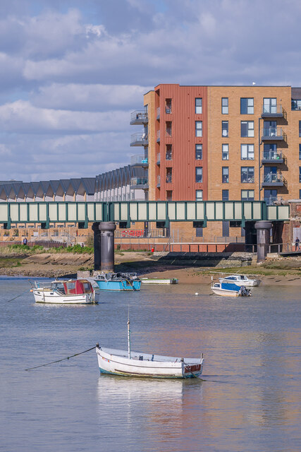
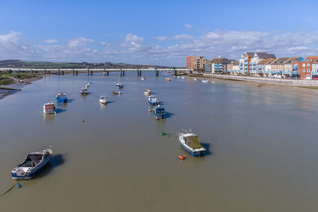
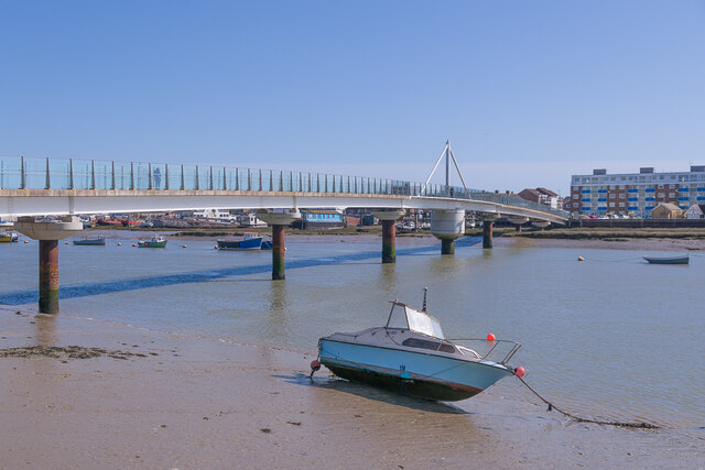
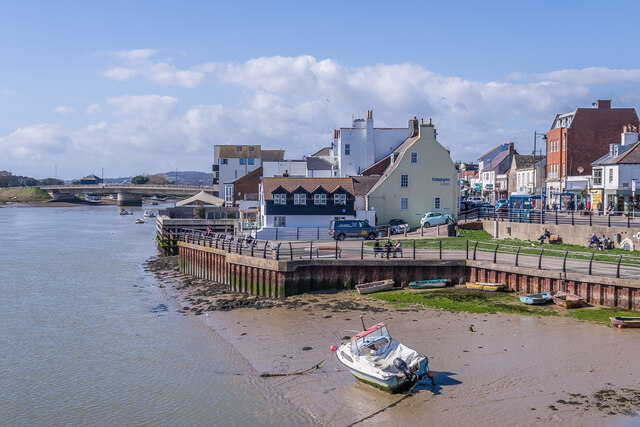
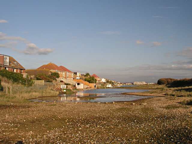
Allen Island is a small island located off the coast of Sussex in the South of England. It is situated in the English Channel, approximately 2 miles south of the town of Littlehampton. The island covers an area of about 0.2 square miles and is primarily known for its natural beauty and wildlife.

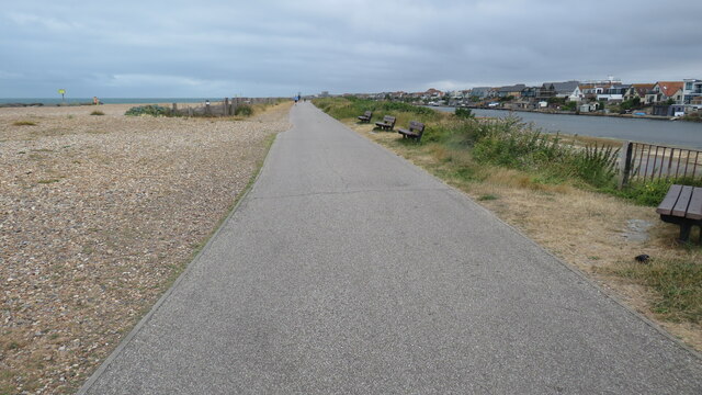
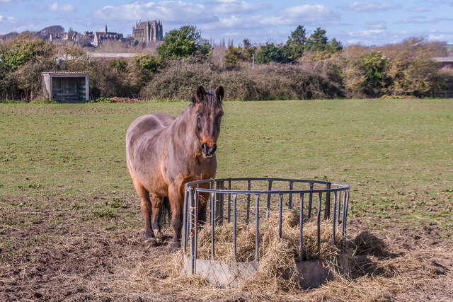
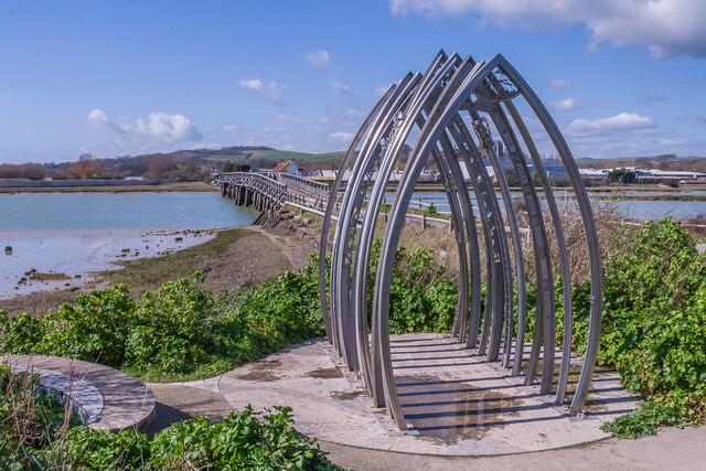
The island is privately owned and is not open to the public, making it a secluded and tranquil destination. It is known for its stunning cliffs, which provide breathtaking views of the surrounding sea. The island is also home to a variety of native and migratory bird species, making it a popular spot for birdwatchers.

Allen Island has a rich history, dating back to the Roman era. It is believed to have been used as a lookout point during the Roman occupation of Britain. In more recent times, it served as a defensive outpost during World War II, with remnants of old fortifications still visible today.

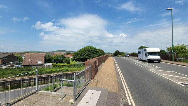
The island is accessible by boat, with a small dock available for private vessels. Fishing is a popular activity around the island, with a variety of fish species found in the surrounding waters.

Despite its small size, Allen Island offers a unique and peaceful escape from the mainland. Its picturesque cliffs, diverse wildlife, and rich history make it a hidden gem in the Sussex coastline.

If you have any feedback on the listing, please let us know in the comments section below.

Allen Island Images

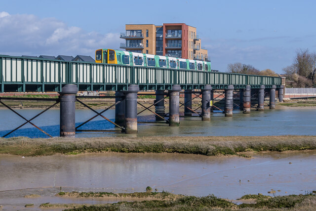
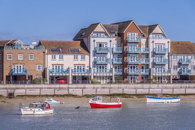
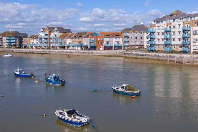
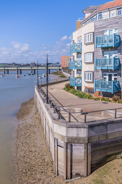
Images are sourced within 2km of 50.825955/-0.29253666 or Grid Reference TQ2004. Thanks to Geograph Open Source API. All images are credited.

Grinstead Lane railway bridge The Bridge was built in the mid sixties for the new A2025 bypass road. The level crossing could be avoided.
Grinstead Lane railway bridge
The Bridge was built in the mid sixties for the new A2025 bypass road. The level crossing could be avoided.
Path by Widewater Lagoon, lancing Widewater Lagoon is an area of brackish water landlocked by a man-made shingle bank. It lies between the beach and A259 coast road (Brighton Road) in Lancing; between the far east of Lancing Beach and the far west of Shoreham Beach.
This path runs between the beach and lagoon
Path by Widewater Lagoon, lancing
Widewater Lagoon is an area of brackish water landlocked by a man-made shingle bank. It lies between the beach and A259 coast road (Brighton Road) in Lancing; between the far east of Lancing Beach and the far west of Shoreham Beach. This path runs between the beach and lagoon
Houses on Brighton Road
Paddock A horse feeding in a paddock off the A283 near Old Shoreham, with Lancing College in the left background.
Paddock
A horse feeding in a paddock off the A283 near Old Shoreham, with Lancing College in the left background.
Artwork Artwork alongside the Downs Link cycle/foot trail, with Old Shoreham Bridge across the River Adur in the background.
Artwork
Artwork alongside the Downs Link cycle/foot trail, with Old Shoreham Bridge across the River Adur in the background.
Old Shoreham Bridge Bridge over the River Adur near Old Shoreham, now a foot/cycle bridge.  Originally built in 1781, it was rebuilt to the same design during the First World War.  Until 1970 it formed part of the A27, with a toll for its use, until relieved by the opening of the Shoreham bypass, with a new viaduct over the river around 300m north of the old bridge.  It was then closed to road traffic and made a bridleway.  It underwent a full restoration in 2008.  Grade II* listed - see <span class="nowrap"><a title="https://historicengland.org.uk/listing/the-list/list-entry/1027895?section=official-list-entry" rel="nofollow ugc noopener" href="https://historicengland.org.uk/listing/the-list/list-entry/1027895?section=official-list-entry">Link</a><img style="margin-left:2px;" alt="External link" title="External link - shift click to open in new window" src="https://s1.geograph.org.uk/img/external.png" width="10" height="10"/></span>.

In the background is Lancing College.
Old Shoreham Bridge
Bridge over the River Adur near Old Shoreham, now a foot/cycle bridge. Originally built in 1781, it was rebuilt to the same design during the First World War. Until 1970 it formed part of the A27, with a toll for its use, until relieved by the opening of the Shoreham bypass, with a new viaduct over the river around 300m north of the old bridge. It was then closed to road traffic and made a bridleway. It underwent a full restoration in 2008. Grade II* listed - see LinkExternal link. In the background is Lancing College.
Old Shoreham Bridge Bridge over the River Adur near Old Shoreham, now a foot/cycle bridge.  Originally built in 1781, it was rebuilt to the same design during the First World War.  Until 1970 it formed part of the A27, with a toll for its use, until relieved by the opening of the Shoreham bypass, with a new viaduct over the river around 300m north of the old bridge.  It was then closed to road traffic and made a bridleway.  It underwent a full restoration in 2008.  Grade II* listed - see <span class="nowrap"><a title="https://historicengland.org.uk/listing/the-list/list-entry/1027895?section=official-list-entry" rel="nofollow ugc noopener" href="https://historicengland.org.uk/listing/the-list/list-entry/1027895?section=official-list-entry">Link</a><img style="margin-left:2px;" alt="External link" title="External link - shift click to open in new window" src="https://s1.geograph.org.uk/img/external.png" width="10" height="10"/></span>.

In the background is St Nicolas' Church, Old Shoreham.
Old Shoreham Bridge
Bridge over the River Adur near Old Shoreham, now a foot/cycle bridge. Originally built in 1781, it was rebuilt to the same design during the First World War. Until 1970 it formed part of the A27, with a toll for its use, until relieved by the opening of the Shoreham bypass, with a new viaduct over the river around 300m north of the old bridge. It was then closed to road traffic and made a bridleway. It underwent a full restoration in 2008. Grade II* listed - see LinkExternal link. In the background is St Nicolas' Church, Old Shoreham.
River Adur Looking along the River Adur from the Old Shoreham Bridge with the A27 Adur Viaduct, completed in 1970, in the background.
River Adur
Looking along the River Adur from the Old Shoreham Bridge with the A27 Adur Viaduct, completed in 1970, in the background.
Shoreham Railway Viaduct Viaduct carrying the West Coastway railway over the River Adur.  It was built in 1893, replacing an earlier wooden trestle viaduct opened in 1845.
Shoreham Railway Viaduct
Viaduct carrying the West Coastway railway over the River Adur. It was built in 1893, replacing an earlier wooden trestle viaduct opened in 1845.
Shoreham Railway Viaduct Viaduct carrying the West Coastway railway over the River Adur.  It was built in 1893, replacing an earlier wooden trestle viaduct opened in 1845.  Seen here with Class 313 no 313215 crossing on a westbound stopping service.
Shoreham Railway Viaduct
Viaduct carrying the West Coastway railway over the River Adur. It was built in 1893, replacing an earlier wooden trestle viaduct opened in 1845. Seen here with Class 313 no 313215 crossing on a westbound stopping service.
Linemans View Part of the Ropetackle development overlooking the River Adur, completed in 2005.
Linemans View
Part of the Ropetackle development overlooking the River Adur, completed in 2005.
Marline Court Part of the Ropetackle development overlooking the River Adur, completed in 2006.
Marline Court
Part of the Ropetackle development overlooking the River Adur, completed in 2006.
Linemans View and Marline Court Parts of the Ropetackle development overlooking the River Adur, completed in 2005 and 2006 respectively.
Linemans View and Marline Court
Parts of the Ropetackle development overlooking the River Adur, completed in 2005 and 2006 respectively.
Marline Court Part of the Ropetackle development overlooking the River Adur, completed in 2006.  In the background is the viaduct carrying the West Coastway railway over the river, with Lancing College beyond.
Marline Court
Part of the Ropetackle development overlooking the River Adur, completed in 2006. In the background is the viaduct carrying the West Coastway railway over the river, with Lancing College beyond.
River Adur Looking across the River Adur towards the viaduct carrying the West Coastway railway over the river, with Ringed Plover Apartments in Salt Marsh Road beyond.
River Adur
Looking across the River Adur towards the viaduct carrying the West Coastway railway over the river, with Ringed Plover Apartments in Salt Marsh Road beyond.
River Adur Looking up the River Adur towards the viaduct carrying the West Coastway railway over the river.
River Adur
Looking up the River Adur towards the viaduct carrying the West Coastway railway over the river.
Adur Ferry Bridge Footbridge over the River Adur, connecting the main part of Shoreham with Shoreham Beach.  Built in 2013, it replaced a previous one dating from 1921.  The central section is a swingbridge, allowing boats to access the next section of the river.
Adur Ferry Bridge
Footbridge over the River Adur, connecting the main part of Shoreham with Shoreham Beach. Built in 2013, it replaced a previous one dating from 1921. The central section is a swingbridge, allowing boats to access the next section of the river.
River Adur shoreline The shoreline of the River Adur, with buildings in High Street on the right.
River Adur shoreline
The shoreline of the River Adur, with buildings in High Street on the right.
Show me another place!

Allen Island is located at Grid Ref: TQ2004 (Lat: 50.825955, Lng: -0.29253666)

Administrative County: West Sussex

District: Adur

Police Authority: Sussex

What 3 Words

///salads.diary.inform. Near Shoreham-by-Sea, West Sussex

Related Wikis

Saltings (electoral division)

Saltings is an electoral division of West Sussex in the United Kingdom, and returns one member to sit on West Sussex County Council. == Extent == It comprises...

Widewater Lagoon

Widewater Lagoon is a 8.8-hectare (22-acre) Local Nature Reserve in Lancing in West Sussex. It is owned by West Sussex County Council and managed by Lancing...

Bungalow Town Halt railway station

Bungalow Town Halt was a small railway station in what is now Shoreham Beach, West Sussex. Bungalow Town had started in the 1870s as a series of converted...

Brighton City Airport

Brighton City Airport (IATA: ESH, ICAO: EGKA), also commonly known as Shoreham Airport, is located in the parish of Lancing in West Sussex, England. It...

Nearby Amenities

Located within 500m of 50.825955,-0.29253666
Barrier: bollard
Lat/Long: 50.8253076/-0.2922006
Traffic Calming: hump
Lat/Long: 50.8291396/-0.2905823
Drinking Water
Lat/Long: 50.825269/-0.2921811
Crossing
Bicycle: yes
Crossing: unmarked
Crossing Island: yes
Kerb: flush
Lat/Long: 50.8278387/-0.2893411
Bus Stop
The Longshore
Naptan AtcoCode: 4400AD0164
Naptan Bearing: NW
Naptan CommonName: The Royal Coach
Naptan Indicator: o/s pub
Naptan Landmark: Beach Green
Naptan NaptanCode: wsxadmdt
Naptan PlusbusZoneRef: BRGHTN
Naptan Street: The Saltings
Naptan Verified: no
Public Transport: platform
Source: naptan_import
Lat/Long: 50.827919/-0.2874888
Bus Stop
The Longshore
Naptan AtcoCode: 4400AD0165
Naptan Bearing: SE
Naptan CommonName: The Royal Coach
Naptan Indicator: opp pub
Naptan Landmark: Beach Green
Naptan NaptanCode: wsxadmdw
Naptan PlusbusZoneRef: BRGHTN
Naptan Street: The Saltings
Naptan Verified: no
Public Transport: platform
Source: naptan_import
Lat/Long: 50.8280481/-0.2874165
Bus Stop
The Longshore
Naptan AtcoCode: 4400AD0166
Naptan Bearing: SW
Naptan CommonName: The Longshore
Naptan Indicator: adj Fishermans Walk
Naptan Landmark: New Salts Farm Road
Naptan NaptanCode: wsxadmga
Naptan Street: Brighton Road
Naptan Verified: no
Public Transport: platform
Source: naptan_import
Lat/Long: 50.8278623/-0.2891766
Bus Stop
The Longshore
Naptan AtcoCode: 4400AD0167
Naptan Bearing: NE
Naptan CommonName: The Longshore
Naptan Indicator: adj Adur Close
Naptan Landmark: New Salts Farm Road
Naptan NaptanCode: wsxadmgd
Naptan Street: Brighton Road
Naptan Verified: no
Source: naptan_import
Lat/Long: 50.82717/-0.2910337
Bus Stop
Wenceling Cottages
Naptan AtcoCode: 4400AD0168
Naptan Bearing: NE
Naptan CommonName: Wenceling Cottages
Naptan Indicator: adj Swallows Close
Naptan Landmark: Swallows Close
Naptan NaptanCode: wsxadmgj
Naptan Street: Brighton Road
Naptan Verified: no
Source: naptan_import
Lat/Long: 50.8264534/-0.2936867
Bus Stop
Wenceling Cottages
Naptan AtcoCode: 4400AD0169
Naptan Bearing: SW
Naptan CommonName: Wenceling Cottages
Naptan Indicator: Opp Swallows Close
Naptan Landmark: Swallows Close
Naptan NaptanCode: wsxadmgm
Naptan Street: Brighton Road
Naptan Verified: no
Public Transport: platform
Source: naptan_import
Lat/Long: 50.8262238/-0.2939791
Bus Stop
Orient Road
Naptan AtcoCode: 4400AD0170
Naptan Bearing: S
Naptan CommonName: Orient Road
Naptan Indicator: adj Orient Road
Naptan Landmark: Orient Road
Naptan NaptanCode: wsxadmgp
Naptan Street: The Broadway
Naptan Verified: no
Source: naptan_import
Lat/Long: 50.8261075/-0.2982469
Orient Road
Naptan AtcoCode: 4400AD0171
Naptan Bearing: N
Naptan BusStopType: CUS
Naptan CommonName: Orient Road
Naptan Indicator: opp Orient Road
Naptan Landmark: Orient Road
Naptan NaptanCode: wsxadmgt
Naptan Street: The Broadway
Naptan Verified: no
Source: naptan_import
Lat/Long: 50.8260813/-0.2983861
Bus Stop
Lancing Broadway
Naptan AtcoCode: 4400AD0172
Naptan Bearing: SW
Naptan CommonName: Lancing Broadway
Naptan Indicator: Opp The Broadway
Naptan Landmark: Broadway
Naptan NaptanCode: wsxadmgw
Naptan Street: Brighton Road. A259
Public Transport: platform
Shelter: yes
Source: naptan_import
Lat/Long: 50.8252801/-0.2984008
Bus Stop
Lancing Broadway
Bench: yes
Naptan AtcoCode: 4400AD0355
Naptan Bearing: E
Naptan CommonName: Lancing Broadway
Naptan Indicator: The Broadway
Naptan Landmark: Brighton Rd
Naptan NaptanCode: wsxdtapa
Naptan Street: Brighton Rd
Shelter: yes
Source: naptan_import
Lat/Long: 50.8257222/-0.2969828
Broadway Caravan Park
Local Ref: TO CAR
Naptan AtcoCode: 4400AD0365
Naptan Bearing: N
Naptan BusStopType: CUS
Naptan CommonName: Broadway Caravan Park
Naptan Indicator: Entrance to Caravan site
Naptan Landmark: Caravan Park
Naptan Street: The Broadway
Naptan Verified: no
Source: naptan_import
Lat/Long: 50.8276122/-0.2991398
Noexit: yes
Lat/Long: 50.8272323/-0.295568
Noexit: yes
Lat/Long: 50.825769/-0.2980265
Post Office
Broadway Post Office
Addr City: Lancing
Addr Country: GB
Addr Housenumber: 401
Addr Postcode: BN15 8JX
Addr Street: Brighton Road
Brand: Post Office
Brand Wikidata: Q1783168
Opening Hours: Mo-Sa 08:30-19:00
Ref Pol Id: 132737
Source: OS_OpenData_StreetView
Website: https://www.postoffice.co.uk/branch-finder/1249088/broadway
Lat/Long: 50.8257693/-0.2973368
Noexit: yes
Lat/Long: 50.8268255/-0.2938876
Turning Circle
Lat/Long: 50.8264298/-0.2955794
Noexit: yes
Lat/Long: 50.8269834/-0.2926581
Noexit: yes
Lat/Long: 50.8275378/-0.2960783
Noexit: yes
Lat/Long: 50.826772/-0.2937504
Noexit: yes
Lat/Long: 50.8273789/-0.2925045
Barrier: block
Lat/Long: 50.8252392/-0.2931618
Waste Basket
Lat/Long: 50.8253463/-0.2922159
Bench
Lat/Long: 50.825351/-0.2922521
Bench
Lat/Long: 50.8252743/-0.2920965
Bicycle Parking
Capacity: 6
Lat/Long: 50.825298/-0.2920013
Post Box
Brand: Royal Mail
Brand Wikidata: Q638098
Brand Wikipedia: en:Royal Mail
Collection Plate: CP1
Collection Times: Mo-Fr 17:15; Sa 12:00
Operator: Royal Mail
Operator Wikidata: Q638098
Post Box Type: pillar
Ref: BN15 1378
Royal Cypher: GR
Royal Cypher Wikidata: Q33102273
Lat/Long: 50.8256739/-0.2977858
Generator Method: photovoltaic
Generator Output Electricity: yes
Generator Source: solar
Generator Type: solar_photovoltaic_panel
Location: roof
Power: generator
Lat/Long: 50.8276935/-0.288869
Generator Method: photovoltaic
Generator Output Electricity: yes
Generator Source: solar
Generator Type: solar_photovoltaic_panel
Location: roof
Power: generator
Lat/Long: 50.8272464/-0.2899951
Generator Method: photovoltaic
Generator Output Electricity: yes
Generator Source: solar
Generator Type: solar_photovoltaic_panel
Location: roof
Power: generator
Lat/Long: 50.8274413/-0.2896598
Generator Method: photovoltaic
Generator Output Electricity: yes
Generator Source: solar
Generator Type: solar_photovoltaic_panel
Location: roof
Power: generator
Lat/Long: 50.8270109/-0.2899575
Generator Method: photovoltaic
Generator Output Electricity: yes
Generator Source: solar
Generator Type: solar_photovoltaic_panel
Location: roof
Power: generator
Lat/Long: 50.8264959/-0.2894881
Generator Method: photovoltaic
Generator Output Electricity: yes
Generator Source: solar
Generator Type: solar_photovoltaic_panel
Location: roof
Power: generator
Lat/Long: 50.8269381/-0.2881309
Generator Method: photovoltaic
Generator Output Electricity: yes
Generator Source: solar
Generator Type: solar_photovoltaic_panel
Location: roof
Power: generator
Lat/Long: 50.8269093/-0.2880827
Generator Method: photovoltaic
Generator Output Electricity: yes
Generator Source: solar
Generator Type: solar_photovoltaic_panel
Location: roof
Power: generator
Lat/Long: 50.8269042/-0.2880076
Generator Method: photovoltaic
Generator Output Electricity: yes
Generator Source: solar
Generator Type: solar_photovoltaic_panel
Location: roof
Power: generator
Lat/Long: 50.8269635/-0.2880237
Defibrillator
Emergency: defibrillator
Lat/Long: 50.825274/-0.2921511
Noexit: yes
Lat/Long: 50.8267049/-0.2910932
Waste Basket
Ashtray: no
Colour: green
Covered: yes
Source: survey
Lat/Long: 50.8279881/-0.2866493
Post Box
Brand: Royal Mail
Brand Wikidata: Q638098
Brand Wikipedia: en:Royal Mail
Collection Plate: CP1D
Collection Times: Mo-Fr 09:00; Sa 07:00
Last Checked: 2020-10-01
Operator: Royal Mail
Operator Wikidata: Q638098
Post Box Type: pillar
Ref: BN43 1537D
Royal Cypher: EIIR
Royal Cypher Wikidata: Q33102113
Source: survey
Lat/Long: 50.8279905/-0.2866354
Traffic Signals
Source: aerial imagery
Traffic Signals: pedestrian_crossing
Traffic Signals Direction: both
Lat/Long: 50.8255469/-0.2974688
Crossing
Lat/Long: 50.8284814/-0.2875868
Access: yes
Capacity: 1
Capacity Disabled: 0
Fixme: Rough locations and positions. Needs refining when aerial imagery available.
Man Made: charge_point
Operator: Shell
Operator Wikidata: Q110716465
Socket Chademo: 1
Socket Chademo Output: 70kw
Socket Type2 Combo: 1
Socket Type2 Combo Output: 150kW
Lat/Long: 50.8286119/-0.2872769
Access: yes
Capacity: 1
Capacity Disabled: 0
Fixme: Rough locations and positions. Needs refining when aerial imagery available.
Man Made: charge_point
Operator: Shell
Operator Wikidata: Q110716465
Socket Chademo: 1
Socket Chademo Output: 70kw
Socket Type2 Combo: 1
Socket Type2 Combo Output: 150kW
Lat/Long: 50.8286273/-0.287239
Access: yes
Capacity: 1
Capacity Disabled: 0
Fixme: Rough locations and positions. Needs refining when aerial imagery available.
Man Made: charge_point
Operator: Shell
Operator Wikidata: Q110716465
Socket Chademo: 1
Socket Chademo Output: 70kw
Socket Type2 Combo: 1
Socket Type2 Combo Output: 150kW
Lat/Long: 50.828642/-0.2872029
Access: yes
Capacity: 1
Capacity Disabled: 0
Fixme: Rough locations and positions. Needs refining when aerial imagery available.
Man Made: charge_point
Operator: Shell
Operator Wikidata: Q110716465
Socket Chademo: 1
Socket Chademo Output: 70kw
Socket Type2 Combo: 1
Socket Type2 Combo Output: 150kW
Lat/Long: 50.8286551/-0.2871706
Access: yes
Capacity: 1
Capacity Disabled: 0
Fixme: Rough locations and positions. Needs refining when aerial imagery available.
Man Made: charge_point
Operator: Shell
Operator Wikidata: Q110716465
Socket Chademo: 1
Socket Chademo Output: 70kw
Socket Type2 Combo: 1
Socket Type2 Combo Output: 150kW
Lat/Long: 50.8286676/-0.2871396
Access: yes
Capacity: 1
Capacity Disabled: 0
Fixme: Rough locations and positions. Needs refining when aerial imagery available.
Man Made: charge_point
Operator: Shell
Operator Wikidata: Q110716465
Socket Chademo: 1
Socket Chademo Output: 70kw
Socket Type2 Combo: 1
Socket Type2 Combo Output: 150kW
Lat/Long: 50.8284672/-0.2869869
Access: yes
Capacity: 1
Capacity Disabled: 0
Fixme: Rough locations and positions. Needs refining when aerial imagery available.
Man Made: charge_point
Operator: Shell
Operator Wikidata: Q110716465
Socket Chademo: 1
Socket Chademo Output: 70kw
Socket Type2 Combo: 1
Socket Type2 Combo Output: 150kW
Lat/Long: 50.8284546/-0.2870179
Access: yes
Capacity: 1
Capacity Disabled: 0
Fixme: Rough locations and positions. Needs refining when aerial imagery available.
Man Made: charge_point
Operator: Shell
Operator Wikidata: Q110716465
Socket Chademo: 1
Socket Chademo Output: 70kw
Socket Type2 Combo: 1
Socket Type2 Combo Output: 150kW
Lat/Long: 50.8284415/-0.2870502
Access: yes
Capacity: 1
Capacity Disabled: 1
Fixme: Rough locations and positions. Needs refining when aerial imagery available.
Man Made: charge_point
Operator: Shell
Operator Wikidata: Q110716465
Socket Chademo: 1
Socket Chademo Output: 70kw
Socket Type2 Combo: 1
Socket Type2 Combo Output: 150kW
Lat/Long: 50.8284268/-0.2870863
Crossing
Lat/Long: 50.828753/-0.2869865
Parking
Access: customers
Capacity: 6
Capacity Disabled: 0
Lat/Long: 50.8285524/-0.2874127
Parking
Access: customers
Capacity: 1
Lat/Long: 50.828128/-0.2872188
Capacity: 1
Man Made: charge_point
Operator: Osprey
Operator Wikidata: Q117706577
Socket Chademo: 1
Socket Chademo Output: 50kW
Socket Type2: 1
Socket Type2 Output: 22kW
Socket Type2 Combo: 1
Socket Type2 Combo Output: 50kW
Lat/Long: 50.8279667/-0.2885533
Capacity: 1
Man Made: charge_point
Operator: Osprey
Operator Wikidata: Q117706577
Socket Chademo: 1
Socket Chademo Output: 50kW
Socket Type2: 1
Socket Type2 Output: 22kW
Socket Type2 Combo: 1
Socket Type2 Combo Output: 50kW
Lat/Long: 50.8279492/-0.2885976
Crossing
Crossing: unmarked
Crossing Markings: no
Lat/Long: 50.8277584/-0.2892496
Noexit: yes
Lat/Long: 50.826465/-0.2962419
Noexit: yes
Lat/Long: 50.8272092/-0.29177
The data included in this document is from www.openstreetmap.org. The data is made available under ODbL.

Have you been to Allen Island?

Leave your review of Allen Island below (or comments, questions and feedback).