Widewater

Lake, Pool, Pond, Freshwater Marsh in Sussex Adur

England

Widewater

Grinstead Lane railway bridge The Bridge was built in the mid sixties for the new A2025 bypass road. The level crossing could be avoided.
Grinstead Lane railway bridge Credit: James Emmans

Widewater is a unique and picturesque body of water located in Sussex, England. It is a coastal lagoon that stretches along the coast between Shoreham-by-Sea and Lancing. The area is comprised of a lake, pool, pond, and a freshwater marsh, making it a diverse and important ecological site.

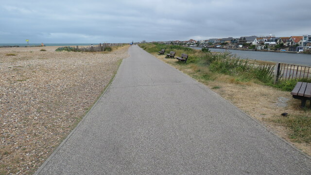
The lake at Widewater is a shallow body of water that is separated from the sea by a shingle beach. It is home to a variety of bird species, including herons, swans, and ducks. The lake also supports a rich underwater ecosystem, with various fish and invertebrates inhabiting its waters.

Adjacent to the lake is a pool which is a popular spot for recreational activities such as paddleboarding and kayaking. The calm and tranquil waters of the pool provide a serene environment for both locals and tourists to enjoy.

The pond at Widewater is a smaller body of water that is teeming with life. It is a haven for amphibians, including frogs and newts, and is a popular spot for birdwatching due to the abundance of bird species that frequent the area.

The freshwater marsh at Widewater is an important habitat for a variety of plant and animal species. It is a wetland area that supports a diverse range of vegetation, including reeds, rushes, and water lilies. The marsh is home to numerous bird species, such as reed warblers and marsh harriers, and provides a vital breeding ground for many aquatic animals.

Overall, Widewater in Sussex is a remarkable natural site, offering a blend of different water landscapes and supporting a wide range of wildlife. Its beauty and ecological significance make it a popular destination for nature enthusiasts and visitors seeking tranquility in a stunning coastal setting.

If you have any feedback on the listing, please let us know in the comments section below.
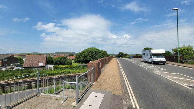
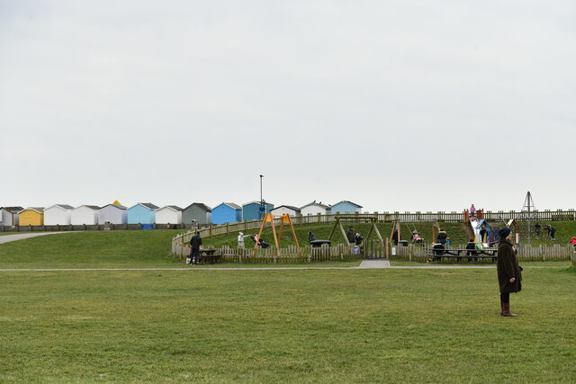
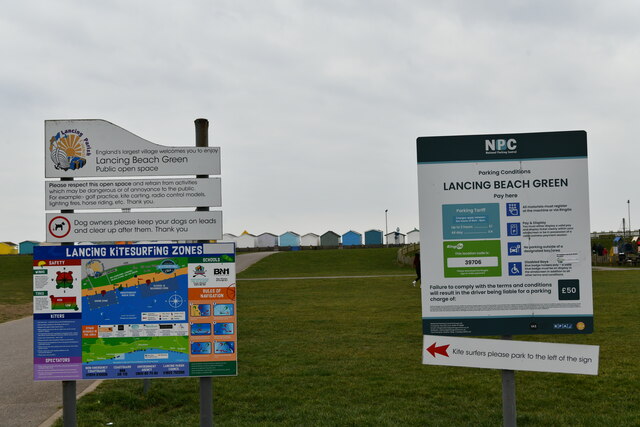
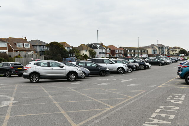
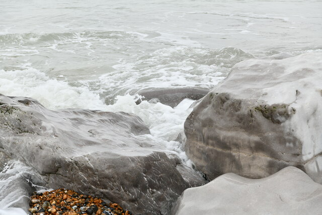
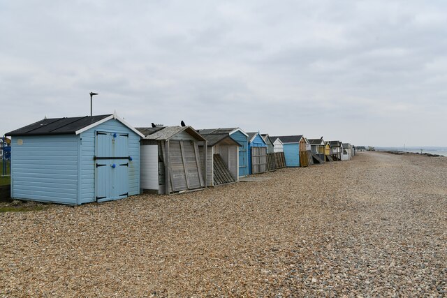
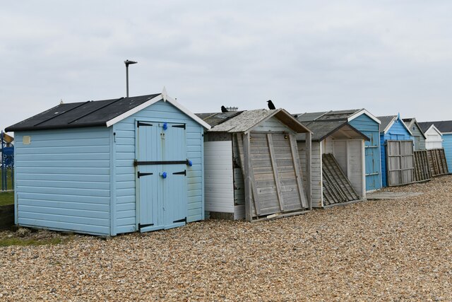
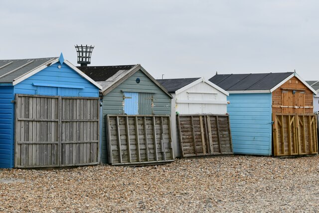
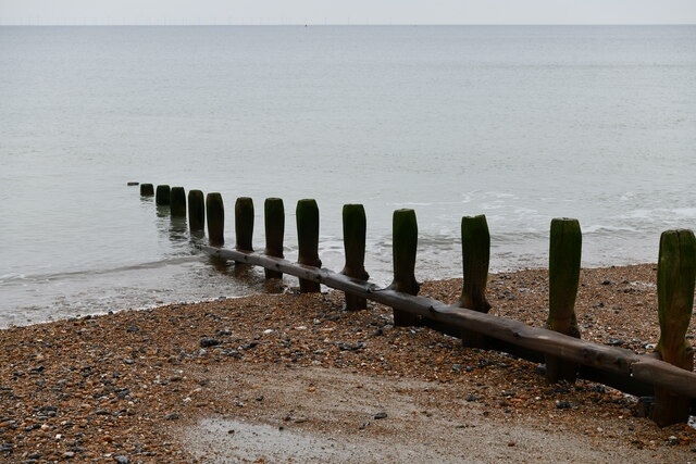
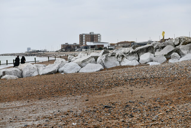
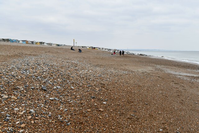
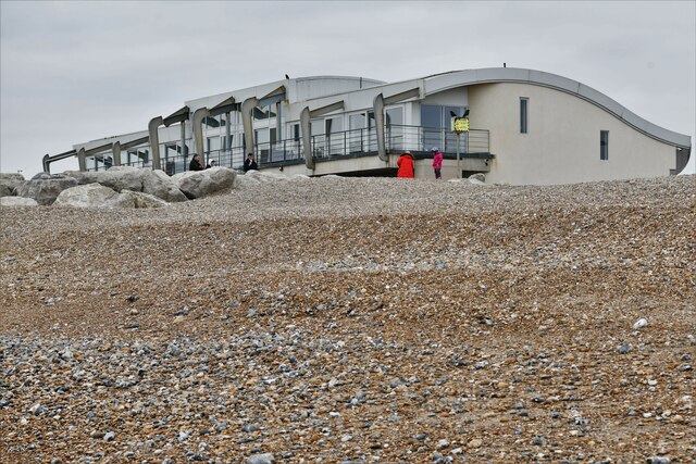
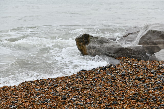
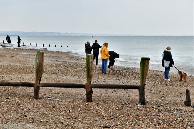
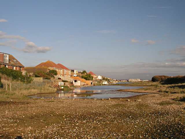
Widewater Images

Images are sourced within 2km of 50.825107/-0.29732415 or Grid Reference TQ2004. Thanks to Geograph Open Source API. All images are credited.

Grinstead Lane railway bridge The Bridge was built in the mid sixties for the new A2025 bypass road. The level crossing could be avoided.
Grinstead Lane railway bridge
The Bridge was built in the mid sixties for the new A2025 bypass road. The level crossing could be avoided.
Path by Widewater Lagoon, lancing Widewater Lagoon is an area of brackish water landlocked by a man-made shingle bank. It lies between the beach and A259 coast road (Brighton Road) in Lancing; between the far east of Lancing Beach and the far west of Shoreham Beach.
This path runs between the beach and lagoon
Path by Widewater Lagoon, lancing
Widewater Lagoon is an area of brackish water landlocked by a man-made shingle bank. It lies between the beach and A259 coast road (Brighton Road) in Lancing; between the far east of Lancing Beach and the far west of Shoreham Beach. This path runs between the beach and lagoon
Lancing: Play area
Lancing: Play area
Lancing: Beach Green information boards
Lancing: Beach Green Car Park
Lancing: Beach Green Car Park, 'pay by card'
Lancing: Incoming tide on the large boulder breakwater
Lancing Beach: Huts
Lancing Beach: Huts
Lancing Beach Green: Path to the beach
Lancing Beach: Huts
Lancing Beach: Huts
Lancing Beach: Huts
Lancing Beach: Huts
Lancing Beach: Breakwater
Lancing Beach: Large boulder breakwater
Lancing Beach looking east
Lancing Beach: Perch Cafe and Gym
Lancing: Incoming tide on the large boulder breakwater
Lancing Beach
Lancing Beach
The Railway Public house in Lancing.
The Railway
Public house in Lancing.
Show me another place!

Widewater is located at Grid Ref: TQ2004 (Lat: 50.825107, Lng: -0.29732415)

Administrative County: West Sussex

District: Adur

Police Authority: Sussex

What 3 Words

///rather.arrow.grace. Near Lancing, West Sussex

Related Wikis

Widewater Lagoon

Widewater Lagoon is a 8.8-hectare (22-acre) Local Nature Reserve in Lancing in West Sussex. It is owned by West Sussex County Council and managed by Lancing...

Saltings (electoral division)

Saltings is an electoral division of West Sussex in the United Kingdom, and returns one member to sit on West Sussex County Council. == Extent == It comprises...

Bungalow Town Halt railway station

Bungalow Town Halt was a small railway station in what is now Shoreham Beach, West Sussex. Bungalow Town had started in the 1870s as a series of converted...

Brighton City Airport

Brighton City Airport (IATA: ESH, ICAO: EGKA), also commonly known as Shoreham Airport, is located in the parish of Lancing in West Sussex, England. It...

Lancing (electoral division)

Lancing is an electoral division of West Sussex in the United Kingdom, and returns one member to sit on West Sussex County Council. == Extent == The division...

Adur Estuary

Adur Estuary is a 62.2-hectare (154-acre) biological Site of Special Scientific Interest on the western outskirts of Shoreham-by-Sea in West Sussex. Part...

Shoreham Town Hall

Shoreham Town Hall is a municipal building in the High Street, Shoreham-by-Sea, West Sussex, England. The town hall, which was the headquarters of Shoreham...

St Peter's Church, Shoreham-by-Sea

The name St Peter's Church has been borne by two Roman Catholic churches in the town of Shoreham-by-Sea in the district of Adur, in the English county...

Nearby Amenities

Located within 500m of 50.825107,-0.29732415
Traffic Calming: island
Lat/Long: 50.8267455/-0.2919886
Traffic Calming: island
Lat/Long: 50.8269584/-0.2912909
Barrier: bollard
Lat/Long: 50.8252784/-0.2922165
Traffic Calming: island
Lat/Long: 50.8256348/-0.2970574
Drinking Water
Lat/Long: 50.825269/-0.2921811
Bicycle Parking
Capacity: 2
Lat/Long: 50.8237767/-0.3010588
Bicycle Parking
Capacity: 2
Lat/Long: 50.8239282/-0.3000866
Bench
Lat/Long: 50.8239337/-0.2996804
Bus Stop
Wenceling Cottages
Naptan AtcoCode: 4400AD0168
Naptan Bearing: NE
Naptan CommonName: Wenceling Cottages
Naptan Indicator: adj Swallows Close
Naptan Landmark: Swallows Close
Naptan NaptanCode: wsxadmgj
Naptan Street: Brighton Road
Public Transport: platform
Shelter: no
Lat/Long: 50.8264496/-0.2936529
Bus Stop
Wenceling Cottages
Naptan AtcoCode: 4400AD0169
Naptan Bearing: SW
Naptan CommonName: Wenceling Cottages
Naptan Indicator: Opp Swallows Close
Naptan Landmark: Swallows Close
Naptan NaptanCode: wsxadmgm
Naptan Street: Brighton Road
Public Transport: platform
Shelter: no
Lat/Long: 50.8262145/-0.2940014
Bus Stop
Orient Road
Naptan AtcoCode: 4400AD0170
Naptan Bearing: S
Naptan CommonName: Orient Road
Naptan Indicator: adj Orient Road
Naptan Landmark: Orient Road
Naptan NaptanCode: wsxadmgp
Naptan Street: The Broadway
Naptan Verified: no
Source: naptan_import
Lat/Long: 50.8261075/-0.2982469
Orient Road
Naptan AtcoCode: 4400AD0171
Naptan Bearing: N
Naptan BusStopType: CUS
Naptan CommonName: Orient Road
Naptan Indicator: opp Orient Road
Naptan Landmark: Orient Road
Naptan NaptanCode: wsxadmgt
Naptan Street: The Broadway
Naptan Verified: no
Source: naptan_import
Lat/Long: 50.8260813/-0.2983861
Bus Stop
Lancing Broadway
Bench: yes
Bin: yes
Naptan AtcoCode: 4400AD0172
Naptan Bearing: SW
Naptan CommonName: Lancing Broadway
Naptan Indicator: Opp The Broadway
Naptan Landmark: Broadway
Naptan NaptanCode: wsxadmgw
Naptan Street: Brighton Road. A259
Public Transport: platform
Shelter: yes
Lat/Long: 50.8252789/-0.2983742
Bus Stop
Broadway Court
Bench: yes
Naptan AtcoCode: 4400AD0173
Naptan Bearing: SW
Naptan CommonName: Broadway Court
Naptan Indicator: Opp Broadway Court
Naptan Landmark: Kia Garage
Naptan NaptanCode: wsxadmja
Naptan Street: Brighton Road A259
Public Transport: platform
Shelter: yes
Lat/Long: 50.8246515/-0.3012871
Bus Stop
Broadway Court
Bench: yes
Naptan AtcoCode: 4400AD0174
Naptan Bearing: NE
Naptan CommonName: Broadway Court
Naptan Indicator: o/s Broadway Court
Naptan Landmark: Kia Garage
Naptan NaptanCode: wsxadmjd
Naptan Street: Brighton Road A259
Public Transport: platform
Shelter: yes
Lat/Long: 50.8247689/-0.3014059
Bus Stop
Lancing Broadway
Bench: yes
Naptan AtcoCode: 4400AD0355
Naptan Bearing: E
Naptan CommonName: Lancing Broadway
Naptan Indicator: The Broadway
Naptan Landmark: Brighton Rd
Naptan NaptanCode: wsxdtapa
Naptan Street: Brighton Rd
Public Transport: platform
Shelter: yes
Lat/Long: 50.8256794/-0.2972744
Broadway Caravan Park
Local Ref: TO CAR
Naptan AtcoCode: 4400AD0365
Naptan Bearing: N
Naptan BusStopType: CUS
Naptan CommonName: Broadway Caravan Park
Naptan Indicator: Entrance to Caravan site
Naptan Landmark: Caravan Park
Naptan Street: The Broadway
Naptan Verified: no
Source: naptan_import
Lat/Long: 50.8276122/-0.2991398
Traffic Calming: island
Lat/Long: 50.8250054/-0.2999721
Noexit: yes
Lat/Long: 50.8257837/-0.2980156
Noexit: yes
Lat/Long: 50.8257727/-0.3039251
Post Office
Broadway Post Office
Addr City: Lancing
Addr Country: GB
Addr Housenumber: 401
Addr Postcode: BN15 8JX
Addr Street: Brighton Road
Addr Substreet: The Broadway
Brand: Post Office
Brand Wikidata: Q1783168
Level: 0
Opening Hours: Mo-Sa 08:30-19:00
Ref Pol Id: 132737
Source Addr Postcode: FHRS Open Data
Website: https://www.postoffice.co.uk/branch-finder/1249088/broadway
Lat/Long: 50.8257693/-0.2973368
Crossing: no
Traffic Calming: island
Lat/Long: 50.8255413/-0.2980024
Traffic Calming: hump
Lat/Long: 50.82763/-0.2994074
Noexit: yes
Lat/Long: 50.8285257/-0.2983981
Traffic Calming: hump
Lat/Long: 50.8289678/-0.2992195
Traffic Calming: hump
Lat/Long: 50.8291413/-0.2995918
Traffic Calming: hump
Lat/Long: 50.829126/-0.3003337
Noexit: yes
Lat/Long: 50.8268255/-0.2938876
Turning Circle
Lat/Long: 50.8264298/-0.2955794
Noexit: yes
Lat/Long: 50.8269834/-0.2926581
Noexit: yes
Lat/Long: 50.8275378/-0.2960783
Noexit: yes
Lat/Long: 50.8272491/-0.2973677
Give Way
Direction: forward
Lat/Long: 50.8268838/-0.2916616
Noexit: yes
Lat/Long: 50.826772/-0.2937504
Noexit: yes
Lat/Long: 50.8273789/-0.2925045
Barrier: block
Lat/Long: 50.825229/-0.2931343
Waste Basket
Lat/Long: 50.8253463/-0.2922159
Bench
Lat/Long: 50.825351/-0.2922521
Bench
Lat/Long: 50.8252743/-0.2920965
Bicycle Parking
Capacity: 6
Lat/Long: 50.825298/-0.2920013
Post Box
Brand: Royal Mail
Brand Wikidata: Q638098
Brand Wikipedia: en:Royal Mail
Collection Plate: CP1
Collection Times: Mo-Fr 17:15; Sa 12:00
Operator: Royal Mail
Operator Wikidata: Q638098
Post Box Type: pillar
Ref: BN15 1378
Royal Cypher: GR
Royal Cypher Wikidata: Q33102273
Lat/Long: 50.8256706/-0.297792
Post Box
Brand: Royal Mail
Brand Wikidata: Q638098
Brand Wikipedia: en:Royal Mail
Collection Plate: CP1D
Collection Times: Mo-Fr 09:00; Sa 07:00
Operator: Royal Mail
Operator Wikidata: Q638098
Post Box Type: pillar
Ref: BN15 1377D
Royal Cypher: GR
Royal Cypher Wikidata: Q33102273
Lat/Long: 50.8243682/-0.3033426
Defibrillator
Emergency: defibrillator
Lat/Long: 50.825274/-0.2921511
Noexit: yes
Lat/Long: 50.8267049/-0.2910932
Noexit: yes
Lat/Long: 50.8274579/-0.2982436
Noexit: yes
Lat/Long: 50.826394/-0.3021689
Crossing
Button Operated: yes
Crossing: traffic_signals
Crossing Island: yes
Crossing Markings: dots
Crossing Signals: yes
Crossing Ref: puffin
Kerb: lowered
Lat/Long: 50.8255465/-0.2974709
Shore Accounting
Office: accountant
Lat/Long: 50.8248872/-0.3014268
Brooks Dance Academy
Dance Teaching: yes
Leisure: dance
Lat/Long: 50.8249444/-0.3011484
Noexit: yes
Lat/Long: 50.8249393/-0.301814
Noexit: yes
Lat/Long: 50.8250026/-0.3015528
Noexit: yes
Lat/Long: 50.826276/-0.2965191
Noexit: yes
Lat/Long: 50.8264574/-0.2962382
Noexit: yes
Lat/Long: 50.8272092/-0.29177
Give Way
Direction: forward
Lat/Long: 50.82548/-0.2979758
Traffic Signals
Crossing: no
Traffic Signals: pedestrian_crossing
Traffic Signals Direction: backward
Lat/Long: 50.8255612/-0.2974012
Traffic Signals
Crossing: no
Traffic Signals: pedestrian_crossing
Traffic Signals Direction: forward
Lat/Long: 50.8255338/-0.2975286
Barrier: kerb
Kerb: lowered
Tactile Paving: yes
Lat/Long: 50.8254871/-0.2974401
Barrier: kerb
Kerb: lowered
Tactile Paving: yes
Lat/Long: 50.8256017/-0.2974995
Traffic Calming: island
Lat/Long: 50.8253309/-0.2984629
Crossing
Crossing: unmarked
Crossing Continuous: no
Crossing Island: yes
Crossing Markings: no
Kerb: lowered
Tactile Paving: yes
Lat/Long: 50.8251841/-0.2991433
Traffic Signals
Crossing: no
Traffic Signals: pedestrian_crossing
Traffic Signals Direction: backward
Lat/Long: 50.8245598/-0.3020497
Traffic Signals
Crossing: no
Traffic Signals: pedestrian_crossing
Traffic Signals Direction: forward
Lat/Long: 50.8245346/-0.302163
Traffic Calming: island
Lat/Long: 50.8243812/-0.3028874
Traffic Calming: island
Lat/Long: 50.8247059/-0.3013744
Traffic Calming: island
Lat/Long: 50.8248119/-0.3008737
Crossing
Button Operated: yes
Crossing: traffic_signals
Crossing Island: yes
Crossing Markings: dots
Crossing Signals: yes
Crossing Ref: puffin
Kerb: lowered
Tactile Paving: yes
Lat/Long: 50.824547/-0.3021064
Noexit: yes
Lat/Long: 50.8269491/-0.2924708
Give Way
Direction: forward
Lat/Long: 50.82595/-0.295803
Give Way
Direction: forward
Lat/Long: 50.8260655/-0.2952563
Traffic Calming: island
Lat/Long: 50.8259414/-0.2956273
Traffic Calming: island
Lat/Long: 50.8257777/-0.2963735
Traffic Calming: island
Lat/Long: 50.8260939/-0.2949178
Traffic Calming: island
Lat/Long: 50.826282/-0.2940394
Traffic Calming: island
Lat/Long: 50.826458/-0.2932524
Give Way
Direction: forward
Lat/Long: 50.8265605/-0.2929997
Traffic Calming: island
Lat/Long: 50.8265932/-0.2926517
Traffic Calming: hump
Lat/Long: 50.827111/-0.2922524
Noexit: yes
Lat/Long: 50.8269221/-0.295154
Noexit: yes
Lat/Long: 50.8262913/-0.296598
Noexit: yes
Lat/Long: 50.8261469/-0.2967898
Noexit: yes
Lat/Long: 50.8262485/-0.2960378
Traffic Calming: hump
Lat/Long: 50.8278526/-0.2986433
Stop
Direction: forward
Lat/Long: 50.8279947/-0.2987309
Traffic Calming: hump
Lat/Long: 50.8280471/-0.2987259
Traffic Calming: hump
Lat/Long: 50.8284688/-0.2989013
Noexit: yes
Lat/Long: 50.8281938/-0.2990667
Noexit: yes
Lat/Long: 50.8287136/-0.3004134
Noexit: yes
Lat/Long: 50.8286175/-0.3003531
Stop
Direction: backward
Lat/Long: 50.8289266/-0.2990874
Stop
Direction: backward
Lat/Long: 50.826219/-0.2982666
Give Way
Direction: backward
Lat/Long: 50.8261908/-0.2984071
Crossing
Crossing: unmarked
Crossing Continuous: no
Crossing Island: no
Crossing Markings: no
Kerb: lowered
Tactile Paving: no
Lat/Long: 50.8255163/-0.2979917
Crossing
Crossing: unmarked
Crossing Continuous: no
Crossing Island: no
Crossing Markings: no
Kerb: lowered
Tactile Paving: no
Lat/Long: 50.8257521/-0.2968562
Barrier: kerb
Kerb: lowered
Tactile Paving: no
Lat/Long: 50.825743/-0.2968987
Barrier: kerb
Kerb: lowered
Tactile Paving: no
Lat/Long: 50.8255405/-0.2978677
Man Made: street_cabinet
Lat/Long: 50.8256117/-0.2975492
Barrier: bollard
Foot: yes
Lat/Long: 50.8256238/-0.2975119
Bus: yes
Direction: forward
Public Transport: stop_position
Lat/Long: 50.8256561/-0.2969502
Barrier: kerb
Kerb: lowered
Tactile Paving: no
Lat/Long: 50.8269436/-0.2915717
Barrier: kerb
Kerb: lowered
Tactile Paving: no
Lat/Long: 50.8266149/-0.2929006
Crossing
Crossing: unmarked
Crossing Continuous: no
Crossing Island: no
Crossing Markings: no
Kerb: lowered
Tactile Paving: no
Lat/Long: 50.8269091/-0.2916829
Barrier: kerb
Kerb: lowered
Tactile Paving: no
Lat/Long: 50.826875/-0.2917922
Bus: yes
Direction: backward
Public Transport: stop_position
Lat/Long: 50.8247176/-0.3013187
Bus: yes
Direction: forward
Public Transport: stop_position
Lat/Long: 50.8246955/-0.301424
Man Made: street_cabinet
Lat/Long: 50.8248749/-0.3009991
Barrier: kerb
Kerb: lowered
Tactile Paving: no
Lat/Long: 50.8247012/-0.3017415
Barrier: kerb
Kerb: lowered
Tactile Paving: no
Lat/Long: 50.8246736/-0.3018706
Barrier: kerb
Kerb: lowered
Tactile Paving: no
Lat/Long: 50.8248392/-0.3010909
Barrier: kerb
Kerb: lowered
Tactile Paving: no
Lat/Long: 50.8248212/-0.3011752
Bus: yes
Direction: backward
Public Transport: stop_position
Lat/Long: 50.8253467/-0.2983896
Crossing
Crossing: unmarked
Crossing Continuous: yes
Crossing Island: no
Crossing Markings: no
Kerb: no
Tactile Paving: no
Lat/Long: 50.8258061/-0.2966052
Crossing
Crossing: unmarked
Crossing Continuous: yes
Crossing Island: no
Crossing Markings: no
Kerb: no
Tactile Paving: no
Lat/Long: 50.8258712/-0.2963033
Noexit: yes
Lat/Long: 50.8267277/-0.2947509
Bus: yes
Direction: backward
Public Transport: stop_position
Lat/Long: 50.8262886/-0.2940098
Bus: yes
Direction: forward
Public Transport: stop_position
Lat/Long: 50.8263767/-0.2936162
Man Made: street_cabinet
Lat/Long: 50.8264686/-0.2935852
Bench
Backrest: yes
Lat/Long: 50.8264833/-0.2935567
Crossing
Crossing: unmarked
Crossing Continuous: no
Crossing Island: no
Crossing Markings: no
Kerb: lowered
Tactile Paving: no
Lat/Long: 50.826097/-0.2952692
Crossing
Crossing: unmarked
Crossing Continuous: no
Crossing Island: no
Crossing Markings: no
Kerb: lowered
Tactile Paving: no
Lat/Long: 50.8259762/-0.2958174
Barrier: kerb
Kerb: lowered
Tactile Paving: no
Lat/Long: 50.8260799/-0.2953421
Barrier: kerb
Kerb: lowered
Tactile Paving: no
Lat/Long: 50.8259889/-0.2957618
Barrier: kerb
Kerb: lowered
Tactile Paving: no
Lat/Long: 50.8259605/-0.2958892
Barrier: kerb
Kerb: lowered
Tactile Paving: no
Lat/Long: 50.8257636/-0.2968026
Barrier: kerb
Kerb: lowered
Tactile Paving: no
Lat/Long: 50.8254954/-0.2980987
Crossing
Crossing: unmarked
Crossing Continuous: no
Crossing Island: no
Crossing Markings: no
Kerb: lowered
Tactile Paving: no
Lat/Long: 50.8248315/-0.3011266
Crossing
Crossing: unmarked
Crossing Continuous: no
Crossing Island: no
Crossing Markings: no
Kerb: lowered
Tactile Paving: no
Lat/Long: 50.8246889/-0.3017995
Barrier: kerb
Kerb: lowered
Tactile Paving: yes
Lat/Long: 50.8252433/-0.2991734
Barrier: kerb
Kerb: lowered
Tactile Paving: yes
Lat/Long: 50.8251245/-0.299113
Barrier: kerb
Kerb: lowered
Tactile Paving: yes
Lat/Long: 50.82449/-0.3020752
Barrier: kerb
Kerb: lowered
Tactile Paving: yes
Lat/Long: 50.8246048/-0.302138
Noexit: yes
Lat/Long: 50.8264447/-0.2947312
Noexit: yes
Lat/Long: 50.8265555/-0.2950383
Barrier: kerb
Kerb: lowered
Tactile Paving: no
Lat/Long: 50.8261108/-0.2952079
Crossing
Crossing: unmarked
Crossing Continuous: yes
Crossing Island: no
Crossing Markings: no
Kerb: no
Tactile Paving: no
Lat/Long: 50.8261894/-0.2948325
Crossing
Crossing: unmarked
Crossing Continuous: yes
Crossing Island: no
Crossing Markings: no
Kerb: no
Tactile Paving: no
Lat/Long: 50.8263252/-0.2941883
Crossing
Crossing: unmarked
Crossing Continuous: no
Crossing Island: no
Crossing Markings: no
Kerb: lowered
Tactile Paving: no
Lat/Long: 50.8265877/-0.2930155
Barrier: kerb
Kerb: lowered
Tactile Paving: no
Lat/Long: 50.8265613/-0.2931272
Noexit: yes
Lat/Long: 50.8268868/-0.3010121
Noexit: yes
Lat/Long: 50.8264742/-0.2966201
Noexit: yes
Lat/Long: 50.8266694/-0.2956941
Traffic Calming: bump
Lat/Long: 50.8247769/-0.295536
Traffic Calming: bump
Lat/Long: 50.8248856/-0.2949589
Traffic Calming: bump
Lat/Long: 50.824998/-0.294376
Traffic Calming: bump
Lat/Long: 50.8251422/-0.2936804
Bench
Lat/Long: 50.8239766/-0.2994678
Bench
Lat/Long: 50.8242558/-0.2980596
Bench
Lat/Long: 50.8242429/-0.2981236
Bench
Lat/Long: 50.8242273/-0.2981999
Bench
Lat/Long: 50.8241501/-0.2986248
Bench
Lat/Long: 50.8239063/-0.299859
Bench
Lat/Long: 50.8237406/-0.3010543
Bench
Lat/Long: 50.8235555/-0.3025436
Bench
Lat/Long: 50.82361/-0.3021297
Bench
Lat/Long: 50.8234746/-0.3032364
Barrier: kerb
Kerb: lowered
Tactile Paving: yes
Lat/Long: 50.8241467/-0.3036672
Barrier: kerb
Kerb: lowered
Tactile Paving: yes
Lat/Long: 50.8242645/-0.3037292
Crossing
Crossing: unmarked
Crossing Island: yes
Crossing Markings: no
Kerb: lowered
Tactile Paving: yes
Lat/Long: 50.8242069/-0.3036989
The data included in this document is from www.openstreetmap.org. The data is made available under ODbL.

Have you been to Widewater?

Leave your review of Widewater below (or comments, questions and feedback).