Sewerby Rocks

Island in Yorkshire

England

Sewerby Rocks

Chalk Pebble beach at Sewerby, Near Bridlington. Looking North East towards Flamborough Head
Chalk Pebble beach at Sewerby, Near Bridlington. Credit: Paul Allison

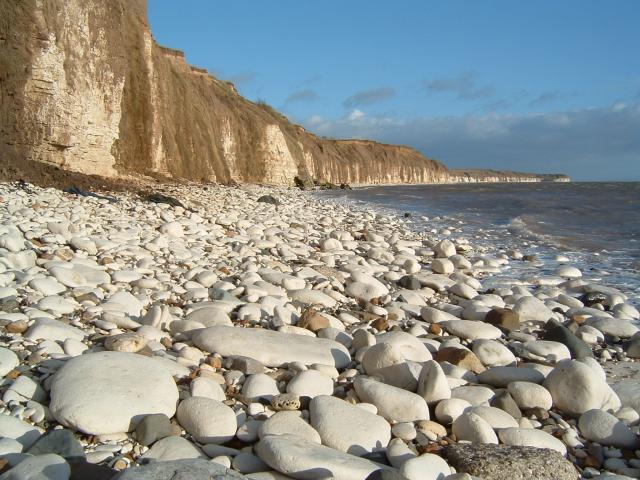
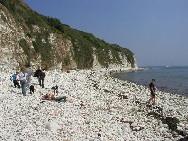
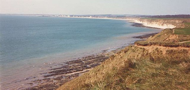
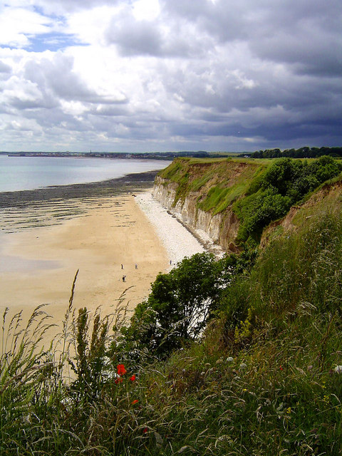
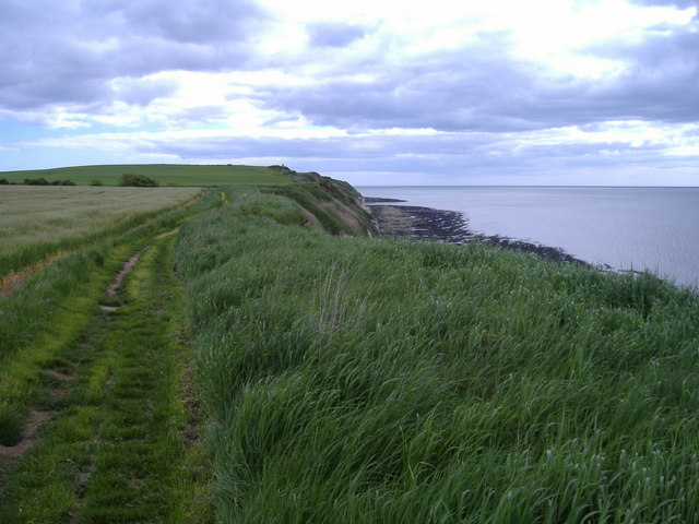
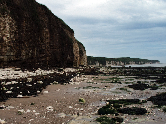
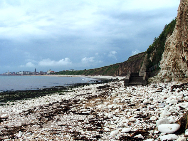
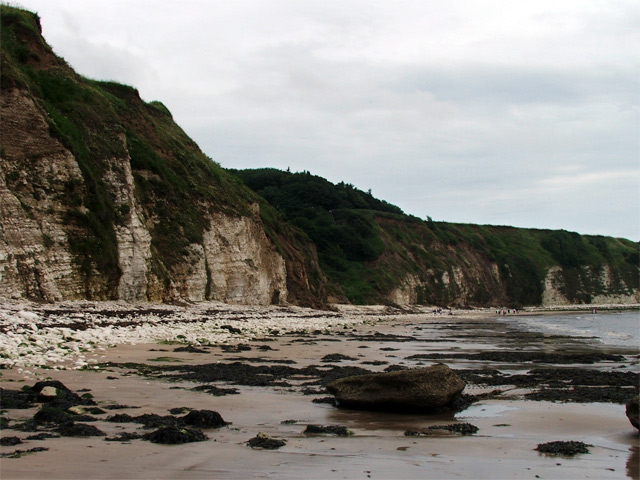
Sewerby Rocks is a small island located off the coast of Yorkshire, England. Situated in the North Sea, the island is known for its rugged and picturesque landscape, making it a popular destination for nature lovers and adventure seekers alike.

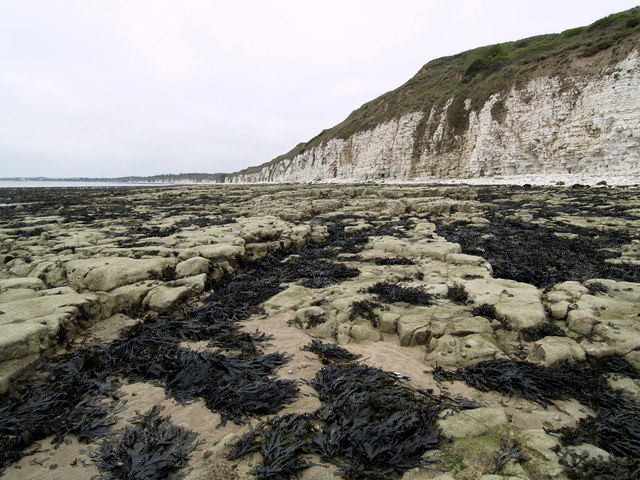
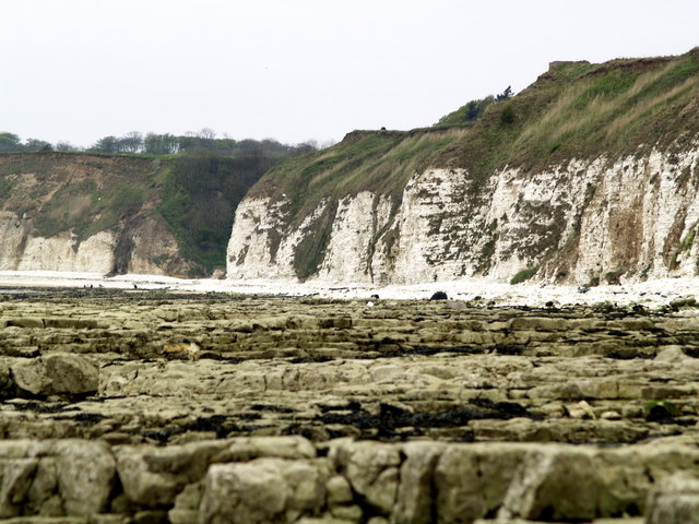
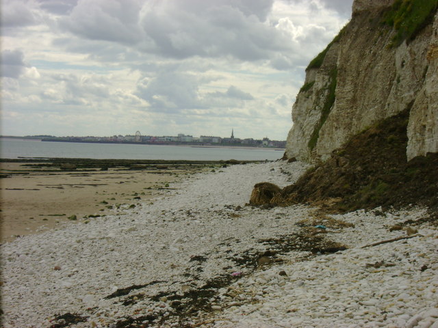
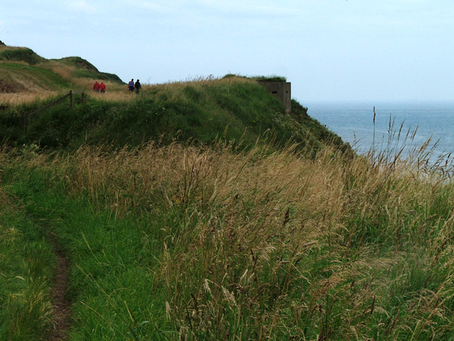
Covered in lush green vegetation and surrounded by towering cliffs, Sewerby Rocks offers breathtaking views of the sea and the surrounding coastline. The island is accessible via a short boat ride from the nearby town of Bridlington, adding to its allure and exclusivity.

Home to a diverse range of wildlife, Sewerby Rocks is a haven for birdwatching enthusiasts. The island boasts a large population of seabirds, including puffins, gannets, and kittiwakes, making it a prime spot for ornithologists and photographers. The rocky shores also attract seals, which can often be seen basking in the sun or swimming in the surrounding waters.

In addition to its natural beauty, Sewerby Rocks is also known for its historical significance. The island is home to the ruins of an ancient monastery, which dates back to the medieval period. Visitors can explore the remnants of the monastery and learn about the island's rich history through informative signage and guided tours.

For adventurers, Sewerby Rocks offers numerous opportunities for outdoor activities such as hiking, rock climbing, and fishing. The rugged terrain and dramatic cliffs provide an exciting challenge for those seeking an adrenaline rush.

Overall, Sewerby Rocks is a hidden gem in Yorkshire, offering a unique blend of natural beauty, wildlife, history, and adventure. Whether you're a nature enthusiast or a history buff, this island is sure to captivate and inspire all who visit.

If you have any feedback on the listing, please let us know in the comments section below.

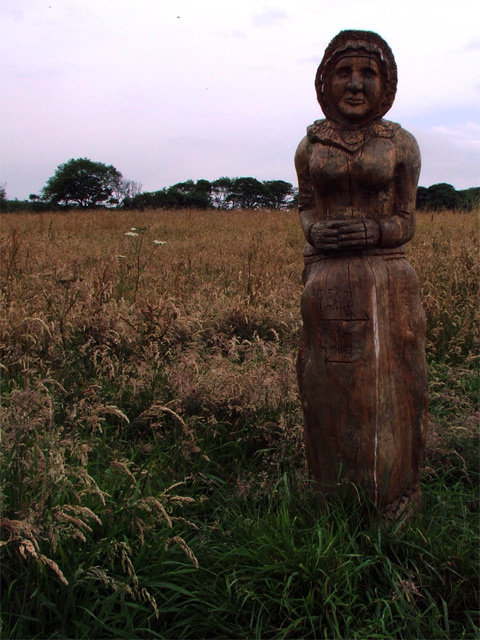
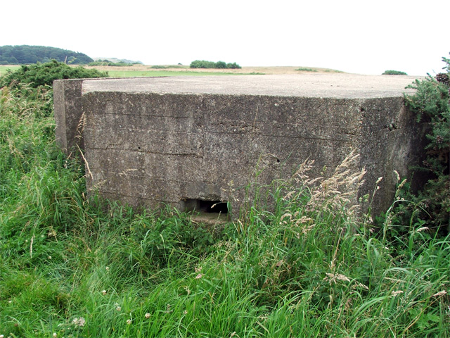
Sewerby Rocks Images

Images are sourced within 2km of 54.100821/-0.15356635 or Grid Reference TA2068. Thanks to Geograph Open Source API. All images are credited.

Chalk Pebble beach at Sewerby, Near Bridlington. Looking North East towards Flamborough Head
Chalk Pebble beach at Sewerby, Near Bridlington.
Looking North East towards Flamborough Head
Carving - Sewerby Hall The gardeners at Sewerby Hall are kept busy with the huge garden.  Apart from the carvings there are amazing and weird trees and bushes and some beautiful formal gardens.
Carving - Sewerby Hall
The gardeners at Sewerby Hall are kept busy with the huge garden. Apart from the carvings there are amazing and weird trees and bushes and some beautiful formal gardens.
Danes Dyke Danes’ Dyke consists of prehistoric earthworks, possibly intended as a defence, and woodland that runs 2½ miles across Flamborough Head. Despite its name, Danes’ Dyke had nothing to do with the Danes, and was a much earlier site - probably dating back to the Bronze Age.
Danes Dyke
Danes’ Dyke consists of prehistoric earthworks, possibly intended as a defence, and woodland that runs 2½ miles across Flamborough Head. Despite its name, Danes’ Dyke had nothing to do with the Danes, and was a much earlier site - probably dating back to the Bronze Age.
Where Dane's Dyke meets the North Sea
View towards Bridlington from Southern end of Danes Dyke
Beacon Hill Views The South Landing and cliffs at Flamborough Head from just beyond Beacon Hill. Looking out across Danes Dyke End, you can just make out Bridlington in the distance.
Beacon Hill Views
The South Landing and cliffs at Flamborough Head from just beyond Beacon Hill. Looking out across Danes Dyke End, you can just make out Bridlington in the distance.
Sewerby Hall Gardens
Marton Hall This photo is actually taken from just outside the gridsquare TA2069, in which the hall is situated.
Marton Hall
This photo is actually taken from just outside the gridsquare TA2069, in which the hall is situated.
Beacon Hill The view eastwards along the cliff top from the very edge of the gridsquare towards Beacon Hill.
Beacon Hill
The view eastwards along the cliff top from the very edge of the gridsquare towards Beacon Hill.
South Flamborough Beach
South Flamborough Beach Looking Towards Danes' Dyke.
South Flamborough Beach
Looking Towards Danes' Dyke.
Sewerby Rocks Bridlington in the background, taken from Danes Dyke Beach
Sewerby Rocks
Bridlington in the background, taken from Danes Dyke Beach
Cliff face, Sewerby An eastwards shot of the cliff face near Dykes End from Sewerby Rocks.
Cliff face, Sewerby
An eastwards shot of the cliff face near Dykes End from Sewerby Rocks.
Steps onto Sewerby Rocks Steps leading from the cliffside footpath down onto Sewerby Rocks. Bridlington's North Sands and the sea front can be seen in the distance.
Steps onto Sewerby Rocks
Steps leading from the cliffside footpath down onto Sewerby Rocks. Bridlington's North Sands and the sea front can be seen in the distance.
Dane's Dyke from the beach A wide view of Dane's Dyke taken from the beach (Dyke's End).
Dane's Dyke from the beach
A wide view of Dane's Dyke taken from the beach (Dyke's End).
Pillbox near Beacon Hill In this photo, what appears to be a pillbox can be seen overlooking the sea. The pillbox may be a Type 22, if it is indeed a pillbox. Inside, there are metal brackets where a wooden shelf would have been fitted had it been a Type 22. There is full access to this structure but there is little to look at internally.
Pillbox near Beacon Hill
In this photo, what appears to be a pillbox can be seen overlooking the sea. The pillbox may be a Type 22, if it is indeed a pillbox. Inside, there are metal brackets where a wooden shelf would have been fitted had it been a Type 22. There is full access to this structure but there is little to look at internally.
Carving, Cliff Plantation A carving of a fisherman's wife, looking out to sea.
Carving, Cliff Plantation
A carving of a fisherman's wife, looking out to sea.
Pillbox on golf course A pillbox stationed a way off from the cliff edge on a golf course. A footpath passes by it but there appears to be no entry to the structure.
Pillbox on golf course
A pillbox stationed a way off from the cliff edge on a golf course. A footpath passes by it but there appears to be no entry to the structure.
Show me another place!

Sewerby Rocks is located at Grid Ref: TA2068 (Lat: 54.100821, Lng: -0.15356635)

Division: East Riding

Unitary Authority: East Riding of Yorkshire

Police Authority: Humberside

What 3 Words

///helpful.wonderful.hounded. Near Flamborough, East Yorkshire

Nearby Locations

Rock Ends Sewerby Rocks

Related Wikis

Sewerby Hall

Sewerby Hall (also known as Sewerby House) is a Grade I listed Georgian country house set in 50 acres (20 ha) of landscaped gardens in the village of Sewerby...

Sewerby

Sewerby is a village in the East Riding of Yorkshire, England approximately 1 mile (1.6 km) north-east of Bridlington on the North Sea coast. The village...

Flamborough railway station

Flamborough railway station was located in the village of Marton, and was originally named after that location. However, there were several other railway...

Headlands School

Headlands School is a coeducational comprehensive school situated on Sewerby Road near the B1255, Bridlington, East Riding of Yorkshire, England. The school...

Nearby Amenities

Located within 500m of 54.100821,-0.15356635
Bunker Type: pillbox
Military: bunker
Source: survey
Lat/Long: 54.1043023/-0.150351
Golf: tee
Lat/Long: 54.1015494/-0.1547691
Golf: pin
Lat/Long: 54.1023678/-0.1537175
Golf: pin
Lat/Long: 54.1027705/-0.1548111
Golf: pin
Lat/Long: 54.1031773/-0.1486576
Golf: tee
Lat/Long: 54.1035699/-0.1527473
Golf: tee
Lat/Long: 54.1036497/-0.1491095
Golf: pin
Lat/Long: 54.1036534/-0.1545792
Golf: tee
Lat/Long: 54.1036886/-0.155578
Defibrillator
Access: yes
Defibrillator Location: outside Bridlington Bay Bowling Club building
Emergency: defibrillator
Indoor: no
Lat/Long: 54.1025156/-0.1590603
Bench
Lat/Long: 54.1024824/-0.1590586
Bench
Lat/Long: 54.1024567/-0.1590479
Bench
Lat/Long: 54.1024336/-0.1590425
Bench
Lat/Long: 54.1024079/-0.159038
Bench
Lat/Long: 54.1023833/-0.1590282
Bench
Lat/Long: 54.1026423/-0.1597345
Bench
Lat/Long: 54.1026564/-0.1596326
Bench
Lat/Long: 54.10267/-0.1595235
Bench
Lat/Long: 54.1026831/-0.1594171
Bench
Lat/Long: 54.1026952/-0.1593134
Bench
Lat/Long: 54.1027099/-0.1592061
The data included in this document is from www.openstreetmap.org. The data is made available under ODbL.

Have you been to Sewerby Rocks?

Leave your review of Sewerby Rocks below (or comments, questions and feedback).