Isle of Rhea

Island in Oxfordshire Oxford

England

Isle of Rhea

Memorial Stone John Thompson stone, in Burgess Field, Oxford.
Memorial Stone Credit: Wayland Smith

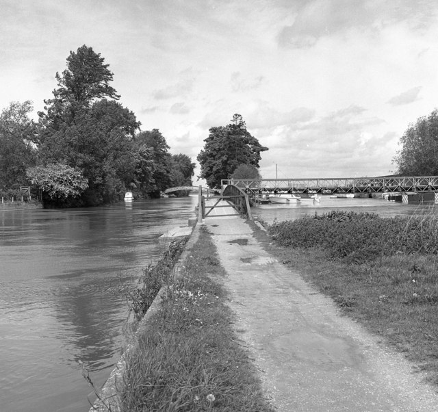
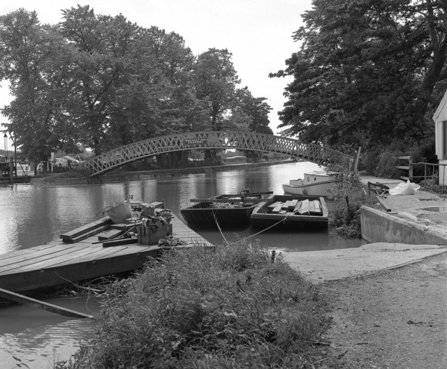
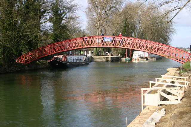
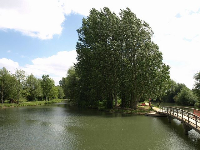
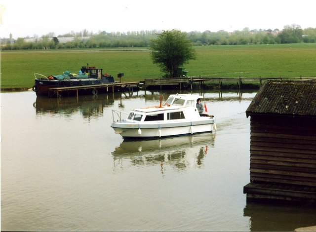
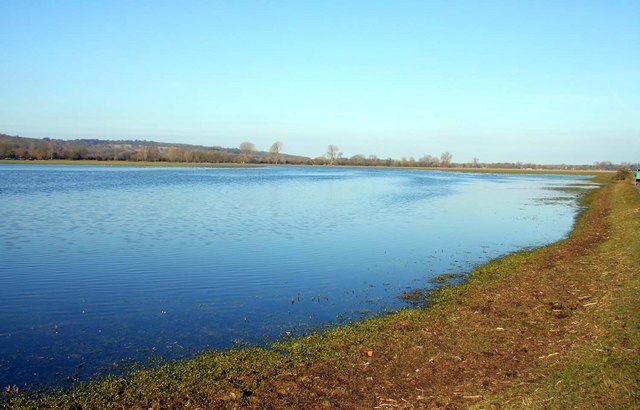
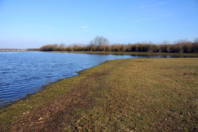
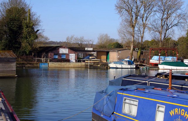
The Isle of Rhea is a small island located in the county of Oxfordshire, England. Situated in the River Thames, it is approximately 2.5 miles southwest of the town of Abingdon. The island covers an area of around 40 acres and is accessible only by boat.

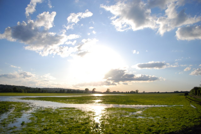
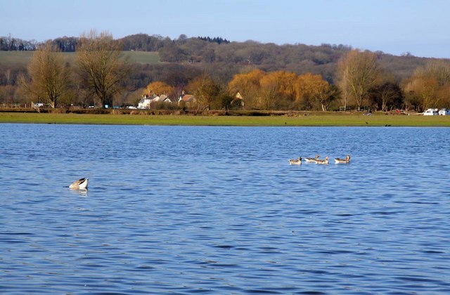
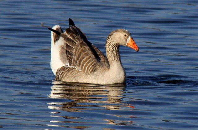
The Isle of Rhea is known for its picturesque beauty and tranquil surroundings. It is a popular destination for nature enthusiasts, providing ample opportunities for birdwatching and wildlife spotting. The island is home to diverse flora and fauna, including rare species of plants and birds.

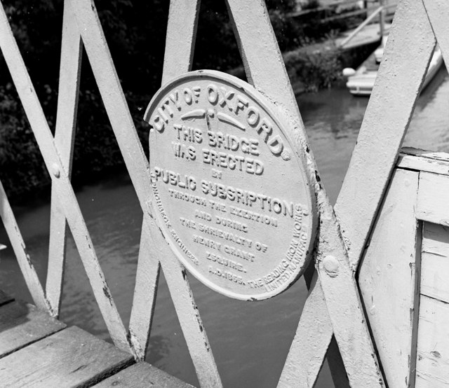
Historically, the Isle of Rhea has been inhabited for centuries. The remains of a medieval chapel and a moated site suggest that it was once a religious center. In the 18th century, the island was used for agricultural purposes, with evidence of farming activity still visible today.

Presently, the Isle of Rhea is privately owned and serves as a residential area. It features a small number of houses and cottages, providing a peaceful retreat for residents seeking a secluded escape from urban life. The island offers a tight-knit community atmosphere, with a strong sense of camaraderie among its residents.

Overall, the Isle of Rhea in Oxfordshire is a charming and idyllic island, offering a serene and picturesque environment for its residents and visitors. Its rich history, natural beauty, and peaceful surroundings make it a hidden gem within the county.

If you have any feedback on the listing, please let us know in the comments section below.
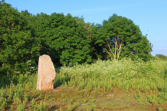
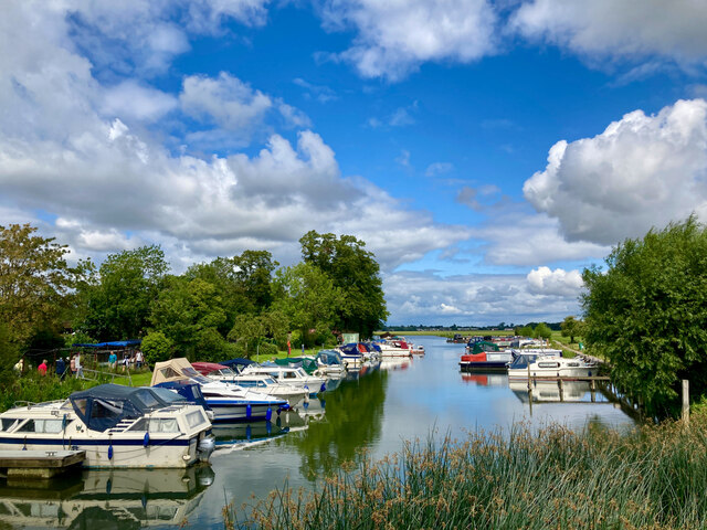
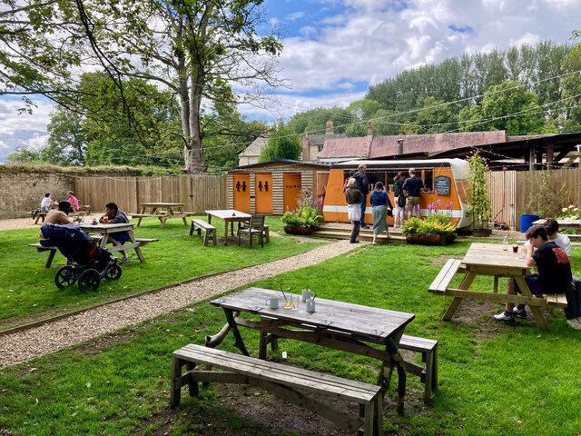
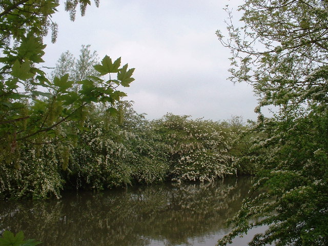
Isle of Rhea Images

Images are sourced within 2km of 51.767464/-1.252582 or Grid Reference SP5107. Thanks to Geograph Open Source API. All images are credited.

Memorial Stone John Thompson stone, in Burgess Field, Oxford.
Memorial Stone
John Thompson stone, in Burgess Field, Oxford.
View across the Thames and bridge from the Towing Path Looking across the river toward Bossom's boatyard and Binsey from the towpath (seated at path level).
View across the Thames and bridge from the Towing Path
Looking across the river toward Bossom's boatyard and Binsey from the towpath (seated at path level).
Marina on the Thames near Binsey A view from the footpath over the Thames.
Marina on the Thames near Binsey
A view from the footpath over the Thames.
Medley Beer Garden by the Thames Not a pub, just a beer garden.
Medley Beer Garden by the Thames
Not a pub, just a beer garden.
The Thames at Oxford Early morning in May.
The Thames at Oxford
Early morning in May.
River Thames at Medley The channel ahead looks like a lock cut, but there is no lock here.  The weir on the right can be crossed somewhat precariously by a Bailey bridge.  The towpath here is actually on a long thin island known as Fiddler's Island.
River Thames at Medley
The channel ahead looks like a lock cut, but there is no lock here. The weir on the right can be crossed somewhat precariously by a Bailey bridge. The towpath here is actually on a long thin island known as Fiddler's Island.
Plaque on Rainbow Bridge The official name of this bridge, which returns the upstream towpath to the west of the river, is Medley Footbridge, but it is often called Rainbow Bridge on account of its particularly graceful shape. It was built in 1865 and has since been refurbished in 1991 but without altering its appearance.
Plaque on Rainbow Bridge
The official name of this bridge, which returns the upstream towpath to the west of the river, is Medley Footbridge, but it is often called Rainbow Bridge on account of its particularly graceful shape. It was built in 1865 and has since been refurbished in 1991 but without altering its appearance.
Rainbow Bridge from the north As seen here, the left-hand end of the bridge is on Fiddler's Island, along which the towpath continues.  Behind the photographer, the path continues on the west side.
Rainbow Bridge from the north
As seen here, the left-hand end of the bridge is on Fiddler's Island, along which the towpath continues. Behind the photographer, the path continues on the west side.
Rainbow Bridge Rainbow Bridge over the Thames
Rainbow Bridge
Rainbow Bridge over the Thames
Fiddler's Island Seen from the footbridge across Castlemill Stream, which runs to the left of the island. On the right is the Thames.
Fiddler's Island
Seen from the footbridge across Castlemill Stream, which runs to the left of the island. On the right is the Thames.
Portmeadow
Portmeadow
The line curves towards Upper Wolvercote
Lazy days Me on my cruiser 'Grey Swan' on the Thames at Blossom's Boatyard, near Binsey. The Dreaming Spires of Oxford are in the background to the top left of the photo.
Lazy days
Me on my cruiser 'Grey Swan' on the Thames at Blossom's Boatyard, near Binsey. The Dreaming Spires of Oxford are in the background to the top left of the photo.
Floods on Port Meadow
Flooding on Port Meadow
Winter flooding on Port Meadow
Swimming on the meadow A Grey Lag Goose swims through the floods on Port Meadow.
Swimming on the meadow
A Grey Lag Goose swims through the floods on Port Meadow.
Bossom's Boatyard on the Thames
Show me another place!

Isle of Rhea is located at Grid Ref: SP5107 (Lat: 51.767464, Lng: -1.252582)

Administrative County: Oxfordshire

District: Oxford

Police Authority: Thames Valley

What 3 Words

///home.tight.boat. Near Oxford, Oxfordshire

Related Wikis

Cherwell Boathouse

The Cherwell Boathouse (also "Boat House") is a boathouse and restaurant on the River Cherwell in Oxford, England. It is located down a small lane off...

New College School

New College School (officially St Mary's College School) is a private preparatory school for boys aged 4 to 13 in Oxford. It was founded in 1379 by William...

Dragon School

The Dragon School is one school on two sites in Oxford, England. The Dragon Pre-Prep (children aged 4–7) and Prep School (children aged 8–13) are both...

Lady Margaret Hall, Oxford

Lady Margaret Hall (LMH) is one of the constituent colleges of the University of Oxford in England, located on a bank of the River Cherwell at Norham Gardens...

Fyfield Road

Fyfield Road is a residential road in North Oxford, England, on the Norham Manor estate.At the northern end of the road is a junction with Norham Road...

Chadlington Road

Chadlington Road is a road in North Oxford, England. == Location == At the northern end is Linton Road, close to the front entrance of Wolfson College...

Bardwell Road

Bardwell Road is a residential road in Oxford, England. It is located in North Oxford off the Banbury Road, within the area of Oxford once owned by St...

Norham Manor

The Norham Manor estate is a residential suburb in Oxford, England. It is part of central North Oxford. To the north is Park Town with its crescents, to...

Related Videos

The Best Day Hike Near London? - Relaxing Hiking Video in Oxfordshire

Today I'm hiking one of my favourite trails within an hours drive of London. Watch through to the end for some useful info if you're ...

OXFORD, ENGLAND - UNITED KINGDOM [1 Hour Walking Tour in 4K]

Walking Tour in Oxford, England - United Kingdom SUBSCRIBE to see more videos like this: ...

Oxford Walking Tour | A Walk Around England's Oldest University Town

In today's video, we take a day trip from London to one of England's most important cities. This video is an Oxford walking tour, ...

Nearby Amenities

Located within 500m of 51.767464,-1.252582
Traffic Calming: hump
Lat/Long: 51.7706713/-1.2572279
Norham Manor
Place: quarter
Wikidata: Q7051197
Lat/Long: 51.764693/-1.2567162
Barrier: kissing_gate
Lat/Long: 51.7640481/-1.2544098
Barrier: stile
Lat/Long: 51.7704928/-1.2530803
Post Box
Collection Times: Mo-Fr 09:00; Sa 07:00
Operator: Royal Mail
Operator Type: private
Operator Wikidata: Q638098
Postal Code: OX2
Ref: OX2 214D
Royal Cypher: GVIR
Lat/Long: 51.7703255/-1.2564003
Post Box
Collection Times: Mo-Fr 09:00; Sa 07:00
Operator: Royal Mail
Operator Type: private
Operator Wikidata: Q638098
Postal Code: OX2
Ref: OX2 151D
Royal Cypher: EVIIR
Lat/Long: 51.7682033/-1.2572477
Post Box
Brand: Royal Mail
Brand Wikidata: Q638098
Brand Wikipedia: en:Royal Mail
Check Date Collection Times: 2023-07-29
Collection Times: Mo-Fr 09:00; Sa 07:00
Colour: red
Operator: Royal Mail
Operator Type: private
Operator Wikidata: Q638098
Post Box Apertures: 1
Post Box Type: pillar
Postal Code: OX2
Ref: OX2 61D
Royal Cypher: GR
Royal Cypher Wikidata: Q33102273
Lat/Long: 51.7650802/-1.2556031
Post Box
Collection Times: Mo-Fr 09:00; Sa 07:00
Listed Status: Grade II
Post Box Design: penfold
Post Box Type: pillar
Postal Code: OX2
Ref: OX2 32
Royal Cypher: VR
Royal Cypher Wikidata: Q33102356
Lat/Long: 51.7664438/-1.2592322
Barrier: entrance
Lat/Long: 51.7706604/-1.2476551
Addr Housenumber: 12
Addr Street: Fyfield Road
Lat/Long: 51.7660526/-1.255814
Addr Housenumber: 48
Addr Street: Park Town
Lat/Long: 51.7665786/-1.2569492
Addr Housenumber: 46
Addr Street: Park Town
Lat/Long: 51.766556/-1.2570529
Addr Housenumber: 44b
Addr Street: Park Town
Lat/Long: 51.7667192/-1.2572548
Addr Housenumber: 44
Addr Street: Park Town
Lat/Long: 51.7666764/-1.2573547
Addr Housenumber: 36
Addr Street: Park Town
Lat/Long: 51.7665254/-1.2579408
Addr Housenumber: 12
Addr Street: Park Town
Lat/Long: 51.7662099/-1.259313
Addr Housenumber: 45
Addr Street: Park Town
Lat/Long: 51.7672589/-1.2575997
Barrier: stile
Lat/Long: 51.7685625/-1.2495452
Barrier: stile
Lat/Long: 51.7680647/-1.2524942
Barrier: stile
Lat/Long: 51.7667123/-1.2463049
Bicycle Parking
Lat/Long: 51.7708895/-1.2558424
Entrance: yes
Wheelchair: yes
Lat/Long: 51.7709192/-1.2551028
Barrier: entrance
Lat/Long: 51.7667153/-1.2588229
Barrier: entrance
Lat/Long: 51.766406/-1.2586003
Crossing
Crossing: zebra
Tactile Paving: yes
Lat/Long: 51.7683555/-1.256281
Barrier: stile
Lat/Long: 51.7705215/-1.2506989
Barrier: kissing_gate
Lat/Long: 51.767517/-1.2516476
Barrier: kissing_gate
Lat/Long: 51.7676343/-1.2520659
Bench
Lat/Long: 51.7652304/-1.2524351
Theatre
Simpkins Lee Theatre
Lat/Long: 51.7650845/-1.2546077
Bar
Talbot Bar
Lat/Long: 51.7650994/-1.2534335
New Old Hall
Shop: laundry
Lat/Long: 51.7645881/-1.2540685
Kathleen Lee
Shop: laundry
Lat/Long: 51.7656406/-1.2543174
Atm
Check Date: 2022-01-10
Fee: £1.35
Operator: InfoCash Ltd
Lat/Long: 51.7651758/-1.2536756
Talbot Hall
Shop: laundry
Lat/Long: 51.7649914/-1.2534972
Vending Machine
Check Date: 2022-01-10
Lat/Long: 51.7652347/-1.2537132
Crossing: uncontrolled
Crossing Ref: zebra
Lat/Long: 51.7708221/-1.2556084
Entrance: yes
Wheelchair: no
Lat/Long: 51.763688/-1.2560097
Entrance: yes
Wheelchair: no
Lat/Long: 51.7641364/-1.2558969
Entrance: yes
Wheelchair: no
Lat/Long: 51.7643177/-1.2555733
Entrance: yes
Wheelchair: yes
Lat/Long: 51.7637094/-1.2555532
Entrance: yes
Wheelchair: yes
Lat/Long: 51.7634436/-1.2557479
Entrance: yes
Wheelchair: yes
Lat/Long: 51.7642281/-1.2557394
Addr Housenumber: 10
Addr Street: Bardwell Road
Entrance: yes
Lat/Long: 51.767413/-1.2594348
Addr Housenumber: 12
Addr Street: Bardwell Road
Entrance: yes
Lat/Long: 51.7674516/-1.2593075
Addr Housenumber: 14
Addr Street: Bardwell Road
Entrance: yes
Lat/Long: 51.7675069/-1.2591194
Addr Housenumber: 16
Addr Street: Bardwell Road
Entrance: yes
Lat/Long: 51.7675436/-1.2589925
Addr Housenumber: 2
Addr Street: Northmoor Road
Entrance: yes
Lat/Long: 51.7684687/-1.2595235
Addr Housenumber: 2D
Addr Street: Northmoor Road
Entrance: yes
Lat/Long: 51.7685225/-1.2595132
Addr Housenumber: 4
Addr Street: Northmoor Road
Entrance: yes
Lat/Long: 51.7686226/-1.2594764
Addr Housenumber: 4A
Addr Street: Northmoor Road
Entrance: yes
Lat/Long: 51.7686847/-1.2595062
Addr Housenumber: 4B
Addr Street: Northmoor Road
Entrance: yes
Lat/Long: 51.7687413/-1.2593209
Addr Housenumber: 6
Addr Street: Bardwell Road
Entrance: yes
Lat/Long: 51.7672936/-1.2597436
Addr Housenumber: 8
Addr Street: Bardwell Road
Entrance: yes
Lat/Long: 51.7673382/-1.2595988
Entrance: yes
Lat/Long: 51.7649171/-1.254892
Entrance: yes
Lat/Long: 51.765616/-1.2537149
BBQ
Lat/Long: 51.7652964/-1.2513132
Entrance: yes
Lat/Long: 51.7648409/-1.2550552
Whitley V Aircraft Crash Memorial Plaque
Historic: memorial
Inscription: In memory of the crew of the Whitley V aircraft which crashed here on a training flight from RAF Abingdon, on 4 May 1941 Pilot Officer Charles Nairn Small, pilot, aged 23 Pilot Officer William Alexander Munro Halley, observer, aged 19 Sergeant John Alfred
Inscription Url: http://openplaques.org/plaques/30803
Memorial: plaque
Openplaques Id: 30803
Source: http://openplaques.org/plaques/30803
Start Date: 1941-05-04
Lat/Long: 51.7711735/-1.2556037
Bench
Havel's Place
Historic: memorial
Inscription: Truth and love must prevail over lies and hatred
Name Cs: Lavička Václava Havla
Start Date: 20141106
Lat/Long: 51.7639769/-1.2518903
Laundry Service: no
Self Service: yes
Shop: laundry
Lat/Long: 51.7642615/-1.254524
Entrance: yes
Lat/Long: 51.7645783/-1.2548054
Bicycle Parking
Bicycle Parking: anchors
Lat/Long: 51.7646433/-1.2550438
Entrance: yes
Lat/Long: 51.765003/-1.2536216
Entrance: yes
Lat/Long: 51.7650982/-1.2545079
Entrance: yes
Lat/Long: 51.7652593/-1.2546399
Entrance: yes
Lat/Long: 51.7653108/-1.2541429
Entrance: yes
Lat/Long: 51.7651192/-1.2538939
Entrance: yes
Lat/Long: 51.7648446/-1.2544375
Entrance: yes
Lat/Long: 51.7647351/-1.254615
Entrance: yes
Lat/Long: 51.7647001/-1.2546715
Entrance: yes
Lat/Long: 51.7647578/-1.2549991
Bicycle Parking
Bicycle Parking: shed
Lat/Long: 51.7648984/-1.2552298
Bench
Lat/Long: 51.7646705/-1.2531215
Bench
Lat/Long: 51.7647776/-1.2529083
Bench
Lat/Long: 51.765075/-1.2533526
Bench
Lat/Long: 51.765104/-1.2533847
Bench
Lat/Long: 51.7651385/-1.2534216
Bench
Lat/Long: 51.7650525/-1.2531297
Bench
Lat/Long: 51.7651963/-1.2532994
Bench
Backrest: yes
Lat/Long: 51.7649714/-1.2535968
Bench
Backrest: yes
Lat/Long: 51.7650345/-1.2536679
Door: hinged
Door Wings: 2
Entrance: yes
Lit: yes
Lat/Long: 51.7641853/-1.2544851
Vending Machine
Ref: OX40
Support: ground
Vending: parking_tickets
Lat/Long: 51.7641003/-1.2553485
Bicycle Parking
Access: private
Bicycle Parking: stands
Covered: no
Lat/Long: 51.7640539/-1.2553951
Advertising: board
Lat/Long: 51.7640406/-1.2543493
Park Town
Is In City: Oxford
Is In Suburb: North Oxford
Place: neighbourhood
Wikidata: Q7138105
Wikipedia: en:Park Town, Oxford
Lat/Long: 51.7665556/-1.2587367
Lazenbee's Ground
Natural: wood
Lat/Long: 51.764311/-1.2528987
Pinnacle from Merton College
Artwork Type: sculpture
Description: A pinnacle from a tower of Merton College gifted to the college after being found in north Oxford stone mason yard by Desmond Kay. After Merton underwent a resurfacing campaign, the pinnacle was removed and replaced, before eventually being gifted to Wolf
Tourism: artwork
Lat/Long: 51.7703511/-1.2543176
TRE FIORI
Artist Name: Rob Ward
Artwork Type: sculpture
Description: Tre Fiori (Itailian: Three Flowers ) Plant Sculpture in memory of the Gartons A sculpture to remember the founding member Jeff Garton, who kindly left his estate to the college. The three flowers represent him, his first wife Natalie and second wife Kay.
Material: metal
Start Date: 2020
Tourism: artwork
Lat/Long: 51.7697758/-1.2546746
Note: Tree not present anymore. Reported by note in June 2022. Leaving this note to avoid remapping based on outdated images.
Removed Natural: tree
Lat/Long: 51.770886/-1.2547132
Bench
Lat/Long: 51.7707293/-1.2538367
Entrance: yes
Lat/Long: 51.7688075/-1.2566156
Entrance: yes
Lat/Long: 51.7685691/-1.2566553
Entrance: yes
Lat/Long: 51.7674491/-1.25552
Entrance: yes
Lat/Long: 51.7679923/-1.2556201
Entrance: yes
Lat/Long: 51.7675033/-1.2565298
Entrance: yes
Lat/Long: 51.7675471/-1.2563551
Entrance: yes
Lat/Long: 51.7678154/-1.2565107
Bicycle Parking
Lat/Long: 51.769428/-1.2539656
Winter Garden
Leisure: garden
Lat/Long: 51.7701665/-1.2542753
Bbq
Lat/Long: 51.7717105/-1.2537983
Entrance: main
Lat/Long: 51.7656201/-1.2591106
Bench
Lat/Long: 51.7631354/-1.2544435
The Buttery
Indoor: room
Lat/Long: 51.7710671/-1.2551268
Dining Hall
Indoor: room
Lat/Long: 51.7704947/-1.2549944
Haldane Room
Indoor: room
Lat/Long: 51.770546/-1.2548349
Direction: 140
Generator Method: photovoltaic
Generator Output Electricity: yes
Generator Solar Modules: 36
Generator Source: solar
Generator Type: solar_photovoltaic_panel
Location: roof
Power: generator
Lat/Long: 51.7648003/-1.2541584
Direction: 140
Generator Method: photovoltaic
Generator Output Electricity: yes
Generator Solar Modules: 16
Generator Source: solar
Generator Type: solar_photovoltaic_panel
Location: roof
Power: generator
Lat/Long: 51.765372/-1.2541065
Direction: 140
Generator Method: photovoltaic
Generator Output Electricity: yes
Generator Solar Modules: 16
Generator Source: solar
Generator Type: solar_photovoltaic_panel
Location: roof
Power: generator
Lat/Long: 51.7656334/-1.254314
Direction: 140
Generator Method: photovoltaic
Generator Output Electricity: yes
Generator Solar Modules: 105
Generator Source: solar
Generator Type: solar_photovoltaic_panel
Location: roof
Power: generator
Lat/Long: 51.7660001/-1.2534641
Generator Method: photovoltaic
Generator Output Electricity: yes
Generator Solar Modules: 18
Generator Source: solar
Generator Type: solar_photovoltaic_panel
Location: roof
Power: generator
Tilted: no
Lat/Long: 51.7660539/-1.2545429
Generator Method: photovoltaic
Generator Output Electricity: yes
Generator Solar Modules: 16
Generator Source: solar
Generator Type: solar_photovoltaic_panel
Location: roof
Power: generator
Tilted: no
Lat/Long: 51.7661318/-1.2545925
Generator Method: photovoltaic
Generator Output Electricity: yes
Generator Solar Modules: 9
Generator Source: solar
Generator Type: solar_photovoltaic_panel
Location: roof
Power: generator
Tilted: no
Lat/Long: 51.7662128/-1.2546577
Direction: 245
Generator Method: photovoltaic
Generator Output Electricity: yes
Generator Solar Modules: 12
Generator Source: solar
Generator Type: solar_photovoltaic_panel
Location: roof
Power: generator
Lat/Long: 51.766075/-1.2550509
Direction: 245
Fixme: survey for panel count & type
Generator Method: photovoltaic
Generator Output Electricity: yes
Generator Solar Modules: 12
Generator Source: solar
Generator Type: solar_photovoltaic_panel
Location: roof
Power: generator
Lat/Long: 51.7657678/-1.2548547
Traffic Calming: hump
Lat/Long: 51.770484/-1.257918
Drinking Water
Bottle: yes
Fee: no
Lat/Long: 51.7694416/-1.2539321
Bench
Backrest: yes
Direction: 115
Material: wood
Seats: 3
Lat/Long: 51.7686556/-1.2557751
Bench
Backrest: yes
Direction: 358
Material: wood
Seats: 3
Lat/Long: 51.7638769/-1.2535727
The Transformed Triangle
Artist Name: Roger Cheney
Artwork Type: sculpture
Fixme: Approximate location
Material: concrete
Start Date: 1974
Tourism: artwork
Lat/Long: 51.7703442/-1.2541773
Traffic Calming: bump
Lat/Long: 51.7711204/-1.2559889
Traffic Calming: bump
Lat/Long: 51.7712753/-1.2559824
The data included in this document is from www.openstreetmap.org. The data is made available under ODbL.

Have you been to Isle of Rhea?

Leave your review of Isle of Rhea below (or comments, questions and feedback).