Norham Manor

Settlement in Oxfordshire Oxford

England

Norham Manor

Helen Road, Oxford A dead-end for vehicles.
Helen Road, Oxford Credit: Robin Webster

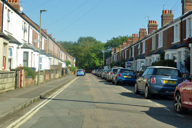
Norham Manor is a residential area located in the city of Oxford, Oxfordshire, England. Situated near the city center, it is bordered by the University Parks to the east and the Cherwell River to the west. The neighborhood is predominantly residential, consisting of a mix of large detached houses, townhouses, and apartments.

Originally a farming area, Norham Manor experienced significant development in the 19th century as Oxford expanded. The architecture in the area reflects this period, with many Victorian and Edwardian-style houses still standing. The properties in Norham Manor are highly sought after due to their proximity to the city center and the University of Oxford.

The area is renowned for its picturesque surroundings and green spaces. University Parks, a large public park, offers residents an opportunity for recreational activities such as walking, running, and picnicking. The Cherwell River, which runs alongside the neighborhood, provides a serene and scenic atmosphere.

Norham Manor benefits from excellent transport links, with regular bus services connecting it to the city center and surrounding areas. The Oxford train station is also within easy reach, offering connections to London and other major cities.

The neighborhood is well-served by amenities, including shops, restaurants, and schools. Additionally, the University of Oxford's science area is situated nearby, enhancing the area's academic and research atmosphere.

Overall, Norham Manor is an attractive residential area that combines a convenient location with a peaceful ambiance and a rich historical heritage.

If you have any feedback on the listing, please let us know in the comments section below.
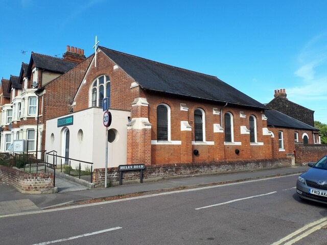
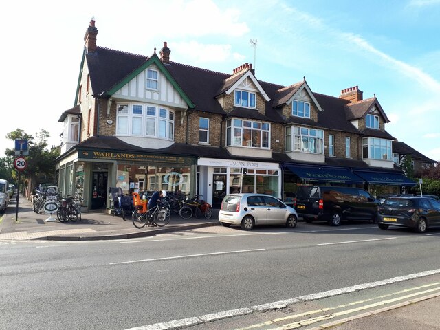
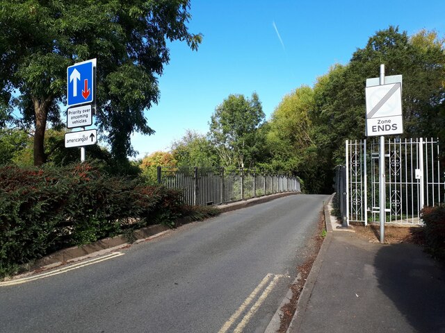
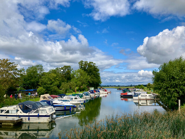
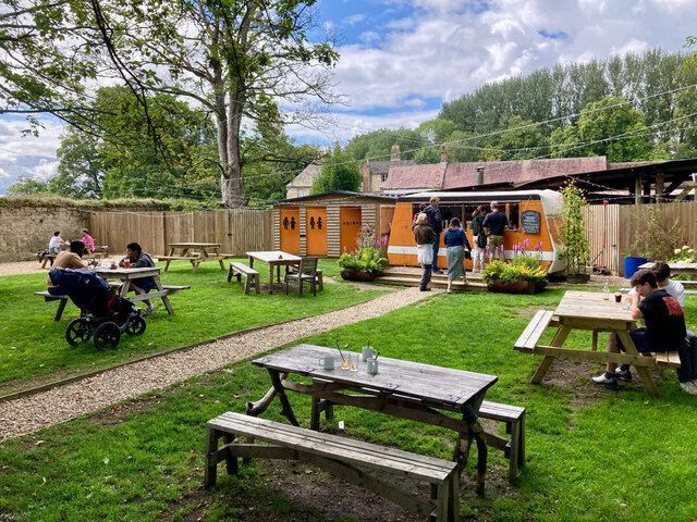
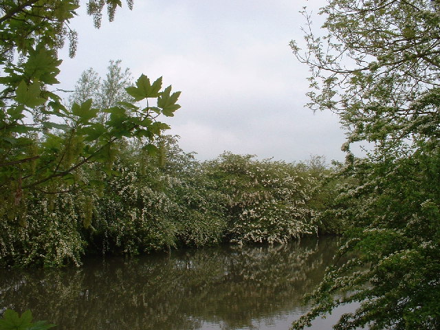
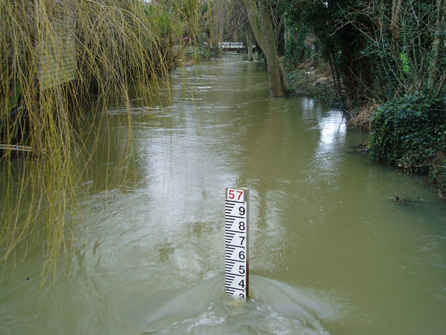
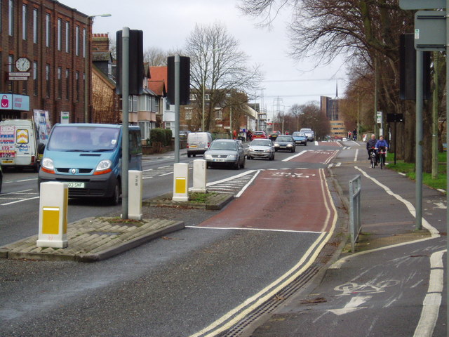
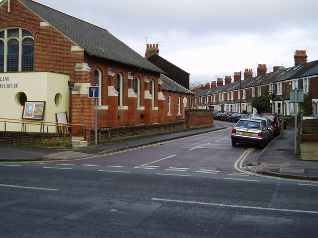
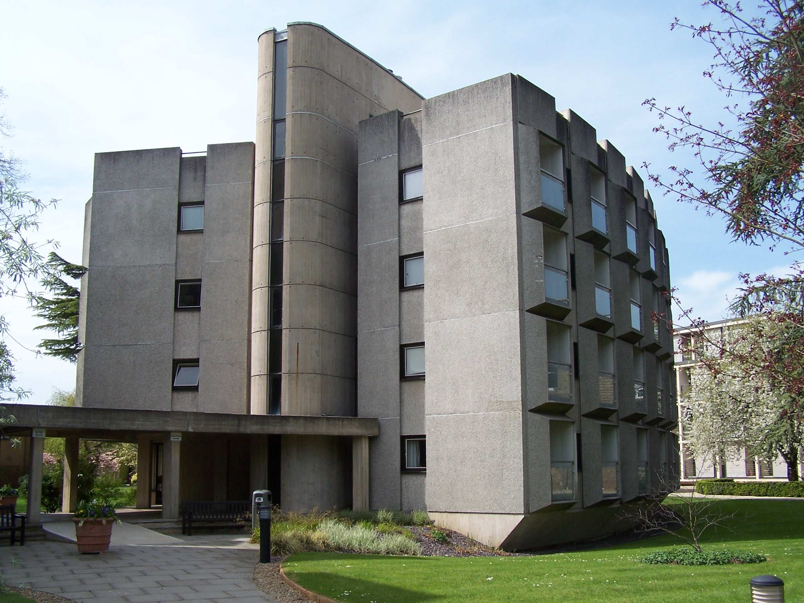
Norham Manor Images

Images are sourced within 2km of 51.76191/-1.2600055 or Grid Reference SP5107. Thanks to Geograph Open Source API. All images are credited.

Helen Road, Oxford A dead-end for vehicles.
Helen Road, Oxford
A dead-end for vehicles.
Barn, Binsey
Barn, Binsey
Memorial Stone John Thompson stone, in Burgess Field, Oxford.
Memorial Stone
John Thompson stone, in Burgess Field, Oxford.
Ferry Hinksey Road Spine road for the Osney Mead insutrial estate.
Ferry Hinksey Road
Spine road for the Osney Mead insutrial estate.
Horses in Thames amused by dinghy sailors Commoners' horses graze on Port Meadow, dinghy from Medley sailing club the other side of the Thames.
Horses in Thames amused by dinghy sailors
Commoners' horses graze on Port Meadow, dinghy from Medley sailing club the other side of the Thames.
Restoration Church, Helen Road, Osney Only a few years ago this was the Elim Chapel <a href="https://www.geograph.org.uk/photo/6217755">SP4906 : Elim Chapel, Helen Road</a> but it was probably not built as a church, as the 1921 map labels it a 'hall'. The style looks to be late 19th / early 20th century.
Restoration Church, Helen Road, Osney
Only a few years ago this was the Elim Chapel SP4906 : Elim Chapel, Helen Road but it was probably not built as a church, as the 1921 map labels it a 'hall'. The style looks to be late 19th / early 20th century.
Shops on Botley Road Currently comprising a cycle sales / repair business, high quality greengrocer and an antique shop specialising in Tuscan pottery. All very Oxford.
Shops on Botley Road
Currently comprising a cycle sales / repair business, high quality greengrocer and an antique shop specialising in Tuscan pottery. All very Oxford.
Binsey Lane bridge A narrow bridge taking a country lane over the Bulstake Stream, one of the many minor branches of the Thames around Oxford. <a href="https://www.geograph.org.uk/photo/6606806">SP4906 : Bridge over Bulstake Stream</a> shows it from the side.
Binsey Lane bridge
A narrow bridge taking a country lane over the Bulstake Stream, one of the many minor branches of the Thames around Oxford. SP4906 : Bridge over Bulstake Stream shows it from the side.
Binsey Lane A country lane from Osney to Binsey. There's something not quite right about those trees to the left: diseased, or badly pruned? The metal gates to the right are the access to an electricity substation.
Binsey Lane
A country lane from Osney to Binsey. There's something not quite right about those trees to the left: diseased, or badly pruned? The metal gates to the right are the access to an electricity substation.
DFS on Botley Road, Oxford I seem to remember DFS stands for Direct Furniture Services. I haven't been able to confirm it online.
DFS on Botley Road, Oxford
I seem to remember DFS stands for Direct Furniture Services. I haven't been able to confirm it online.
View across the Thames and bridge from the Towing Path Looking across the river toward Bossom's boatyard and Binsey from the towpath (seated at path level).
View across the Thames and bridge from the Towing Path
Looking across the river toward Bossom's boatyard and Binsey from the towpath (seated at path level).
Marina on the Thames near Binsey A view from the footpath over the Thames.
Marina on the Thames near Binsey
A view from the footpath over the Thames.
Medley Beer Garden by the Thames Not a pub, just a beer garden.
Medley Beer Garden by the Thames
Not a pub, just a beer garden.
The Thames at Oxford Early morning in May.
The Thames at Oxford
Early morning in May.
Stream at Botley Park This stream links Seacourt Stream with the Isis.  The photograph is taken at the end of Henry Road where a small bridge crosses into Botley Park.
Stream at Botley Park
This stream links Seacourt Stream with the Isis. The photograph is taken at the end of Henry Road where a small bridge crosses into Botley Park.
Botley Road - Oxford Each morning this road is heavy with traffic trying to enter Oxford. Each evening it all streams out again.
Botley Road - Oxford
Each morning this road is heavy with traffic trying to enter Oxford. Each evening it all streams out again.
Helen Road - Oxford Junction of Helen Road with the Botley Road. On the corner is the Elim Pentecostal Church.
Helen Road - Oxford
Junction of Helen Road with the Botley Road. On the corner is the Elim Pentecostal Church.
Binsey Lane - Oxford Junction of Binsey Lane with the Botley Road
Binsey Lane - Oxford
Junction of Binsey Lane with the Botley Road
Show me another place!

Norham Manor is located at Grid Ref: SP5107 (Lat: 51.76191, Lng: -1.2600055)

Administrative County: Oxfordshire

District: Oxford

Police Authority: Thames Valley

What 3 Words

///chefs.vast.frozen. Near Oxford, Oxfordshire

Related Wikis

H. B. Allen Centre

The H B Allen Centre is the graduate centre of Keble College, one of the constituent colleges of the University of Oxford in England. == Background... ==

Wycliffe Hall, Oxford

Wycliffe Hall () is a permanent private hall of the University of Oxford affiliated with the Church of England. It is named after the Bible translator...

Acland Hospital

The Acland Hospital (also previously known as the Acland Nursing Home, Acland Home and the Sarah Acland Home for Nurses) was a private nursing home and...

St Anne's College, Oxford

St Anne's College is a constituent college of the University of Oxford in England. It was founded in 1879 and gained full college status in 1959. Originally...

Related Videos

The Best Day Hike Near London? - Relaxing Hiking Video in Oxfordshire

Today I'm hiking one of my favourite trails within an hours drive of London. Watch through to the end for some useful info if you're ...

OXFORD, ENGLAND | WALKING TOUR [4K]

Join this channel to access its perks: https://www.youtube.com/channel/UC3_qdtTCsHa1uK4_cmianUA/join Check out my website ...

Oxford Walking Tour | A Walk Around England's Oldest University Town

In today's video, we take a day trip from London to one of England's most important cities. This video is an Oxford walking tour, ...

Walking in OXFORD / England (UK) 🇬🇧- 4K 60fps (UHD)

Oxford in England is known for its prestigious university which makes it an intellectual center of England and Europe. Oxford was ...

Nearby Amenities

Located within 500m of 51.76191,-1.2600055
Barrier: bollard
Bollard: fixed
Lat/Long: 51.7579779/-1.2622433
Crossing
Button Operated: yes
Check Date Crossing: 2021-01-01
Crossing: traffic_signals
Crossing Island: no
Crossing Ref: pelican
Source: Bing
Tactile Paving: yes
Traffic Signals Sound: yes
Traffic Signals Vibration: yes
Lat/Long: 51.7604817/-1.2616963
Check Date: 2021-10-18
Source: Bing
Traffic Calming: choker
Lat/Long: 51.7623437/-1.2639491
Barrier: bollard
Bollard: fixed
Lat/Long: 51.764178/-1.2636237
Crossing
Crossing: traffic_signals
Crossing Island: no
Crossing Ref: pelican
Tactile Paving: yes
Lat/Long: 51.7640038/-1.2642332
Traffic Signals
Source: photograph
Traffic Signals Direction: backward
Lat/Long: 51.7619402/-1.2603989
Norham Manor
Place: quarter
Wikidata: Q7051197
Lat/Long: 51.764693/-1.2567162
Post Box
Brand: Royal Mail
Brand Wikidata: Q638098
Brand Wikipedia: en:Royal Mail
Collection Times: Mo-Fr 17:30; Sa 11:00
Operator: Royal Mail
Operator Wikidata: Q638098
Post Box Type: wall
Ref: OX1 131
Royal Cypher: EVIIR
Royal Cypher Wikidata: Q33102324
Source: gps_survey;Bing
Lat/Long: 51.7576292/-1.2595766
Post Box
Collection Times: Mo-Fr 17:30; Sa 11:30
Post Box Type: wall
Postal Code: OX2
Ref: OX2 130
Royal Cypher: GR
Royal Cypher Wikidata: Q33102273
Lat/Long: 51.7620441/-1.2635267
Barrier: kissing_gate
Lat/Long: 51.7640481/-1.2544098
Crossing
Crossing: uncontrolled
Crossing Island: yes
Kerb: lowered
Tactile Paving: yes
Lat/Long: 51.7619698/-1.259976
Old Phone: +44 1865 553629
Removed Amenity: telephone
Lat/Long: 51.7650988/-1.260612
Post Box
Brand: Royal Mail
Brand Wikidata: Q638098
Brand Wikipedia: en:Royal Mail
Check Date Collection Times: 2019-03-11
Collection Times: Mo-Fr 09:00; Sa 07:00
Colour: red
Operator: Royal Mail
Operator Wikidata: Q638098
Post Box Apertures: 1
Post Box Type: pillar
Ref: OX1 155
Lat/Long: 51.7597727/-1.2578235
Post Box
Brand: Royal Mail
Brand Wikidata: Q638098
Brand Wikipedia: en:Royal Mail
Check Date Collection Times: 2023-07-29
Collection Times: Mo-Fr 09:00; Sa 07:00
Colour: red
Operator: Royal Mail
Operator Type: private
Operator Wikidata: Q638098
Post Box Apertures: 1
Post Box Type: pillar
Postal Code: OX2
Ref: OX2 61D
Royal Cypher: GR
Royal Cypher Wikidata: Q33102273
Lat/Long: 51.7650802/-1.2556031
Post Box
Collection Times: Mo-Fr 09:00, Sa 07:00
Post Box Type: pillar
Postal Code: OX2
Ref: OX2 68D
Royal Cypher: EVIIR
Royal Cypher Wikidata: Q33102324
Lat/Long: 51.7646662/-1.2609225
Post Box
Brand: Royal Mail
Brand Wikidata: Q638098
Brand Wikipedia: en:Royal Mail
Collection Times: Mo-Fr 09:00; Sa 07:00
Colour: red
Drive Through: no
Operator: Royal Mail
Operator Wikidata: Q638098
Post Box Type: pillar
Ref: OX2 49
Royal Cypher: EVIIR
Royal Cypher Wikidata: Q33102324
Lat/Long: 51.7619857/-1.2602303
Post Box
Collection Times: Mo-Fr 17:30; Sa 12:00
Post Box Type: wall
Ref: OX2 132
Royal Cypher: EIIR
Royal Cypher Wikidata: Q33102113
Lat/Long: 51.7603472/-1.2603012
Crossing
Button Operated: yes
Crossing: traffic_signals
Crossing Island: no
Crossing Ref: pelican
Source: photograph
Tactile Paving: yes
Traffic Signals Sound: yes
Traffic Signals Vibration: no
Lat/Long: 51.76523/-1.2609341
Pub
The Rose And Crown
Addr City: Oxford
Addr Housenumber: 14
Addr Postcode: OX2 6LX
Addr Street: North Parade Avenue
Check Date: 2023-07-30
Fhrs Id: 269099
Opening Hours: 11:00+
Smoking: no
Source: photograph
Lat/Long: 51.7647059/-1.2616289
Pub
Gardeners Arms
Addr City: Oxford
Addr Housenumber: 8
Addr Postcode: OX2 6LX
Addr Street: North Parade Avenue
Check Date: 2023-07-30
Fhrs Id: 269095
Note: Not to be confused with the Plantation Road one, to the WSW of here.
Source: photograph
Source Addr: FHRS Open Data
Lat/Long: 51.7645044/-1.2620572
Telephone
Booth: KX100
Covered: booth
Phone: +44 1865 516992
Source: photograph
Lat/Long: 51.7625539/-1.2630505
Post Box
Collection Times: Mo-Fr 17:15; Sa 12:00
Postal Code: OX2
Ref: OX2 8
Lat/Long: 51.7641999/-1.2646971
Crossing
Lat/Long: 51.7588398/-1.2609888
Bicycle Parking
Capacity: 104
Source: local_knowledge
Lat/Long: 51.7589146/-1.2562539
Bicycle Parking
Capacity: 12
Source: photograph;gps_survey
Lat/Long: 51.7580739/-1.256638
Bicycle Parking
Bicycle Parking: stands
Capacity: 12
Source: photograph;gps_survey
Lat/Long: 51.757816/-1.2575267
Bicycle Parking
Bicycle Parking: stands
Capacity: 12
Covered: no
Source: photograph;gps_survey
Lat/Long: 51.7592513/-1.2598742
Bicycle Parking
Bicycle Parking: stands
Capacity: 12
Covered: no
Source: photograph;gps_survey
Lat/Long: 51.7591768/-1.2598502
Bicycle Parking
Capacity: 22
Source: photograph;gps_survey
Lat/Long: 51.7603004/-1.258793
Bicycle Parking
Capacity: 6
Source: photograph;gps_survey
Lat/Long: 51.7605655/-1.2590214
Bicycle Parking
Capacity: 63
Source: photograph;gps_survey
Lat/Long: 51.7603115/-1.2599878
Bicycle Parking
Bicycle Parking: stands
Capacity: 6
Covered: no
Source: photograph;gps_survey
Lat/Long: 51.7574122/-1.2601839
Bicycle Parking
Bicycle Parking: stands
Capacity: 42
Covered: no
Note: Ignoring broken wheelbenders and 4 loose Sheffield stands
Note 2: previous note from 2008, capacity retagged 2021
Source: photograph;gps_survey
Lat/Long: 51.7584791/-1.2603764
Post Box
Brand: Royal Mail
Brand Wikidata: Q638098
Brand Wikipedia: en:Royal Mail
Check Date: 2021-07-02
Collection Times: Mo-Fr 18:30; Sa 12:00
Colour: red
Drive Through: no
Operator: Royal Mail
Operator Wikidata: Q638098
Post Box Apertures: 1
Post Box Design: type_a
Post Box Type: pillar
Priority Covid19: yes
Ref: OX2 71
Royal Cypher: EIIR
Royal Cypher Wikidata: Q33102113
Lat/Long: 51.7587172/-1.2609441
Bicycle Parking
Bicycle Parking: stands
Capacity: 10
Covered: no
Source: photograph;gps_survey;survey
Lat/Long: 51.758776/-1.2609651
Bicycle Parking
Bicycle Parking: stands
Capacity: 32
Covered: yes
Created By: Potlatch 0.10f
Source: photograph;gps_survey
Lat/Long: 51.7584462/-1.2621708
Bicycle Parking
Bicycle Parking: stands
Capacity: 8
Covered: no
Source: photograph;gps_survey
Lat/Long: 51.7581693/-1.2625632
Bicycle Parking
Bicycle Parking: stands
Capacity: 6
Check Date Capacity: 2023-07-29
Covered: no
Fee: no
Source: Bing;survey;yahoo_imagery
Lat/Long: 51.757981/-1.262301
Bicycle Parking
Bicycle Parking: stands
Capacity: 18
Covered: no
Fee: no
Source: Bing;survey;yahoo_imagery
Lat/Long: 51.757954/-1.262196
Bicycle Parking
Bicycle Parking: stands
Capacity: 24
Covered: no
Fee: no
Source: survey;yahoo_imagery
Lat/Long: 51.757814/-1.262873
Barrier: bollard
Bollard: fixed
Lat/Long: 51.7640534/-1.2641523
Created By: osm2go v0.6-7
Lat/Long: 51.7586479/-1.264253
Addr Housenumber: 12
Addr Street: Park Town
Lat/Long: 51.7662099/-1.259313
Addr Housenumber: 2
Addr Street: Park Town
Lat/Long: 51.7658975/-1.2604571
Crossing
Button Operated: yes
Crossing: traffic_signals
Crossing Island: no
Crossing Ref: pelican
Tactile Paving: yes
Traffic Signals Sound: yes
Traffic Signals Vibration: no
Lat/Long: 51.7590752/-1.2599471
Bicycle Parking
Bicycle Parking: stands
Capacity: 8
Covered: no
Created By: Potlatch 0.10f
Lat/Long: 51.7591683/-1.2648138
Bicycle Parking
Bicycle Parking: stands
Capacity: 6
Covered: no
Lat/Long: 51.7576556/-1.2602879
Former Amenity: bicycle_parking
Former Capacity: 6
Note: Pulled out; surveyed 2011-05-20
Lat/Long: 51.757972/-1.2604546
Bicycle Parking
Bicycle Parking: stands
Capacity: 4
Check Date: 2024-02-08
Covered: no
Lat/Long: 51.7577248/-1.2597325
Bicycle Parking
Bicycle Parking: stands
Capacity: 25
Covered: no
Note: Sheffield type poorly implemented meaning some sides are unuable
Lat/Long: 51.7596478/-1.2611563
Bicycle Parking
Bicycle Parking: stands
Capacity: 48
Covered: no
Lat/Long: 51.7598046/-1.2614332
Bicycle Parking
Bicycle Parking: stands
Capacity: 4
Covered: no
Lat/Long: 51.7597989/-1.2612279
Bicycle Parking
Bicycle Parking: stands
Capacity: 6
Covered: no
Lat/Long: 51.7625032/-1.2630857
Post Box
Brand: Royal Mail
Brand Wikidata: Q638098
Brand Wikipedia: en:Royal Mail
Check Date: 2022-02-21
Collection Times: Mo-Fr 09:00; Sa 07:00
Operator: Royal Mail
Operator Wikidata: Q638098
Post Box Type: pillar
Postal Code: OX2
Ref: OX2 65D
Royal Cypher: EVIIR
Royal Cypher Wikidata: Q33102324
Lat/Long: 51.7593448/-1.2653155
Camera Mount: wall
Camera Type: dome
Height: 7
Man Made: surveillance
Surveillance: public
Surveillance Type: camera
Lat/Long: 51.7581535/-1.2561169
Bicycle Parking
Bicycle Parking: stands
Capacity: 42
Covered: yes
Created By: Potlatch 0.10f
Note: These are double-length Sheffields so should be able to take twice as manay as usual, but they end on a wall, so counted as normal length
Lat/Long: 51.75834/-1.2621022
Bus Stop
Parks Road
Bus: yes
Local Ref: NW-Bound
Naptan AtcoCode: 340002013PAR
Naptan NaptanCode: oxfgtgwp
Note: Guided tour bus stop 15
Public Transport: platform
Shelter: no
Tour Bus Only: yes
Lat/Long: 51.7599538/-1.2580941
Crossing
Crossing: traffic_signals
Crossing Island: no
Crossing Ref: pelican
Kerb: lowered
Tactile Paving: yes
Lat/Long: 51.7595757/-1.2572707
Crossing
Bicycle: no
Crossing: traffic_signals
Crossing Island: no
Crossing Ref: pelican
Kerb: lowered
Tactile Paving: yes
Lat/Long: 51.7580015/-1.2564681
Bus Stop
St Giles Church
Bench: no
Bin: no
Bus: yes
Lit: yes
Local Ref: adj
Naptan AtcoCode: 340001002CS
Naptan NaptanCode: oxfgwdmj
Public Transport: platform
Shelter: no
Tactile Paving: no
Tour Bus Only: yes
Lat/Long: 51.7586174/-1.2604786
Bus Stop
Keble Road
Bench: no
Bin: no
Bus: yes
Lit: yes
Local Ref: opp
Naptan AtcoCode: 340001060OPP
Naptan Bearing: N
Naptan CommonName: Keble Road
Naptan Indicator: Opposite
Naptan Landmark: Keble Road
Naptan NaptanCode: oxfadwpm
Naptan PlusbusZoneRef: OXFD
Naptan Street: Banbury Road
Park And Ride: 500
Public Transport: platform
Ref: 69323976
Route Ref: 2;2A;2B;2C;2D;7A;7B;N7;14;14A;25;25A;59;59A;93;94;95;218;500;S5;NS5;X88
Shelter: no
Source: naptan_import;survey
Tactile Paving: no
Lat/Long: 51.759476/-1.2601313
Bar
Angels
Addr City: Oxford
Addr Housename: Unit 3, Dartington House
Addr Housenumber: 55
Addr Postcode: OX1 2HS
Addr Street: Little Clarendon Street
Addr Unit: Unit 3
Fhrs Id: 268937
Phone: +44 1865 554224
Source Addr: FHRS Open Data
Website: https://www.angelscocktailbar.co.uk/
Lat/Long: 51.7586197/-1.2615518
Bicycle Parking
Access: permissive
Capacity: 58
Lat/Long: 51.7600093/-1.2602748
Maxspeed: 20 mph
Maxspeed Note: Oxford 20 mph zone
Maxspeed Spec: Banbury Rd's junction with St Giles
Lat/Long: 51.7581442/-1.25999
Maxspeed: 20 mph
Maxspeed Note: Oxford 20 mph zone
Maxspeed Spec: Banbury Rd's junction with St Giles
Lat/Long: 51.7577645/-1.2598496
Maxspeed: 20 mph
Maxspeed Note: Oxford 20 mph zone
Maxspeed Spec: 47m N of Keble Rd junction
Lat/Long: 51.7596221/-1.2600636
Maxspeed: 20 mph
Maxspeed Note: Oxford 20 mph zone
Maxspeed Spec: A point 67m N of its jn w/ Little Clarendon St, S to...
Lat/Long: 51.7594843/-1.2611452
The Little Barber Shop
Addr Housenumber: 36-38
Addr Street: Little Clarendon Street
Shop: hairdresser
Lat/Long: 51.7581417/-1.2625482
Bus Stop
Bevington Road
Bench: no
Bin: yes
Bus: yes
Direction: N
Local Ref: adj
Naptan AtcoCode: 340001059OPP
Naptan Bearing: N
Naptan CommonName: Bevington Road
Naptan Indicator: Opposite Wycliffe Hall
Naptan Landmark: Wycliffe Hall
Naptan NaptanCode: oxfadwta
Naptan PlusbusZoneRef: OXFD
Naptan Street: Banbury Road
Public Transport: platform
Ref: 69323982
Route Ref: 2;2A;2B;2C;2D;7A;7B;N7;14;14A;25;25A;59;59A;93;94;95;218;S5;NS5
Shelter: no
Source: naptan_import;survey
Tactile Paving: no
Lat/Long: 51.7624432/-1.2606033
Pharmacy
Woodstock Road Chemist
Addr City: Oxford
Addr Housenumber: 59
Addr Postcode: OX2 6HJ
Addr Street: Woodstock Road
Check Date: 2023-07-30
Healthcare: pharmacy
Opening Hours: Mo-Fr 08:30-18:30; Sa 09:00-13:00
Source Postcode: OS_OpenData_CodePoint
Website: https://woodstockroadchemist.co.uk/
Wheelchair: yes
Lat/Long: 51.762163/-1.2632792
Johnsons specialist cleaning
Addr Postcode: OX2 6HJ
Operator: Johnsons
Shop: dry_cleaning
Source Postcode: OS_OpenData_CodePoint
Lat/Long: 51.762186/-1.2633356
Addr City: Oxford
Addr Housenumber: 9B
Addr Postcode: OX2 6LX
Addr Street: North Parade Avenue
Disused Amenity: restaurant
Disused Cuisine: japanese
Disused Fhrs Id: 842962
Old Name: Koto
Source Addr: FHRS Open Data
Lat/Long: 51.7645467/-1.2622526
Post Box
Collection Times: Mo-Fr 09:00; Sa 07:00
Ref: OX2 770
Royal Cypher: EIIR
Lat/Long: 51.7646593/-1.2617584
Fast Food
Viny's North
Cuisine: italian
Opening Hours: Mo-Fr 09:00-16:00
Lat/Long: 51.7645673/-1.2618061
Addr Housenumber: 6
Addr Street: North Parade Avenue
Landuse: residential
Lat/Long: 51.7644541/-1.2620026
Cafe
Barefoot Coffee & Cake
Addr City: Oxford
Addr Housenumber: 9
Addr Postcode: OX2 6LX
Addr Street: North Parade Avenue
Cuisine: sandwich
Opening Hours: Mo-Fr 07:00-18:00; Sa, Su 08:00-18:00
Website: https://www.barefootoxford.co.uk/
Lat/Long: 51.7645982/-1.2620964
2 North Parade Produce Store
Addr Street: North Parade Avenue
Shop: greengrocer
Lat/Long: 51.7646006/-1.2616682
Barefoot Bakery
Addr Housenumber: 9
Addr Street: North Parade Avenue
Shop: bakery
Lat/Long: 51.7645621/-1.2621842
Restaurant
Jee Saheb
Addr City: Oxford
Addr Housenumber: 15
Addr Postcode: OX2 6LX
Addr Street: North Parade Avenue
Check Date: 2023-07-30
Cuisine: asian
Fhrs Id: 268874
Website: https://www.jeesaheb.co.uk/
Lat/Long: 51.7647503/-1.261534
Bus Stop
Little Clarendon Street
Bus: yes
Frequency: 0
Naptan AtcoCode: 340000001W
Naptan Bearing: W
Naptan CommonName: Little Clarendon Street
Naptan Indicator: University Offices
Naptan Landmark: University Offices
Naptan NaptanCode: oxfamgmp
Naptan Notes: Case Only
Naptan PlusbusZoneRef: OXFD
Naptan Street: Little Clarendon Street
Naptan Verified: no
Physically Present: no
Public Transport: platform
Source: naptan_import
Lat/Long: 51.7582364/-1.2624682
Bus Stop
Plantation Road
Bench: yes
Bin: yes
Bus: yes
Lit: no
Local Ref: adj
Naptan AtcoCode: 340001001CNR
Naptan Bearing: N
Naptan CommonName: Plantation Road
Naptan Indicator: Corner
Naptan Landmark: Plantation Road
Naptan NaptanCode: oxfadtdw
Naptan PlusbusZoneRef: OXFD
Naptan Street: Woodstock Road
Operator: Oxford Bus Company
Public Transport: platform
Ref: 69323839
Shelter: no
Source: naptan_import
Tactile Paving: no
Lat/Long: 51.76356/-1.2640333
Bus Stop
Plantation Road
Bench: yes
Bin: yes
Bus: yes
Lit: yes
Local Ref: opp
Naptan AtcoCode: 340001001OPP
Naptan Bearing: S
Naptan CommonName: Plantation Road
Naptan Indicator: Opposite
Naptan Landmark: Plantation Road
Naptan NaptanCode: oxfadtgd
Naptan PlusbusZoneRef: OXFD
Naptan Street: Woodstock Road
Public Transport: platform
Ref: 69323843
Route Ref: 6;18;18A;206;853;S2;NS2;S3
Shelter: yes
Source: naptan_import
Tactile Paving: no
Lat/Long: 51.7631507/-1.2635921
Bus Stop
Radcliffe Observatory Quarter
Bench: no
Bin: yes
Bus: yes
Lit: yes
Local Ref: opp
Naptan AtcoCode: 340001002OPP
Naptan Bearing: S
Naptan CommonName: Radcliffe Infirmary
Naptan Indicator: Opposite
Naptan Landmark: Radcliffe Infirmary
Naptan NaptanCode: oxfadptg
Naptan PlusbusZoneRef: OXFD
Naptan Street: Woodstock Road
Park And Ride: 300
Public Transport: platform
Shelter: yes
Source: naptan_import
Tactile Paving: no
Wheelchair: yes
Lat/Long: 51.7603522/-1.2615489
Bus Stop
Radcliffe Observatory Quarter
Bench: yes
Bin: no
Bus: yes
Check Date Shelter: 2021-10-25
Departures Board: realtime
Lit: yes
Naptan AtcoCode: 340001002OUT
Naptan Bearing: N
Naptan CommonName: Radcliffe Infirmary
Naptan Indicator: Outside
Naptan Landmark: Radcliffe Infirmary
Naptan NaptanCode: oxfadtjt
Naptan PlusbusZoneRef: OXFD
Naptan Street: Woodstock Road
Network: Stagecoach
Park And Ride: 300
Public Transport: platform
Ref: 69323858
Shelter: yes
Source: naptan_import
Tactile Paving: no
Wheelchair: yes
Lat/Long: 51.7607832/-1.2619925
Bus Stop
Phoenix Cinema
Bench: no
Bin: yes
Bus: yes
Check Date Shelter: 2021-10-18
Frequency: 0
Naptan AtcoCode: 340001044OPP
Naptan Bearing: S
Naptan CommonName: Phoenix Cinema
Naptan Indicator: Opposite
Naptan Landmark: Phoenix Cinema
Naptan NaptanCode: oxfagdpd
Naptan PlusbusZoneRef: OXFD
Naptan Street: Walton Street
Public Transport: platform
Shelter: no
Source: naptan_import
Tactile Paving: no
Timetable: yes
Lat/Long: 51.7605536/-1.2666811
Bus Stop
Phoenix Cinema
Bus: yes
Frequency: 0
Naptan AtcoCode: 340001044OUT
Naptan Bearing: N
Naptan CommonName: Phoenix Cinema
Naptan Indicator: Outside
Naptan Landmark: Phoenix Cinema
Naptan NaptanCode: oxfagdpa
Naptan PlusbusZoneRef: OXFD
Naptan Street: Walton Street
Public Transport: platform
Shelter: no
Source: naptan_import
Timetable: yes
Lat/Long: 51.7602826/-1.2664849
Bus Stop
Park Town
Bench: yes
Bin: yes
Bus: yes
Lit: yes
Local Ref: adj
Naptan AtcoCode: 340001058OPC
Naptan Bearing: S
Naptan CommonName: Park Town
Naptan Indicator: Opposite Canterbury Road
Naptan Landmark: Park Town
Naptan NaptanCode: oxfadwtg
Naptan PlusbusZoneRef: OXFD
Naptan Street: Banbury Road
Naptan Verified: yes
Public Transport: platform
Shelter: yes
Source: naptan_import
Tactile Paving: no
Waiting Time Display: yes
Wheelchair: yes
Lat/Long: 51.7655521/-1.2609068
Bus Stop
Park Town
Bench: yes
Bin: yes
Bus: yes
Lit: yes
Local Ref: opp
Naptan AtcoCode: 340001058OPP
Naptan Bearing: N
Naptan CommonName: Park Town
Naptan Indicator: Opposite Park Town
Naptan Landmark: Park Town
Naptan NaptanCode: oxfadwtd
Naptan PlusbusZoneRef: OXFD
Naptan Street: Banbury Road
Naptan Verified: yes
Public Transport: platform
Shelter: yes
Source: naptan_import
Tactile Paving: no
Lat/Long: 51.7659216/-1.2612362
Bus Stop
Bevington Road
Bench: yes
Bin: yes
Bus: yes
Local Ref: opp
Naptan AtcoCode: 340001059OUT
Naptan Bearing: S
Naptan CommonName: Bevington Road
Naptan Indicator: Outside Wycliffe Hall
Naptan Landmark: Wycliffe Hall
Naptan NaptanCode: oxfadwpw
Naptan PlusbusZoneRef: OXFD
Naptan Street: Banbury Road
Public Transport: platform
Shelter: yes
Source: naptan_import
Lat/Long: 51.7627705/-1.2604583
Bus Stop
Keble Road
Bus: yes
Local Ref: adj
Naptan AtcoCode: 340001060CNR
Naptan Bearing: S
Naptan CommonName: Keble Road
Naptan Indicator: Corner
Naptan Landmark: Keble Road
Naptan NaptanCode: oxfadwpt
Naptan PlusbusZoneRef: OXFD
Naptan Street: Banbury Road
Park And Ride: 500
Public Transport: platform
Shelter: no
Source: naptan_import
Lat/Long: 51.7586537/-1.2598874
Bar
Raoul's
Addr City: Oxford
Addr Housenumber: 32
Addr Postcode: OX2 6AA
Addr Street: Walton Street
Fhrs Id: 269431
Source Addr: FHRS Open Data
Website: https://www.raoulsbar.com/
Lat/Long: 51.7580796/-1.2637446
The Big Bang
Abandoned: yes
Demolished: 2012
Disused Amenity: restaurant
Phone: +44 1865 511441
Lat/Long: 51.7581609/-1.2635099
Level: 0
Lat/Long: 51.7594476/-1.2594465
Entrance: yes
Level: 1
Lat/Long: 51.7597448/-1.2594264
Barrier: cycle_barrier
Lat/Long: 51.7622821/-1.2661936
Entrance: yes
Lat/Long: 51.7644382/-1.2650432
Entrance: yes
Lat/Long: 51.7648128/-1.2654026
Entrance: yes
Lat/Long: 51.7643024/-1.2653421
Entrance: yes
Lat/Long: 51.7643623/-1.2650101
Entrance: yes
Lat/Long: 51.7646532/-1.2651963
Entrance: yes
Lat/Long: 51.764803/-1.2654567
Entrance: yes
Lat/Long: 51.7645487/-1.265151
Entrance: yes
Lat/Long: 51.7645205/-1.2655048
Entrance: yes
Lat/Long: 51.7646126/-1.2655474
Entrance: yes
Lat/Long: 51.7647659/-1.265619
Entrance: yes
Lat/Long: 51.7642532/-1.2649604
Entrance: yes
Lat/Long: 51.7648387/-1.2652537
Entrance: yes
Lat/Long: 51.7643249/-1.2652166
Entrance: yes
Lat/Long: 51.7648648/-1.2651047
Entrance: yes
Lat/Long: 51.7643956/-1.2654484
Entrance: yes
Lat/Long: 51.7643335/-1.264997
Entrance: yes
Lat/Long: 51.7645746/-1.2651617
Entrance: yes
Lat/Long: 51.7648553/-1.2651571
Entrance: yes
Lat/Long: 51.7647058/-1.2655902
Entrance: yes
Lat/Long: 51.7642805/-1.2654657
Entrance: yes
Lat/Long: 51.764289/-1.265421
Entrance: yes
Lat/Long: 51.7647281/-1.2652301
Entrance: yes
Lat/Long: 51.7644116/-1.2650312
Entrance: yes
Lat/Long: 51.7645808/-1.2655338
Entrance: yes
Lat/Long: 51.7646247/-1.2651844
Entrance: yes
Lat/Long: 51.7648288/-1.2653087
Entrance: yes
Lat/Long: 51.7643329/-1.2651745
Entrance: yes
Lat/Long: 51.764281/-1.2649729
Entrance: yes
Lat/Long: 51.7643103/-1.2653003
Entrance: yes
Lat/Long: 51.7644281/-1.2654636
Entrance: yes
Lat/Long: 51.7647016/-1.2652188
Entrance: yes
Lat/Long: 51.764674/-1.2655765
School: entrance
Lat/Long: 51.7634794/-1.2666027
Source Postcode: OS_OpenData_CodePoint
Lat/Long: 51.7628451/-1.2655143
Source: Bing
Lat/Long: 51.7611913/-1.2632081
Entrance: yes
Lat/Long: 51.7655619/-1.2620541
Entrance: yes
Lat/Long: 51.7655196/-1.2622626
Crossing
Crossing: uncontrolled
Crossing Island: yes
Kerb: lowered
Tactile Paving: yes
Lat/Long: 51.7597155/-1.2576585
Crossing
Button Operated: yes
Check Date Crossing: 2021-09-08
Crossing: traffic_signals
Crossing Island: yes
Crossing Ref: pelican
Tactile Paving: yes
Traffic Signals Sound: yes
Lat/Long: 51.7589667/-1.2608872
Oxford War Memorial
Historic: memorial
Inscription: IN / MEMORY / OF / THOSE WHO / FOUGHT AND / THOSE WHO / FELL / 1914–1918. AND / 1939–1945. AND ALL OTHERS WHO HAVE GIVEN THEIR LIVES / IN THE SERVICE OF THEIR COUNTRY
Memorial: war_memorial
Source: local_knowledge;Bing
Source Ref: https://www.historicengland.org.uk/listing/the-list/list-entry/1440081
Wikidata: Q66478189
Lat/Long: 51.7583141/-1.2601774
Recycling
Access: private
Source: survey
Lat/Long: 51.7642039/-1.265518
Entrance: yes
Lat/Long: 51.7616389/-1.261764
Entrance: yes
Lat/Long: 51.7619587/-1.2609555
Entrance: yes
Lat/Long: 51.7614339/-1.2618796
Bicycle Parking
Access: private
Lat/Long: 51.7621226/-1.2606711
Entrance: yes
Lat/Long: 51.7619513/-1.2610566
Entrance: yes
Lat/Long: 51.7621728/-1.2625218
Entrance: yes
Lat/Long: 51.761233/-1.2617235
Entrance: yes
Lat/Long: 51.7616988/-1.2618442
Level: 1
Lat/Long: 51.760406/-1.2595439
Entrance: yes
Lat/Long: 51.7620932/-1.2617617
Bicycle Parking
Access: private
Lat/Long: 51.7623399/-1.2607409
Entrance: yes
Lat/Long: 51.7614492/-1.2608171
Entrance: yes
Wheelchair: yes
Lat/Long: 51.7589341/-1.2572743
Bench
Lat/Long: 51.7587187/-1.2574845
Bench
Lat/Long: 51.759342/-1.2583351
Bench
Lat/Long: 51.7587358/-1.2573919
Bench
Lat/Long: 51.759389/-1.2579204
Source Postcode: OS_OpenData_CodePoint
Lat/Long: 51.7621143/-1.2662402
Access: private
Entrance: main
Foot: private
Motor Vehicle: no
Wheelchair: yes
Lat/Long: 51.7597428/-1.2614427
Entrance: yes
Lat/Long: 51.7596396/-1.2617865
Entrance: yes
Lat/Long: 51.7585835/-1.2634972
Entrance: yes
Lat/Long: 51.7585797/-1.2636727
Entrance: yes
Lat/Long: 51.7588679/-1.2637306
Entrance: yes
Wheelchair: yes
Lat/Long: 51.7597222/-1.2615118
Entrance: yes
Lat/Long: 51.7587552/-1.2638528
Entrance: yes
Lat/Long: 51.7596096/-1.2618864
Access: private
Entrance: yes
Wheelchair: yes
Lat/Long: 51.7591509/-1.2559119
Addr Housenumber: 76
Addr Postcode: OX2 6EJ
Addr Street: Saint Bernard's Road
Source Addr: survey
Source Postcode: OS_OpenData_CodePoint
Lat/Long: 51.7620871/-1.2651804
East West Provisions
Addr City: Oxford
Addr Housenumber: 61a
Addr Postcode: OX2 6HJ
Addr Street: Woodstock Road
Check Date: 2023-07-30
Fhrs Id: 269495
Shop: convenience
Source: survey
Source Addr Postcode: FHRS Open Data
Wheelchair: yes
Lat/Long: 51.762221/-1.2634005
Addr Housenumber: 86
Addr Postcode: OX2 6EJ
Addr Street: Saint Bernard's Road
Source Addr: survey
Source Postcode: OS_OpenData_CodePoint
Lat/Long: 51.7622239/-1.264262
Addr Housenumber: 73
Addr Postcode: OX2 6EJ
Addr Street: Saint Bernard's Road
Source Addr: survey
Source Postcode: OS_OpenData_CodePoint
Lat/Long: 51.7620487/-1.2654415
Court Candy Shop
Addr City: Oxford
Addr Housenumber: 65
Addr Postcode: OX2 6HJ
Addr Street: Woodstock Road
Check Date: 2023-07-30
Fhrs Id: 269497
Shop: convenience
Source: survey
Source Addr Postcode: FHRS Open Data
Lat/Long: 51.7622791/-1.2634679
Addr Housenumber: 8
Addr Street: Saint Bernard's Road
Source Addr: survey
Source Postcode: OS_OpenData_CodePoint
Lat/Long: 51.7623436/-1.2646642
Addr Housenumber: 3
Addr Street: Saint Bernard's Road
Source Addr: survey
Source Postcode: OS_OpenData_CodePoint
Lat/Long: 51.7624163/-1.2642229
Source: survey
Traffic Calming: choker
Lat/Long: 51.7635618/-1.2665887
Addr Housenumber: 79
Addr Postcode: OX2 6EJ
Addr Street: Saint Bernard's Road
Source Addr: survey
Source Postcode: OS_OpenData_CodePoint
Lat/Long: 51.7621391/-1.2648572
Addr Housenumber: 67
Addr Postcode: OX2 6EJ
Addr Street: Saint Bernard's Road
Source Addr: survey
Source Postcode: OS_OpenData_CodePoint
Lat/Long: 51.7619797/-1.2660016
Addr Housenumber: 4
Addr Street: Saint Bernard's Road
Source Addr: survey
Source Postcode: OS_OpenData_CodePoint
Lat/Long: 51.7623953/-1.2643365
Check Date: 2021-10-18
Source: Bing
Traffic Calming: choker
Lat/Long: 51.7623101/-1.2642219
Addr Housenumber: 14
Addr Street: Saint Bernard's Road
Source Addr: survey
Source Postcode: OS_OpenData_CodePoint
Lat/Long: 51.7622746/-1.2651851
Sirene
Addr Housenumber: 63
Addr Postcode: OX2 6HJ
Addr Street: Woodstock Road
Male: yes
Shop: hairdresser
Source: survey
Source Postcode: OS_OpenData_CodePoint
Wheelchair: yes
Lat/Long: 51.7622549/-1.2634345
Addr Housename: Bagley House
Addr Housenumber: 1-2
Addr Street: Saint Bernard's Road
Source Addr: survey
Source Postcode: OS_OpenData_CodePoint
Lat/Long: 51.7624439/-1.2640966
Check Date: 2021-10-18
Source: survey
Traffic Calming: choker
Lat/Long: 51.7621135/-1.2654988
Addr Housenumber: 63
Addr Postcode: OX2 6EJ
Addr Street: Saint Bernard's Road
Source Addr: survey
Source Postcode: OS_OpenData_CodePoint
Lat/Long: 51.7619366/-1.26634
Addr Housenumber: 9
Addr Street: Saint Bernard's Road
Source Addr: survey
Source Postcode: OS_OpenData_CodePoint
Lat/Long: 51.7623325/-1.2648142
Crossing
Crossing: uncontrolled
Crossing Island: no
Crossing Ref: zebra
Source: Bing
Tactile Paving: yes
Lat/Long: 51.7580179/-1.2635749
Entrance: yes
Lat/Long: 51.7607852/-1.2669918
Entrance: yes
Source: survey
Lat/Long: 51.7604359/-1.2668021
Entrance: yes
Source: survey
Lat/Long: 51.7597082/-1.2658308
Entrance: yes
Source: survey
Lat/Long: 51.7607061/-1.266883
Barrier: bollard
Bicycle: yes
Bollard: foldable
Foot: yes
Lat/Long: 51.7601714/-1.2663685
Crossing
Crossing: zebra
Crossing Island: no
Kerb: lowered
Tactile Paving: yes
Traffic Calming: choked_table
Lat/Long: 51.7607222/-1.2669914
Entrance: yes
Source: survey
Lat/Long: 51.7603887/-1.266658
Entrance: yes
Source: survey
Lat/Long: 51.7597543/-1.2659039
Entrance: yes
Source: survey
Lat/Long: 51.7607496/-1.2669428
Addr Housenumber: 47A
Addr Street: Walton Street
Entrance: yes
Lat/Long: 51.7596876/-1.265803
Entrance: yes
Source: survey
Lat/Long: 51.7603396/-1.2665797
Addr Housenumber: 48A
Addr Street: Walton Street
Entrance: yes
Source: survey
Lat/Long: 51.759722/-1.2658495
Check Date: 2021-10-18
Traffic Calming: hump
Lat/Long: 51.7602416/-1.2663562
Atm
Cash In: no
Check Date: 2024-03-12
Operator: Bank Machine
Lat/Long: 51.759455/-1.2654887
Entrance: yes
Lat/Long: 51.7595071/-1.2655591
Entrance: yes
Lat/Long: 51.7606916/-1.266863
Check Date: 2021-10-18
Traffic Calming: hump
Lat/Long: 51.7596065/-1.2655163
Addr Housenumber: 110A
Addr Street: Walton Street
Entrance: yes
Source: survey
Lat/Long: 51.7607387/-1.2669278
Addr Housenumber: 43A
Addr Street: Walton Street
Entrance: yes
Lat/Long: 51.7595657/-1.2656382
Entrance: yes
Source: survey
Lat/Long: 51.7601435/-1.261401
Entrance: yes
Source: survey
Lat/Long: 51.7584044/-1.2608095
Software Engineering Centre
Addr Housenumber: 39A
Addr Postcode: OX1 3LN
Addr Street: Saint Giles'
Entrance: yes
Office: university
Source: survey
Website: https://www.cs.ox.ac.uk/softeng/programme/index.html
Lat/Long: 51.7579291/-1.2605834
Entrance: yes
Source: survey
Lat/Long: 51.7590618/-1.2608485
Entrance: yes
Source: survey
Lat/Long: 51.7575825/-1.2604086
Entrance: yes
Source: survey
Lat/Long: 51.7591841/-1.2608997
Entrance: yes
Source: survey
Lat/Long: 51.7599512/-1.2613094
Entrance: yes
Source: survey
Lat/Long: 51.7585283/-1.2608777
Entrance: yes
Source: survey
Lat/Long: 51.7579489/-1.2605941
Entrance: yes
Source: survey
Lat/Long: 51.7594794/-1.2610485
Entrance: yes
Source: survey
Lat/Long: 51.7589349/-1.2610762
Entrance: yes
Source: survey
Lat/Long: 51.7577071/-1.2604644
Entrance: yes
Source: survey
Lat/Long: 51.7584693/-1.2608452
Entrance: yes
Source: survey
Lat/Long: 51.7600862/-1.2613737
Entrance: yes
Source: survey
Lat/Long: 51.7592244/-1.2609167
Entrance: yes
Source: survey
Lat/Long: 51.7588661/-1.2610502
Entrance: yes
Source: survey
Lat/Long: 51.7598841/-1.2612774
Entrance: yes
Source: survey
Lat/Long: 51.7580929/-1.2606847
Entrance: yes
Source: survey
Lat/Long: 51.7599376/-1.2613029
Entrance: yes
Source: survey
Lat/Long: 51.7593266/-1.2612161
Entrance: yes
Source: survey
Lat/Long: 51.7577691/-1.260663
Entrance: yes
Source: survey
Lat/Long: 51.7592127/-1.2611753
Vending Machine
Check Date: 2023-02-13
Payment Coins: yes
Source: survey
Vending: parking_tickets
Lat/Long: 51.7582604/-1.260618
Entrance: yes
Source: survey
Lat/Long: 51.7600738/-1.2613678
Entrance: yes
Source: survey
Lat/Long: 51.7581153/-1.260695
Entrance: yes
Source: survey
Lat/Long: 51.7598684/-1.2612699
Entrance: yes
Source: survey
Lat/Long: 51.7575344/-1.2603842
Entrance: yes
Source: survey
Lat/Long: 51.7602166/-1.2614358
Entrance: yes
Source: survey
Wheelchair: no
Lat/Long: 51.7595705/-1.2611172
Entrance: yes
Source: survey
Lat/Long: 51.7600203/-1.2613423
Entrance: yes
Source: survey
Lat/Long: 51.7593954/-1.2612414
Entrance: yes
Source: survey
Lat/Long: 51.7587661/-1.2610087
Entrance: yes
Source: survey
Lat/Long: 51.7592494/-1.2611885
Entrance: yes
Source: survey
Lat/Long: 51.7574332/-1.2603431
Entrance: yes
Source: survey
Lat/Long: 51.7591299/-1.260877
Entrance: yes
Source: survey
Lat/Long: 51.7601544/-1.2614062
Entrance: yes
Source: survey
Lat/Long: 51.7586797/-1.2609611
Entrance: yes
Source: survey
Lat/Long: 51.7591107/-1.261139
Bicycle Parking
Bicycle Parking: stands
Capacity: 6
Covered: no
Lat/Long: 51.7575445/-1.2602448
Entrance: yes
Source: survey
Lat/Long: 51.7578838/-1.2605563
Entrance: yes
Source: survey
Lat/Long: 51.7600055/-1.2613353
Entrance: yes
Source: survey
Lat/Long: 51.7598209/-1.2612473
Entrance: yes
Source: survey
Lat/Long: 51.7606954/-1.2617138
Entrance: yes
Source: survey
Lat/Long: 51.7583039/-1.2607848
Vending Machine
Payment Coins: yes
Source: survey
Vending: parking_tickets
Lat/Long: 51.7585857/-1.2609042
Crossing
Crossing: traffic_signals
Crossing Ref: pelican
Kerb: lowered
Tactile Paving: yes
Lat/Long: 51.7617667/-1.2601677
Crossing
Crossing: traffic_signals
Crossing Island: yes
Crossing Ref: pelican
Tactile Paving: yes
Lat/Long: 51.7620802/-1.2604329
Crossing
Crossing: traffic_signals
Crossing Ref: pelican
Kerb: lowered
Tactile Paving: yes
Lat/Long: 51.7619263/-1.2602292
Leisure: outdoor_seating
Lat/Long: 51.7591039/-1.2551689
Bicycle Parking
Capacity: 60
Lat/Long: 51.7590274/-1.255023
Bicycle Parking
Capacity: 10
Lat/Long: 51.7591226/-1.2553733
Cafe
New Biochemistry Café
Note: Monday to Friday in term time only
Wheelchair: yes
Lat/Long: 51.7592459/-1.2552199
Crossing
Crossing: priority
Crossing Island: no
Crossing Ref: zebra
Tactile Paving: yes
Lat/Long: 51.7591175/-1.2648287
Addr Housename: e-Science Building
Addr Postcode: OX1 3QG
Addr Street: Keble Road
Entrance: yes
Lat/Long: 51.7596504/-1.2585595
Direction: forward
Source: Bing
Traffic Calming: choker
Lat/Long: 51.7620062/-1.2664311
Telephone
Booth: KX100
Check Date: 2021-10-25
Covered: booth
Operator: BT
Operator Wikidata: Q593786
Phone: +44 1865 559390
Source: photograph
Lat/Long: 51.7581897/-1.2625008
Fixme: Quite a bit of unmapped bike parking along here
Lat/Long: 51.7595348/-1.2589618
Bicycle Parking
Bicycle Parking: stands
Capacity: 16
Source: survey
Lat/Long: 51.7596719/-1.2583332
Bicycle Parking
Bicycle Parking: stands
Capacity: 12
Source: survey
Lat/Long: 51.7596923/-1.2582365
Level: 1
Lat/Long: 51.7594929/-1.2592825
Level: 0
Lat/Long: 51.7600312/-1.2588764
Level: 1
Lat/Long: 51.7600259/-1.2589168
Entrance: yes
Level: 1
Lat/Long: 51.7602981/-1.2594589
Barrier: bollard
Lat/Long: 51.7582047/-1.2624283
Cycleway: asl
Lat/Long: 51.7616923/-1.2603377
Cycleway: asl
Lat/Long: 51.7621062/-1.2604391
Addr City: Oxford
Addr Housenumber: 34
Addr Postcode: OX2 6AA
Addr Street: Walton Street
Source: survey
Lat/Long: 51.7581354/-1.2637619
Bench
Source: survey
Lat/Long: 51.7604148/-1.2542434
Doctors
Jericho Health Centre
Addr City: Oxford
Addr Housename: New Radcliffe House
Addr Postcode: OX2 6NW
Addr Street: Walton Street
Check Date: 2023-07-29
Healthcare: centre
Opening Hours: Mo-Fr 08:30-18:00; Sa 08:30-11:30
Phone: +441865429993
Website: https://www.gpjerichotwo.co.uk/
Wikidata: Q6182162
Wikipedia: en:Jericho Health Centre
Lat/Long: 51.7600536/-1.2655578
Bicycle Parking
Bicycle Parking: stands
Capacity: 12
Covered: no
Lit: yes
Source: photograph
Lat/Long: 51.759973/-1.2656683
Bicycle Parking
Bicycle Parking: stands
Capacity: 26
Covered: no
Lit: yes
Source: photograph
Lat/Long: 51.7600956/-1.2654268
Recycling
Lat/Long: 51.7627727/-1.2612226
Entrance: porters
Occupier: porters
Lat/Long: 51.7621734/-1.2626152
Addr Housenumber: 60
Addr Street: Woodstock Road
Entrance: yes
Lat/Long: 51.7623191/-1.262835
Addr Housenumber: 3
Addr Street: Bevington Road
Entrance: yes
Lat/Long: 51.7625182/-1.2623913
Addr Housenumber: 58
Addr Street: Woodstock Road
Entrance: yes
Lat/Long: 51.7622628/-1.2627888
Addr Housenumber: 7
Addr Street: Bevington Road
Entrance: yes
Lat/Long: 51.7626103/-1.2619988
Addr Housenumber: 39
Addr Street: Banbury Road
Entrance: yes
Lat/Long: 51.7627243/-1.2609313
Addr Housenumber: 5
Addr Street: Bevington Road
Entrance: yes
Lat/Long: 51.7625574/-1.2622108
Addr Housenumber: 9
Addr Street: Bevington Road
Entrance: yes
Lat/Long: 51.7626701/-1.2617449
Addr Housenumber: 41
Addr Street: Banbury Road
Entrance: yes
Lat/Long: 51.7628074/-1.2609734
Addr Housenumber: 1
Addr Street: Bevington Road
Entrance: yes
Lat/Long: 51.7624653/-1.262602
Addr Housenumber: 54
Addr Street: Woodstock Road
Entrance: yes
Lat/Long: 51.7619034/-1.2624435
Bicycle Parking
Access: private
Lat/Long: 51.7576272/-1.2592314
Camera Mount: wall
Camera Type: dome
Height: 7
Man Made: surveillance
Surveillance: public
Surveillance Type: camera
Lat/Long: 51.7579746/-1.2566142
Entrance: yes
Level: 1
Lat/Long: 51.7604565/-1.2595379
Entrance: main
Lat/Long: 51.7599899/-1.2582581
Entrance: yes
Lat/Long: 51.7597827/-1.2581603
Bicycle Parking
Lat/Long: 51.7600322/-1.2583756
Entrance: yes
Level: 1
Lat/Long: 51.7595595/-1.2591897
Access: private
Entrance: yes
Level: 1
Lat/Long: 51.7599763/-1.2588856
Building: university
Learning: oxford_department
Lat/Long: 51.7602415/-1.2589348
Entrance: yes
Lat/Long: 51.7602842/-1.2587932
Entrance: yes
Lat/Long: 51.7603598/-1.2588596
Entrance: yes
Lat/Long: 51.7633461/-1.2590475
Entrance: yes
Wheelchair: no
Lat/Long: 51.763688/-1.2560097
Entrance: yes
Lat/Long: 51.7632502/-1.2609366
Entrance: yes
Lat/Long: 51.7634105/-1.2609511
Entrance: yes
Lat/Long: 51.7635073/-1.2609582
Entrance: yes
Wheelchair: no
Lat/Long: 51.7635964/-1.2609792
Entrance: yes
Wheelchair: no
Lat/Long: 51.7637/-1.26099
Childhood Cancer Research Group
Addr City: Oxford
Addr Housenumber: 57
Addr Street: Woodstock Road
Operator: University of Oxford
Lat/Long: 51.7621063/-1.2633311
Entrance: yes
Lat/Long: 51.7635713/-1.2603726
Entrance: yes
Lat/Long: 51.7644124/-1.2603483
Entrance: yes
Lat/Long: 51.7584168/-1.2620101
Entrance: yes
Wheelchair: no
Lat/Long: 51.7641364/-1.2558969
Entrance: yes
Wheelchair: no
Lat/Long: 51.7643177/-1.2555733
Entrance: yes
Lat/Long: 51.7594286/-1.2564442
Entrance: yes
Lat/Long: 51.7598794/-1.2568618
Entrance: yes
Wheelchair: no
Lat/Long: 51.7634826/-1.262339
Entrance: yes
Wheelchair: yes
Lat/Long: 51.7598805/-1.2604921
Entrance: yes
Wheelchair: no
Lat/Long: 51.7600613/-1.2605182
Entrance: main
Wheelchair: yes
Lat/Long: 51.7634807/-1.2600167
Entrance: main
Wheelchair: yes
Lat/Long: 51.7634546/-1.2594609
Oxford Institute of Ageing
Lat/Long: 51.7648188/-1.2603859
Entrance: yes
Lat/Long: 51.7648181/-1.2604198
Entrance: yes
Wheelchair: yes
Lat/Long: 51.7601497/-1.262271
Entrance: yes
Wheelchair: yes
Lat/Long: 51.7633689/-1.2624968
Entrance: yes
Wheelchair: no
Lat/Long: 51.7633464/-1.2603969
Elevator
Wheelchair: yes
Lat/Long: 51.7629129/-1.2616412
Entrance: yes
Wheelchair: yes
Lat/Long: 51.7629174/-1.2616338
Entrance: yes
Wheelchair: no
Lat/Long: 51.7629487/-1.2614526
Entrance: yes
Wheelchair: no
Lat/Long: 51.7629791/-1.2613041
Entrance: yes
Wheelchair: yes
Lat/Long: 51.763812/-1.2604017
Entrance: yes
Wheelchair: no
Lat/Long: 51.7633857/-1.2632327
Entrance: yes
Wheelchair: yes
Lat/Long: 51.7597301/-1.2614851
Entrance: yes
Wheelchair: no
Lat/Long: 51.7643344/-1.263412
Entrance: yes
Wheelchair: yes
Lat/Long: 51.7640706/-1.2604137
Entrance: yes
Lat/Long: 51.758423/-1.262256
Entrance: yes
Lat/Long: 51.7585348/-1.2622659
Entrance: yes
Lat/Long: 51.7621716/-1.2625212
Entrance: yes
Lat/Long: 51.7622743/-1.2625789
Entrance: yes
Lat/Long: 51.7623305/-1.2623984
Entrance: yes
Lat/Long: 51.7623717/-1.2622195
Entrance: yes
Lat/Long: 51.7624114/-1.262038
Entrance: yes
Lat/Long: 51.7624321/-1.261759
Entrance: yes
Lat/Long: 51.7624623/-1.2614529
Entrance: yes
Wheelchair: no
Lat/Long: 51.7635416/-1.2628119
Entrance: yes
Wheelchair: no
Lat/Long: 51.7630538/-1.2610027
Entrance: yes
Lat/Long: 51.7589357/-1.2571268
Entrance: yes
Wheelchair: on request
Lat/Long: 51.7586943/-1.2626211
Entrance: yes
Wheelchair: no
Lat/Long: 51.7593396/-1.2631154
Entrance: yes
Wheelchair: yes
Lat/Long: 51.7585847/-1.2560028
Elevator
Lat/Long: 51.7585872/-1.2559639
Entrance: yes
Lat/Long: 51.7640027/-1.2638096
Entrance: yes
Wheelchair: yes
Lat/Long: 51.7589039/-1.2597931
Addr Housenumber: 62
Addr Street: Woodstock Road
Entrance: main
Wheelchair: yes
Lat/Long: 51.7632627/-1.2634558
Entrance: yes
Wheelchair: yes
Lat/Long: 51.7633699/-1.2632908
Entrance: yes
Wheelchair: yes
Lat/Long: 51.7635976/-1.2630605
Entrance: yes
Wheelchair: yes
Lat/Long: 51.7628852/-1.2621757
Entrance: yes
Wheelchair: yes
Lat/Long: 51.7629772/-1.2623175
Entrance: yes
Wheelchair: yes
Lat/Long: 51.763055/-1.263079
Entrance: yes
Wheelchair: yes
Lat/Long: 51.7632623/-1.2632449
Entrance: yes
Wheelchair: yes
Lat/Long: 51.7631522/-1.2610962
Entrance: main
Wheelchair: yes
Lat/Long: 51.7638774/-1.2601698
Entrance: yes
Wheelchair: yes
Lat/Long: 51.7634017/-1.2600797
Entrance: yes
Wheelchair: on request
Lat/Long: 51.7597268/-1.2611752
Entrance: yes
Wheelchair: yes
Lat/Long: 51.7597832/-1.2612141
Entrance: yes
Wheelchair: yes
Lat/Long: 51.7644408/-1.2634939
Entrance: yes
Lat/Long: 51.7638403/-1.260968
Entrance: yes
Wheelchair: no
Lat/Long: 51.7627566/-1.263234
Entrance: yes
Wheelchair: no
Lat/Long: 51.7628071/-1.2632674
Entrance: yes
Wheelchair: yes
Lat/Long: 51.7637094/-1.2555532
Entrance: yes
Wheelchair: yes
Lat/Long: 51.7634281/-1.2559082
Entrance: yes
Wheelchair: yes
Lat/Long: 51.7634436/-1.2557479
Entrance: yes
Wheelchair: yes
Lat/Long: 51.7642281/-1.2557394
Entrance: yes
Wheelchair: yes
Lat/Long: 51.75833/-1.2556787
Entrance: yes
Wheelchair: yes
Lat/Long: 51.760418/-1.2609234
Entrance: yes
Wheelchair: no
Lat/Long: 51.7604551/-1.2604907
Entrance: yes
Wheelchair: yes
Lat/Long: 51.7588571/-1.2561031
Addr Housenumber: 71
Addr Street: Banbury Road
Entrance: yes
Lat/Long: 51.7646458/-1.2610088
Entrance: yes
Lat/Long: 51.7647956/-1.2643021
Waste Basket
Check Date: 2023-07-29
Lat/Long: 51.7655569/-1.2609076
Waste Basket
Lat/Long: 51.76594/-1.2612435
Waste Basket
Lat/Long: 51.7659576/-1.2610041
Bench
Lat/Long: 51.7659753/-1.2610029
Bench
Lat/Long: 51.7659891/-1.2610091
Addr Housename: 11A;11C;11B
Addr Street: North Parade Avenue
Entrance: yes
Lat/Long: 51.7646162/-1.2619157
Addr Housename: Canterbury Cottage
Addr Street: Canterbury Road
Entrance: yes
Lat/Long: 51.7651423/-1.2627421
Addr Housename: North Parade Chambers
Addr Housenumber: 75A
Addr Street: Banbury Road
Entrance: yes
Lat/Long: 51.7647191/-1.2612665
Addr Housenumber: 12
Addr Street: Winchester Road
Entrance: yes
Lat/Long: 51.7642075/-1.2624733
Addr Housenumber: 13
Addr Street: North Parade Avenue
Entrance: yes
Lat/Long: 51.7644067/-1.2620718
Addr Housenumber: 13
Addr Street: North Parade Avenue
Entrance: yes
Lat/Long: 51.7646612/-1.2617491
Addr Housenumber: 14
Addr Street: North Parade Avenue
Entrance: yes
Lat/Long: 51.7644572/-1.2621028
Addr Housenumber: 15
Addr Street: Winchester Road
Entrance: yes
Lat/Long: 51.7644055/-1.2625125
Addr Housenumber: 17
Addr Street: Winchester Road
Entrance: yes
Lat/Long: 51.7645014/-1.2626087
Addr Housenumber: 18
Addr Street: Winchester Road
Entrance: yes
Lat/Long: 51.764562/-1.2626478
Addr Housenumber: 19
Addr Street: Winchester Road
Entrance: yes
Lat/Long: 51.7646083/-1.2626776
Addr Housenumber: 2
Addr Street: Church Walk
Entrance: yes
Lat/Long: 51.7643815/-1.2632364
Addr Housenumber: 20
Addr Street: Winchester Road
Entrance: yes
Lat/Long: 51.7646408/-1.2626985
Addr Housenumber: 22
Addr Street: Winchester Road
Entrance: yes
Lat/Long: 51.7642188/-1.2628338
Addr Housenumber: 2A;3A
Addr Street: North Parade Avenue
Entrance: yes
Lat/Long: 51.7646198/-1.2616519
Addr Housenumber: 5
Addr Street: Canterbury Road
Entrance: yes
Lat/Long: 51.7651173/-1.2628643
Addr Housenumber: 5
Addr Street: Church Walk
Entrance: yes
Lat/Long: 51.7642563/-1.2629565
Addr Housenumber: 5A;5B
Addr Street: North Parade Avenue
Entrance: yes
Lat/Long: 51.7645717/-1.2618507
Addr Housenumber: 6
Addr Street: North Parade Avenue
Entrance: yes
Lat/Long: 51.7645561/-1.261916
Addr Housenumber: 67A
Addr Street: Banbury Road
Entrance: yes
Lat/Long: 51.7645023/-1.261022
Dentist
Addr Housenumber: 69
Addr Street: Banbury Road
Entrance: yes
Lat/Long: 51.7645884/-1.260994
Addr Housenumber: 6A
Addr Street: Canterbury Road
Entrance: yes
Lat/Long: 51.7650281/-1.2633601
Tom Constantine
Addr Housenumber: 7
Addr Street: North Parade Avenue
Entrance: yes
Shop: art
Wheelchair: no
Lat/Long: 51.7645426/-1.2619718
Addr Housenumber: 70
Addr Street: Woodstock Road
Lat/Long: 51.7646972/-1.2644209
Addr Housenumber: 77
Addr Street: Banbury Road
Entrance: yes
Lat/Long: 51.7648357/-1.2610923
Entrance: yes
Lat/Long: 51.764896/-1.2610796
Oxford Yarn Store
Addr Housename: 3
Addr Street: North Parade Avenue
Check Date: 2023-07-30
Phone: +44 1865 604112
Shop: fabric
Website: http://www.oxfordyarnstore.co.uk
Lat/Long: 51.7645886/-1.2617156
Riach Architects
Addr Housenumber: 65
Addr Street: Banbury Road
Entrance: yes
Office: architect
Lat/Long: 51.7644709/-1.2610094
mhp property consultants
Addr Housenumber: 73
Addr Street: Banbury Road
Entrance: yes
Phone: +44 1865 553860
Shop: estate_agent
Website: http://www.mhphomes.co.uk
Lat/Long: 51.7646962/-1.2610227
Waste Basket
Check Date: 2022-12-20
Lat/Long: 51.7643689/-1.2626682
Waste Basket
Check Date: 2022-12-20
Lat/Long: 51.7644218/-1.2626843
Bench
Backrest: yes
Lat/Long: 51.7644472/-1.2609327
Bicycle Parking
Bicycle Parking: stands
Capacity: 4
Covered: no
Lat/Long: 51.7647893/-1.2610167
Entrance: yes
Lat/Long: 51.765002/-1.2632678
Entrance: yes
Lat/Long: 51.7650037/-1.2634689
Waste Basket
Lat/Long: 51.7652689/-1.2631937
The Co-operative Food
Brand: The Co-operative Food
Brand Wikidata: Q107617274
Opening Hours: Mo-Su 07:00-22:00
Operator: Midcounties Co-operative
Operator Wikidata: Q6841138
Shop: convenience
Lat/Long: 51.7581639/-1.2635572
Entrance: yes
Lat/Long: 51.7604603/-1.2626148
Sobell House
Check Date: 2023-06-02
Shop: charity
Lat/Long: 51.7585757/-1.2616394
Entrance: yes
Lat/Long: 51.7649171/-1.254892
Bicycle Parking
Access: private
Lat/Long: 51.7586815/-1.2593411
Cowboymod and Son
Addr City: Oxford
Addr Housenumber: 33
Addr Postcode: OX2 6AA
Addr Street: Walton Street
Contact Phone: +44 1865 452637
Contact Website: http://www.cowboymod.com/
Opening Hours: Mo-Sa 10:00-18:00; PH off
Shop: hairdresser
Source: http://www.cowboymod.com/index.php/photo-gallery/category/C5/
Lat/Long: 51.7581097/-1.2637559
Entrance: yes
Lat/Long: 51.7648409/-1.2550552
Waste Basket
Check Date: 2021-10-18
Lat/Long: 51.7599715/-1.2657025
Entrance: yes
Lat/Long: 51.75765/-1.2577912
Entrance: yes
Lat/Long: 51.7575949/-1.2579788
Entrance: yes
Lat/Long: 51.7576319/-1.257853
Entrance: yes
Lat/Long: 51.7576128/-1.257918
Building: university
Operator: Keble College
Lat/Long: 51.7587134/-1.2576025
Staircase VII
Entrance: main
Lat/Long: 51.7593892/-1.2581711
Description: Access to the Hall and library
Entrance: main
Lat/Long: 51.758795/-1.2578326
Centre for the Studies of African Economics
Addr Housenumber: 21
Addr Street: Winchester Road
Entrance: yes
Lat/Long: 51.7645127/-1.2630235
Addr Housenumber: 10
Addr Street: Bevington Road
Entrance: yes
Lat/Long: 51.7626905/-1.2616503
Addr Housenumber: 2
Addr Street: Bevington Road
Entrance: yes
Lat/Long: 51.7624867/-1.2625081
Addr Housenumber: 4
Addr Street: Bevington Road
Entrance: yes
Lat/Long: 51.7625313/-1.2623331
Addr Housenumber: 6
Addr Street: Bevington Road
Entrance: yes
Lat/Long: 51.7625711/-1.2621504
Addr Housenumber: 8
Addr Street: Bevington Road
Entrance: yes
Lat/Long: 51.762631/-1.2619063
Entrance: main
Lat/Long: 51.7657864/-1.2627749
St Hugh's entrance
Entrance: yes
Lat/Long: 51.7658511/-1.2632702
Flore
Artist Name: Aristide Maillol
Artwork Type: statue
Material: bronze
Tourism: artwork
Lat/Long: 51.7655255/-1.2592333
Mini Roundabout
Direction: clockwise
Lat/Long: 51.7605261/-1.2635937
Clarendon Laboratory
Historic: memorial
Memorial: blue_plaque
Openplaques Id: 4698
Operator: Royal Society of Chemistry
Start Date: 24 September 2007
Lat/Long: 51.7594188/-1.2564389
Addr Housenumber: 11
Addr Street: Winchester Road
Entrance: yes
Lat/Long: 51.7640851/-1.2622923
Addr Housenumber: 13
Addr Street: Winchester Road
Entrance: yes
Lat/Long: 51.7642856/-1.2625235
Addr Housenumber: 14
Addr Street: Winchester Road
Entrance: yes
Lat/Long: 51.7643327/-1.2625373
Addr City: Oxford
Addr Housenumber: 16
Addr Postcode: OX2 6NA
Addr Street: Winchester Road
Entrance: yes
Wikidata: Q26668844
Lat/Long: 51.7644567/-1.2625115
Motorcycle Parking
Access: private
Level: 0
Operator: University of Oxford
Lat/Long: 51.7601938/-1.2592176
Olivia May
Addr City: Oxford
Addr Housenumber: 31
Addr Postcode: OX1 2HU
Addr Street: Little Clarendon Street
Clothes: women
Shop: clothes
Lat/Long: 51.7581089/-1.2631376
Mahogany
Addr City: Oxford
Addr Street: Little Clarendon Street
Shop: hairdresser
Lat/Long: 51.7581355/-1.2630719
Addr City: Oxford
Addr Housenumber: 29
Addr Postcode: OX1 2HU
Addr Street: Little Clarendon Street
Lat/Long: 51.7581513/-1.2630169
Clement & Church
Addr City: Oxford
Addr Housenumber: 27
Addr Street: Little Clarendon Street
Clothes: men
Shop: clothes
Lat/Long: 51.7581811/-1.2629257
Wild Honey
Addr City: Oxford
Addr Housenumber: 26
Addr Street: Little Clarendon Street
Diet Vegan: yes
Shop: health_food
Website: https://www.wildhoneylove.com/
Lat/Long: 51.7582102/-1.2628533
Jericho Cheese Company
Addr City: Oxford
Addr Housenumber: 25
Addr Postcode: OX1 2HU
Addr Street: Little Clarendon Street
Check Date: 2023-06-02
Email: hello@jerichocheese.co.uk
Fhrs Id: 989697
Level: 0
Opening Hours: Tu-Sa 10:00-18:00; Su 11:00-16:00
Phone: +44 1865 516000
Shop: cheese
Website: https://www.jerichocheese.co.uk
Lat/Long: 51.7582359/-1.2627829
Popham
Addr City: Oxford
Addr Street: Little Clarendon Street
Alt Name: Walton and Giles
Shop: hairdresser
Lat/Long: 51.7582691/-1.2627085
Fast Food
Moshi
Addr City: Oxford
Addr Housenumber: 23
Addr Postcode: OX1 2HU
Addr Street: Little Clarendon Street
Check Date: 2023-06-02
Cuisine: japanese
Drive Through: no
Fhrs Id: 406128
Source Addr: FHRS Open Data
Website: moshioxford.co.uk
Lat/Long: 51.7582924/-1.2626401
Addr City: Oxford
Addr Housenumber: 20
Addr Postcode: OX1 2HP
Addr Street: Little Clarendon Street
Fhrs Id: 997133
Source Addr: FHRS Open Data
Lat/Long: 51.7583746/-1.2624483
Posh Frocks
Shop: clothes
Lat/Long: 51.7580794/-1.2627212
Shop: vacant
Lat/Long: 51.7580263/-1.2628701
Cafe
Common Ground
Addr City: Oxford
Addr Housenumber: 37-38
Addr Postcode: OX1 2HF
Addr Street: Little Clarendon Street
Internet Access: yes
Office: coworking
Opening Hours: Mo-Fr 08:00-18:00, Sa 08:00-17:00
Theme: bicycle
Lat/Long: 51.7581176/-1.2626327
Clinic
Isis Centre
Healthcare: clinic
Lat/Long: 51.7585534/-1.2617006
St Anne's College
Lat/Long: 51.7622798/-1.2627883
Entrance: main
Lat/Long: 51.7591175/-1.2645482
Entrance: yes
Lat/Long: 51.7579616/-1.2634613
Entrance: yes
Lat/Long: 51.7580495/-1.2632964
Entrance: yes
Lat/Long: 51.7580576/-1.2635258
Entrance: yes
Lat/Long: 51.7580985/-1.2633159
Entrance: yes
Lat/Long: 51.7581494/-1.2635818
Entrance: yes
Lat/Long: 51.7574815/-1.2605532
Bar
Oxford Wine Cafe
Addr City: Oxford
Addr Housenumber: 32
Addr Postcode: OX1 2HU
Addr Street: Little Clarendon Street
Email: george@oxfordwine.co.uk
Fhrs Id: 997140
Opening Hours: Mo-Sa 10:00-19:00; Su 10:00-18:00
Phone: +44 1865 604334
Website: https://www.oxfordwinecafe.co.uk/
Wheelchair: yes
Lat/Long: 51.7580165/-1.2634269
Bicycle Parking
Bicycle Parking: stands
Capacity: 150
Covered: no
Lat/Long: 51.7605171/-1.2624835
Barrier: entrance
Lat/Long: 51.7606133/-1.2619568
Bicycle Parking
Bicycle Parking: stands
Capacity: 66
Covered: no
Lit: yes
Lat/Long: 51.7590944/-1.263956
Barrier: bollard
Bicycle: yes
Foot: yes
Vehicle: permit
Lat/Long: 51.7590757/-1.2642095
Entrance: main
Ref: Main Reception
Lat/Long: 51.7597292/-1.2568516
SCIO
Addr City: Oxford
Addr Housenumber: 8
Addr Postcode: OX2 6QB
Addr Street: Norham Gardens
Office: educational_institution
Lat/Long: 51.7625049/-1.2592497
Addr City: Oxford
Addr Housenumber: 30
Addr Street: Adelaide Street
Source: survey
Lat/Long: 51.7619683/-1.2648197
Addr City: Oxford
Addr Housenumber: 12
Addr Street: Adelaide Street
Source: survey
Lat/Long: 51.761519/-1.2659171
Addr City: Oxford
Addr Housenumber: 71A
Addr Street: Observatory Street
Lat/Long: 51.7617326/-1.2644461
Addr Housenumber: 79
Addr Street: Observatory Street
Lat/Long: 51.7619465/-1.2639653
Man Made: surveillance
Source: survey
Lat/Long: 51.7587171/-1.2609817
Man Made: surveillance
Source: survey
Lat/Long: 51.7583398/-1.2608054
Addr Housenumber: 39
Addr Street: Saint Bernard's Road
Lat/Long: 51.7619955/-1.2671545
Addr City: Oxford
Addr Housenumber: 28
Addr Street: Saint Bernard's Road
Lat/Long: 51.7621137/-1.2663777
Addr Housenumber: 62
Addr Street: Saint Bernard's Road
Lat/Long: 51.761865/-1.266438
Addr Housenumber: 61
Addr Street: Saint Bernard's Road
Lat/Long: 51.7618505/-1.2665318
Addr Housenumber: 59
Addr Street: Saint Bernard's Road
Lat/Long: 51.7618308/-1.2666674
Addr Housenumber: 58
Addr Street: Saint Bernard's Road
Lat/Long: 51.7618059/-1.2668398
Addr City: Oxford
Addr Housenumber: 55
Addr Street: Saint Bernard's Road
Lat/Long: 51.7617727/-1.2671391
Addr Housenumber: 56
Addr Street: Saint Bernard's Road
Lat/Long: 51.7617846/-1.2670453
Addr City: Oxford
Addr Housenumber: 57
Addr Street: Saint Bernard's Road
Lat/Long: 51.7617976/-1.2669534
Man Made: surveillance
Lat/Long: 51.7576093/-1.258385
Man Made: surveillance
Lat/Long: 51.7577628/-1.2573691
Man Made: surveillance
Lat/Long: 51.7594407/-1.2574952
Man Made: surveillance
Lat/Long: 51.7594632/-1.2577274
Bicycle Parking
Access: permissive
Bicycle Parking: informal
Capacity: 4
Covered: no
Description: Former public bike hire scheme
Disused Amenity: bicycle_rental
Disused Network: Oxonbikes
Lit: yes
Lat/Long: 51.7605042/-1.2619774
Cafe
Vinny's Cafe
Addr City: Oxford
Addr Housenumber: 10A
Addr Postcode: OX2 6LX
Addr Street: North Parade Avenue
Cuisine: sandwich
Fhrs Id: 743833
Opening Hours: Mo-Fr 08:00-17:00; Sa 09:00-16:00; Su 10:00-16:00
Source Addr: FHRS Open Data
Lat/Long: 51.7646232/-1.2620123
Fast Food
Little Venice Pizzeria
Addr Street: North Parade Avenue
Cuisine: mediterranean
Lat/Long: 51.7646835/-1.2617055
9 to 9
Shop: convenience
Lat/Long: 51.764688/-1.2613082
Cafe
Brew
Addr City: Oxford
Addr Housenumber: 75B
Addr Postcode: OX2 6PE
Addr Street: Banbury Road
Check Date: 2024-04-21
Check Date Opening Hours: 2021-10-25
Fhrs Id: 988109
Opening Hours: Mo-Fr 07:30-17:30; Sa-Su 08:30-17:30
Operator: Brew Oxford Ltd
Payment Cash: yes
Payment Mastercard: yes
Payment Visa: yes
Source Addr: FHRS Open Data
Lat/Long: 51.7647538/-1.2610714
Access: private
Entrance: yes
Wheelchair: yes
Lat/Long: 51.7589216/-1.2561437
Entrance: yes
Lat/Long: 51.7589513/-1.2563582
Entrance: main
Wheelchair: no
Lat/Long: 51.7592055/-1.2559439
Place Of Worship
Oxford University Islamic Society Prayer Room
Place Of Worship: prayer_room
Religion: muslim
Website: https://ouisoc.org/prayer-room
Lat/Long: 51.7589725/-1.2560206
Cafe
GAIL's
Addr City: Oxford
Addr Housenumber: 21-22
Addr Postcode: OX1 2HU
Addr Street: Little Clarendon Street
Brand: GAIL's Bakery
Brand Wikidata: Q110662562
Check Date: 2023-06-02
Cuisine: bakery
Email: jericho@gailsbread.co.uk
Fhrs Id: 964599
Level: 0
Opening Hours: Mo-Fr 07:00-19:00; Sa-Su, PH 08:00-19:00
Phone: +44 1865 557839
Shop: bakery
Website: https://gailsbread.co.uk/bakeries/jericho/
Lat/Long: 51.7583431/-1.2625328
Laundry Service: no
Self Service: yes
Shop: laundry
Lat/Long: 51.7642615/-1.254524
Entrance: yes
Lat/Long: 51.7645783/-1.2548054
Bicycle Parking
Bicycle Parking: anchors
Lat/Long: 51.7646433/-1.2550438
Entrance: yes
Lat/Long: 51.7647351/-1.254615
Entrance: yes
Lat/Long: 51.7647001/-1.2546715
Entrance: yes
Lat/Long: 51.7647578/-1.2549991
Bicycle Parking
Bicycle Parking: shed
Lat/Long: 51.7648984/-1.2552298
Bicycle Parking
Lat/Long: 51.7618819/-1.2605893
Bench
Backrest: yes
Material: wood
Lat/Long: 51.7610156/-1.2544987
Bicycle Parking
Bicycle Parking: rack
Lat/Long: 51.7592998/-1.2566243
Shuttercraft Oxford
Addr City: Oxford
Addr County: Oxfordshire
Addr Housenumber: Belsyre Court
Addr Postcode: OX2 6HJ
Addr Street: 57 Woodstock Road
Description: Shutters
Opening Hours: Mo-Fr 09:00-18:00
Phone: +44 1865 389412
Website: https://www.shuttercraft-oxford.co.uk
Lat/Long: 51.7622509/-1.263779
Bench
Armrest: yes
Backrest: yes
Material: wood
Lat/Long: 51.7620259/-1.2602317
Crossing
Crossing: uncontrolled
Crossing Island: no
Kerb: lowered
Tactile Paving: yes
Lat/Long: 51.7629763/-1.2608103
Waste Basket
Support: ground
Lat/Long: 51.7620353/-1.2602532
Waste Basket
Support: ground
Lat/Long: 51.7588173/-1.260937
Door: hinged
Door Opening: inside
Door Wings: 1
Entrance: main
Lat/Long: 51.7594073/-1.2615642
Door: hinged
Door Opening: inside
Door Wings: 1
Entrance: main
Lat/Long: 51.7593933/-1.2615569
Bench
Armrest: yes
Backrest: yes
Material: wood
Lat/Long: 51.7603509/-1.2617684
Vending Machine
Ref: OX39
Support: ground
Vending: parking_tickets
Lat/Long: 51.7634701/-1.2566781
Vending Machine
Ref: OX38
Support: ground
Vending: parking_tickets
Lat/Long: 51.7630822/-1.2583901
Vending Machine
Ref: OX37
Support: ground
Vending: parking_tickets
Lat/Long: 51.7626079/-1.2595407
Door: hinged
Door Wings: 2
Entrance: yes
Lit: yes
Lat/Long: 51.7641853/-1.2544851
Vending Machine
Ref: OX40
Support: ground
Vending: parking_tickets
Lat/Long: 51.7641003/-1.2553485
Bicycle Parking
Access: private
Bicycle Parking: stands
Covered: no
Lat/Long: 51.7640539/-1.2553951
Waste Disposal
Lat/Long: 51.7587415/-1.263468
Restaurant
Parsonage Grill
Addr City: Oxford
Addr Housenumber: 1-3
Addr Postcode: OX2 6NN
Addr Street: Banbury Road
Opening Hours: Mo-Su 07:00-23:00
Phone: +44 1865 292305
Website: https://www.parsonagegrill.co.uk/
Lat/Long: 51.75944/-1.260504
Traffic Signals
Source: photograph
Traffic Signals Direction: forward
Lat/Long: 51.7617382/-1.2603498
Traffic Signals
Traffic Signals Direction: backward
Lat/Long: 51.7617576/-1.2603189
Entrance: yes
Lat/Long: 51.7645928/-1.2617583
Entrance: main
Lat/Long: 51.7639303/-1.2626823
Entrance: yes
Lat/Long: 51.7638038/-1.262678
Entrance: yes
Lat/Long: 51.7637841/-1.2626708
Entrance: yes
Lat/Long: 51.7638402/-1.262627
Entrance: yes
Lat/Long: 51.7637839/-1.2625785
Entrance: yes
Lat/Long: 51.7636832/-1.2625087
Bench
Backrest: yes
Lat/Long: 51.7593937/-1.2602424
Bench
Backrest: yes
Lat/Long: 51.7594248/-1.2602463
Bench
Backrest: yes
Lat/Long: 51.7594538/-1.2602303
Bench
Backrest: yes
Lat/Long: 51.7594551/-1.2601943
Bench
Lat/Long: 51.7658846/-1.2612327
Ice Cream
George & Davis
Addr City: Oxford
Addr Housename: Unit 2, Dartington House
Addr Housenumber: 55
Addr Postcode: OX1 2HS
Addr Street: Little Clarendon Street
Addr Unit: 2
Check Date: 2023-06-02
Opening Hours: Mo-Su 08:00-24:00
Outdoor Seating: no
Phone: +44 1865 516652
Website: http://www.gdcafe.com/website/index.php/Locations/LC
Lat/Long: 51.7586475/-1.2614419
Cafe
The Hub Cafe
Lat/Long: 51.7642579/-1.2598817
Theatre
O'Reilly Theatre
Operator: Keble College
Wikidata: Q7071944
Lat/Long: 51.7586454/-1.2586466
Entrance: yes
Lat/Long: 51.7581153/-1.2621863
Advertising: board
Lat/Long: 51.7640406/-1.2543493
Waste Basket
Lat/Long: 51.7600074/-1.2573934
Advertising: board
Lat/Long: 51.7619272/-1.259569
Information: map
Tourism: information
Lat/Long: 51.7596433/-1.2576843
Bicycle Parking
Bicycle Parking: stands
Covered: no
Lat/Long: 51.7599286/-1.2573851
Library
Keble College Library
Operator: Keble College
Lat/Long: 51.7587616/-1.2576534
Dentist
Healthcare: dentist
Website: https://42stgiles.com/
Lat/Long: 51.7575952/-1.2604673
Genetic Garden
Leisure: garden
Lat/Long: 51.7601021/-1.2553516
Bench
Lat/Long: 51.7609028/-1.2586169
Bench
Lat/Long: 51.7615884/-1.2591372
Bench
Lat/Long: 51.7614098/-1.2588218
Wellingtonians
Description: 8 giant sequoias
Leaf Cycle: evergreen
Leaf Type: needleleaved
Natural: wood
Species: Sequoiadendron giganteum
Species Wikidata: Q17363934
Lat/Long: 51.7618623/-1.2589319
Gandhi Plaque
Fixme: check exact location
Historic: memorial
Inscription: THIS TREE Koelreuteria Paniculata (Pride of India) WAS PLANTED TO COMMEMORATE THE 125TH ANNIVERSARY OF THE BIRTH ON 2ND OCTOBER 1869 of M K GANDHI An inspiration to us all
Memorial: plaque
Subject Wikidata: Q1001
Lat/Long: 51.7606852/-1.2584383
Bicycle Parking
Bicycle Parking: stands
Capacity: 16
Covered: no
Lit: yes
Source: Oxford City Council
Lat/Long: 51.7595405/-1.2587968
Bicycle Parking
Bicycle Parking: stands
Capacity: 24
Covered: no
Lit: yes
Source: Oxford City Council
Lat/Long: 51.759396/-1.2592133
Bicycle Parking
Bicycle Parking: wall_loops
Capacity: 10
Covered: no
Source: Oxford City Council
Lat/Long: 51.7595762/-1.2656203
Oxford University IT Services
Addr City: Oxford
Addr Housename: Dartington House
Addr Postcode: OX1 2JD
Addr Street: Wellington Square
Office: it
Operator: University of Oxford
Website: https://www.it.ox.ac.uk
Lat/Long: 51.7585288/-1.2614969
Oxford University IT Services
Addr City: Oxford
Addr Housename: Gibson Building
Addr Postcode: OX2 6GG
Addr Street: Woodstock Road
Office: it
Operator: University of Oxford
Website: https://www.it.ox.ac.uk
Lat/Long: 51.7607647/-1.2649636
Oxford Centre for Mission Studies
Office: university
Website: https://www.ocms.ac.uk/
Wikidata: Q7115269
Wikipedia: en:Oxford Centre for Mission Studies
Lat/Long: 51.7643376/-1.2641873
Barrier: lift_gate
Bicycle: yes
Foot: yes
Motor Vehicle: no
Lat/Long: 51.760812/-1.2626043
Library
St Antony's College Library
Operator: St Antony's College
Source: Bing;local knowledge
Lat/Long: 51.7628904/-1.2628296
Crossing
Crossing: uncontrolled
Crossing Island: yes
Tactile Paving: yes
Lat/Long: 51.7626202/-1.2633054
Crossing
Crossing: uncontrolled
Crossing Island: yes
Tactile Paving: yes
Lat/Long: 51.7611876/-1.2622152
Entrance: main
Lat/Long: 51.7656201/-1.2591106
Artwork Type: statue
Tourism: artwork
Lat/Long: 51.7583883/-1.2597649
Bench
Lat/Long: 51.7631354/-1.2544435
Bench
Lat/Long: 51.7628386/-1.2542547
Bench
Lat/Long: 51.7628551/-1.2539067
Bench
Lat/Long: 51.7629653/-1.2537821
Bench
Lat/Long: 51.7624954/-1.253361
Bench
Backrest: yes
Lat/Long: 51.7620267/-1.2529339
Crossing
Lat/Long: 51.7612798/-1.2603363
Barrier: bollard
Lat/Long: 51.7608518/-1.2630273
Waste Basket
Covered: no
Indoor: no
Lat/Long: 51.7586355/-1.2566221
Bench
Backrest: no
Lit: no
Lat/Long: 51.7586785/-1.2566519
Waste Basket
Covered: no
Indoor: no
Waste: trash
Lat/Long: 51.7585255/-1.256553
Bench
Access: yes
Backrest: no
Lit: no
Lat/Long: 51.7585848/-1.2565918
Direction: 170
Generator Method: photovoltaic
Generator Output Electricity: yes
Generator Solar Modules: 20
Generator Source: solar
Generator Type: solar_photovoltaic_panel
Location: roof
Power: generator
Lat/Long: 51.758794/-1.2594533
Direction: 165
Generator Method: photovoltaic
Generator Output Electricity: yes
Generator Solar Modules: 28
Generator Source: solar
Generator Type: solar_photovoltaic_panel
Location: roof
Power: generator
Lat/Long: 51.7585197/-1.2591005
Direction: 165
Generator Method: photovoltaic
Generator Output Electricity: yes
Generator Solar Modules: 58
Generator Source: solar
Generator Type: solar_photovoltaic_panel
Location: roof
Power: generator
Lat/Long: 51.75854/-1.2592029
Fixme: solar panels?
Lat/Long: 51.7581899/-1.2634078
Direction: 240
Generator Method: photovoltaic
Generator Output Electricity: yes
Generator Solar Modules: 15
Generator Source: solar
Generator Type: solar_photovoltaic_panel
Location: roof
Power: generator
Lat/Long: 51.7583553/-1.2632679
Direction: 60
Generator Method: photovoltaic
Generator Output Electricity: yes
Generator Solar Modules: 15
Generator Source: solar
Generator Type: solar_photovoltaic_panel
Location: roof
Power: generator
Lat/Long: 51.7583585/-1.2632573
Generator Method: photovoltaic
Generator Output Electricity: yes
Generator Solar Modules: 55
Generator Source: solar
Generator Type: solar_photovoltaic_panel
Location: roof
Power: generator
Tilted: no
Lat/Long: 51.759338/-1.2641305
Direction: 155
Generator Method: photovoltaic
Generator Output Electricity: yes
Generator Solar Modules: 30
Generator Source: solar
Generator Type: solar_photovoltaic_panel
Location: roof
Power: generator
Lat/Long: 51.7597465/-1.2624112
Generator Method: photovoltaic
Generator Output Electricity: yes
Generator Solar Modules: 124
Generator Source: solar
Generator Type: solar_photovoltaic_panel
Location: roof
Power: generator
Tilted: no
Lat/Long: 51.7603029/-1.2658343
Bench
Backrest: yes
Lat/Long: 51.7581538/-1.2601547
Bench
Backrest: yes
Lat/Long: 51.7581577/-1.2601084
Bench
Backrest: yes
Lat/Long: 51.7585757/-1.2603072
Bench
Backrest: yes
Lat/Long: 51.7585857/-1.2602081
Clock
Artwork Type: sculpture
Display: sundial
Tourism: artwork
Lat/Long: 51.7585388/-1.2602379
Bench
Backrest: yes
Lat/Long: 51.7588819/-1.2601317
Bench
Backrest: yes
Lat/Long: 51.7588619/-1.2601697
Bench
Backrest: yes
Lat/Long: 51.7589224/-1.260206
Bench
Backrest: yes
Lat/Long: 51.7589162/-1.2601588
Direction: 160
Fixme: survey for panel count
Generator Method: photovoltaic
Generator Output Electricity: yes
Generator Solar Modules: 8
Generator Source: solar
Generator Type: solar_photovoltaic_panel
Location: roof
Power: generator
Lat/Long: 51.766377/-1.2608275
Waste Basket
Material: metal
Waste: trash
Lat/Long: 51.7592247/-1.2651301
Waste Basket
Material: metal
Waste: trash
Lat/Long: 51.7581581/-1.2636502
Cafe
pi cafe
Check Date: 2023-03-05
Lat/Long: 51.7600444/-1.2629649
Bicycle Parking
Bicycle Parking: stands
Capacity: 20
Covered: no
Lat/Long: 51.7594108/-1.2595103
Bicycle Parking
Bicycle Parking: stands
Capacity: 32
Covered: no
Lat/Long: 51.7593509/-1.259686
Cafe
Horsebox Coffee
Cuisine: coffee_shop
Outdoor Seating: yes
Website: https://horseboxcoffeeco.com/
Lat/Long: 51.7586266/-1.2565665
Bench
Backrest: yes
Direction: 358
Material: wood
Seats: 3
Lat/Long: 51.7638769/-1.2535727
Bench
Backrest: yes
Direction: 329
Material: wood
Seats: 3
Lat/Long: 51.7606494/-1.2555533
Bench
Backrest: yes
Direction: 149
Material: wood
Seats: 3
Lat/Long: 51.7605842/-1.2558135
Waste Basket
Colour: green
Material: plastic
Waste: litter
Lat/Long: 51.7604573/-1.2560346
Bench
Backrest: yes
Direction: 328
Material: wood
Seats: 3
Lat/Long: 51.7603133/-1.2563839
Bench
Backrest: yes
Direction: 339
Inscription: IN MEMORY OF DIGBY HENRY CHRIST 1902-1975
Material: wood
Seats: 3
Lat/Long: 51.7601096/-1.2568278
Waste Basket
Colour: green
Material: plastic
Waste: litter
Lat/Long: 51.7601027/-1.2568755
Waste Basket
Colour: green
Material: plastic
Waste: litter
Lat/Long: 51.7599629/-1.257333
Defibrillator
Defibrillator Location: wall mounted yellow box toilet build wall
Emergency: defibrillator
Indoor: no
Lat/Long: 51.761605/-1.2536678
Fire Hydrant
Emergency: fire_hydrant
Fire Hydrant Diameter: 12
Fire Hydrant Position: sidewalk
Fire Hydrant Type: underground
Lat/Long: 51.7654035/-1.2608837
Fire Hydrant
Emergency: fire_hydrant
Fire Hydrant Type: underground
Lat/Long: 51.7589179/-1.2644827
Fire Hydrant
Emergency: fire_hydrant
Fire Hydrant Diameter: 75
Fire Hydrant Type: underground
Lat/Long: 51.7585031/-1.2639305
Bicycle Parking
Access: permissive
Bicycle Parking: stands
Capacity: 14
Covered: no
Lit: yes
Lat/Long: 51.7605205/-1.2619258
Access: private
Entrance: yes
Wheelchair: designated
Lat/Long: 51.7605968/-1.2630385
Bicycle Parking
Access: permissive
Bicycle Parking: stands
Capacity: 30
Covered: yes
Lat/Long: 51.7599011/-1.2624748
Bicycle Parking
Access: permissive
Bicycle Parking: stands
Capacity: 10
Covered: no
Lat/Long: 51.7599066/-1.2622534
Bicycle Parking
Access: permissive
Bicycle Parking: stands
Capacity: 6
Covered: no
Lat/Long: 51.7597407/-1.2628755
Bench
Backrest: no
Material: wood
Seats: 34
Lat/Long: 51.7599326/-1.2630362
Bicycle Parking
Access: permissive
Bicycle Parking: stands
Capacity: 10
Covered: no
Lat/Long: 51.7599683/-1.2620448
Bicycle Parking
Access: permissive
Bicycle Parking: stands
Capacity: 12
Covered: no
Lat/Long: 51.7596596/-1.2628262
Bicycle Parking
Access: permissive
Bicycle Parking: stands
Capacity: 18
Covered: no
Lat/Long: 51.7602925/-1.2633335
Bicycle Parking
Access: permissive
Bicycle Parking: stands
Capacity: 68
Covered: no
Lat/Long: 51.7600982/-1.2631639
Parking
Capacity: 1
Capacity Disabled: 1
Parking: surface
Lat/Long: 51.7602151/-1.2622884
Bicycle Parking
Access: permissive
Bicycle Parking: stands
Capacity: 6
Covered: no
Lat/Long: 51.759759/-1.2624968
Bicycle Parking
Access: permissive
Bicycle Parking: stands
Capacity: 28
Covered: no
Lat/Long: 51.7598997/-1.2624083
Bicycle Parking
Access: permissive
Bicycle Parking: stands
Capacity: 34
Covered: no
Note: 4th one in has a little artwork on it, and the inscription "any fact becomes important when it's connected to another"
Lat/Long: 51.7598115/-1.2629568
Parking
Capacity: 2
Capacity Disabled: 2
Parking: surface
Lat/Long: 51.7600915/-1.2621917
Bicycle Parking
Access: permissive
Bicycle Parking: stands
Capacity: 12
Covered: no
Lat/Long: 51.7600289/-1.2620682
Bicycle Parking
Access: permissive
Bicycle Parking: stands
Capacity: 20
Covered: no
Lat/Long: 51.7602552/-1.2623199
Bicycle Parking
Access: permissive
Bicycle Parking: stands
Capacity: 8
Covered: no
Lat/Long: 51.7606193/-1.2643989
Motorcycle Parking
Capacity: 4
Lit: yes
Parking: surface
Lat/Long: 51.7605947/-1.2644808
Waste Basket
Waste: trash
Lat/Long: 51.7606111/-1.2644244
Bicycle Parking
Access: permissive
Bicycle Parking: stands
Capacity: 18
Covered: no
Lat/Long: 51.7606288/-1.2650897
Bicycle Parking
Access: permissive
Bicycle Parking: stands
Capacity: 30
Covered: no
Lit: yes
Lat/Long: 51.7604869/-1.2648059
Bicycle Parking
Access: permissive
Bicycle Parking: stands
Capacity: 10
Covered: no
Lat/Long: 51.7605619/-1.2654916
Waste Basket
Waste: trash
Lat/Long: 51.7604321/-1.2653004
Bicycle Parking
Access: permissive
Bicycle Parking: stands
Capacity: 10
Covered: no
Lat/Long: 51.7606468/-1.2654334
Bicycle Repair Station
Deluxe Repair Station
Brand: cyclehoop
Service Bicycle Pump: yes
Service Bicycle Stand: yes
Service Bicycle Tools: yes
Lat/Long: 51.7604061/-1.265251
The Alchemical Tree
Artist Name: Simon Periton
Artwork Subject: figurative
Artwork Type: sculpture
Material: metal
Tourism: artwork
Lat/Long: 51.7604528/-1.26335
John Radcliffe
Artist Wikipedia: en:Martin_Jennings
Artist Name: Martin Jennings
Artwork Type: statue
Material: bronze
Subject Wikipedia: en:John_Radcliffe_(physician)
Tourism: artwork
Wikimedia Commons: File:John_Radcliffe_statue_3.jpg
Lat/Long: 51.7606997/-1.2637684
Restaurant
Fusion House
Addr Housenumber: 4-6
Addr Postcode: OX2 6HT
Addr Street: Woodstock Road
Cuisine: chinese
Source: survey
Source Geometry: Bing
Website: http://fusionhouse.co.uk/?utm_source=gmb&utm_medium=referral
Lat/Long: 51.7591489/-1.2608204
Board Type: history;science
Information: board
Inscription: A MEETING OF THE BRITISH ASSOCIATION HELD 30 JUNE 1860 WITHIN THIS DOOR WAS THE SCENE OF THE MEMORABLE DEBATE ON EVOLUTION BETWEEN SAMUEL WILBERFORCE BISHOP OF OXFORD AND THOMAS HENRY HUXLEY
Subject Wikidata: Q165720
Subject Wikipedia: en:1860 Oxford evolution debate
Tourism: information
Lat/Long: 51.7587451/-1.2560174
Bicycle Parking
Bicycle Parking: stands
Capacity: 38
Covered: no
Lit: yes
Lat/Long: 51.7590397/-1.2642438
Bicycle Parking
Bicycle Parking: stands
Capacity: 6
Covered: no
Lit: yes
Lat/Long: 51.7590919/-1.2641573
Bicycle Parking
Bicycle Parking: stands
Capacity: 26
Covered: no
Lit: yes
Lat/Long: 51.7597171/-1.2648988
Bicycle Parking
Bicycle Parking: stands
Capacity: 20
Covered: yes
Lit: yes
Lat/Long: 51.7596757/-1.2650456
Bicycle Parking
Bicycle Parking: stands
Capacity: 16
Covered: no
Lit: yes
Lat/Long: 51.7596603/-1.2644774
Bicycle Parking
Bicycle Parking: stands
Capacity: 28
Covered: no
Lit: yes
Lat/Long: 51.7599432/-1.265525
Bicycle Parking
Bicycle Parking: stands
Capacity: 28
Covered: no
Lit: yes
Lat/Long: 51.7600555/-1.2653025
Grit Bin
Lat/Long: 51.7600956/-1.2651519
Bicycle Parking
Bicycle Parking: stands
Capacity: 8
Covered: no
Lit: yes
Lat/Long: 51.7599505/-1.2657986
Bench
Backrest: no
Material: wood
Seats: 2
Lat/Long: 51.759791/-1.2657123
Triad
Artist Wikipedia: en:Wendy_Taylor
Artist Name: Wendy Taylor
Artwork Type: sculpture
Material: metal
Tourism: artwork
Lat/Long: 51.7590218/-1.2624166
Elipsodrome
Artist Wikipedia: de:Friederich_Werthmann
Artist Name: Friederich Werthmann
Artwork Type: sculpture
Material: bronze
Tourism: artwork
Lat/Long: 51.7593642/-1.2626754
Solidarity
Artist Wikipedia: en:Naomi_Blake
Artist Name: Naomi Blake
Artwork Type: sculpture
Material: bronze
Tourism: artwork
Lat/Long: 51.7631687/-1.2634111
Andres Bello
Artist Name: Santiago Poletto
Artwork Type: bust
Material: bronze
Subject Wikipedia: en:Andrés_Bello
Tourism: artwork
Lat/Long: 51.7629707/-1.2632437
Charging Station
Brand: Blink
Fee: yes
Lat/Long: 51.7595384/-1.2586328
Charging Station
Brand: EVbox
Lat/Long: 51.7593826/-1.2592746
Experience Light
Leisure: fitness_centre
Sport: yoga
Website: https://experiencelight.co.uk
Lat/Long: 51.7645741/-1.2617718
Bicycle Parking
Bicycle Parking: stands
Capacity: 20
Lat/Long: 51.7644894/-1.2622468
Social Facility
The Gatehouse
Addr Housename: St Giles Church Rooms
Addr Housenumber: 10
Addr Postcode: OX2 6HT
Addr Street: Woodstock Road
Operator: St Giles' Church
Operator Type: religious
Social Facility For: homeless;underprivileged
Website: https://oxfordgatehouse.org/
Lat/Long: 51.7594756/-1.2609673
Bicycle Parking
Bicycle Parking: stands
Lat/Long: 51.7635106/-1.2608528
Bicycle Parking
Bicycle Parking: stands
Lat/Long: 51.76331/-1.2603878
The data included in this document is from www.openstreetmap.org. The data is made available under ODbL.

Have you been to Norham Manor?

Leave your review of Norham Manor below (or comments, questions and feedback).