Alney Island
Island in Gloucestershire Gloucester
England
Alney Island

Alney Island is a small island located in the county of Gloucestershire, England. Situated in the city of Gloucester, the island is formed by the River Severn and the River Twyver, which surround it on three sides. Spanning an area of about 45 hectares, Alney Island is predominantly made up of meadows, wetlands, and woodland, creating a rich and diverse natural habitat.
The island has a long history, with evidence of human habitation dating back to the Roman era. Over the centuries, Alney Island has been used for various purposes, including agriculture and industry. In the 19th century, it became a hub for boatbuilding and timber trade due to its proximity to the river.
Today, Alney Island is primarily a nature reserve managed by the Gloucestershire Wildlife Trust. It is home to a wide range of wildlife, including birds, mammals, amphibians, and insects. The wetland areas attract numerous species of waterbirds, making it a popular spot for birdwatching.
The island is accessible via a footbridge from the mainland, providing visitors with the opportunity to explore its tranquil surroundings. There are several walking trails that meander through the meadows and woodlands, allowing visitors to immerse themselves in the natural beauty of the island.
Alney Island offers a peaceful retreat from the bustling city of Gloucester, providing a haven for both wildlife and nature enthusiasts. Its unique location and diverse ecosystem make it a valuable asset to the local community and an important conservation area.
If you have any feedback on the listing, please let us know in the comments section below.
Alney Island Images
Images are sourced within 2km of 51.868533/-2.2598531 or Grid Reference SO8218. Thanks to Geograph Open Source API. All images are credited.


Alney Island is located at Grid Ref: SO8218 (Lat: 51.868533, Lng: -2.2598531)
Administrative County: Gloucestershire
District: Gloucester
Police Authority: Gloucestershire
What 3 Words
///scan.fried.clips. Near Gloucester, Gloucestershire
Nearby Locations
Related Wikis

Castle Meads Power Station
Castle Meads Power Station was a coal-fired power station situated on Alney Island in the River Severn at Gloucester. == History == Construction of the...
Westgate Galleria
The Westgate Galleria are grade II listed almshouses in Westgate Street, Gloucester, now used as a small shopping centre. The building dates from 1787...
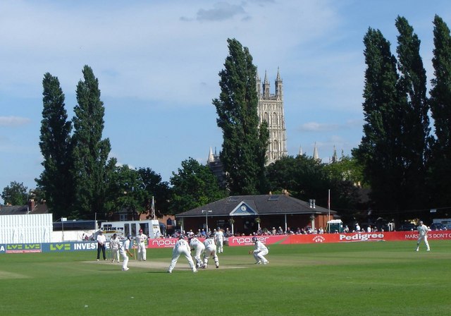
Archdeacon Meadow
Archdeacon Meadow is a cricket ground in Gloucester, England. The land is owned by The King's School. The ground was first used by the Gloucestershire...
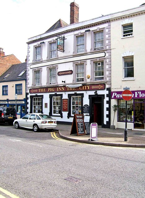
Lower George Hotel
The Lower George Hotel, now the Lower George Inn, is a grade II listed building at 121 Westgate Street, Gloucester.For some time the building was home...
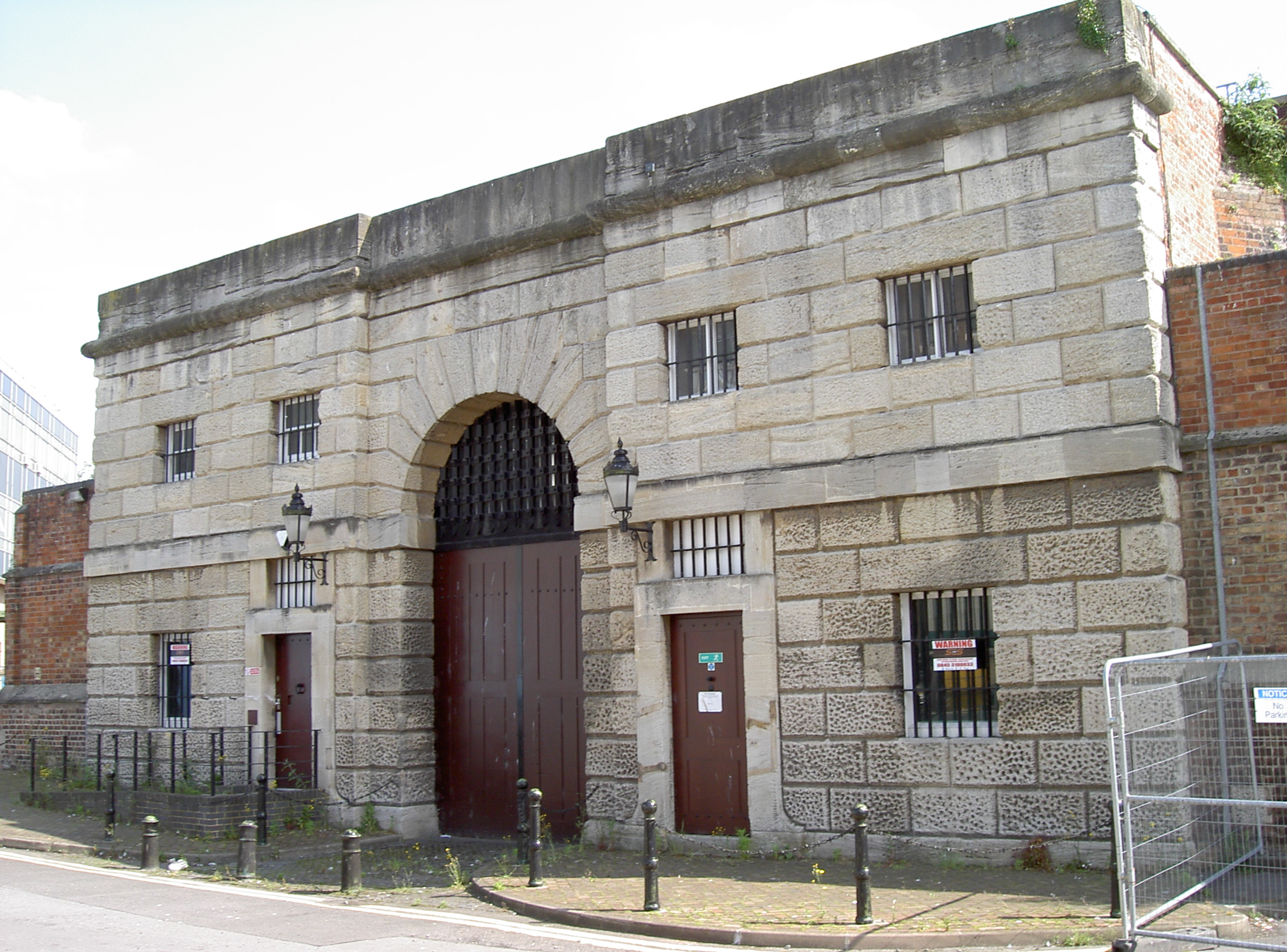
HM Prison Gloucester
HM Prison Gloucester was a Category B men's prison located in Gloucester, Gloucestershire, England. It was originally opened in 1792, on the site of Gloucester...
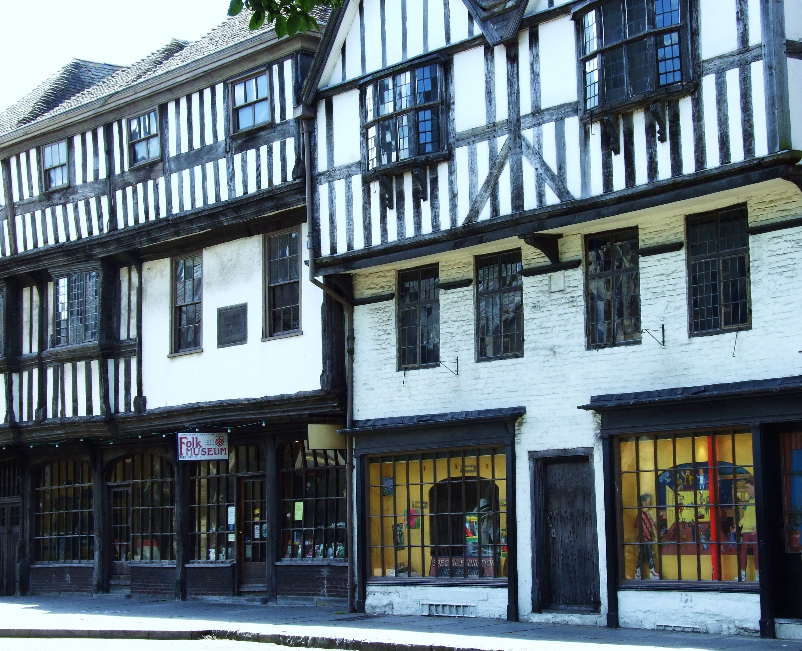
The Folk of Gloucester
The Folk of Gloucester is a museum which is housed in two of the oldest buildings in the City of Gloucester, a Tudor merchant's house and a 17th-century...
St Nicholas Church, Gloucester
St Nicholas Church is a historic church in Westgate Street in the city of Gloucester, England, under the care of The Churches Conservation Trust. It is...
Gloucester
Gloucester ( GLOST-ər) is a cathedral city and the county town of Gloucestershire in the South West of England. Gloucester lies on the River Severn, between...
Nearby Amenities
Located within 500m of 51.868533,-2.2598531Have you been to Alney Island?
Leave your review of Alney Island below (or comments, questions and feedback).