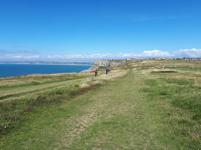
Tar Rocks

Island in Dorset

England

Tar Rocks
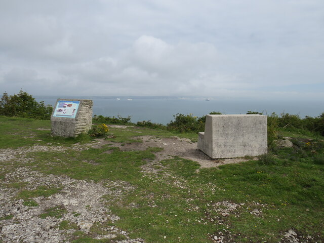
Viewpoint at East Weare, Isle of Portland A concrete bench and an information display at East Weare, overlooking Weymouth Bay.  Several cruise ships were moored in the bay, out of use due to the prevailing Covid-19 pandemic.
Viewpoint at East Weare, Isle of Portland Credit: Malc McDonald

The requested URL returned error: 429 Too Many Requests

If you have any feedback on the listing, please let us know in the comments section below.

Tar Rocks Images

Images are sourced within 2km of 50.550438/-2.4520735 or Grid Reference SY6872. Thanks to Geograph Open Source API. All images are credited.
Viewpoint at East Weare, Isle of Portland A concrete bench and an information display at East Weare, overlooking Weymouth Bay.  Several cruise ships were moored in the bay, out of use due to the prevailing Covid-19 pandemic.
Viewpoint at East Weare, Isle of Portland
A concrete bench and an information display at East Weare, overlooking Weymouth Bay. Several cruise ships were moored in the bay, out of use due to the prevailing Covid-19 pandemic.
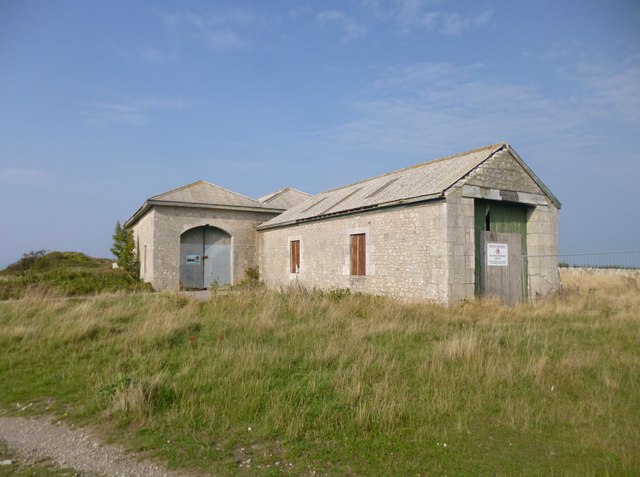
Old engine shed, Portland A former shed of the Portland quarry railways.
Old engine shed, Portland
A former shed of the Portland quarry railways.
Old engine shed, Portland A former shed of the Portland quarry railways.
Old engine shed, Portland
A former shed of the Portland quarry railways.
Grove Road, Portland A row of houses on Portland near to the Youth Offenders' Institute.
Grove Road, Portland
A row of houses on Portland near to the Youth Offenders' Institute.
Grove, engine shed Once housing locomotives from the Easton & Church Hope Railway, moving stone from Admiralty Quarries to the breakwater.
Grove, engine shed
Once housing locomotives from the Easton & Church Hope Railway, moving stone from Admiralty Quarries to the breakwater.
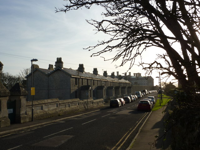
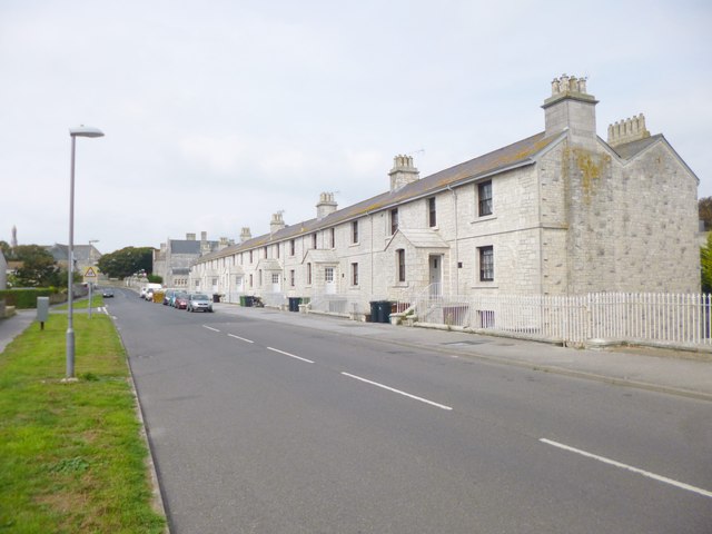
Grove, Alma Terrace On Grove Road, former prison warders' cottages for HMP Portland. Note the stone porches, common on Portland. The cottages are English Heritage-listed, and mid-Victorian: <span class="nowrap"><a title="http://www.imagesofengland.org.uk/Details/Default.aspx?id=381959&mode=adv" rel="nofollow ugc noopener" href="http://www.imagesofengland.org.uk/Details/Default.aspx?id=381959&mode=adv">Link</a><img style="margin-left:2px;" alt="External link" title="External link - shift click to open in new window" src="https://s1.geograph.org.uk/img/external.png" width="10" height="10"/></span>
Grove, Alma Terrace
On Grove Road, former prison warders' cottages for HMP Portland. Note the stone porches, common on Portland. The cottages are English Heritage-listed, and mid-Victorian: LinkExternal link
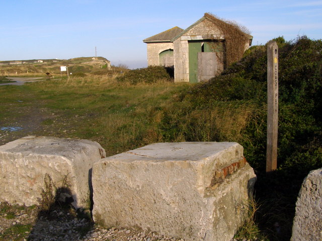
Stone blocks All around this part of Portland there are these new stone blocks alongside the tracks, presumably to keep vehicles on the road and off the grass.
Stone blocks
All around this part of Portland there are these new stone blocks alongside the tracks, presumably to keep vehicles on the road and off the grass.
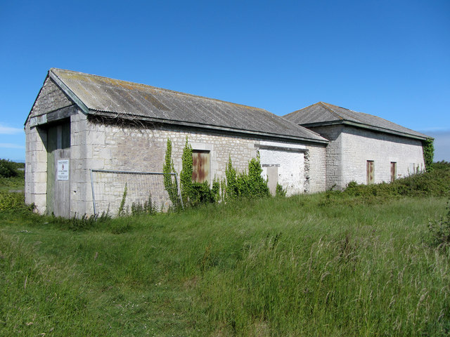
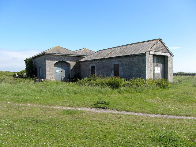
The Old Engine Shed These neglected buildings are the Old Engine Sheds for the cable-operated Admiralty Incline tramway that used to run down to the Navy Dockyard. The Grade II listed building has not been used since the 1920s. There is a proposal to convert the shed into a visitor centre with interpretive displays, a cafe and so on.
The Old Engine Shed
These neglected buildings are the Old Engine Sheds for the cable-operated Admiralty Incline tramway that used to run down to the Navy Dockyard. The Grade II listed building has not been used since the 1920s. There is a proposal to convert the shed into a visitor centre with interpretive displays, a cafe and so on.
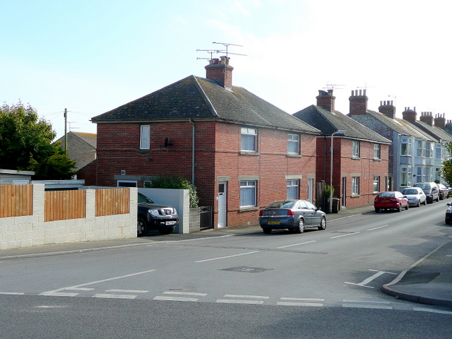
Victoria Road, Grove Housing presumably originally provided for prison staff.
Victoria Road, Grove
Housing presumably originally provided for prison staff.
Looking towards St George Reforne
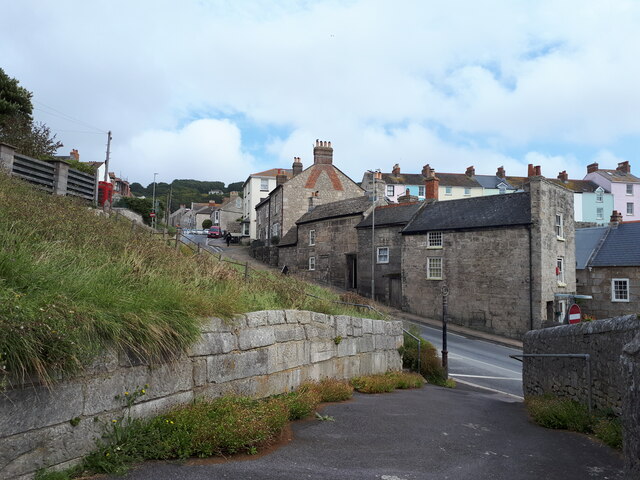
High Street, Fortuneswell
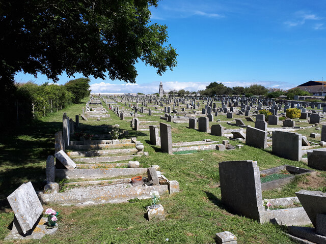
Graveyard of St George Reforne
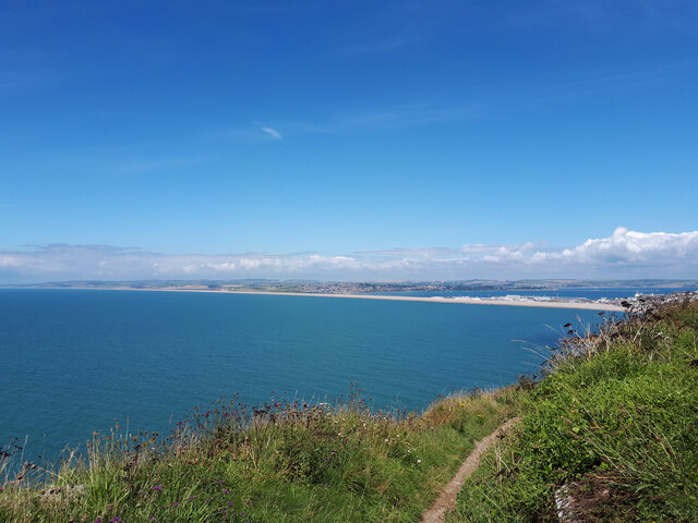
Chesil Beach from Blacknor Fort
Blacknor Fort The fortress was built in 1900-02 as a coastal defence overlooking Lyme Bay to defend Portland Harbour and the other naval institutions on the island. The fort was operational during both World Wars. <span class="nowrap"><a title="https://en.wikipedia.org/wiki/Blacknor_Fort" rel="nofollow ugc noopener" href="https://en.wikipedia.org/wiki/Blacknor_Fort">Link</a><img style="margin-left:2px;" alt="External link" title="External link - shift click to open in new window" src="https://s1.geograph.org.uk/img/external.png" width="10" height="10"/></span>
Blacknor Fort
The fortress was built in 1900-02 as a coastal defence overlooking Lyme Bay to defend Portland Harbour and the other naval institutions on the island. The fort was operational during both World Wars. LinkExternal link
Barleycrates Lane
Barleycrates Lane
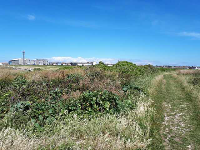
Portland Coastal Path heading towards Weston
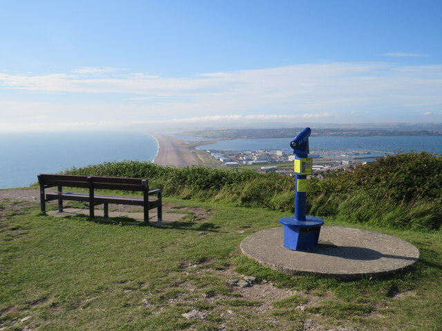
Viewpoint at Portland Heights, overlooking Weymouth A viewpoint at Portland Heights, with views over Weymouth and Chesil Beach.
Viewpoint at Portland Heights, overlooking Weymouth
A viewpoint at Portland Heights, with views over Weymouth and Chesil Beach.
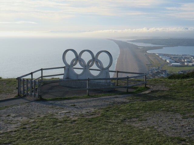
Olympic Rings overlooking Chesil Beach London was the host city for the 2012 Olympic and Paralympic Games.  However, not all of the events took place in London.  Sailing events were held in Weymouth.  The Olympic rings sculpture stood outside Weymouth railway station for the duration of the Olympic games.  It was then moved to the viewpoint at Portland Heights, to serve as a permanent reminder of Weymouth and Portland's contribution to the 2012 Olympic Games.  The viewpoint overlooks Chesil Beach.

More information about the sculpture can be found on The Encyclopaedia of Portland History website: <span class="nowrap"><a title="https://www.portlandhistory.co.uk/olympic-rings.html" rel="nofollow ugc noopener" href="https://www.portlandhistory.co.uk/olympic-rings.html">Link</a><img style="margin-left:2px;" alt="External link" title="External link - shift click to open in new window" src="https://s1.geograph.org.uk/img/external.png" width="10" height="10"/></span>
Olympic Rings overlooking Chesil Beach
London was the host city for the 2012 Olympic and Paralympic Games. However, not all of the events took place in London. Sailing events were held in Weymouth. The Olympic rings sculpture stood outside Weymouth railway station for the duration of the Olympic games. It was then moved to the viewpoint at Portland Heights, to serve as a permanent reminder of Weymouth and Portland's contribution to the 2012 Olympic Games. The viewpoint overlooks Chesil Beach. More information about the sculpture can be found on The Encyclopaedia of Portland History website: LinkExternal link
Show me another place!

Tar Rocks is located at Grid Ref: SY6872 (Lat: 50.550438, Lng: -2.4520735)

Unitary Authority: Dorset

Police Authority: Dorset

What 3 Words

///redeemed.fetches.typed. Near Fortuneswell, Dorset

Related Wikis

Tar Rocks

Tar Rocks are coastal rocks on the west side of the Isle of Portland, Dorset, England. The rocks become mostly covered at high tide. == See also == List...

Clay Ope

Clay Ope is on the west side of the Isle of Portland in Dorset, England. It forms part of the Jurassic Coast. The geology of the area includes Purbeck...

Hallelujah Bay

Hallelujah Bay is a bay located on the west side of the Isle of Portland, Dorset, England. The bay is situated below West Weares, with Clay Ope, Blacknor...

South Coast Steam

South Coast Steam Ltd is a United Kingdom based steam locomotive operating company, based on the Isle of Portland, Dorset. Owned by Barry Gambles and incorporated...

Nearby Amenities

Located within 500m of 50.550438,-2.4520735
Source: PGS
Lat/Long: 50.5547878/-2.4502727
Source: PGS
Lat/Long: 50.5538529/-2.4508691
Source: PGS
Lat/Long: 50.5536906/-2.4508748
Source: PGS
Lat/Long: 50.5532237/-2.4512314
Source: PGS
Lat/Long: 50.5526989/-2.4514108
Source: PGS
Lat/Long: 50.5524169/-2.451833
Source: PGS
Lat/Long: 50.5521021/-2.4522042
Source: PGS
Lat/Long: 50.5517584/-2.4524489
Source: PGS
Lat/Long: 50.5511731/-2.4525815
Source: PGS
Lat/Long: 50.5506152/-2.4522503
Source: PGS
Lat/Long: 50.5502154/-2.4518186
Source: PGS
Lat/Long: 50.5496782/-2.4516049
Source: PGS
Lat/Long: 50.5491393/-2.4519656
Source: PGS
Lat/Long: 50.548262/-2.4519754
Source: PGS
Lat/Long: 50.5469909/-2.4526686
Source: PGS
Lat/Long: 50.5466076/-2.4530162
Source: PGS
Lat/Long: 50.546258/-2.4535594
Source: PGS
Lat/Long: 50.5460963/-2.453696
Clay Ope
Place: locality
Wikidata: Q5129958
Wikipedia: en:Clay Ope
Lat/Long: 50.5476762/-2.4514053
Hallelujah Bay
Natural: bay
Wikidata: Q15222631
Wikipedia: en:Hallelujah Bay
Lat/Long: 50.5473511/-2.4523051
Information: board
Tourism: information
Lat/Long: 50.5518141/-2.4475927
Fixme: stone in circle of other stones?
Tourism: artwork
Lat/Long: 50.551275/-2.4474326
Description: Two wells
Tourism: attraction
Wheelchair: no
Lat/Long: 50.5532187/-2.4471751
Barrier: block
Lat/Long: 50.5478938/-2.4487389
Barrier: block
Lat/Long: 50.5478449/-2.4471049
Tourism: viewpoint
Lat/Long: 50.5515014/-2.4486084
Barrier: yes
Fixme: closure locatoin needs to be confirmed
Note: path closed northwards 5/6/23.
Lat/Long: 50.5516897/-2.4487945
Barrier: yes
Note: SWCP closed southwards 5/6/23.
Lat/Long: 50.5473337/-2.4501992
Parking
Lat/Long: 50.5504649/-2.4460401
The data included in this document is from www.openstreetmap.org. The data is made available under ODbL.

Have you been to Tar Rocks?

Leave your review of Tar Rocks below (or comments, questions and feedback).