Rèisa an t-Sruith

Island in Argyllshire

Scotland

Rèisa an t-Sruith

Tip of Coiresa Looking out towards Jura on the left and just visible behind and to the right Scarba.
Tip of Coiresa Credit: Steve Houldsworth

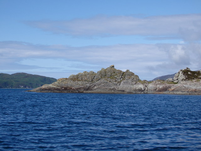
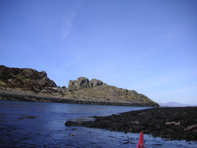
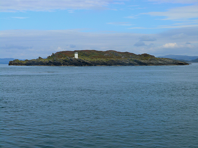
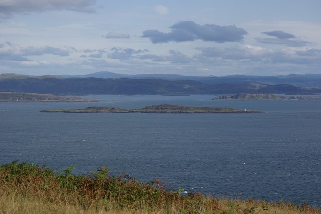
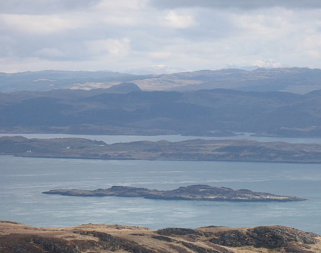
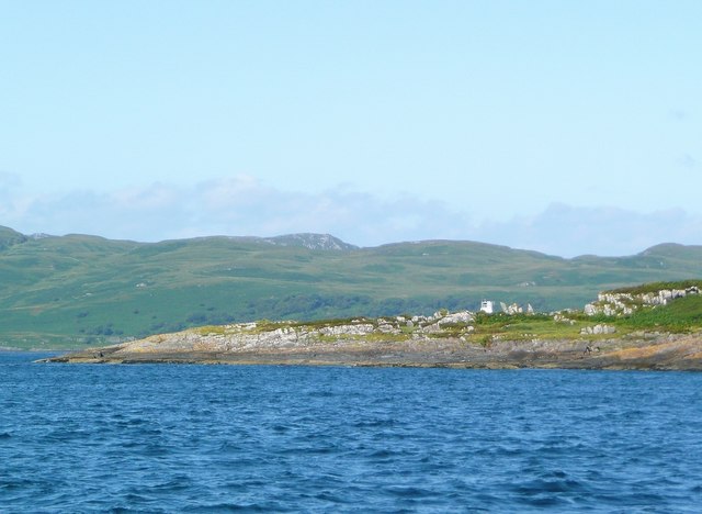
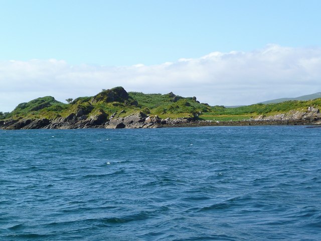
Rèisa an t-Sruith is a small island located in Argyllshire, Scotland. It is situated off the west coast of the mainland, in the Inner Hebrides. The island is known for its rugged and breathtaking natural beauty, with picturesque landscapes that attract visitors from all over the world.

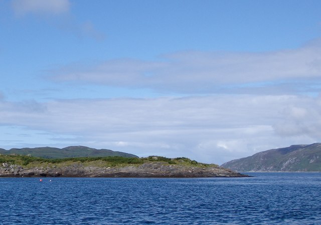
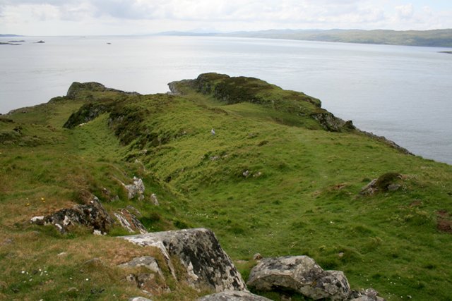
Covering an area of approximately 3 square kilometers, Rèisa an t-Sruith is mostly uninhabited, with only a handful of residents. The island is predominantly hilly, with its highest point reaching around 100 meters above sea level. These hills offer stunning panoramic views of the surrounding sea and neighboring islands.

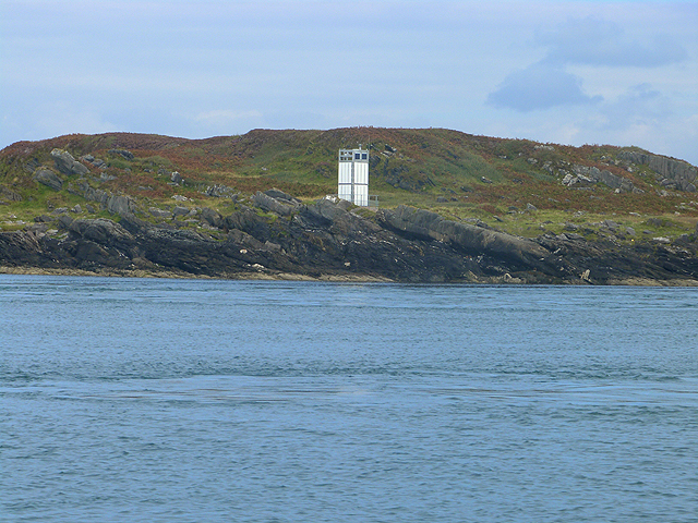
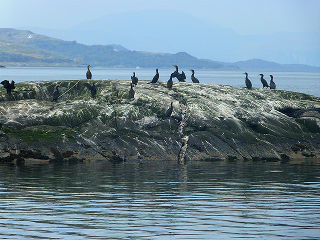
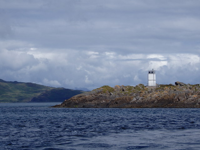
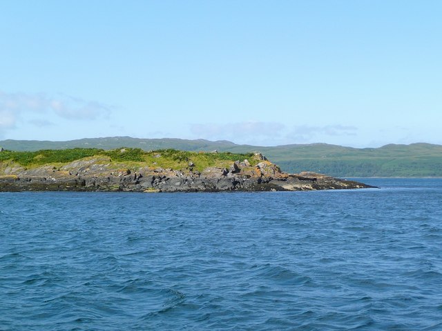
The island's coastline is characterized by rocky cliffs and pebble beaches, providing a haven for wildlife enthusiasts and nature lovers. Seals, dolphins, and various species of seabirds can often be spotted along the shores, making it a popular spot for birdwatching and marine wildlife observation.

Rèisa an t-Sruith is also home to a number of archaeological sites, including ancient stone circles and burial mounds, which offer a glimpse into the island's rich history. Visitors can explore these sites and learn about the island's past.

Access to Rèisa an t-Sruith is possible by boat, with regular ferry services operating from the nearby mainland. The island offers a tranquil and secluded retreat for those seeking a peaceful getaway amidst stunning natural surroundings.

If you have any feedback on the listing, please let us know in the comments section below.

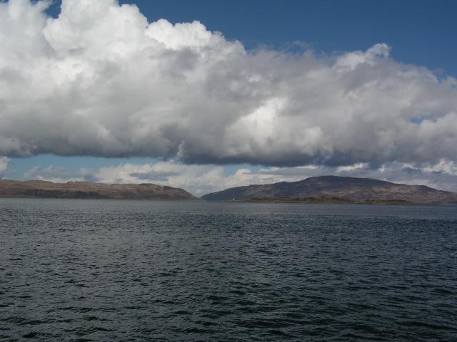
Rèisa an t-Sruith Images

Images are sourced within 2km of 56.132005/-5.64504 or Grid Reference NR7399. Thanks to Geograph Open Source API. All images are credited.

Tip of Coiresa Looking out towards Jura on the left and just visible behind and to the right Scarba.
Tip of Coiresa
Looking out towards Jura on the left and just visible behind and to the right Scarba.
Coiresa In front of the kayak is south point of Reisa Mhic Phaidean.
Coiresa
In front of the kayak is south point of Reisa Mhic Phaidean.
Rèisa an t-Struith Small island with navigation light in the mouth of Loch Craignish.
Rèisa an t-Struith
Small island with navigation light in the mouth of Loch Craignish.
Navigation light on Rèisa an t-Struith Small island in the mouth of Loch Craignish.
Navigation light on Rèisa an t-Struith
Small island in the mouth of Loch Craignish.
Sgeir na Maoile One of a cluster of four rocks which just project above high water mark in the mouth of Loch Craignish. Cormorants and shags in residence.
Sgeir na Maoile
One of a cluster of four rocks which just project above high water mark in the mouth of Loch Craignish. Cormorants and shags in residence.
Rèisa an t-Struith Looking across towards the Gulf of Corryvreckan with Jura visible to the left and Scarba on the right.
Rèisa an t-Struith
Looking across towards the Gulf of Corryvreckan with Jura visible to the left and Scarba on the right.
Rèisa an t-Struith Rèisa an t-Struith with the lighthouse on the headland and Jura visible to the left in the background.
Rèisa an t-Struith
Rèisa an t-Struith with the lighthouse on the headland and Jura visible to the left in the background.
Reisa an t-Sruith
Reisa an t-Sruith
Rubha na Traighe Rubha na Traighe is the rocky promontory jutting out into the Sound of Jura as seen from the highpoint in the square.
Rubha na Traighe
Rubha na Traighe is the rocky promontory jutting out into the Sound of Jura as seen from the highpoint in the square.
Reisa an t-Sruith from Jura The little outcrop of rock called Reisa an t-Sruith as seen from Jura. The Scottish mainland can be seen in the distance.
Reisa an t-Sruith from Jura
The little outcrop of rock called Reisa an t-Sruith as seen from Jura. The Scottish mainland can be seen in the distance.
Rèisa an t-Sruith Island in the middle of a tide race. Looks as if it is moving as the sea floods southwards.
Rèisa an t-Sruith
Island in the middle of a tide race. Looks as if it is moving as the sea floods southwards.
The northern tip of Reisa an t-Sruith The name translates as 'The tidal race island in the current'.  This is an small and fairly insignificant island, but take care when the tide is in full flood!
The northern tip of Reisa an t-Sruith
The name translates as 'The tidal race island in the current'. This is an small and fairly insignificant island, but take care when the tide is in full flood!
The southern tip of Reisa an t-'Sruith The light on the west side can just be seen.  The name translates as 'The tidal race island in the current'. This is a small and fairly insignificant island, but take care when the tide is in full flood!  The land in the background is the northern end of Jura, just before the Corryvreckan whirlpool.
The southern tip of Reisa an t-'Sruith
The light on the west side can just be seen. The name translates as 'The tidal race island in the current'. This is a small and fairly insignificant island, but take care when the tide is in full flood! The land in the background is the northern end of Jura, just before the Corryvreckan whirlpool.
Reisa an t-'Sruith The name translates as 'The tidal race island in the current'. This is an small and fairly insignificant island, but take care when the tide is in full flood!
Reisa an t-'Sruith
The name translates as 'The tidal race island in the current'. This is an small and fairly insignificant island, but take care when the tide is in full flood!
Show me another place!

Rèisa an t-Sruith is located at Grid Ref: NR7399 (Lat: 56.132005, Lng: -5.64504)

Unitary Authority: Argyll and Bute

Police Authority: Argyll and West Dunbartonshire

What 3 Words

///lunging.shock.quilting. Near Lochgilphead, Argyll & Bute

Related Wikis

Kinuachdrachd

Kinuachdrachd or Kinuachdrach is a place about 22 miles from Craighouse on the island of Jura, in the council area of Argyll and Bute, Scotland. It comprises...

Barnhill, Jura

Barnhill is a farmhouse in the north of the island of Jura in the Scottish Inner Hebrides overlooking the Sound of Jura. It stands on the site of a larger...

Craignish Castle

Craignish Castle is located on the Craignish peninsula in Argyll, western Scotland and is a category B listed building. The present castle includes a 16th...

Gulf of Corryvreckan

The Gulf of Corryvreckan (from the Gaelic Coire Bhreacain, meaning 'cauldron of the speckled seas' or 'cauldron of the plaid'), also called the Strait...

Nearby Amenities

Located within 500m of 56.132005,-5.64504
Seamark Light Character: Fl
Seamark Light Colour: white
Seamark Light Group: 2
Seamark Light Height: 12
Seamark Light Period: 12
Seamark Light Range: 7
Seamark Light Reference: A 4208
Seamark Light Sequence: 0.5+(1.5)+0.5+(9.5)
Seamark Type: light_minor
Source: US NGA Pub. 114. 2011-05-26.
Lat/Long: 56.12935/-5.6483667
The data included in this document is from www.openstreetmap.org. The data is made available under ODbL.

Have you been to Rèisa an t-Sruith?

Leave your review of Rèisa an t-Sruith below (or comments, questions and feedback).