Gillick Rock

Island in Cornwall

England

Gillick Rock

Beach Cafe at Godrevy Towans, near Hayle
Beach Cafe at Godrevy Towans, near Hayle Credit: Richard Rogerson

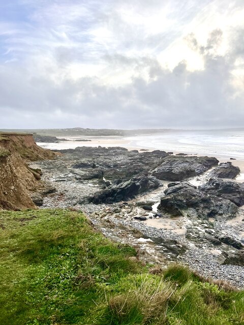
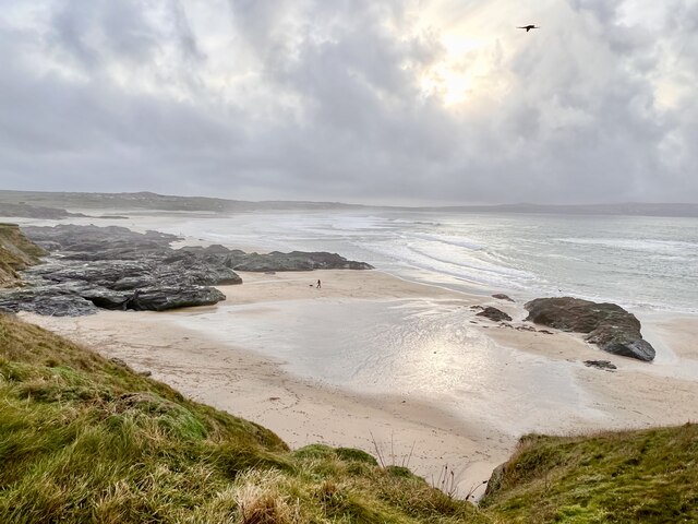
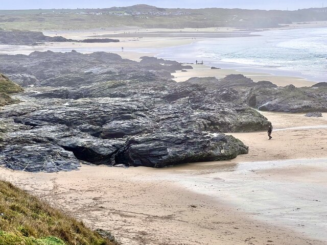
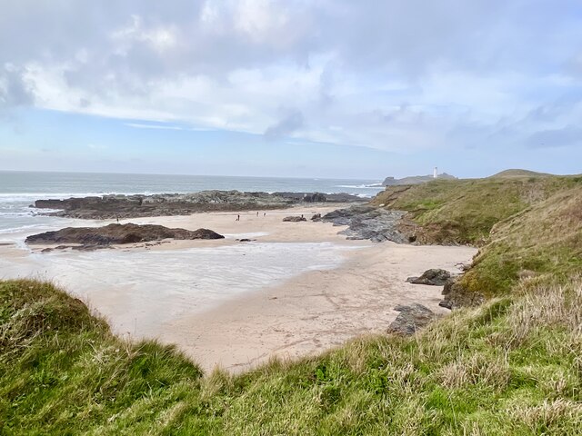
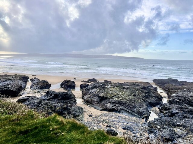
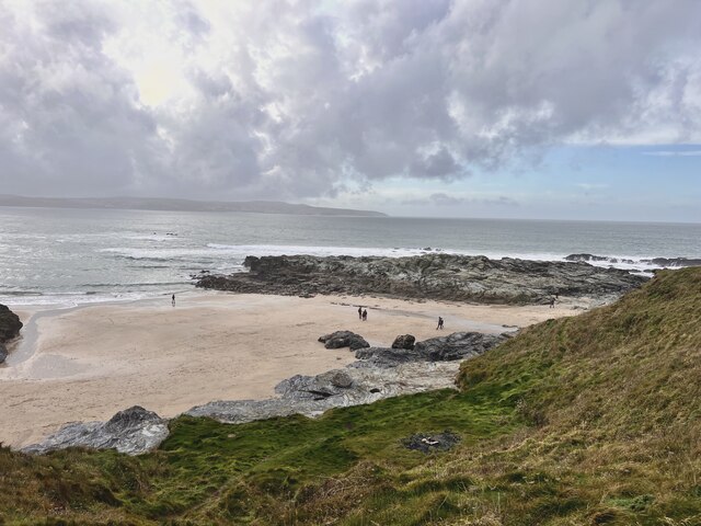
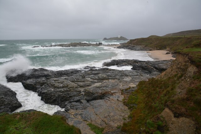
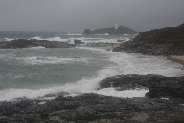
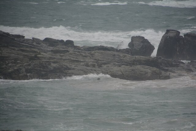
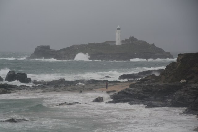
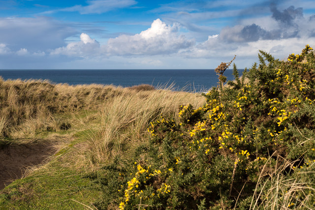
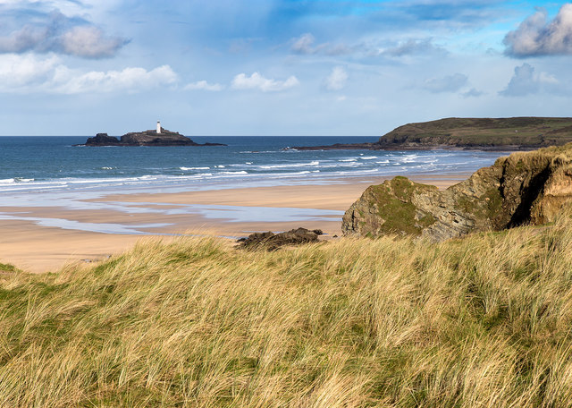
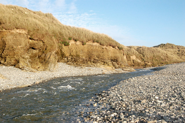
Gillick Rock is a small island located off the coast of Cornwall, England. It is a popular destination for tourists and locals alike, known for its stunning views and rugged coastline. The island is surrounded by clear blue waters, making it a great spot for swimming, snorkeling, and diving.

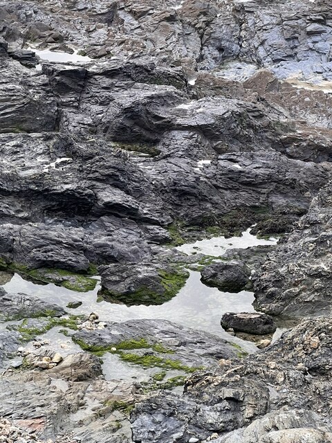
Gillick Rock is also home to a variety of wildlife, including seabirds and seals. The island's rocky terrain and cliffs provide a habitat for nesting birds, such as puffins and guillemots. Visitors can often spot these colorful creatures perched on the cliffs or flying overhead.

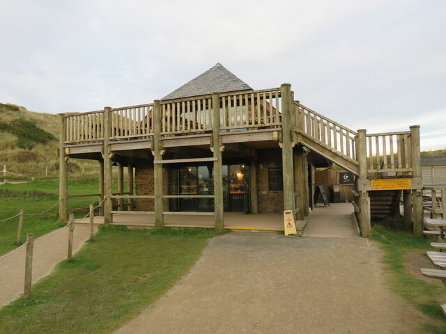
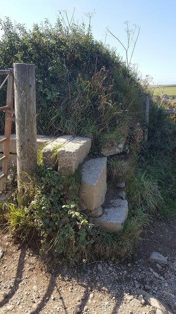
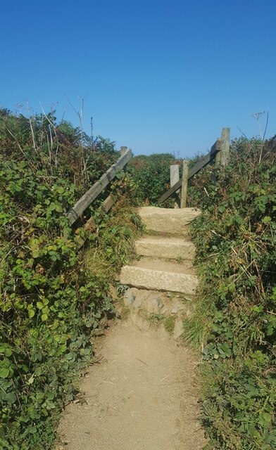
The island is accessible by boat or kayak, with many tour operators offering trips to Gillick Rock. Once on the island, visitors can explore its rocky shores, caves, and tidal pools. The clear waters around the island make it a popular spot for snorkeling and diving, with colorful marine life and underwater rock formations to discover.

Overall, Gillick Rock is a picturesque and peaceful destination for nature lovers and outdoor enthusiasts looking to explore the beauty of Cornwall's coastline.

If you have any feedback on the listing, please let us know in the comments section below.

Gillick Rock Images

Images are sourced within 2km of 50.226887/-5.3954481 or Grid Reference SW5741. Thanks to Geograph Open Source API. All images are credited.

Beach Cafe at Godrevy Towans, near Hayle
Godrevy Beach Beach and rocks on the foreshore at Godrevy.
Godrevy Beach
Beach and rocks on the foreshore at Godrevy.
Godrevy beach A small beach between the rocky foreshore.
Godrevy beach
A small beach between the rocky foreshore.
Foreshore Rocks Rocks on Godrevy beach, the height can be gauged by a walker on the sand.
Foreshore Rocks
Rocks on Godrevy beach, the height can be gauged by a walker on the sand.
Rock pool One of many  pools amongst the rocks.
Rock pool
One of many pools amongst the rocks.
Godrevy Beach A more northerly section of the beach at Godrevy.
Godrevy Beach
A more northerly section of the beach at Godrevy.
Rocks and Streams There are several streams running through the fissures in the rocks.
Rocks and Streams
There are several streams running through the fissures in the rocks.
Godrevy Beach The northern section of beach in this grid square. Several dog walkers are taking advantage of the relaxed rules regarding dogs on beaches during the winter months.
Godrevy Beach
The northern section of beach in this grid square. Several dog walkers are taking advantage of the relaxed rules regarding dogs on beaches during the winter months.
Stone Stile SW5942 On the Coast Path between Hell’s Mouth and Godrevy Point, overlooking Fishing Cove. 
Beside a galvanised steel farm gate.
Granite steps, turning through ninety degrees, with two granite steps on each side to a granite top step of two blocks at right angles.
Public footpath 203/1/4 gold CP from Hell’s Mouth to Godrevy Point
Stone Stile SW5942
On the Coast Path between Hell’s Mouth and Godrevy Point, overlooking Fishing Cove. Beside a galvanised steel farm gate. Granite steps, turning through ninety degrees, with two granite steps on each side to a granite top step of two blocks at right angles. Public footpath 203/1/4 gold CP from Hell’s Mouth to Godrevy Point
Stone Stile SW5943 On the Coast Path between Hell’s Mouth and Godrevy Point, to the north of Castle Giver Cove.
Granite steps. Two steps on south side and four steps on north side of a top step. Wooden handrails on both sides.
Public footpath 101/47/1, 101/32/1 gold CP from Hell’s Mouth to Godrevy Point.
Stone Stile SW5943
On the Coast Path between Hell’s Mouth and Godrevy Point, to the north of Castle Giver Cove. Granite steps. Two steps on south side and four steps on north side of a top step. Wooden handrails on both sides. Public footpath 101/47/1, 101/32/1 gold CP from Hell’s Mouth to Godrevy Point.
Gwithian : Godrevy Cove Looking across the coastline.
Gwithian : Godrevy Cove
Looking across the coastline.
Gwithian : Godrevy Cove A wet and rough day to be beside the sea.
Gwithian : Godrevy Cove
A wet and rough day to be beside the sea.
Gwithian : Godrevy Cove Looking towards a seal poking his head from the water.
Gwithian : Godrevy Cove
Looking towards a seal poking his head from the water.
Gwithian : Godrevy Cove Looking across Godrevy Cove with Godrevy Island and lighthouse in view.
Gwithian : Godrevy Cove
Looking across Godrevy Cove with Godrevy Island and lighthouse in view.
Gwithian : Road A small road and parking spaces alongside it.
Gwithian : Road
A small road and parking spaces alongside it.
Gwithian Wesleyan Methodist chapel
Gwithian Towans coastal dunes An expanse of sand dunes with grass and gorse vegetation. <span class="nowrap"><a title="http://www.gwithian.org.uk/environment.htm" rel="nofollow ugc noopener" href="http://www.gwithian.org.uk/environment.htm">Link</a><img style="margin-left:2px;" alt="External link" title="External link - shift click to open in new window" src="https://s1.geograph.org.uk/img/external.png" width="10" height="10"/></span>
Gwithian Towans coastal dunes
An expanse of sand dunes with grass and gorse vegetation. LinkExternal link
View towards Godrevy Island Looking north from the Gwithian Towans dunes, across the beach towards the lighthouse on Godrevy Island.
View towards Godrevy Island
Looking north from the Gwithian Towans dunes, across the beach towards the lighthouse on Godrevy Island.
Show me another place!

Gillick Rock is located at Grid Ref: SW5741 (Lat: 50.226887, Lng: -5.3954481)

Unitary Authority: Cornwall

Police Authority: Devon and Cornwall

What 3 Words

///breathed.coiling.plankton. Near Hayle, Cornwall

Related Wikis

St Gothian Sands

St Gothian Sands (grid reference SW585418) is a Local Nature Reserve near Gwithian, Cornwall. It was declared a Local Nature Reserve in 2005 by the Penwith...

Gwithian

Gwithian (Cornish: Godhyan) is a coastal village and former civil parish, now in the parish of Gwinear-Gwithian, in the Cornwall district, in west Cornwall...

Red River (Koner)

The Red River (Cornish: Dowr Koner) is a small river in north-west Cornwall, England, United Kingdom which issues into St Ives Bay at Godrevy on Cornwall...

St Gothian's Church, Gwithian

St Gothian's Church, Gwithian is a Grade II* listed parish church in the Church of England Diocese of Truro in Gwithian, Cornwall, England, UK. Nothing...

Nearby Amenities

Located within 500m of 50.226887,-5.3954481
Source: PGS
Lat/Long: 50.2291581/-5.3910658
Source: PGS
Lat/Long: 50.2254279/-5.3937873
Source: PGS
Lat/Long: 50.2246167/-5.3955626
Source: PGS
Lat/Long: 50.2242414/-5.3966542
Source: PGS
Lat/Long: 50.2235614/-5.3961799
Source: PGS
Lat/Long: 50.223117/-5.3965592
Source: PGS
Lat/Long: 50.2306279/-5.3928306
Cafe
The Jam Pot
Addr City: Hayle
Addr Country: GB
Addr Housenumber: 113
Addr Place: Gwithian
Addr Postcode: TR27 5BU
Addr Street: Gwithian Towans
Fhrs Id: 1152344
Lat/Long: 50.224252/-5.3925207
The data included in this document is from www.openstreetmap.org. The data is made available under ODbL.

Have you been to Gillick Rock?

Leave your review of Gillick Rock below (or comments, questions and feedback).