Peter's Point

Coastal Feature, Headland, Point in Cornwall

England

Peter's Point

Beach Cafe at Godrevy Towans, near Hayle
Beach Cafe at Godrevy Towans, near Hayle Credit: Richard Rogerson

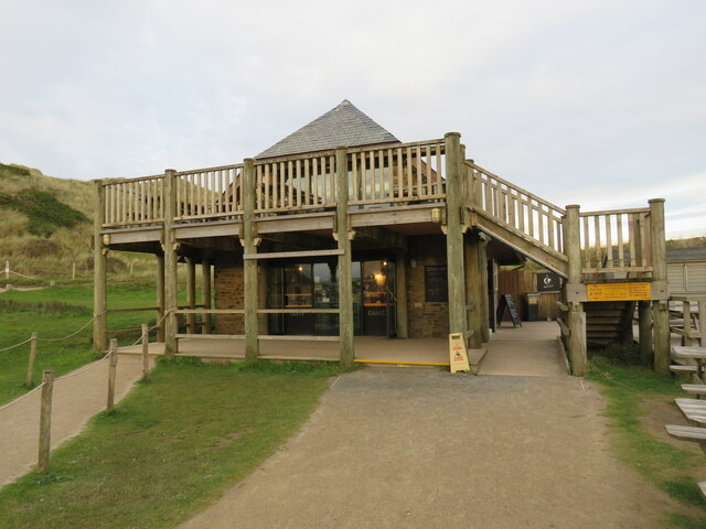
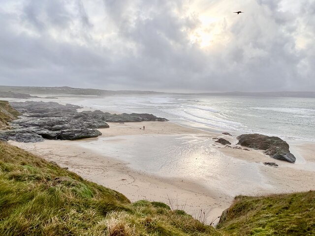
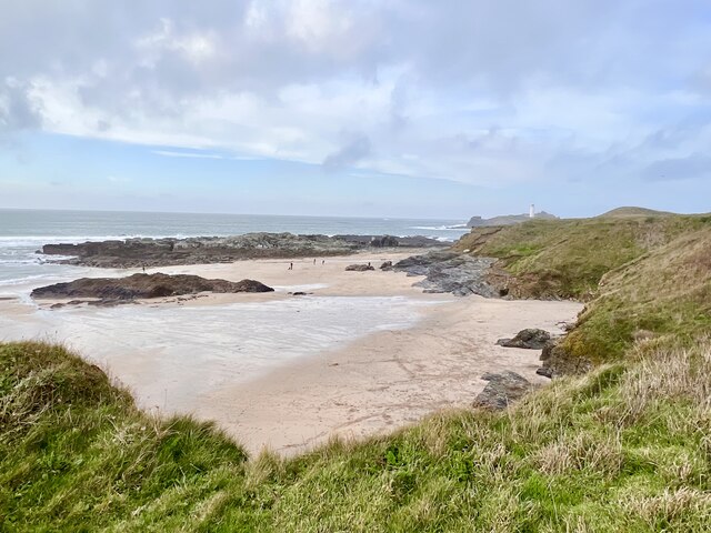
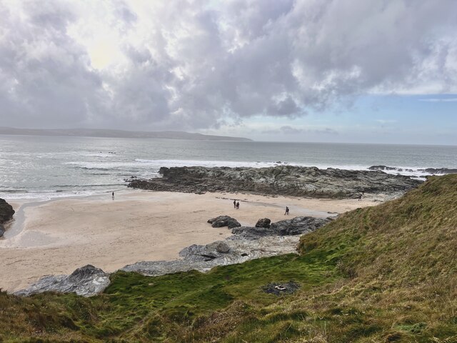
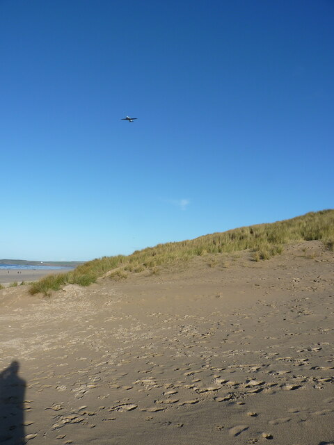
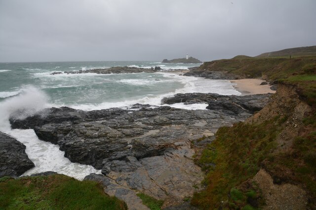
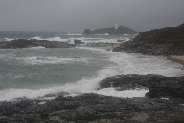
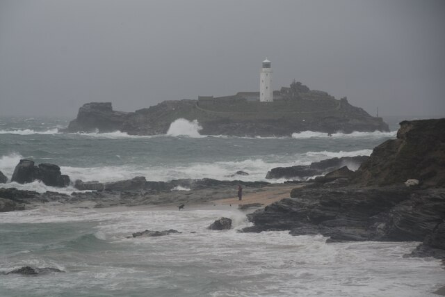
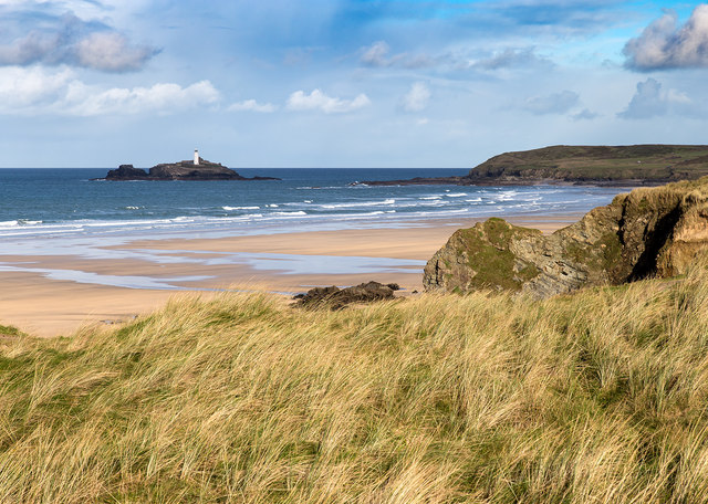
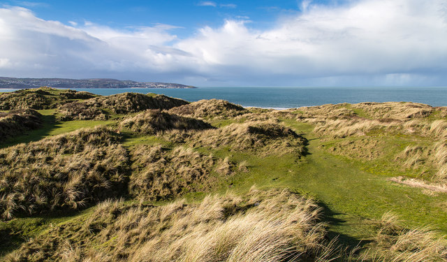
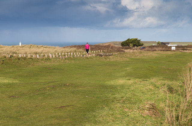
Peter's Point is a prominent headland located on the coast of Cornwall, England. Situated on the southwestern tip of the county, it offers breathtaking views of the Atlantic Ocean and is a popular destination for locals and tourists alike.

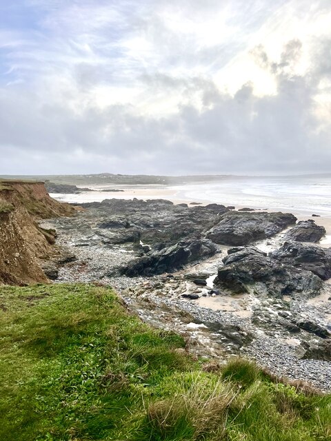
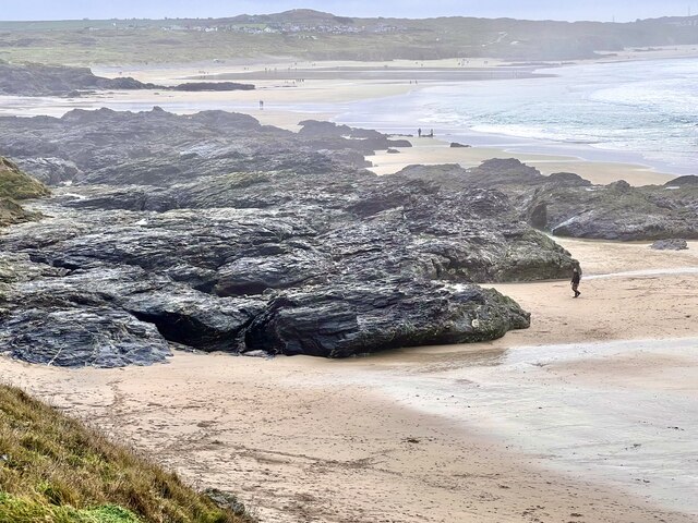
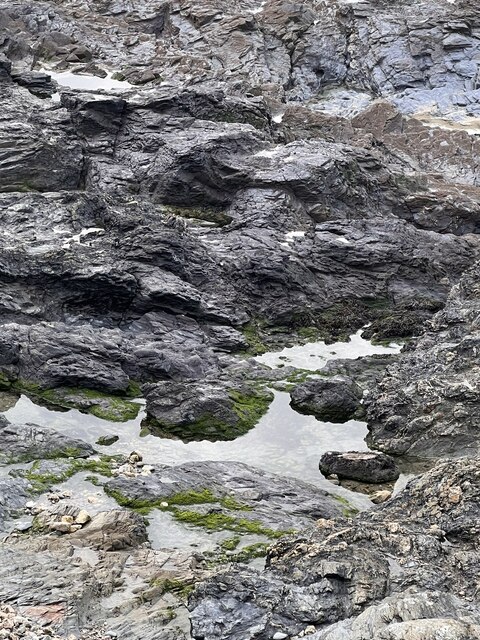
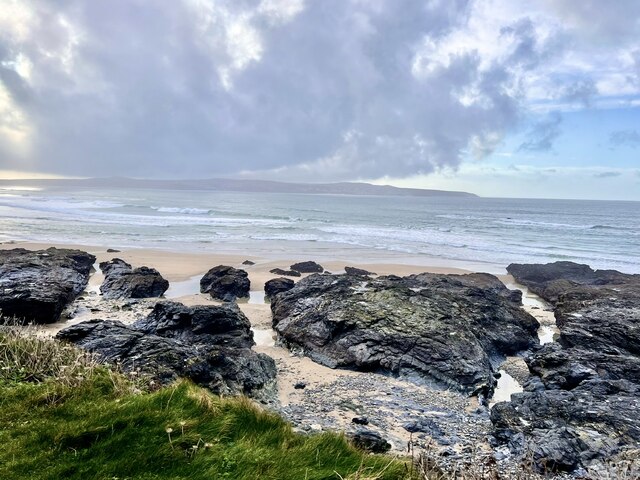
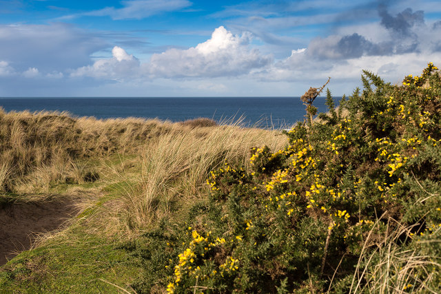
The headland is characterized by its rugged cliffs, which rise dramatically from the sea, and its rocky shoreline. These cliffs, composed mainly of sedimentary rocks, are a result of millions of years of geological processes, including erosion by the powerful waves and wind.

Peter's Point is known for its diverse marine life. The surrounding waters are home to a variety of species, including seals, dolphins, and seabirds. During certain times of the year, visitors have the opportunity to witness the migration of whales, making it a prime spot for wildlife enthusiasts.

The headland also boasts several walking trails that take visitors along the cliff tops, providing panoramic views of the coastline. These trails are well-maintained and offer opportunities for hikers to explore the area's natural beauty and observe the unique flora and fauna that thrive in this coastal environment.

In addition to its natural attractions, Peter's Point has historical significance. It is believed to have been a lookout point during ancient times, providing a vantage point for early settlers to monitor the sea for potential threats. Today, remnants of these ancient fortifications can still be seen on the headland.

Overall, Peter's Point is a captivating coastal feature that combines stunning natural scenery, diverse wildlife, and a rich history. Whether it is for a leisurely stroll, wildlife spotting, or simply enjoying the breathtaking views, this headland offers a captivating experience for visitors of all ages.

If you have any feedback on the listing, please let us know in the comments section below.

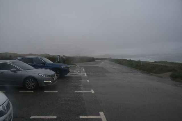
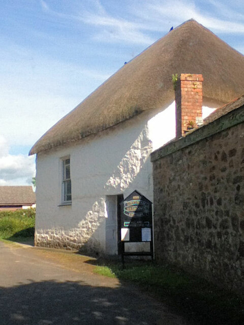
Peter's Point Images

Images are sourced within 2km of 50.220747/-5.397746 or Grid Reference SW5741. Thanks to Geograph Open Source API. All images are credited.

Beach Cafe at Godrevy Towans, near Hayle
Godrevy Beach Beach and rocks on the foreshore at Godrevy.
Godrevy Beach
Beach and rocks on the foreshore at Godrevy.
Godrevy beach A small beach between the rocky foreshore.
Godrevy beach
A small beach between the rocky foreshore.
Foreshore Rocks Rocks on Godrevy beach, the height can be gauged by a walker on the sand.
Foreshore Rocks
Rocks on Godrevy beach, the height can be gauged by a walker on the sand.
Rock pool One of many  pools amongst the rocks.
Rock pool
One of many pools amongst the rocks.
Godrevy Beach A more northerly section of the beach at Godrevy.
Godrevy Beach
A more northerly section of the beach at Godrevy.
Rocks and Streams There are several streams running through the fissures in the rocks.
Rocks and Streams
There are several streams running through the fissures in the rocks.
Godrevy Beach The northern section of beach in this grid square. Several dog walkers are taking advantage of the relaxed rules regarding dogs on beaches during the winter months.
Godrevy Beach
The northern section of beach in this grid square. Several dog walkers are taking advantage of the relaxed rules regarding dogs on beaches during the winter months.
Gravity Gradiometry survey aircraft A 1940s-era Dakota DC-3 aircraft, operated by a geological survey company, is here seen flying one of many passes across the beach near Phillack Towans. It was operating from a base at Southampton for several weeks in late 2021, surveying a large area of southern Cornwall for gravity anomalies, in the hope (expectation?) of finding commercially viable mineral deposits, such as lithium, as well as potential geothermal localities.
Gravity Gradiometry survey aircraft
A 1940s-era Dakota DC-3 aircraft, operated by a geological survey company, is here seen flying one of many passes across the beach near Phillack Towans. It was operating from a base at Southampton for several weeks in late 2021, surveying a large area of southern Cornwall for gravity anomalies, in the hope (expectation?) of finding commercially viable mineral deposits, such as lithium, as well as potential geothermal localities.
Gwithian : Godrevy Cove Looking across the coastline.
Gwithian : Godrevy Cove
Looking across the coastline.
Gwithian : Godrevy Cove A wet and rough day to be beside the sea.
Gwithian : Godrevy Cove
A wet and rough day to be beside the sea.
Gwithian : Godrevy Cove Looking across Godrevy Cove with Godrevy Island and lighthouse in view.
Gwithian : Godrevy Cove
Looking across Godrevy Cove with Godrevy Island and lighthouse in view.
Gwithian : Road A small road and parking spaces alongside it.
Gwithian : Road
A small road and parking spaces alongside it.
Gwithian Wesleyan Methodist chapel
Gwithian Towans coastal dunes An expanse of sand dunes with grass and gorse vegetation. <span class="nowrap"><a title="http://www.gwithian.org.uk/environment.htm" rel="nofollow ugc noopener" href="http://www.gwithian.org.uk/environment.htm">Link</a><img style="margin-left:2px;" alt="External link" title="External link - shift click to open in new window" src="https://s1.geograph.org.uk/img/external.png" width="10" height="10"/></span>
Gwithian Towans coastal dunes
An expanse of sand dunes with grass and gorse vegetation. LinkExternal link
View towards Godrevy Island Looking north from the Gwithian Towans dunes, across the beach towards the lighthouse on Godrevy Island.
View towards Godrevy Island
Looking north from the Gwithian Towans dunes, across the beach towards the lighthouse on Godrevy Island.
Gwithian Towans dune system View west towards St. Ives in the distance. <span class="nowrap"><a title="http://www.gwithian.org.uk/environment.htm" rel="nofollow ugc noopener" href="http://www.gwithian.org.uk/environment.htm">Link</a><img style="margin-left:2px;" alt="External link" title="External link - shift click to open in new window" src="https://s1.geograph.org.uk/img/external.png" width="10" height="10"/></span>
Gwithian Towans dune system
View west towards St. Ives in the distance. LinkExternal link
View north from the car park Looking north from the car park at Gwithian Towans.
View north from the car park
Looking north from the car park at Gwithian Towans.
Show me another place!

Peter's Point is located at Grid Ref: SW5741 (Lat: 50.220747, Lng: -5.397746)

Unitary Authority: Cornwall

Police Authority: Devon and Cornwall

What 3 Words

///canine.petulant.fabric. Near Hayle, Cornwall

Related Wikis

Gwithian

Gwithian (Cornish: Godhyan) is a coastal village and former civil parish, now in the parish of Gwinear-Gwithian, in the Cornwall district, in west Cornwall...

St Gothian's Church, Gwithian

St Gothian's Church, Gwithian is a Grade II* listed parish church in the Church of England Diocese of Truro in Gwithian, Cornwall, England, UK. Nothing...

St Gothian Sands

St Gothian Sands (grid reference SW585418) is a Local Nature Reserve near Gwithian, Cornwall. It was declared a Local Nature Reserve in 2005 by the Penwith...

Gwinear–Gwithian

Gwinear–Gwithian (Cornish: Sen Gwynnyer–Sen Goedhyan) is a coastal civil parish in west Cornwall, England, United Kingdom. It includes the villages of...

Nearby Amenities

Located within 500m of 50.220747,-5.397746
Source: PGS
Lat/Long: 50.2246167/-5.3955626
Source: PGS
Lat/Long: 50.2242414/-5.3966542
Source: PGS
Lat/Long: 50.2235614/-5.3961799
Source: PGS
Lat/Long: 50.223117/-5.3965592
Source: PGS
Lat/Long: 50.2222018/-5.3971398
Source: PGS
Lat/Long: 50.2208662/-5.3982302
Source: PGS
Lat/Long: 50.2206137/-5.3979419
Source: PGS
Lat/Long: 50.2204852/-5.3978549
Source: PGS
Lat/Long: 50.2202195/-5.3981213
Source: PGS
Lat/Long: 50.2199158/-5.3981501
Source: PGS
Lat/Long: 50.2182205/-5.3992709
Source: PGS
Lat/Long: 50.2178045/-5.3998229
Source: PGS
Lat/Long: 50.2168047/-5.4004426
Cafe
Sunset Surf café
Addr City: Hayle
Addr Country: GB
Addr Housenumber: 10
Addr Place: Gwithian
Addr Postcode: TR27 5BT
Addr Street: Gwithian Towans
Fhrs Id: 1034522
Phone: +44 1736 755 007
Website: https://www.sunset-surf.com/
Lat/Long: 50.2217328/-5.3945592
Sunset Surf Shop
Phone: +44 1736 752 575
Shop: outdoor
Lat/Long: 50.2217795/-5.3945487
Post Box
Collection Times: Mo-Fr 11:00; Sa 11:00
Operator: Royal Mail
Operator Wikidata: Q638098
Post Box Type: lamp
Ref: TR27 192
Royal Cypher: EIIR
Royal Cypher Wikidata: Q33102113
Source: survey
Survey Date: 2016-04-23
Lat/Long: 50.2218413/-5.3948544
WW2 Coastal Gun Battery
Building: bunker
Bunker Type: gun_emplacement
Military: bunker
Lat/Long: 50.2208731/-5.3967575
The data included in this document is from www.openstreetmap.org. The data is made available under ODbL.

Have you been to Peter's Point?

Leave your review of Peter's Point below (or comments, questions and feedback).