Rubha Gainmhich

Landscape Feature in Argyllshire

Scotland

Rubha Gainmhich

Allt a' Bheoil-àth Dheirg A burn dropping into Loch Bà.
Allt a' Bheoil-àth Dheirg Credit: Alan Reid

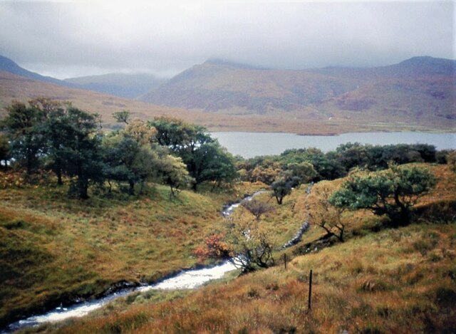
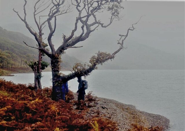
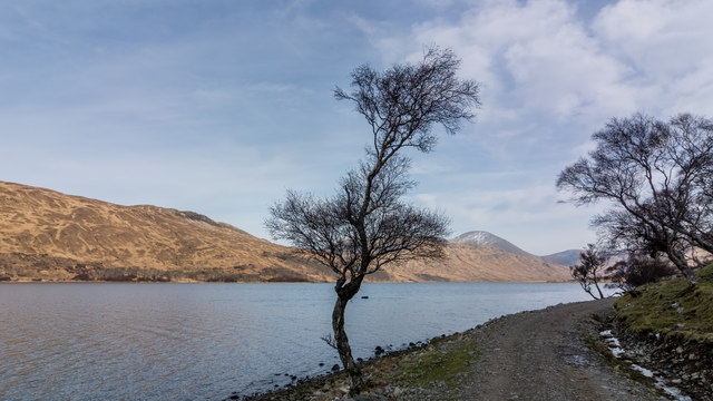
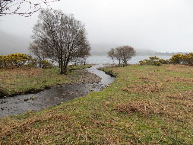
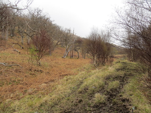
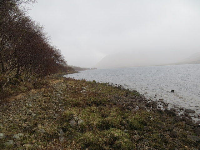
Rubha Gainmhich is a picturesque landscape feature located in Argyllshire, Scotland. Situated on the west coast of the country, it is known for its stunning natural beauty and rugged coastline. The area is characterized by rocky cliffs and pebble beaches, offering breathtaking views of the surrounding sea and nearby islands.

The prominent feature of Rubha Gainmhich is its lighthouse, which stands proudly on the edge of the peninsula. Originally built in 1857, the lighthouse serves as a navigational aid for ships passing through the treacherous waters of the Sound of Mull. It is an iconic landmark in the region and adds to the charm and allure of the area.

The landscape surrounding the lighthouse is rich in flora and fauna. The peninsula is covered in heather and grass, providing a habitat for various bird species, including seabirds and migratory birds. Visitors can often spot gannets, puffins, and guillemots nesting on the cliffs, creating a vibrant and lively atmosphere.

Rubha Gainmhich is a popular destination for nature lovers and outdoor enthusiasts. The rugged terrain and coastal walks offer opportunities for hiking and exploring. The jagged cliffs provide a sense of adventure, while the tranquil beaches invite visitors to relax and soak in the stunning surroundings.

Overall, Rubha Gainmhich is a must-visit location for those seeking natural beauty and tranquility in Argyllshire. Its unique landscape, diverse wildlife, and historical lighthouse make it a captivating destination for all who venture to this part of Scotland.

If you have any feedback on the listing, please let us know in the comments section below.

Rubha Gainmhich Images

Images are sourced within 2km of 56.465145/-5.9391123 or Grid Reference NM5737. Thanks to Geograph Open Source API. All images are credited.

Allt a' Bheoil-àth Dheirg A burn dropping into Loch Bà.
Allt a' Bheoil-àth Dheirg
A burn dropping into Loch Bà.
Allt a' Bheoil-àth Dheirg reaching Loch Ba
Doire Daraich by Loch Bà
Tree beside Loch Ba
Tree beside Loch Ba
Burn flowing into Loch Ba Bridge shown on the map does not exist
Burn flowing into Loch Ba
Bridge shown on the map does not exist
Rough track along the loch shore near Doire Daraich
Loch Ba shoreline at Doire Daraich
Estate road on south side of Loch Bà The estate road near to Sròn a' Chrann-Lithe heading west towards the small settlement of Knock.
Estate road on south side of Loch Bà
The estate road near to Sròn a' Chrann-Lithe heading west towards the small settlement of Knock.
Bay of Loch Bà The bay is a minor feature of the loch's south side. There's more of the loch in the distance beyond which rises Beinn na Duatharach.
Bay of Loch Bà
The bay is a minor feature of the loch's south side. There's more of the loch in the distance beyond which rises Beinn na Duatharach.
Flat, marshy ground on south side of Loch Bà Cruach Tòrr an Lochain is the hill seen centrally across the water.
Flat, marshy ground on south side of Loch Bà
Cruach Tòrr an Lochain is the hill seen centrally across the water.
Knockantivore Knockantivore is a small building on the Benmore estate used presumably as a fishing lodge located as it is, close to the shore of Loch Bà.
Knockantivore
Knockantivore is a small building on the Benmore estate used presumably as a fishing lodge located as it is, close to the shore of Loch Bà.
Birch woodland beside Loch Bà Small, well spaced birches through which passes the estate road following the south-west side of the Loch.
The hill seen above the trees is unnamed on OS maps but is known by some hill-goers as Beinn Coille na Sroine.
Birch woodland beside Loch Bà
Small, well spaced birches through which passes the estate road following the south-west side of the Loch. The hill seen above the trees is unnamed on OS maps but is known by some hill-goers as Beinn Coille na Sroine.
Birch trees beside stream The stream, unnamed on OS maps, descends to enter the southern end of Loch Bà.
Beinn na Duatharach is the distant hill.
Birch trees beside stream
The stream, unnamed on OS maps, descends to enter the southern end of Loch Bà. Beinn na Duatharach is the distant hill.
Mountain slope with birch trees The slope is descending towards Loch Ba, northwards, from Bìth-bheinn, a location on a ridge of the 704 m. peak, Cruachan Dearg.
The partly misted mountain beyond the higher tree is Beinn a' Ghràig; the lower hill to the right is unnamed on OS maps but is known by some hill-goers as Beinn Coille na Sroine.
Mountain slope with birch trees
The slope is descending towards Loch Ba, northwards, from Bìth-bheinn, a location on a ridge of the 704 m. peak, Cruachan Dearg. The partly misted mountain beyond the higher tree is Beinn a' Ghràig; the lower hill to the right is unnamed on OS maps but is known by some hill-goers as Beinn Coille na Sroine.
'Clachaig' A building, Clachaig, is marked on OS maps at all scales and named as such at 1:50 000 and 1:25 000 scales. At the 1:25 000 scale however, it's described as a ruin and the one in the image is certainly not ruinous; it must be either a replacement or a renovation and in use for 'sporting' purposes.
'Clachaig'
A building, Clachaig, is marked on OS maps at all scales and named as such at 1:50 000 and 1:25 000 scales. At the 1:25 000 scale however, it's described as a ruin and the one in the image is certainly not ruinous; it must be either a replacement or a renovation and in use for 'sporting' purposes.
Sròn a' Chrann-Lithe The natural shoreline of Loch Bà.
Sròn a' Chrann-Lithe
The natural shoreline of Loch Bà.
Road to Glen Cannel About to pass a fish farm on Loch Bà.
Road to Glen Cannel
About to pass a fish farm on Loch Bà.
Loch Bà A natural shoreline near Sròn a' Chrann-Lithe.
Loch Bà
A natural shoreline near Sròn a' Chrann-Lithe.
Show me another place!

Rubha Gainmhich is located at Grid Ref: NM5737 (Lat: 56.465145, Lng: -5.9391123)

Unitary Authority: Argyll and Bute

Police Authority: Argyll and West Dunbartonshire

What 3 Words

///bathtubs.neat.club. Near Salen, Argyll & Bute

Related Wikis

Loch Bà (Mull)

Loch Bà is a freshwater loch, about 5 km long, in the centre of the Isle of Mull, in Scotland. It is drained by the River Bà, flowing into Loch na Keal...

Isle of Mull

The Isle of Mull (Scottish Gaelic: An t-Eilean Muileach [əɲ ˈtʲʰelan ˈmuləx]) or just Mull (Scots pronunciation: [mʌl]; Scottish Gaelic: Muile [ˈmulə]...

Inner Hebrides

The Inner Hebrides ( HEB-rid-eez; Scottish Gaelic: na h-Eileanan a-staigh, lit. 'the Inner Isles') is an archipelago off the west coast of mainland Scotland...
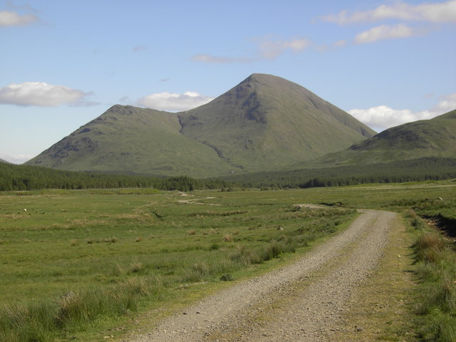
Beinn Talaidh

Beinn Talaidh (762 m) is a peak on the Isle of Mull, Scotland, located in the mountainous centre of the Island. The mountain is shaped like a symmetrical...

Have you been to Rubha Gainmhich?

Leave your review of Rubha Gainmhich below (or comments, questions and feedback).