Àrd Mòr

Landscape Feature in Argyllshire

Scotland

Àrd Mòr

Road, Glen Forsa Quite busy today with construction work and logging taking place.
Road, Glen Forsa Credit: Richard Webb

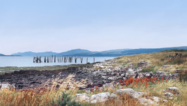
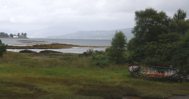
Àrd Mòr is a prominent landscape feature located in Argyllshire, Scotland. It is an elevated headland situated on the western coast of the region, overlooking the Atlantic Ocean. With its stunning cliffs and rugged terrain, Àrd Mòr offers breathtaking panoramic views of the surrounding landscape.

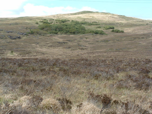
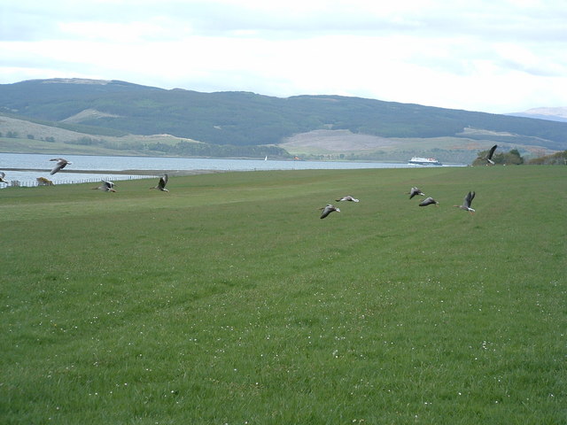
The headland itself is characterized by its towering cliffs, which reach heights of up to 100 meters (328 feet) above sea level. These cliffs are composed of ancient rock formations, displaying layers of sedimentary rock that have been shaped by years of erosion from the crashing waves below. The cliffs provide nesting sites for various seabirds, including guillemots and kittiwakes, adding to the area's natural beauty and biodiversity.

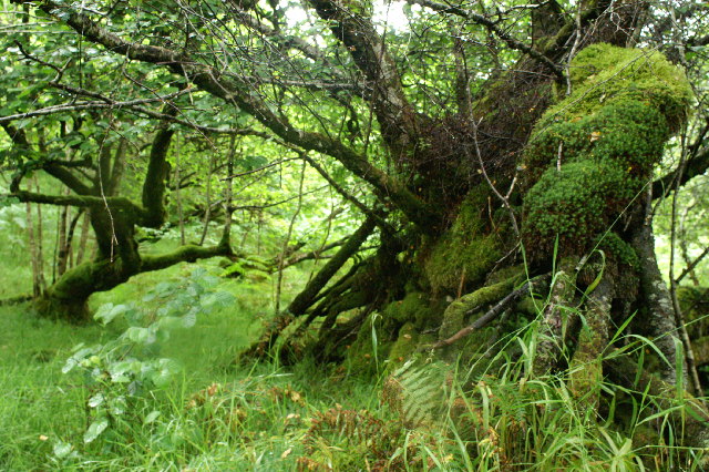
In addition to its dramatic cliffs, Àrd Mòr also boasts a diverse range of flora and fauna. The headland supports a variety of plant species that are well adapted to the harsh coastal conditions, including hardy grasses, heathers, and wildflowers. The surrounding waters are home to a rich marine ecosystem, with seals often spotted basking on the rocks and dolphins occasionally seen swimming offshore.

Due to its remote location and rugged terrain, Àrd Mòr is a popular destination for outdoor enthusiasts and nature lovers. Hiking trails traverse the headland, providing visitors with the opportunity to explore its stunning vistas and observe the local wildlife. The area is also a haven for birdwatchers, who flock to Àrd Mòr to catch a glimpse of the seabird colonies that inhabit the cliffs.

Overall, Àrd Mòr in Argyllshire is a captivating landscape feature, offering a unique blend of dramatic cliffs, diverse flora and fauna, and unparalleled coastal views.

If you have any feedback on the listing, please let us know in the comments section below.

Àrd Mòr Images

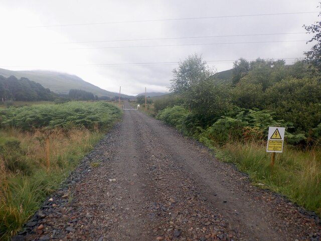
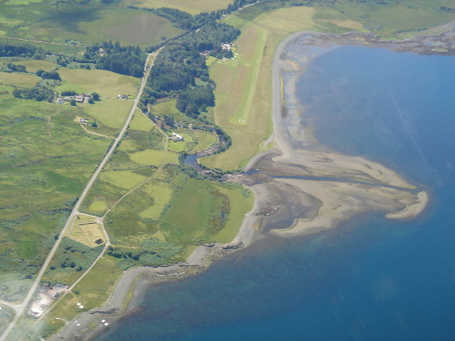
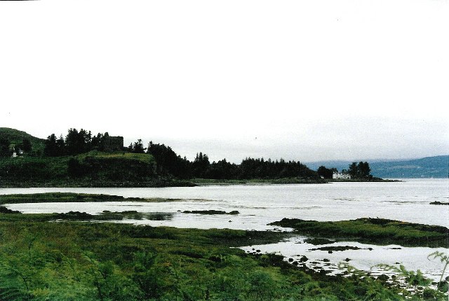
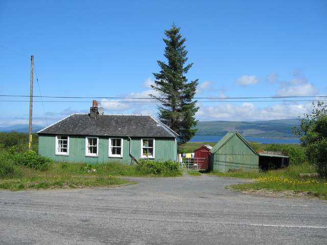
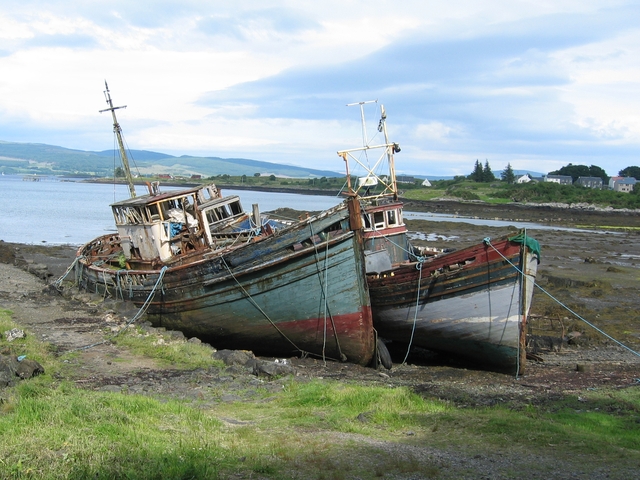
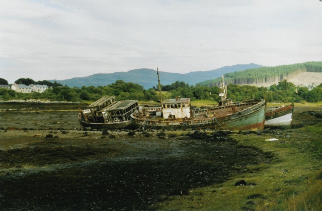
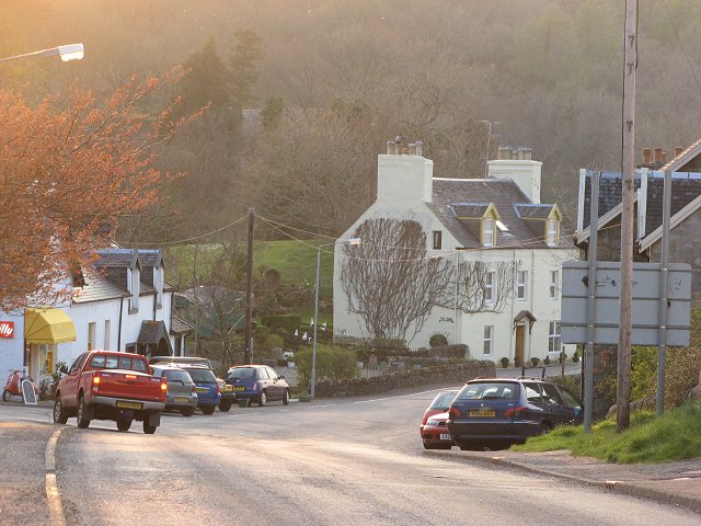
Images are sourced within 2km of 56.52055/-5.9373031 or Grid Reference NM5743. Thanks to Geograph Open Source API. All images are credited.

Road, Glen Forsa Quite busy today with construction work and logging taking place.
Road, Glen Forsa
Quite busy today with construction work and logging taking place.
Old Pier at Salen An old picture from the 1980s showing a few bits more structure than in more recent shots.
Old Pier at Salen
An old picture from the 1980s showing a few bits more structure than in more recent shots.
Girl Claire and Pavonia The fishing boats have been here since the 1970s.
Girl Claire and Pavonia
The fishing boats have been here since the 1970s.
The Salen Wrecks Compare with earlier versions to see the rate of deterioration!
The Salen Wrecks
Compare with earlier versions to see the rate of deterioration!
Glenforsa Airfield
Glenforsa Airfield
Aros Castle & the White House of Aros Seen from the roadside towards the southern edge of the square, these 2 landmarks mark the bottom of Glen Aros as it meets the Tobermory road.
Aros Castle & the White House of Aros
Seen from the roadside towards the southern edge of the square, these 2 landmarks mark the bottom of Glen Aros as it meets the Tobermory road.
Sound of Mull From Salen The area in the foreground floods on High water springs. The view is to the North west towards Tobermory up the Sound of Mull. On the left is Aros point. A yacht race is taking place out of Tobermory Harbour.
Sound of Mull From Salen
The area in the foreground floods on High water springs. The view is to the North west towards Tobermory up the Sound of Mull. On the left is Aros point. A yacht race is taking place out of Tobermory Harbour.
Trees in the wood above Salen
Dual carriageway The old road bridge on the left has been supplemented by the new bridge when the road was upgraded to 2 lane.
Dual carriageway
The old road bridge on the left has been supplemented by the new bridge when the road was upgraded to 2 lane.
Woodland on Braigh a' choire Mhor
Gooseflight 10 taking off from Glenforsa
Glenforsa Airfield View of the runway from the east end, the terminal"!" is centre screen. 
Note the dead sheep skulls on the fenceposts, presumably they bring good luck, to pilots but not sheep.
Glenforsa Airfield
View of the runway from the east end, the terminal"!" is centre screen. Note the dead sheep skulls on the fenceposts, presumably they bring good luck, to pilots but not sheep.
Hospital at Salen As far as I am aware, the building in the photo is the only NHS hospital for Mull, housing the casualty, out patients and x-ray departments for all of the island. It is also an old people's home.
Hospital at Salen
As far as I am aware, the building in the photo is the only NHS hospital for Mull, housing the casualty, out patients and x-ray departments for all of the island. It is also an old people's home.
Glenforsa airfield Flight control and the waiting room at the grass runway airfield.
Glenforsa airfield
Flight control and the waiting room at the grass runway airfield.
Old House near Salen
Boats at the old pier, Salen These three fishing boats have been tied up here at the disused pier to rot away. Odd how they look so attractive, when dumped cars and the like look so ugly.
Boats at the old pier, Salen
These three fishing boats have been tied up here at the disused pier to rot away. Odd how they look so attractive, when dumped cars and the like look so ugly.
Wrecks at Salen Familiar to any visitor who's travelled up or down this road, these have been here for years and are immortalised on a local postcard too (a better picture than mine!).
Wrecks at Salen
Familiar to any visitor who's travelled up or down this road, these have been here for years and are immortalised on a local postcard too (a better picture than mine!).
Salen The centre of the village, looking downhill to the junction with the Gruline road.
Salen
The centre of the village, looking downhill to the junction with the Gruline road.
Show me another place!

Àrd Mòr is located at Grid Ref: NM5743 (Lat: 56.52055, Lng: -5.9373031)

Unitary Authority: Argyll and Bute

Police Authority: Argyll and West Dunbartonshire

What 3 Words

///edicts.pipe.materials. Near Salen, Argyll & Bute

Related Wikis

Salen, Mull

Salen (Scottish Gaelic: An t-Sàilean) is a settlement on the Isle of Mull, Scotland. It is on the east coast of the island, on the Sound of Mull, approximately...

Great Mull Air Mystery

The Great Mull Air Mystery is the name given by the media to the disappearance of pilot Peter Gibbs on 24 December 1975 after he took an unscheduled solo...

Aros Castle

Aros Castle, also known as Dounarwyse Castle, is a ruined 13th-century castle near Salen on the Isle of Mull, Scotland. The castle overlooks the Sound...

SS Rondo

SS Rondo was a steam cargo ship. She was built by Tampa Shipbuilding & Drydock Company of Florida for the British government under the name War Wonder...

Nearby Amenities

Located within 500m of 56.52055,-5.9373031
Source: PGS
Lat/Long: 56.5211114/-5.9452427
Source: PGS
Lat/Long: 56.5214849/-5.942821
Source: PGS
Lat/Long: 56.5218081/-5.9427169
Source: PGS
Lat/Long: 56.5219302/-5.9430619
Source: PGS
Lat/Long: 56.5222785/-5.9431986
Source: PGS
Lat/Long: 56.5223898/-5.9424174
Source: PGS
Lat/Long: 56.5225801/-5.9423002
Source: PGS
Lat/Long: 56.5228171/-5.9419487
Source: PGS
Lat/Long: 56.5230343/-5.9412153
Source: PGS
Lat/Long: 56.5236458/-5.9413883
Source: PGS
Lat/Long: 56.5237861/-5.9407678
Source: PGS
Lat/Long: 56.5239544/-5.9407678
Source: PGS
Lat/Long: 56.5246333/-5.938764
Source: PGS
Lat/Long: 56.5243023/-5.9380316
Source: PGS
Lat/Long: 56.5244762/-5.937523
Source: PGS
Lat/Long: 56.5246501/-5.9371161
Source: PGS
Lat/Long: 56.5245491/-5.936516
Created By: dmgroom_coastlines
Source: PGS
Lat/Long: 56.524371/-5.936107
Source: PGS
Lat/Long: 56.5239712/-5.9357531
Source: PGS
Lat/Long: 56.5235168/-5.9356412
Source: PGS
Lat/Long: 56.522995/-5.9353259
Source: PGS
Lat/Long: 56.5227313/-5.9348275
Source: PGS
Lat/Long: 56.5224844/-5.9338815
Source: PGS
Lat/Long: 56.5220692/-5.9329559
Source: PGS
Lat/Long: 56.5218504/-5.9319082
Source: PGS
Lat/Long: 56.5219065/-5.9311555
Source: PGS
Lat/Long: 56.5218391/-5.9306022
Source: PGS
Lat/Long: 56.5216641/-5.9300732
Source: PGS
Lat/Long: 56.5213768/-5.9296175
Source: PGS
Lat/Long: 56.5200481/-5.9295831
Source: PGS
Lat/Long: 56.5197493/-5.93045
Police
Lat/Long: 56.5205061/-5.9445258
Post Box
Ref: PA72 152
Lat/Long: 56.5186989/-5.9434373
Community Centre
Salen Community Centre
Lat/Long: 56.5190075/-5.9430007
Generator Method: photovoltaic
Generator Output Electricity: yes
Generator Source: solar
Generator Type: solar_photovoltaic_panel
Power: generator
Lat/Long: 56.5244967/-5.9391683
Generator Method: photovoltaic
Generator Output Electricity: yes
Generator Source: solar
Generator Type: solar_photovoltaic_panel
Power: generator
Lat/Long: 56.5217299/-5.9413041
Generator Method: photovoltaic
Generator Output Electricity: yes
Generator Source: solar
Generator Type: solar_photovoltaic_panel
Power: generator
Lat/Long: 56.5204888/-5.940231
Power: pole
Lat/Long: 56.5179982/-5.9382042
Power: pole
Lat/Long: 56.5175197/-5.9383261
Power: pole
Lat/Long: 56.5167441/-5.9385385
Power: pole
Lat/Long: 56.5162467/-5.9349868
Generator Method: photovoltaic
Generator Output Electricity: yes
Generator Source: solar
Generator Type: solar_photovoltaic_panel
Power: generator
Lat/Long: 56.5240561/-5.9392986
Generator Method: photovoltaic
Generator Output Electricity: yes
Generator Source: solar
Generator Type: solar_photovoltaic_panel
Power: generator
Lat/Long: 56.5194688/-5.9431937
Leisure: picnic_table
Lat/Long: 56.520071/-5.9394953
Defibrillator
Defibrillator Location: Outside the school near the carpark
Emergency: defibrillator
Indoor: no
Lat/Long: 56.5189632/-5.9428375
The data included in this document is from www.openstreetmap.org. The data is made available under ODbL.

Have you been to Àrd Mòr?

Leave your review of Àrd Mòr below (or comments, questions and feedback).