Salen Bay

Bay in Argyllshire

Scotland

Salen Bay

Rocks and Seaweed at Aros The remains of Aros Castle are on the headland.
Wikipedia says this about it. "Aros Castle, also known as Dounarwyse Castle, is a ruined 13th-century castle near Salen on the Isle of Mull, Scotland. The castle overlooks the Sound of Mull. The castle was initially a stronghold of the Clan MacDougall."
Rocks and Seaweed at Aros Credit: Des Blenkinsopp

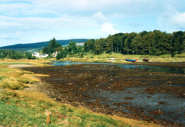
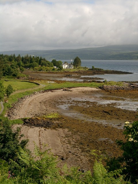
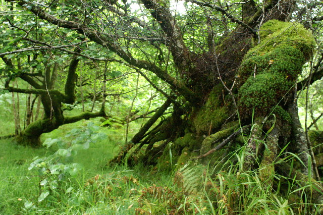
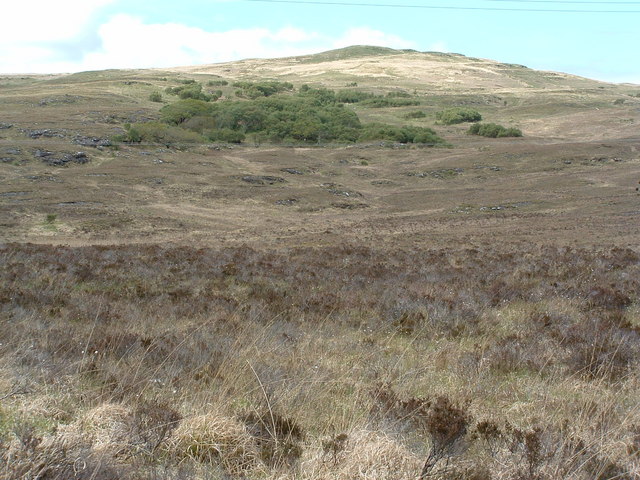
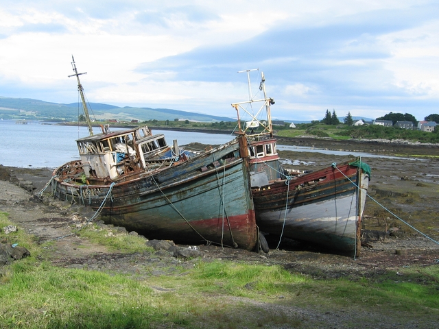
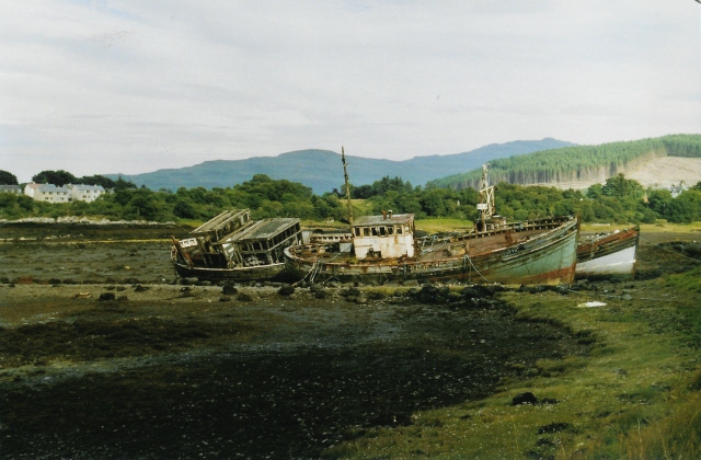
Salen Bay is a picturesque bay located in Argyllshire, Scotland. Situated on the eastern coast of the Ardnamurchan Peninsula, it is known for its stunning natural beauty and tranquil surroundings. The bay is surrounded by lush greenery and rolling hills, creating a peaceful and serene atmosphere for visitors to enjoy.

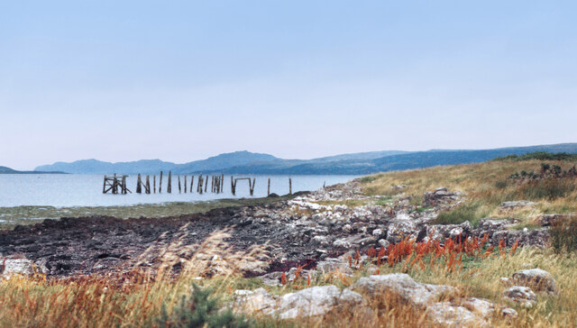
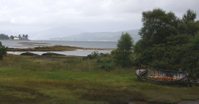
Salen Bay is a popular destination for those looking to explore the rugged coastline of Argyllshire. The bay offers a variety of outdoor activities, including hiking, bird watching, and fishing. Visitors can also take in the breathtaking views of the surrounding landscape, including the nearby islands of Mull and Coll.

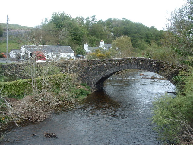
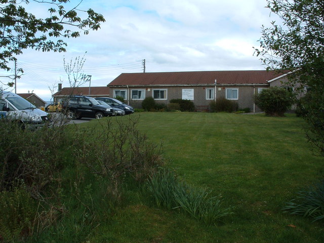
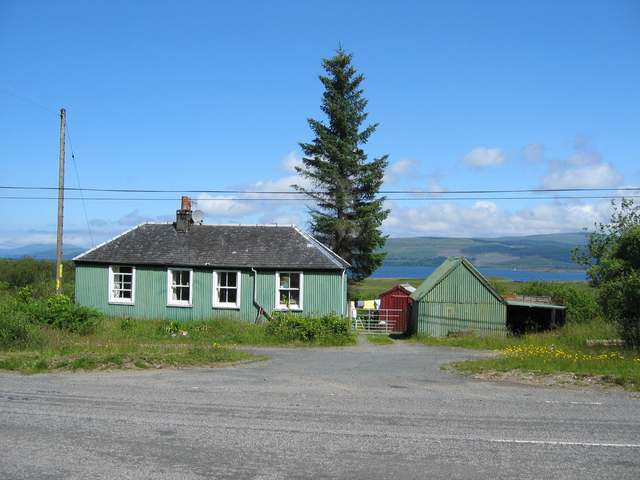
The bay is home to a small community of residents, who take pride in maintaining the area's natural beauty. There are a few local businesses and amenities in the area, including a charming pub and a small grocery store.

Overall, Salen Bay is a hidden gem in Argyllshire, offering visitors a peaceful retreat from the hustle and bustle of everyday life. Whether you are looking to relax on the beach, explore the surrounding countryside, or simply take in the stunning views, Salen Bay has something to offer everyone.

If you have any feedback on the listing, please let us know in the comments section below.
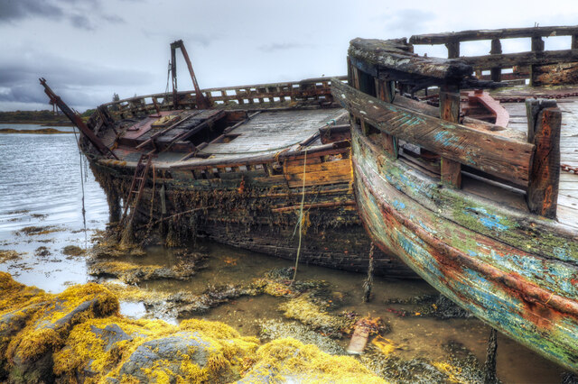
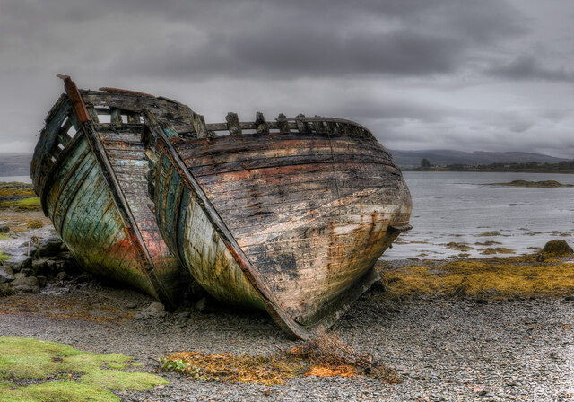
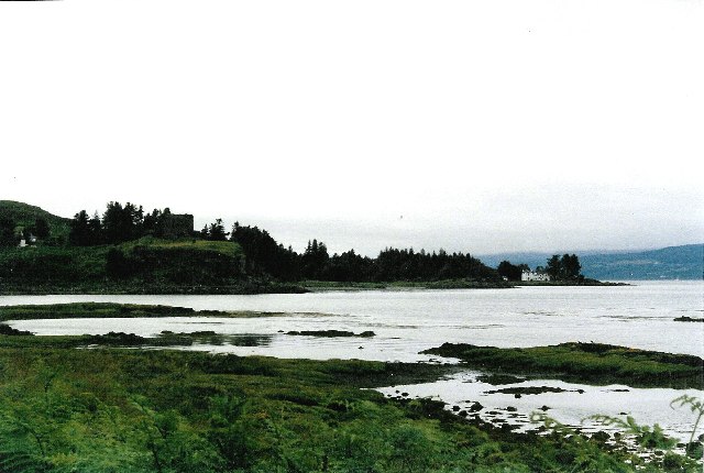
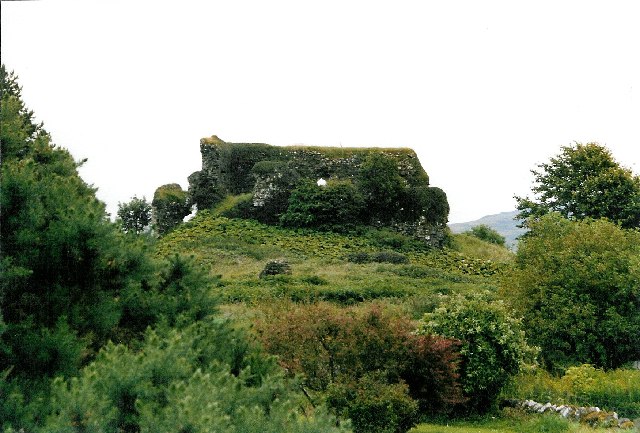
Salen Bay Images

Images are sourced within 2km of 56.522828/-5.9490904 or Grid Reference NM5743. Thanks to Geograph Open Source API. All images are credited.

Rocks and Seaweed at Aros The remains of Aros Castle are on the headland.
Wikipedia says this about it. "Aros Castle, also known as Dounarwyse Castle, is a ruined 13th-century castle near Salen on the Isle of Mull, Scotland. The castle overlooks the Sound of Mull. The castle was initially a stronghold of the Clan MacDougall."
Rocks and Seaweed at Aros
The remains of Aros Castle are on the headland. Wikipedia says this about it. "Aros Castle, also known as Dounarwyse Castle, is a ruined 13th-century castle near Salen on the Isle of Mull, Scotland. The castle overlooks the Sound of Mull. The castle was initially a stronghold of the Clan MacDougall."
Old Pier at Salen An old picture from the 1980s showing a few bits more structure than in more recent shots.
Old Pier at Salen
An old picture from the 1980s showing a few bits more structure than in more recent shots.
Aros Castle The ruin of Aros Castle seen across the inlet through which the Aros River reaches the Sound of Mull.
Aros Castle
The ruin of Aros Castle seen across the inlet through which the Aros River reaches the Sound of Mull.
Low Tide at Aros The short estuary of the Aros River.
From a print.
Low Tide at Aros
The short estuary of the Aros River. From a print.
Girl Claire and Pavonia The fishing boats have been here since the 1970s.
Girl Claire and Pavonia
The fishing boats have been here since the 1970s.
The Salen Wrecks Compare with earlier versions to see the rate of deterioration!
The Salen Wrecks
Compare with earlier versions to see the rate of deterioration!
Aros Castle & the White House of Aros Seen from the roadside towards the southern edge of the square, these 2 landmarks mark the bottom of Glen Aros as it meets the Tobermory road.
Aros Castle & the White House of Aros
Seen from the roadside towards the southern edge of the square, these 2 landmarks mark the bottom of Glen Aros as it meets the Tobermory road.
Aros Castle The castle seen from behind, on the small road through Aros Mains.  Picture taken at the southern edge of the square, looking south-east.
Aros Castle
The castle seen from behind, on the small road through Aros Mains. Picture taken at the southern edge of the square, looking south-east.
The White House of Aros On Mull's east coast, taken from the ruined Aros Castle just outside the square.
The White House of Aros
On Mull's east coast, taken from the ruined Aros Castle just outside the square.
Sound of Mull From Salen The area in the foreground floods on High water springs. The view is to the North west towards Tobermory up the Sound of Mull. On the left is Aros point. A yacht race is taking place out of Tobermory Harbour.
Sound of Mull From Salen
The area in the foreground floods on High water springs. The view is to the North west towards Tobermory up the Sound of Mull. On the left is Aros point. A yacht race is taking place out of Tobermory Harbour.
Trees in the wood above Salen
Old bridge at Aros As seen from new bridge
Old bridge at Aros
As seen from new bridge
Woodland on Braigh a' choire Mhor
Hospital at Salen As far as I am aware, the building in the photo is the only NHS hospital for Mull, housing the casualty, out patients and x-ray departments for all of the island. It is also an old people's home.
Hospital at Salen
As far as I am aware, the building in the photo is the only NHS hospital for Mull, housing the casualty, out patients and x-ray departments for all of the island. It is also an old people's home.
The new bridge at Aros As seen from the old bridge
The new bridge at Aros
As seen from the old bridge
Old House near Salen
Boats at the old pier, Salen These three fishing boats have been tied up here at the disused pier to rot away. Odd how they look so attractive, when dumped cars and the like look so ugly.
Boats at the old pier, Salen
These three fishing boats have been tied up here at the disused pier to rot away. Odd how they look so attractive, when dumped cars and the like look so ugly.
Wrecks at Salen Familiar to any visitor who's travelled up or down this road, these have been here for years and are immortalised on a local postcard too (a better picture than mine!).
Wrecks at Salen
Familiar to any visitor who's travelled up or down this road, these have been here for years and are immortalised on a local postcard too (a better picture than mine!).
Show me another place!

Salen Bay is located at Grid Ref: NM5743 (Lat: 56.522828, Lng: -5.9490904)

Unitary Authority: Argyll and Bute

Police Authority: Argyll and West Dunbartonshire

What 3 Words

///fabric.amended.graphic. Near Salen, Argyll & Bute

Related Wikis

Salen, Mull

Salen (Scottish Gaelic: An t-Sàilean) is a settlement on the Isle of Mull, Scotland. It is on the east coast of the island, on the Sound of Mull, approximately...
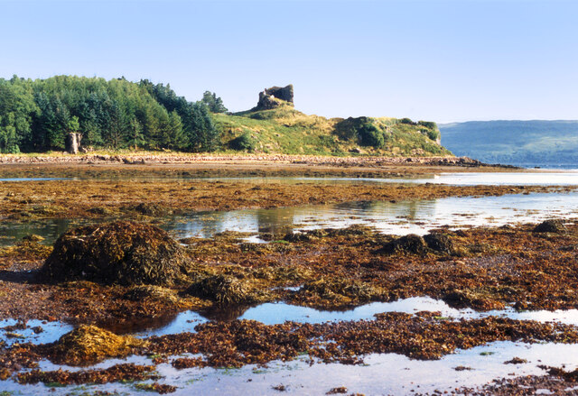
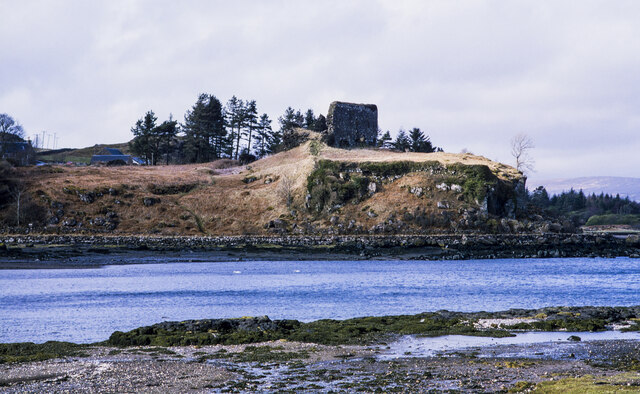
Aros Castle

Aros Castle, also known as Dounarwyse Castle, is a ruined 13th-century castle near Salen on the Isle of Mull, Scotland. The castle overlooks the Sound...

Great Mull Air Mystery

The Great Mull Air Mystery is the name given by the media to the disappearance of pilot Peter Gibbs on 24 December 1975 after he took an unscheduled solo...

SS Rondo

SS Rondo was a steam cargo ship. She was built by Tampa Shipbuilding & Drydock Company of Florida for the British government under the name War Wonder...

Nearby Amenities

Located within 500m of 56.522828,-5.9490904
Source: PGS
Lat/Long: 56.5228155/-5.9565681
Source: PGS
Lat/Long: 56.5227322/-5.9561671
Source: PGS
Lat/Long: 56.522557/-5.9558859
Source: PGS
Lat/Long: 56.5223013/-5.955839
Created By: dmgroom_coastlines
Source: PGS
Lat/Long: 56.522114/-5.955629
Source: PGS
Lat/Long: 56.521856/-5.9552245
Source: PGS
Lat/Long: 56.5216894/-5.9548339
Source: PGS
Lat/Long: 56.5214939/-5.9546174
Source: PGS
Lat/Long: 56.5210756/-5.9541466
Source: PGS
Lat/Long: 56.5204597/-5.9536758
Source: PGS
Lat/Long: 56.5203011/-5.9534466
Leisure: slipway
Source: PGS
Lat/Long: 56.5201959/-5.9531651
Source: PGS
Lat/Long: 56.5195326/-5.9524261
Source: PGS
Lat/Long: 56.5194835/-5.9514216
Source: PGS
Lat/Long: 56.5200552/-5.9493017
Source: PGS
Lat/Long: 56.5202137/-5.9493179
Source: PGS
Lat/Long: 56.5202411/-5.948364
Source: PGS
Lat/Long: 56.5208565/-5.9483284
Source: PGS
Lat/Long: 56.52072/-5.9475798
Source: PGS
Lat/Long: 56.5209247/-5.9462713
Source: PGS
Lat/Long: 56.5211114/-5.9452427
Source: PGS
Lat/Long: 56.5214849/-5.942821
Source: PGS
Lat/Long: 56.5218081/-5.9427169
Source: PGS
Lat/Long: 56.5219302/-5.9430619
Source: PGS
Lat/Long: 56.5222785/-5.9431986
Source: PGS
Lat/Long: 56.5223898/-5.9424174
Source: PGS
Lat/Long: 56.5225801/-5.9423002
Source: PGS
Lat/Long: 56.5228171/-5.9419487
Source: PGS
Lat/Long: 56.5230343/-5.9412153
Source: PGS
Lat/Long: 56.5236458/-5.9413883
Police
Lat/Long: 56.5205061/-5.9445258
Boat wrecks
Historic: wreck
Seamark Type: wreck
Lat/Long: 56.5201927/-5.9531263
Generator Method: photovoltaic
Generator Output Electricity: yes
Generator Source: solar
Generator Type: solar_photovoltaic_panel
Power: generator
Lat/Long: 56.5217299/-5.9413041
The data included in this document is from www.openstreetmap.org. The data is made available under ODbL.

Have you been to Salen Bay?

Leave your review of Salen Bay below (or comments, questions and feedback).