Magow Rocks

Island in Cornwall

England

Magow Rocks

Beach Cafe at Godrevy Towans, near Hayle
Beach Cafe at Godrevy Towans, near Hayle Credit: Richard Rogerson

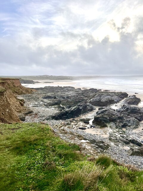
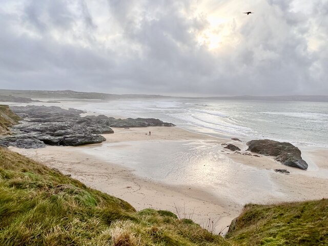
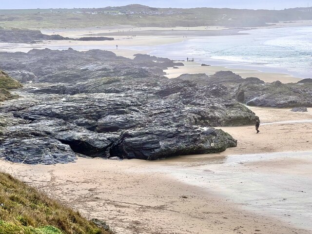
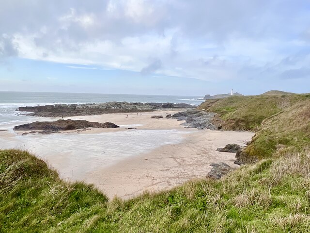
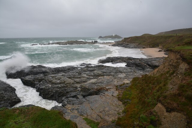
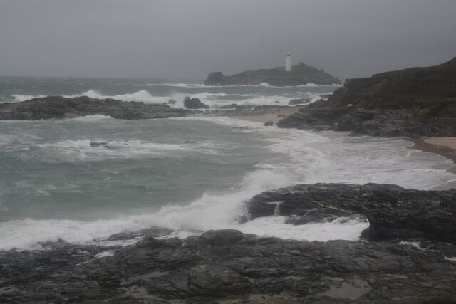
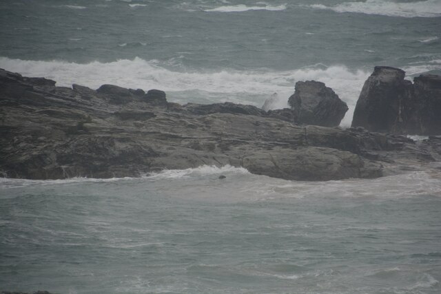
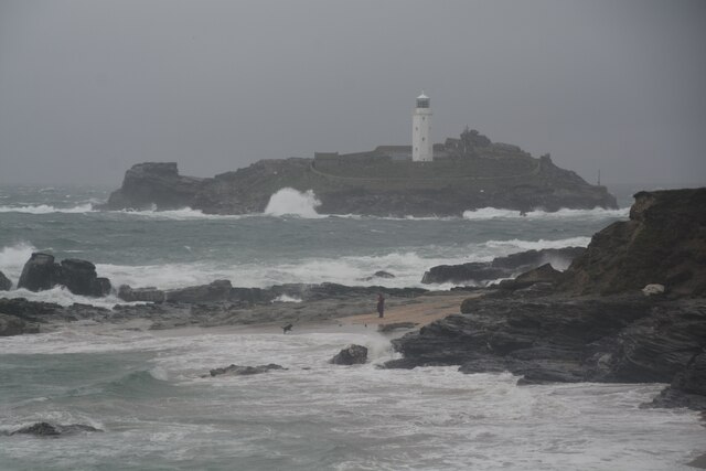
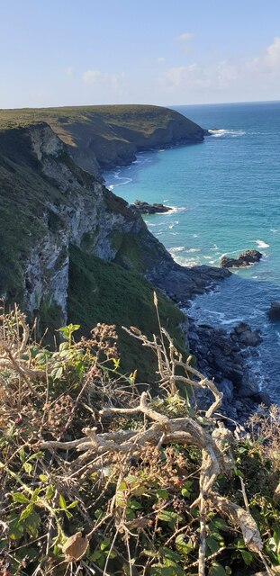
Magow Rocks is a small island located off the coast of Cornwall, England. Situated in the Celtic Sea, it is known for its rugged beauty and rich wildlife. The island is part of the Isles of Scilly archipelago, which consists of over 140 islands and islets.

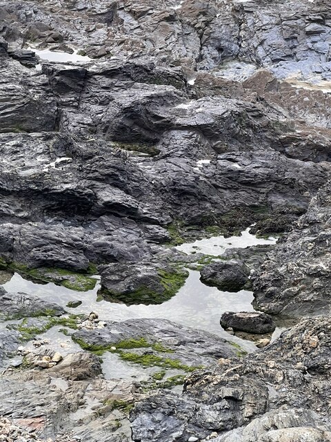
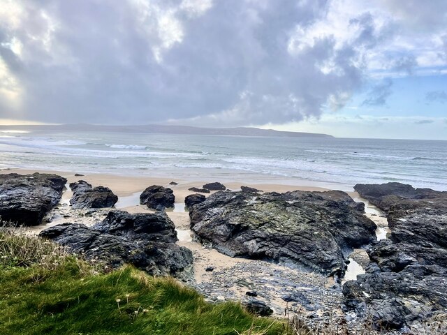
Measuring approximately 1.5 hectares in size, Magow Rocks is uninhabited and remains untouched by human development. The island is primarily made up of rocky cliffs and is surrounded by clear blue waters, making it a popular spot for diving and snorkeling enthusiasts. Visitors are often captivated by the diverse marine life that can be found in its surrounding waters, including colorful fish, seals, and even occasional sightings of dolphins and whales.

The island is also a haven for birdwatchers, as it serves as a nesting ground for various seabird species, including puffins, razorbills, and fulmars. Visitors can observe these magnificent creatures in their natural habitat, making it a popular destination for nature enthusiasts.

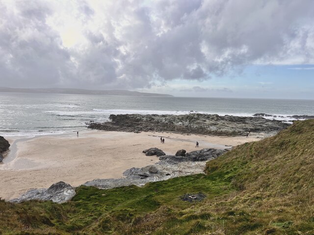
Access to Magow Rocks is mainly limited to boat trips or guided tours, as there are no regular ferry services to the island. Visitors are advised to check weather conditions and tides before planning a visit due to its exposed location and potentially treacherous waters.

Magow Rocks offers a unique and tranquil experience for those seeking to escape the hustle and bustle of everyday life. With its scenic beauty and abundant wildlife, it is truly a gem of Cornwall's natural landscape.

If you have any feedback on the listing, please let us know in the comments section below.
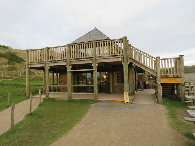
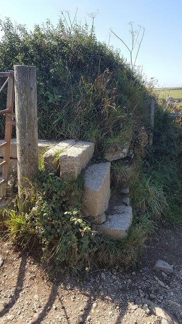
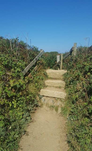
Magow Rocks Images

Images are sourced within 2km of 50.230992/-5.3925844 or Grid Reference SW5842. Thanks to Geograph Open Source API. All images are credited.

Beach Cafe at Godrevy Towans, near Hayle
Godrevy Beach Beach and rocks on the foreshore at Godrevy.
Godrevy Beach
Beach and rocks on the foreshore at Godrevy.
Godrevy beach A small beach between the rocky foreshore.
Godrevy beach
A small beach between the rocky foreshore.
Foreshore Rocks Rocks on Godrevy beach, the height can be gauged by a walker on the sand.
Foreshore Rocks
Rocks on Godrevy beach, the height can be gauged by a walker on the sand.
Rock pool One of many  pools amongst the rocks.
Rock pool
One of many pools amongst the rocks.
Godrevy Beach A more northerly section of the beach at Godrevy.
Godrevy Beach
A more northerly section of the beach at Godrevy.
Rocks and Streams There are several streams running through the fissures in the rocks.
Rocks and Streams
There are several streams running through the fissures in the rocks.
Godrevy Beach The northern section of beach in this grid square. Several dog walkers are taking advantage of the relaxed rules regarding dogs on beaches during the winter months.
Godrevy Beach
The northern section of beach in this grid square. Several dog walkers are taking advantage of the relaxed rules regarding dogs on beaches during the winter months.
Stone Stile SW5942 On the Coast Path between Hell’s Mouth and Godrevy Point, overlooking Fishing Cove. 
Beside a galvanised steel farm gate.
Granite steps, turning through ninety degrees, with two granite steps on each side to a granite top step of two blocks at right angles.
Public footpath 203/1/4 gold CP from Hell’s Mouth to Godrevy Point
Stone Stile SW5942
On the Coast Path between Hell’s Mouth and Godrevy Point, overlooking Fishing Cove. Beside a galvanised steel farm gate. Granite steps, turning through ninety degrees, with two granite steps on each side to a granite top step of two blocks at right angles. Public footpath 203/1/4 gold CP from Hell’s Mouth to Godrevy Point
Stone Stile SW5943 On the Coast Path between Hell’s Mouth and Godrevy Point, to the north of Castle Giver Cove.
Granite steps. Two steps on south side and four steps on north side of a top step. Wooden handrails on both sides.
Public footpath 101/47/1, 101/32/1 gold CP from Hell’s Mouth to Godrevy Point.
Stone Stile SW5943
On the Coast Path between Hell’s Mouth and Godrevy Point, to the north of Castle Giver Cove. Granite steps. Two steps on south side and four steps on north side of a top step. Wooden handrails on both sides. Public footpath 101/47/1, 101/32/1 gold CP from Hell’s Mouth to Godrevy Point.
Gwithian : Godrevy Cove Looking across the coastline.
Gwithian : Godrevy Cove
Looking across the coastline.
Gwithian : Godrevy Cove A wet and rough day to be beside the sea.
Gwithian : Godrevy Cove
A wet and rough day to be beside the sea.
Gwithian : Godrevy Cove Looking towards a seal poking his head from the water.
Gwithian : Godrevy Cove
Looking towards a seal poking his head from the water.
Gwithian : Godrevy Cove Looking across Godrevy Cove with Godrevy Island and lighthouse in view.
Gwithian : Godrevy Cove
Looking across Godrevy Cove with Godrevy Island and lighthouse in view.
Gwithian : Road A small road and parking spaces alongside it.
Gwithian : Road
A small road and parking spaces alongside it.
Gwithian Wesleyan Methodist chapel
Fishing Cove from cliff A view of Fishing Cove and out to Navax Point headland from a nice spot to sit on a cliff.
Fishing Cove from cliff
A view of Fishing Cove and out to Navax Point headland from a nice spot to sit on a cliff.
Fishing Cove from cliff Another view of Fishing Cove from the cliff.
Fishing Cove from cliff
Another view of Fishing Cove from the cliff.
Show me another place!

Magow Rocks is located at Grid Ref: SW5842 (Lat: 50.230992, Lng: -5.3925844)

Unitary Authority: Cornwall

Police Authority: Devon and Cornwall

What 3 Words

///holidays.desire.utter. Near Hayle, Cornwall

Related Wikis

St Gothian Sands

St Gothian Sands (grid reference SW585418) is a Local Nature Reserve near Gwithian, Cornwall. It was declared a Local Nature Reserve in 2005 by the Penwith...
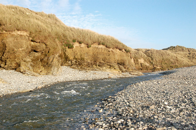
Red River (Koner)

The Red River (Cornish: Dowr Koner) is a small river in north-west Cornwall, England, United Kingdom which issues into St Ives Bay at Godrevy on Cornwall...

Godrevy

Godrevy (Cornish: Godrevi, meaning small farms) ( gə-DREE-vee) is an area on the eastern side of St Ives Bay, west Cornwall, England, United Kingdom, which...

St Gothian's Church, Gwithian

St Gothian's Church, Gwithian is a Grade II* listed parish church in the Church of England Diocese of Truro in Gwithian, Cornwall, England, UK. Nothing...

Nearby Amenities

Located within 500m of 50.230992,-5.3925844
Source: PGS
Lat/Long: 50.2328633/-5.391258
Source: PGS
Lat/Long: 50.2305133/-5.3910849
Source: PGS
Lat/Long: 50.2291581/-5.3910658
Source: PGS
Lat/Long: 50.2306279/-5.3928306
WW2 Pillbox (site of)
Building: bunker
Bunker Type: pillbox
Military: bunker
Lat/Long: 50.2307486/-5.3910538
The data included in this document is from www.openstreetmap.org. The data is made available under ODbL.

Have you been to Magow Rocks?

Leave your review of Magow Rocks below (or comments, questions and feedback).