Chapel Rock

Island in Cornwall

England

Chapel Rock

Rocks in Trenow Cove, looking south
Rocks in Trenow Cove, looking south Credit: David Medcalf

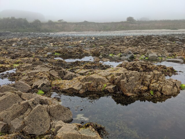
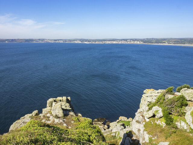
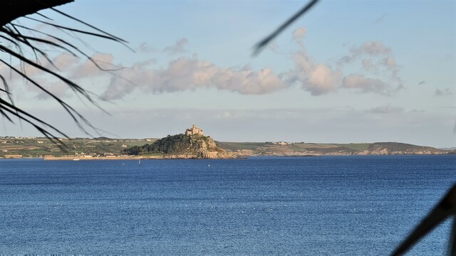
Chapel Rock is a small island located off the coast of Cornwall, England. Situated near the popular tourist destination of St. Ives, this rocky outcrop is a picturesque landmark that attracts visitors from around the world.

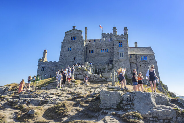
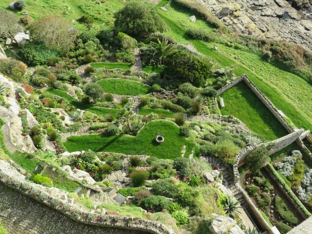
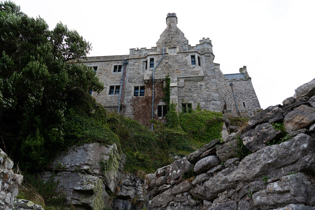
The island is named after the prominent chapel that sits atop its rocky cliffs. The chapel, dedicated to St. Michael, was built in the 14th century and is a significant historical site. However, due to erosion and the island's isolation, the chapel has fallen into disrepair over the years and now stands as a haunting reminder of the island's past.

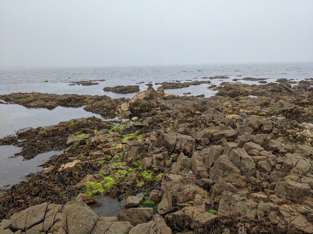
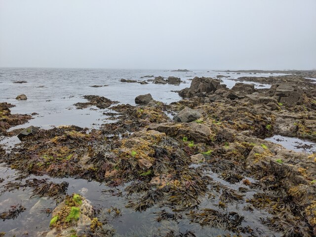
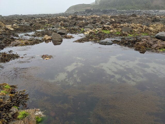
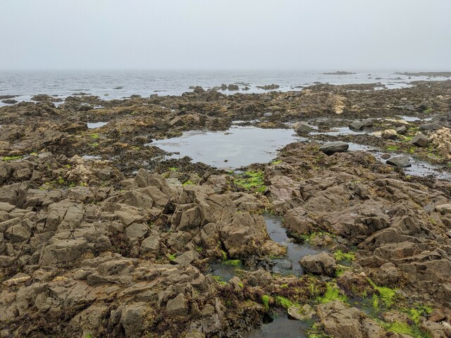
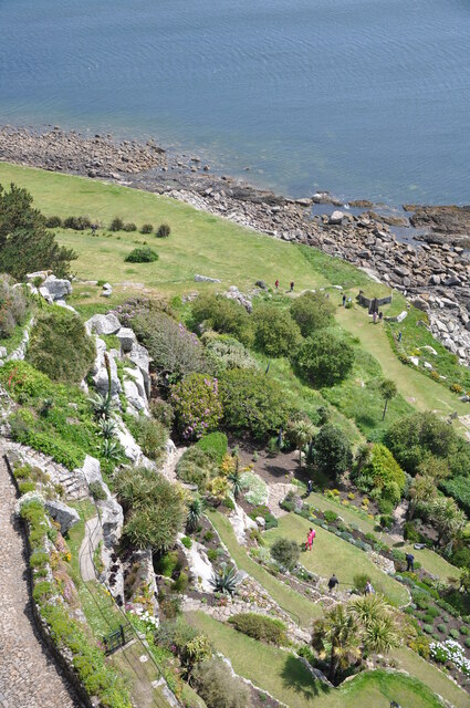
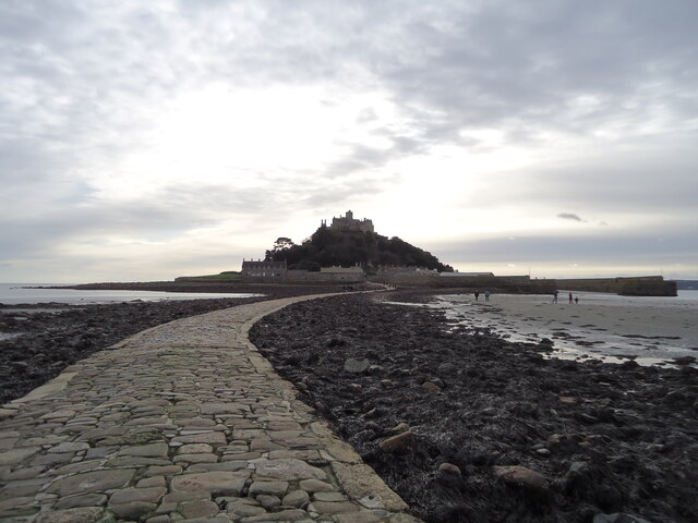
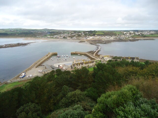
Chapel Rock is accessible only during low tide when a natural causeway is exposed. This limited window of access adds to the island's allure, as visitors must time their visit carefully to explore the rugged landscape and the remnants of the chapel. The island is also home to a diverse range of wildlife, including seabirds and marine life, making it a popular destination for nature enthusiasts.

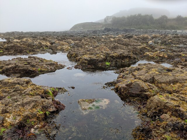
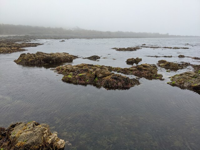
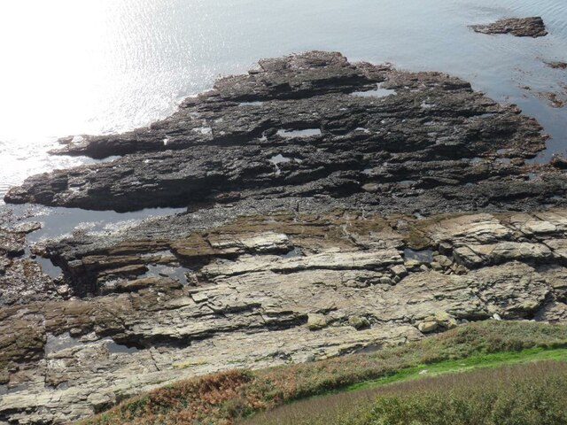
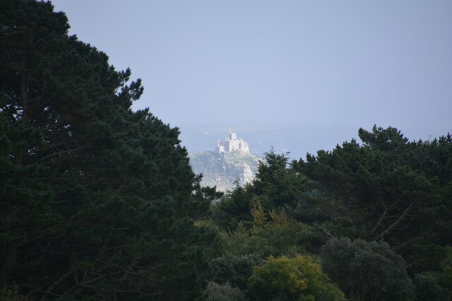
The island's dramatic cliffs and crashing waves provide a dramatic backdrop for photographers and artists, who are drawn to Chapel Rock for its unique beauty. Its isolation and tranquil atmosphere make it an ideal spot for those seeking solitude and a break from the hustle and bustle of everyday life.

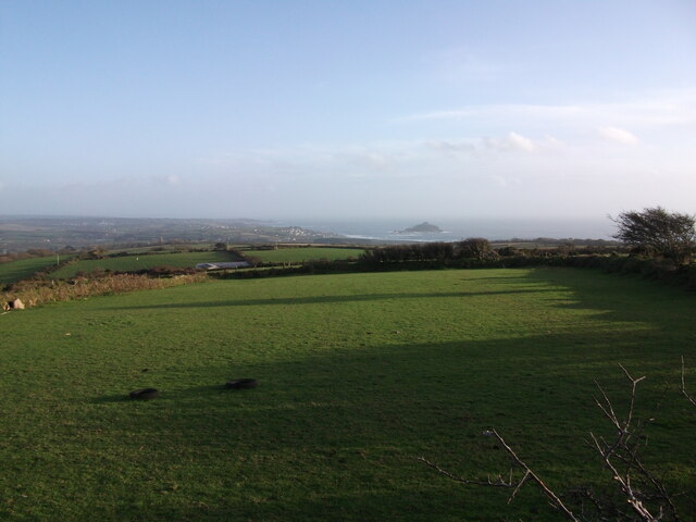
Overall, Chapel Rock is a captivating destination that combines historical significance, natural beauty, and a sense of mystery. Whether visitors are interested in its intriguing past or simply want to soak in the stunning coastal scenery, a visit to Chapel Rock is sure to leave a lasting impression.

If you have any feedback on the listing, please let us know in the comments section below.

Chapel Rock Images

Images are sourced within 2km of 50.122432/-5.4755568 or Grid Reference SW5130. Thanks to Geograph Open Source API. All images are credited.

Rocks in Trenow Cove, looking south
Rocks at Trenow Cove, looking west St Michael's Mount is lost in the mist.
Rocks at Trenow Cove, looking west
St Michael's Mount is lost in the mist.
A great place for rock pooling As long as you watch for the incoming tide!
A great place for rock pooling
As long as you watch for the incoming tide!
The edge of the rock shelf in Trenow Cove
Rock pools and seaweed
Rocks, weed and clear water
Low tide in Trenow Cove
St Michael's Mount Morning visitors gather at the west entrance to the castle on the last warm day of summer 2021.
St Michael's Mount
Morning visitors gather at the west entrance to the castle on the last warm day of summer 2021.
Rocky cliff top View west from below the castle entrance.
Penzance in the distance.
Rocky cliff top
View west from below the castle entrance. Penzance in the distance.
Terrace garden, St Michael's Mount The garden which was designed in 1878 for Sir John St Aubyn.
Terrace garden, St Michael's Mount
The garden which was designed in 1878 for Sir John St Aubyn.
Rocky foreshore, St Michael's Mount
View to St. Michael's Mount from Quarry Hill A view over Mounts Bay to St. Michaels Mount from the junction of Quarry Hill and the B3311 above Penzance.
View to St. Michael's Mount from Quarry Hill
A view over Mounts Bay to St. Michaels Mount from the junction of Quarry Hill and the B3311 above Penzance.
Castle of St Michael's Mount viewed from footpath below
The gardens at St. Michael's Mount
St Michael's Mount From Penzance
St Michael's Mount
From Penzance
Madron : St Michael's Mount From Trengwaiton Estate looking across to St Michael's Mount.
Madron : St Michael's Mount
From Trengwaiton Estate looking across to St Michael's Mount.
St Michael's Mount Seen across the causeway which is available when the tide is low.
St Michael's Mount
Seen across the causeway which is available when the tide is low.
St Michael's Mount Looking back across the causeway which is walkable when the tide is out.
St Michael's Mount
Looking back across the causeway which is walkable when the tide is out.
Show me another place!

Chapel Rock is located at Grid Ref: SW5130 (Lat: 50.122432, Lng: -5.4755568)

Unitary Authority: Cornwall

Police Authority: Devon and Cornwall

What 3 Words

///cinemas.joints.dressings. Near Marazion, Cornwall

Related Wikis

Marazion Town Hall

Marazion Town Hall is a municipal building in the Market Place, Marazion, Cornwall, England. The town hall, which is currently used as a museum, is a Grade...

Marazion

Marazion (; Cornish: Marhasyow) is a civil parish and town, on the shore of Mount's Bay in Cornwall, England, United Kingdom. It is 2 miles (3.2 km) east...

Marazion Marsh

Marazion Marsh is a Royal Society for the Protection of Birds (RSPB) reserve situated in a shallow river valley, half a kilometre to the west of Marazion...

St Michael's Mount Tramway

The St Michael's Mount Tramway runs from near the harbour up to the castle which dominates the tidal island of St Michael's Mount, in Cornwall, England...

Nearby Amenities

Located within 500m of 50.122432,-5.4755568
St. Michael's Mount
Is In: Cornwall, England, UK
Is In Country: England
Is In Country Code: GB
Is In County: Cornwall
Name Kw: Karrek Loos yn Koos
Place: hamlet
Source: npe
Wikidata: Q1431121
Wikipedia: en:St Michael's Mount
Lat/Long: 50.1184017/-5.4776453
Crossing
Check Date Crossing: 2021-07-01
Crossing: zebra
Crossing Island: no
Tactile Paving: no
Lat/Long: 50.1236769/-5.4718509
Pub
The Godolphin Arms
Addr City: Marazion
Addr Country: GB
Addr Housename: Godolphin Arms
Addr Postcode: TR17 0EN
Addr Street: West End
Fhrs Id: 573977
Phone: +44 1736 888510
Toilets Wheelchair: yes
Website: https://www.godolphinarms.co.uk/
Wheelchair: yes
Wheelchair Description: Fully accessible via wheelchair lift from the front door, staff extremely helpful should you require any assistance.
Wikidata: Q26454074
Lat/Long: 50.1234214/-5.474527
Rosario
Addr City: Marazion
Addr Country: GB
Addr Housename: Rosario
Addr Postcode: TR17 0BH
Addr Street: The Square
Fhrs Id: 802169
Guest House: bed_and_breakfast
Tourism: guest_house
Url: http://www.rosario-marazion.co.uk/
Lat/Long: 50.1237019/-5.4739873
Toilets
Marazion Square Toilets
Check Date: 2022-07-09
Fee: no
Female: yes
Male: yes
Wheelchair: no
Lat/Long: 50.1233494/-5.4733493
Cafe
Island Cafe
Addr City: Penzance
Addr Country: GB
Addr Hamlet: St Michaels Mount
Addr Housename: Mount Cafe
Addr Place: Marazion
Addr Postcode: TR17 0HS
Diet Vegetarian: yes
Fhrs Id: 573980
Source Addr: FHRS Open Data
Lat/Long: 50.1182993/-5.4762086
Bus Stop
Feliskirk Lane
Bench: yes
Bin: no
Bus: yes
Naptan AtcoCode: 0800COD40544
Naptan Bearing: NW
Naptan CommonName: Feliskirk Lane
Naptan Crossing: Feliskirk Lane
Naptan NaptanCode: coragjdm
Naptan PlusbusZoneRef: PENZNCE
Naptan Street: West End
Naptan Verified: yes
Public Transport: platform
Shelter: yes
Source: naptan_import;survey
Lat/Long: 50.1264586/-5.4782045
Bus Stop
Feliskirk Lane
Bench: no
Bin: no
Bus: yes
Lit: yes
Naptan AtcoCode: 0800COD40545
Naptan Bearing: SW
Naptan CommonName: Feliskirk Lane
Naptan Crossing: West End
Naptan NaptanCode: coragjdt
Naptan PlusbusZoneRef: PENZNCE
Naptan Street: Godolphin Place
Naptan Verified: no
Public Transport: platform
Shelter: no
Source: naptan_import
Tactile Paving: no
Lat/Long: 50.1263467/-5.4778535
Bus Stop
The Manor
Bench: no
Bin: yes
Bus: yes
Naptan AtcoCode: 0800COD40546
Naptan Bearing: NW
Naptan CommonName: The Manor
Naptan Crossing: Kings Road
Naptan NaptanCode: coragjgd
Naptan PlusbusZoneRef: PENZNCE
Naptan Street: West End
Naptan Verified: yes
Public Transport: platform
Shelter: no
Source: naptan_import;survey
Lat/Long: 50.1246953/-5.4762915
Bus Stop
The Manor
Bench: no
Bin: no
Bus: yes
Naptan AtcoCode: 0800COD40547
Naptan Bearing: SE
Naptan CommonName: The Manor
Naptan Crossing: Kings Road
Naptan NaptanCode: coragjgj
Naptan PlusbusZoneRef: PENZNCE
Naptan Street: West End
Naptan Verified: no
Public Transport: platform
Shelter: no
Source: naptan_import
Survey Date: 2022-07-09
Lat/Long: 50.1247536/-5.4762024
Bus Stop
The Square
Bench: no
Bus: yes
Naptan AtcoCode: 0800COD40548
Naptan Bearing: NW
Naptan CommonName: The Square
Naptan Crossing: The Square
Naptan NaptanCode: coragjgt
Naptan PlusbusZoneRef: PENZNCE
Naptan Street: West End
Naptan Verified: no
Public Transport: platform
Shelter: no
Source: naptan_import
Survey Date: 2022-07-09
Lat/Long: 50.1234229/-5.4742659
Bus Stop
The Square
Bench: no
Bin: no
Bus: yes
Lit: yes
Naptan AtcoCode: 0800COD40549
Naptan Bearing: E
Naptan CommonName: The Square
Naptan Crossing: West End
Naptan NaptanCode: coragjma
Naptan PlusbusZoneRef: PENZNCE
Naptan Street: The Square
Naptan Verified: no
Public Transport: platform
Shelter: no
Source: naptan_import
Tactile Paving: no
Lat/Long: 50.1235162/-5.473534
Bus Stop
The Flats
Bench: no
Bus: yes
Naptan AtcoCode: 0800COD40550
Naptan Bearing: E
Naptan CommonName: The Flats
Naptan Crossing: Leys Lane
Naptan NaptanCode: coragjpa
Naptan PlusbusZoneRef: PENZNCE
Naptan Street: Fore Street
Naptan Verified: no
Public Transport: platform
Shelter: no
Source: naptan_import
Lat/Long: 50.1238266/-5.4703798
Bus Stop
The Flats
Bench: no
Bin: no
Bus: yes
Lit: yes
Naptan AtcoCode: 0800COD40551
Naptan Bearing: W
Naptan CommonName: The Flats
Naptan Crossing: Leys Lane
Naptan NaptanCode: coragjpd
Naptan PlusbusZoneRef: PENZNCE
Naptan Street: Fore Street
Naptan Verified: no
Public Transport: platform
Shelter: no
Source: naptan_import
Tactile Paving: no
Lat/Long: 50.1237748/-5.4703061
Cafe
Chapel Rock Cafe
Addr City: Marazion
Addr Country: GB
Addr Housename: Chapel Rock
Addr Place: West End
Addr Postcode: TR17 0EJ
Addr Street: Kings Road
Fhrs Id: 667400
Lat/Long: 50.1237425/-5.4748707
Marazion Hotel
Tourism: hotel
Lat/Long: 50.1237029/-5.4731166
Post Office
Marazion Post Office
Addr City: Marazion
Addr Country: GB
Addr Housenumber: 1
Addr Postcode: TR17 0AR
Addr Street: Market Place
Brand: Post Office
Brand Wikidata: Q1783168
Collection Times: Mo-Fr 17:15; Sa 11:30
Contact Website: https://www.postoffice.co.uk/branch-finder/6984584/marazion
Opening Hours: Mo,Tu,Th,Fr,Su 07:00-18:30; We,Sa 07:00-19:30
Ref Pol Id: 127009
Lat/Long: 50.1234365/-5.4729835
Post Box
Brand: Royal Mail
Brand Wikidata: Q638098
Brand Wikipedia: en:Royal Mail
Check Date: 2021-07-01
Collection Times: Mo-Fr 16:45, Sa 11:30; Su off
Operator: Royal Mail
Operator Wikidata: Q638098
Post Box Design: type_a
Post Box Mounting: building
Post Box Type: wall
Ref: TR17 65
Royal Cypher: GR
Royal Cypher Wikidata: Q33102273
Source: survey;streetlevel imagery;aerial imagery
Survey Date: 2022-07-09
Lat/Long: 50.1234015/-5.4728585
Historic: memorial
Memorial: obelisk
Lat/Long: 50.1237126/-5.4716575
Blue Horizon Guest House
Source: survey
Tourism: guest_house
Lat/Long: 50.1241401/-5.469143
Fast Food
Tudor Chippy
Cuisine: fish_and_chips
Source: survey
Lat/Long: 50.1243004/-5.4753824
Marazion
Alt Name: Market Jew
Is In: Cornwall, England, UK
Name Br: Marhasyow
Name Kw: Marghasyow
Place: town
Source Alt Name: OS_OpenData_StreetView
Source Name: OS_OpenData_StreetView
Source Name Br: proper translation
Lat/Long: 50.1239321/-5.4727698
Ferry Terminal
Ferry: yes
Public Transport: station
Lat/Long: 50.1183166/-5.4760683
Tourism: picnic_site
Lat/Long: 50.1184113/-5.4761929
Bench
Backrest: yes
Colour: black
Material: wood
Lat/Long: 50.1185338/-5.4767696
Bench
Backrest: yes
Check Date: 2021-07-01
Colour: black
Material: wood
Lat/Long: 50.1185553/-5.476907
Collection Times Signed: no
Disused Amenity: post_box
Note: Previously TR17 119
Post Box Type: wall
Royal Cypher: VR
Source: survey
Lat/Long: 50.1185866/-5.4769214
Board Type: board
Check Date: 2021-07-01
Information: board
Tourism: information
Lat/Long: 50.1258864/-5.4789456
H.M.S Warspite 1915-1945
Historic: memorial
Lat/Long: 50.1245231/-5.476992
Bench
Backrest: yes
Check Date: 2021-07-01
Lat/Long: 50.1249556/-5.4777633
Waste Basket
Check Date: 2021-07-01
Lat/Long: 50.1235885/-5.4734033
Bench
Backrest: yes
Check Date: 2021-07-01
Lat/Long: 50.1235589/-5.4734978
Telephone
Booth: K6
Check Date: 2021-07-01
Covered: booth
Listed Status: Grade II
Lat/Long: 50.1235344/-5.4735883
Historic: memorial
Material: stone
Memorial: stele
Lat/Long: 50.1235821/-5.4735146
Cafe
The Copper Spoon
Addr City: Penzance
Addr Hamlet: Marazion
Addr Housename: Suffolk House
Addr Postcode: TR17 0AH
Addr Street: Fore Street
Cuisine: sandwich;ice_cream;cake;coffee_shop
Diet Vegetarian: yes
Fhrs Id: 927689
Opening Hours: Sa-Mo 10:00-17:00, We-Th 10:00-17:00
Outdoor Seating: no
Source Addr: FHRS Open Data
Lat/Long: 50.1236467/-5.470643
Cobble Corner
Shop: convenience
Lat/Long: 50.1234107/-5.472909
Post Box
Brand: Royal Mail
Brand Wikidata: Q638098
Check Date: 2022-06-01
Collection Times: Mo-Fr 11:30, Sa 11:30; Su off
Drive Through: no
Note: Listed in RM2013 as TR20 143 but is within TR17 boundary. Now displays TR17 143.
Operator: Royal Mail
Operator Wikidata: Q638098
Post Box Type: wall
Ref: TR17 143
Royal Cypher: GR
Royal Cypher Wikidata: Q33102273
Source: survey;aerial imagery;streetlevel imagery
Survey Date: 2022-07-09
Lat/Long: 50.1253191/-5.4770235
St Michael's B&B
Tourism: guest_house
Lat/Long: 50.124198/-5.4695785
Market House Gallery
Shop: art
Lat/Long: 50.1237149/-5.4724174
The Summerhouse Gallery
Shop: art
Lat/Long: 50.123586/-5.4721117
St.Michael's Mount
Harbour: yes
Port Of Entry: no
Seamark Type: harbour
Lat/Long: 50.119796/-5.477661
Seamark Rock Water Level: covers
Seamark Type: rock
Lat/Long: 50.1208682/-5.4818466
Seamark Rock Water Level: covers
Seamark Type: rock
Lat/Long: 50.1210729/-5.4810178
Seamark Rock Water Level: covers
Seamark Type: rock
Lat/Long: 50.1212139/-5.4805297
Seamark Rock Water Level: covers
Seamark Type: rock
Lat/Long: 50.1213928/-5.4798551
Seamark Rock Water Level: covers
Seamark Type: rock
Lat/Long: 50.1219035/-5.4821229
Rose Hill
Natural: peak
Lat/Long: 50.1249771/-5.4711753
Recycling
Glass only recycling bank
Lat/Long: 50.1236298/-5.4751731
Restaurant
Ben's Conish Kitchen
Addr City: Marazion
Addr Country: GB
Addr Housename: Bens Cornish Kitchen
Addr Postcode: TR17 0EL
Addr Street: West End
Fhrs Id: 502506
Lat/Long: 50.1238636/-5.4747645
Covered: no
Leisure: picnic_table
Lat/Long: 50.1184798/-5.4771983
Philps Famous Pasties
Addr City: Penzance
Addr Country: GB
Addr Housenumber: 1
Addr Place: Marazion
Addr Postcode: TR17 0AR
Addr Street: Market Place
Fhrs Id: 547121
Shop: bakery
Lat/Long: 50.1234679/-5.4725452
Power: pole
Lat/Long: 50.1251215/-5.4723206
Power: pole
Lat/Long: 50.125756/-5.4711834
Generator Method: photovoltaic
Generator Output Electricity: yes
Generator Source: solar
Generator Type: solar_photovoltaic_panel
Location: roof
Power: generator
Lat/Long: 50.1241964/-5.4734042
Generator Method: photovoltaic
Generator Output Electricity: yes
Generator Source: solar
Generator Type: solar_photovoltaic_panel
Location: roof
Power: generator
Lat/Long: 50.1265556/-5.4755902
Bench
Backrest: yes
Lat/Long: 50.1233245/-5.4742129
Bench
Backrest: yes
Lat/Long: 50.1233116/-5.4740855
Leisure: picnic_table
Lat/Long: 50.1233709/-5.4740252
Covered: no
Leisure: picnic_table
Lat/Long: 50.1184802/-5.477169
Covered: no
Leisure: picnic_table
Lat/Long: 50.1184789/-5.4772666
Covered: no
Leisure: picnic_table
Lat/Long: 50.1184793/-5.4772348
Generator Method: photovoltaic
Generator Output Electricity: small_installation
Generator Source: solar
Generator Type: solar_photovoltaic_panel
Location: roof
Power: generator
Source: bing
Lat/Long: 50.1262066/-5.4770842
Generator Method: photovoltaic
Generator Output Electricity: small_installation
Generator Source: solar
Generator Type: solar_photovoltaic_panel
Location: roof
Power: generator
Source: bing
Lat/Long: 50.1265677/-5.47555
Generator Method: photovoltaic
Generator Output Electricity: small_installation
Generator Source: solar
Generator Type: solar_photovoltaic_panel
Location: roof
Power: generator
Source: bing
Lat/Long: 50.1242084/-5.4733828
Generator Method: photovoltaic
Generator Output Electricity: small_installation
Generator Source: solar
Generator Type: solar_photovoltaic_panel
Location: roof
Power: generator
Source: bing
Lat/Long: 50.1243468/-5.4729389
Public Bookcase
Book Box
Booth: K6
Disused Amenity: telephone
Man Made: telephone_box
Public Bookcase Type: phone_box
Survey Date: 2022-07-09
Lat/Long: 50.1266063/-5.4781128
Bicycle Parking
Access: yes
Bicycle Parking: stands
Capacity: 8
Covered: no
Fee: no
Lat/Long: 50.1250016/-5.4767764
Bench
Backrest: yes
Lat/Long: 50.123561/-5.4734445
The Beacon
Description: Old-fashioned fire beacon
Man Made: beacon
Lat/Long: 50.1244551/-5.4709968
Entrance: yes
Lat/Long: 50.1242867/-5.4758791
Bench
Lat/Long: 50.1244076/-5.4712884
Access: yes
Backrest: yes
Lit: no
Material: wood
Seats: 2
Tourism: viewpoint
Lat/Long: 50.1243759/-5.4713179
Bench
Lat/Long: 50.1244065/-5.4712246
Bench
Lat/Long: 50.1242108/-5.4714254
Life Ring
Emergency: life_ring
Survey Date: 2022-07-09
Lat/Long: 50.1229799/-5.4732703
Bench
Survey Date: 2022-07-09
Lat/Long: 50.1226635/-5.471324
Bench
Survey Date: 2022-07-09
Lat/Long: 50.122651/-5.471266
Defibrillator
Emergency: defibrillator
Indoor: no
Survey Date: 2022-07-09
Lat/Long: 50.1241044/-5.4699235
Fire Hydrant
Emergency: fire_hydrant
Fire Hydrant Type: underground
Survey Date: 2022-07-09
Lat/Long: 50.1240041/-5.4697326
Waste Basket
Survey Date: 2022-07-09
Lat/Long: 50.1240833/-5.4697359
Waste Basket
Survey Date: 2022-07-09
Lat/Long: 50.1237359/-5.4717061
Waste Basket
Survey Date: 2022-07-09
Lat/Long: 50.1234469/-5.4729514
Waste Basket
Survey Date: 2022-07-09
Lat/Long: 50.123408/-5.4740463
Waste Basket
Survey Date: 2022-07-09
Lat/Long: 50.1233864/-5.4740366
Bench
Survey Date: 2022-07-09
Lat/Long: 50.1233136/-5.4739902
Telescope
Survey Date: 2022-07-09
Lat/Long: 50.1234051/-5.4740894
Waste Basket
Survey Date: 2022-07-09
Lat/Long: 50.1246762/-5.4762663
Fire Hydrant
Emergency: fire_hydrant
Fire Hydrant Type: underground
Survey Date: 2022-07-09
Lat/Long: 50.1236992/-5.4707348
Bench
Survey Date: 2022-07-09
Lat/Long: 50.123628/-5.4715308
Bench
Survey Date: 2022-07-09
Lat/Long: 50.1236292/-5.4716476
Bench
Survey Date: 2022-07-09
Lat/Long: 50.1236993/-5.4715601
Advertising: sculpture
Survey Date: 2022-07-09
Lat/Long: 50.1233287/-5.4740421
Bench
Backrest: yes
Survey Date: 2022-07-09
Lat/Long: 50.1261522/-5.4777083
Bench
Survey Date: 2022-07-09
Lat/Long: 50.123702/-5.4716656
Life Ring
Emergency: life_ring
Survey Date: 2022-07-09
Lat/Long: 50.1226131/-5.4713916
Waste Basket
Survey Date: 2022-07-09
Lat/Long: 50.1235798/-5.4725748
Ferry Terminal
Ferry: yes
Public Transport: station
Lat/Long: 50.1225487/-5.4756156
Ferry Terminal
Ferry: yes
Public Transport: station
Lat/Long: 50.122455/-5.4735175
Ferry Terminal
Ferry: yes
Public Transport: station
Lat/Long: 50.122531/-5.4714081
Defibrillator
Emergency: defibrillator
Lat/Long: 50.1235331/-5.4748072
Ferry Terminal
Ferry: yes
Public Transport: station
Lat/Long: 50.1186915/-5.4772719
St Michaels Mount
Power: substation
Voltage: 11000
Lat/Long: 50.1184056/-5.4780693
Location Transition: yes
Power: pole
Transformer: distribution
Lat/Long: 50.1247329/-5.4730234
Location Transition: yes
Power: pole
Lat/Long: 50.1245196/-5.4697913
Power: pole
Lat/Long: 50.1247088/-5.4700246
Power: pole
Lat/Long: 50.1252814/-5.4706255
Email: tickets@stmichaelsmount.co.uk
Operator: St Michael's Mount
Payment Cards: yes
Payment Contactless: yes
Phone: +44 1736 887822
Shop: ticket
Website: https://www.stmichaelsmount.co.uk/
Lat/Long: 50.1187495/-5.4767676
The data included in this document is from www.openstreetmap.org. The data is made available under ODbL.

Have you been to Chapel Rock?

Leave your review of Chapel Rock below (or comments, questions and feedback).