Eilean a' Chrotaich

Island in Ross-shire

Scotland

Eilean a' Chrotaich

Coastline, Rubh' Dubh, Eye Peninsula, Isle of Lewis Looking towards <a href="https://www.geograph.org.uk/photo/639694">NB5129 : Eilean a Crotaich</a>.
Coastline, Rubh' Dubh, Eye Peninsula, Isle of Lewis Credit: Claire Pegrum

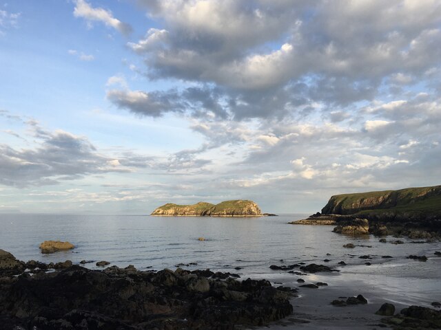
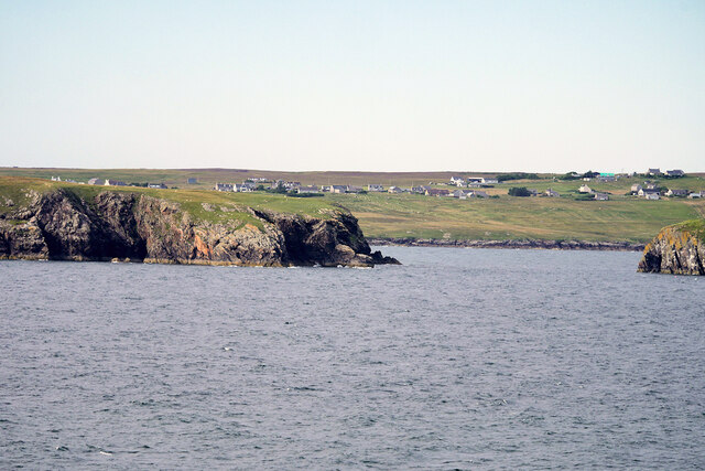
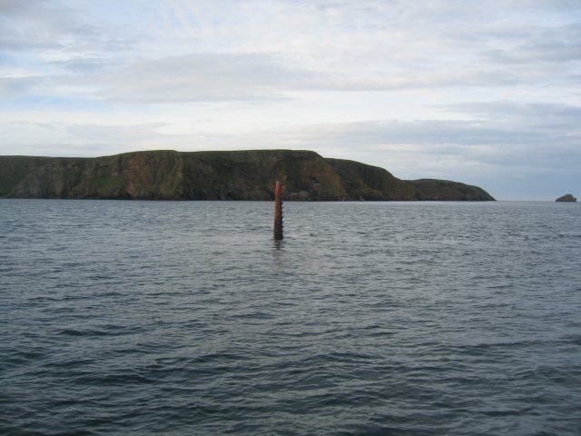
Eilean a' Chrotaich, also known as the Isle of Crotach, is a small uninhabited island located off the coast of Ross-shire in the Scottish Highlands. It lies in the Inner Sound, between the Isle of Skye and the mainland, and is part of the Inner Hebrides archipelago.

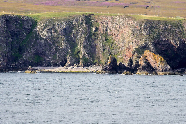
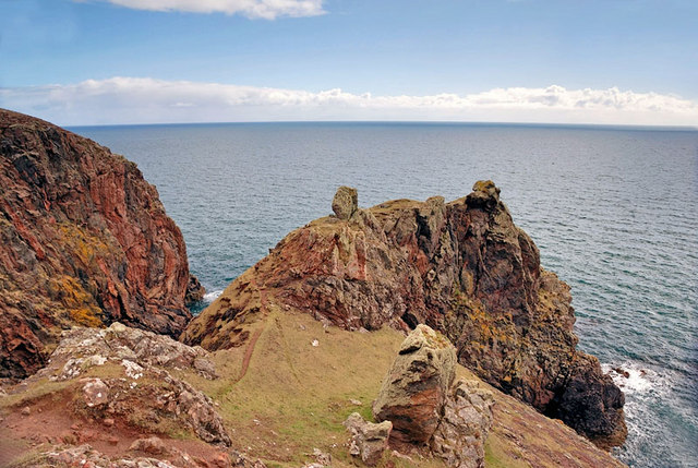
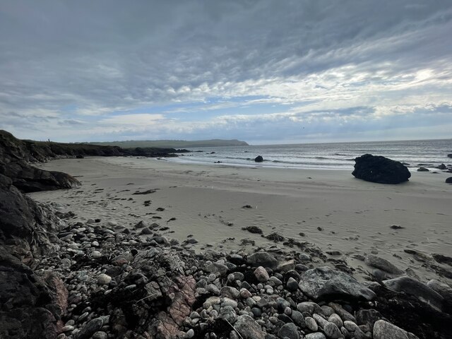
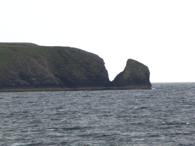
Covering an area of approximately 0.8 hectares, Eilean a' Chrotaich is characterized by its rugged and rocky landscape. The island is mostly comprised of steep cliffs, with its highest point reaching around 50 meters above sea level. It is accessible by boat, and visitors are often drawn to its natural beauty and tranquility.

The island is home to a variety of seabirds, including puffins, razorbills, and guillemots, which nest on the cliffs during the breeding season. Seals can also be spotted basking on the rocky shores, while dolphins and porpoises are occasionally seen swimming in the surrounding waters.

Eilean a' Chrotaich is rich in history and folklore, with the ruins of an ancient chapel and a burial ground still visible on the island. It is believed to have been a place of religious significance in the past, and local legends tell tales of ghostly apparitions and mystical happenings.

Due to its small size and lack of facilities, Eilean a' Chrotaich is not suitable for long-term habitation, but it remains a popular destination for day trips and nature enthusiasts seeking a remote and unspoiled experience in the Scottish Highlands.

If you have any feedback on the listing, please let us know in the comments section below.

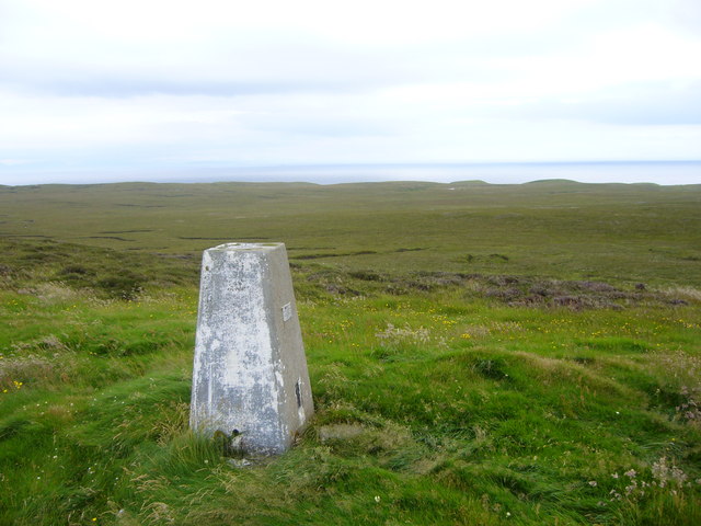
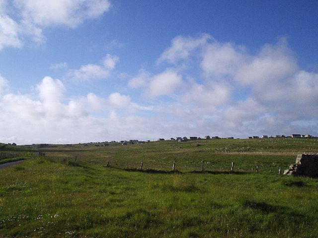
Eilean a' Chrotaich Images

Images are sourced within 2km of 58.180193/-6.2269657 or Grid Reference NB5129. Thanks to Geograph Open Source API. All images are credited.

Coastline, Rubh' Dubh, Eye Peninsula, Isle of Lewis Looking towards <a href="https://www.geograph.org.uk/photo/639694">NB5129 : Eilean a Crotaich</a>.
Coastline, Rubh' Dubh, Eye Peninsula, Isle of Lewis
Looking towards NB5129 : Eilean a Crotaich.
Isle of Lewis, cliffs on the Eye Peninsula
Eilean a' Crotaich A small islet off the Eye peninsula on Lewis.
Eilean a' Crotaich
A small islet off the Eye peninsula on Lewis.
Eilean a Crotaich A prominent islet off the Eye Peninsula. Chicken Head can be seen in the distance.
Eilean a Crotaich
A prominent islet off the Eye Peninsula. Chicken Head can be seen in the distance.
Site of Ancient Temple According to the map this area is the site of the remains of an ancient temple. Despite a lengthy search I couldn't find any sign of it but the view more than made up for the disappointment and the long hike!
Site of Ancient Temple
According to the map this area is the site of the remains of an ancient temple. Despite a lengthy search I couldn't find any sign of it but the view more than made up for the disappointment and the long hike!
The Muddy Pool Never have I been more disappointed. After walking a fair way to photograph Loch Cuilc I was confronted with this muddy pool. At first I thought I'd got the co-ordinates wrong but no....this is it!
The Muddy Pool
Never have I been more disappointed. After walking a fair way to photograph Loch Cuilc I was confronted with this muddy pool. At first I thought I'd got the co-ordinates wrong but no....this is it!
Beach at Pabail Looking out to sea from the beach at Pabail near Stornoway.
Beach at Pabail
Looking out to sea from the beach at Pabail near Stornoway.
Bayble Beach Geocaching is a type of global treasure hunt of people looking for caches, or hidden stashes of objects. Geocaching may also be described as a series of hide-and-seek games, where hiders provide online clues for seekers. Seekers use global positioning system (GPS) devices to find hidden caches
Bayble Beach
Geocaching is a type of global treasure hunt of people looking for caches, or hidden stashes of objects. Geocaching may also be described as a series of hide-and-seek games, where hiders provide online clues for seekers. Seekers use global positioning system (GPS) devices to find hidden caches
Eilean  Mòr Phabail
Eilean Mòr Phabail
Roads of An Rubha
Roads of An Rubha
Isle of Lewis, Eye Peninsula Rubha na Strianaich
Eilean Mòr Phabail Bayble Island (Scottish Gaelic: Eilean Phabail) is an uninhabited island off the south coast of the Eye Peninsula of Lewis. It lies at the southern end of Bayble Bay (Pabail Bay) and actually consists of two islands (Eilean Mòr Phabaill and Eilean Beag Phabail), but these appear as a single island from most directions. The hamlets of Upper and Lower Bayble overlook the island and bay.
Wikipedia  <span class="nowrap"><a title="https://en.wikipedia.org/wiki/Bayble_Island" rel="nofollow ugc noopener" href="https://en.wikipedia.org/wiki/Bayble_Island">Link</a><img style="margin-left:2px;" alt="External link" title="External link - shift click to open in new window" src="https://s1.geograph.org.uk/img/external.png" width="10" height="10"/></span>
Eilean Mòr Phabail
Bayble Island (Scottish Gaelic: Eilean Phabail) is an uninhabited island off the south coast of the Eye Peninsula of Lewis. It lies at the southern end of Bayble Bay (Pabail Bay) and actually consists of two islands (Eilean Mòr Phabaill and Eilean Beag Phabail), but these appear as a single island from most directions. The hamlets of Upper and Lower Bayble overlook the island and bay. Wikipedia LinkExternal link
Chicken Head The red beacon marking Chicken Rock is seen centre of frame with Chicken Head prominent behind it and Eilean Croitach to extreme right.
The name of this headland is misleading in that in Old Norse it would have been "Kirk Ness" meaning the point or headland with a Church.
The Scottish Gaelic word for "chicken" is "Cearc" which is similar in pronunciation to "Kirk" (Church). The translations were mixed up so we have finished up with "Chicken Head" on the modern maps.
Chicken Head
The red beacon marking Chicken Rock is seen centre of frame with Chicken Head prominent behind it and Eilean Croitach to extreme right. The name of this headland is misleading in that in Old Norse it would have been "Kirk Ness" meaning the point or headland with a Church. The Scottish Gaelic word for "chicken" is "Cearc" which is similar in pronunciation to "Kirk" (Church). The translations were mixed up so we have finished up with "Chicken Head" on the modern maps.
Chicken Head Viewed from the causeway across to the Eye Peninsula.
Chicken Head
Viewed from the causeway across to the Eye Peninsula.
Eilean Mor Phabail Off the south coast of the Eye Peninsula of Lewis, in the Outer Hebrides.
Eilean Mor Phabail
Off the south coast of the Eye Peninsula of Lewis, in the Outer Hebrides.
Beach at Pabail A little beach facing southeast on the south coast of the Eye peninsula, Lewis
Beach at Pabail
A little beach facing southeast on the south coast of the Eye peninsula, Lewis
Bayble Hill trig
Bayble Hill trig
Pabail Iarach (Lower Bayble) The village of Pabail Iarach stretches out along the road which curves round Bagh Phabail (Bayble Bay), about 50m above the bay.
Pabail Iarach (Lower Bayble)
The village of Pabail Iarach stretches out along the road which curves round Bagh Phabail (Bayble Bay), about 50m above the bay.
Show me another place!

Eilean a' Chrotaich is located at Grid Ref: NB5129 (Lat: 58.180193, Lng: -6.2269657)

Unitary Authority: Na h-Eileanan an Iar

Police Authority: Highlands and Islands

What 3 Words

///reckons.downs.sapping. Near Stornoway, Na h-Eileanan Siar

Related Wikis

Bayble Island

Bayble Island lies at the southern end of Bayble Bay (Pabail Bay). It consists of two islands (Eilean Mòr Phabaill and Eilean Beag Phabaill), but these...

Bayble

Bayble (Scottish Gaelic: Pabail) is a village in Point (An Rubha), on the Isle of Lewis, 6 miles (10 kilometres) east of Stornoway. Bayble is also within...

Knock, Isle of Lewis

Knock, from the Gaelic, An Cnoc (a small hill), is a village in Point peninsula on the Isle of Lewis in the Outer Hebrides of Scotland. Point (an Rubha...

Garrabost

Garrabost (Scottish Gaelic: Garrabost) is a village in the Point (An Rubha) peninsula isthmus on the east coast of the Isle of Lewis, in the Outer Hebrides...

Have you been to Eilean a' Chrotaich?

Leave your review of Eilean a' Chrotaich below (or comments, questions and feedback).