Great Hogus

Island in Cornwall

England

Great Hogus

Rocks in Trenow Cove, looking south
Rocks in Trenow Cove, looking south Credit: David Medcalf

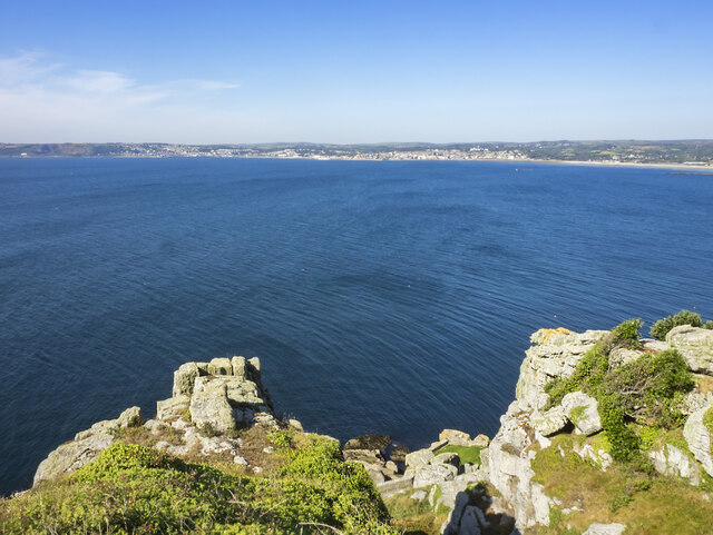
Great Hogus is a small island located off the coast of Cornwall in southwestern England. With a total area of approximately 35 acres, it is a relatively small landmass that is accessible only by boat. The island is known for its rugged and untouched natural beauty, making it a popular destination for nature enthusiasts and those seeking a peaceful retreat.

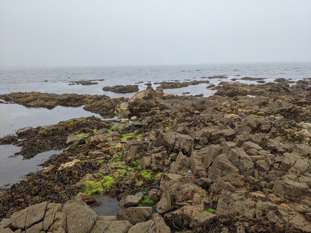
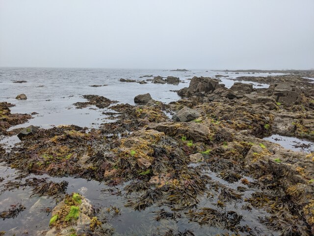
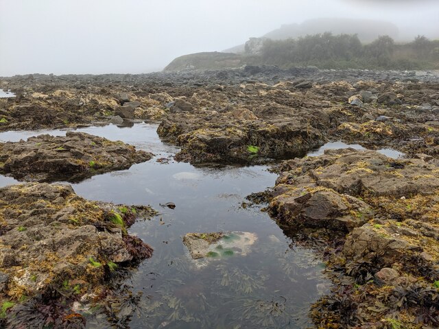
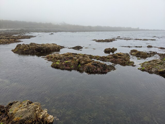
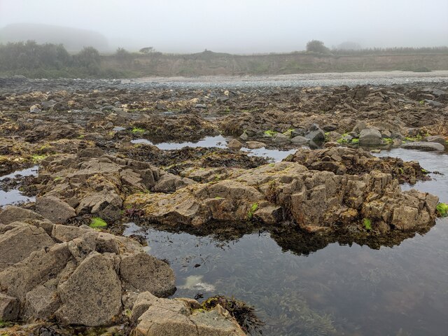
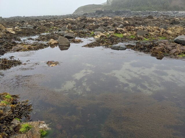
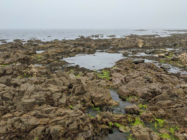
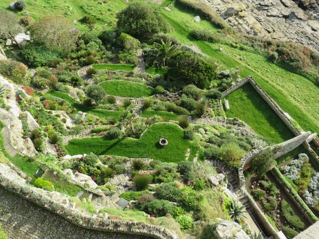
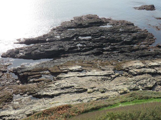
Great Hogus boasts a diverse landscape, with rocky cliffs, sandy beaches, and lush greenery. The island is home to a variety of wildlife, including seabirds, seals, and occasionally dolphins that can be spotted in the surrounding waters. The island's isolation and lack of development contribute to its unspoiled charm, offering visitors a chance to immerse themselves in a tranquil and untouched environment.

There are no permanent residents on Great Hogus, but it is occasionally used for camping and picnicking by locals and tourists alike. The island's limited facilities include a small shelter and basic amenities for campers. Visitors are encouraged to bring their own supplies and pack out any waste, as there are no waste disposal facilities on the island.

Due to its remote location, Great Hogus provides a unique opportunity for solitude and relaxation. The absence of significant human activity allows visitors to enjoy the stunning natural scenery and experience a sense of tranquility that is rarely found in more populated areas. Whether it's exploring the rugged coastline, birdwatching, or simply unwinding on the beach, Great Hogus offers a peaceful escape from the hustle and bustle of everyday life.

If you have any feedback on the listing, please let us know in the comments section below.
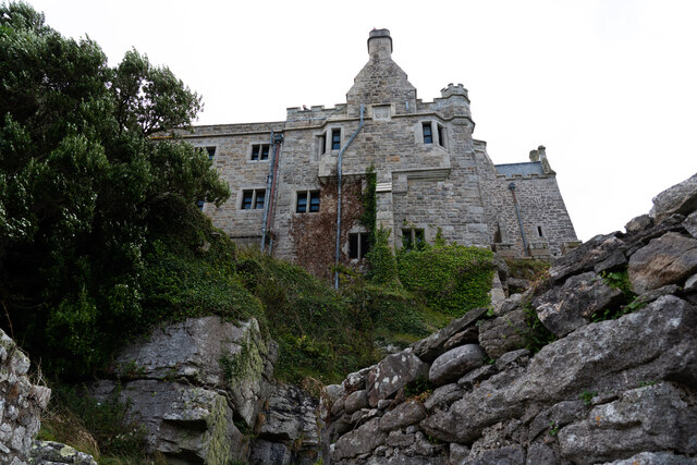
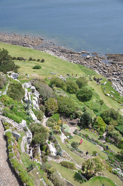
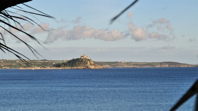
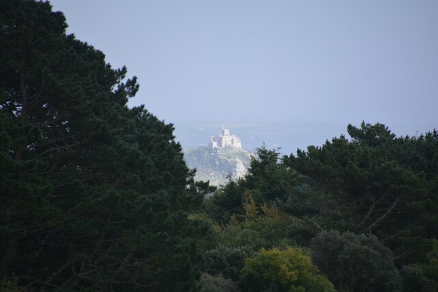
Great Hogus Images

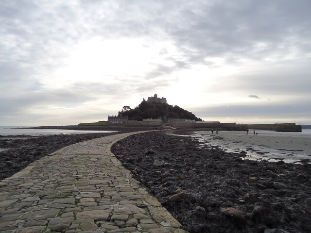
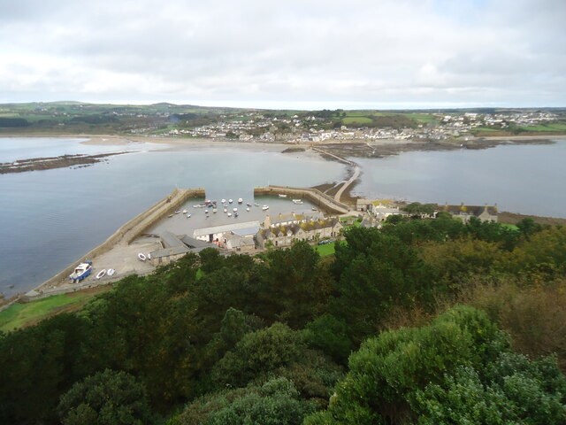
Images are sourced within 2km of 50.122259/-5.4804279 or Grid Reference SW5130. Thanks to Geograph Open Source API. All images are credited.

Rocks in Trenow Cove, looking south
Rocks at Trenow Cove, looking west St Michael's Mount is lost in the mist.
Rocks at Trenow Cove, looking west
St Michael's Mount is lost in the mist.
A great place for rock pooling As long as you watch for the incoming tide!
A great place for rock pooling
As long as you watch for the incoming tide!
The edge of the rock shelf in Trenow Cove
Rock pools and seaweed
Rocks, weed and clear water
Low tide in Trenow Cove
St Michael's Mount Morning visitors gather at the west entrance to the castle on the last warm day of summer 2021.
St Michael's Mount
Morning visitors gather at the west entrance to the castle on the last warm day of summer 2021.
Rocky cliff top View west from below the castle entrance.
Penzance in the distance.
Rocky cliff top
View west from below the castle entrance. Penzance in the distance.
Terrace garden, St Michael's Mount The garden which was designed in 1878 for Sir John St Aubyn.
Terrace garden, St Michael's Mount
The garden which was designed in 1878 for Sir John St Aubyn.
Rocky foreshore, St Michael's Mount
View to St. Michael's Mount from Quarry Hill A view over Mounts Bay to St. Michaels Mount from the junction of Quarry Hill and the B3311 above Penzance.
View to St. Michael's Mount from Quarry Hill
A view over Mounts Bay to St. Michaels Mount from the junction of Quarry Hill and the B3311 above Penzance.
Castle of St Michael's Mount viewed from footpath below
The gardens at St. Michael's Mount
St Michael's Mount From Penzance
St Michael's Mount
From Penzance
Madron : St Michael's Mount From Trengwaiton Estate looking across to St Michael's Mount.
Madron : St Michael's Mount
From Trengwaiton Estate looking across to St Michael's Mount.
St Michael's Mount Seen across the causeway which is available when the tide is low.
St Michael's Mount
Seen across the causeway which is available when the tide is low.
St Michael's Mount Looking back across the causeway which is walkable when the tide is out.
St Michael's Mount
Looking back across the causeway which is walkable when the tide is out.
Show me another place!

Great Hogus is located at Grid Ref: SW5130 (Lat: 50.122259, Lng: -5.4804279)

Unitary Authority: Cornwall

Police Authority: Devon and Cornwall

What 3 Words

///coolest.forget.bypasses. Near Marazion, Cornwall

Related Wikis

Marazion

Marazion (; Cornish: Marhasyow) is a civil parish and town, on the shore of Mount's Bay in Cornwall, England, United Kingdom. It is 2 miles (3.2 km) east...

St Michael's Mount Tramway

The St Michael's Mount Tramway runs from near the harbour up to the castle which dominates the tidal island of St Michael's Mount, in Cornwall, England...

Marazion Marsh

Marazion Marsh is a Royal Society for the Protection of Birds (RSPB) reserve situated in a shallow river valley, half a kilometre to the west of Marazion...

Red River (Amal)

The Red River (Cornish: Dowr Amal, meaning boundary river) which discharges into the sea to the west of Marazion is one of two watercourses in Cornwall...

Nearby Amenities

Located within 500m of 50.122259,-5.4804279
St. Michael's Mount
Is In: Cornwall, England, UK
Is In Country: England
Is In Country Code: GB
Is In County: Cornwall
Name Kw: Karrek Loos yn Koos
Place: hamlet
Source: npe
Wikidata: Q1431121
Wikipedia: en:St Michael's Mount
Lat/Long: 50.1184017/-5.4776453
Pub
The Godolphin Arms
Addr City: Marazion
Addr Country: GB
Addr Housename: Godolphin Arms
Addr Postcode: TR17 0EN
Addr Street: West End
Fhrs Id: 573977
Phone: +44 1736 888510
Toilets Wheelchair: yes
Website: https://www.godolphinarms.co.uk/
Wheelchair: yes
Wheelchair Description: Fully accessible via wheelchair lift from the front door, staff extremely helpful should you require any assistance.
Wikidata: Q26454074
Lat/Long: 50.1234214/-5.474527
Rosario
Addr City: Marazion
Addr Country: GB
Addr Housename: Rosario
Addr Postcode: TR17 0BH
Addr Street: The Square
Fhrs Id: 802169
Guest House: bed_and_breakfast
Tourism: guest_house
Url: http://www.rosario-marazion.co.uk/
Lat/Long: 50.1237019/-5.4739873
Bus Stop
Feliskirk Lane
Bench: yes
Bin: no
Bus: yes
Naptan AtcoCode: 0800COD40544
Naptan Bearing: NW
Naptan CommonName: Feliskirk Lane
Naptan Crossing: Feliskirk Lane
Naptan NaptanCode: coragjdm
Naptan PlusbusZoneRef: PENZNCE
Naptan Street: West End
Naptan Verified: yes
Public Transport: platform
Shelter: yes
Source: naptan_import;survey
Lat/Long: 50.1264586/-5.4782045
Bus Stop
Feliskirk Lane
Bench: no
Bin: no
Bus: yes
Lit: yes
Naptan AtcoCode: 0800COD40545
Naptan Bearing: SW
Naptan CommonName: Feliskirk Lane
Naptan Crossing: West End
Naptan NaptanCode: coragjdt
Naptan PlusbusZoneRef: PENZNCE
Naptan Street: Godolphin Place
Naptan Verified: no
Public Transport: platform
Shelter: no
Source: naptan_import
Tactile Paving: no
Lat/Long: 50.1263467/-5.4778535
Bus Stop
The Manor
Bench: no
Bin: yes
Bus: yes
Naptan AtcoCode: 0800COD40546
Naptan Bearing: NW
Naptan CommonName: The Manor
Naptan Crossing: Kings Road
Naptan NaptanCode: coragjgd
Naptan PlusbusZoneRef: PENZNCE
Naptan Street: West End
Naptan Verified: yes
Public Transport: platform
Shelter: no
Source: naptan_import;survey
Lat/Long: 50.1246953/-5.4762915
Bus Stop
The Manor
Bench: no
Bin: no
Bus: yes
Naptan AtcoCode: 0800COD40547
Naptan Bearing: SE
Naptan CommonName: The Manor
Naptan Crossing: Kings Road
Naptan NaptanCode: coragjgj
Naptan PlusbusZoneRef: PENZNCE
Naptan Street: West End
Naptan Verified: no
Public Transport: platform
Shelter: no
Source: naptan_import
Survey Date: 2022-07-09
Lat/Long: 50.1247536/-5.4762024
Bus Stop
The Square
Bench: no
Bus: yes
Naptan AtcoCode: 0800COD40548
Naptan Bearing: NW
Naptan CommonName: The Square
Naptan Crossing: The Square
Naptan NaptanCode: coragjgt
Naptan PlusbusZoneRef: PENZNCE
Naptan Street: West End
Naptan Verified: no
Public Transport: platform
Shelter: no
Source: naptan_import
Survey Date: 2022-07-09
Lat/Long: 50.1234229/-5.4742659
Cafe
Chapel Rock Cafe
Addr City: Marazion
Addr Country: GB
Addr Housename: Chapel Rock
Addr Place: West End
Addr Postcode: TR17 0EJ
Addr Street: Kings Road
Fhrs Id: 667400
Lat/Long: 50.1237425/-5.4748707
Cafe
Sail Loft Coffee House
Addr City: Penzance
Addr Country: GB
Addr Hamlet: Marazion
Addr Place: Saint Michaels Mount
Addr Postcode: TR17 0HT
Fhrs Id: 621378
Source Addr: FHRS Open Data
Lat/Long: 50.118179/-5.4784488
Fast Food
Tudor Chippy
Cuisine: fish_and_chips
Source: survey
Lat/Long: 50.1243004/-5.4753824
Bench
Backrest: yes
Colour: black
Material: wood
Lat/Long: 50.1185338/-5.4767696
Bench
Backrest: yes
Check Date: 2021-07-01
Colour: black
Material: wood
Lat/Long: 50.1185553/-5.476907
Collection Times Signed: no
Disused Amenity: post_box
Note: Previously TR17 119
Post Box Type: wall
Royal Cypher: VR
Source: survey
Lat/Long: 50.1185866/-5.4769214
Board Type: board
Check Date: 2021-07-01
Information: board
Tourism: information
Lat/Long: 50.1258864/-5.4789456
H.M.S Warspite 1915-1945
Historic: memorial
Lat/Long: 50.1245231/-5.476992
Bench
Backrest: yes
Check Date: 2021-07-01
Lat/Long: 50.1249556/-5.4777633
Post Box
Brand: Royal Mail
Brand Wikidata: Q638098
Check Date: 2022-06-01
Collection Times: Mo-Fr 11:30, Sa 11:30; Su off
Drive Through: no
Note: Listed in RM2013 as TR20 143 but is within TR17 boundary. Now displays TR17 143.
Operator: Royal Mail
Operator Wikidata: Q638098
Post Box Type: wall
Ref: TR17 143
Royal Cypher: GR
Royal Cypher Wikidata: Q33102273
Source: survey;aerial imagery;streetlevel imagery
Survey Date: 2022-07-09
Lat/Long: 50.1253191/-5.4770235
St.Michael's Mount
Harbour: yes
Port Of Entry: no
Seamark Type: harbour
Lat/Long: 50.119796/-5.477661
Seamark Rock Water Level: covers
Seamark Type: rock
Lat/Long: 50.118464/-5.479603
Seamark Rock Water Level: covers
Seamark Type: rock
Lat/Long: 50.1208682/-5.4818466
Seamark Rock Water Level: covers
Seamark Type: rock
Lat/Long: 50.1210729/-5.4810178
Seamark Rock Water Level: covers
Seamark Type: rock
Lat/Long: 50.1212139/-5.4805297
Seamark Rock Water Level: covers
Seamark Type: rock
Lat/Long: 50.1212277/-5.4825842
Seamark Rock Water Level: covers
Seamark Type: rock
Lat/Long: 50.1213928/-5.4798551
Seamark Rock Water Level: covers
Seamark Type: rock
Lat/Long: 50.1219035/-5.4821229
Recycling
Glass only recycling bank
Lat/Long: 50.1236298/-5.4751731
Restaurant
Ben's Conish Kitchen
Addr City: Marazion
Addr Country: GB
Addr Housename: Bens Cornish Kitchen
Addr Postcode: TR17 0EL
Addr Street: West End
Fhrs Id: 502506
Lat/Long: 50.1238636/-5.4747645
Ice Cream
Sail Loft
Takeaway: only
Lat/Long: 50.1182042/-5.4782365
Covered: no
Leisure: picnic_table
Lat/Long: 50.1184798/-5.4771983
Tourism: picnic_site
Lat/Long: 50.1179849/-5.478359
Bench
Backrest: yes
Lat/Long: 50.1233245/-5.4742129
Bench
Backrest: yes
Lat/Long: 50.1233116/-5.4740855
Leisure: picnic_table
Lat/Long: 50.1233709/-5.4740252
Covered: no
Leisure: picnic_table
Lat/Long: 50.1184802/-5.477169
Covered: no
Leisure: picnic_table
Lat/Long: 50.1184789/-5.4772666
Covered: no
Leisure: picnic_table
Lat/Long: 50.1184793/-5.4772348
Generator Method: photovoltaic
Generator Output Electricity: small_installation
Generator Source: solar
Generator Type: solar_photovoltaic_panel
Location: roof
Power: generator
Source: bing
Lat/Long: 50.1262066/-5.4770842
Bicycle Parking
Access: yes
Bicycle Parking: stands
Capacity: 8
Covered: no
Fee: no
Lat/Long: 50.1250016/-5.4767764
Entrance: yes
Lat/Long: 50.1242867/-5.4758791
Waste Basket
Survey Date: 2022-07-09
Lat/Long: 50.123408/-5.4740463
Waste Basket
Survey Date: 2022-07-09
Lat/Long: 50.1233864/-5.4740366
Bench
Survey Date: 2022-07-09
Lat/Long: 50.1233136/-5.4739902
Telescope
Survey Date: 2022-07-09
Lat/Long: 50.1234051/-5.4740894
Waste Basket
Survey Date: 2022-07-09
Lat/Long: 50.1246762/-5.4762663
Advertising: sculpture
Survey Date: 2022-07-09
Lat/Long: 50.1233287/-5.4740421
Bench
Backrest: yes
Survey Date: 2022-07-09
Lat/Long: 50.1261522/-5.4777083
Ferry Terminal
Ferry: yes
Public Transport: station
Lat/Long: 50.1225487/-5.4756156
Ferry Terminal
Ferry: yes
Public Transport: station
Lat/Long: 50.122455/-5.4735175
Defibrillator
Emergency: defibrillator
Lat/Long: 50.1235331/-5.4748072
Ferry Terminal
Ferry: yes
Public Transport: station
Lat/Long: 50.1186915/-5.4772719
St Michaels Mount
Power: substation
Voltage: 11000
Lat/Long: 50.1184056/-5.4780693
Email: tickets@stmichaelsmount.co.uk
Operator: St Michael's Mount
Payment Cards: yes
Payment Contactless: yes
Phone: +44 1736 887822
Shop: ticket
Website: https://www.stmichaelsmount.co.uk/
Lat/Long: 50.1187495/-5.4767676
The data included in this document is from www.openstreetmap.org. The data is made available under ODbL.

Have you been to Great Hogus?

Leave your review of Great Hogus below (or comments, questions and feedback).