Crowner Rocks

Island in Cornwall

England

Crowner Rocks

Penwith : Boat & Sea A boat is heading back to St Ives Harbour.
Penwith : Boat & Sea Credit: Lewis Clarke

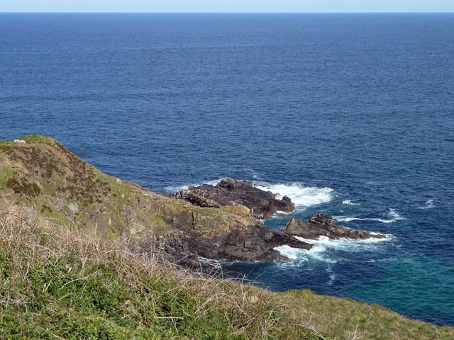
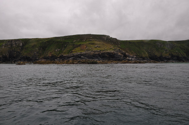
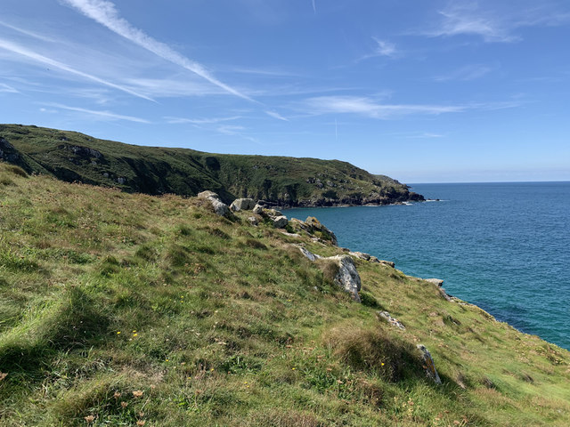
Crowner Rocks is a small island located off the coast of Cornwall, England. Situated in the Celtic Sea, it is part of the Isles of Scilly archipelago. Crowner Rocks measures approximately 250 meters in length and 150 meters in width, with an area of about 3 hectares.

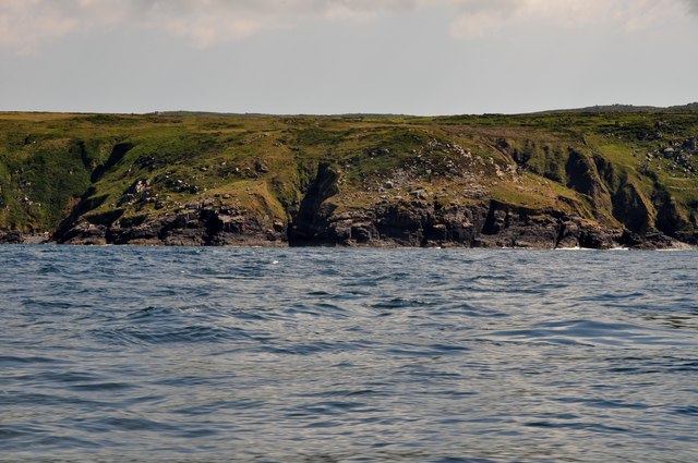
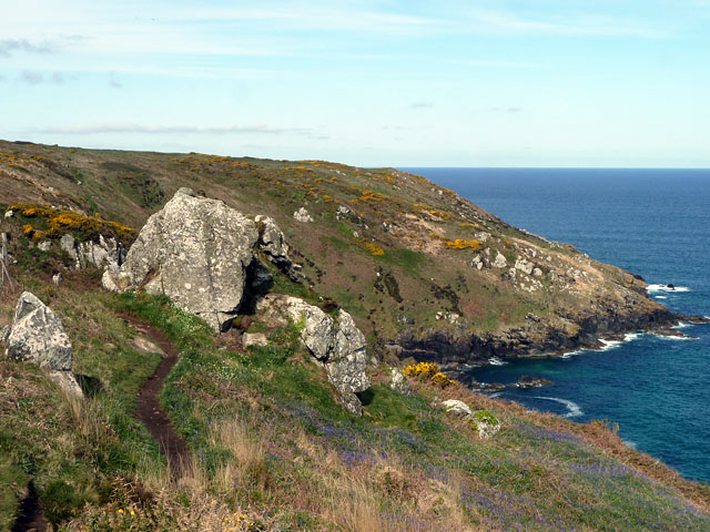
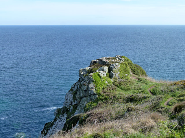
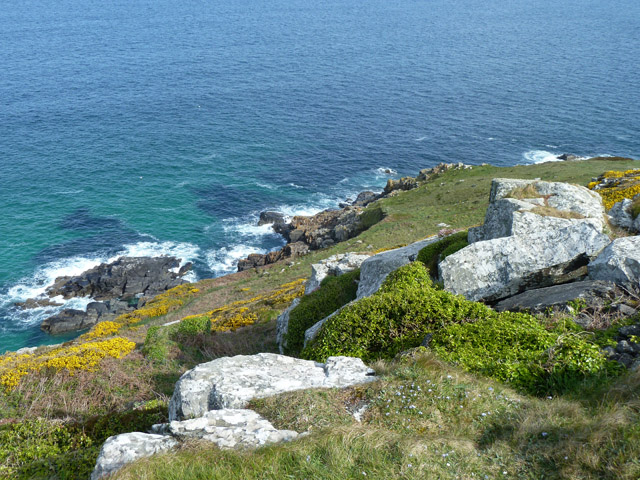
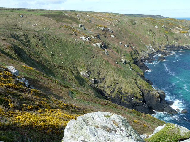
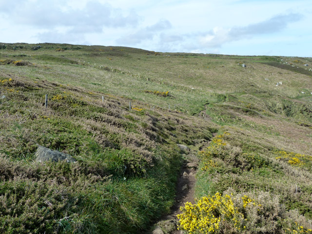
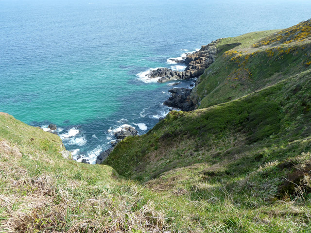
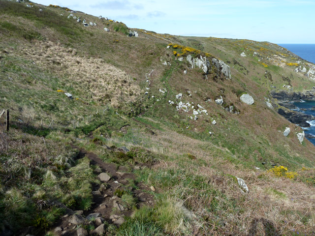
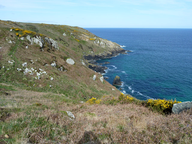
The island is known for its rugged and rocky terrain, consisting of granite and gneiss formations. It is largely uninhabited and lacks any significant vegetation, except for some hardy grasses and mosses that manage to cling to the rocky surface. Due to its exposed location, Crowner Rocks is frequently battered by strong winds and rough seas, making it a challenging environment for any form of human settlement.

The island is surrounded by crystal-clear waters that are home to a diverse range of marine life, including seals, dolphins, and various species of seabirds. The surrounding waters are also known for their strong currents, which can make navigation around the island treacherous for boats and ships.

While Crowner Rocks itself does not have any notable landmarks or structures, it does offer breathtaking panoramic views of the surrounding sea and neighboring islands. Its isolation and untouched natural beauty make it a popular destination for nature enthusiasts, birdwatchers, and photographers.

Access to Crowner Rocks is limited, with no regular ferry service available. However, private boat tours and charters may offer visits to the island, allowing visitors to experience its wild and untamed landscape.

If you have any feedback on the listing, please let us know in the comments section below.

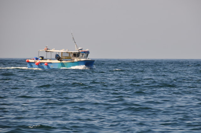
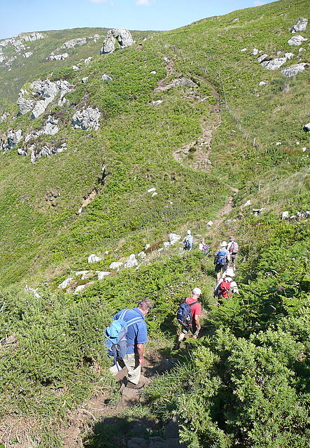
Crowner Rocks Images

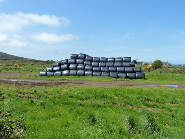
Images are sourced within 2km of 50.217568/-5.4867071 or Grid Reference SW5141. Thanks to Geograph Open Source API. All images are credited.

Penwith : Boat & Sea A boat is heading back to St Ives Harbour.
Penwith : Boat & Sea
A boat is heading back to St Ives Harbour.
Penwith : Cornish Coastline Looking towards the coastline of Cornwall.
Penwith : Cornish Coastline
Looking towards the coastline of Cornwall.
Along Trowan Cliff The coastal path threads its way, high above the coast, along a thin path through the bracken and gorse.  Ahead is the climb towards Hellesveor.
Along Trowan Cliff
The coastal path threads its way, high above the coast, along a thin path through the bracken and gorse. Ahead is the climb towards Hellesveor.
Coastal footpath, Trowan Cliff The blue on the slope is bluebells.
Coastal footpath, Trowan Cliff
The blue on the slope is bluebells.
Hor Point Viewed from one of the several alternative paths to the official SW Coastal Path.
Hor Point
Viewed from one of the several alternative paths to the official SW Coastal Path.
Cornwall : Hor Point Just about a mile along the north Cornish coast from St Ives lies the rugged Hor Point. In World War Two this location was chosen to site a Chain Home Low radar station M115.
Cornwall : Hor Point
Just about a mile along the north Cornish coast from St Ives lies the rugged Hor Point. In World War Two this location was chosen to site a Chain Home Low radar station M115.
Coastal path, Hellesveor Cliff There is also another path lower down the slope.
Coastal path, Hellesveor Cliff
There is also another path lower down the slope.
Outcrop on Hellesveor Cliff One would have thought this would have a name, but nobody told the mapmakers if it has got one.
Outcrop on Hellesveor Cliff
One would have thought this would have a name, but nobody told the mapmakers if it has got one.
Rocks on Hellesveor Cliff According to the geological map, the lighter near rocks are likely to be 'Unnamed Igneous Intrusion, Devonian - Metagabbro and metamicrogabbro'. The darker rock, which is more general here, is the Mylor Slate formation.
Rocks on Hellesveor Cliff
According to the geological map, the lighter near rocks are likely to be 'Unnamed Igneous Intrusion, Devonian - Metagabbro and metamicrogabbro'. The darker rock, which is more general here, is the Mylor Slate formation.
Trowan Cliff Along here there is a great deal of steep coastal slope and not much sheer bare cliff. Not the place to be careless, though.
Trowan Cliff
Along here there is a great deal of steep coastal slope and not much sheer bare cliff. Not the place to be careless, though.
Coastal footpath, Trowan Cliff Heading west.
Coastal footpath, Trowan Cliff
Heading west.
Caterpillar on the coastal footpath, Trowan Cliff It looks like a Drinker moth caterpillar, but where there should be a tuft of hair at the head end, it looks more like a red mite or similar.
Caterpillar on the coastal footpath, Trowan Cliff
It looks like a Drinker moth caterpillar, but where there should be a tuft of hair at the head end, it looks more like a red mite or similar.
Trowan Cliff Looking from the coastal path.
Trowan Cliff
Looking from the coastal path.
Coastal footpath, Trowan Cliff A ford is mapped in the dip, but there was nothing today, just a little muddy.
Coastal footpath, Trowan Cliff
A ford is mapped in the dip, but there was nothing today, just a little muddy.
Trowan Cliff Looking from the coastal footpath.
Trowan Cliff
Looking from the coastal footpath.
Farm machinery near Trowan
Silage bales near Trowan
Pen Enys Point from Hor Point
Show me another place!

Crowner Rocks is located at Grid Ref: SW5141 (Lat: 50.217568, Lng: -5.4867071)

Unitary Authority: Cornwall

Police Authority: Devon and Cornwall

What 3 Words

///describes.yelled.highly. Near St Ives, Cornwall

Related Wikis

SS Alba

SS Alba was a Panamanian-registered ship owned by Burger B. that sank off St Ives in Cornwall, England on 31 January 1938. == Shipwreck == Alba was seeking...

Tate St Ives

Tate St Ives is an art gallery in St Ives, Cornwall, England, exhibiting work by modern British artists with links to the St Ives area. The Tate also took...

Alfred Wallis

Alfred Wallis (18 August 1855 – 29 August 1942) was a British fisherman and artist known for his port landscapes and shipping scenes painted in a naïve...

The Sloop Inn

The Sloop Inn is an inn in St Ives, Cornwall, England, located on the wharf. It is one of the oldest inns in Cornwall, the public house is dated to "circa...

Nearby Amenities

Located within 500m of 50.217568,-5.4867071
Source: PGS
Lat/Long: 50.2149234/-5.4867216
Source: PGS
Lat/Long: 50.2158881/-5.4875702
Source: PGS
Lat/Long: 50.2166631/-5.492987
Toilets
Porthmeor Carpark Toilets (Male)
Check Date: 2021-08-10
Fee: no
Female: no
Male: yes
Source: survey
Wheelchair: yes
Lat/Long: 50.2144171/-5.4848727
Toilets
Porthmeor Beach Toilets
Fee: no
Wheelchair: no
Lat/Long: 50.2153192/-5.4820047
Man's Head
Place: locality
Lat/Long: 50.2167811/-5.4886703
Cafe
West Beach Bar & Cafe
Lat/Long: 50.214574/-5.4857736
Bench
Backrest: yes
Backrest Type: wall
Lat/Long: 50.2137178/-5.4849504
Bench
Backrest: yes
Source: GPS survey
Lat/Long: 50.2142807/-5.484719
Bench
Backrest: yes
Source: GPS survey
Lat/Long: 50.2147951/-5.4838916
Bench
Backrest: yes
Source: GPS survey
Lat/Long: 50.2156637/-5.4883759
Bench
Backrest: yes
Source: GPS survey
Lat/Long: 50.2161815/-5.4886171
Bench
Backrest: yes
Source: GPS survey
Lat/Long: 50.2162647/-5.4886556
Bench
Backrest: yes
Source: GPS survey
Lat/Long: 50.2165245/-5.488662
Bench
Backrest: yes
Source: GPS survey
Lat/Long: 50.2164773/-5.48889
Bench
Backrest: yes
Source: GPS survey
Lat/Long: 50.2163953/-5.4890396
Hiking: yes
Information: guidepost
Source: GPS survey
Tourism: information
Lat/Long: 50.2161392/-5.4920748
Arts Centre
Porthmeor Studios
Lat/Long: 50.2155842/-5.4804411
Beachside Guest House
Tourism: guest_house
Lat/Long: 50.2152854/-5.4808361
Leisure: slipway
Lat/Long: 50.2149244/-5.4831078
Entrance: main
Lat/Long: 50.214923/-5.4825413
Bench
Backrest: yes
Source: GPS survey
Lat/Long: 50.2147012/-5.4871135
Bench
Backrest: yes
Source: GPS survey
Lat/Long: 50.2146425/-5.4871787
Bench
Backrest: yes
Source: GPS survey
Lat/Long: 50.214936/-5.4873166
Bench
Backrest: yes
Source: GPS survey
Lat/Long: 50.2149764/-5.4873748
Bench
Backrest: yes
Source: GPS survey
Lat/Long: 50.2150425/-5.4874682
Bench
Backrest: yes
Source: GPS survey
Lat/Long: 50.2152193/-5.4877175
Noexit: yes
Lat/Long: 50.2138654/-5.4832539
Life Ring
Emergency: life_ring
Ref: SW512410
Lat/Long: 50.2165767/-5.4885322
Noexit: yes
Lat/Long: 50.2137944/-5.4834526
Toilets
Porthmeor Carpark Toilets (Female)
Check Date: 2021-08-10
Fee: no
Female: yes
Male: no
Source: survey
Wheelchair: yes
Lat/Long: 50.2143854/-5.4849814
Bench
Backrest: yes
Source: GPS survey
Lat/Long: 50.2146223/-5.487193
Bench
Backrest: yes
Source: GPS survey
Lat/Long: 50.2153426/-5.4878853
Bench
Backrest: yes
Source: GPS survey
Lat/Long: 50.2151066/-5.4875548
Bench: yes
Covered: no
Leisure: picnic_table
Source: GPS survey
Lat/Long: 50.2146003/-5.4865343
Bench: yes
Covered: no
Leisure: picnic_table
Source: GPS survey
Lat/Long: 50.2146315/-5.48652
Waste Basket
Ref: W1-0835
Lat/Long: 50.2147886/-5.4839288
Bench
Backrest: yes
Source: GPS survey
Lat/Long: 50.2147832/-5.4839646
Bench
Backrest: yes
Source: GPS survey
Lat/Long: 50.2147747/-5.4840111
Bench
Backrest: yes
Source: GPS survey
Lat/Long: 50.2148077/-5.4838249
Bench
Backrest: yes
Lat/Long: 50.2148368/-5.4836525
Cafe
Café at Tate St Ives
Fee: no
Level: 4
Opening Hours: Mo-Su 10:00-16:50
Outdoor Seating: yes
Survey Date: 2021-10-25
Website: https://www.tate.org.uk/visit/tate-st-ives/cafe-tate-st-ives
Lat/Long: 50.2149076/-5.4822398
Bench
Backrest: yes
Material: wood
Lat/Long: 50.2142109/-5.4828591
Tate St Ives
Fee: yes
Opening Hours: Mar-Oct: 10:00-17:20; Nov-Feb: Mo off,Tu-Su 10:00-16:20; Dec 24-Dec 26: off
Operator: Tate
Operator Wikidata: Q430682
Tourism: gallery
Website: https://www.tate.org.uk/visit/tate-st-ives
Wikidata: Q2577210
Wikipedia: en:Tate St Ives
Lat/Long: 50.2148039/-5.4823798
Cafe
St Eia
Addr City: St Ives
Addr Postcode: TR26 1HR
Addr Street: The Digey
Check Date: 2023-04-12
Contact Instagram: st_eia
Email: contact@steia.co.uk
Opening Hours: Mo off; Tu-Th 09:00-17:00; Fr-Sa 09:00-20:00; Su 09:00-16:00
Shop: wine
Website: https://steiawines.com/
Lat/Long: 50.2152235/-5.4811838
Waste Basket
Ref: W1-0630
Lat/Long: 50.214641/-5.4843024
Waste Basket
Ref: W1-0834
Lat/Long: 50.2148278/-5.4837032
Bench
Backrest: yes
Lat/Long: 50.2143265/-5.4857756
Bench
Backrest: yes
Lat/Long: 50.2142886/-5.4853052
Barrier: bollard
Bollard: removable
Lat/Long: 50.2145456/-5.4872198
Waste Basket
Lat/Long: 50.2147227/-5.4870995
Waste Basket
Lat/Long: 50.2148848/-5.4872936
Bench
Backrest: yes
Lat/Long: 50.2157867/-5.4885535
Bench
Backrest: yes
Lat/Long: 50.2159259/-5.4888111
Bench
Backrest: yes
Lat/Long: 50.2161019/-5.4892977
Bench
Backrest: yes
Lat/Long: 50.2160891/-5.4885851
Natural: rock
Lat/Long: 50.2161633/-5.4920625
Historic: memorial
Memorial: plaque
Lat/Long: 50.2154032/-5.4815245
Alfred Wallis
Cemetery: grave
Subject Wikidata: Q3354650
Wikimedia Commons: File:Alfred Wallis tomb.jpg
Lat/Long: 50.2134664/-5.484243
Cafe
Porthmeor Beach Cafe
Addr City: St Ives
Addr Country: GB
Addr Postcode: TR26 1JZ
Fhrs Id: 673129
Lat/Long: 50.2152307/-5.4822816
Bench
Backrest: yes
Source: GPS survey
Lat/Long: 50.2148197/-5.4837528
Barrier: bollard
Bollard: foldable
Lat/Long: 50.2147878/-5.4833087
Addr Housename: Verbena
Addr Street: Orange Lane
Lat/Long: 50.2133049/-5.487767
Addr Housename: Spernen Wyn
Addr Street: Orange Lane
Lat/Long: 50.2131191/-5.4877504
Addr Housename: Blue Horizon
Addr Housenumber: 12
Addr Street: Ocean View Terrace
Lat/Long: 50.213374/-5.4874585
Porthmeor Bowling Club
Club: sport
Sport: bowls
Lat/Long: 50.2144971/-5.4865616
Holy Well Of St Ia
Drinking Water: no
Historic: water_well
Man Made: water_well
Pump: no
Wikidata: Q26436110
Lat/Long: 50.214356/-5.4846178
Waste Basket
Lat/Long: 50.2148893/-5.487272
The data included in this document is from www.openstreetmap.org. The data is made available under ODbL.

Have you been to Crowner Rocks?

Leave your review of Crowner Rocks below (or comments, questions and feedback).