Linton
Settlement in Yorkshire Craven
England
Linton
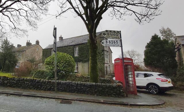
Linton is a charming village located in the Craven district of North Yorkshire, England. Situated in the Yorkshire Dales National Park, it is nestled in a picturesque valley alongside the River Wharfe. Linton can be accessed via the B6160 road, which connects it to nearby towns such as Grassington and Skipton.
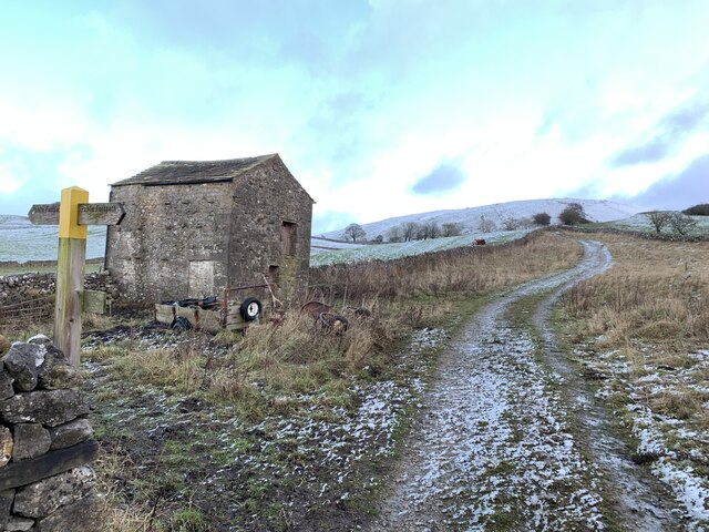
The village is known for its stunning natural beauty, with rolling green hills and a tranquil atmosphere. Linton is surrounded by lush meadows and woodlands, offering visitors and residents ample opportunities for outdoor activities such as hiking, cycling, and fishing. The River Wharfe, which flows through the village, adds to the scenic appeal, providing a peaceful spot for picnics and riverside walks.
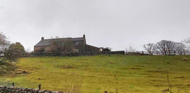
Linton is home to a close-knit community and has a rich history dating back centuries. The village retains its traditional charm, with many stone-built houses and buildings that showcase the local architectural style. St. Michael and All Angels Church, a Grade II listed building, stands prominently in the village and is worth a visit for its impressive architecture and historical significance.
The village also boasts a popular pub, The Fountaine Inn, which serves delicious food and local ales. Additionally, Linton has a village hall that hosts various events and activities throughout the year, bringing the community together.
Overall, Linton, Yorkshire offers a serene and idyllic setting for those seeking a peaceful retreat amidst the stunning landscapes of the Yorkshire Dales National Park.
If you have any feedback on the listing, please let us know in the comments section below.
Linton Images
Images are sourced within 2km of 54.063673/-2.0035549 or Grid Reference SD9963. Thanks to Geograph Open Source API. All images are credited.
![Grassington features [2] Grassington Bridge, also known as Linton Bridge, carries Station Road, B6265, over the River Wharfe. With 17th century origins, the bridge was widened in 1780 and the road surface substantially rebuilt in 1824. With 4 segmental arches in squared, coursed gritstone with some ashlar. Listed, grade II, with details at: <span class="nowrap"><a title="https://historicengland.org.uk/listing/the-list/list-entry/1316846" rel="nofollow ugc noopener" href="https://historicengland.org.uk/listing/the-list/list-entry/1316846">Link</a><img style="margin-left:2px;" alt="External link" title="External link - shift click to open in new window" src="https://s1.geograph.org.uk/img/external.png" width="10" height="10"/></span>
Grassington is a small market town, receiving its charter in 1282. The town is located in Wharfedale in the Yorkshire Dales National Park, some 7½ miles north of Skipton. Lead mining brought prosperity to the town in the 18th and 19th centuries. The town now attracts many tourists, especially walkers, with some excellent routes on the surrounding fells.](https://s2.geograph.org.uk/geophotos/07/03/85/7038550_b7091aeb.jpg)
![Grassington features [3] Grassington Bridge, also known as Linton Bridge, carries Station Road, B6265, over the River Wharfe. With 17th century origins, the bridge was widened in 1780 and the road surface substantially rebuilt in 1824. With 4 segmental arches in squared, coursed gritstone with some ashlar. Listed, grade II, with details at: <span class="nowrap"><a title="https://historicengland.org.uk/listing/the-list/list-entry/1316846" rel="nofollow ugc noopener" href="https://historicengland.org.uk/listing/the-list/list-entry/1316846">Link</a><img style="margin-left:2px;" alt="External link" title="External link - shift click to open in new window" src="https://s1.geograph.org.uk/img/external.png" width="10" height="10"/></span>
Grassington is a small market town, receiving its charter in 1282. The town is located in Wharfedale in the Yorkshire Dales National Park, some 7½ miles north of Skipton. Lead mining brought prosperity to the town in the 18th and 19th centuries. The town now attracts many tourists, especially walkers, with so](https://s0.geograph.org.uk/geophotos/07/03/85/7038556_397c2fd6.jpg)
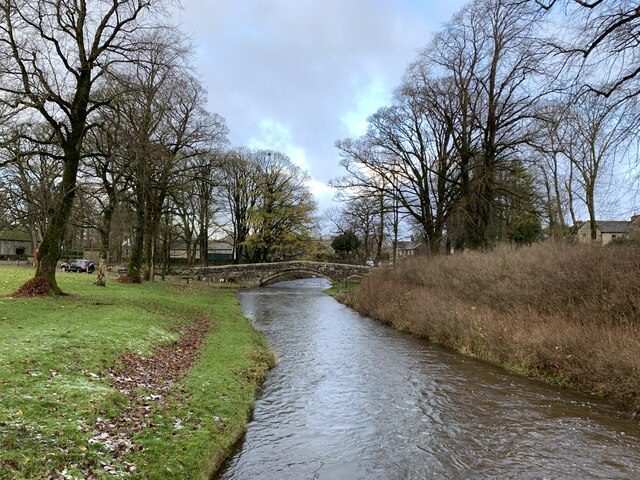
![Grassington features [4] The River Wharfe, looking upstream from Grassington Bridge which carries Station Road, B6265.
Grassington is a small market town, receiving its charter in 1282. The town is located in Wharfedale in the Yorkshire Dales National Park, some 7½ miles north of Skipton. Lead mining brought prosperity to the town in the 18th and 19th centuries. The town now attracts many tourists, especially walkers, with some excellent routes on the surrounding fells.](https://s0.geograph.org.uk/geophotos/07/03/85/7038560_a39b39a7.jpg)
![Grassington features [5] The River Wharfe, looking downstream from Grassington Bridge which carries Station Road, B6265.
Grassington is a small market town, receiving its charter in 1282. The town is located in Wharfedale in the Yorkshire Dales National Park, some 7½ miles north of Skipton. Lead mining brought prosperity to the town in the 18th and 19th centuries. The town now attracts many tourists, especially walkers, with some excellent routes on the surrounding fells.](https://s2.geograph.org.uk/geophotos/07/03/85/7038562_4e2c9c73.jpg)
![Grassington features [6] This County Bridge Marker is seen on the south side of Station Road, B6265. The marker indicates the extent of roadway adjoining the bridge that the County was obliged to maintain.
Grassington is a small market town, receiving its charter in 1282. The town is located in Wharfedale in the Yorkshire Dales National Park, some 7½ miles north of Skipton. Lead mining brought prosperity to the town in the 18th and 19th centuries. The town now attracts many tourists, especially walkers, with some excellent routes on the surrounding fells.](https://s1.geograph.org.uk/geophotos/07/03/85/7038565_6a08fee3.jpg)
![Grassington houses [7] Ladywell Cottage in located in Linton Road near a spring known as Our Lady&#039;s Well. The existing house was erected next to a steeply roofed, possibly cruck built, building, now the site of a 20th century range. The house is 17th century of gritstone rubble with freestone dressings under a stone slate roof. Listed, grade II, with details at: <span class="nowrap"><a title="https://historicengland.org.uk/listing/the-list/list-entry/1132095" rel="nofollow ugc noopener" href="https://historicengland.org.uk/listing/the-list/list-entry/1132095">Link</a><img style="margin-left:2px;" alt="External link" title="External link - shift click to open in new window" src="https://s1.geograph.org.uk/img/external.png" width="10" height="10"/></span>
Grassington is a small market town, receiving its charter in 1282. The town is located in Wharfedale in the Yorkshire Dales National Park, some 7½ miles north of Skipton. Lead mining brought prosperity to the town in the 18th and 19th centuries. The town now attracts many tourists, especially walkers, with some excellent routes on the surrounding fells.](https://s0.geograph.org.uk/geophotos/07/03/85/7038576_3b2a2c56.jpg)
![Grassington houses [8] Bridge End Farmhouse, Linton Road, was built in the mid or late 18th century. Constructed of gritstone rubble, partly slobbered, under a stone slate roof. Listed, grade II, with details at: <span class="nowrap"><a title="https://historicengland.org.uk/listing/the-list/list-entry/1132096" rel="nofollow ugc noopener" href="https://historicengland.org.uk/listing/the-list/list-entry/1132096">Link</a><img style="margin-left:2px;" alt="External link" title="External link - shift click to open in new window" src="https://s1.geograph.org.uk/img/external.png" width="10" height="10"/></span>
Grassington is a small market town, receiving its charter in 1282. The town is located in Wharfedale in the Yorkshire Dales National Park, some 7½ miles north of Skipton. Lead mining brought prosperity to the town in the 18th and 19th centuries. The town now attracts many tourists, especially walkers, with some excellent routes on the surrounding fells.](https://s0.geograph.org.uk/geophotos/07/03/85/7038580_c792a225.jpg)
![Swinden Quarry [1] The quarry sign.
The quarry is 2 miles south of Grassington and supplies limestone. The quarry is served by the former Skipton to Grassington railway, which now terminates here.](https://s3.geograph.org.uk/geophotos/07/03/90/7039039_ccbc39e4.jpg)
![Swinden Quarry [3] Railway wagons at the end of the line.
The quarry is 2 miles south of Grassington and supplies limestone. The quarry is served by the former Skipton to Grassington railway, which now terminates here.](https://s3.geograph.org.uk/geophotos/07/03/90/7039043_e3fe59df.jpg)
![Swinden Quarry [4] This fine view of Elbolton Hill is seen by those departing the quarry.
The quarry is 2 miles south of Grassington and supplies limestone. The quarry is served by the former Skipton to Grassington railway, which now terminates here.](https://s0.geograph.org.uk/geophotos/07/03/90/7039044_ac75fd8d.jpg)
Linton is located at Grid Ref: SD9963 (Lat: 54.063673, Lng: -2.0035549)
Division: West Riding
Administrative County: North Yorkshire
District: Craven
Police Authority: North Yorkshire
What 3 Words
///outs.howler.february. Near Grassington, North Yorkshire
Nearby Locations
Related Wikis

Linton, North Yorkshire
Linton is a village and civil parish in the Craven district of North Yorkshire, England. The population as of the 2011 census was 176. It lies not far...

Linton Falls Hydro
Linton Falls Hydro is a hydroelectric generating power station located on the Linton Falls Weir of the River Wharfe, near Grassington, North Yorkshire...

Grassington & Threshfield railway station
Grassington & Threshfield railway station (or Threshfield station) was a railway station that served the town of Grassington and village of Threshfield...

Grassington
Grassington is a village and civil parish in North Yorkshire, England. The population of the parish at the 2011 Census was 1,126. Historically part of...
Nearby Amenities
Located within 500m of 54.063673,-2.0035549Have you been to Linton?
Leave your review of Linton below (or comments, questions and feedback).