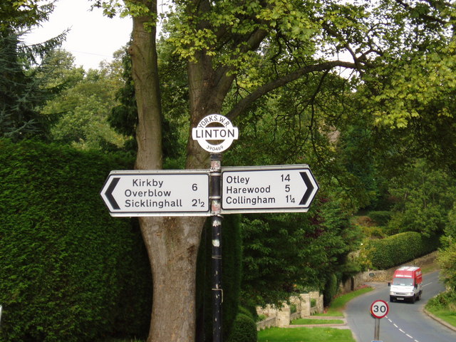
Linton

Settlement in Yorkshire

England

Linton

St Oswald's Church, Collingham The parish church of Collingham.
St Oswald's Church, Collingham Credit: John Davidson

Linton is a small village located in the Craven district of North Yorkshire, England. Situated in the heart of the Yorkshire Dales National Park, Linton is renowned for its picturesque setting, charming stone houses, and tranquil atmosphere. With a population of around 250 residents, the village offers a peaceful escape from the hustle and bustle of city life.

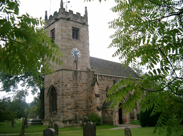
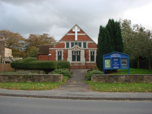
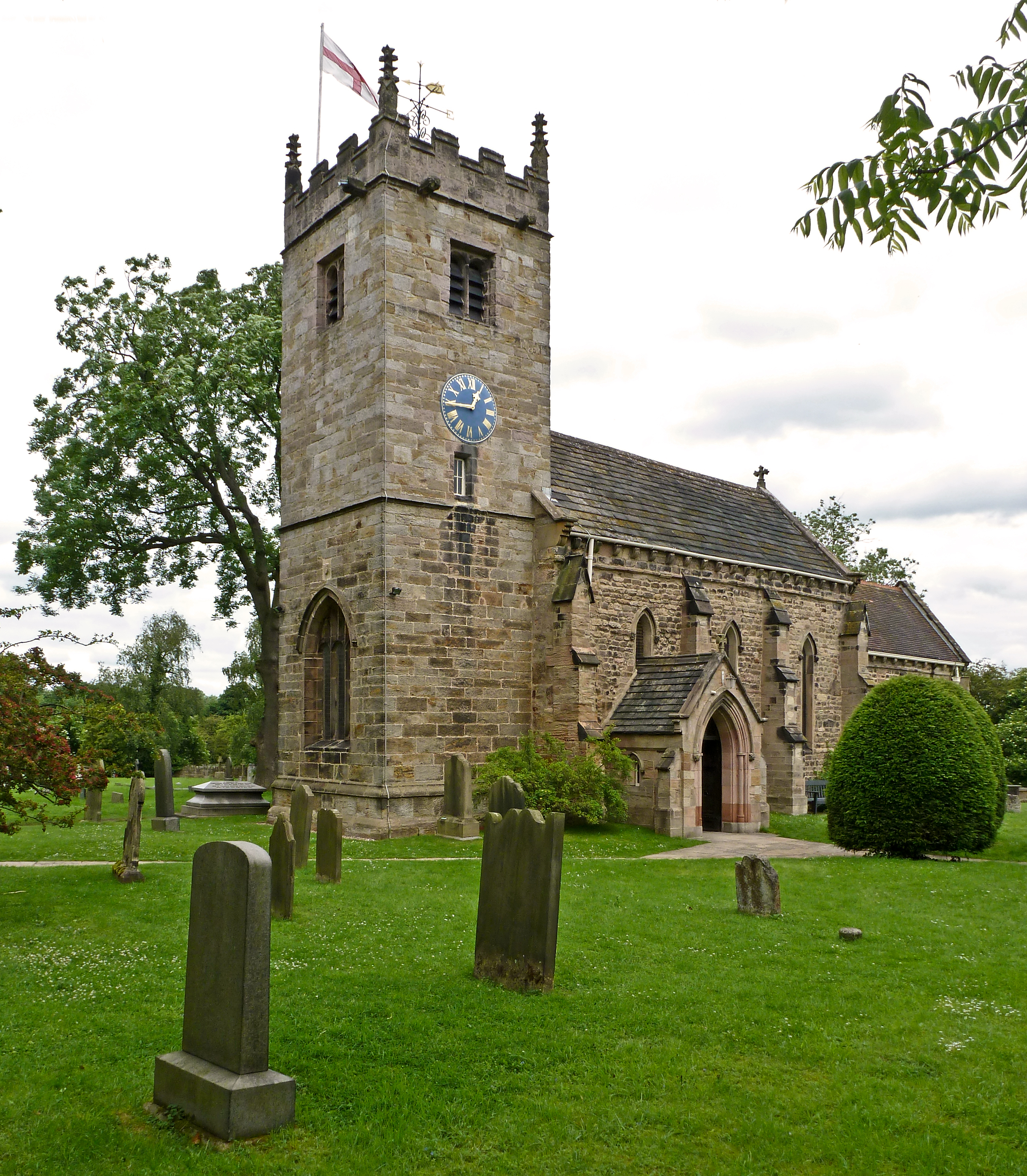
Linton is steeped in history and retains much of its traditional character. The village is home to several historic landmarks, including St. Michael's Church, which dates back to the 12th century. The church's impressive architecture and beautiful stained glass windows attract visitors from far and wide.

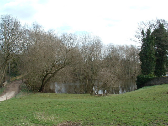
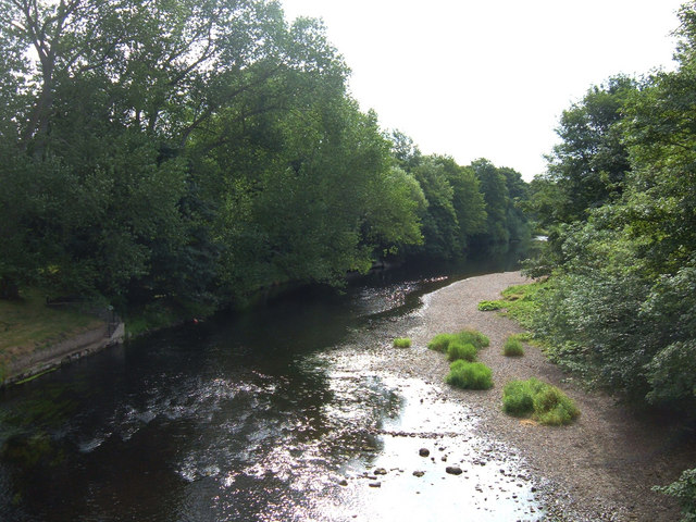
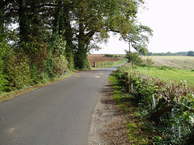
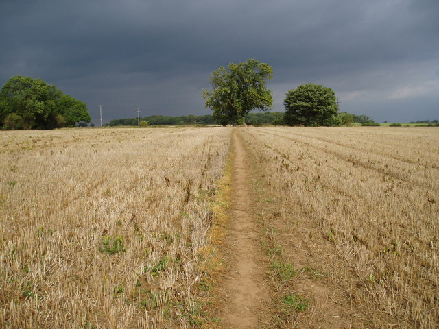
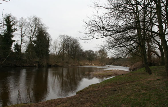
Nature lovers will find Linton to be a paradise, with its close proximity to stunning natural landscapes. The village sits along the River Wharfe, providing opportunities for scenic walks and picnics by the water. Linton Falls, a series of picturesque waterfalls, is a popular attraction for visitors and photographers alike.

In terms of amenities, Linton offers a range of facilities to cater to both residents and tourists. The village boasts a traditional pub, The Fountaine Inn, serving delicious food and local ales. Additionally, Linton has a community-run village shop, providing essential groceries and other basic necessities.

Overall, Linton is a charming village that offers a peaceful and idyllic retreat for those seeking a taste of rural Yorkshire. Its natural beauty, rich history, and warm community make it a delightful place to visit or call home.

If you have any feedback on the listing, please let us know in the comments section below.

Linton Images

Images are sourced within 2km of 53.915899/-1.410763 or Grid Reference SE3846. Thanks to Geograph Open Source API. All images are credited.

St Oswald's Church, Collingham The parish church of Collingham.
St Oswald's Church, Collingham
The parish church of Collingham.
The Pond at Compton A big pond for a little hamlet
The Pond at Compton
A big pond for a little hamlet
River Wharfe from Linton Bridge The River Wharfe here forms the boundary between the villages of Linton and Collingham to the southwest of Wetherby. View downstream towards Wetherby.
River Wharfe from Linton Bridge
The River Wharfe here forms the boundary between the villages of Linton and Collingham to the southwest of Wetherby. View downstream towards Wetherby.
Collingham and Linton Cricket Club Situated on Harewood Road (A659). The club was founded in 1880 and plays in the Airedale and Wharfedale Senior Cricket League.
Collingham and Linton Cricket Club
Situated on Harewood Road (A659). The club was founded in 1880 and plays in the Airedale and Wharfedale Senior Cricket League.
Welcome to Collingham Entering the village on Jewitt Lane. Only 300 metres south of the junction with the A58.
Welcome to Collingham
Entering the village on Jewitt Lane. Only 300 metres south of the junction with the A58.
Sicklinghall Road, North and West Yorkshire Looking west from the junction with Northgate Lane (from Linton) towards the village of Sicklinghall about 1.5 miles away. To the left of shot is West Yorkshire and to the right is North Yorkshire. The county boundary follows the white line down the middle of the road.
Sicklinghall Road, North and West Yorkshire
Looking west from the junction with Northgate Lane (from Linton) towards the village of Sicklinghall about 1.5 miles away. To the left of shot is West Yorkshire and to the right is North Yorkshire. The county boundary follows the white line down the middle of the road.
Paper Pulp Mountain near Wetherby Paper pulp is an environmentally friendly soil conditioner. This mound is waiting to be spread on local fields once the harvest has been gathered. The pulp is a waste product from the paper making industry and would have been disposed of in a landfill site.
Paper Pulp Mountain near Wetherby
Paper pulp is an environmentally friendly soil conditioner. This mound is waiting to be spread on local fields once the harvest has been gathered. The pulp is a waste product from the paper making industry and would have been disposed of in a landfill site.
Welcome to Linton A cast reconstituted stone sign on Northgate Lane.
Welcome to Linton
A cast reconstituted stone sign on Northgate Lane.
Golf Course, Linton Ings I had hoped to be able to capture the old railway running through this square but couldn't see anywhere immediately obvious where I could gain access, and I had to be elsewhere, so I had to make do with this shot of the golf course instead. Facing east, the old railway is somewhere in the trees beyond, and further on flows the River Wharfe before it passes through Wetherby town centre.
Golf Course, Linton Ings
I had hoped to be able to capture the old railway running through this square but couldn't see anywhere immediately obvious where I could gain access, and I had to be elsewhere, so I had to make do with this shot of the golf course instead. Facing east, the old railway is somewhere in the trees beyond, and further on flows the River Wharfe before it passes through Wetherby town centre.
Trip Lane The Ebor Way follows this lane, though the number of speed humps along it suggests it is popular with local rat runners as well.
Trip Lane
The Ebor Way follows this lane, though the number of speed humps along it suggests it is popular with local rat runners as well.
Footpath
Footpath
New growth The recently sown crop is just breaking through in this field south of Spring Wood near Sicklinghall.
New growth
The recently sown crop is just breaking through in this field south of Spring Wood near Sicklinghall.
Straw bales Linton Spring Farm advertises DIY livery stables, so presumably these bales provide fodder or bedding for the horses.
Straw bales
Linton Spring Farm advertises DIY livery stables, so presumably these bales provide fodder or bedding for the horses.
Road sign with Grid Reference These old road signs make it easy to check exactly where you are.
Road sign with Grid Reference
These old road signs make it easy to check exactly where you are.
A58 / A659 Junction at Wattle Syke Entering Collingham towards the junction with the A58.
A58 / A659 Junction at Wattle Syke
Entering Collingham towards the junction with the A58.
A58 Lay By Lay By on the A58 towards Wetherby.
A58 Lay By
Lay By on the A58 towards Wetherby.
Collingham Methodist Church
River Wharfe
River Wharfe
Show me another place!

Linton is located at Grid Ref: SE3846 (Lat: 53.915899, Lng: -1.410763)

Division: West Riding

Unitary Authority: Leeds

Police Authority: West Yorkshire

What 3 Words

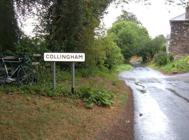
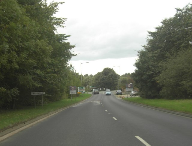
///cracks.vine.sculpting. Near Collingham, West Yorkshire

Nearby Locations

Linton Beck Woods

Related Wikis

Linton, West Yorkshire

Linton is a village in the City of Leeds metropolitan borough, in West Yorkshire, England. It is 1.5 miles (2.4 km) south-west of Wetherby Wetherby on...
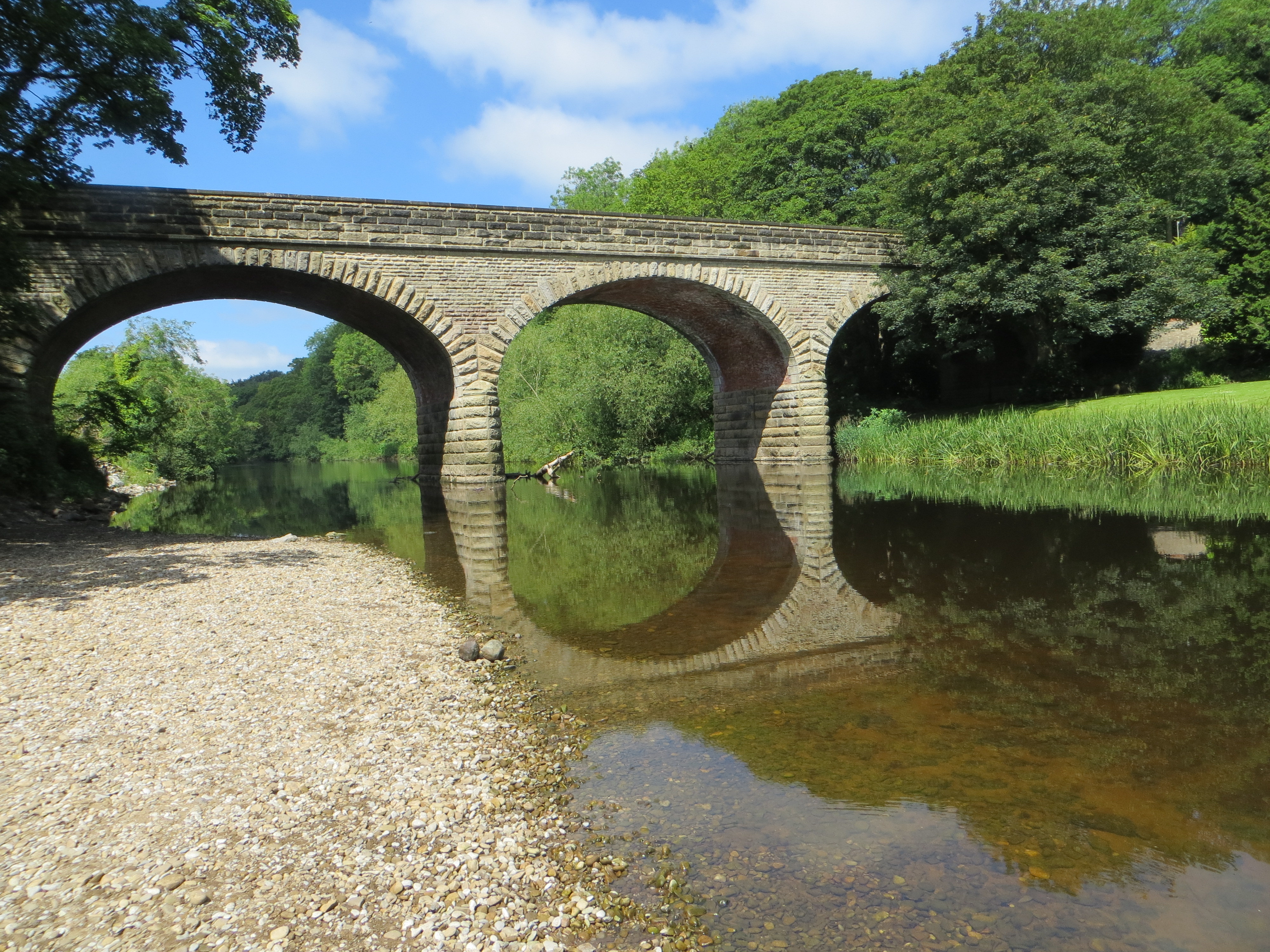
Linton Bridge

Linton Bridge carries the minor road that links Collingham and Linton over the River Wharfe near Wetherby in West Yorkshire, England. The Grade II listed...

Collingham Bridge railway station

Collingham Bridge railway station was a railway station serving the villages of Collingham and Linton in West Yorkshire, England. The station opened on...

St Oswald's Church, Collingham

St Oswald's Church is an active Anglican church in Collingham, West Yorkshire, England. It is in the Harrogate deanery and Diocese of Leeds. The church...

Nearby Amenities

Located within 500m of 53.915899,-1.410763
Linton
Place: village
Postal Code: LS22
Wikidata: Q6554886
Lat/Long: 53.9148041/-1.4064824
Passing Place
Lat/Long: 53.9158847/-1.4127348
Bus Stop
Main Street Trip Lane
Bus: yes
Local Ref: 45014885
Naptan AtcoCode: 450014885
Naptan Bearing: N
Naptan CommonName: Main Street Trip Lane
Naptan Crossing: Trip Lane
Naptan Indicator: Stop 45014885
Naptan Landmark: Windmill PH
Naptan PlusbusZoneRef: LEEDS
Naptan ShortCommonName: Trip Lane
Naptan Street: Main Street
Naptan Verified: no
Public Transport: platform
Source: naptan_import
Lat/Long: 53.9154851/-1.4074934
Bus Stop
Linton Road
Bus: yes
Local Ref: 45014886
Naptan AtcoCode: 450014886
Naptan Bearing: S
Naptan CommonName: Linton Road
Naptan Indicator: Stop 45014886
Naptan PlusbusZoneRef: LEEDS
Naptan ShortCommonName: Linton Common
Naptan Street: Linton Road
Naptan Verified: no
Public Transport: platform
Source: naptan_import
Lat/Long: 53.91236/-1.4098821
Bus Stop
Linton Common
Bus: yes
Local Ref: 45023968
Naptan AtcoCode: 450023968
Naptan Bearing: E
Naptan CommonName: Linton Common
Naptan Crossing: Linton Common
Naptan Indicator: Stop 45023968
Naptan PlusbusZoneRef: LEEDS
Naptan ShortCommonName: Main Street
Naptan Street: Linton Common
Naptan Verified: no
Public Transport: platform
Source: naptan_import
Lat/Long: 53.9132142/-1.4099462
Linton Windmill Inn
Local Ref: 45050233
Naptan AtcoCode: 450050233
Naptan Bearing: S
Naptan BusStopType: CUS
Naptan CommonName: Linton Windmill Inn
Naptan Indicator: Stop 45050233
Naptan PlusbusZoneRef: LEEDS
Naptan ShortCommonName: Windmill Lane
Naptan Street: Main Street
Naptan Verified: no
Source: naptan_import
Lat/Long: 53.9154847/-1.4074173
Bus Stop
Linton Road Linton
Bus: yes
Local Ref: 45050234
Naptan AtcoCode: 450050234
Naptan Bearing: N
Naptan BusStopType: CUS
Naptan CommonName: Linton Road Linton
Naptan Indicator: Stop 45050234
Naptan PlusbusZoneRef: LEEDS
Naptan ShortCommonName: Linton Bridge
Naptan Street: Linton Road
Naptan Verified: no
Public Transport: platform
Source: naptan_import
Lat/Long: 53.9123608/-1.4100496
Turning Circle
Source: Bing
Lat/Long: 53.9197363/-1.4073304
Turning Circle
Source: Bing
Lat/Long: 53.9145671/-1.4104482
Noexit: yes
Lat/Long: 53.916211/-1.4059797
Noexit: yes
Lat/Long: 53.918659/-1.4093057
Turning Circle
Lat/Long: 53.9171203/-1.4100868
Bench
Lat/Long: 53.9154697/-1.4075409
Public Bookcase
Linton Bookswap
Booth: K6
Colour: red
Disused Amenity: telephone
Man Made: telephone_box
Public Bookcase Type: phone_box
Lat/Long: 53.9158395/-1.407482
Kindergarten
Cherry Tree Montessori Nursery
Addr City: Wetherby
Addr Housename: Linton Village Hall
Addr Postcode: LS22 4HL
Addr Street: Linton Lane
Addr Suburb: Linton
Fhrs Id: 467432
Lat/Long: 53.9167803/-1.4069541
Post Box
Operator: Royal Mail
Post Box Type: lamp
Ref: LS22 409
Lat/Long: 53.9183007/-1.4105395
Post Box
Operator: Royal Mail
Post Box Type: wall
Ref: LS22 876
Lat/Long: 53.9140856/-1.407984
Defibrillator
Access: yes
Defibrillator Location: External wall of Linton Memorial Hall, to left of entrance steps & notice board
Emergency: defibrillator
Indoor: no
Ref GB The Circuit: 0005BBFD-6FD1-49A1-9C48-AD4B00D3425D
Lat/Long: 53.9168328/-1.4070989
Turning Circle
Lat/Long: 53.9190901/-1.4071229
Turning Circle
Lat/Long: 53.9202874/-1.4123808
Noexit: yes
Lat/Long: 53.9181007/-1.4123605
Bench
Lat/Long: 53.9121953/-1.4089553
Bench
Lat/Long: 53.9123589/-1.4093276
Information: route_marker
Tourism: information
Lat/Long: 53.9167202/-1.4074596
The data included in this document is from www.openstreetmap.org. The data is made available under ODbL.

Have you been to Linton?

Leave your review of Linton below (or comments, questions and feedback).