Raveen

Island in Cornwall

England

Raveen

Church Point
Church Point Credit: David Lally

Raveen, Cornwall, also known as Raveen Island, is a small island located off the coast of Cornwall in southwest England. This picturesque island is situated in the Celtic Sea and is accessible by boat or ferry from the mainland.

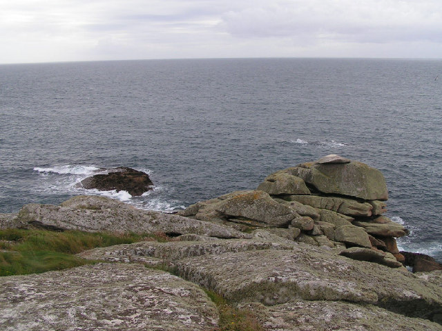
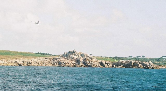
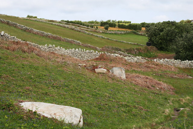
Raveen Island boasts stunning natural beauty, with rugged cliffs, sandy beaches, and rolling green hills. The island is relatively small in size, spanning approximately 2 square miles. Its quaint charm and unspoiled landscapes make it a popular destination for nature lovers and those seeking a peaceful retreat.

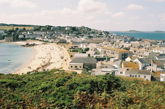
The island is home to a small population, with only a few hundred residents. The main settlement on the island is a small village, characterized by traditional stone cottages and narrow, winding streets. The locals are known for their friendly and welcoming nature, creating a warm and inclusive atmosphere for visitors.

Raveen Island offers various outdoor activities, including hiking, cycling, and bird-watching. The coastal paths provide breathtaking views of the surrounding sea and the chance to spot diverse wildlife. The island's beaches are perfect for relaxation and sunbathing, while also offering opportunities for water sports such as kayaking and paddleboarding.

Visitors to Raveen Island can explore its rich history by visiting the island's ancient ruins and historical landmarks. From Neolithic burial sites to medieval castles, the island is steeped in fascinating heritage.

Overall, Raveen Island is a hidden gem in Cornwall, offering a tranquil escape from the hustle and bustle of modern life, while providing breathtaking natural landscapes and a rich cultural history.

If you have any feedback on the listing, please let us know in the comments section below.

Raveen Images

Images are sourced within 2km of 49.909356/-6.3128598 or Grid Reference SV9009. Thanks to Geograph Open Source API. All images are credited.

Church Point
Church Point
Pillbox entrance On Tolman Point.
Pillbox entrance
On Tolman Point.
Sunrise over Penninis Glad I decided to walk this way this morning.
Sunrise over Penninis
Glad I decided to walk this way this morning.
Dropnose just before sunrise
Rock formations at Peninnis Head
Morning Point, the Garrison Looking SE to the offshore rocks Wras and (behind and smaller) Biggal; Inner Head <a href="https://www.geograph.org.uk/gridref/SV908093">SV908093</a> (part of Peninnis Head) is just visible to the far left, on the other side of Porth Cressa bay. Note the passing storm on the horizon...
Morning Point, the Garrison
Looking SE to the offshore rocks Wras and (behind and smaller) Biggal; Inner Head SV908093 (part of Peninnis Head) is just visible to the far left, on the other side of Porth Cressa bay. Note the passing storm on the horizon...
Peninnis Head Looking SSE to the lighthouse from approx. SV910097.
Peninnis Head
Looking SSE to the lighthouse from approx. SV910097.
Old Town Bay from Peninnis There is a former Battery on the island to the right of the pine tree.
Old Town Bay from Peninnis
There is a former Battery on the island to the right of the pine tree.
Tolman Point Viewed from the north on the very edge of the square; note the WW2 pillbox.
Tolman Point
Viewed from the north on the very edge of the square; note the WW2 pillbox.
Church Point The end of Church Point (just below the end of the main runway of St Mary's Airport) looking out to sea; this (and a rock off the end of Giant's Castle) is the only land in the square.
Church Point
The end of Church Point (just below the end of the main runway of St Mary's Airport) looking out to sea; this (and a rock off the end of Giant's Castle) is the only land in the square.
Lighthouse at Peninnis Head, St. Mary's The lighthouse guides shipping passing through St. Mary's Sound, between the islands of Agnes and St. Mary's.  The lattice-work construction reduces its wind resistance.
Lighthouse at Peninnis Head, St. Mary's
The lighthouse guides shipping passing through St. Mary's Sound, between the islands of Agnes and St. Mary's. The lattice-work construction reduces its wind resistance.
St. Mary’s: Peninnis Point Viewed from the ferry from Penzance shortly before arrival on the island.
St. Mary’s: Peninnis Point
Viewed from the ferry from Penzance shortly before arrival on the island.
St. Mary’s: plane over Church Point A plane approaches Scilly's airport, viewed from the ferry from Penzance.
St. Mary’s: plane over Church Point
A plane approaches Scilly's airport, viewed from the ferry from Penzance.
Photographing the Rock Labyrinth The area between the lighthouse and the Outer Head is appropriately known as the Rock Labyrinth. In younger (and slimmer) days we would explore this fantastic maze of huge granite rocks.
Photographing the Rock Labyrinth
The area between the lighthouse and the Outer Head is appropriately known as the Rock Labyrinth. In younger (and slimmer) days we would explore this fantastic maze of huge granite rocks.
Carn Leh, St. Mary's, Scilly Isles
Footpath on Peninnis Head, St. Mary's, Scilly Isles
Granite Stone Walls Granite is pretty much the only rock there is on the Scillies and there's plenty of it, so it makes sense to build your field walls out of it.
Granite Stone Walls
Granite is pretty much the only rock there is on the Scillies and there's plenty of it, so it makes sense to build your field walls out of it.
Fields on the eastern side of Peninnis The field at the bottom of the hill on the right is being used for bulb growing, the others look as though they have been left to grass.
Fields on the eastern side of Peninnis
The field at the bottom of the hill on the right is being used for bulb growing, the others look as though they have been left to grass.
Show me another place!

Raveen is located at Grid Ref: SV9009 (Lat: 49.909356, Lng: -6.3128598)

Division: Isles of Scilly

Unitary Authority: Isles of Scilly

Police Authority: Devon and Cornwall

What 3 Words

///bends.bicker.homecare. Near St Mary's, Isles of Scilly

Related Wikis

Buzza Tower

Buzza Tower is a Grade II listed structure on St Mary's, Isles of Scilly now used as a camera obscura. The tower was built in 1821 as a windmill. It was...

Hugh Town

Hugh Town (Cornish: Treworenys or Tre Huw) is the largest settlement on the Isles of Scilly and its administrative centre. The town is situated on the...

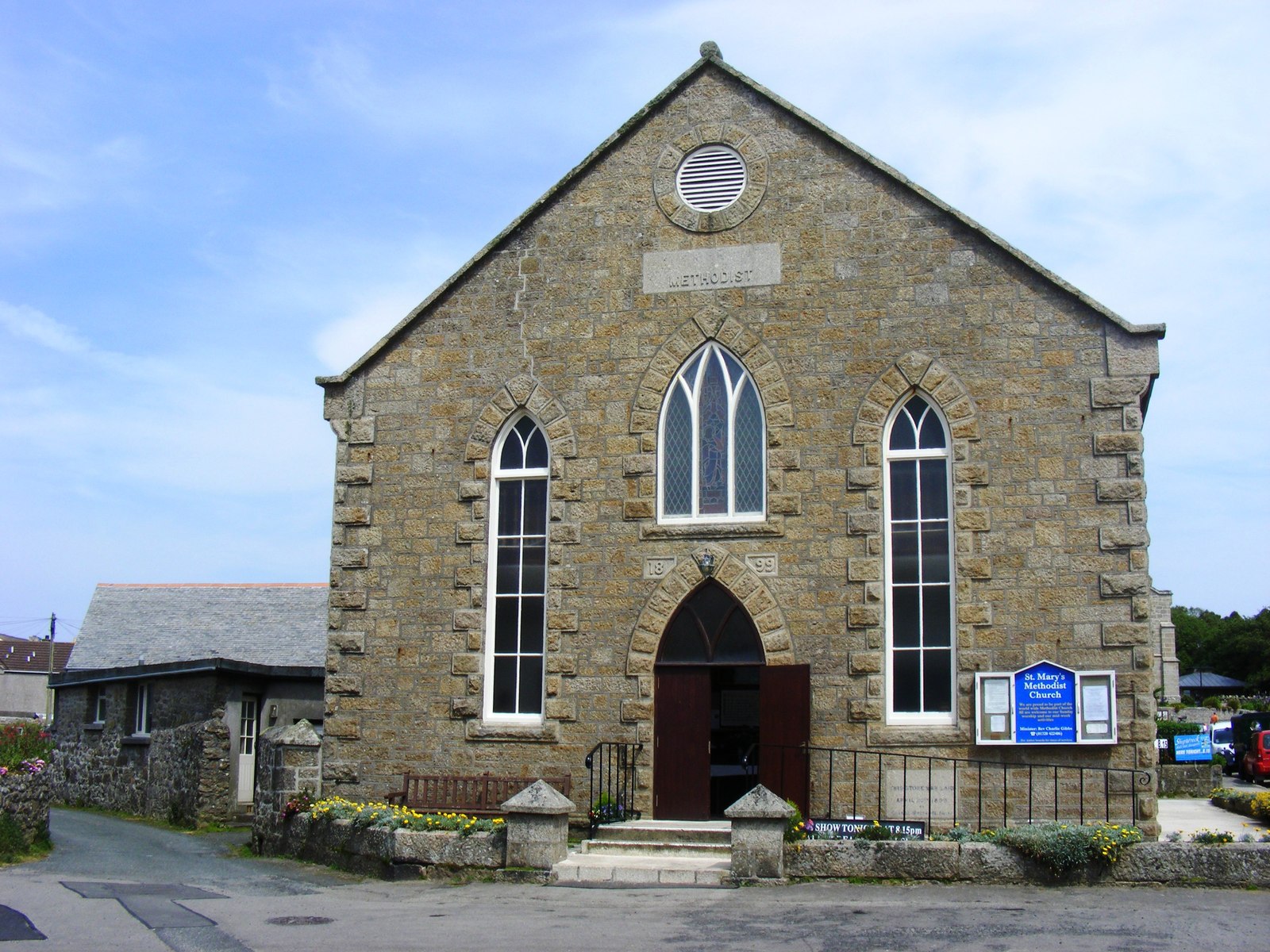
St Mary's Methodist Church, Isles of Scilly

St Mary's Methodist Church, Hugh Town is a Methodist church in Hugh Town, Isles of Scilly. It is currently Grade II listed. == History == Bible Christians...

Wesleyan Methodist Church, Hugh Town

Wesleyan Methodist Church, Hugh Town, Isles of Scilly was a Wesleyan Methodist church in Hugh Town, Isles of Scilly from 1790. It is currently Grade II...

Nearby Amenities

Located within 500m of 49.909356,-6.3128598
Source: PGS
Lat/Long: 49.9117741/-6.3110473
Source: PGS
Lat/Long: 49.9131039/-6.3132106
Source: PGS
Lat/Long: 49.912369/-6.3124168
Source: PGS
Lat/Long: 49.9133202/-6.3158963
Source: PGS
Lat/Long: 49.9132917/-6.3143428
Source: PGS
Lat/Long: 49.9132193/-6.313651
Sibleys Launderette
Operator: Sibleys on Scilly
Phone: +44 1720 422431
Shop: laundry
Website: https://www.sibleysonscilly.co.uk/
Lat/Long: 49.9137775/-6.3133014
Source: PGS
Lat/Long: 49.9133931/-6.3151877
Barrier: stile
Lat/Long: 49.909471/-6.3095507
Barrier: stile
Lat/Long: 49.9087421/-6.3080648
Barrier: stile
Lat/Long: 49.9099098/-6.3102695
Barrier: stile
Lat/Long: 49.9091148/-6.3189834
Buzza Hill
Alt Name: Mill Hill
Ele: 32
Natural: peak
Lat/Long: 49.9134412/-6.3105992
Sibleys Estate Agency
Office: estate_agent
Phone: +44 1720 422431
Website: https://www.sibleysonscilly.co.uk/
Lat/Long: 49.9137399/-6.3133805
Porth Cressa
Natural: bay
Lat/Long: 49.9116884/-6.3148622
Library
St Mary's Library
Lat/Long: 49.9137434/-6.313066
Leisure: slipway
Lat/Long: 49.9135604/-6.3131861
Tourism: viewpoint
Lat/Long: 49.9133641/-6.3108986
Historic: archaeological_site
Wikidata: Q17649595
Lat/Long: 49.9133479/-6.3114742
Bench
Lat/Long: 49.913065/-6.3118164
Fuel
Compressed Air: yes
Operator: Sibley's
Lat/Long: 49.9138038/-6.3132759
Morning Point Battery
Historic: fort
Lat/Long: 49.9089138/-6.3183708
Government: register_office
Office: government
Operator: Council of the Isles of Scilly
Lat/Long: 49.913676/-6.3131074
Camera Obscura
Description: Camera Obscura & Museum of Curiosities
Tourism: attraction
Lat/Long: 49.9134062/-6.3107992
Stony Porth
Natural: bay
Source: OS Open Names
Lat/Long: 49.9083693/-6.3092985
Generator Method: photovoltaic
Generator Output Electricity: yes
Generator Source: solar
Generator Type: solar_photovoltaic_panel
Location: roof
Power: generator
Lat/Long: 49.9132132/-6.3099068
Generator Method: photovoltaic
Generator Output Electricity: yes
Generator Source: solar
Generator Type: solar_photovoltaic_panel
Location: roof
Power: generator
Lat/Long: 49.9132883/-6.3097452
The data included in this document is from www.openstreetmap.org. The data is made available under ODbL.

Have you been to Raveen?

Leave your review of Raveen below (or comments, questions and feedback).