Lincoln

Settlement in Lincolnshire Lincoln

England

Lincoln

Offerings Box Offerings collection box in the churchyard of St. Mary le Wigford. Constructed in 1975 using stones from the nearby demolished church of St. Mark, surmounted by a capital thought to have come from St. Benedict's church
Offerings Box Credit: Richard Croft

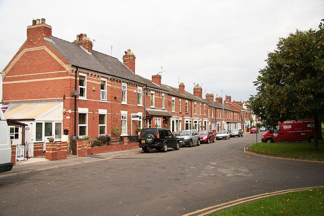
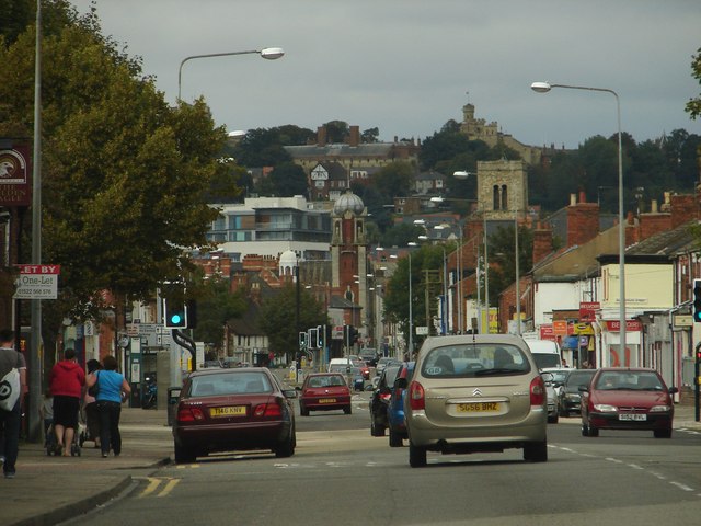
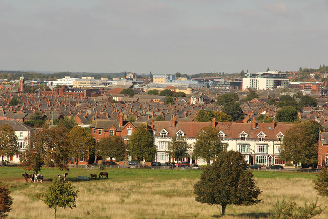
Lincoln, Lincolnshire is a historic city situated in the East Midlands region of England. It serves as the county town of Lincolnshire and is known for its rich heritage, stunning architecture, and picturesque landscapes.

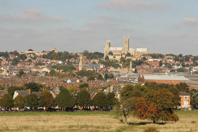
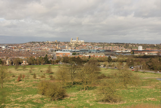
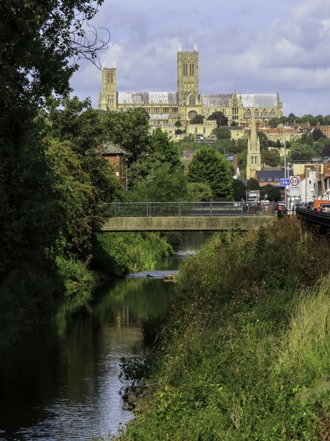
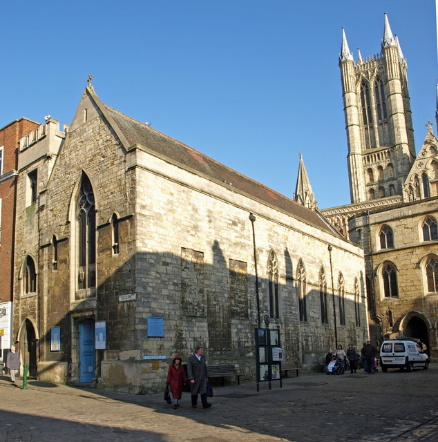
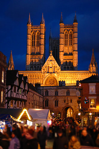
The city is nestled on a hilltop, offering breathtaking views of the surrounding countryside. Its most prominent feature is the magnificent Lincoln Cathedral, which dates back to the 11th century and is one of the finest examples of Gothic architecture in Europe. Adjacent to the cathedral is Lincoln Castle, a medieval fortress that houses a copy of the famous Magna Carta.

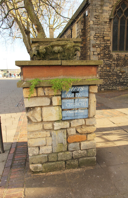
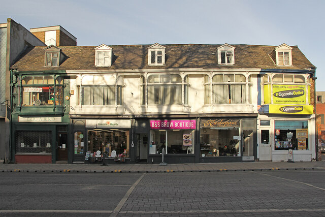
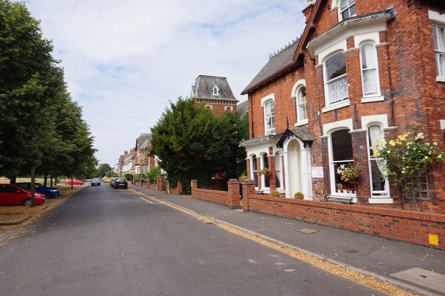
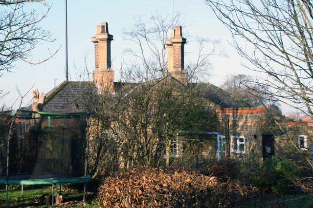
Lincoln's history can be traced back to Roman times, and evidence of its past can be seen throughout the city. The cobbled streets of the Bailgate area, lined with charming independent shops and cafes, take visitors on a journey through time. The Steep Hill, a steep and narrow street, showcases medieval buildings and is a popular spot for tourists and locals alike.

The city also boasts a vibrant cultural scene, with numerous galleries, museums, and theaters. The Collection Museum houses an impressive collection of art and artifacts, including archaeological finds from the region. The Lincoln Drill Hall hosts a variety of performances, ranging from live music to theatrical productions.

Additionally, Lincoln hosts several annual events that draw visitors from far and wide. The Lincoln Christmas Market, one of the largest in Europe, transforms the city into a winter wonderland, with stalls selling crafts, food, and festive delights.

Overall, Lincoln offers a perfect blend of history, culture, and natural beauty, making it a must-visit destination for history enthusiasts, art lovers, and anyone seeking a charming English city experience.

If you have any feedback on the listing, please let us know in the comments section below.
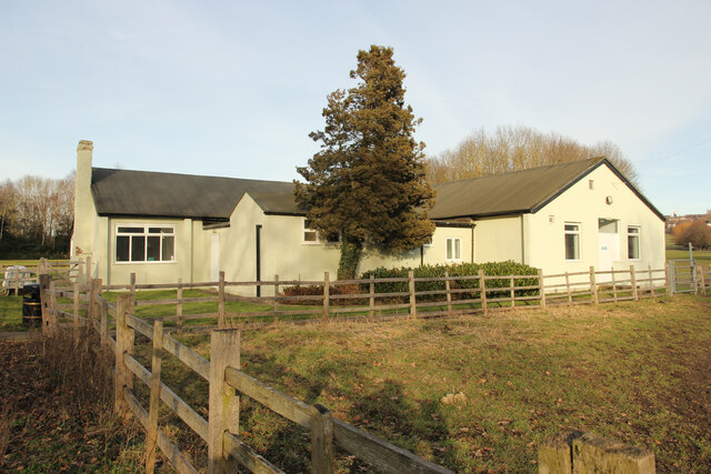
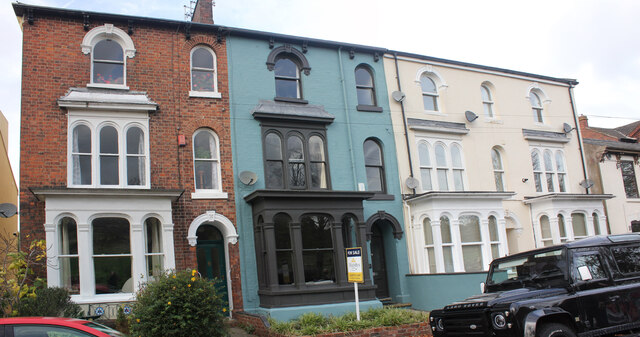
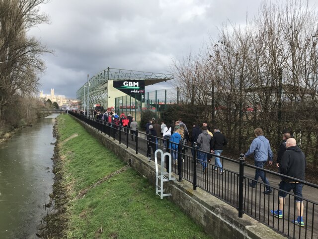
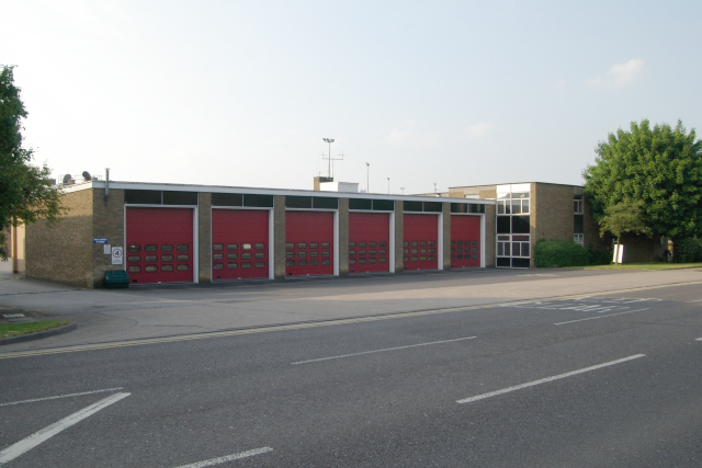
Lincoln Images

Images are sourced within 2km of 53.234824/-0.538418 or Grid Reference SK9771. Thanks to Geograph Open Source API. All images are credited.

Offerings Box Offerings collection box in the churchyard of St. Mary le Wigford. Constructed in 1975 using stones from the nearby demolished church of St. Mark, surmounted by a capital thought to have come from St. Benedict's church
Offerings Box
Offerings collection box in the churchyard of St. Mary le Wigford. Constructed in 1975 using stones from the nearby demolished church of St. Mark, surmounted by a capital thought to have come from St. Benedict's church
1 - 5 St Mary's Street Originally five houses by Pearson Bellamy in 1847, reduced in size and converted to shops by Bellamy & Hardy in 1883.
1 - 5 St Mary's Street
Originally five houses by Pearson Bellamy in 1847, reduced in size and converted to shops by Bellamy & Hardy in 1883.
Isaac Newton Building The Isaac Newton Building at the University of Lincoln. Completed in 2017 at a cost of £28 million, home for the Schools of Computer Science, Engineering and Mathematics & Physics
Isaac Newton Building
The Isaac Newton Building at the University of Lincoln. Completed in 2017 at a cost of £28 million, home for the Schools of Computer Science, Engineering and Mathematics & Physics
Ross Lucas Medical Sciences Building The Ross Lucas Medical Sciences Building at the University of Lincoln. Completed in March 2021 it houses most of the Medical School, with lecture theatres, laboratories, anatomy suite and the Ross Library.
Ross Lucas Medical Sciences Building
The Ross Lucas Medical Sciences Building at the University of Lincoln. Completed in March 2021 it houses most of the Medical School, with lecture theatres, laboratories, anatomy suite and the Ross Library.
West Common Pavilion Pavilion / Clubhouse for bowls, tennis, cricket and football on the West Common.
The core was formerly the Officer's Mess for 'No.4 (Lincoln) Aircraft Acceptance Park' during the First World War, purchased by the Corporation from the Air Ministry in 1919.
West Common Pavilion
Pavilion / Clubhouse for bowls, tennis, cricket and football on the West Common. The core was formerly the Officer's Mess for 'No.4 (Lincoln) Aircraft Acceptance Park' during the First World War, purchased by the Corporation from the Air Ministry in 1919.
52-55 South Park, Lincoln A row of 4 houses previously known as 4 to 1 South Park Villas. (I can find only two planning applications for 4 houses in South Park, both 1872 in date). Planning for no.55 was approved for owner/architect Barker & Son in April 1948 for 'conversion', possibly to flats? Planning for no.52 was approved for owners Lindum Estates, architect C Warren-Neil in August 1951 for 'conversion'. Nos. 54 and 55 differ from the other two in having only one access door, presumably a passage. They now comprise 7 flats, 6 1-bed and 1 3-bed in the basement. 2021 particulars described them as "looking a little ‘tired’ and would benefit from a scheme of refurbishment".
52-55 South Park, Lincoln
A row of 4 houses previously known as 4 to 1 South Park Villas. (I can find only two planning applications for 4 houses in South Park, both 1872 in date). Planning for no.55 was approved for owner/architect Barker & Son in April 1948 for 'conversion', possibly to flats? Planning for no.52 was approved for owners Lindum Estates, architect C Warren-Neil in August 1951 for 'conversion'. Nos. 54 and 55 differ from the other two in having only one access door, presumably a passage. They now comprise 7 flats, 6 1-bed and 1 3-bed in the basement. 2021 particulars described them as "looking a little ‘tired’ and would benefit from a scheme of refurbishment".
Football supporters heading to the Lincoln City v Peterborough United match on 18 March 2023 The league 1 match was a comfortable 3-0 victory for Peterborough United
Football supporters heading to the Lincoln City v Peterborough United match on 18 March 2023
The league 1 match was a comfortable 3-0 victory for Peterborough United
Lincoln South fire station Lincoln South fire station, South Park Avenue, Lincoln, Lincolnshire
Lincoln South fire station
Lincoln South fire station, South Park Avenue, Lincoln, Lincolnshire
South Park Victorian houses overlooking the South Common
South Park
Victorian houses overlooking the South Common
Up the High Street View from outside the Golden Eagle northwards along the High Street.  Note the tower on Lincoln Castle on the horizon.
Up the High Street
View from outside the Golden Eagle northwards along the High Street. Note the tower on Lincoln Castle on the horizon.
Sincil Bank The Lincoln Co-op family stand at Sincil Bank football ground and Sincil Drain
Sincil Bank
The Lincoln Co-op family stand at Sincil Bank football ground and Sincil Drain
South Common view View to Lincoln from the South Common
South Common view
View to Lincoln from the South Common
South Common view View to the Castle & Cathedral from the South Common
South Common view
View to the Castle & Cathedral from the South Common
South Common View across the South Common from the IBCC <a title="https://www.geograph.org.uk/photo/5319716" href="https://www.geograph.org.uk/photo/5319716">Link</a> with the city of Lincoln and St.Mary's Cathedral beyond
South Common
View across the South Common from the IBCC Link with the city of Lincoln and St.Mary's Cathedral beyond
South Park, Lincoln
South Park, Lincoln
Canwick Toll House, Lincoln Toll House in the parish of Lincoln (Lincoln District), Toll Bar Lodge, Canwick Road (B1188).

Grade II listed.
List Entry Number: 1388480 <span class="nowrap"><a title="https://historicengland.org.uk/listing/the-list/list-entry/1388480" rel="nofollow ugc noopener" href="https://historicengland.org.uk/listing/the-list/list-entry/1388480">Link</a><img style="margin-left:2px;" alt="External link" title="External link - shift click to open in new window" src="https://s1.geograph.org.uk/img/external.png" width="10" height="10"/></span> 

Surveyed

Milestone Society National ID: LI.LIN
Canwick Toll House, Lincoln
Toll House in the parish of Lincoln (Lincoln District), Toll Bar Lodge, Canwick Road (B1188). Grade II listed. List Entry Number: 1388480 LinkExternal link Surveyed Milestone Society National ID: LI.LIN
Toll Bar Lodge, junction of Washingborough Road and Canwick Road, Lincoln Grade II Listed. Presumably built by the Turnpike Trust when Canwick road was constructed in 1843 (as indicated on the date-stone). Tolls ceased in 1870 and the trust was wound up. The building points to the former corner of Canwick Road and Washingborough Road before it was moved south in 1855/6. It is reasonable to assume the garden wall and front-gate piers were added around 1856 when the cemetery was laid out. The City of Lincoln Directory 1857 seems to ignore this lodge as I can find no reference to it. In the garden is a well, reported in 1859 to have high concentrations of iron oxide similar to the water at Monks Abbey.
Toll Bar Lodge, junction of Washingborough Road and Canwick Road, Lincoln
Grade II Listed. Presumably built by the Turnpike Trust when Canwick road was constructed in 1843 (as indicated on the date-stone). Tolls ceased in 1870 and the trust was wound up. The building points to the former corner of Canwick Road and Washingborough Road before it was moved south in 1855/6. It is reasonable to assume the garden wall and front-gate piers were added around 1856 when the cemetery was laid out. The City of Lincoln Directory 1857 seems to ignore this lodge as I can find no reference to it. In the garden is a well, reported in 1859 to have high concentrations of iron oxide similar to the water at Monks Abbey.
Sincil Dyke in Lincoln
Show me another place!

Lincoln is located at Grid Ref: SK9771 (Lat: 53.234824, Lng: -0.538418)

Division: Parts of Lindsey

Administrative County: Lincolnshire

District: Lincoln

Police Authority: Lincolnshire

What 3 Words

///double.ahead.actual. Near Lincoln, Lincolnshire

Related Wikis

Battle of Lincoln (1141)

The Battle of Lincoln, or the First Battle of Lincoln, occurred on 2 February 1141 in Lincoln, England between King Stephen of England and forces loyal...

St Mary Magdalene, Bailgate, Lincoln

St Mary Magdalene, Bailgate, is a Grade II listed parish church in Lincoln, England. It is dedicated to Jesus' companion, Mary Magdalene. == History... ==

Siege of Lincoln

The siege of Lincoln took place from 3 to 6 May 1644 during the First English Civil War, when the important town of Lincoln was besieged by Parliamentarian...

Lincoln Grand Prix

The Rapha Lincoln Grand Prix (formerly the Witham-Valley Grand Prix) is a road bicycle race that starts and finishes in Lincoln. The 2021 version was 166...

Lincoln Christmas Market

Lincoln Christmas Market, held in Lincoln, England, was one of the largest Christmas markets in Europe, attracting over 250,000 people over the four-day...
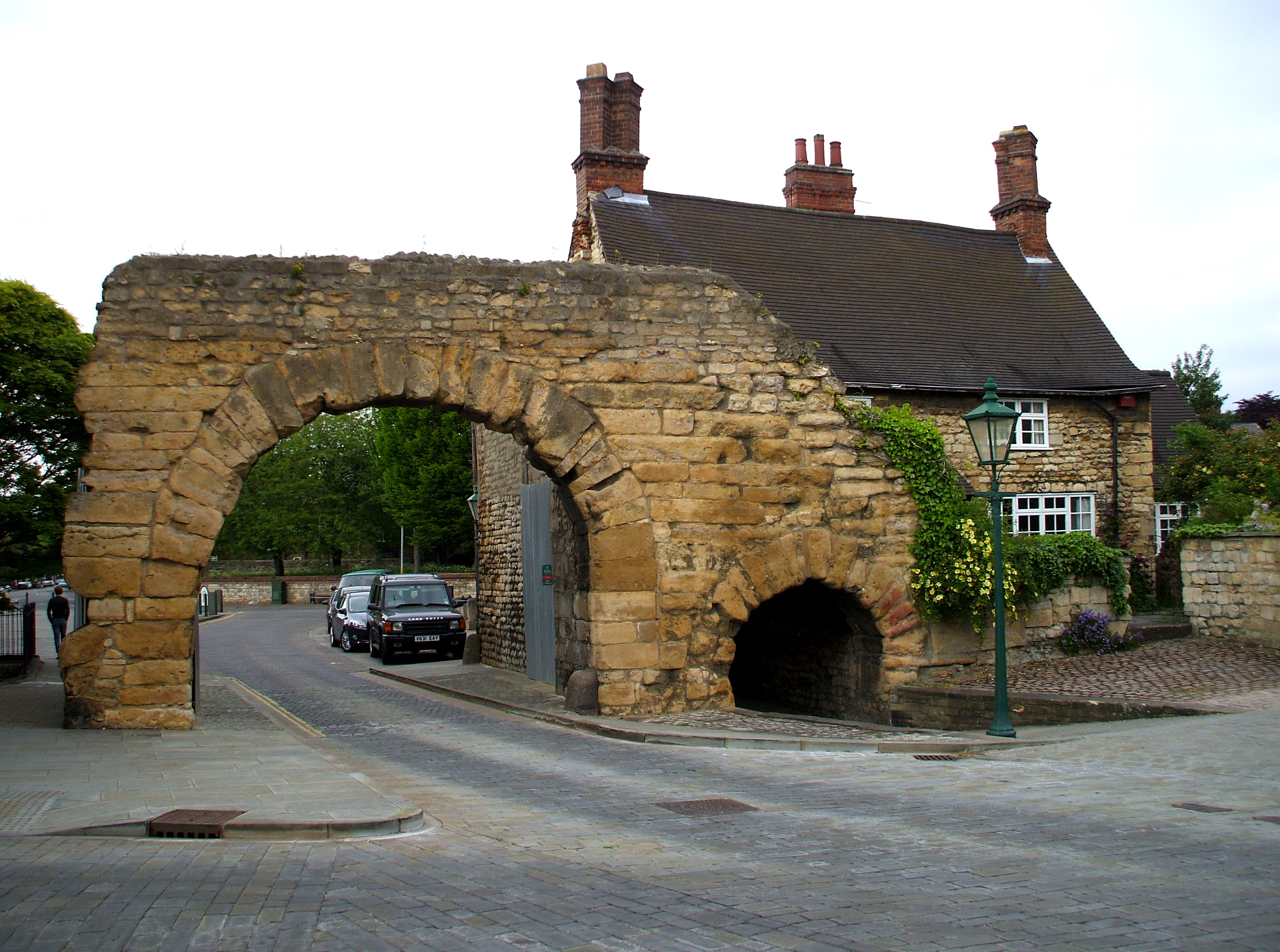
Lindum Colonia

Lindum Colonia was the Roman settlement which is now the City of Lincoln in Lincolnshire. It was founded as a Roman Legionary Fortress during the reign...
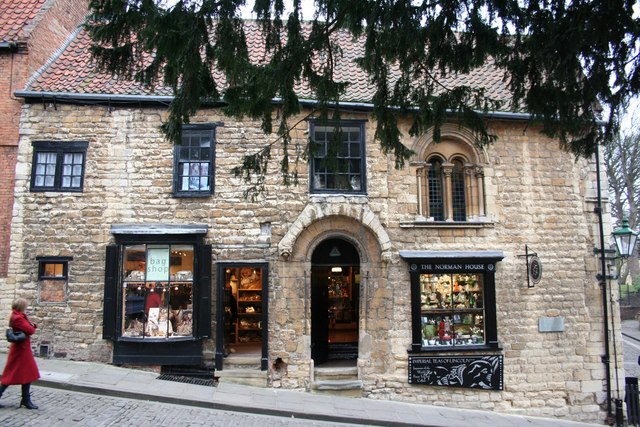
Norman House

Norman House on Steep Hill, Lincoln, England is an historic building and an example of Norman domestic architecture.The building is at 46–47 Steep Hill...

Diocese of Lincoln

The Diocese of Lincoln forms part of the Province of Canterbury in England. The present diocese covers the ceremonial county of Lincolnshire. == History... ==

Nearby Amenities

Located within 500m of 53.234824,-0.538418
074
Source: GPS waypoint
Upload Tag: ojw_lincoln
Lat/Long: 53.2308077/-0.535734
Barrier: sally_port
Foot: yes
Source: GPS waypoint
Lat/Long: 53.2345448/-0.53971
Source: GPS waypoint
Upload Tag: ojw_lincoln
Lat/Long: 53.2361949/-0.5419483
Source: GPS waypoint
Lat/Long: 53.2356671/-0.5429592
Source: GPS waypoint
Lat/Long: 53.2341953/-0.5437674
Restaurant
Browns Pie Shop
Addr City: Lincoln
Addr Country: GB
Addr Housenumber: 33
Addr Postcode: LN2 1LU
Addr Street: Steep Hill
Fhrs Id: 330525
Note: Very good, game pies
Source Addr: FHRS Open Data
Lat/Long: 53.234229/-0.5388918
Crossing
Source: Bing
Lat/Long: 53.2391267/-0.538252
Traffic Calming: table
Lat/Long: 53.2357179/-0.5384901
Place Of Worship
Bailgate Methodist Church
Denomination: methodist
Religion: christian
Source: survey
Source Name: voice
Lat/Long: 53.2367508/-0.5378148
Parking Entrance
Lat/Long: 53.2358572/-0.5400259
Telephone
Booth: K6
Covered: booth
Listed Status: Grade II
Operator: BT
Phone: +44 1522 576539
Source: survey
Lat/Long: 53.2356975/-0.538565
Post Box
Collection Times: Mo-Fr 09:00; Sa 07:00
Operator: Royal Mail
Operator Wikidata: Q638098
Post Box Type: pillar
Ref: LN1 571D
Royal Cypher: EIIR
Royal Cypher Wikidata: Q33102113
Source: survey
Lat/Long: 53.2356676/-0.5385688
Telephone
Booth: K6
Covered: booth
Listed Status: Grade II
Man Made: telephone_box
Source: survey
Lat/Long: 53.2344516/-0.5389472
Traffic Signals
Bicycle: no
Button Operated: yes
Crossing: traffic_signals
Crossing Ref: pelican
Tactile Paving: yes
Traffic Signals Sound: yes
Lat/Long: 53.23051/-0.5399392
Crossing
Crossing: traffic_signals
Tactile Paving: yes
Lat/Long: 53.2306866/-0.5369286
Crossing
Bicycle: no
Crossing: traffic_signals
Crossing Ref: pelican
Lat/Long: 53.2305572/-0.5380779
Street Lamp
Barrier: sally_port
Lat/Long: 53.2335816/-0.5358453
Post Box
Post Box Type: pillar
Postal Code: LN2
Ref: LN2 1
Royal Cypher: EVIIR
Royal Cypher Wikidata: Q33102324
Source: memory
Lat/Long: 53.2307652/-0.5369863
Traffic Signals
Button Operated: yes
Crossing: traffic_signals
Traffic Signals Sound: yes
Lat/Long: 53.2377294/-0.5439145
Source: GPS
Lat/Long: 53.2361896/-0.5354853
Barrier: bollard
Bicycle: no
Lat/Long: 53.2366651/-0.5443047
Barrier: bollard
Lat/Long: 53.2314374/-0.5433013
Pub
Morning Star
Lat/Long: 53.2352461/-0.531858
Bus Stop
Constitutional Club
Bench: no
Bus: yes
Naptan AtcoCode: 2700LLSS2867
Naptan Bearing: NE
Naptan CommonName: Constitutional Club
Naptan Indicator: opp
Naptan Landmark: Constitutional Club
Naptan NaptanCode: linatwpa
Naptan PlusbusZoneRef: LINCLNC
Naptan Street: Silver Street
Naptan Verified: no
Public Transport: platform
Shelter: no
Source: naptan_import
Lat/Long: 53.2304542/-0.5372152
Bus Stop
Bench: yes
Bin: no
Shelter: no
Tactile Paving: no
Lat/Long: 53.235838/-0.5342766
Post Box
Collection Times: Mo-Fr 09:00; Sa 07:00
Operator: Royal Mail
Operator Wikidata: Q638098
Post Box Mounting: wall
Post Box Type: wall
Ref: LN1 16D
Royal Cypher: EVIIR
Royal Cypher Wikidata: Q33102324
Source: survey
Lat/Long: 53.2363285/-0.5429395
Source: GPS
Lat/Long: 53.2362655/-0.5343058
Leisure: playground
Lat/Long: 53.2361661/-0.5448453
John Dawber Garden
Fee: no
Leisure: garden
Lat/Long: 53.2364087/-0.5447314
Barrier: bollard
Bicycle: yes
Foot: yes
Horse: yes
Lat/Long: 53.2363939/-0.5355383
Bus Stop
Cecil Street
Naptan AtcoCode: 270000007529
Naptan Bearing: E
Naptan CommonName: Cecil Street
Naptan Indicator: opp
Naptan Landmark: Cecil Street
Naptan NaptanCode: lingjgma
Naptan PlusbusZoneRef: LINCLNC
Naptan Street: Rasen Lane
Naptan Verified: yes
Source: naptan_import
Lat/Long: 53.2380329/-0.5425802
Bus Stop
Cecil Street
Bench: no
Bin: no
Check Date Shelter: 2022-08-12
Lit: no
Naptan AtcoCode: 270000007530
Naptan Bearing: W
Naptan CommonName: Cecil Street
Naptan Indicator: adj
Naptan Landmark: Cecil Street
Naptan NaptanCode: lingjgmd
Naptan PlusbusZoneRef: LINCLNC
Naptan Street: Rasen Lane
Naptan Verified: yes
Shelter: no
Source: naptan_import
Tactile Paving: no
Lat/Long: 53.2382298/-0.5411406
Bus Stop
Radio Lincolnshire
Bench: no
Bin: no
Check Date Shelter: 2022-08-12
Lit: no
Naptan AtcoCode: 270000007534
Naptan Bearing: N
Naptan CommonName: Radio Lincolnshire
Naptan Indicator: opp
Naptan Landmark: Radio Lincolnshire
Naptan NaptanCode: lingjgmt
Naptan PlusbusZoneRef: LINCLNC
Naptan Street: Newport
Naptan Verified: no
Shelter: no
Source: naptan_import
Tactile Paving: no
Lat/Long: 53.2382411/-0.538398
Bus Stop
Lincoln Hotel
Bench: no
Bin: yes
Bus: yes
Lit: yes
Naptan AtcoCode: 270000007543
Naptan Bearing: SW
Naptan CommonName: Lincoln Hotel
Naptan Indicator: opp
Naptan Landmark: Lincoln Hotel
Naptan NaptanCode: lingjgta
Naptan PlusbusZoneRef: LINCLNC
Naptan Street: Northgate
Naptan Verified: no
Public Transport: platform
Shelter: no
Source: naptan_import
Tactile Paving: no
Lat/Long: 53.2357106/-0.5343786
Bus Stop
Lincoln Hotel
Bench: yes
Bin: yes
Check Date Shelter: 2022-08-09
Lit: yes
Naptan AtcoCode: 270000007544
Naptan Bearing: NE
Naptan CommonName: Lincoln Hotel
Naptan Indicator: adj
Naptan Landmark: Lincoln Hotel
Naptan NaptanCode: lingjgtd
Naptan PlusbusZoneRef: LINCLNC
Naptan Street: Northgate
Naptan Verified: no
Shelter: no
Source: naptan_import
Tactile Paving: no
Lat/Long: 53.235706/-0.5347383
Bus Stop
College Of Art
Bench: no
Bin: no
Bus: yes
Lit: yes
Naptan AtcoCode: 270000007600
Naptan Bearing: E
Naptan CommonName: College Of Art
Naptan Indicator: adj
Naptan Landmark: College Of Art
Naptan NaptanCode: lingjmwd
Naptan PlusbusZoneRef: LINCLNC
Naptan Street: Monks Road
Naptan Verified: no
Public Transport: platform
Shelter: no
Source: naptan_import
Tactile Paving: no
Lat/Long: 53.2309175/-0.5349918
Bus Stop
Winnowsty Lane
Bench: no
Bin: no
Lit: yes
Naptan AtcoCode: 270000007603
Naptan Bearing: NE
Naptan CommonName: Winnowsty Lane
Naptan Indicator: adj
Naptan Landmark: Winnowsty Lane
Naptan NaptanCode: lingjmwm
Naptan PlusbusZoneRef: LINCLNC
Naptan Street: Wragby Road
Naptan Verified: no
Shelter: no
Source: naptan_import
Tactile Paving: no
Lat/Long: 53.2341904/-0.5313889
Bus Stop
Hungate
Naptan AtcoCode: 2700LCRWA733
Naptan Bearing: NW
Naptan CommonName: Hungate
Naptan Indicator: adj
Naptan Landmark: Hungate
Naptan NaptanCode: linagdwg
Naptan PlusbusZoneRef: LINCLNC
Naptan Street: West Parade
Naptan Verified: no
Source: naptan_import
Lat/Long: 53.2310236/-0.5416198
Bus Stop
Radio Lincolnshire
Bench: yes
Bin: no
Check Date Shelter: 2024-04-14
Lit: no
Naptan AtcoCode: 2700LLBR2436
Naptan Bearing: S
Naptan CommonName: Radio Lincolnshire
Naptan Indicator: adj
Naptan Landmark: Radio Lincolnshire
Naptan NaptanCode: linatagd
Naptan PlusbusZoneRef: LINCLNC
Naptan Street: Newport
Naptan Verified: no
Shelter: yes
Source: naptan_import
Tactile Paving: no
Lat/Long: 53.2382925/-0.5381864
Bus Stop
The Collection
Bus: yes
Naptan AtcoCode: 2700LLBW6106
Naptan Bearing: E
Naptan CommonName: The Collection
Naptan Indicator: opp
Naptan Landmark: The Collection
Naptan NaptanCode: lingamat
Naptan PlusbusZoneRef: LINCLNC
Naptan Street: Danes Terrace
Naptan Verified: no
Public Transport: platform
Source: naptan_import
Wheelchair: yes
Lat/Long: 53.2320574/-0.5372682
Bus Stop
Tourist Information Centre
Bench: yes
Bin: yes
Bus: yes
Lit: no
Naptan AtcoCode: 2700LLCS2318
Naptan Bearing: E
Naptan CommonName: Tourist Information Centre
Naptan Indicator: adj
Naptan Landmark: Tourist Information Centre
Naptan NaptanCode: linaptja
Naptan PlusbusZoneRef: LINCLNC
Naptan Street: Castle Hill
Naptan Verified: no
Public Transport: platform
Shelter: no
Source: naptan_import
Tactile Paving: no
Lat/Long: 53.2344452/-0.5390027
Bus Stop
Cathedral
Bench: no
Bin: no
Bus: yes
Naptan AtcoCode: 2700LLMY6127
Naptan Bearing: NW
Naptan CommonName: Cathedral
Naptan Indicator: adj
Naptan Landmark: Cathedral
Naptan NaptanCode: lingamjd
Naptan PlusbusZoneRef: LINCLNC
Naptan Street: Minster Yard
Naptan Verified: no
Public Transport: platform
Shelter: no
Source: naptan_import
Lat/Long: 53.2340567/-0.5373269
Bus Stop
Westgate School
Naptan AtcoCode: 2700LLS02186
Naptan Bearing: NW
Naptan CommonName: Westgate School
Naptan Indicator: opp
Naptan Landmark: Westgate School
Naptan PlusbusZoneRef: LINCLNC
Naptan Street: Westgate
Naptan Verified: no
Source: naptan_import
Lat/Long: 53.236151/-0.5417057
Bus Stop
St Martins Lane
Bus: yes
Naptan AtcoCode: 2700LLSM2324
Naptan Bearing: W
Naptan CommonName: St Martins Lane
Naptan Landmark: High Street
Naptan NaptanCode: linaptjt
Naptan PlusbusZoneRef: LINCLNC
Naptan Street: St Martins Lane
Naptan Verified: no
Public Transport: platform
Source: naptan_import
Lat/Long: 53.2315986/-0.5399427
Bus Stop
Lawn Visitor Centre
Naptan AtcoCode: 2700LLUR1833
Naptan Bearing: S
Naptan CommonName: Lawn Visitor Centre
Naptan Indicator: opp
Naptan Landmark: Lawn Visitor Centre
Naptan NaptanCode: linamtga
Naptan PlusbusZoneRef: LINCLNC
Naptan Street: Union Road
Naptan Verified: no
Shelter: no
Source: naptan_import
Lat/Long: 53.2350874/-0.5429406
Bus Stop
Westgate School
Naptan AtcoCode: 2700LLWS3001
Naptan Bearing: E
Naptan CommonName: Westgate School
Naptan Indicator: adj
Naptan Landmark: Westgate School
Naptan NaptanCode: linawdwa
Naptan PlusbusZoneRef: LINCLNC
Naptan Street: Westgate
Naptan Verified: no
Shelter: no
Source: naptan_import
Lat/Long: 53.2362983/-0.5419854
Post Box
Check Date Collection Times: 2022-12-30
Collection Times: Mo-Fr 09:00; Sa 07:00
Post Box Mounting: wall
Post Box Type: wall
Ref: LN1 118D
Royal Cypher: GR
Royal Cypher Wikidata: Q33102273
Lat/Long: 53.2339423/-0.5426032
Barrier: bollard
Bicycle: yes
Foot: yes
Material: metal
Lat/Long: 53.2312966/-0.5390285
Barrier: bollard
Bollard: fixed
Lat/Long: 53.2313852/-0.5395269
Parking
Lat/Long: 53.2317705/-0.5417884
Parking
Lat/Long: 53.2315784/-0.5404082
Bicycle Parking
Access: yes
Bicycle Parking: stands
Capacity: 12
Covered: no
Lat/Long: 53.234397/-0.5381613
Barrier: entrance
Bicycle: no
Foot: yes
Lat/Long: 53.2343003/-0.5414396
Leisure: playground
Lat/Long: 53.2372796/-0.5406001
Cafe
Castle Cafe
Internet Access: wlan
Internet Access Fee: no
Opening Hours Covid19: off
Outdoor Seating: yes
Lat/Long: 53.234696/-0.540808
Post Box
Minster Yard, Petergate
Collection Times: Mo-Fr 18:45; Sa 10:45
Post Box Type: pillar
Ref: LN2 115
Royal Cypher: VR
Royal Cypher Wikidata: Q33102356
Lat/Long: 53.2340471/-0.5338835
Roman Reservoir
Historic: archaeological_site
Lat/Long: 53.2370571/-0.5370241
Lincoln Eleanor Cross
Historic: memorial
Lat/Long: 53.2345576/-0.5402662
Bench
The Mayor's Chair
Backrest: yes
Construction Date: 2010
Lat/Long: 53.2329598/-0.5384256
Bench
Backrest: yes
Source: survey
Lat/Long: 53.2344222/-0.538771
West Gate
Barrier: sally_port
Foot: yes
Lat/Long: 53.2355841/-0.5423303
Lucy Tower
Historic: ruins
Lat/Long: 53.2342325/-0.5416189
Bench
Source: Bing
Lat/Long: 53.2347748/-0.5400384
Bench
Source: Bing
Lat/Long: 53.2349387/-0.5401426
Bench
Source: Bing
Lat/Long: 53.2348632/-0.5400863
Bench
Source: Bing
Lat/Long: 53.2350198/-0.5402727
Crossing
Crossing: traffic_signals
Crossing Island: no
Crossing Ref: puffin
Kerb: lowered
Tactile Paving: yes
Lat/Long: 53.2313266/-0.5421751
Barrier: lift_gate
Source: Bing
Lat/Long: 53.2314905/-0.5416555
Cycleway: asl
Traffic Signals Direction: backward
Lat/Long: 53.2353241/-0.5345761
Addr Housenumber: 4;5;6;7
Addr Street: Neustadt Court
Entrance: yes
Source: survey
Lat/Long: 53.232019/-0.5385806
Castle Shop
Opening Hours Covid19: off
Payment Cash: yes
Payment Credit Cards: yes
Shop: gift
Lat/Long: 53.2345771/-0.5403816
Crossing
Crossing: uncontrolled
Source: Bing
Tactile Paving: no
Lat/Long: 53.2362444/-0.534221
Barrier: bollard
Lat/Long: 53.2316183/-0.5355824
Waste Basket
Source: survey
Lat/Long: 53.2344526/-0.5389592
Waste Basket
Source: survey
Lat/Long: 53.2344145/-0.538694
Post Box
Collection Times: Mo-Fr 17:00; Sa 12:15
Colour: gold
Commemorates: Sophie Wells, Gold Medal Winner, London 2012 Olympic Games Equestrian: Team, Open/
Note: Painted gold due to Olympics 2012 medal winner
Operator: Royal Mail
Post Box Design: reproduction_penfold
Post Box Type: pillar
Ref: LN2 18
Royal Cypher: VR
Royal Cypher Wikidata: Q33102356
Source: survey
Lat/Long: 53.2343197/-0.5385069
Waste Basket
Source: survey
Lat/Long: 53.2343198/-0.5385276
Atm
Brand: Post Office
Check Date: 2022-12-30
Opening Hours: 24/7
Operator: Bank of Ireland
Lat/Long: 53.2349092/-0.5384408
Bench
Backrest: yes
Source: survey
Lat/Long: 53.235773/-0.539063
Bench
Backrest: yes
Source: survey
Lat/Long: 53.2357899/-0.5393106
Waste Basket
Source: survey
Lat/Long: 53.2357808/-0.5391612
Bench
Backrest: yes
Source: survey
Lat/Long: 53.2357804/-0.5391836
Bench
Fixme: location?
Source: survey
Lat/Long: 53.2357224/-0.5397075
Bench
Fixme: location?
Source: survey
Lat/Long: 53.2357495/-0.5398028
Bench
Backrest: yes
Source: survey
Lat/Long: 53.2341969/-0.5380344
Waste Basket
Source: survey
Lat/Long: 53.2342132/-0.5380277
Bench
Backrest: yes
Source: survey
Lat/Long: 53.2342294/-0.538021
Bench
Backrest: no
Source: survey
Lat/Long: 53.2320336/-0.5386865
Waste Basket
Check Date: 2023-01-06
Source: survey
Lat/Long: 53.2318554/-0.5389256
Barrier: bollard
Bicycle: yes
Bollard: fixed
Foot: yes
Material: metal
Lat/Long: 53.2315688/-0.5394327
Access: private
Barrier: lift_gate
Lat/Long: 53.2318537/-0.5439307
Man Made: flagpole
Source: Bing
Lat/Long: 53.2348078/-0.5440189
Mini Roundabout
Direction: clockwise
Lat/Long: 53.2341231/-0.5341901
Crossing
Crossing: traffic_signals
Source: Bing
Lat/Long: 53.233956/-0.5316817
Crossing
Crossing: unmarked
Source: Bing
Lat/Long: 53.2339624/-0.5338592
Traffic Signals
Traffic Signals Direction: forward
Lat/Long: 53.2351241/-0.5347951
Barrier: arch
Source: Bing
Lat/Long: 53.2349168/-0.5347925
Traffic Signals
Lat/Long: 53.2354847/-0.534675
Crossing
Crossing: traffic_signals
Crossing Island: no
Crossing Ref: puffin
Kerb: lowered
Tactile Paving: yes
Lat/Long: 53.2314253/-0.5421667
Mini Roundabout
Lat/Long: 53.2363946/-0.5427987
Traffic Calming: cushion
Lat/Long: 53.2382287/-0.5413716
Traffic Calming: cushion
Lat/Long: 53.2383391/-0.5407244
Traffic Calming: cushion
Lat/Long: 53.238515/-0.5388182
Crossing
Crossing: unmarked
Source: Bing
Tactile Paving: no
Lat/Long: 53.2362921/-0.5340527
Traffic Calming: cushion
Lat/Long: 53.2378094/-0.5435061
Crossing
Crossing Island: yes
Lat/Long: 53.2362997/-0.542869
Barrier: bollard
Bollard: removable
Lat/Long: 53.2345315/-0.5396623
Barrier: bollard
Bollard: removable
Lat/Long: 53.234561/-0.5397651
Restaurant
Newport Arch
Cuisine: chinese
Lat/Long: 53.2371792/-0.5383715
Traffic Signals
Button Operated: yes
Crossing: traffic_signals
Lat/Long: 53.2305312/-0.5366562
Bench
Backrest: yes
Lat/Long: 53.2344146/-0.538353
Bench
Backrest: yes
Lat/Long: 53.2344081/-0.538272
Bench
Backrest: yes
Lat/Long: 53.2344211/-0.5384341
Access: private
Entrance: yes
Lat/Long: 53.2340282/-0.5366255
Access: private
Entrance: yes
Lat/Long: 53.2339863/-0.5357978
Entrance: yes
Lat/Long: 53.2331849/-0.5324197
Access: private
Entrance: yes
Lat/Long: 53.2330468/-0.5322823
Crossing: informal
Lat/Long: 53.2326104/-0.5323181
Telephone
Booth: KX100
Covered: booth
Lat/Long: 53.2307749/-0.5368735
Post Box
Collection Times: Mo-Fr 16:30; Sa 11:30
Post Box Apertures: 2
Post Box Design: type_c
Post Box Type: pillar
Ref: LN2 140
Royal Cypher: EIIR
Royal Cypher Wikidata: Q33102113
Lat/Long: 53.2306096/-0.5402212
Traffic Signals
Lat/Long: 53.2307839/-0.5360186
Crossing
Button Operated: yes
Crossing: traffic_signals
Lat/Long: 53.2308266/-0.5363631
Traffic Signals
Button Operated: yes
Crossing: traffic_signals
Lat/Long: 53.2308726/-0.5362318
Entrance: yes
Lat/Long: 53.2346628/-0.5405889
Elevator
Lat/Long: 53.2344294/-0.5400023
Traffic Calming: hump
Lat/Long: 53.235129/-0.5370005
Traffic Calming: cushion
Lat/Long: 53.238436/-0.5396797
Traffic Calming: cushion
Lat/Long: 53.2379645/-0.5427248
Nightclub
Fever & Boutique
Addr City: Lincoln
Addr Housenumber: 280-281
Addr Postcode: LN2 1JG
Addr Street: High Street
Note: entrance in middle of building, presumably 1st floor or basement
Phone: +441522 525828
Smoking: outside
Website: https://feverlincoln.com/
Lat/Long: 53.2306874/-0.5397768
Board Type: history
Information: board
Tourism: information
Lat/Long: 53.2354244/-0.5349201
Bar
Bar 67
Level: -1
Lat/Long: 53.2357329/-0.5349609
Toilets
Lat/Long: 53.2346668/-0.5358855
Cafe
Patisserie Valerie
Addr City: Lincoln
Addr Country: GB
Addr Housenumber: 264
Addr Postcode: LN2 1HW
Addr Street: High Street
Brand: Patisserie Valerie
Brand Wikidata: Q22101966
Brand Wikipedia: en:Patisserie Valerie
Cuisine: coffee_shop
Fhrs Id: 434136
Source: survey
Source Addr: FHRS Open Data
Takeaway: yes
Lat/Long: 53.2314963/-0.5396455
Jew's Court Books
Shop: books
Source: survey
Lat/Long: 53.2322249/-0.5386835
St Barnabas
Addr Street: High Street
Shop: charity
Source: survey
Lat/Long: 53.231558/-0.5396478
Superfi
Addr Street: High Street
Shop: hifi
Source: survey
Lat/Long: 53.2312995/-0.5395426
Scope
Addr Street: High Street
Brand: Scope
Brand Wikidata: Q7434435
Brand Wikipedia: en:Scope (charity)
Shop: charity
Source: survey
Lat/Long: 53.2312515/-0.539771
Barnardo's
Addr Street: High Street
Brand: Barnardo's
Brand Wikidata: Q2884670
Shop: charity
Source: survey
Lat/Long: 53.2314547/-0.5396656
Daniella Draper
Addr Street: High Street
Shop: clothes
Source: survey
Lat/Long: 53.2312006/-0.5397911
Agatha
Addr City: Lincoln
Addr Country: GB
Addr Housenumber: 262A
Addr Postcode: LN2 1HW
Addr Street: High Street
Shop: clothes
Source: survey
Source Addr: Companies House Open Data
Website: https://agatha-boutique.co.uk/
Lat/Long: 53.2313624/-0.5397286
Disused Shop: yes
Lat/Long: 53.2380529/-0.5380616
Bench
Backrest: no
Colour: white
Material: stone
Seats: 4
Lat/Long: 53.2319259/-0.5368618
Bench
Backrest: no
Colour: white
Material: stone
Seats: 4
Lat/Long: 53.231961/-0.5368591
Cafe
Stones
Outdoor Seating: yes
Toilets: yes
Toilets Access: customers
Lat/Long: 53.231975/-0.5371701
Bench
Backrest: no
Colour: white
Material: stone
Seats: 4
Lat/Long: 53.2318976/-0.5368118
Bench
Backrest: no
Colour: white
Material: stone
Seats: 4
Lat/Long: 53.2319237/-0.5367571
Artwork Type: sculpture
Tourism: artwork
Lat/Long: 53.2320019/-0.5360536
Entrance: yes
Lat/Long: 53.2346744/-0.5416781
Barrier: lift_gate
Lat/Long: 53.2345277/-0.5385773
Waste Basket
Source: survey
Lat/Long: 53.2356374/-0.5391589
Information: board
Tourism: information
Lat/Long: 53.2357289/-0.5393728
Information: board
Tourism: information
Lat/Long: 53.2356715/-0.538666
Waste Basket
Lat/Long: 53.2356452/-0.5388484
Board Type: history
Check Date: 2024-04-06
Information: board
Tourism: information
Lat/Long: 53.2356468/-0.5388182
Waste Basket
Source: survey
Lat/Long: 53.2357819/-0.5390134
Barrier: bollard
Bicycle: yes
Foot: yes
Material: metal
Lat/Long: 53.2362127/-0.5395236
Crossing: informal
Lat/Long: 53.2353381/-0.5371886
Bicycle Parking: stands
Capacity: 12
Lat/Long: 53.2344846/-0.5396734
Crossing
Lat/Long: 53.2309725/-0.5422674
Entrance: yes
Lat/Long: 53.23112/-0.5423268
Grit Bin
Lat/Long: 53.2313143/-0.5422629
Waste Basket
Lat/Long: 53.2312461/-0.5422595
Grit Bin
Lat/Long: 53.2310109/-0.5423527
Traffic Signals
Lat/Long: 53.2312993/-0.5419393
Crossing
Crossing: traffic_signals
Crossing Island: no
Crossing Ref: puffin
Kerb: lowered
Tactile Paving: yes
Lat/Long: 53.2313303/-0.5419941
Entrance: yes
Lat/Long: 53.2310194/-0.5413458
Entrance: yes
Lat/Long: 53.2309192/-0.5411712
Entrance: yes
Lat/Long: 53.2309015/-0.5411435
Entrance: yes
Lat/Long: 53.230911/-0.5411584
Crossing
Lat/Long: 53.2306598/-0.5409327
Barrier: lift_gate
Lat/Long: 53.2310017/-0.540696
Barrier: lift_gate
Lat/Long: 53.2306756/-0.5387942
Crossing
Lat/Long: 53.2305448/-0.5388044
Board Type: public_transport
Information: board
Tourism: information
Lat/Long: 53.2312359/-0.5376648
Barrier: lift_gate
Lat/Long: 53.2314348/-0.5370485
Entrance: yes
Lat/Long: 53.2318104/-0.5372178
Waste Basket
Lat/Long: 53.2320621/-0.5373444
Barrier: bollard
Material: metal
Lat/Long: 53.2319971/-0.5370165
Bicycle Parking
Access: yes
Bicycle Parking: stands
Capacity: 8
Covered: no
Fee: no
Lit: yes
Opening Hours: 24/7
Smoothness: excellent
Supervised: no
Surface: paving_stones
Lat/Long: 53.2318803/-0.5376377
Grit Bin
Lat/Long: 53.232107/-0.5375992
Information: guidepost
Tourism: information
Lat/Long: 53.2320803/-0.5376119
Barrier: bollard
Lat/Long: 53.2320037/-0.5377923
Information: board
Tourism: information
Lat/Long: 53.2320212/-0.5386922
Information: guidepost
Tourism: information
Lat/Long: 53.2320514/-0.5386763
Addr Housenumber: 4;5;6;7
Addr Street: Neustadt Court
Entrance: yes
Source: survey
Lat/Long: 53.2319531/-0.5386131
Barrier: lift_gate
Lat/Long: 53.2314852/-0.5378712
Bench
Backrest: yes
Lat/Long: 53.231226/-0.5379888
Cafe
Caffè Portico
Addr City: Lincoln
Addr Country: GB
Addr Postcode: LN2 1BD
Addr Street: Grantham Street
Cuisine: italian;pizza;coffee_shop;sandwich
Internet Access Fee: no
Outdoor Seating: yes
Phone: +441522708898
Website: https://caffeportico.co.uk
Lat/Long: 53.2312734/-0.5379227
Board Type: history
Information: board
Tourism: information
Lat/Long: 53.2315861/-0.5394428
Entrance: yes
Lat/Long: 53.2322074/-0.5386682
Society for Lincolnshire Hisrtory and Archaeology
Office: research
Lat/Long: 53.2322007/-0.5387059
Entrance: yes
Lat/Long: 53.2321365/-0.5387377
Historic: yes
Listed Status: Grade II
Man Made: water_well
Start Date: C19
Lat/Long: 53.2325643/-0.5384001
Street Lamp
Historic: yes
Lat/Long: 53.2326933/-0.5376861
Grit Bin
Lat/Long: 53.2326921/-0.537907
Camera Mount: wall
Camera Type: panning
Description: Dome / PTZ camera with two static cameras at same locations
Man Made: surveillance
Surveillance: public
Surveillance Type: camera
Surveillance Zone: town
Lat/Long: 53.2343258/-0.5386077
Board Type: history
Check Date: 2024-01-07
Information: board
Tourism: information
Lat/Long: 53.2344117/-0.5384595
Information: guidepost
Tourism: information
Lat/Long: 53.2350505/-0.5371611
Waste Basket
Lat/Long: 53.2349266/-0.5377086
Bench
Backrest: yes
Lat/Long: 53.2350502/-0.5352375
Bench
Backrest: yes
Lat/Long: 53.235006/-0.5353131
Bench
Backrest: yes
Lat/Long: 53.2350979/-0.5353086
Bench
Backrest: yes
Lat/Long: 53.2350566/-0.5354132
Barrier: bollard
Lat/Long: 53.2348062/-0.537055
Barrier: bollard
Lat/Long: 53.2348371/-0.5370362
Barrier: bollard
Lat/Long: 53.2348206/-0.5370332
Information: guidepost
Tourism: information
Lat/Long: 53.2342949/-0.5387324
Bench
Backrest: yes
Source: survey
Lat/Long: 53.2344121/-0.5386607
Crossing: informal
Lat/Long: 53.2340294/-0.5350312
Barrier: sally_port
Lat/Long: 53.2336043/-0.5354044
Information: guidepost
Tourism: information
Lat/Long: 53.2339826/-0.5349964
Board Type: history
Check Date: 2024-03-09
Information: board
Tourism: information
Lat/Long: 53.2338845/-0.5366391
Street Lamp
Lat/Long: 53.2336037/-0.5361682
Information: board
Tourism: information
Lat/Long: 53.2336067/-0.5360629
Information: board
Tourism: information
Lat/Long: 53.2337322/-0.53665
Street Lamp
Lat/Long: 53.2337265/-0.5366611
Street Lamp
Lat/Long: 53.2336122/-0.5364747
Entrance: yes
Lat/Long: 53.2334855/-0.5361226
Entrance: yes
Lat/Long: 53.2334876/-0.5362995
Crossing: informal
Lat/Long: 53.2336607/-0.5349693
Crossing: informal
Lat/Long: 53.2336063/-0.534933
Crossing: informal
Lat/Long: 53.2331611/-0.5345517
Barrier: sally_port
Lat/Long: 53.2332472/-0.5329582
Crossing
Lat/Long: 53.2331138/-0.5328321
Information: guidepost
Tourism: information
Lat/Long: 53.2331028/-0.5329291
Grit Bin
Lat/Long: 53.2331329/-0.5327266
Check Date: 2024-03-22
Information: board
Tourism: information
Lat/Long: 53.2331375/-0.5327119
Crossing
Lat/Long: 53.2332174/-0.532681
Street Lamp
Historic: yes
Lat/Long: 53.2328231/-0.5380956
Information: guidepost
Tourism: information
Lat/Long: 53.232972/-0.5384092
Street Lamp
Historic: yes
Lat/Long: 53.2330206/-0.53846
Camera Mount: wall
Camera Type: panning
Description: Dome / PTZ camera with two static cameras at same locations
Man Made: surveillance
Surveillance: public
Surveillance Type: camera
Surveillance Zone: town
Lat/Long: 53.2329449/-0.5384236
Entrance: yes
Lat/Long: 53.2336053/-0.5386427
Barrier: lift_gate
Lat/Long: 53.2335317/-0.5378174
Waste Basket
Lat/Long: 53.2335598/-0.5378181
Information: guidepost
Tourism: information
Lat/Long: 53.2325613/-0.5326044
Barrier: sally_port
Lat/Long: 53.2326399/-0.5342623
Bench
Backrest: yes
Lat/Long: 53.2328331/-0.534291
Board Type: history
Check Date: 2024-02-24
Information: board
Tourism: information
Lat/Long: 53.2328943/-0.5344251
Grit Bin
Lat/Long: 53.232865/-0.5343923
Waste Basket
Lat/Long: 53.2328504/-0.5343001
Street Lamp
Lat/Long: 53.2334155/-0.5369736
Bench
Lat/Long: 53.2334769/-0.5368435
Bench
Lat/Long: 53.2334099/-0.5369514
Bicycle Parking
Covered: no
Fee: no
Lit: yes
Opening Hours: 24/7
Lat/Long: 53.2336475/-0.5370825
Bench
Backrest: yes
Lat/Long: 53.2316376/-0.5360442
Bench
Backrest: yes
Lat/Long: 53.2316557/-0.536016
Waste Basket
Lat/Long: 53.2316697/-0.5359878
Entrance: main
Lat/Long: 53.2320396/-0.5367486
Information: guidepost
Tourism: information
Lat/Long: 53.2326243/-0.5371764
Artwork Type: statue
Tourism: artwork
Lat/Long: 53.2318977/-0.5367573
Artwork Type: statue
Tourism: artwork
Lat/Long: 53.2318977/-0.5368622
Waste Basket
Lat/Long: 53.2322684/-0.5369249
Bench
Backrest: yes
Lat/Long: 53.2320049/-0.5363476
Bench
Backrest: yes
Lat/Long: 53.2319874/-0.5365293
Street Lamp
Lat/Long: 53.2318395/-0.5363845
Bench
Backrest: yes
Lat/Long: 53.2322806/-0.5357562
Bench
Backrest: yes
Lat/Long: 53.2322792/-0.5358155
A Mighty Blow of Freedom: Fuck the Media
Artist Name: Michael Sandle
Artwork Type: sculpture
Start Date: 1988
Tourism: artwork
Website: http://www.heslamtrust.org.uk/collection/view/a-mighty-blow-for-freedom-fuck-the-media/
Lat/Long: 53.2323029/-0.5359114
Waste Basket
Lat/Long: 53.2323321/-0.5369399
Waste Basket
Lat/Long: 53.2326499/-0.5370872
Waste Basket
Lat/Long: 53.2325487/-0.5368366
Street Lamp
Lat/Long: 53.2325467/-0.536824
Street Lamp
Lat/Long: 53.232567/-0.5365806
Bench
Backrest: yes
Lat/Long: 53.2325754/-0.5367523
Street Lamp
Lat/Long: 53.232674/-0.5370869
Board Type: history
Information: board
Tourism: information
Lat/Long: 53.2326685/-0.5370587
Bench
Backrest: yes
Lat/Long: 53.2326055/-0.5362021
Bench
Backrest: yes
Lat/Long: 53.2324205/-0.5366309
Bench
Backrest: yes
Lat/Long: 53.2324695/-0.5364016
Street Lamp
Historic: yes
Lat/Long: 53.2320691/-0.53464
Street Lamp
Historic: yes
Lat/Long: 53.2321317/-0.5344206
Waste Basket
Lat/Long: 53.2321404/-0.5343973
Bench
Backrest: yes
Lat/Long: 53.2321359/-0.5344073
Information: guidepost
Tourism: information
Lat/Long: 53.2321226/-0.5343376
Waste Basket
Lat/Long: 53.2336183/-0.5388229
Board Type: history
Check Date: 2024-04-06
Information: board
Tourism: information
Lat/Long: 53.2336257/-0.5388221
Barrier: bollard
Lat/Long: 53.2325656/-0.5384355
Barrier: bollard
Lat/Long: 53.232565/-0.5384698
Street Lamp
Historic: yes
Lat/Long: 53.2325081/-0.538818
Waste Basket
Lat/Long: 53.2325686/-0.5384214
Bicycle Parking
Access: yes
Bicycle Parking: rack
Capacity: 6
Covered: no
Fee: no
Lat/Long: 53.2310317/-0.537913
Information: guidepost
Tourism: information
Lat/Long: 53.2357084/-0.5428711
Turning Circle
Lat/Long: 53.2341889/-0.5426565
Bench
Lat/Long: 53.2339052/-0.5424546
Steep Hill
Alt Name: Lincoln Cliff
Ele: 75
Natural: peak
Source: wikipedia
Source Url: https://en.wikipedia.org/wiki/Lincoln,_England#Geography_and_environment
Lat/Long: 53.2343835/-0.538738
Bench
Backrest: yes
Lat/Long: 53.2330125/-0.5384612
King George III
Access: yes
Description: A Codestone bust of King George III that was originally a full figure located on a tower on Dunston Heath near Lincoln. It was taken down at the start of the second world war as it became a hazard to aircraft taking off from a nearby RAF base.
Historic: monument
Lat/Long: 53.2353233/-0.5405935
Bath House
Description: Used by female prisoners in the Castle prison to wash clothes and other items.
Historic: building
Lat/Long: 53.2354806/-0.5406766
Bicycle Rental
The Lawn (Union Road)
Capacity: 8
Network: hirebikeLincoln
Operator: hirebikeLincoln
Lat/Long: 53.2353653/-0.5431306
Cafe
Cloister Refectory
Note: Access from inside and outside cathedral
Outdoor Seating: yes
Lat/Long: 53.2349146/-0.5356291
Restaurant
Lat/Long: 53.2356099/-0.5394731
Restaurant
Reform
Lat/Long: 53.2359092/-0.5391963
Traffic Signals
Traffic Signals Direction: backward
Lat/Long: 53.2314612/-0.5421864
Traffic Signals
Traffic Signals Direction: backward
Lat/Long: 53.2353235/-0.534512
Cycleway: asl
Lat/Long: 53.2353336/-0.535031
Traffic Signals
Traffic Signals Direction: forward
Lat/Long: 53.2353352/-0.5350994
Camera Mount: wall
Camera Type: panning
Description: Dome / PTZ camera with two static cameras at same locations
Man Made: surveillance
Surveillance: public
Surveillance Type: camera
Surveillance Zone: town
Lat/Long: 53.2337208/-0.5388397
Camera Mount: wall
Camera Type: panning
Description: Dome / PTZ camera with two static cameras at same locations
Man Made: surveillance
Surveillance: public
Surveillance Type: camera
Surveillance Zone: town
Lat/Long: 53.2320498/-0.5386731
Camera Mount: wall
Camera Type: panning
Description: Dome / PTZ camera with two static cameras at same locations
Man Made: surveillance
Surveillance: public
Surveillance Type: camera
Surveillance Zone: town
Lat/Long: 53.2314021/-0.5396463
Camera Mount: pole
Camera Type: panning
Description: Dome / PTZ camera with four static cameras at same locations
Man Made: surveillance
Surveillance: public
Surveillance Type: camera
Surveillance Zone: town
Lat/Long: 53.2304799/-0.5400056
Camera Mount: pole
Camera Type: panning
Man Made: surveillance
Surveillance: public
Surveillance Type: camera
Surveillance Zone: town
Lat/Long: 53.2308105/-0.536309
Camera Mount: pole
Camera Type: panning
Man Made: surveillance
Surveillance: public
Surveillance Type: camera
Surveillance Zone: town
Lat/Long: 53.2322422/-0.5369206
Fountain
Description: Bronze fountain set in a stone bowl, with an inscribed poem by Alfred Lord Tennyson hidden within
Lat/Long: 53.2349735/-0.5363727
Artwork Type: statue
Tourism: artwork
Lat/Long: 53.2351145/-0.5365593
Telephone
Booth: K6
Covered: booth
Listed Status: Grade II
Man Made: telephone_box
Old Phone: +44 1522 526462
Lat/Long: 53.2309536/-0.5361043
Telephone
Booth: K6
Covered: booth
Listed Status: Grade II
Man Made: telephone_box
Old Phone: +44 1522 526461
Lat/Long: 53.2309412/-0.5361076
Roman city gate
Access: private
Archaeological Site: fortification
Description: Roman city gate entirely buried by Norman mound, discovered in 1836 by innkeeper wishing to extend his pub. Was lithographed, collapsed in a few days and afterwards covered back up again.
Historic: archaeological_site
Historic Civilization: ancient_roman
Source: https://www.roger-pearse.com/weblog/2018/03/24/the-buried-west-gate-of-roman-lindum-lincoln/
Lat/Long: 53.2358419/-0.5423331
Toilets
Access: yes
Male: yes
Toilets Disposal: flush
Lat/Long: 53.2346971/-0.5398871
Toilets
Access: yes
Fee: no
Female: yes
Toilets Disposal: flush
Wheelchair: no
Lat/Long: 53.2345576/-0.5400252
Note: no name visible on drive-by
Shop: electrical
Lat/Long: 53.2376865/-0.5436858
Homecare
Shop: yes
Lat/Long: 53.23762/-0.543645
Shop: yes
Lat/Long: 53.2371944/-0.5433428
Marique
Addr City: Lincoln
Addr Housenumber: 20
Addr Street: Burton Road
Shop: hairdresser
Lat/Long: 53.2368955/-0.5434244
Westgate Stores
Shop: convenience
Lat/Long: 53.2365017/-0.5428009
Decimal Place
Addr City: Lincoln
Addr Housenumber: 10
Addr Street: Burton Road
Shop: yes
Lat/Long: 53.2367418/-0.5433288
Artwork Type: statue
Tourism: artwork
Lat/Long: 53.2341976/-0.5431972
Crossing
Crossing Island: no
Crossing Markings: no
Crossing Signals: no
Tactile Paving: no
Lat/Long: 53.2370989/-0.5380908
The data included in this document is from www.openstreetmap.org. The data is made available under ODbL.

Have you been to Lincoln?

Leave your review of Lincoln below (or comments, questions and feedback).