Lincluden
Settlement in Kirkcudbrightshire
Scotland
Lincluden
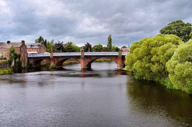
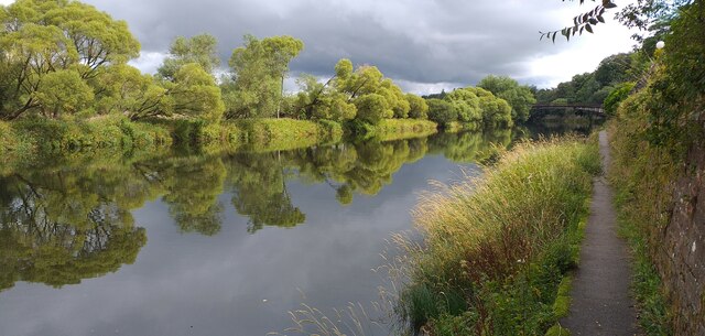
Lincluden is a small village located in the historical county of Kirkcudbrightshire, in southwest Scotland. Situated just two miles north of Dumfries, it lies on the eastern bank of the River Nith. The village is known for its picturesque setting, surrounded by rolling hills and lush green fields.
One of the notable landmarks in Lincluden is Lincluden Collegiate Church, a ruined church that dates back to the 14th century. This impressive structure features stunning medieval architecture, including intricate stone carvings and a beautiful rose window. The church was originally built as a collegiate church for the Benedictine nunnery of Lincluden, which was founded in the 12th century.
Lincluden also offers several recreational activities for nature enthusiasts. The nearby Mabie Forest provides ample opportunities for hiking, cycling, and wildlife spotting. The forest is home to a variety of bird species, as well as deer and red squirrels.
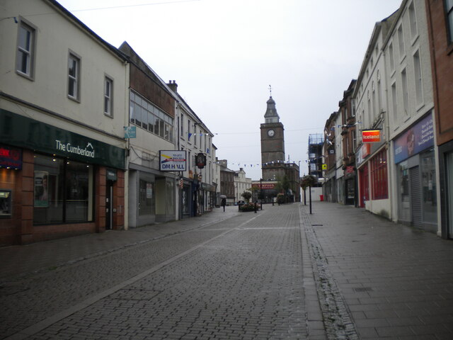
The village itself has a small population and a close-knit community. Amenities in Lincluden include a local pub, a village hall, and a primary school. For additional amenities and services, residents can easily access the nearby town of Dumfries, which offers a wider range of shops, restaurants, and leisure facilities.
Overall, Lincluden is a charming village with a rich historical heritage and natural beauty, making it an attractive destination for both residents and visitors.
If you have any feedback on the listing, please let us know in the comments section below.
Lincluden Images
Images are sourced within 2km of 55.085419/-3.625811 or Grid Reference NX9677. Thanks to Geograph Open Source API. All images are credited.


Lincluden is located at Grid Ref: NX9677 (Lat: 55.085419, Lng: -3.625811)
Unitary Authority: Dumfries and Galloway
Police Authority: Dumfries and Galloway
What 3 Words
///airtime.outhouse.victory. Near Dumfries, Dumfries & Galloway
Nearby Locations
Related Wikis
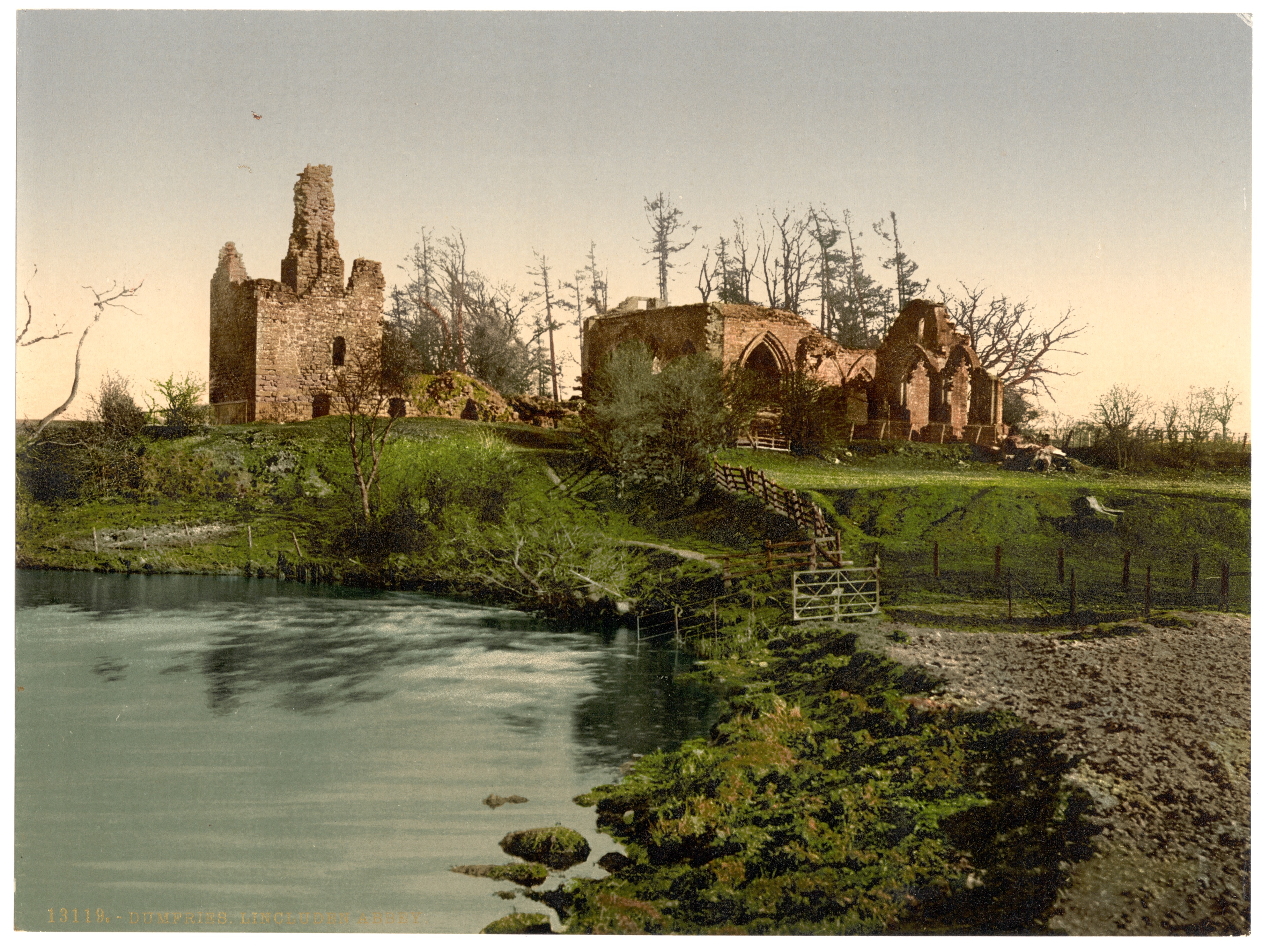
Lincluden Collegiate Church
Lincluden Collegiate Church, known earlier as Lincluden Priory or Lincluden Abbey (the name by which it is still known locally), is a ruined religious...

Newbridge Drive
Newbridge Drive is a relatively new suburb in Dumfries. It is situated on the Maxwelltown side of the River Nith and is approx 1.8 miles north-west from...

Cairn Water
Cairn Water is a small river in Dumfries and Galloway, Scotland. The river, formed by the confluence of the Castlefern, Craigdarroch and Dalquhat, flows...
Nunholm
Nunholm is a cricket ground in Dumfries, Scotland. The first recorded match held on the ground came in 1979 when Scotland B played a combined Central...
Maxwelltown High School
Maxwelltown High School was a state funded, six-year comprehensive secondary school in the Lochside area of Dumfries, Scotland. Founded in 1971, Maxwelltown...
Nithsdale Amateur Rowing Club
Nithsdale Amateur Rowing Club is a rowing club on the River Nith, based at Nith Avenue, Dumfries, Dumfries and Galloway, Scotland. The club is affiliated...

Palmerston Park
Palmerston Park is a football stadium on Terregles Street in Dumfries, Dumfries and Galloway, Scotland. It is the home ground of Scottish League One club...

Gracefield Arts Centre
Gracefield Arts Centre is located in Dumfries. The gallery's main building, a Category B listed building, was bought in 1951 by a committee of local people...
Related Videos


We Stayed in a Pod at Dumfries and Galloway | Forrest Walk | Murray's Monument
We hope you enjoy this video. We went away to Dumfries and Galloway, We stayed inside of a pod at Barnharrow Holiday Pods.

Tag2Holiday Holiday Accommodation in Dumfries and Galloway Scotland by #DigitalMediaScotlandUK
Promote using #Tag2Holiday in Dumfries and Galloway Scotland. Welcome to Dumfries and Galloway, Scotland's hidden gem, ...
Wednesday Short: The Rain Didn't Stop! #rain #nature #scotland #hiking
The Solway Coast trail - Dumfries & Galloway, Scotland. The rain finally stopped but it made some parts of this route fairly hard to ...
Nearby Amenities
Located within 500m of 55.085419,-3.625811Have you been to Lincluden?
Leave your review of Lincluden below (or comments, questions and feedback).