Cow Bottom

Valley in Sussex Adur

England

Cow Bottom

Tapsel gate and squeeze gate at Coombes Church, West Sussex The entrance to Coombes Parish Church is marked by a Tapsel gate and a squeeze gate. The Tapsel gate is shown here in the closed position.
Tapsel gate and squeeze gate at Coombes Church, West Sussex Credit: Andrew Diack

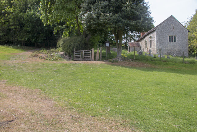
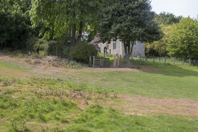
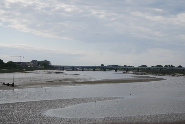
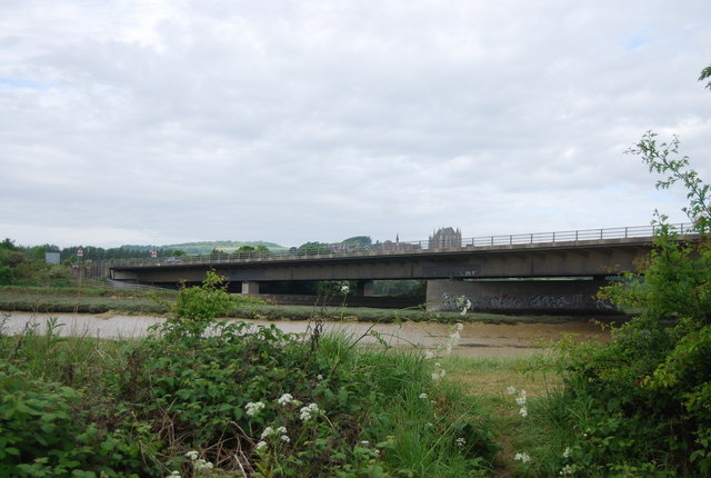
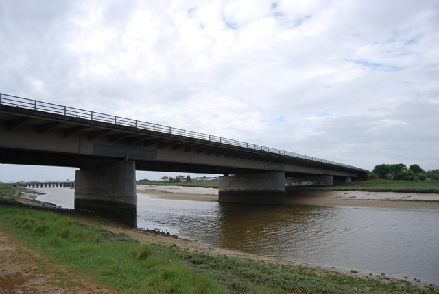
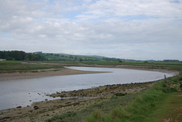
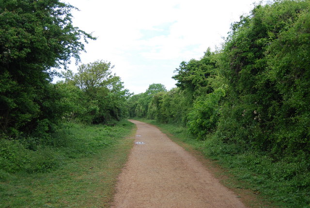
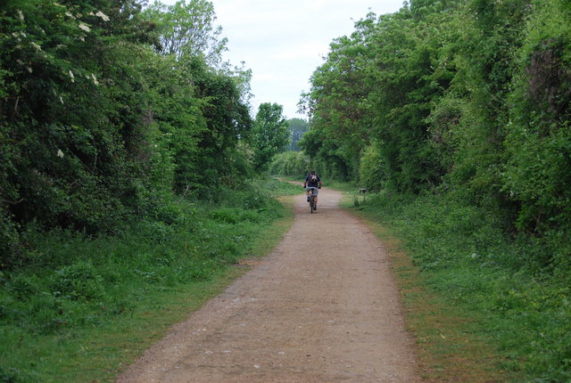
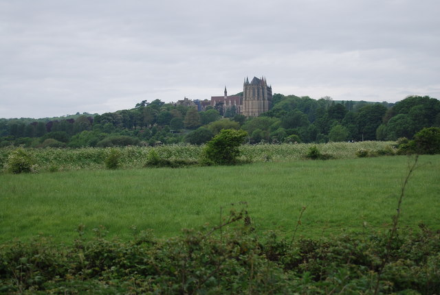
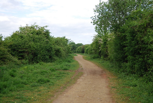
Cow Bottom is a picturesque valley located in the county of Sussex, in the southern part of England. Situated amidst rolling hills and lush green fields, this idyllic valley offers breathtaking natural beauty and a tranquil atmosphere that attracts visitors from far and wide.

The name "Cow Bottom" is derived from the presence of dairy farms in the region, where cows graze peacefully in the valley's meadows. The area is renowned for its dairy industry, and visitors can witness the traditional farming practices and even sample fresh milk and cheese produced by local farmers.

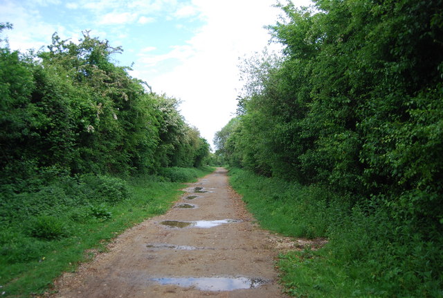
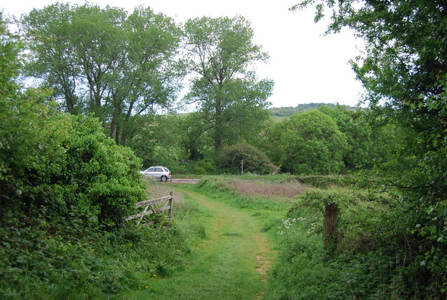
The landscape of Cow Bottom is characterized by gently sloping hills and meandering streams, providing a picturesque setting for outdoor activities such as hiking, cycling, and picnicking. The valley is adorned with colorful wildflowers during the spring and summer months, adding to its charm and natural splendor.

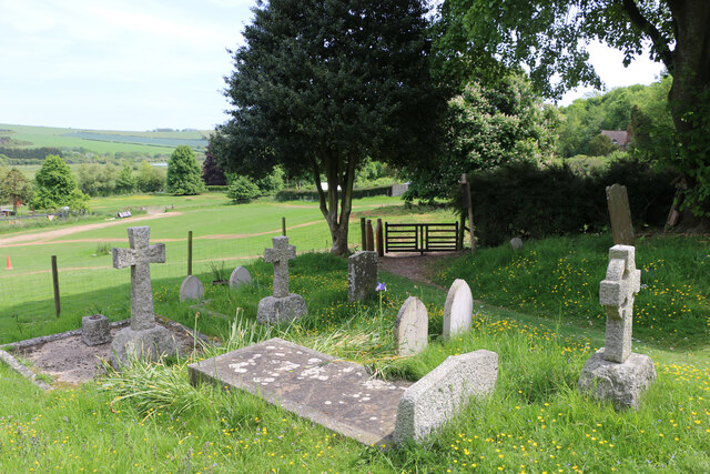
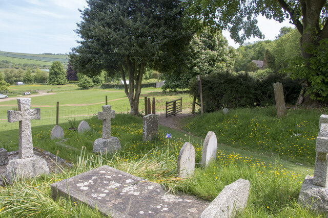
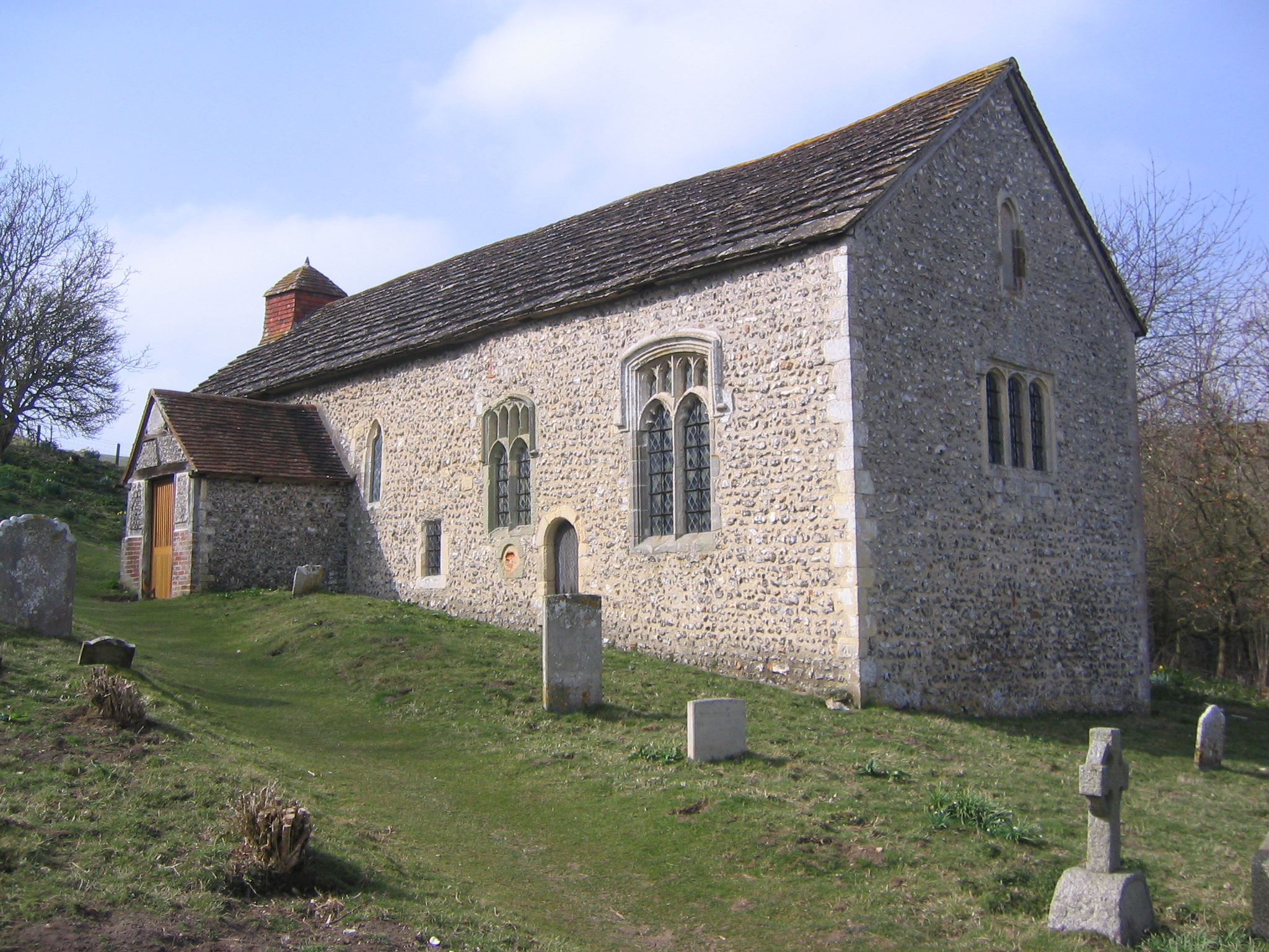
In addition to its natural beauty, Cow Bottom is also home to several historical landmarks and cultural attractions. The valley boasts a number of ancient churches, charming cottages, and traditional English pubs that offer a glimpse into the rich heritage and history of the region.

Overall, Cow Bottom, Sussex is a hidden gem that offers visitors a chance to escape the hustle and bustle of city life and immerse themselves in the serenity of the countryside. With its stunning landscapes, agricultural traditions, and historical charm, Cow Bottom is a must-visit destination for nature lovers, history enthusiasts, and those seeking a peaceful retreat in the heart of Sussex.

If you have any feedback on the listing, please let us know in the comments section below.
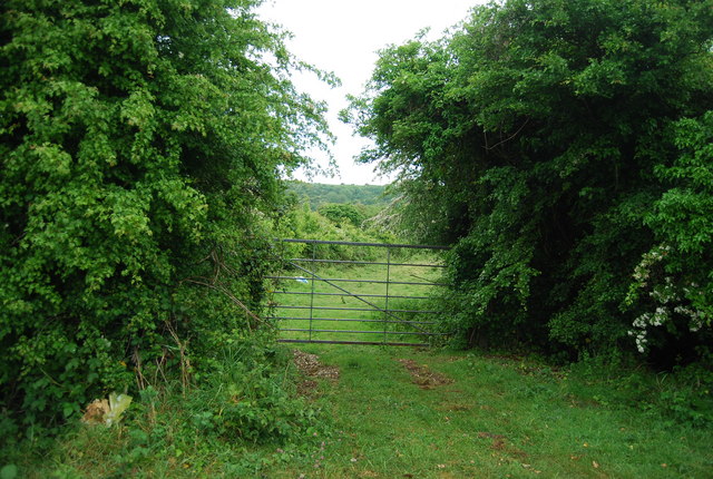
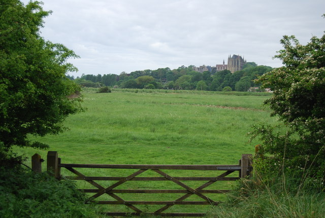
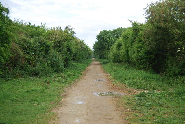
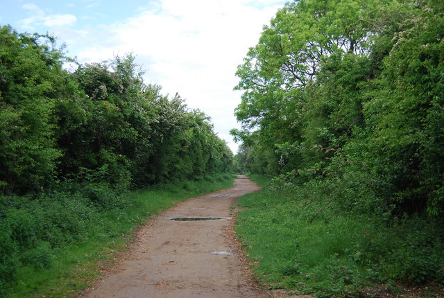
Cow Bottom Images

Images are sourced within 2km of 50.850922/-0.31370219 or Grid Reference TQ1807. Thanks to Geograph Open Source API. All images are credited.

Tapsel gate and squeeze gate at Coombes Church, West Sussex The entrance to Coombes Parish Church is marked by a Tapsel gate and a squeeze gate. The Tapsel gate is shown here in the closed position.
Tapsel gate and squeeze gate at Coombes Church, West Sussex
The entrance to Coombes Parish Church is marked by a Tapsel gate and a squeeze gate. The Tapsel gate is shown here in the closed position.
Tapsel gate in closed position at Coombes Parish Church, West Sussex This photo shows the Tapsel gate and adjacent squeeze gate at Coombes Parish Church. The Tapsel gate is in a closed position. The photo was taken from inside the churchyard while looking in an east-southeast direction.
Tapsel gate in closed position at Coombes Parish Church, West Sussex
This photo shows the Tapsel gate and adjacent squeeze gate at Coombes Parish Church. The Tapsel gate is in a closed position. The photo was taken from inside the churchyard while looking in an east-southeast direction.
Tapsel gate at Coombes Parish Church in an open position, West Sussex The photo shows the Tapsel gate at Coombes Parish Church in an open position. The adjacent squeeze gate, which prevents cattle or other large animals entering the churchyard, is in a permanently open position. The photo was taken from inside the churchyard and it looks in an east-southeast direction.
Tapsel gate at Coombes Parish Church in an open position, West Sussex
The photo shows the Tapsel gate at Coombes Parish Church in an open position. The adjacent squeeze gate, which prevents cattle or other large animals entering the churchyard, is in a permanently open position. The photo was taken from inside the churchyard and it looks in an east-southeast direction.
Tapsel gate at Coombes Parish Church in an open position, Sussex This view was taken from the car park looking east-southeast and it shows the Tapsel gate at Coombes Parish Church in an open position. Next to the Tapsel gate, there is a squeeze gate which, because of its design, remains permanently open.
Tapsel gate at Coombes Parish Church in an open position, Sussex
This view was taken from the car park looking east-southeast and it shows the Tapsel gate at Coombes Parish Church in an open position. Next to the Tapsel gate, there is a squeeze gate which, because of its design, remains permanently open.
A27 crosses the River Adur The river was formerly navigable for large vessels up as far as Steyning, where there was a large port, but over time the river valley became silted up and the port moved down to the deeper waters nearer the mouth in Shoreham-by-Sea.  <span class="nowrap"><a title="https://en.wikipedia.org/wiki/River_Adur" rel="nofollow ugc noopener" href="https://en.wikipedia.org/wiki/River_Adur">Link</a><img style="margin-left:2px;" alt="External link" title="External link - shift click to open in new window" src="https://s1.geograph.org.uk/img/external.png" width="10" height="10"/></span>
A27 crosses the River Adur
The river was formerly navigable for large vessels up as far as Steyning, where there was a large port, but over time the river valley became silted up and the port moved down to the deeper waters nearer the mouth in Shoreham-by-Sea. LinkExternal link
A27 over the River Adur The river was formerly navigable for large vessels up as far as Steyning, where there was a large port, but over time the river valley became silted up and the port moved down to the deeper waters nearer the mouth in Shoreham-by-Sea.  <span class="nowrap"><a title="https://en.wikipedia.org/wiki/River_Adur" rel="nofollow ugc noopener" href="https://en.wikipedia.org/wiki/River_Adur">Link</a><img style="margin-left:2px;" alt="External link" title="External link - shift click to open in new window" src="https://s1.geograph.org.uk/img/external.png" width="10" height="10"/></span>
A27 over the River Adur
The river was formerly navigable for large vessels up as far as Steyning, where there was a large port, but over time the river valley became silted up and the port moved down to the deeper waters nearer the mouth in Shoreham-by-Sea. LinkExternal link
A27 bridge over the River Adur The river was formerly navigable for large vessels up as far as Steyning, where there was a large port, but over time the river valley became silted up and the port moved down to the deeper waters nearer the mouth in Shoreham-by-Sea.  <span class="nowrap"><a title="https://en.wikipedia.org/wiki/River_Adur" rel="nofollow ugc noopener" href="https://en.wikipedia.org/wiki/River_Adur">Link</a><img style="margin-left:2px;" alt="External link" title="External link - shift click to open in new window" src="https://s1.geograph.org.uk/img/external.png" width="10" height="10"/></span>
A27 bridge over the River Adur
The river was formerly navigable for large vessels up as far as Steyning, where there was a large port, but over time the river valley became silted up and the port moved down to the deeper waters nearer the mouth in Shoreham-by-Sea. LinkExternal link
River Adur The river was formerly navigable for large vessels up as far as Steyning, where there was a large port, but over time the river valley became silted up and the port moved down to the deeper waters nearer the mouth in Shoreham-by-Sea.  <span class="nowrap"><a title="https://en.wikipedia.org/wiki/River_Adur" rel="nofollow ugc noopener" href="https://en.wikipedia.org/wiki/River_Adur">Link</a><img style="margin-left:2px;" alt="External link" title="External link - shift click to open in new window" src="https://s1.geograph.org.uk/img/external.png" width="10" height="10"/></span>
River Adur
The river was formerly navigable for large vessels up as far as Steyning, where there was a large port, but over time the river valley became silted up and the port moved down to the deeper waters nearer the mouth in Shoreham-by-Sea. LinkExternal link
Downs Link The Downs Link is a 37-mile (59 km) footpath and bridleway linking the North Downs Way <a title="https://www.geograph.org.uk/snippet/174" href="https://www.geograph.org.uk/snippet/174">Link</a>  at St. Martha's Hill in Surrey with the South Downs Way <a title="https://www.geograph.org.uk/snippet/1186" href="https://www.geograph.org.uk/snippet/1186">Link</a>  near Steyning in West Sussex and on via the Coastal Link to Shoreham-by-Sea. Most of the route follows two dismantled railway lines, both closed by the Beeching cuts in the 1960s. The Shoreham-On-Sea to Christ’s Hospital line and the Christ’s Hospital to Shalford Junction line. The link opened in 1984. 
Cycle Route 223 follows the Downs link from Guildford to Shoreham.
The logo for the walk is the viaduct across the River Arun <a href="https://www.geograph.org.uk/photo/1870646">TQ0932 : Double Viaduct over the River Arun</a>.
A full history of the Cranleigh line (Christ’s Hospital to Shalford Junction) can be read at <span class="nowrap"><a title="http://en.wikipedia.org/wiki/Cranleigh_Line" rel="nofollow ugc noopener" href="http://en.wikipedia.org/wiki/Cranleigh_Line">Link</a><img style="margin-left:2px;" alt="External link" title="External link - shift click to open in new window" src="https://s1.geograph.org.uk/img/external.png" width="10" height="10"/></span>
Downs Link
The Downs Link is a 37-mile (59 km) footpath and bridleway linking the North Downs Way Link at St. Martha's Hill in Surrey with the South Downs Way Link near Steyning in West Sussex and on via the Coastal Link to Shoreham-by-Sea. Most of the route follows two dismantled railway lines, both closed by the Beeching cuts in the 1960s. The Shoreham-On-Sea to Christ’s Hospital line and the Christ’s Hospital to Shalford Junction line. The link opened in 1984. Cycle Route 223 follows the Downs link from Guildford to Shoreham. The logo for the walk is the viaduct across the River Arun TQ0932 : Double Viaduct over the River Arun. A full history of the Cranleigh line (Christ’s Hospital to Shalford Junction) can be read at LinkExternal link
Cycling on the Downs Link The Downs Link is a 37-mile (59 km) footpath and bridleway linking the North Downs Way <a title="https://www.geograph.org.uk/snippet/174" href="https://www.geograph.org.uk/snippet/174">Link</a>  at St. Martha's Hill in Surrey with the South Downs Way <a title="https://www.geograph.org.uk/snippet/1186" href="https://www.geograph.org.uk/snippet/1186">Link</a>  near Steyning in West Sussex and on via the Coastal Link to Shoreham-by-Sea. Most of the route follows two dismantled railway lines, both closed by the Beeching cuts in the 1960s. The Shoreham-On-Sea to Christ’s Hospital line and the Christ’s Hospital to Shalford Junction line. The link opened in 1984. 
Cycle Route 223 follows the Downs link from Guildford to Shoreham.
The logo for the walk is the viaduct across the River Arun <a href="https://www.geograph.org.uk/photo/1870646">TQ0932 : Double Viaduct over the River Arun</a>.
A full history of the Cranleigh line (Christ’s Hospital to Shalford Junction) can be read at <span class="nowrap"><a title="http://en.wikipedia.org/wiki/Cranleigh_Line" rel="nofollow ugc noopener" href="http://en.wikipedia.org/wiki/Cranleigh_Line">Link</a><img style="margin-left:2px;" alt="External link" title="External link - shift click to open in new window" src="https://s1.geograph.org.uk/img/external.png" width="10" height="10"/></span>
Cycling on the Downs Link
The Downs Link is a 37-mile (59 km) footpath and bridleway linking the North Downs Way Link at St. Martha's Hill in Surrey with the South Downs Way Link near Steyning in West Sussex and on via the Coastal Link to Shoreham-by-Sea. Most of the route follows two dismantled railway lines, both closed by the Beeching cuts in the 1960s. The Shoreham-On-Sea to Christ’s Hospital line and the Christ’s Hospital to Shalford Junction line. The link opened in 1984. Cycle Route 223 follows the Downs link from Guildford to Shoreham. The logo for the walk is the viaduct across the River Arun TQ0932 : Double Viaduct over the River Arun. A full history of the Cranleigh line (Christ’s Hospital to Shalford Junction) can be read at LinkExternal link
Looking towards Lancing College
Downs Link The Downs Link is a 37-mile (59 km) footpath and bridleway linking the North Downs Way <a title="https://www.geograph.org.uk/snippet/174" href="https://www.geograph.org.uk/snippet/174">Link</a>  at St. Martha's Hill in Surrey with the South Downs Way <a title="https://www.geograph.org.uk/snippet/1186" href="https://www.geograph.org.uk/snippet/1186">Link</a>  near Steyning in West Sussex and on via the Coastal Link to Shoreham-by-Sea. Most of the route follows two dismantled railway lines, both closed by the Beeching cuts in the 1960s. The Shoreham-On-Sea to Christ’s Hospital line and the Christ’s Hospital to Shalford Junction line. The link opened in 1984. 
Cycle Route 223 follows the Downs link from Guildford to Shoreham.
The logo for the walk is the viaduct across the River Arun <a href="https://www.geograph.org.uk/photo/1870646">TQ0932 : Double Viaduct over the River Arun</a>.
A full history of the Cranleigh line (Christ’s Hospital to Shalford Junction) can be read at <span class="nowrap"><a title="http://en.wikipedia.org/wiki/Cranleigh_Line" rel="nofollow ugc noopener" href="http://en.wikipedia.org/wiki/Cranleigh_Line">Link</a><img style="margin-left:2px;" alt="External link" title="External link - shift click to open in new window" src="https://s1.geograph.org.uk/img/external.png" width="10" height="10"/></span>
Downs Link
The Downs Link is a 37-mile (59 km) footpath and bridleway linking the North Downs Way Link at St. Martha's Hill in Surrey with the South Downs Way Link near Steyning in West Sussex and on via the Coastal Link to Shoreham-by-Sea. Most of the route follows two dismantled railway lines, both closed by the Beeching cuts in the 1960s. The Shoreham-On-Sea to Christ’s Hospital line and the Christ’s Hospital to Shalford Junction line. The link opened in 1984. Cycle Route 223 follows the Downs link from Guildford to Shoreham. The logo for the walk is the viaduct across the River Arun TQ0932 : Double Viaduct over the River Arun. A full history of the Cranleigh line (Christ’s Hospital to Shalford Junction) can be read at LinkExternal link
Gate by the Downs Link
View towards Lancing College
Downs Link The Downs Link is a 37-mile (59 km) footpath and bridleway linking the North Downs Way <a title="https://www.geograph.org.uk/snippet/174" href="https://www.geograph.org.uk/snippet/174">Link</a>  at St. Martha's Hill in Surrey with the South Downs Way <a title="https://www.geograph.org.uk/snippet/1186" href="https://www.geograph.org.uk/snippet/1186">Link</a>  near Steyning in West Sussex and on via the Coastal Link to Shoreham-by-Sea. Most of the route follows two dismantled railway lines, both closed by the Beeching cuts in the 1960s. The Shoreham-On-Sea to Christ’s Hospital line and the Christ’s Hospital to Shalford Junction line. The link opened in 1984. 
Cycle Route 223 follows the Downs link from Guildford to Shoreham.
The logo for the walk is the viaduct across the River Arun <a href="https://www.geograph.org.uk/photo/1870646">TQ0932 : Double Viaduct over the River Arun</a>.
A full history of the Cranleigh line (Christ’s Hospital to Shalford Junction) can be read at <span class="nowrap"><a title="http://en.wikipedia.org/wiki/Cranleigh_Line" rel="nofollow ugc noopener" href="http://en.wikipedia.org/wiki/Cranleigh_Line">Link</a><img style="margin-left:2px;" alt="External link" title="External link - shift click to open in new window" src="https://s1.geograph.org.uk/img/external.png" width="10" height="10"/></span>
Downs Link
The Downs Link is a 37-mile (59 km) footpath and bridleway linking the North Downs Way Link at St. Martha's Hill in Surrey with the South Downs Way Link near Steyning in West Sussex and on via the Coastal Link to Shoreham-by-Sea. Most of the route follows two dismantled railway lines, both closed by the Beeching cuts in the 1960s. The Shoreham-On-Sea to Christ’s Hospital line and the Christ’s Hospital to Shalford Junction line. The link opened in 1984. Cycle Route 223 follows the Downs link from Guildford to Shoreham. The logo for the walk is the viaduct across the River Arun TQ0932 : Double Viaduct over the River Arun. A full history of the Cranleigh line (Christ’s Hospital to Shalford Junction) can be read at LinkExternal link
Looking towards Steyning Rd
Show me another place!

Cow Bottom is located at Grid Ref: TQ1807 (Lat: 50.850922, Lng: -0.31370219)

Administrative County: West Sussex

District: Adur

Police Authority: Sussex

What 3 Words

///ever.champions.rift. Near Lancing, West Sussex

Nearby Locations

Cow Bottom Coombes

Related Wikis

Lancing College Chapel

Lancing College Chapel is the chapel to Lancing College in West Sussex, England, and is an example of Gothic Revival architecture. The chapel was designed...

Lancing Ring

Lancing Ring is a 29.4-hectare (73-acre) Local Nature Reserve in Lancing in West Sussex. It is owned and managed by Adur District Council.This chalk grassland...

Coombes Church

Coombes Church is a Church of England parish church in the rural hamlet of Coombes in the Adur District of West Sussex, England. It has served the rural...

Sompting & North Lancing (electoral division)

Sompting & North Lancing is an electoral division of West Sussex in the United Kingdom, and returns one member to sit on the West Sussex County Council...

Nearby Amenities

Located within 500m of 50.850922,-0.31370219
Lancing Hill
Created By: Potlatch 0.10f
Natural: peak
Source: NPE
Lat/Long: 50.8470648/-0.3130755
Barrier: stile
Lat/Long: 50.8503576/-0.31341
Barrier: stile
Lat/Long: 50.8475518/-0.3160698
The data included in this document is from www.openstreetmap.org. The data is made available under ODbL.

Have you been to Cow Bottom?

Leave your review of Cow Bottom below (or comments, questions and feedback).