Winding Bottom

Valley in Sussex Horsham

England

Winding Bottom

Teasel - Dipsacus fullonum
Teasel - Dipsacus fullonum Credit: Ian Cunliffe

Winding Bottom, Sussex (Valley) is a picturesque region located in the county of Sussex, England. Nestled within the South Downs National Park, it is known for its serene beauty and charming countryside landscapes. The valley is aptly named after the meandering river that winds through its lush green fields.

The area boasts an abundance of natural beauty, with rolling hills covered in vibrant wildflowers and ancient woodlands. Visitors to Winding Bottom can enjoy scenic walks and hikes along the many well-marked trails that crisscross the valley. The tranquility of the surroundings makes it a popular destination for nature lovers and outdoor enthusiasts.

Winding Bottom is also home to a rich variety of wildlife, including deer, foxes, and a wide array of bird species. Birdwatchers flock to the area to catch a glimpse of the rare and elusive species that inhabit the region.

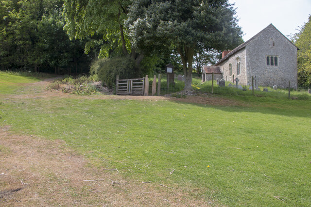
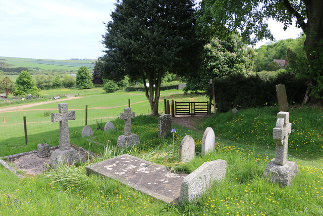
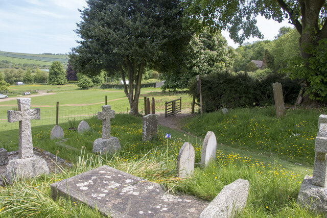
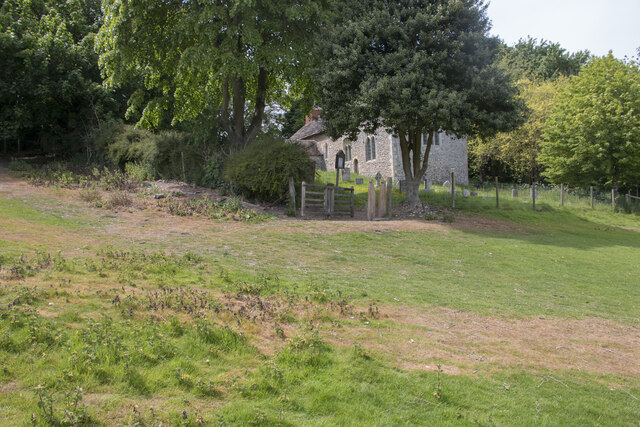
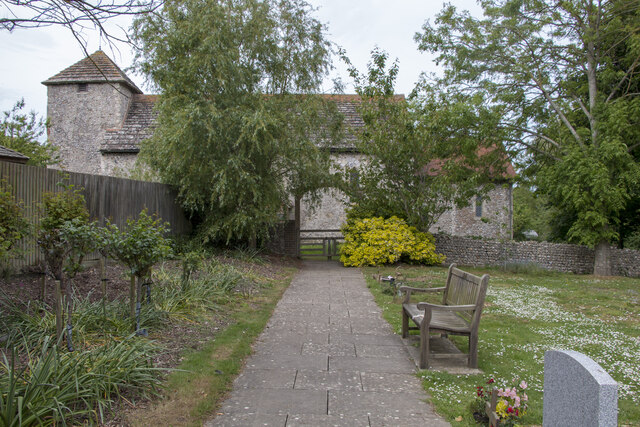
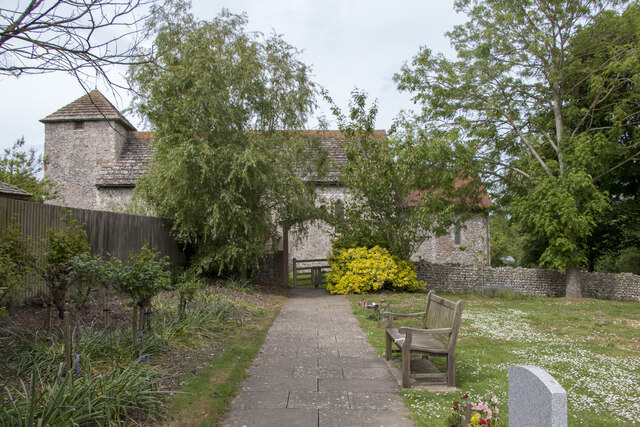
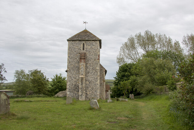
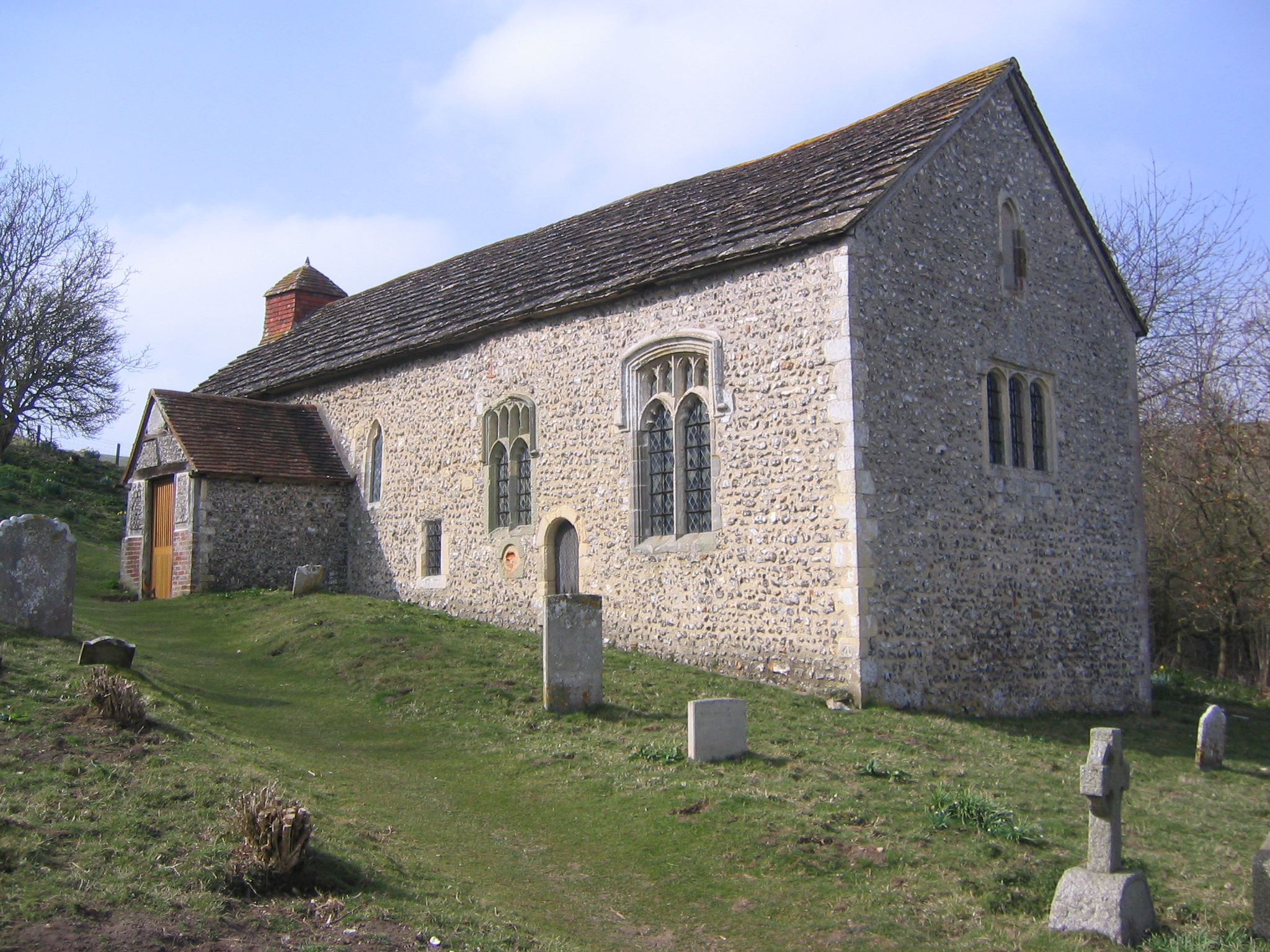
In addition to its natural wonders, Winding Bottom offers a glimpse into the past with its historic sites. The valley is dotted with quaint villages and hamlets, each with its own unique charm and architecture. The local churches and historic buildings provide a fascinating insight into the area's cultural heritage.

For those seeking a peaceful retreat away from the hustle and bustle of city life, Winding Bottom, Sussex (Valley) offers a tranquil haven of natural beauty and historical significance. Whether it's exploring the winding river paths or immersing oneself in the local history, this idyllic valley has something to offer for everyone.

If you have any feedback on the listing, please let us know in the comments section below.

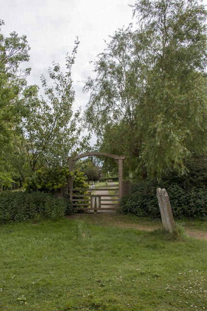
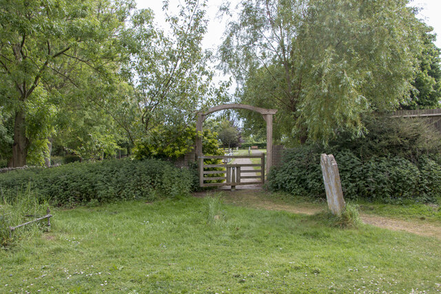
Winding Bottom Images

Images are sourced within 2km of 50.867706/-0.31637956 or Grid Reference TQ1808. Thanks to Geograph Open Source API. All images are credited.

Teasel - Dipsacus fullonum
Tapsel gate and squeeze gate at Coombes Church, West Sussex The entrance to Coombes Parish Church is marked by a Tapsel gate and a squeeze gate. The Tapsel gate is shown here in the closed position.
Tapsel gate and squeeze gate at Coombes Church, West Sussex
The entrance to Coombes Parish Church is marked by a Tapsel gate and a squeeze gate. The Tapsel gate is shown here in the closed position.
Tapsel gate in closed position at Coombes Parish Church, West Sussex This photo shows the Tapsel gate and adjacent squeeze gate at Coombes Parish Church. The Tapsel gate is in a closed position. The photo was taken from inside the churchyard while looking in an east-southeast direction.
Tapsel gate in closed position at Coombes Parish Church, West Sussex
This photo shows the Tapsel gate and adjacent squeeze gate at Coombes Parish Church. The Tapsel gate is in a closed position. The photo was taken from inside the churchyard while looking in an east-southeast direction.
Tapsel gate at Coombes Parish Church in an open position, West Sussex The photo shows the Tapsel gate at Coombes Parish Church in an open position. The adjacent squeeze gate, which prevents cattle or other large animals entering the churchyard, is in a permanently open position. The photo was taken from inside the churchyard and it looks in an east-southeast direction.
Tapsel gate at Coombes Parish Church in an open position, West Sussex
The photo shows the Tapsel gate at Coombes Parish Church in an open position. The adjacent squeeze gate, which prevents cattle or other large animals entering the churchyard, is in a permanently open position. The photo was taken from inside the churchyard and it looks in an east-southeast direction.
Tapsel gate at Coombes Parish Church in an open position, Sussex This view was taken from the car park looking east-southeast and it shows the Tapsel gate at Coombes Parish Church in an open position. Next to the Tapsel gate, there is a squeeze gate which, because of its design, remains permanently open.
Tapsel gate at Coombes Parish Church in an open position, Sussex
This view was taken from the car park looking east-southeast and it shows the Tapsel gate at Coombes Parish Church in an open position. Next to the Tapsel gate, there is a squeeze gate which, because of its design, remains permanently open.
Tapsel gate at St Botolph's Church, West Sussex, in a closed position, This photo shows the Tapsel gate at St Botolph's church in a closed position. The photo was taken looking north and it shows the Grade I listed church in the background. The Tapsel gate links the churchyard of St Botolph's with an adjacent council burial ground. The gate was installed in late 2003 and it was consecrated in 2004 by Bishop Lindsay Urwin, who was the Bishop of Horsham between 1993 and 2009.
Tapsel gate at St Botolph's Church, West Sussex, in a closed position,
This photo shows the Tapsel gate at St Botolph's church in a closed position. The photo was taken looking north and it shows the Grade I listed church in the background. The Tapsel gate links the churchyard of St Botolph's with an adjacent council burial ground. The gate was installed in late 2003 and it was consecrated in 2004 by Bishop Lindsay Urwin, who was the Bishop of Horsham between 1993 and 2009.
Tapsel gate in an open position at St Botolph's Church, West Sussex This photo shows the Tapsel gate at St Botolph's church as seen looking north from the churchyard. The arched frame of the five bar gate is reminiscent of the Tapsel gate design at St Mary the Virgin church at Friston in East Sussex.
Tapsel gate in an open position at St Botolph's Church, West Sussex
This photo shows the Tapsel gate at St Botolph's church as seen looking north from the churchyard. The arched frame of the five bar gate is reminiscent of the Tapsel gate design at St Mary the Virgin church at Friston in East Sussex.
Closed Tapsel gate at St Botolph's church seen looking south The Tapsel gate at St Botolph's church in West Sussex is a modern one having been installed in 2003. This date is carved into the top of arched wooden frame. The gate was funded by the joint parish council of the area to enable the use of the church by visitors to the burial ground.
Closed Tapsel gate at St Botolph's church seen looking south
The Tapsel gate at St Botolph's church in West Sussex is a modern one having been installed in 2003. This date is carved into the top of arched wooden frame. The gate was funded by the joint parish council of the area to enable the use of the church by visitors to the burial ground.
Open Tapsel gate at St Botolph's Church seen looking south The Tapsel gate at St Botolph's church in West Sussex is a modern one having been installed in late 2003. Although this date is carved into the top of arched wooden frame, it is difficult to see, in this photo, without added magnification. At present, the central pivot is slightly more stiff to open than other Tapsel gates but an application of lubricant would remedy this.
Open Tapsel gate at St Botolph's Church seen looking south
The Tapsel gate at St Botolph's church in West Sussex is a modern one having been installed in late 2003. Although this date is carved into the top of arched wooden frame, it is difficult to see, in this photo, without added magnification. At present, the central pivot is slightly more stiff to open than other Tapsel gates but an application of lubricant would remedy this.
St Botolph's Church viewed looking east, West Sussex On the 15th March 1955, the Saxon Church of St Botolph's was listed as a Grade I building and by definition that means that the site was considered to be of exceptional, national importance. The building dates to about AD 950 and it is listed as one of the 500 holiest sites in Britain. Notable features of the church include three bells made, in 1536, by John Tonne which commemorate the old dedication to St Peter with the inscription “Sancte Petre ora pro nobis”;  an oak, Jacobean pulpit dating from 1630; traces of wall murals which were recorded in 1897 and a square baptism font, supported by a brick plinth, which probably dates to the 18th century. Another interesting feature, of the church, are the slanted side windows which allowed lepers, from the leper colony in Bramber, to stand outside and see the service taking place without transmitting the disease to the congregation inside the church.
St Botolph's Church viewed looking east, West Sussex
On the 15th March 1955, the Saxon Church of St Botolph's was listed as a Grade I building and by definition that means that the site was considered to be of exceptional, national importance. The building dates to about AD 950 and it is listed as one of the 500 holiest sites in Britain. Notable features of the church include three bells made, in 1536, by John Tonne which commemorate the old dedication to St Peter with the inscription “Sancte Petre ora pro nobis”; an oak, Jacobean pulpit dating from 1630; traces of wall murals which were recorded in 1897 and a square baptism font, supported by a brick plinth, which probably dates to the 18th century. Another interesting feature, of the church, are the slanted side windows which allowed lepers, from the leper colony in Bramber, to stand outside and see the service taking place without transmitting the disease to the congregation inside the church.
Autumn Lady Tresses Autumn Lady Tresses, Spiranthes spiralis in flower at Anchor Bottom next to the A283 in East Sussex.
Autumn Lady Tresses
Autumn Lady Tresses, Spiranthes spiralis in flower at Anchor Bottom next to the A283 in East Sussex.
Remains of Bramber Castle: West Sussex An evening shot of a part of the ruins. This castle is situated between the centre and north eastern section of the grid square.
Remains of Bramber Castle: West Sussex
An evening shot of a part of the ruins. This castle is situated between the centre and north eastern section of the grid square.
Castle Church : Bramber (West Sussex) This church is apparently 1000 years or so old and was built as part of the castle residences and buildings. It is situated at the foot of the castle and in the centre to north eastern section of the square.
Castle Church : Bramber (West Sussex)
This church is apparently 1000 years or so old and was built as part of the castle residences and buildings. It is situated at the foot of the castle and in the centre to north eastern section of the square.
Steyning Housing in the centre of the square.
Steyning
Housing in the centre of the square.
Two bridges at Bramber The road bridge and 'The Bridge' inn on the River Adur at Bramber.
Two bridges at Bramber
The road bridge and 'The Bridge' inn on the River Adur at Bramber.
Bramber Castle. This is the only major remain of the Norman castle. It received very heavy damage during the English Civil War.
Bramber Castle.
This is the only major remain of the Norman castle. It received very heavy damage during the English Civil War.
Bramber Castle ruin This is just what is left of the Gatehouse tower, some floor joist holes can still be seen. It is a pleasant place to sit and have a picnic in the shadow of the remains of the old Norman castle.
Bramber Castle ruin
This is just what is left of the Gatehouse tower, some floor joist holes can still be seen. It is a pleasant place to sit and have a picnic in the shadow of the remains of the old Norman castle.
Upper Maudlin Farm from Steyning Roundhill Looking East South East from Steyning Roundhill across Upper Maudlin Farm with the Cement Works Quarry in the distance.
Upper Maudlin Farm from Steyning Roundhill
Looking East South East from Steyning Roundhill across Upper Maudlin Farm with the Cement Works Quarry in the distance.
Show me another place!

Winding Bottom is located at Grid Ref: TQ1808 (Lat: 50.867706, Lng: -0.31637956)

Administrative County: West Sussex

District: Horsham

Police Authority: Sussex

What 3 Words

///form.dries.changes. Near Steyning, West Sussex

Related Wikis

Coombes

Coombes is a small village and civil parish in the Adur District of West Sussex, England. The village is in the Adur Valley 2 miles (3.2 km) northwest...

Botolphs

Botolphs, formerly known as Annington, is a tiny village and former civil parish, now in the parish of Bramber, in the Horsham District of West Sussex...

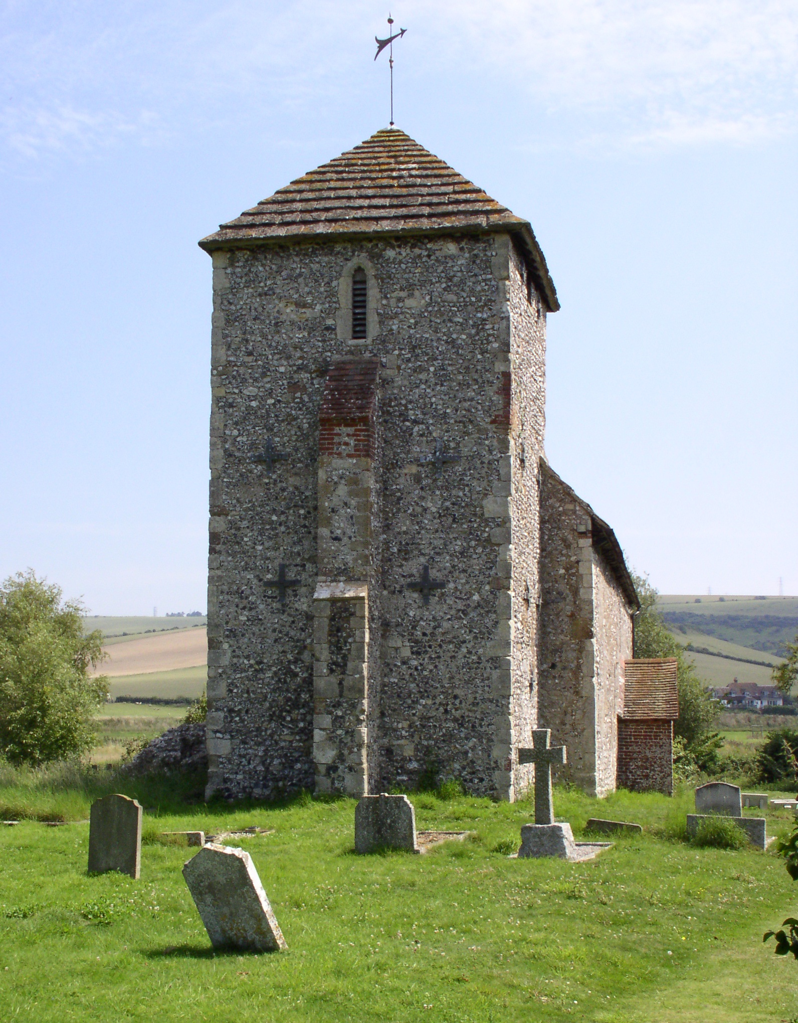
St Botolph's Church, Botolphs

The Grade I listed Saxon church of St Botolph's at Botolphs, West Sussex, England, is situated in the valley of the River Adur and is now part of the Church...

Coombes Church

Coombes Church is a Church of England parish church in the rural hamlet of Coombes in the Adur District of West Sussex, England. It has served the rural...

Bramber railway station

Bramber was a railway station in England on the Steyning Line which served the village of Bramber. The station was patronised by tourists visiting nearby...

Bramber

Bramber is a former manor, village and civil parish in the Horsham District of West Sussex, England. It has a ruined mediaeval castle which was the caput...

Battle of Bramber Bridge

The Battle of Bramber Bridge was a minor skirmish that took place on 13 December 1643, during the First English Civil War. A Royalist detachment from...

Upper Beeding

Upper Beeding is a village and civil parish in the Horsham District of West Sussex, England. It is located at the northern end of the River Adur gap in...

Nearby Amenities

Located within 500m of 50.867706,-0.31637956
Power: tower
Source: Bing
Lat/Long: 50.8684799/-0.3177363
Power: tower
Source: Bing
Lat/Long: 50.868225/-0.3232168
Power: tower
Source: Bing
Lat/Long: 50.8669779/-0.3144392
Power: tower
Source: Bing
Lat/Long: 50.8693136/-0.3196687
Power: tower
Source: Bing
Lat/Long: 50.8658823/-0.3120374
Winding Bottom
Place: locality
Source: OS_OpenData_StreetView
Lat/Long: 50.8691094/-0.3196871
The data included in this document is from www.openstreetmap.org. The data is made available under ODbL.

Have you been to Winding Bottom?

Leave your review of Winding Bottom below (or comments, questions and feedback).