Race Dale
Valley in Yorkshire
England
Race Dale

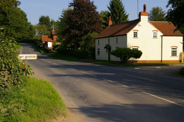
Race Dale is a picturesque valley located in Yorkshire, England. Nestled between rolling hills and lush greenery, this idyllic countryside destination offers a serene and tranquil setting for visitors seeking a retreat from the hustle and bustle of city life.
The valley is known for its breathtaking natural beauty, with a river meandering through the landscape, creating a sense of peace and serenity. The river is a popular spot for fishing enthusiasts, who come to try their luck at catching trout and salmon.
Race Dale is also home to a diverse range of flora and fauna, making it a haven for nature lovers and wildlife enthusiasts. The area is renowned for its wildflower meadows, which burst into a riot of colors during the spring and summer months. Visitors can spot a variety of bird species, including kingfishers and herons, as well as small mammals such as otters and badgers.
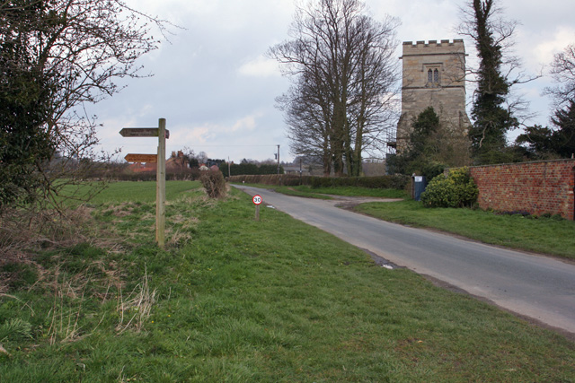
For those looking to explore the area on foot, Race Dale offers numerous walking trails that wind through the valley and its surrounding hills. These trails provide stunning panoramic views of the landscape, allowing hikers to fully immerse themselves in the natural beauty of the area.
In addition to its natural wonders, Race Dale is also home to a small, tight-knit community. The village, with its charming cottages and friendly locals, offers a warm and welcoming atmosphere for visitors. There are a few quaint tea rooms and traditional pubs where visitors can sample local cuisine and experience the warm hospitality of the residents.
Overall, Race Dale is a hidden gem in Yorkshire, offering a peaceful retreat and a chance to reconnect with nature in a truly stunning setting.
If you have any feedback on the listing, please let us know in the comments section below.
Race Dale Images
Images are sourced within 2km of 53.952418/-0.67667617 or Grid Reference SE8651. Thanks to Geograph Open Source API. All images are credited.


Race Dale is located at Grid Ref: SE8651 (Lat: 53.952418, Lng: -0.67667617)
Division: East Riding
Unitary Authority: East Riding of Yorkshire
Police Authority: Humberside
What 3 Words
///angry.stitching.applauded. Near Millington, East Yorkshire
Nearby Locations
Related Wikis

St James' Church, Warter
St James’ Church lies in Warter, an estate village in England, in the Yorkshire Wolds, part of the East Riding of Yorkshire. == Origins and history... ==
Warter
Warter is a small village and civil parish in the East Riding of Yorkshire, England. It is situated approximately 4 miles (6.4 km) east of Pocklington...

Warter Priory
Warter Priory is an 11,000 acres (4,500 ha) country estate in the East Riding of Yorkshire Yorkshire Wolds, centred 1 mile (2 km) south-west of the village...
Bigger Trees Near Warter
Bigger Trees Near Warter or ou Peinture en Plein Air pour l'age Post-Photographique is a large landscape painting by British artist David Hockney. Measuring...
Nunburnholme Priory
Nunburnholme Priory was a priory of Benedictine nuns in the East Riding of Yorkshire, England. It was founded during the reign of Henry II of England by...

Huggate
Huggate is a village and civil parish in the East Riding of Yorkshire, England. It is situated approximately 13 miles (21 km) north-west of Beverley town...

Millington, East Riding of Yorkshire
Millington is a small village and civil parish in the East Riding of Yorkshire, England. It is situated approximately 2 miles (3.2 km) north-east of Pocklington...
Nunburnholme
Nunburnholme is a village and civil parish in the East Riding of Yorkshire, England. It is approximately 3 miles (5 km) east of the market town of Pocklington...
Nearby Amenities
Located within 500m of 53.952418,-0.67667617Have you been to Race Dale?
Leave your review of Race Dale below (or comments, questions and feedback).