Nettle Dale

Valley in Yorkshire Scarborough

England

Nettle Dale

Port Mulgrave The pier was damaged to prevent Germans from using it to land during WW2.
Port Mulgrave Credit: T Eyre

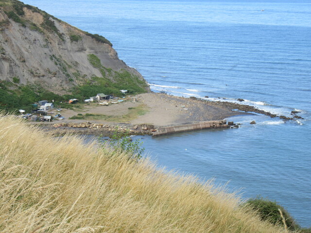
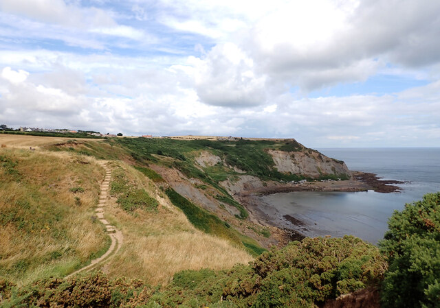
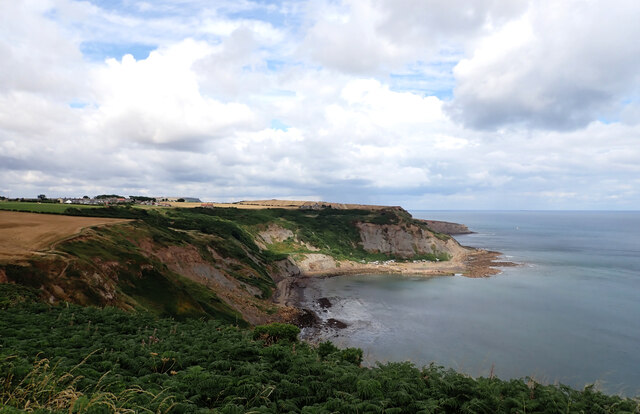
Nettle Dale, located in the county of Yorkshire, England, is a picturesque valley renowned for its natural beauty and tranquil surroundings. Nestled amidst the rolling hills and lush green meadows, this idyllic valley offers visitors a peaceful retreat from the hustle and bustle of urban life.

The valley takes its name from the abundance of nettles that grow in the area, adding a touch of wildness to its charm. Nettle Dale is home to a diverse range of flora and fauna, with wildflowers dotting the landscape and various species of birds and small mammals inhabiting the surrounding woodlands.

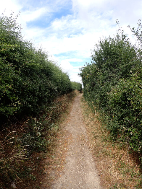
A network of walking trails crisscrosses the valley, allowing visitors to explore its hidden gems. The trails wind through ancient woodlands, offering glimpses of cascading waterfalls, babbling brooks, and serene ponds along the way. The valley is particularly famous for its bluebell woods, which transform into a sea of vibrant blue during the spring months, creating a truly enchanting sight.

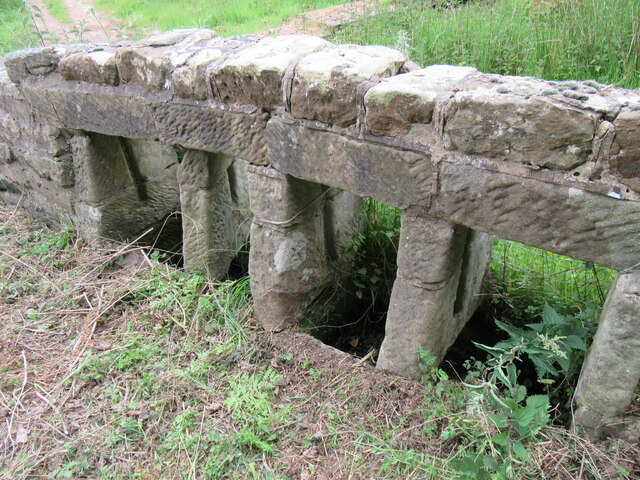
Nettle Dale is also home to several historical landmarks, including the ruins of an old priory that dates back to the medieval era. The priory, now a protected monument, stands as a testament to the valley's rich heritage and provides a fascinating glimpse into the past.

Visitors to Nettle Dale can find solace in its tranquility, enjoying a picnic amidst the breathtaking scenery or simply immersing themselves in the soothing sounds of nature. Whether it's for a leisurely stroll or a peaceful escape, Nettle Dale offers an unforgettable experience for nature enthusiasts and those seeking respite in the heart of Yorkshire.

If you have any feedback on the listing, please let us know in the comments section below.
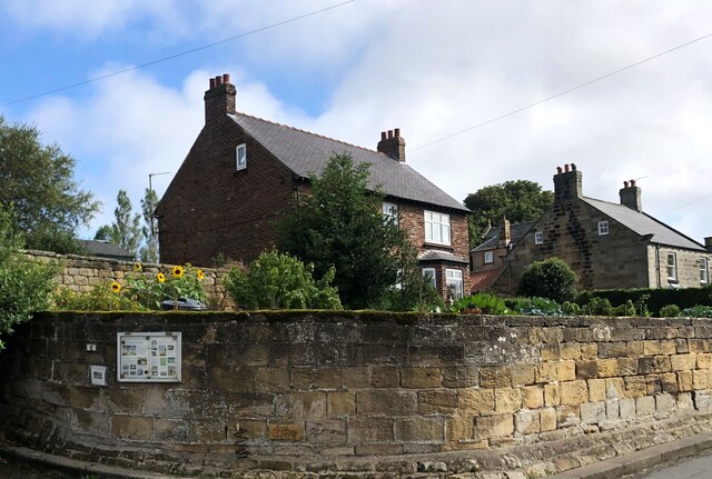
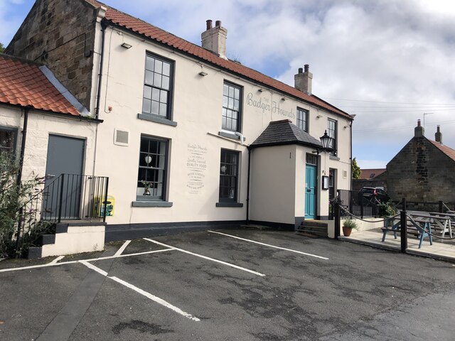
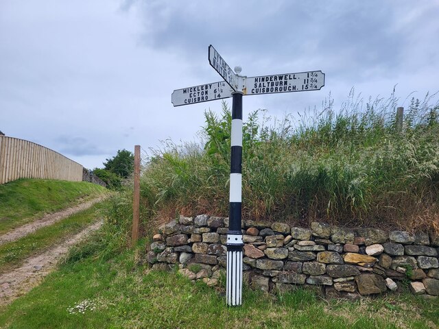
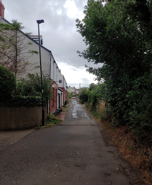
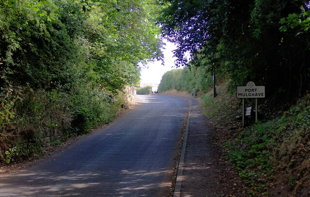
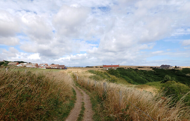
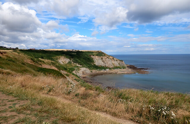
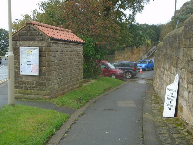
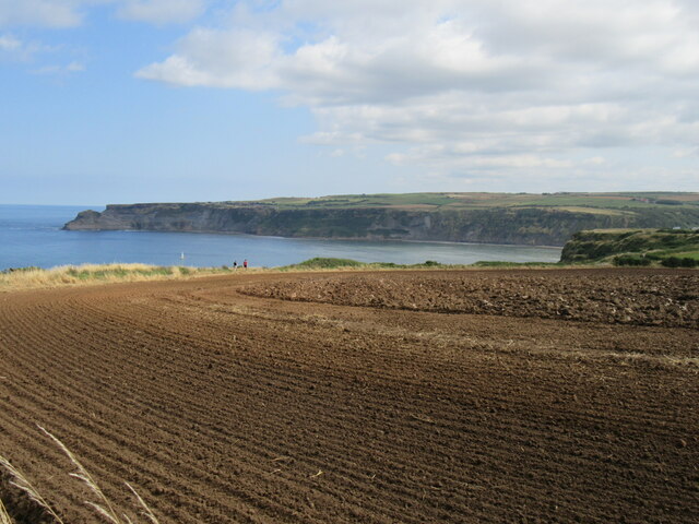
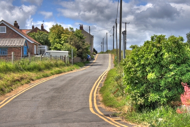
Nettle Dale Images

Images are sourced within 2km of 54.531591/-0.75373444 or Grid Reference NZ8015. Thanks to Geograph Open Source API. All images are credited.

Port Mulgrave The pier was damaged to prevent Germans from using it to land during WW2.
Port Mulgrave
The pier was damaged to prevent Germans from using it to land during WW2.
Hinderwell-The Brown Cow Public House on High Street.
Hinderwell-The Brown Cow
Public House on High Street.
Milestone, High Street (A174), Hinderwell The milestone reads:
"NORTH RIDING OF
YORKSHIRE
HINDERWELL
U.D.C.
WHITBY
9⅛
SCARBRO
30⅛
SALTBURN
10
REDCAR
16
GUISBRO
14".
The milestone can be seen in context in <a href="https://www.geograph.org.uk/photo/7041387">NZ7916 : Bus shelter and milestone, High Street (A174), Hinderwell</a>.
Milestone, High Street (A174), Hinderwell
The milestone reads: "NORTH RIDING OF YORKSHIRE HINDERWELL U.D.C. WHITBY 9⅛ SCARBRO 30⅛ SALTBURN 10 REDCAR 16 GUISBRO 14". The milestone can be seen in context in NZ7916 : Bus shelter and milestone, High Street (A174), Hinderwell.
Bus shelter and milestone, High Street (A174), Hinderwell A close-up of the milestone can be seen in <a href="https://www.geograph.org.uk/photo/7041385">NZ7916 : Milestone, High Street (A174), Hinderwell</a>.
Bus shelter and milestone, High Street (A174), Hinderwell
A close-up of the milestone can be seen in NZ7916 : Milestone, High Street (A174), Hinderwell.
House on the High Street, Hinderwell The notice on the wall is for holiday cottages
House on the High Street, Hinderwell
The notice on the wall is for holiday cottages
The Badger Hounds, Hinderwell Public house and restaurant on the High Street
The Badger Hounds, Hinderwell
Public house and restaurant on the High Street
Direction Sign – Signpost on Ryeland Lane in Ellerby Located on the west side of the T junction of Ryeland Lane and Ellerby Bank in Ellerby parish. 3 arms and ball finial. See also <a title="https://www.geograph.org.uk/photo/3434355" href="https://www.geograph.org.uk/photo/3434355">Link</a>.

Milestone Society National ID: YN_NZ7914
Direction Sign – Signpost on Ryeland Lane in Ellerby
Located on the west side of the T junction of Ryeland Lane and Ellerby Bank in Ellerby parish. 3 arms and ball finial. See also Link. Milestone Society National ID: YN_NZ7914
Porret Lane, Hinderwell
Rosedale Lane entering Port Mulgrave
The Cleveland Way entering Port Mulgrave The Cleveland Way runs 110 miles (177 km) between Helmsley and the Brigg at Filey, skirting the North York Moors National Park. Its highest point is at Urra Moor, 1,489 ft (454 m).
The Cleveland Way entering Port Mulgrave
The Cleveland Way runs 110 miles (177 km) between Helmsley and the Brigg at Filey, skirting the North York Moors National Park. Its highest point is at Urra Moor, 1,489 ft (454 m).
The Cleveland Way above Rosedale Cliffs The Cleveland Way runs 110 miles (177 km) between Helmsley and the Brigg at Filey, skirting the North York Moors National Park. Its highest point is at Urra Moor, 1,489 ft (454 m).
The Cleveland Way above Rosedale Cliffs
The Cleveland Way runs 110 miles (177 km) between Helmsley and the Brigg at Filey, skirting the North York Moors National Park. Its highest point is at Urra Moor, 1,489 ft (454 m).
Rosedale Wyke and Port Mulgrave Harbour seen from The Cleveland Way A harbour was built in 1856-27 on Rosedale Wyke to ship ironstone from Charles Palmer's nearby mine. When the mine at Rosedale Wyke began to give out a mine (Grinkle Mine) was established three miles inland near Dalehouse. The ore was moved from the mine to the port along a tramway which finished in a tunnel a mile long emerging 10m above the sea in the cliff above the harbour. Ships were loaded from a gantry on the east harbour wall.
In 1916 Grinkle Mine was linked to the railway network and the harbour at Port Mulgrave began to fall into decay. The west harbour wall was destroyed by the army in World War II to prevent it being used by a potential German invasion.
Fishing cabins made mostly from flotsam and other found materials now line the base of the cliffs.
Rosedale Wyke and Port Mulgrave Harbour seen from The Cleveland Way
A harbour was built in 1856-27 on Rosedale Wyke to ship ironstone from Charles Palmer's nearby mine. When the mine at Rosedale Wyke began to give out a mine (Grinkle Mine) was established three miles inland near Dalehouse. The ore was moved from the mine to the port along a tramway which finished in a tunnel a mile long emerging 10m above the sea in the cliff above the harbour. Ships were loaded from a gantry on the east harbour wall. In 1916 Grinkle Mine was linked to the railway network and the harbour at Port Mulgrave began to fall into decay. The west harbour wall was destroyed by the army in World War II to prevent it being used by a potential German invasion. Fishing cabins made mostly from flotsam and other found materials now line the base of the cliffs.
The Cleveland Way and Port Mulgrave Harbour The Cleveland Way runs 110 miles (177 km) between Helmsley and the Brigg at Filey, skirting the North York Moors National Park. Its highest point is at Urra Moor, 1,489 ft (454 m).
The Cleveland Way and Port Mulgrave Harbour
The Cleveland Way runs 110 miles (177 km) between Helmsley and the Brigg at Filey, skirting the North York Moors National Park. Its highest point is at Urra Moor, 1,489 ft (454 m).
Rosedale Wyke seen from Lingrow Cliffs, Hinderwell
Water troughs in Ellerby Unusual water troughs in Ellerby.
Water troughs in Ellerby
Unusual water troughs in Ellerby.
Old Milestone, on the A174, N end of Hinderwell Located on the East side of road, near bus stop & sign Port Mulgrave ½ mile. Cast iron post, Bedale rose casting design, 19th century. Alternative views see Link & Link

Inscription reads: WHITBY / 9½/ {arrow to right} /SCARBRO / 30½ // HINDERWELL / U. D. C // SALTBURN / 10 / ß / REDCAR / 16 / GUISBRO / 14 // NORTH RIDING OF / rose / YORKSHIRE // F MATTISON & Co / BEDALE 

Grade II listed by Historic England. 

Milestone Society National ID: YN_WYRD09
Old Milestone, on the A174, N end of Hinderwell
Located on the East side of road, near bus stop & sign Port Mulgrave ½ mile. Cast iron post, Bedale rose casting design, 19th century. Alternative views see Link & Link Inscription reads: WHITBY / 9½/ {arrow to right} /SCARBRO / 30½ // HINDERWELL / U. D. C // SALTBURN / 10 / ß / REDCAR / 16 / GUISBRO / 14 // NORTH RIDING OF / rose / YORKSHIRE // F MATTISON & Co / BEDALE Grade II listed by Historic England. Milestone Society National ID: YN_WYRD09
Old milepost This shows the position of the NRYCC milepost almost hidden behind the bus-stop at the north end of Hinderwell on the A174.   Recently painted so an historic asset for the village.  Grade II listed 1301972.
Old milepost
This shows the position of the NRYCC milepost almost hidden behind the bus-stop at the north end of Hinderwell on the A174. Recently painted so an historic asset for the village. Grade II listed 1301972.
Lingrow Cliffs Looking east on Lingrow Cliffs.
Lingrow Cliffs
Looking east on Lingrow Cliffs.
Show me another place!

Nettle Dale is located at Grid Ref: NZ8015 (Lat: 54.531591, Lng: -0.75373444)

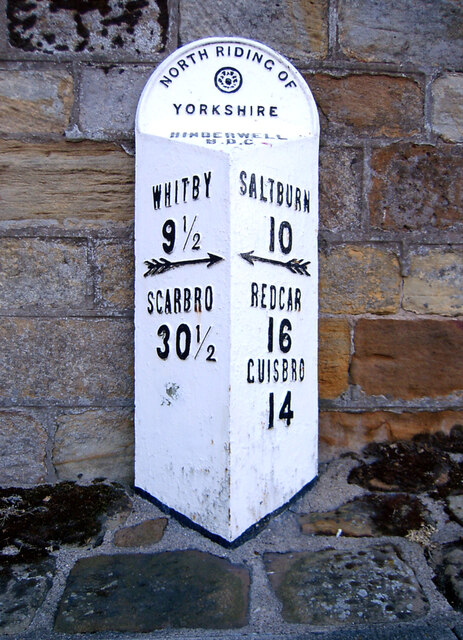
Division: North Riding

Administrative County: North Yorkshire

District: Scarborough

Police Authority: North Yorkshire

What 3 Words

///insiders.manifests.trusts. Near Loftus, North Yorkshire

Nearby Locations

Nettle Dale Dunsley Dale

Related Wikis

Runswick Bay Lifeboat Station

Runswick Bay Lifeboat Station was a Royal National Lifeboat Institution (RNLI) lifeboat station located in Runswick Bay in North Yorkshire, England. The...

Runswick Bay

Runswick Bay is a bay in the Scarborough Borough of North Yorkshire, England. It is also the name of a village located on the western edge of the bay...

Hob Holes

The Hob Holes are caves in the cliffs of Runswick Bay, Scarborough, England which resulted from mining for jet – fossilised wood which is valuable as a...

Hinderwell railway station

Hinderwell railway station was a railway station on the Whitby Redcar and Middlesbrough Union Railway. It was opened on 3 December 1883, and served the...

Ellerby, North Yorkshire

Ellerby is a village and civil parish in the Scarborough district of North Yorkshire, England, located within the North York Moors National Park. According...

Hinderwell

Hinderwell is a village and civil parish in the Scarborough district of North Yorkshire, England which lies within the North York Moors National Park,...

Newton Mulgrave

Newton Mulgrave is a village and civil parish in the Scarborough district of North Yorkshire, England. The population of the civil parish was estimated...

Port Mulgrave, North Yorkshire

Port Mulgrave is a derelict former ironstone exporting port on the North Yorkshire coast midway between Staithes and Runswick Bay in the civil parish of...

Nearby Amenities

Located within 500m of 54.531591,-0.75373444
Source: PGS
Lat/Long: 54.530258/-0.7473155
Source: PGS
Lat/Long: 54.531937/-0.7491233
Source: PGS
Lat/Long: 54.5323083/-0.7489406
Source: PGS
Lat/Long: 54.5331047/-0.749797
Source: PGS
Lat/Long: 54.5338312/-0.7489023
Source: PGS
Lat/Long: 54.5339464/-0.7485783
Source: PGS
Lat/Long: 54.5344662/-0.7479963
Runswick Bay
Place: village
Wikidata: Q24638325
Wikipedia: en:Runswick Bay
Lat/Long: 54.5327493/-0.7503506
Cafe
Runswick Bay Tea Garden
Addr City: Saltburn-by-the-Sea
Addr Country: GB
Addr Housenumber: 2
Addr Postcode: TS13 5HS
Addr Street: Ellerby Lane
Addr Village: Runswick Bay
Fhrs Id: 164209
Lat/Long: 54.5339311/-0.7556692
Source: PGS
Lat/Long: 54.5333831/-0.7496367
Post Box
Collection Times: Mo-Fr 16:15; Sa 09:30
Post Box Type: lamp
Ref: TS13 515
Royal Cypher: EIIR
Royal Cypher Wikidata: Q33102113
Source: survey
Lat/Long: 54.5334606/-0.7501158
Post Box
Operator: Royal Mail
Post Box Type: lamp
Ref: TS13 514D
Royal Cypher: EIIR
Royal Cypher Wikidata: Q33102113
Lat/Long: 54.5339573/-0.7554021
Bench
Lat/Long: 54.5340455/-0.7516466
Power: pole
Source: Bing
Lat/Long: 54.5316703/-0.7608236
Power: pole
Source: Bing
Lat/Long: 54.5323804/-0.7599066
Power: pole
Source: Bing
Lat/Long: 54.5330481/-0.7589979
Power: pole
Source: Bing
Lat/Long: 54.5334253/-0.7584844
Power: pole
Source: Bing
Lat/Long: 54.5337293/-0.7581005
Telephone
Booth: K6
Covered: booth
Source: survey
Lat/Long: 54.5331099/-0.7503362
Information: guidepost
Tourism: information
Lat/Long: 54.5341194/-0.7549719
Bench
Lat/Long: 54.5341169/-0.7553572
Addr Housename: Lilac Cottage
Lat/Long: 54.5332788/-0.7507154
Addr Housename: Seagull Cottage
Lat/Long: 54.5333051/-0.7505959
York Cottage
Addr City: Saltburn-by-the-Sea
Addr Housename: York Cottage
Addr Postcode: TS13 5HT
Addr Suburb: Runswick Bay
Tourism: guest_house
Website: http://www.yorkcottagerunswickbay.com/
Lat/Long: 54.5332621/-0.7508405
Bar
Cliffemount Hotel
Lat/Long: 54.5340264/-0.7521945
Toilets
Lat/Long: 54.5331159/-0.7502499
Bus Stop
Lat/Long: 54.5337644/-0.7554393
Mini Roundabout
Lat/Long: 54.532733/-0.7506202
Bench
Lat/Long: 54.5338749/-0.7521293
Bench
Lat/Long: 54.5338695/-0.7520394
Bench
Source: survey
Lat/Long: 54.5326244/-0.7495775
Bench
Source: survey
Lat/Long: 54.5326548/-0.749607
Bench
Source: survey
Lat/Long: 54.5326692/-0.7496654
Bench
Source: survey
Lat/Long: 54.5326937/-0.7496982
Bench
Source: survey
Lat/Long: 54.532698/-0.7497465
Bench
Source: survey
Lat/Long: 54.5327345/-0.7498055
Bench
Source: survey;gps
Lat/Long: 54.5332049/-0.7504606
Bench
Source: survey;gps
Lat/Long: 54.5332217/-0.7504385
Bench
Source: survey;gps
Lat/Long: 54.5340224/-0.7508308
Barrier: stile
Material: wood
Source: survey;gps
Stile: stepover
Lat/Long: 54.535132/-0.7515281
Defibrillator
Access: yes
Emergency: defibrillator
Indoor: no
Ref: AHA274
Lat/Long: 54.534196/-0.7550993
Runswick Bank Top
Fixme: Hamlet or locality?
Place: hamlet
Lat/Long: 54.5340099/-0.7554066
Bench
Backrest: yes
Lat/Long: 54.5331649/-0.7537115
The data included in this document is from www.openstreetmap.org. The data is made available under ODbL.

Have you been to Nettle Dale?

Leave your review of Nettle Dale below (or comments, questions and feedback).