Hippenscombe Bottom

Valley in Wiltshire

England

Hippenscombe Bottom

Farmland, Chute With the bridleway heading south from Chantry.
Farmland, Chute Credit: Andrew Smith

Hippenscombe Bottom is a picturesque valley located in the county of Wiltshire, England. Situated near the village of East Tytherley, the valley is known for its stunning natural beauty and tranquil atmosphere.

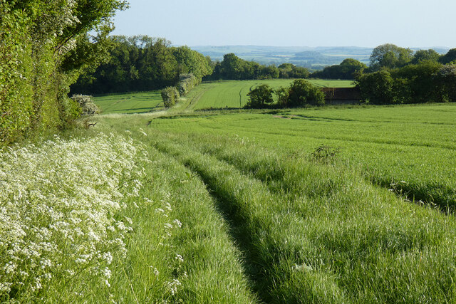
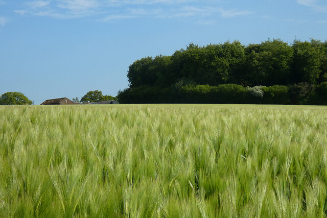
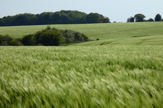
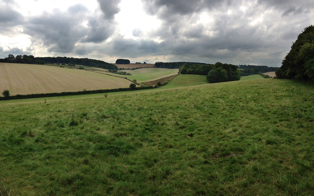
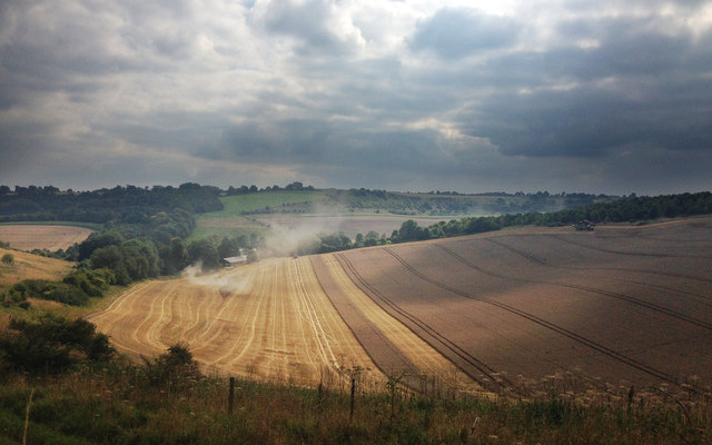
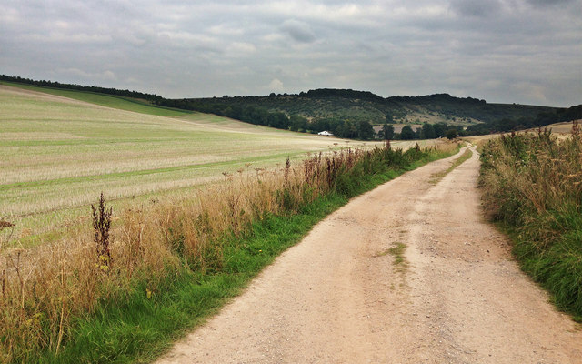
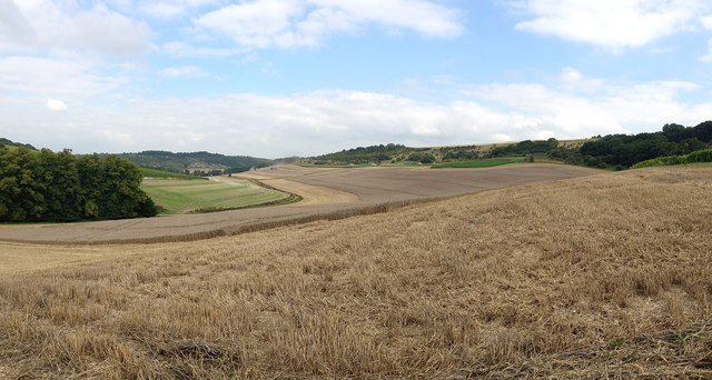
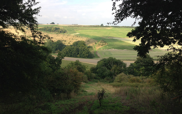
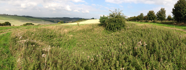
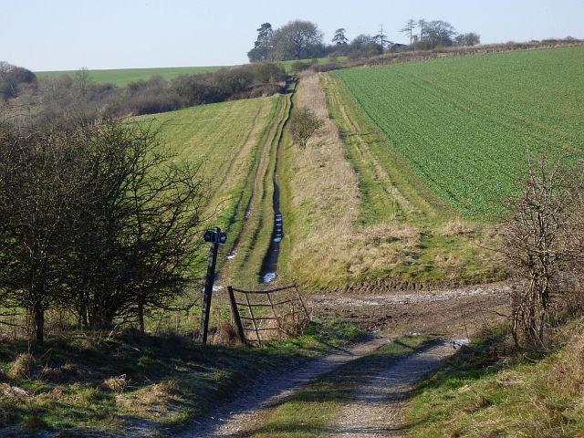
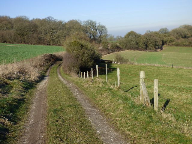
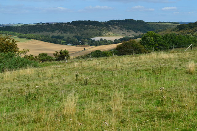
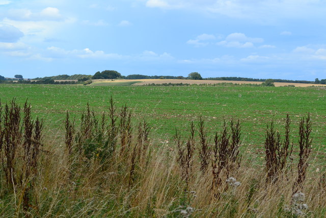
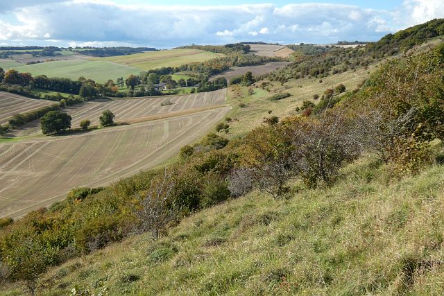
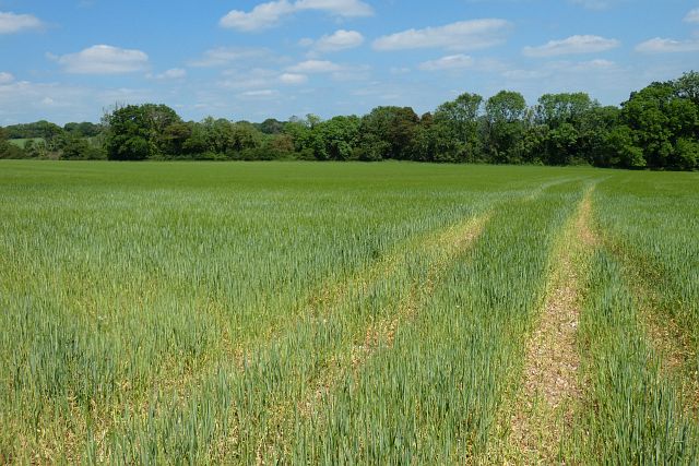
The valley is nestled between rolling hills and is characterized by its lush greenery, vibrant wildflowers, and meandering stream that runs through its heart. The landscape is dotted with ancient woodlands, providing a rich habitat for a variety of flora and fauna. The area is particularly renowned for its diverse bird population, making it a popular destination for birdwatchers and nature enthusiasts.

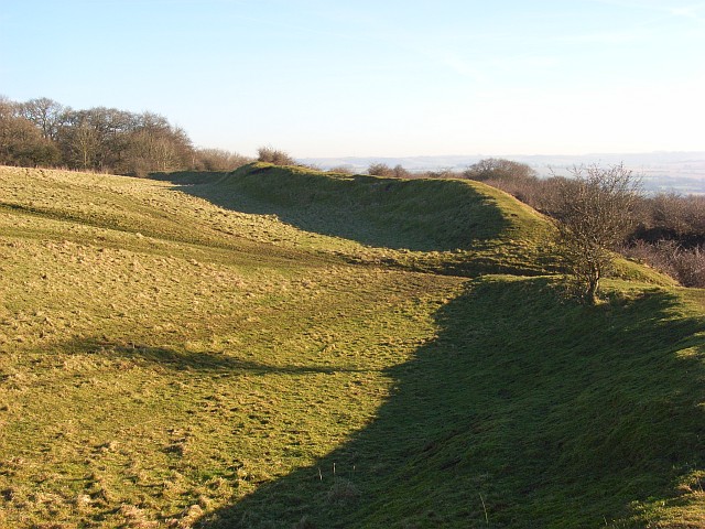
Hippenscombe Bottom also boasts a rich historical background. The remains of Iron Age settlements and ancient burial mounds can be found within the valley, serving as a testament to its long-standing human habitation. The area has been farmed for centuries, and the traditional agricultural practices continue to shape the landscape today.

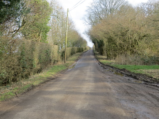
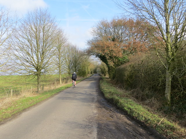
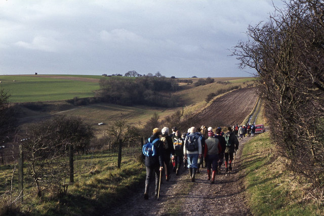
The valley offers numerous walking trails and footpaths, allowing visitors to explore its serenity at their own pace. It is a haven for outdoor activities such as hiking, picnicking, and photography. The valley's tranquil ambiance and natural beauty make it an ideal location for those seeking a peaceful retreat or a scenic spot to unwind.

Overall, Hippenscombe Bottom, Wiltshire, is a hidden gem that showcases the beauty of the English countryside. Its stunning landscapes, rich history, and diverse wildlife make it a must-visit destination for nature lovers and anyone in search of a peaceful and idyllic escape.

If you have any feedback on the listing, please let us know in the comments section below.

Hippenscombe Bottom Images

Images are sourced within 2km of 51.301324/-1.576834 or Grid Reference SU2955. Thanks to Geograph Open Source API. All images are credited.

Farmland, Chute With the bridleway heading south from Chantry.
Farmland, Chute
With the bridleway heading south from Chantry.
Farmland, Collingbourne Kingston Buildings at Gammon's Farm and the northern tip of Rag Copse seen across a field of barley.
Farmland, Collingbourne Kingston
Buildings at Gammon's Farm and the northern tip of Rag Copse seen across a field of barley.
Farmland, Tidcombe Gently undulating fields of barley viewed from a bridleway to the south of the village.
Farmland, Tidcombe
Gently undulating fields of barley viewed from a bridleway to the south of the village.
Chalk pasture and arable farmland Mixed farmland near Tidcombe, Wiltshire, featuring pasture and arable, separated by hedging and dotted with small areas of woodland
Chalk pasture and arable farmland
Mixed farmland near Tidcombe, Wiltshire, featuring pasture and arable, separated by hedging and dotted with small areas of woodland
Harvesting wheat A cloud of dust and cut straw emerges from behind a modern day combine harvester in a mid-sized arable field at Hippenscombe, Fosbury, Wiltshire
Harvesting wheat
A cloud of dust and cut straw emerges from behind a modern day combine harvester in a mid-sized arable field at Hippenscombe, Fosbury, Wiltshire
Field track A well constructed field track-cum-bridleway traversing the valley bottom at Hippenscombe Bottom.
Field track
A well constructed field track-cum-bridleway traversing the valley bottom at Hippenscombe Bottom.
Mixed chalk landscape The view extends to the ancient Fosbury Camp in the distance, down through Hippenscombe Bottom, a broad valley given over to arable farming and bounded by rough grazing land on the chalk sides.  Areas of scrub and woodland are also evident.
Mixed chalk landscape
The view extends to the ancient Fosbury Camp in the distance, down through Hippenscombe Bottom, a broad valley given over to arable farming and bounded by rough grazing land on the chalk sides. Areas of scrub and woodland are also evident.
Across the steep-sided chalk valley at Hippenscombe Having climbed the southern flank of the valley at Hippencombe Bottom, this view looking across to the northern slopes demonstrates the mixed landscape hereabouts.  In the distance lies the cultivated chalk ridge, which descends down through rough calcareous grassland and small areas of woodland to the valley bottom, along which travels a bridlepath eastwards to the farm buildings at Hippenscombe.
Across the steep-sided chalk valley at Hippenscombe
Having climbed the southern flank of the valley at Hippencombe Bottom, this view looking across to the northern slopes demonstrates the mixed landscape hereabouts. In the distance lies the cultivated chalk ridge, which descends down through rough calcareous grassland and small areas of woodland to the valley bottom, along which travels a bridlepath eastwards to the farm buildings at Hippenscombe.
Site of Roman quarry pit The overgrown nature of this Roman quarry hides its other feature, the mysterious Kenwardstone, a slab of saracen stone with wave-like markings on its surface.  There is much conjecture as to how these carvings were formed, some say they were manmade while others suggest they are the result of weathering. See: <span class="nowrap"><a title="http://www.themodernantiquarian.com/post/35935/images/kenward_stone.html" rel="nofollow ugc noopener" href="http://www.themodernantiquarian.com/post/35935/images/kenward_stone.html">Link</a><img style="margin-left:2px;" alt="External link" title="External link - shift click to open in new window" src="https://s1.geograph.org.uk/img/external.png" width="10" height="10"/></span>
Site of Roman quarry pit
The overgrown nature of this Roman quarry hides its other feature, the mysterious Kenwardstone, a slab of saracen stone with wave-like markings on its surface. There is much conjecture as to how these carvings were formed, some say they were manmade while others suggest they are the result of weathering. See: LinkExternal link
Chute Causeway Looking eastward in the direction of Cornholt.
Chute Causeway
Looking eastward in the direction of Cornholt.
Chute Causeway at Little Down Looking north-eastward.
Chute Causeway at Little Down
Looking north-eastward.
Bridleway and farmland, Fosbury The crossroads of bridleways above Hippenscombe.
Bridleway and farmland, Fosbury
The crossroads of bridleways above Hippenscombe.
Bridleway and farmland, Fosbury The most direct route between Hippenscombe and Oxenwood.
Bridleway and farmland, Fosbury
The most direct route between Hippenscombe and Oxenwood.
View over Hippenscombe Bottom
Field above Hippenscombe Bottom
Walking group west of Fosbury Farm
Downland, Fosbury The scrubby southern flank of Haydown Hill above arable fields in Hippenscombe Bottom.
Downland, Fosbury
The scrubby southern flank of Haydown Hill above arable fields in Hippenscombe Bottom.
Farmland, Chute Spring barley to the east of Dummer Lane.
Farmland, Chute
Spring barley to the east of Dummer Lane.
Show me another place!

Hippenscombe Bottom is located at Grid Ref: SU2955 (Lat: 51.301324, Lng: -1.576834)

Unitary Authority: Wiltshire

Police Authority: Wiltshire

What 3 Words

///club.limits.schematic. Near Collingbourne Kingston, Wiltshire

Related Wikis

Hippenscombe

Hippenscombe is a hamlet within the civil parish of Tidcombe and Fosbury, Wiltshire, in the southwest of England. Marked only on large-scale maps, it lies...

Chute, Wiltshire

Chute is a civil parish in east Wiltshire, England, on the border with Hampshire. It includes the main village of Upper Chute and the smaller settlements...

Tidcombe and Fosbury

Tidcombe and Fosbury is a civil parish in Wiltshire, England, about 10 miles (16 km) southeast of Marlborough and 7 miles (11 km) south of Hungerford,...

Fosbury Camp

Fosbury Camp, is the site of an Iron Age bivallate hillfort located in Wiltshire. The site is oval in shape, and approximately 26 acres in areaThe site...

Tidcombe

Tidcombe is a small village in Wiltshire, England, on the eastern edge of the county, near Hampshire, about 9 miles (14 km) southeast of Marlborough and...

Conholt

Conholt was a small village in east Wiltshire, England, close to the Hampshire border and about 6 miles (10 km) northeast of Andover. It is now the site...

Fosbury House

Fosbury House is a Grade II listed country house northwest of the village of Fosbury in Wiltshire, England, about 11 miles (18 km) southeast of Marlborough...

Fosbury

Fosbury is a small village in Wiltshire, England, on the eastern edge of the county, near Hampshire. It lies about 11 miles (18 km) southeast of Marlborough...

Nearby Amenities

Located within 500m of 51.301324,-1.576834
Hippenscombe Bottom
Place: locality
Source: OS_OpenData_StreetView
Lat/Long: 51.3012/-1.5767527
The data included in this document is from www.openstreetmap.org. The data is made available under ODbL.

Have you been to Hippenscombe Bottom?

Leave your review of Hippenscombe Bottom below (or comments, questions and feedback).