Three Beech Bottom

Valley in Hampshire New Forest

England

Three Beech Bottom

Path on Setley Plain
Path on Setley Plain Credit: David Martin

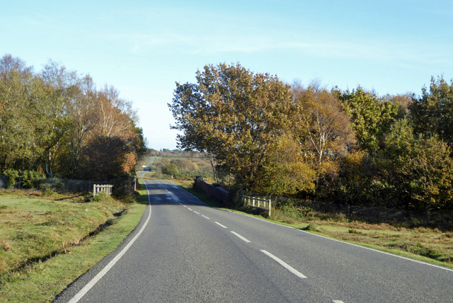
Three Beech Bottom is a small rural village located in the picturesque county of Hampshire, England. Situated in a valley surrounded by rolling hills and lush green countryside, it is known for its idyllic and tranquil setting. The village gets its name from the three beech trees that stand proudly at the entrance, welcoming visitors with their majestic presence.

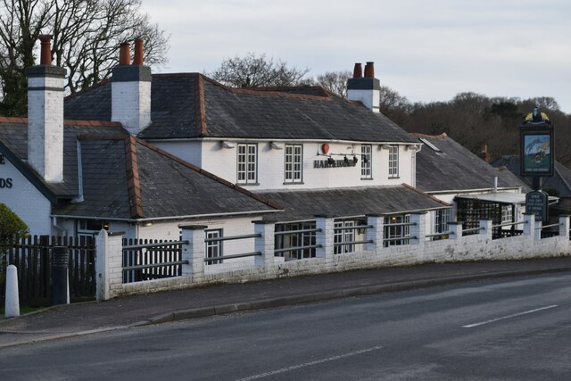
The main feature of Three Beech Bottom is its charming cottages, which are predominantly made of local materials such as flint and brick, giving the village a distinct traditional character. These cottages are nestled together along narrow winding lanes, creating a sense of intimacy and community.

The village is home to a close-knit population of friendly and welcoming locals. The community spirit is evident in the village's annual events, including the summer fete and Christmas market, which bring residents together for fun-filled activities and celebrations.

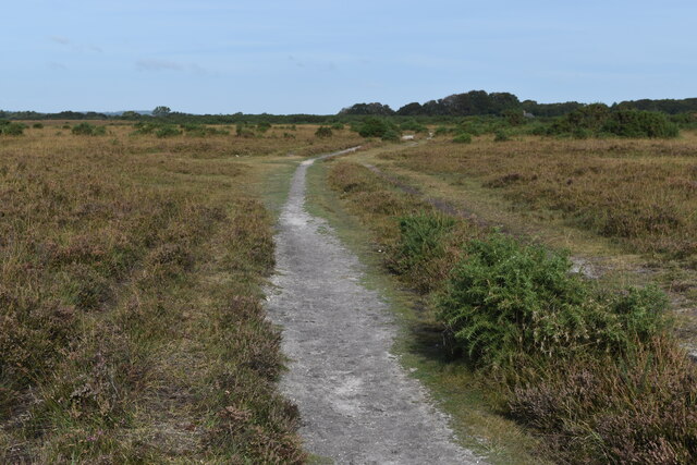
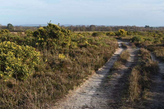
Nature enthusiasts are drawn to Three Beech Bottom for its stunning surroundings. The village is surrounded by an abundance of scenic walking trails and nature reserves, making it an ideal destination for hikers and wildlife enthusiasts. The nearby Beech Bottom Nature Reserve is particularly popular, boasting a diverse range of flora and fauna.

While Three Beech Bottom provides a peaceful rural escape, it is conveniently located within easy reach of larger towns and cities. The bustling market town of Petersfield is just a short drive away, offering a range of amenities, shops, and restaurants.

Overall, Three Beech Bottom is a hidden gem in Hampshire, offering a serene countryside retreat with a strong sense of community and plenty of natural beauty to explore.

If you have any feedback on the listing, please let us know in the comments section below.

Three Beech Bottom Images

Images are sourced within 2km of 50.797992/-1.5838904 or Grid Reference SZ2999. Thanks to Geograph Open Source API. All images are credited.

Path on Setley Plain
View across Milking Pound Bottom Low-lying land southwest of the railway embankment, which is just visible on the far slope.
View across Milking Pound Bottom
Low-lying land southwest of the railway embankment, which is just visible on the far slope.
Track towards Longslade View car park Gravel track leading to a car park about 250m north of Wilverley Road.
Track towards Longslade View car park
Gravel track leading to a car park about 250m north of Wilverley Road.
Gorse-lined path on heathland north of Sway
The Hare and Hounds at Durns Town
33KV  electricity lines along Milking Pound Bottom Running parallel to the railway line, which is to the right of the lines.
33KV electricity lines along Milking Pound Bottom
Running parallel to the railway line, which is to the right of the lines.
Railway bridge on road towards Cobblers Corner The road passes over the main line to Bournemouth. In the distance, a whitish feature is where the road passes under the branch to Lymington.
Railway bridge on road towards Cobblers Corner
The road passes over the main line to Bournemouth. In the distance, a whitish feature is where the road passes under the branch to Lymington.
Road to Cobblers Corner In the distance, the road passes under a railway bridge on the branch to Lymington.
Road to Cobblers Corner
In the distance, the road passes under a railway bridge on the branch to Lymington.
A model yacht on Setley Pond A recognized venue for the pastime, hence the buoys. Only one yacht today. The captain is on the right.
A model yacht on Setley Pond
A recognized venue for the pastime, hence the buoys. Only one yacht today. The captain is on the right.
Near Setley Pond, New Forest The trees are along the boundary of the New Forest area.
Near Setley Pond, New Forest
The trees are along the boundary of the New Forest area.
Railway bridge, Manchester Road, Sway The main line to Bournemouth crosses.
Railway bridge, Manchester Road, Sway
The main line to Bournemouth crosses.
Setley Pond, New Forest Used for model boat sailing, hence the buoys.
Setley Pond, New Forest
Used for model boat sailing, hence the buoys.
Car park at Setley Pond, New Forest The pony is saddled up, and was ridden off later.
Car park at Setley Pond, New Forest
The pony is saddled up, and was ridden off later.
Old Milestone by the B3055, Durns Town, Sway parish Carved stone post by the B3055, in parish of SWAY (NEW FOREST District), Durns Town; 100m North of forest boundary (cattle grid) and 50m South of railway bridge, by the road, on West side of road. Erected by a private company in the 19th century. 

Inscription once read:-
(Lyndhurst)
(6)
(Milford)
(5)  

Milestone Society National ID: HA_LHMF06.
Old Milestone by the B3055, Durns Town, Sway parish
Carved stone post by the B3055, in parish of SWAY (NEW FOREST District), Durns Town; 100m North of forest boundary (cattle grid) and 50m South of railway bridge, by the road, on West side of road. Erected by a private company in the 19th century. Inscription once read:- (Lyndhurst) (6) (Milford) (5) Milestone Society National ID: HA_LHMF06.
Model Yachts on Setley Pond
35028 'Clan Line' with the 'Bournemouth Belle' Rebuilt 'Merchant Navy' class Pacific No.35028 'Clan Line' with the 'Bournemouth Belle' Pullman dining train from Waterloo to Bournemouth on 5th July 2017.  The train was a re-creation of steam days when the 'Bournemouth Belle' ran daily on this route.  The 'Merchant Navies' and their smaller cousins the 'West Country' and 'Battle of Britain' Pacifics were regularly employed on this line.
35028 'Clan Line' with the 'Bournemouth Belle'
Rebuilt 'Merchant Navy' class Pacific No.35028 'Clan Line' with the 'Bournemouth Belle' Pullman dining train from Waterloo to Bournemouth on 5th July 2017. The train was a re-creation of steam days when the 'Bournemouth Belle' ran daily on this route. The 'Merchant Navies' and their smaller cousins the 'West Country' and 'Battle of Britain' Pacifics were regularly employed on this line.
Path on Setley Plain
Edge of Setley Plain near Latchmoor House
Show me another place!

Three Beech Bottom is located at Grid Ref: SZ2999 (Lat: 50.797992, Lng: -1.5838904)

Administrative County: Hampshire

District: New Forest

Police Authority: Hampshire

What 3 Words

///ship.revisits.lollipop. Near Sway, Hampshire

Nearby Locations

Three Beech Bottom

Related Wikis

A337 road

The A337 road is a road in southern England that runs from the M27 motorway in Hampshire to Christchurch in Dorset. == Route of Road == The A337 begins...

Lymington River SSSI

Lymington River SSSI is a 34.8-hectare (86-acre) biological and geological Site of Special Scientific Interest along Lymington River and its tributaries...

No. 1 New Zealand General Hospital

The № 1 New Zealand General Hospital (1NZGH) was a World War I military hospital in Brockenhurst, Hampshire, England. The hospital was established in June...

Shirley Holms Halt railway station

Shirley Holms Halt was a railway halt in the New Forest district of Hampshire. Opened in 1860 it was closed in 1888 with opening of Sway on the South West...

Nearby Amenities

Located within 500m of 50.797992,-1.5838904
Created By: osmeditor2
Lat/Long: 50.801509/-1.5796668
Ford: yes
Lat/Long: 50.7941119/-1.5823708
Created By: osmeditor2
Lat/Long: 50.7963371/-1.5773387
Created By: osmeditor2
Lat/Long: 50.8011834/-1.5813926
Created By: osmeditor2
Lat/Long: 50.7972772/-1.5770019
Ford: yes
Lat/Long: 50.8004805/-1.5876833
The data included in this document is from www.openstreetmap.org. The data is made available under ODbL.

Have you been to Three Beech Bottom?

Leave your review of Three Beech Bottom below (or comments, questions and feedback).