Hive Garn Bottom

Valley in Hampshire New Forest

England

Hive Garn Bottom

Bowl barrow at Ashley Cross (Scales 1m) <span class="nowrap"><a title="https://historicengland.org.uk/listing/the-list/list-entry/1012537?section=official-listing" rel="nofollow ugc noopener" href="https://historicengland.org.uk/listing/the-list/list-entry/1012537?section=official-listing">Link</a><img style="margin-left:2px;" alt="External link" title="External link - shift click to open in new window" src="https://s1.geograph.org.uk/img/external.png" width="10" height="10"/></span>
Bowl barrow at Ashley Cross Credit: Sandy Gerrard

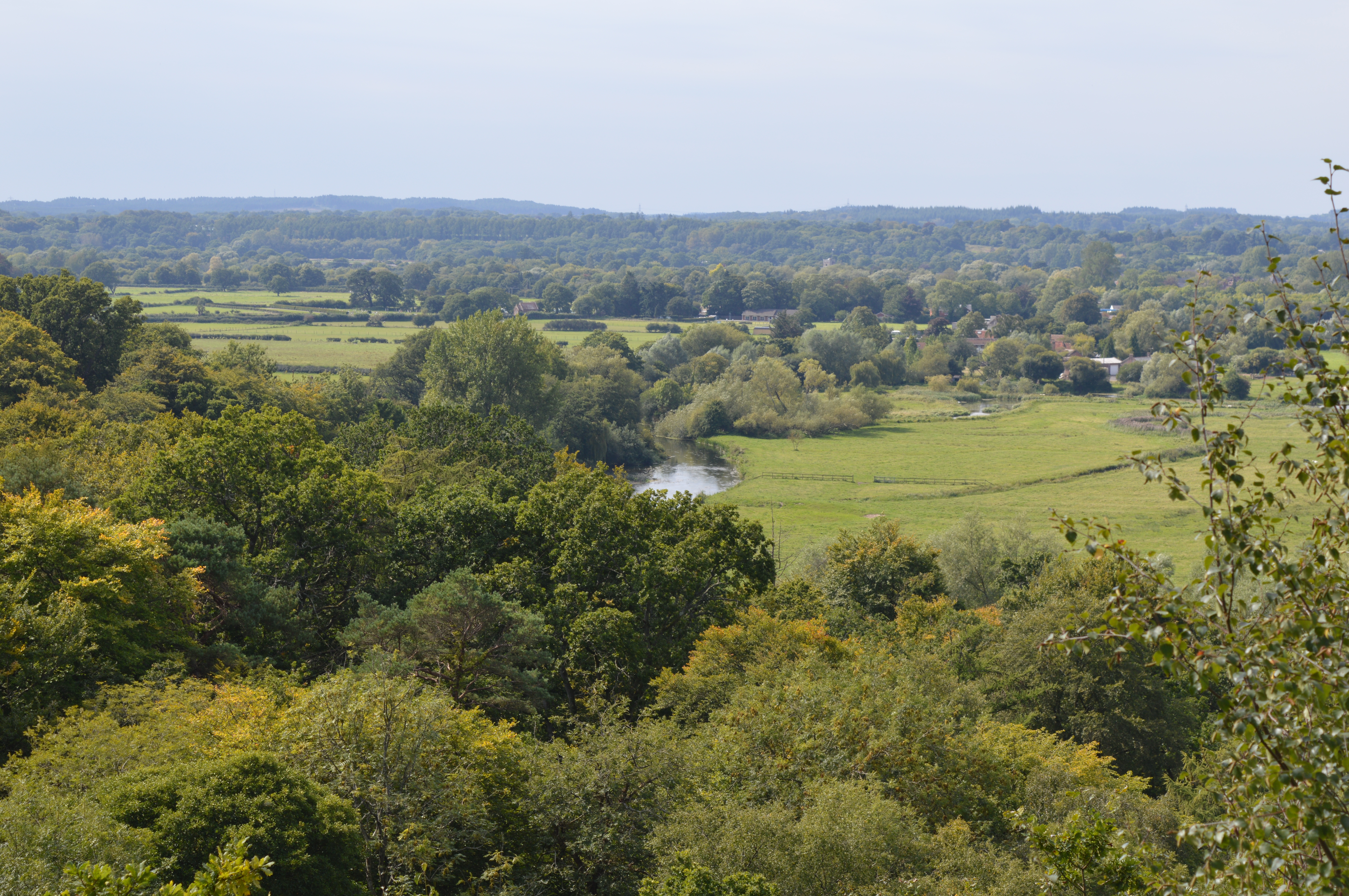
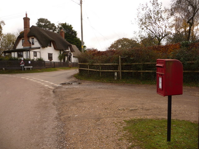
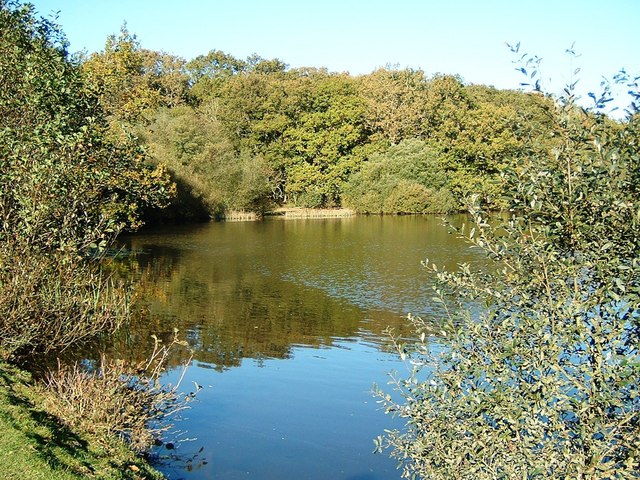
Hive Garn Bottom is a picturesque valley located in Hampshire, England. Nestled amidst the stunning countryside, it is a popular destination for nature lovers and outdoor enthusiasts. The valley is situated near the village of Hive, which adds to its charm and tranquility.

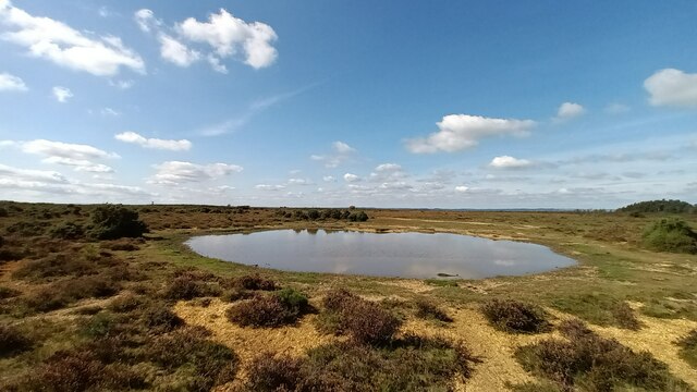
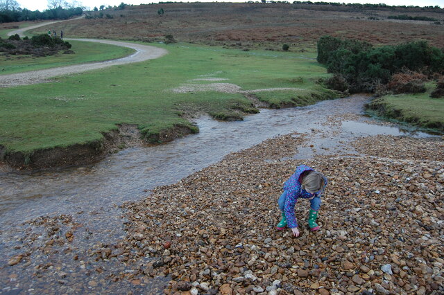
The valley is characterized by rolling hills, lush green meadows, and a meandering stream that runs through it. The stream, known as Garn Brook, is a prominent feature of Hive Garn Bottom and adds to the overall beauty of the landscape. The clear and babbling waters of the brook attract various species of birds and wildlife, making it an ideal spot for birdwatching and nature photography.

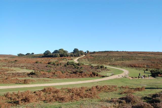
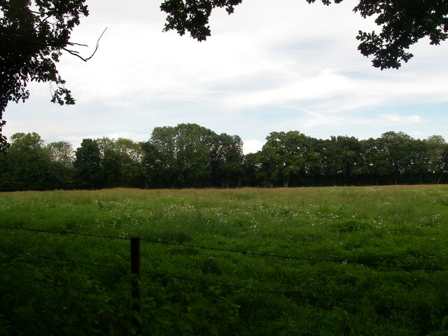
The surrounding area of Hive Garn Bottom is predominantly rural, with a mix of farmland and woodland. This creates a diverse ecosystem, supporting a wide range of plant and animal species. Visitors can explore the numerous walking trails and footpaths that crisscross the valley, offering breathtaking views of the countryside and opportunities to spot wildlife.

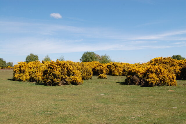
Hive Garn Bottom is also home to a variety of plant life, including wildflowers, native grasses, and ancient trees. During the spring and summer months, the valley comes alive with vibrant colors, as the flowers bloom and the meadows become a haven for butterflies and bees.

Overall, Hive Garn Bottom offers a peaceful and idyllic retreat for those seeking to connect with nature and enjoy the beauty of the Hampshire countryside. Whether it's a leisurely stroll, a picnic by the stream, or simply taking in the scenic views, this valley provides a serene escape from the hustle and bustle of everyday life.

If you have any feedback on the listing, please let us know in the comments section below.

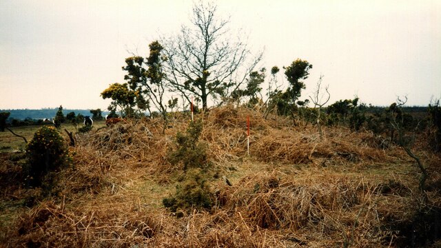
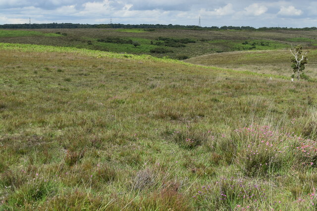
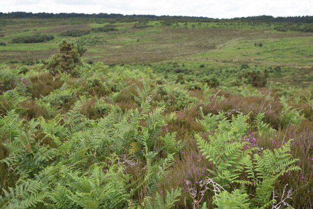
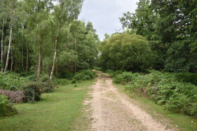
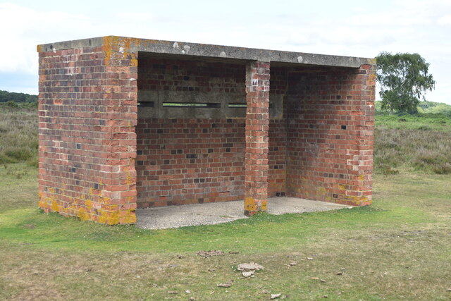
Hive Garn Bottom Images

Images are sourced within 2km of 50.933882/-1.7215847 or Grid Reference SU1914. Thanks to Geograph Open Source API. All images are credited.

Bowl barrow at Ashley Cross (Scales 1m) <span class="nowrap"><a title="https://historicengland.org.uk/listing/the-list/list-entry/1012537?section=official-listing" rel="nofollow ugc noopener" href="https://historicengland.org.uk/listing/the-list/list-entry/1012537?section=official-listing">Link</a><img style="margin-left:2px;" alt="External link" title="External link - shift click to open in new window" src="https://s1.geograph.org.uk/img/external.png" width="10" height="10"/></span>
Bowl barrow at Ashley Cross
(Scales 1m) LinkExternal link
Barrow forming part of a Round Barrow Cemetery known as The Butts (Scales 1m) <span class="nowrap"><a title="https://historicengland.org.uk/listing/the-list/list-entry/1012538?section=official-listing" rel="nofollow ugc noopener" href="https://historicengland.org.uk/listing/the-list/list-entry/1012538?section=official-listing">Link</a><img style="margin-left:2px;" alt="External link" title="External link - shift click to open in new window" src="https://s1.geograph.org.uk/img/external.png" width="10" height="10"/></span>
Barrow forming part of a Round Barrow Cemetery known as The Butts
(Scales 1m) LinkExternal link
Track passing west of Island Thorns Inclosure
View down side valley into Black Gutter Bottom
Bracken across the path above Black Gutter Bottom
Cows and ponies on target The animals and photographer are standing on one of the major target areas of Ashley Walk Bombing Range. Fortunately it closed in 1946. For full details see <a href="https://www.geograph.org.uk/photo/4477882">SU2014 : (7d) A tour of the WWII Ashley Walk Bombing Range - Observation Shelter (detail)</a>.
Cows and ponies on target
The animals and photographer are standing on one of the major target areas of Ashley Walk Bombing Range. Fortunately it closed in 1946. For full details see SU2014 : (7d) A tour of the WWII Ashley Walk Bombing Range - Observation Shelter (detail).
Track climbing from the ford in Ashley Bottom
Observation shelter on the former Ashley Walk Bombing Range On the inside of the near end wall is the information board shown in <a href="https://www.geograph.org.uk/photo/4477882">SU2014 : (7d) A tour of the WWII Ashley Walk Bombing Range - Observation Shelter (detail)</a>.
Observation shelter on the former Ashley Walk Bombing Range
On the inside of the near end wall is the information board shown in SU2014 : (7d) A tour of the WWII Ashley Walk Bombing Range - Observation Shelter (detail).
Island Thorns Inclosure Track heading downhill into open mixed woodland.
<span class="nowrap"><a title="www.newforestnpa.gov.uk" rel="nofollow ugc noopener" href="http://www.newforestnpa.gov.uk">Link</a><img style="margin-left:2px;" alt="External link" title="External link - shift click to open in new window" src="https://s1.geograph.org.uk/img/external.png" width="10" height="10"/></span>
Island Thorns Inclosure
Track heading downhill into open mixed woodland. LinkExternal link
Grand Slam View looking WNW across Grand Slam bomb crater  from top of  tumulus.
Grand Slam
View looking WNW across Grand Slam bomb crater from top of tumulus.
Gorse at Godshill near Fordingbridge. New Forest
The snake path near Godshill
Ditchend Brook near The Snake Path
Show me another place!

Hive Garn Bottom is located at Grid Ref: SU1914 (Lat: 50.933882, Lng: -1.7215847)

Administrative County: Hampshire

District: New Forest

Police Authority: Hampshire

What 3 Words

///skies.typhoon.between. Near Fordingbridge, Hampshire

Related Wikis

Ashley Range

Ashley Range is a former World War II bombing range in the New Forest, Hampshire, England. The range is approximately 5 mi (8.0 km) north-west of Lyndhurst...

Sandy Balls

Sandy Balls is 120 acres (0.49 km2) of woods and parkland near the New Forest in Hampshire, England. Located between the village of Godshill and the town...

Blissford

Blissford is a hamlet in the civil parish of Hyde situated in the New Forest National Park in Hampshire, England. Its nearest town is Fordingbridge, which...

Godshill, Hampshire

Godshill is a village and civil parish and in New Forest National Park in Hampshire, England. It is about 1+1⁄2 miles (2.4 km) east of the town of Fordingbridge...

Frankenbury Camp

Frankenbury Camp is the site of an Iron Age univallate hillfort located in Hampshire. The site is on a very slight promontory overlooking the Avon Valley...

Ogdens

Ogdens is a small hamlet south of Hyde Common near Frogham in the New Forest area of Hampshire, England. Ogdens is a hamlet in the civil parish of Hyde...

Eyeworth Pond

Eyeworth Pond is a pond located near Fritham in the New Forest, in Hampshire, England. The pond was created in 1871 by damming Latchmore Brook, with the...

Frogham, Hampshire

Frogham is a small village in the New Forest National Park of Hampshire, England. It is in the civil parish of Hyde. Its nearest town is Fordingbridge...

Related Videos

NEW FOREST WALK FROM THE HIGH CORNER INN TO GODSHILL VIA FROGHAM (A "PUB TO PUB" WALK)

In this episode of my series “New Forest Walks”, I take a walk from the High Corner Inn (near Linwood) to The Fighting Cocks pub ...

Loop around Godshill

This is a 10-mile walk looping around the New Forest Town of Godshill. It starts at Godshill Inclosure, coming out at the village of ...

Christmas at Undercastle Cottage

We always decorate the cottage for Christmas Holidays.

Nearby Amenities

Located within 500m of 50.933882,-1.7215847
Bicycle: yes
Ford: yes
Motor Vehicle: yes
Lat/Long: 50.9305478/-1.7231495
Site of Medieval Hunting Lodge
Access: yes
Historic: ruins
Historic Civilization: medieval
Ruins: lodge
Lat/Long: 50.9324783/-1.7161046
Lodge Hill
Ele: 105
Natural: peak
Lat/Long: 50.9345091/-1.718223
Hive Garn Bottom
Place: locality
Lat/Long: 50.9336977/-1.7226219
Little Cockley Plain
Place: locality
Lat/Long: 50.9375381/-1.7206263
Great Cockley Plain
Place: locality
Lat/Long: 50.935315/-1.726255
Ford: yes
Lat/Long: 50.9320868/-1.7257622
Ele: 100
Natural: peak
Lat/Long: 50.9365808/-1.7235921
The data included in this document is from www.openstreetmap.org. The data is made available under ODbL.

Have you been to Hive Garn Bottom?

Leave your review of Hive Garn Bottom below (or comments, questions and feedback).