Must Thorns Bottom

Valley in Hampshire New Forest

England

Must Thorns Bottom

Bowl barrow at Ashley Cross (Scales 1m) <span class="nowrap"><a title="https://historicengland.org.uk/listing/the-list/list-entry/1012537?section=official-listing" rel="nofollow ugc noopener" href="https://historicengland.org.uk/listing/the-list/list-entry/1012537?section=official-listing">Link</a><img style="margin-left:2px;" alt="External link" title="External link - shift click to open in new window" src="https://s1.geograph.org.uk/img/external.png" width="10" height="10"/></span>
Bowl barrow at Ashley Cross Credit: Sandy Gerrard

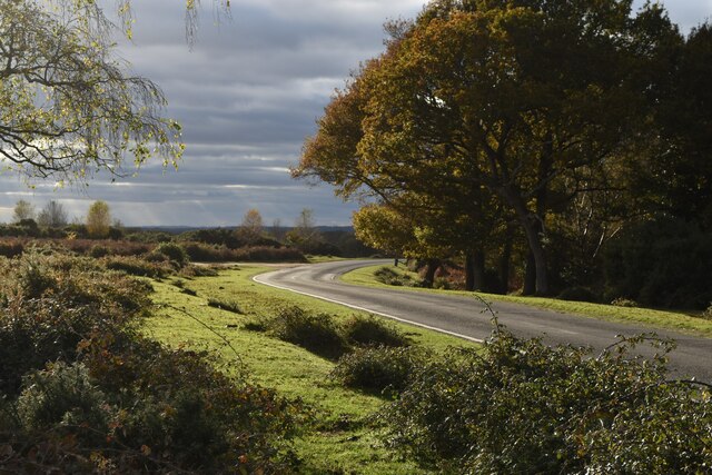
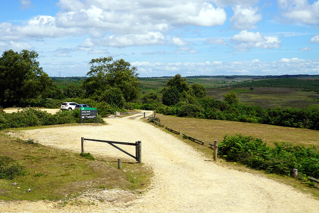
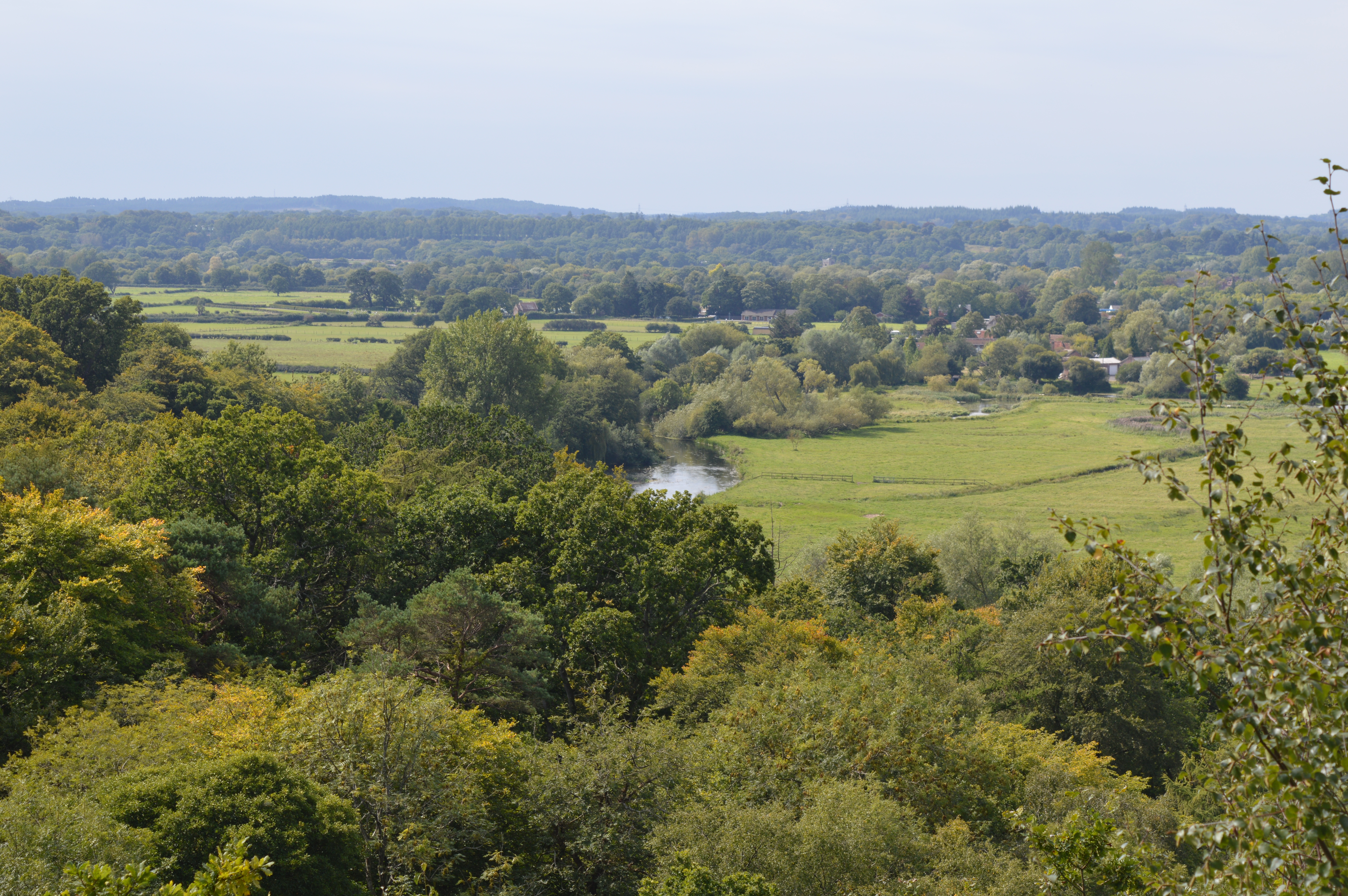
Located in the county of Hampshire, Must Thorns Bottom is a picturesque valley nestled within the rolling hills of the South Downs National Park. This idyllic natural landscape stretches over an area of approximately 2 square kilometers and offers visitors a serene and tranquil environment to explore.

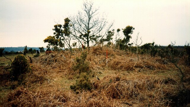
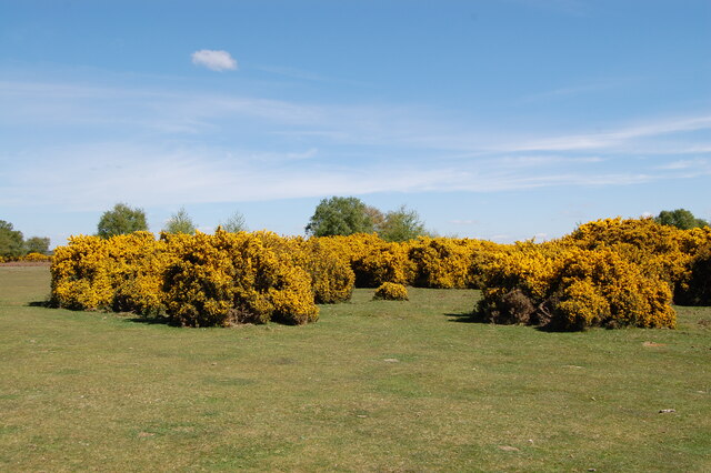
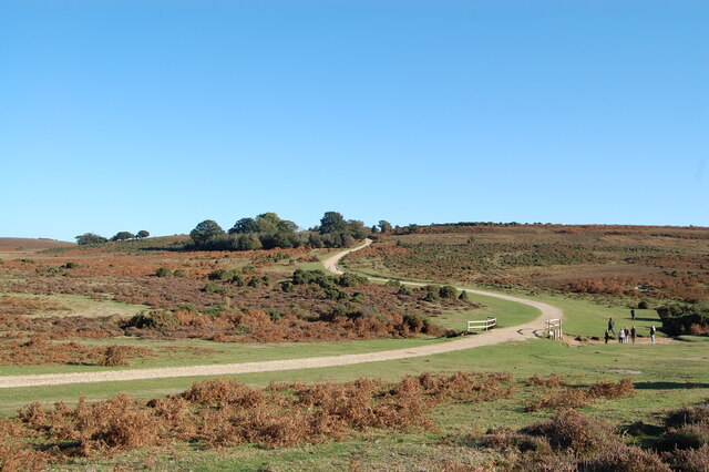
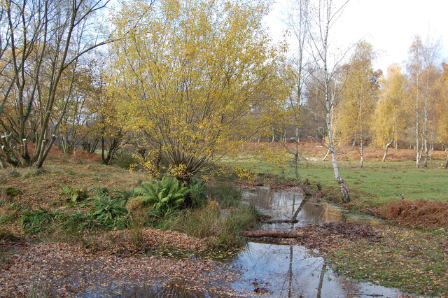
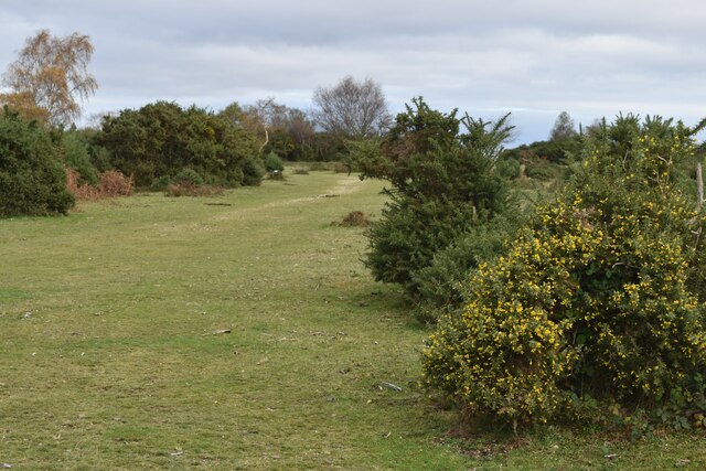
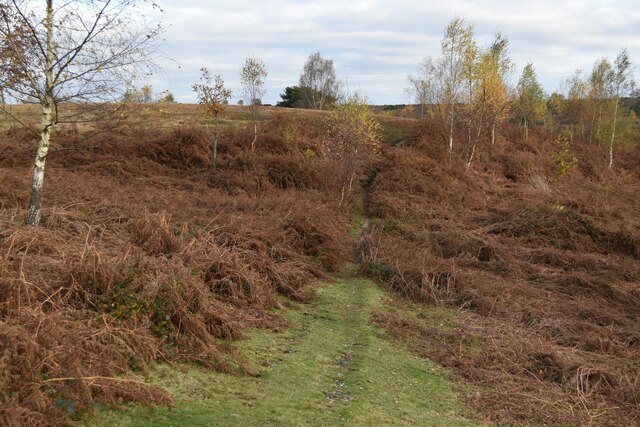
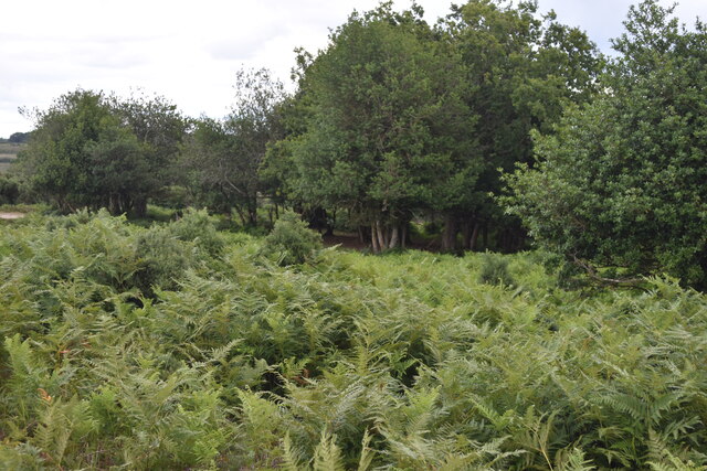
Must Thorns Bottom is known for its diverse and rich biodiversity, with a variety of plant and animal species calling it home. The valley is covered with lush green meadows, dotted with wildflowers during the summer months, and framed by dense woodland on either side. The flora includes an array of native species such as bluebells, primroses, and foxgloves.

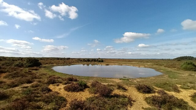
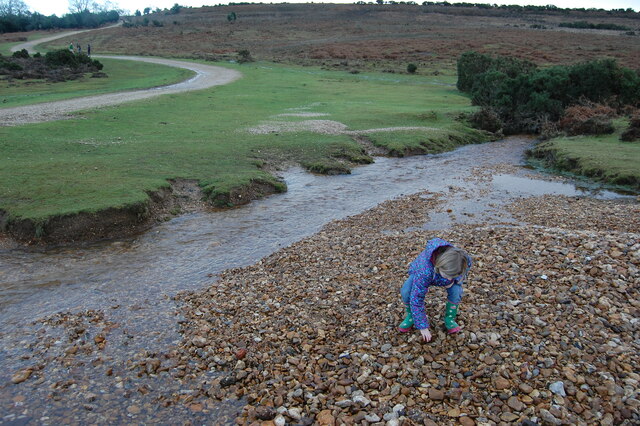
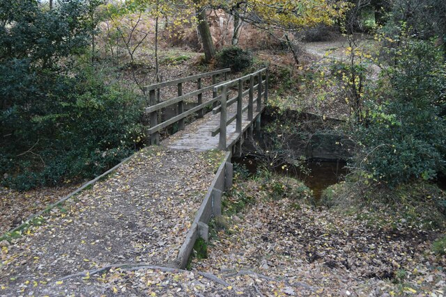
The valley is crisscrossed by several small streams that meander through the landscape, creating a soothing ambiance and providing a habitat for various aquatic creatures. The presence of these streams also contributes to the valley's abundant wildlife, which includes an array of bird species, butterflies, and small mammals.

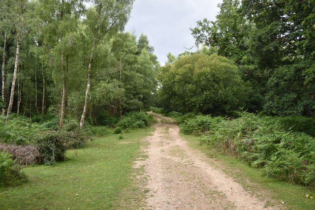
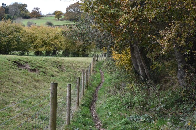
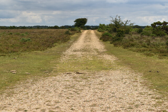
For nature enthusiasts and hikers, Must Thorns Bottom offers a network of well-maintained footpaths and trails that allow visitors to explore the valley's charms while taking in the breathtaking views. The valley also serves as a popular spot for picnics and family outings, with designated areas for visitors to relax and enjoy the peaceful surroundings.

In summary, Must Thorns Bottom in Hampshire is a picturesque valley brimming with natural beauty and biodiversity. With its meadows, woodlands, streams, and abundance of wildlife, it provides a haven for those seeking tranquility and a deep connection with nature.

If you have any feedback on the listing, please let us know in the comments section below.

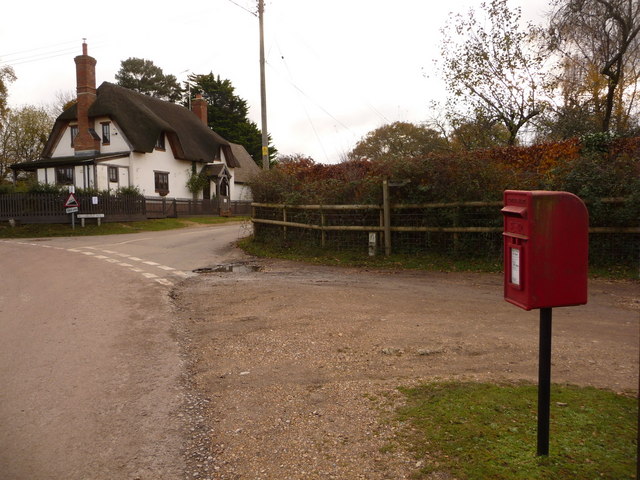
Must Thorns Bottom Images

Images are sourced within 2km of 50.929919/-1.7303452 or Grid Reference SU1914. Thanks to Geograph Open Source API. All images are credited.

Bowl barrow at Ashley Cross (Scales 1m) <span class="nowrap"><a title="https://historicengland.org.uk/listing/the-list/list-entry/1012537?section=official-listing" rel="nofollow ugc noopener" href="https://historicengland.org.uk/listing/the-list/list-entry/1012537?section=official-listing">Link</a><img style="margin-left:2px;" alt="External link" title="External link - shift click to open in new window" src="https://s1.geograph.org.uk/img/external.png" width="10" height="10"/></span>
Bowl barrow at Ashley Cross
(Scales 1m) LinkExternal link
Cows and ponies on target The animals and photographer are standing on one of the major target areas of Ashley Walk Bombing Range. Fortunately it closed in 1946. For full details see <a href="https://www.geograph.org.uk/photo/4477882">SU2014 : (7d) A tour of the WWII Ashley Walk Bombing Range - Observation Shelter (detail)</a>.
Cows and ponies on target
The animals and photographer are standing on one of the major target areas of Ashley Walk Bombing Range. Fortunately it closed in 1946. For full details see SU2014 : (7d) A tour of the WWII Ashley Walk Bombing Range - Observation Shelter (detail).
Track climbing from the ford in Ashley Bottom
Observation shelter on the former Ashley Walk Bombing Range On the inside of the near end wall is the information board shown in <a href="https://www.geograph.org.uk/photo/4477882">SU2014 : (7d) A tour of the WWII Ashley Walk Bombing Range - Observation Shelter (detail)</a>.
Observation shelter on the former Ashley Walk Bombing Range
On the inside of the near end wall is the information board shown in SU2014 : (7d) A tour of the WWII Ashley Walk Bombing Range - Observation Shelter (detail).
Grand Slam View looking WNW across Grand Slam bomb crater  from top of  tumulus.
Grand Slam
View looking WNW across Grand Slam bomb crater from top of tumulus.
Gorse at Godshill near Fordingbridge. New Forest
The snake path near Godshill
Ditchend Brook near The Snake Path
Small stream in Pitts Wood Inclosure,  New Forest The stream has divided here to form a small island.
Small stream in Pitts Wood Inclosure, New Forest
The stream has divided here to form a small island.
Path towards Godshill Cricket Pitch
Path south of Godshill
Path below Godshill Inclosure
Footbridge in Millersford Bottom
Autumn afternoon sunlight near Godshill Cricket Ground
Seat on the green at Godshill Godshill is on the western boundary of the New Forest national park.
Seat on the green at Godshill
Godshill is on the western boundary of the New Forest national park.
Ashley Walk car park on Godshill Ridge Looking over Stone Quarry Bottom.
Ashley Walk car park on Godshill Ridge
Looking over Stone Quarry Bottom.
Track on Little Cockley Plain Within the area of the former Ashley Walk Bombing Range. For details see <a href="https://www.geograph.org.uk/photo/4477882">SU2014 : (7d) A tour of the WWII Ashley Walk Bombing Range - Observation Shelter (detail)</a>.
Track on Little Cockley Plain
Within the area of the former Ashley Walk Bombing Range. For details see SU2014 : (7d) A tour of the WWII Ashley Walk Bombing Range - Observation Shelter (detail).
Bracken and woodland at Lodge Hill
Show me another place!

Must Thorns Bottom is located at Grid Ref: SU1914 (Lat: 50.929919, Lng: -1.7303452)

Administrative County: Hampshire

District: New Forest

Police Authority: Hampshire

What 3 Words

///grapevine.shovels.crew. Near Fordingbridge, Hampshire

Related Wikis

Ashley Range

Ashley Range is a former World War II bombing range in the New Forest, Hampshire, England. The range is approximately 5 mi (8.0 km) north-west of Lyndhurst...

Blissford

Blissford is a hamlet in the civil parish of Hyde situated in the New Forest National Park in Hampshire, England. Its nearest town is Fordingbridge, which...

Sandy Balls

Sandy Balls is 120 acres (0.49 km2) of woods and parkland near the New Forest in Hampshire, England. Located between the village of Godshill and the town...

Godshill, Hampshire

Godshill is a village and civil parish and in New Forest National Park in Hampshire, England. It is about 1+1⁄2 miles (2.4 km) east of the town of Fordingbridge...

Nearby Amenities

Located within 500m of 50.929919,-1.7303452
Odbl: clean
Lat/Long: 50.9315004/-1.734414
Odbl: clean
Lat/Long: 50.9306927/-1.7323323
Odbl: clean
Lat/Long: 50.9303698/-1.7306999
Bicycle: yes
Ford: yes
Motor Vehicle: yes
Lat/Long: 50.9307192/-1.7268078
Bicycle: yes
Ford: yes
Motor Vehicle: yes
Lat/Long: 50.9295196/-1.731941
Bicycle: yes
Ford: yes
Motor Vehicle: yes
Lat/Long: 50.9284213/-1.7369259
Bicycle: yes
Ford: yes
Motor Vehicle: yes
Lat/Long: 50.9299673/-1.7297787
Bicycle: yes
Ford: yes
Motor Vehicle: yes
Lat/Long: 50.9314806/-1.7342609
Ditchend Shade
Place: locality
Lat/Long: 50.9301369/-1.7364036
Ford: yes
Lat/Long: 50.9290896/-1.735994
Ford: yes
Lat/Long: 50.9320868/-1.7257622
Ford: yes
Lat/Long: 50.9258858/-1.7310038
Ford: yes
Lat/Long: 50.9267815/-1.7329676
Ford: yes
Lat/Long: 50.9280122/-1.7365417
Must Thorns Bottom
Place: locality
Lat/Long: 50.9296922/-1.7281893
Tickets Bury
Place: locality
Lat/Long: 50.9282074/-1.7247177
The data included in this document is from www.openstreetmap.org. The data is made available under ODbL.

Have you been to Must Thorns Bottom?

Leave your review of Must Thorns Bottom below (or comments, questions and feedback).