Flax Dale

Valley in Derbyshire Derbyshire Dales

England

Flax Dale

Stone Slab Footbridge Over The River Bradford
Stone Slab Footbridge Over The River Bradford Credit: Brian Deegan

Flax Dale is a picturesque valley located in Derbyshire, England. Nestled amidst rolling hills and lush greenery, it is renowned for its stunning natural beauty and tranquil atmosphere. The valley is named after the flax plant, which was historically grown in the area for its fibers used in the textile industry.

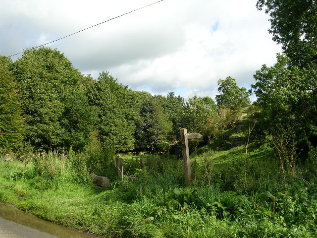
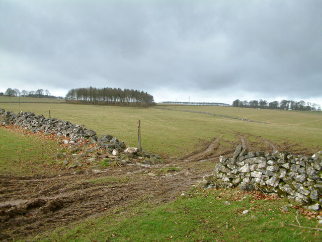
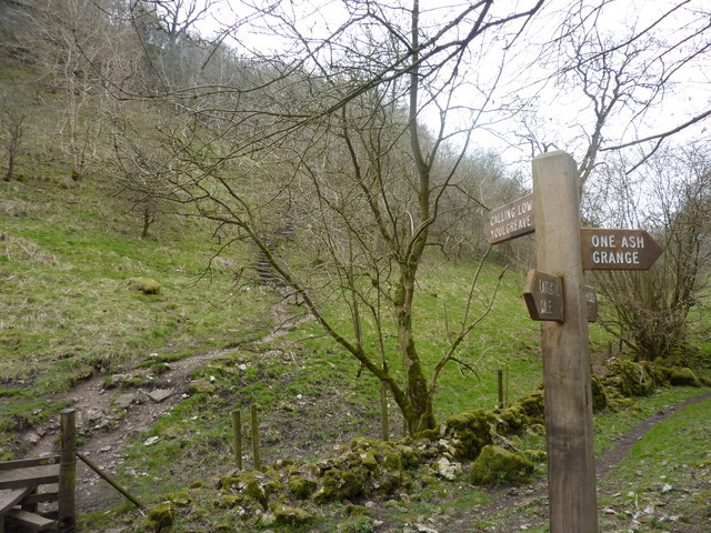
The landscape of Flax Dale is characterized by meandering streams, dense woodlands, and charming meadows. The valley is home to a diverse range of wildlife, including various bird species, small mammals, and rare plants. Nature enthusiasts flock to Flax Dale to enjoy its unspoiled surroundings and engage in activities such as hiking, birdwatching, and photography.

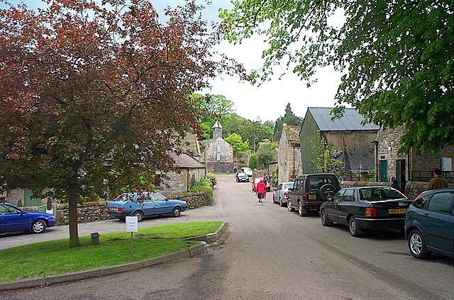
The village of Flax Dale, situated at the heart of the valley, is a quaint and close-knit community. It features a collection of traditional stone cottages, some of which date back several centuries. The village has a small but welcoming population, with locals known for their hospitality and strong sense of community.

Flax Dale also offers a range of amenities for visitors and residents alike. There are several charming bed and breakfasts and country inns, providing comfortable accommodations and delicious local cuisine. Additionally, the valley is dotted with well-maintained walking trails and picnic spots, offering opportunities for relaxation and recreation.

In summary, Flax Dale is a captivating valley in Derbyshire that captivates visitors with its natural beauty, rich wildlife, and charming village. It is a haven for those seeking a peaceful retreat in the heart of the English countryside.

If you have any feedback on the listing, please let us know in the comments section below.

Flax Dale Images

Images are sourced within 2km of 53.167499/-1.7172318 or Grid Reference SK1963. Thanks to Geograph Open Source API. All images are credited.

Stone Slab Footbridge Over The River Bradford
Kissing gate on the Limestone Way Low Moor Plantation can be seen in the background.
Kissing gate on the Limestone Way
Low Moor Plantation can be seen in the background.
Stile on the Limestone Way Stile in a drystone wall on the Limestone Way near Youlgreave.
Stile on the Limestone Way
Stile in a drystone wall on the Limestone Way near Youlgreave.
Sign on Back Lane Sign on Back Lane, a country road to Youlgreave.
Sign on Back Lane
Sign on Back Lane, a country road to Youlgreave.
Barn in farmland Barn in farmland above Lathkill Dale near Youlgreave.
Barn in farmland
Barn in farmland above Lathkill Dale near Youlgreave.
Footpath to Over Haddon Footpath to Lathkill Dale and the village of Over Haddon.
Footpath to Over Haddon
Footpath to Lathkill Dale and the village of Over Haddon.
Barn & Tree, Middleton / Youlgrave
Middleton-By-Youlgrave This is a quiet unspoilt village on an unclassified loop road near Youlgrave.
Middleton-By-Youlgrave
This is a quiet unspoilt village on an unclassified loop road near Youlgrave.
Low Moor Wood From Limestone Way footpath. A remnant of a larger woodland planted in the early 1800s. Purchased by the Peak District National Park Authority in 2001 to celebrate the 50th anniversary of the establishing of the National Park.
Low Moor Wood
From Limestone Way footpath. A remnant of a larger woodland planted in the early 1800s. Purchased by the Peak District National Park Authority in 2001 to celebrate the 50th anniversary of the establishing of the National Park.
On road approaching Middleton - Derbyshire The start point of a very pleasant circular walk with three geocaches en route.
On road approaching Middleton - Derbyshire
The start point of a very pleasant circular walk with three geocaches en route.
Barn on the Limestone Way above Bradford Dale This barn is used as a shelter for grazing cattle.  It is situated at SK198642 where the Limestone Way meets the minor road to Youlgreave.
Barn on the Limestone Way above Bradford Dale
This barn is used as a shelter for grazing cattle. It is situated at SK198642 where the Limestone Way meets the minor road to Youlgreave.
Countryside near Middleton by Youlgreave.
Remains of a limekiln. Limestone when burnt with coal or other fuel in one of these limekilns produces quicklime. This then has several uses including a soil conditioner for use on acid farmland, tanning leather and for making mortar for the building industry.
Remains of a limekiln.
Limestone when burnt with coal or other fuel in one of these limekilns produces quicklime. This then has several uses including a soil conditioner for use on acid farmland, tanning leather and for making mortar for the building industry.
Countryside near Middleton By Youlgreave.
Near Middleton By Youlgreave. The picture shows Green Lane, which is unmade in many places and leads to Hand Dale, near Hartington.
Near Middleton By Youlgreave.
The picture shows Green Lane, which is unmade in many places and leads to Hand Dale, near Hartington.
Near Middleton By Youlgreave. A view looking along Rake Lane.
Near Middleton By Youlgreave.
A view looking along Rake Lane.
Kenslow Knoll This good agricultural land is cattle rearing territory.  The trees to the left are on the top of Kenslow Knoll and in the mid background is a spoil heap from a disused quarry.
Kenslow Knoll
This good agricultural land is cattle rearing territory. The trees to the left are on the top of Kenslow Knoll and in the mid background is a spoil heap from a disused quarry.
Derelict Barn A typical limestone and slate barn which has seen better days.
Derelict Barn
A typical limestone and slate barn which has seen better days.
Show me another place!

Flax Dale is located at Grid Ref: SK1963 (Lat: 53.167499, Lng: -1.7172318)

Administrative County: Derbyshire

District: Derbyshire Dales

Police Authority: Derbyshire

What 3 Words

///grove.says.opinion. Near Youlgreave, Derbyshire

Related Wikis

Middleton-by-Youlgreave

Middleton, often known as Middleton-by-Youlgreave or Middleton-by-Youlgrave to distinguish it from nearby Middleton-by-Wirksworth, is a village in the...

Middleton and Smerrill

Middleton and Smerrill is a civil parish within the Derbyshire Dales district, in the county of Derbyshire, England. Largely rural except for the village...

Youlgreave

Youlgreave or Youlgrave is a village and civil parish in the Peak District of Derbyshire, England, on the River Bradford 2+1⁄2 miles (4.0 km) south of...

Conksbury

Conksbury is the site of a deserted medieval settlement between Over Haddon and Youlgreave in Derbyshire, England. == History == The village was recorded...

Limey Way

The Limey Way is a 65-kilometre (40 mi) challenge walk through Derbyshire, England. It starts at Castleton and progresses through 15 major and 5 minor...

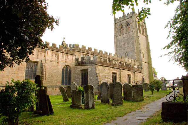
All Saints' Church, Youlgreave

All Saints’ Church, Youlgreave is a Grade I listed parish church in the Church of England in Youlgreave, Derbyshire. == History == The church dates from...

Cales Dale

Cales Dale is a short valley towards the head of Lathkill Dale near Monyash, Derbyshire in the Peak District of England. Cales Dale is included within...

Gratton, Derbyshire

Gratton is a civil parish in the Derbyshire Dales district of central Derbyshire, half a mile west of the neighbouring village, Elton. == See also... ==

Nearby Amenities

Located within 500m of 53.167499,-1.7172318
Tourism: information
Lat/Long: 53.1666129/-1.7099677
Bateman's Tomb
Cemetery: grave
Lat/Long: 53.166599/-1.7100722
The data included in this document is from www.openstreetmap.org. The data is made available under ODbL.

Have you been to Flax Dale?

Leave your review of Flax Dale below (or comments, questions and feedback).